High Sleets, Hawkswick, North Yorkshire

Enclosure:  OS Grid Reference – SD 95415 69019
Getting Here

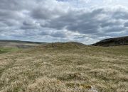
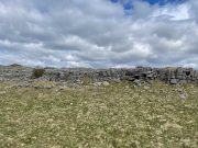
Enclosure walls beneath the long crags

Going along the B6160 road from Grassington to Kettlewell and taking the little road to Arncliffe on your left just a few hundred yards past Kilnsey Crags, after ¾ of a mile keep your eyes peeled for the small parking spot on the left-side of the road, with the steep rocky stream that leads up to the Sleet Gill Cave. Walk up this steep slope, following the same directions to reach the Sleets Gill Top enclosure. From here you’ll notice a large gap in the rocky crags about 200 yards WSW that you can walk through. On the other side of this gap, along a small footpath about another 200 yards along you’ll reach a large ovoid rock.  Just before this, on your right, is a long rocky rise with distinct drystone walling below it.  That’s the spot!

Archaeology & History
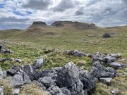
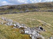
Walled section, looking S

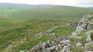
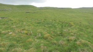
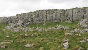
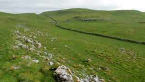
Encircling a slightly sloping area of ground that stretches out beneath a long line of limestone crags is this notable walled enclosure running almost the full length of the rocky ridge.  Measuring 40 yards (36m) in length by 10 yards (9m) across at its greatest width, this elongated rectangular enclosure has all attributes of being Iron Age in origin, much like many others in this area.  However, in comparison with the others close by, this is a pretty small construction and—if used for human habitation, as is likely—would have housed only two or three families.
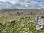
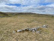
Western end of enclosure

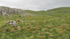
Within the enclosure itself, near its  western end, we find an internal line of walling that creates a single room: enough for a single family, or perhaps even where animals were kept.  Only an excavation would tell us for sure.
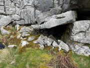
Curious stone ‘cupboard’

One notable interesting feature exists roughly halfway along the enclosure, up against the crag itself: here is small man-made stone “cupboard” of sorts, akin to some modern pantry.  You’ll get an idea of it in the photo.  At first I wondered if this would have been a sleeping space, but, unless it was where a shaman liked to encase him/herself inside a domestic household cave (highly improbable), it would have served a simple pragmatic function. Make up your own mind.

I liked this place. It’s surrounded by crags on almost all sides with some ancient spirit-infested rocky hills very close by, giving it a beautiful ambience.  Immediately below the enclosure is what looks to be a large dried-up pool, which was probably well stocked with fish.  A perfect living environment.  Check it out!

References:

  1. Raistrick, Arthur, Prehistoric Yorkshire, Dalesman: Clapham 1964.

© Paul BennettThe Northern Antiquarian

Sleets Gill Top, Hawkswick, North Yorkshire

Enclosure:  OS Grid Reference – SD 95735 69145

Getting Here

Sleets Gill enclosure hillock

Go up the B6160 road from Grassington to Kettlewell and just a few hundred yards past the famous Kilnsey Crags, take the little road to Arncliffe on your left.  After ¾ of a mile, keep your eyes peeled for the small parking spot on the left-side of the road, with the steep rocky stream that leads up to the Sleet Gill Cave. Walk up to the cave, then keep going up the same steep slope to the wall/fence above. You can get over the wooden fence and keep following the wall until it just about levels out nearly 200 yards up.  From here, walk 100 yards to your right where the land rises up and you’re at the edge of the walled enclosure.  Look around.

Archaeology & History

Walled section, looking W

On top of a small rise in the land is this large, roughly rectangular walled enclosure measuring about 55 yards across at its longest axis (roughly WNW to ESE) and averaging 24 yards wide.  The walling is pretty low down and, in some areas (mainly on its eastern edges) almost disappears beneath the vegetation—but you can still make it out – just!  The southernmost edge of the enclosure is built upon a the edge of a natural rocky outcrop (typical of many enclosure and settlement sites in this neck o’ the woods) and when you stand on this section you see a very distinct rectangular enclosure, sloping down from here.  This would likely have been where animals were kept as it makes no sense as a human living quarter due it being on a slope.  But below this, where the land levels out, another low line of ancient walling reaches towards the high modern walls.  This is one of three lines of ancient walling running, roughly parallel to the more modern walls (which themselves may have an Iron Age origin) from the main enclosure.

Aerial view of site

The entire structure is Iron Age in origin, but the site would have been in continual use throughout the Romano-British period and possibly even into early medieval centuries (though only an excavation would confirm that).  Its basic architecture is replicated in the many other prehistoric settlements that still exist on the hills all round here (there are dozens of them).  You’ll see this clearly when you visit the High Sleets enclosure less than 400 yards southwest from here.

References:

  1. Raistrick, Arthur, Prehistoric Yorkshire, Dalesman: Clapham 1964.

© Paul BennettThe Northern Antiquarian

Beamsley Beacon, Beamsley, North Yorkshire

Cairn:  OS Grid Reference – SE 09891 52435

Also Known as:

  1. Howber Hill

Getting Here

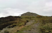
Beamsley Beacon, looking NW

If you’re coming via Ilkley, cross the bridge to Middleton and turn left, following the long winding road for several miles until you hit Langbar village.  If you’re coming via Bolton Bridge, go to Beamsley village and turn left up Lanshaw Bank until you hit Langbar village.  Whichever of the two routes you use: on the north side of Langabr village is a distinct small rough car park.  From here, cross the road where the footpath sign is and walk straight up the steep hill to Beamsley Beacon at the top.  You can’t miss it!

Archaeology & History

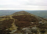
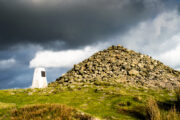
At the highest point on these hills, 1300 feet up, we come across this ancient prehistoric cairn.  Its position in the landscape is impressive to say the least, being visible from nearly every direction on the moorland heights for many miles around, as well as being conspicuous from the riverlands below.  A visit to the site nowadays shows it surmounted by a more recent mass of small stones turning it into a large walker’s cairn with only its compact base showing any real sign of antiquity.

Site shown on 1853 map
Western side of the cairn

Mentioned briefly in parish records from 1658 onwards, it was highlighted on the earliest OS-map as simply a Beacon hill, due to it being used for beacon fires.  We’re not certain when its beaconesque function first came about; and, it’s possible, that its beacon element could have replaced a much earlier heathen fiery function, typical of many hilltop sites up and down this and other countries.  But we do know that such fires were lit here at the beginning of the 19th century.  The great Harry Speight (1900) told that of its

“use as a prospecting-point and beacon there is no doubt.  In the Bolton Abbey registers, under date 1803, is this entry:

“Apprehensive of a French invasion, Beamsley Beacon was put in a state of repair, and four people appointed to watch it.  About — of the inhabitants of this chapelry inrolled themselves as Volunteers, the whole number of whom in Craven amounted to 1,200 Infantry and 200 Cavalry.  A Sergeant was appointed to drill the volunteers of this chapelry at Bolton.”

The beacon at this time received light from Pinhaw on Carlton Moor and sent it forward to Otley Chevin, as appears by an old chart at Wakefield, dated 1803.”

Photo by James Elkington

The beacon’s ancient name of Howber Hill is literally the Hill of Tombs, as derived from the Teutonic haugr, and Anglian how, being a burial mound; and berg is a hill, sometimes fortified.  Whilst there seems to be no evidence of ancient fortification, compacted cairn material at the base seems to confirms the -how element.  Yet despite Speight citing this etymology, he was was somewhat sceptical wondering, instead, if the site was merely a giant boundary marker—which it has been for centuries.

A short distance along the footpath to the east is the denuded old cairn known as The Old Pike.  Further east still, along the same boundary line, there was once another old tomb, long since gone…

Folklore

I’m not sure whether this should gone in the folklore section or not.  But, well, it’s here nonetheless!  In Guy Phillips’s (1976) book on the mythic history of ancient Brigantia, he describes a number of alignments, or leys (not one of those stupid energy lines, which has nowt to do with leys)—one of which crosses Beamsley Beacon.  It’s an west-east line that begins at Cockerham and from there goes,

“through Top of Blaze Moss SD 619525, Slaidburn (it is very clear here), Flambers Hill SD 877523, southern edge of Copy Hill 952523, Draughton (extremely clear), Beamsley Gibbeter and Beamsley Beacon, Heligar Pike, Scow Hall 203523, Little Almscliffe Crag, Tockwith church and on to the coast.”

I have to say that I’m sceptical of the veracity of this alignment.

References:

  1. Bogg, Edmund, Higher Wharfeland, James Miles: Leeds 1904.
  2. Cobley, Fred, On Foot through Wharfedale, William Walker: Otley 1880.
  3. Phillips, Guy Ragland, Brigantia – A Mysteriography, RKP: London 1976.
  4. Smith, A.H., English Place-Name Elements – volume 1, Cambridge University Press 1956.
  5. Smith, A.H., The Place-Names of the West Riding of Yorkshire – volume 5, Cambridge University Press 1963.
  6. Speight, Harry, Upper Wharfedale, Elliott Stock: London 1900.

Acknowledgements:  Huge thanks to James Elkington for use of his photo on this site profile.  Cheers mate. 😉

© Paul BennettThe Northern Antiquarian

Clowder (1), Arncliffe, North Yorkshire

Enclosures:  OS Grid Reference – SD 9165 6968

Also Known as:

  1. Clouder

Getting Here

Looking down on Clowder-1

To the right of The Falcon Inn across from Arncliffe village green is a trackway called the Monk’s Way.  Walk up here for about 450 yards until there’s a stile on your right which is the start of the diagonal footpath SW up the hillside.  Once you hit the limestone ridge several hundred yards up, keep on the path that curves round the edge of the hill for 1.3 miles (2.1km), going over 5 walls until, at the 6th one, you should look uphill, east, at the small cliff-face 100 yards above you.  That’s where you need to be!

Archaeology & History

This is one of several clusters of large prehistoric enclosures and settlements in the expanse of land known as Clowder, on the hills 1.65 miles (2.63km) southwest of Arncliffe.  It’s in a very good state preservation and, surprisingly, almost nothing has been written about it.

Covered hut circle on NW edge
Cliffs & walls of Clowder-1

A multi-period site whose construction probably began  sometime in the Iron Age (although the old Yorkshire Dales archaeologist, Arthur Raistrick, thought the settlements up originated in the Bronze Age), we can say with some certainty that parts of this complex were definitely being used until medieval times due to the lack of growth on some of the walling.

The entire complex comprises of a series of interlinked walled enclosures running roughly north-south for a distance of more than 200 yards.  Along the 200 yards are at least eight conjoined walled sections of varying shapes and sizes.  Some of the walling, particularly along its western edges, measuring up to 10 feet across (some of this will be due to collapse) is very overgrown indeed and is probably the oldest aspect of the enclosure.  The inner walled sections, much of it leading up to the small cliff face, are rough rectangular structures, each of them averaging 30 yards from their western edge to the eastern cliff and rock faces.

Most recent walled section

Within the largest and best preserved section at the northern end, a smaller and more recent walled rectangular enclosure would seem to have been used for either cattle or storage of some form, as it’s on too much of a slope to have been viable as a living quarter.  Also on the very northern edge is a well-preserved but much overgrown hut circle, between 8-9 yards across.

Faint walling looking south

The entirity of Clowder-1 is difficult to assess without an archaeological dig.  Despite this, as half of the walled enclosures (in the northern half) are on slopes leading up to the cliffs they would seem unsuitable for people to live in.  It is more probable that these sections were used for livestock and other storage.  At the more southern end however, the land begins to level out and this would be feasible as good living quarters.  There was also once a good source of water immediately beneath the entire complex, but with deforestation the waters eventually fell back to Earth.Back to its southern end and down towards the modern-day walling, some 70 yards on we find more ancient structures of the same architectural form that we’ve just walked along.  This lower section has just one notable singular oval-shaped hut circle, 20 yards east-west by 29 yards north-south.  Other probable man-made structures seem to be just below this; and this part of the settlement then continues on the other side of the walling, into the large Dew Bottoms (5) settlement complex.

Folklore

Weather lore of the ‘Clauder’ hill tells that it “draws the skies down” – i.e., as Halliwell Sutcliffe (1929) put it:

“A deluge may be in process on each side of the Clouder when lower down the sun is hot on tired pastures.”

We encountered just such a truth when James ElkingtonChris Swales and I visited the sites up here just a week or so ago…

References:

  1. Dixon, John & Phillip, Journeys through Brigantia – volume 2, Aussteiger: Barnoldswick 1990.
  2. Sutcliffe, Halliwell, The Striding Dales, Frederick Warne: London 1929.

Acknowledgements:  Huge thanks to James Elkington and Chris Swales, without whose guidance this site profile would never have been written.

© Paul BennettThe Northern Antiquarian

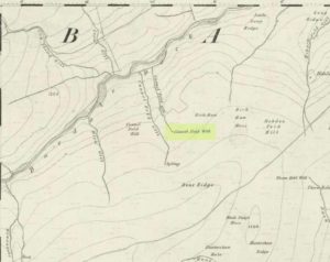
Cunnel Fold Well, Marsett, Bainbridge, North Yorkshire

Healing Well:  OS Grid Reference – SD 88727 85543

Archaeology & History

Cunnel Fold Well on 1856 map

Found high on the moors several miles south of Hawes, this is a small almost insignificant water source that I sat with, drinking in both the landscape and the waters many moons ago in a daydreaming amble.  It’s history is only remembered in the name it was given, no doubt by some local to the Ordnance Survey lads in their own, albeit more focussed assessment on these hills.  Its name puzzled me for a long while and I wondered if some untold story lay behind it.  Sadly that doesn’t appear to be the case.  Although there are doubtless many tales that could be told of the people who, through the centuries, have sat and drank the waters here, we know none.

Its name very probably derives from the misapprehended dialect word ‘cannel’ which, as Mr Wright (1898) explains, is simply “a ditch…gutter, watercourse,” which seems appropriate here.  Of the place-names shown on the 1856 OS-map, it seems the most likely solution to the word.

As for a place to sit and have a drink, it’s very refreshing after the rains have fallen.  All too often nowadays, as with many of the old hilltop watercourses, their life-blood is falling back to Earth…

References:

  1. Wright, Thomas (ed.), English Dialect Dictionary – volume 1, Henry Frowde: London 1898.

© Paul BennettThe Northern Antiquarian


Skyreholme Carving (406), Appletreewick, North Yorkshire

Cup-marked Stone:  OS Grid Reference – SE 0740 6254

Getting Here

Skyreholme 406

Skyreholme 406 carving

Along the B6265 Pateley Bridge-Grassington road, roughly halfway between Stump Cross Caverns and the turn to Skyeholme and Applecross (New Lane) is a dirt-track on your right-hand side called Black Hill Road. Walk down here for a few hundred yards till y’ reach the gate on the right. A track goes downhill to the psilocybin-rich pastures of Nussey Green. Several hundred yards down, to the right-hand side of the track, we find this and its several companions. Look around!

Archaeology & History

Skyreholme-406 carving

Sketch showing cups

Just a few yards away from the Skyrehome Carving-404, this very basic petroglyph was rediscovered by Stuart Feather (1969) during one his many forays in this area.  Although the stone has what initially seems to be a number cup-marks on it, it seems only two of them are man-made. The rock art students Boughey & Vickerman (2003) think there may be up to four of them.

References:

  1. Boughey, Keith & Vickerman, E.A., Prehistoric Rock Art of the West Riding, WYAS 2003.
  2. Feather, Stuart, “Appletreewick, W.R.: Black Hill,” in Yorkshire Archaeological Journal, volume 42, part 167, 1969.

© Paul BennettThe Northern Antiquarian


Skyreholme Carving (405), Appletreewick, North Yorkshire

Cup-Marked Stone:  OS Grid Reference – SE 07395 62382

Getting Here

Skyreholme 405 Carving

Skyreholme 405 Carving

Going down (south) off the B6265 Black Hill Road towards Skyreholme, turn right and go all round the hill ahead of you, but instead of looking to the right (where other carvings, described elsewhere, are found), turn left where the collapsed entrance to a mine-shaft is visible about 50 yards up the hill on the left. Walk up here, keeping to the right side of the collapsed mine, till you reach this rock.

Archaeology & History

Only for the purist petroglyph fanatics amongst you, the rock art students Boughey & Vickerman (2003) allege there to be four cup-markings here—and debatable ones at that—but we could really only make out the topmost cup, shown in the picture and an elongated one (which they think may have been two cups merged into one).  A faint “X” is also carved on the stone, possibly from the mining days.

References:

  1. Boughey, Keith & Vickerman, E.A., Prehistoric Rock Art of the West Riding, WYAS: Wakefield 2003.

© Paul BennettThe Northern Antiquarian 


Arncliffe, Littondale, North Yorkshire

‘Carved Stone’:  OS Grid Reference – SD 93 72

Archaeology & History

The Arncliffe Carving

The Arncliffe Carving

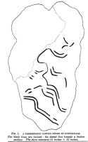
This is a frustrating site entry.  Not only do we not know where it is, this carving is not listed in any of the modern books on British petroglyphs, yet it was described and referenced by the famous archaeologist Jacquetta Hawkes following its discovery more than 80 years ago.  After a brief mention of the carving in Frank Elgee’s (1933) Archaeology of Yorkshire, an article describing the carving was penned in the journal Man, from which I draw the only information available. It appears to have been found in the early 1930s (no date or discoverer is cited), but has a couple of peculiarities which may bring the authenticity of the stone into question.  Mrs Hawkes (1934) told that the carved stone was,

“found in the bed of a moorland beck in the village of Arncliffe, Littondale, West Riding of Yorkshire.  It is of buff-coloured limestone measuring 21 inches x 12 inches x 6 inches in thickness; the decorated surface is almost flat.  The curvilinear pattern is executed in regular incisions about 4mm wide and 3mm deep; portions of it have been obliterated by water actions and, as is illustrated in the illustration, at one end the surface has broken away altogether.  The whole stone has been much battered and may well be only a fragment of a much larger one.  The state of preservation suggested that it had been in the stream for a considerable period; it is therefore probable that it was washed down from the open moorland above Arncliffe.  In the original (carving), the design is more coherent than it here appears owing to the fact that in the water-worn portions faint lines are visible to the eye which cannot be shown on a tracing.

“Mr W.J. Hemp, who has kindly examined the Arncliffe tracing, identifies the style of the design with the ‘entrail’ pattern of the well-known Pattern Stone from the chambered cairn of Bryn Celli Ddu in Anglesey…

“The technique of the Arncliffe tracing is comparable with the simple incisions which form the oldest of the four techniques recognizable in the Irish megalithic tumuli, where its early date is indicated by the fact that some examples are demonstrably older than the construction of the tumuli in which they occur…

“Mr Frank Elgee, who has also been good enough to comment on the Arncliffe tracing, cannot suggest immediate comparisons from this neighbouring group (around Ilkley, PB), but such evidence as there is he considers to be against assigning a date earlier than the MIddle Bronze Age.”

The late great Eric Cowling also mentioned the stone in his prehistoric survey of the mid-Pennines, but added no further details of his own and seems to have just copied what we have just read.

The fact that the ‘carving’ was found in a stream-bed may mean that the markings on the stone were due to natural erosion; and the fact that the rock was limestone may give added weight to this idea.  However, the fact that Mrs Hawkes, Frank Elgee and W.J. Hemp thought the carving to be authentic cannot be overlooked.  The area is also rich in prehistoric remains (see Douky BottomDewbottoms, Yockenthwaite, Blue Scar, etc)  The design itself is an odd one and has none of the traditional hallmarks consistent with neolithic and Bronze Age cup-and-ring stones, but seems more reminiscent of much earlier mesolithic and palaeolithic images of carved animals and dancing human figures.

If anyone knows more about this site, particularly its whereabouts (perhaps in private possession or hiding in some museum box, where increasing numbers of cup-and-rings are wrongfully kept), or whether the ‘carving’ has been disregarded as little more than natural weathering, it would be good to know for certain.

References:

  1. Cowling, E.T., Rombald’s Way: A Prehistory of Mid-Wharfedale, William Walker: Otley 1946.
  2. Elgee, Frank & Harriet, The Archaeology of Yorkshire, Methuen: London 1933.
  3. Hawkes, Jacquetta, “A Prehistoric Carved Stone in Littondale,” in Man, volume 34, 1934.

© Paul BennettThe Northern Antiquarian


Douky Bottom, Arncliffe, North Yorkshire

Settlement:  OS Grid Reference – SD 95203 69067

Getting Here

Aerial view of settlement

Go up the B6160 road, heading for Kilnsey Crag.  A few hundred yards past the famous crags, take the little road to Arncliffe.  About a mile up, where you reach the second building on the left-side of the road, walk up behind here, up the steep fields and towards the craggy heights above.  Keep right uphill till you see the cluster of cairns on the peak above; but before reaching them, walk over the rocky landscape to your left (southeast) and you’ll eventually see an excess of straight walling a coupla hundred yards away. That’s it!

Archaeology & History

A bittova climb to get here – but well worth it in the end.  On a spur of land amidst the outstanding limestone plateaux less than a mile south of Arncliffe village, rising near the silent ghostly cairns upon Knotts ridge above it, we come across an extensive prehistoric settlement complex.  It is one of many in this upland region.

Looking south at the settlement
Knott cairns above the settlement

Poorly described (if at all) by official archaeology websites, this place is big!  All that we can see today at ground level are lines of very extensive lines of enclosure walling, between one and three feet high, intersecting each other and forming very large rectangles growing further and further out from each other towards the western scree.  Much of the walled structures are in good condition if they are prehistoric, as presumed by archaeologists; but it seems obvious that the site was in continuous use by local people for domestic and agricultural purposes all through medieval and later periods.

One of the settlement hut circles
Raised lines of ancient walling

The longest stretch of visible walling runs from northeast to southwest and measures 175 yards long (160m), with several stretches of parallel walling splitting the settlement into different sections of large enclosures all attached to each other.  These parallel walls measure a maximum of 54 yards (49.5m) and run northwest to southeast.  The aerial image of the site shows the structures very clearly in some parts.  Others are more vague and some are difficult to see at ground level.  But the settlement as a whole cannot be missed.  Several hut circles have been built inside the main rectangular enclosures, with two others faintly visible on the outer edges.

As far as I’m aware, no excavations have taken place here, so we are still grasping at periodic straws when it comes to dating the place.  When Arthur Raistrick (1929) wrote his article about the associated enclosures like that at Blue Scar, a short distance to the east, he thought them to be Iron Age in origin.  He may well right.  A singular enclosure circle can be found a few hundred yards to the south.

References:

  1. Elgee, Frank & Harriet, The Archaeology of Yorkshire, Methuen: London 1933.
  2. Raistrick, Arthur & Chapman, S.E., ‘The Lynchet Groups of Upper Wharfedale, Yorkshire,’ in Antiquity, volume 3, 1929.

© Paul Bennett, The Northern Antiquarian


Forty Acres (3), Stelling, Marske, North Yorkshire

Cup-and-Ring Stone:  OS Grid Reference – NZ 0758 0058

Getting Here

Surface of Forty Acres 3 carving
Surface of Forty Acres (3) CnR

From Marske village, take the road west and uphill to the villages of Fremington and Reeth.  At the top of the hill where the fields open up, several hundred yards along on your right, past the field with the track, a footpath sign points you up onto the moor. Go up the field till you hit the wall that goes right to the top of the moor. Where the four walls meet, go straight across and then walk northwards along the line of walling for 2-300 yards, keeping your eyes peeled for a solitary stone on its own, 100 yards west.  You’ll find it.

Archaeology & History

Deep carved line features

A pretty basic petroglyph located within a massive arena of prehistoric sites dating from the neolithic and continuing through the Bronze Age period and beyond.  Found a few hundred yards northwest of the once giant cairn of Cock Howe, this design is characterized mainly by the two large deep channels deliberately cut into the stone that run from the middle of the upper surface down to ground level.  One of them emerges from a single cup-marking, at an angle; whilst the other comes from the edge of a natural crack in the rock.  The channels are wide and flattened. Other faint lines can be discerned too, which may have originally been carved.  We need to explore this design in different lighting conditions to see if there are additional features here.

Looking east-ish
Looking east-ish

An archetypal cup-marking can seen on the vertical edge of the stone and three other faint ones scatter the top.  Another small ‘cup’ is along the southern vertical face of the rock which, when we found it, thought was natural; but a photograph of the stone by James Elkington seems to show a ring surrounding much of the cup-mark.  We need to go back and take another look at the place.

A number of other carvings described in Paul and Barbara Brown’s (2008) survey can be found in the region.

References:

  1. Brown, Paul & Barbara, Prehistoric Rock Art in the Northern Dales, Tempus: Stroud 2008.

© Paul Bennett, The Northern Antiquarian