About mile south of Northchurch, on the far side of the A41 dual carriageway, somewhere past the old crossroads (or perhaps even at the crossing) an ancient tree lived—and truly lived in the minds of local people, for perhaps a thousand years or so. Mentioned in the Lay Subsidy Rolls in 1307, the Cross Oak gave its name to the old building that once stood in the trees and the hill itself, at the place now known as Oak Corner. Whether or not a “cross” of any form was set up by this old oak, records are silent on the matter. Its heathen ways however, were pretty renowned! (a plaque should be mounted here)
Folklore
The first reference I’ve found of this place is in William Black’s (1883) folklore survey where he told that “certain oak trees at Berkhampstead, in Hertfordshire, were long famous for the cure of ague”—ague being an intense fever or even malaria. But a few years later when the local historian Henry Nash (1890) wrote about this place, he told that there was only one tree that was renowned for such curative traditions, that being the Cross Oak. He gave us the longest account of the place, coming from the old tongues who knew of it when they were young—and it had it’s very own ritual which, if abided by, would cure a person of their malady. “The legend ran thus”, wrote Mr Nash:
“Any one suffering from this disease was to proceed, with the assistance of a friend, to the old oak tree, known as Cross Oak, then to bore a small hole in the said tree, gather up a lock of the patient’s hair and make it fast in the hole with a peg, the patient then to tear himself from the tree, leaving the lock behind, and the disease was to disappear.
“This process was found to be rather a trying one for a weak patient, and by some authority unknown the practice was considerably modified. It was found to be equally efficacious to remove a lock of hair by gentle means, and convey it to the tree and peg it in securely, and with the necessary amount of faith the result was generally satisfactory. This is no mere fiction, as the old tree with its innumerable peg-holes was able to testify. This celebrated tree, like many other celebrities, has vanished, and another occupies its place, but whether it possesses the same healing virtues as its predecessor is doubtful. It is however a curious coincidence, that the bane and the antidote have passed away together.”
The lore of this magickal tree even found its way into one of J.G. Frazer’s (1933) volumes of The Golden Bough, where he told how the “transference of the malady to the tree was simple but painful.”
Traditions such as this are found in many aboriginal cultures from different parts of the world, where the spirit of the tree (or stone, or well…) will take on the illness of the person for an offering from the afflicted person: basic sympathetic magick, as it’s known. Our Earth is alive!
References:
Black, William G., Folk Medicine, Folk-lore Society: London 1883.
Frazer, James G., The Scapegoat, MacMillan: London 1933.
Jones-Baker, Doris, The Folklore of Hertfordshire, B.T. Batsford: London 1977.
Nash, Henry, Reminiscences of Berkhamsted, W. Cooper & Nephews: Berkhamsted 1890.
Acknowledgements:Huge thanks for use of the Ordnance Survey map in this site profile, reproduced with the kind permission of the National Library of Scotland.
Travel along the B867 road from Bankfoot to Dunkeld (running roughly parallel with the A9) and you’ll reach the hamlet of Waterloo about one mile north of Bankfoot. As you approach the far end of the village, keep your eyes peeled for the small turning on your left and head up there for just over a mile. The road runs to a dead end at Meikle Obney farm, but shortly before reaching there you’ll pass this large standing stone on the right-side of the road, just along the fence-line. It’s almost impossible to miss!
Archaeology & History
This is one of “the large rude upright stones found in the parish” that William Marshall (1880) mentioned briefly, amidst his quick sojourn into the Druidic history of Perthshire. It’s an impressive standing stone on the southern edges of the Obney Hills that doesn’t seem to be in its original position. And it’s another one that was lucky to survive, as solid metal staples were hammered into it more than a hundred years ago when it was incorporated into the fencing, much like the massive Kor Stone 6½ miles south-west of here.
Site shown on 1867 mapWitch’s Stone at roadside
Shown on the first Ordnance Survey map of the area in 1867, its bulky 6½-foot-tall body stands all alone on this relatively flat plain, with open views to the east, south and west. It gave me the distinct impression that it was once part of a larger megalithic complex, but I can find no additional evidence to substantiate this. Call it a gut-feeling if you will. Intriguingly, the closest site to this are two standing stones just out of view literally ⅔-mile (1.07km) to the northeast, aligned perfectly to the Witch’s Stone! Most odd…
Folklore
The story behind this old stone is a creation myth that we find all over the country, but usually relating to prehistoric tombs more than monoliths. The great Fred Coles (1908) wrote:
“the common legend is told of a witch who, when flying through the air on some Satanic behest, let the Stone fall out of her apron.”
Marshall, William, Historic Scenes in Perthshire, William Oliphant: Edinburgh 1880.
Stewart, Elizabeth, Dunkeld – An Ancient City, Munro Press: Perth 1926.
Acknowledgements:Huge thanks for use of the Ordnance Survey map in this site profile, reproduced with the kind permission of the National Library of Scotland.
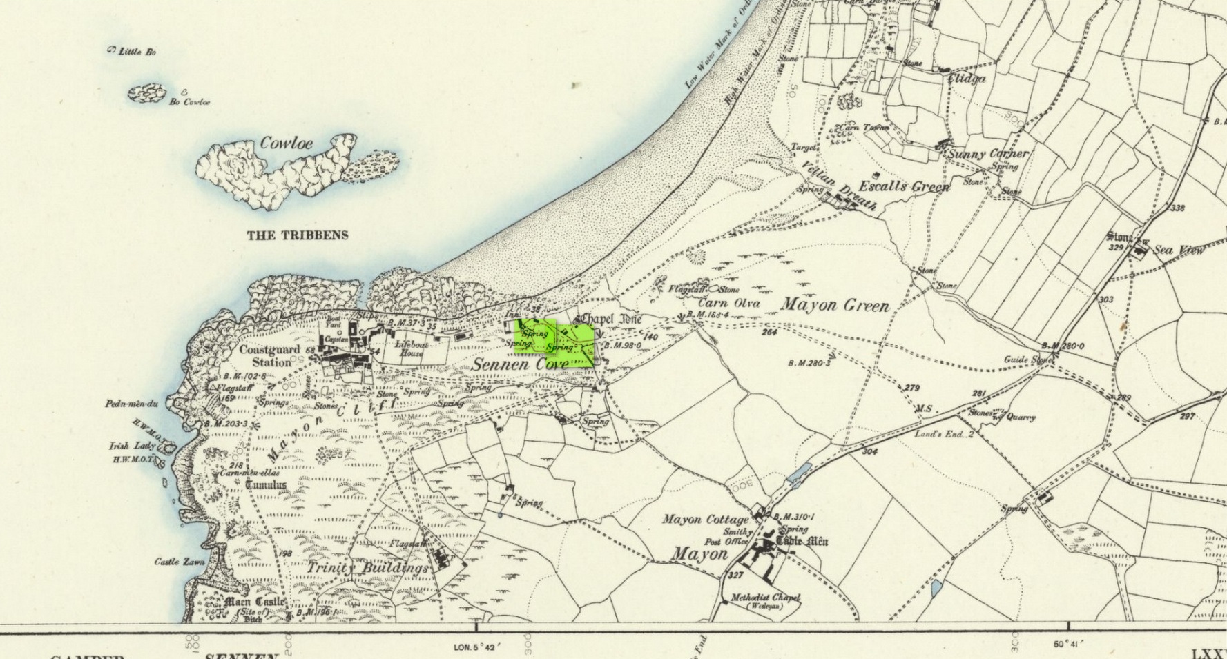
Holy Well (lost): OS Grid reference – SW 3550 2626
Archaeology & History
The springs of Chapel Idne
Highlighted on the 1888 Ordnance Survey map of Sennen Cove are the remains of Chapel Idne, just above the coast. Across the road from the chapel on its south-side, and also next to an old inn to its immediate west, springs of water are shown and it would seem more than likely that one of these two would have been the forgotten holy well of Sennen that was described, albeit briefly, in the great Mr Blight’s (1861) literary tour of the area. He told us that:
“At Sennen Cove was an ancient chapel, called by the people Chapel Idne, the “narrow chapel” being forty-five feet long and fifteen feet wide. It is now converted into a dwelling. Tradition says it was founded by one Lord of Goonhilly, who possessed dome portion of the land of Lyonesse. There was a holy well of some repute here also.”
The waters of St. Sennen’s Well were used in an act of ceremonial magick in the Arthurian tale known as the Battle of Vellan-druchar, as told in Robert Hunt’s (1865) great Romances. An attempted invasion by the Danes was met with by Arthur and nine other kings and the foreigners were slaughtered.
“A few had been left in charge of the ships, and as soon as they learned the fate of their brethren, they hastened to escape, hoping to return to their own northern land. A holy woman, whose name has not been preserved to us, “brought home a west wind” by emptying the Holy Well against the hill, and sweeping the church from the door to the altar. Thus they were prevented from escaping, and were all thrown by the force of a storm and the currents either on the rocky shore, or on the sands, where they were left high and dry. It happened on the occasion of an extraordinary spring-tide, which was yet increased by the wind, so that the ships lay high up on the rocks, or on the sands; and for years the birds built their nests in the masts and rigging.
Thus perished the last army of Danes who dared to land upon our western shores.
King Arthur and the nine kings pledged each other in the holy water from St Sennen’s Well, they returned thanks for their victory in St Sennen’s Chapel, and dined that day on the Table-men.
Merlin, the prophet, was amongst the host, and the feast being ended, he was seized with the prophetic afflatus, and in the hearing of all the host proclaimed–
“The northmen wild once more shall land,
And leave their bones on Escol’s sand.
The soil of Vellan-Druchar’s plain
Again shall take a sanguine stain;
And o’er the mill-wheel roll a flood
Of Danish mix’d with Cornish blood.
When thus the vanquish’d find no tomb,
Expect the dreadful day of doom.”
References:
Blight, J.T., A Week at the Land’s End, Longmans Green: London 1861.
Hunt, Robert, Popular Romances of the West of England, 1865.
Straffon, Cheryl, “Chapel Idne and the Holy Well,” in Meym Mamvro no.34, 1997.
Weatherhill, Craig, “A Guide to Holy Wells and Celebrated Springs in West Penwith,” in Meym Mamvro no.4, 1997.
Acknowledgements: Big thanks for use of the early edition OS-map in this site profile, Reproduced with the kind permission of the National Library of Scotland.
Cup-Marked Stone (lost): OS Grid reference – NN 8866 5320
Also Known as:
Sunday Well
Tobar an Donich
Archaeology & History
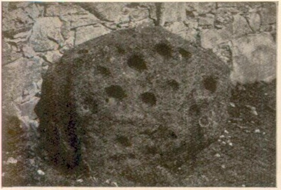
Tobairandonaich stone, c.1920
Located some 30 yards south of a holy well known (in English language) as the Sunday Well, this carving was rediscovered shortly before John Dixon (1922) wrote his survey of petroglyphs in the Strathtay region. It would seem to have been a large “portable” cup-marked stone that had been placed, face-downward, into an old doorstep at the stable at Easter Tobairandonaich and forgotten about, long long ago. Then, at the beginning of the 20th century when the people living here had to clear a drain beneath the stable, the stone was moved and the cup-markings were noticed. The carving was a pretty simplistic design, as you can see, which was described by Mr Dixon as follows:
“The stone…has nineteen cups all on the same face. The largest cup is 3¾ inches in diameter and 2 inches deep. The next largest has the same diameter, but is 1½ inch deep. Other five of the cups are very nearly the same size. The smallest cup is 1¾ inch in diameter and ½ inch deep, but weathering has effected much towards almost obliterating some of the smaller cups. The stone is of whinstone with slight veins of quartz. It is oval in form and varies in thickness from 2½ inches to 4 inches. Its greatest diameter is 3 feet 2 inches, and its least diameter 2 feet 8 inches.”
Tom MacLaren’s 1921 sketch
The stone would seem to have disappeared as no one has seen it for fifty years or more. It may (hopefully) be in one of the walls, or perhaps buried somewhere under the soil. Or maybe, tragically, some fuckwit has destroyed it. Twouldst be good to find out one way or the other. The photograph above, taken by Mr Dixon sometime around 1920, is the only thing that remains of the carving.
In this small part of Strathtay we are fortunate in finding a cluster of petroglyphs with folklore about them relating to our faerie and witch folk. Some larger man-made stone “bowls” in the area were also used as “praying stones.” I have little doubt that the people who originally used this carving as a doorstep were fully aware of the cup-marks—and I’d suggest that they even put it here on purpose, probably as a form of protection from the fairies who might have stolen or caused sickness to the horses.
References:
Dixon, John H., “Cup-Marked Stones in Strathtay, Perthshire,” in Proceedings Society Antiquaries, Scotland, volume 56, 1922.
Kennedy, James, Folklore and Reminiscences of Strathtay and Grandtully, Munro Press: Perth 1927.
Yellowlees, Walter, Cupmarked Stones in Strathtay, Scotland Magazine: Edinburgh 2004.
The first that I read of this place was in an article of the Scottish Ecclesiastical Society journal, on the parish history of Horndean. Standing originally at the edge of the ruined remains of the old churchyard, the author W.S. Moodie (1915), told that a long lost,
“grim relic of olden days is said to have existed here till fifty years ago. This was the Witches Stone—an upright pillar with a hole in it, to which the bodies of the poor unfortunates were fastened after they had been glede, while the faggots were piled around.”
A perusal in the Royal Commission inventory (1915) of the same year told that it had been moved several miles northeast to Paxton Cottage (NT 9279 5229) in the adjacent village. It was described as being,
“about 4 feet 6 inches in height above the ground, some 2 feet in breadth, tapering towards the upper end, and about 7 inches thick. Near the top are two perforations, not quite on the same level, about 2 inches in diameter at the surface on either side, constricted towards the Centre, and about 9 inches distant from centre to centre.”
Is this old stone still in existence…?
References:
Moodie, W. Steven, “Ladykirk, or the Kirk of Steill, Berwickshire,” in Transactions of the Scottish Ecclesiological Society, 4:3, Aberdeen 1915.
Royal Commission Ancient & Historical Monuments, Scotland, Inventory of Monuments and Constructions in the County of Berwick, HMSO: Edinburgh 1915.
Cross / Sacred Tree: OS Grid Reference – NN 581 012
Also Known as:
Law Tree
Archaeology & History
As a folklorist and antiquarian, I find this long lost site more than intriguing. Most ancient crosses are stone; but in early centuries many were made from wood which, obviously, have decayed down the years. But this cross, located on the northeast edge of the Lake of Menteith, was actually a tree: a hawthorn no less. This choice would have been made based on it being one of the few trees that are deemed sacred in both christian and indigenous lore. It was described—albeit briefly—in A.F. Hutchison’s (1899) excellent history book of the area:
“The cross of the burgh is said to have been the trunk of an old hawthorn tree, which stood by the lake side, opposite the manse of Port, and was known as ” the law tree.” Around this tree an annual fair was held in the month of September, and called after St. Michael.”
We’re obviously seeing here the traditional animistic veneration of trees by local people, with the incoming christian symbol being grafted onto it. Hawthorns were one of the potent protections against witchcraft and so the handshake between christian and pre-christian systems obviously worked here. Faerie-lore was also rampant at many places for many miles around this site.
References:
Hutchison, Andrew F., The Lake of Menteith – Its Islands and Vicinity, Eneas Mackay: Stirling 1899.
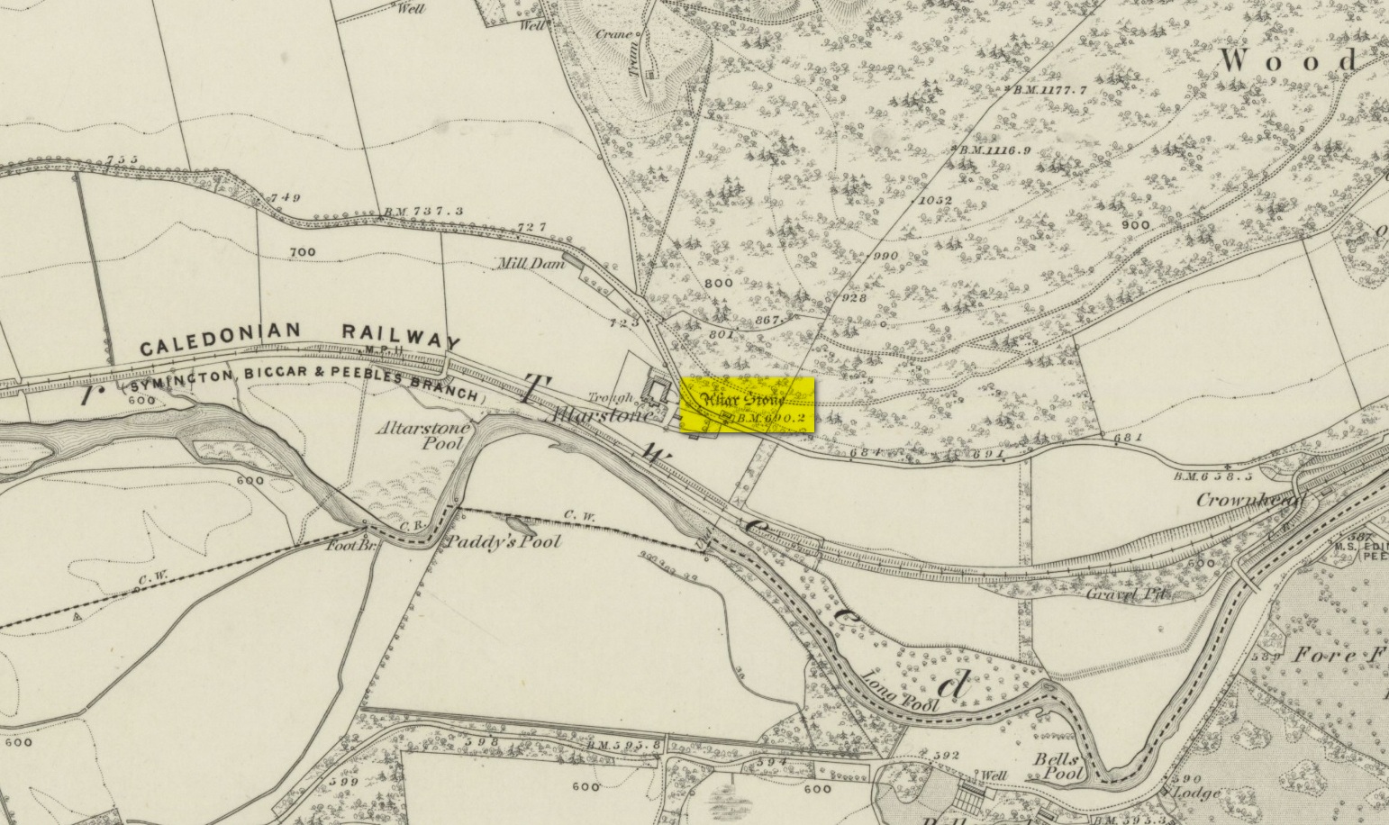
Various ways to get here. From Peebles take the A72 road west to Kirkurd, but after 4 miles turn left onto B712. Several miles down, go past Stobo village and before crossing the bridge over the River Tweed, turn left up minor road leading to Dreva and Broughton. The track into Altarstone Farm is about a mile along and the stone is across the road from there. The other way is going south along the A701 from Broughton village, where you take the left turn towards Stobo. Go along here for just over 3 miles where you reach the woodland (park here where the small track goes into the woods). A coupla hundred yards further along is Altar Stone Farm on your right and the stone is above the verge on your left.
Archaeology & History
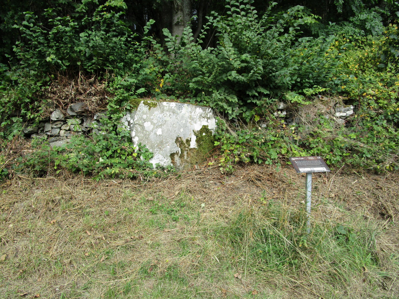
Altar Stone, Stobo
Archaeologically speaking, there’s nowt much to say about this site apart from the usual tedium of its measurements and the rock-type. I’ll give the latter a miss, but the stone stands at nearly five feet high and nearly as broad; with its upper face relatively smooth and the top of it pretty flat. A section from the top of this stone was cut and sliced off a few centuries ago and this was said to have been taken to Stobo church a few miles away, where it was fashioned into a stone font for baptisms. If this is true, then it’s possible that this was once an authentic prehistoric standing stone, but we’ll probably never know for certain. Also on top of the stone you can see a number of geophysical scratches, one of which looks as if it may have been worked by human hands and which has some relevance to the folklore of the stone.
It is shown on the 1859 OS-map of the area and was mentioned in the Ordnance Name Book where they told how it was “supposed to have formed the Altar of a druids Temple or some such object,” but they could find no local verification of such lore at the time of their visit… or at least, no one was telling them anything about it…
Folklore
This fascinating bit of rock—or possible sliced standing stone—is of note due to its association with that old shaman of shamans known as Merlin! Near the end of His days, when He’d truly retired from the world of men and wandered, they say, mad amidst the great lowland forests, an old christian dood by the name of Kentigern—later known as St Mungo—who’d been trying to convert our old magickian away from the animistic ways of Nature. Legend says that He succeeded. The old Scottish traveller Ratcliffe Barnett (1925) wrote:
“Merlin is the real genius of Drumelzier. Dumelzier means the Ridge of Meldred, a pagan prince of the district. And it was Meldred’s shepherds that slew Merlin the bard. The heathen bard was present at the battle of Arthuret in the year 573, when the christian army gained a victory over the Heathen Host. Merlin fled to the forest of Caledon at Drumelzier and there ever after the old Druid spent his life among the wild hills with a repute for insanity. This poet priest was doubtless heart-broken at the defeat of his pagan friends. The old order was changing. But the christian king had brought his friend, St Kentigern or Munro, to preach the gospel in upper Tweedside at Stobo. One day Kentigern met a weird-looking man and demanded who he was. “Once I was the prophet of Vortigern (Gwendollen). My name is Merlin. Now I am in these solitudes enduring many privations.”
“So Kentigern preached the gospel to the old nature worshipper and won him to Christ. Up yonder, at the east end of the Dreva road, you will find the rude Altar Stone where, it is said, Kentigern received the Druid into the christian church and dispensed the sacrament. But in those dark days of the faith, the Druids and their pagan adherents fought hard against the new religion. So immediately after the admission of Merlin to the Church, the shepherds of Meldred sought him out, stoned him to death on the haugh of Drumelzier, and there, where the Powsail Burn falls quietly into Tweed, Merlin the Martyr was buried. For long his grave was marked by a hawthorn tree.”
These shepherds were said to have stoned him and then threw his body upon a sharp stake and then into the stream. (stone – wood – water)
If there is any hint of truth in this tale, it is unlikely Merlin would have given himself over to the christian ways unless—as any shaman would—he knew of his impending death. In which case it would have done him no harm to pretend a final allegiance to the unnatural spirituality that was growing in the land. But whatever he may have been thinking, it is said that this Altar Stone was where he made such a deed.
Scratch-marks of the mythic hareAltar Stone, Stobo
An equally peculiar legend—variations of which are found at a number of places in the hills of northern England and Scotland—speaks of another shamanic motif, i.e., of humans changing into animals and back. For here, legend tells, an old witch was being chased (by whom, we know not) across the land. She’d turned herself into the form of a hare and, as she crossed over the Altar Stone, her claws dug so deeply into the rock that they left deep scars that can still be seen to this day. From here, the hare scampered at speed downhill until reaching the River Tweed at the bottom, whereupon transforming itself back into the form of the witch, who promptly fled into the hills above on the far side of the river.
One final thing mentioned by Barnett (1943) was the potential oracular property of the Altar Stone:
“You have to only place your hand on top of this rude altar, shut your eyes, and if you have the gift you will see visions.”
References:
Ardrey, Adam, Finding Merlin, Mainstream 2012.
Barnett, Ratcliffe, Border By-Ways and Lothian Lore, John Grant: Edinburgh 1925.
Buchan, J.W. & Paton, H., A History of Peeblesshire – volume 3, Glasgow 1927.
Crichton, Robin, On the Trail of Merlin in a Dark Age, R. Crichton 2017.
Glennie, John Stuart, Arthurian Localities, Edmonston & Douglas: Edinburgh 1869.
Moffat, Alistair, Arthur and the Lost Kingdoms, Phoenix: London 1999.
Rich, Deike & Begg, Ean, On the Trail of Merlin, Aquarian: London 1991.
Wheatley, Henry B., Merlin, or, The Early History of King Arthur – 2 volumes, Trubner: London 1865.
Acknowledgements: Big thanks for use of the 1st edition OS-map in this site profile, Reproduced with the kind permission of the National Library of Scotland.
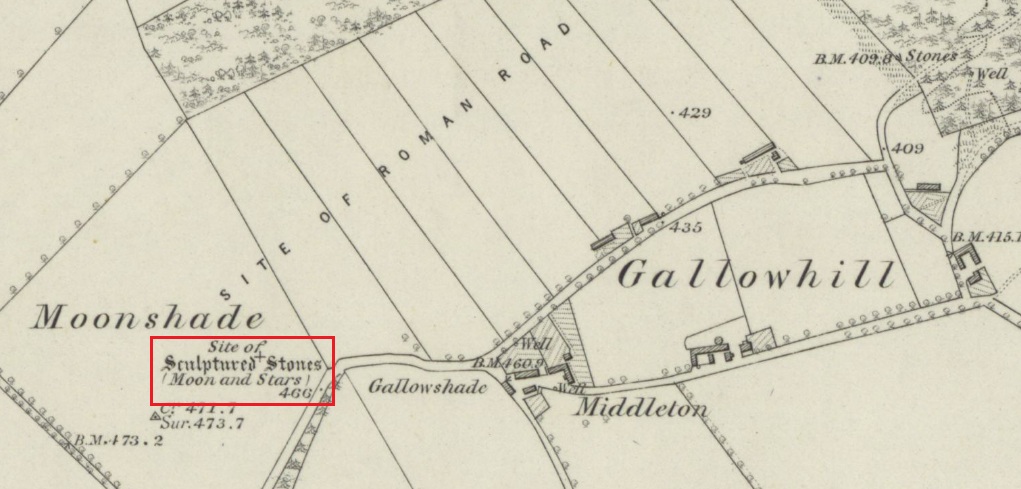
Travelling north, turn right to Wolfhill off the A93 at Cargill, then up the hill, turning left at the first junction. The stones are buried in the field to your left before the bend.
Archaeology & History
The earliest description of these stones, and the only one written while they were still standing comes from J.P.Bannerman, writing in the Old Statistical Account in 1793:
‘Near the village of Cargill may be seen some erect stones of considerable magnitude, having the figure of the moon and stars cut out on them, and are probably the rude remains of Pagan superstition. The corn-field where these stones stand is called the Moonshade to this day.’
Later writers, who only had verbal reports of the stones from locals who remembered them, gave differing descriptions of them. The people who spoke to the Ordnance Survey name book scouts around 1860, described them as:
‘Moonshade – “This name is applied to an arable field immediately west of Gallowhill. Two large Standing Stones having the representation of the Moon and 7 Stars cut out on one of them were removed from this field about 60 years ago.”‘
The local antiquary Andrew Jervise wrote in 1861 that the stones were:
‘interesting relics….purposely buried below the reach of the plough, appear to have been of the same class of antiquities as the sculptured stones at Meigle and, from the desire which is now being manifested for the preservation of national antiquities, it is hoped that those relics will soon be disinterred, so that their symbols may be properly examined.’
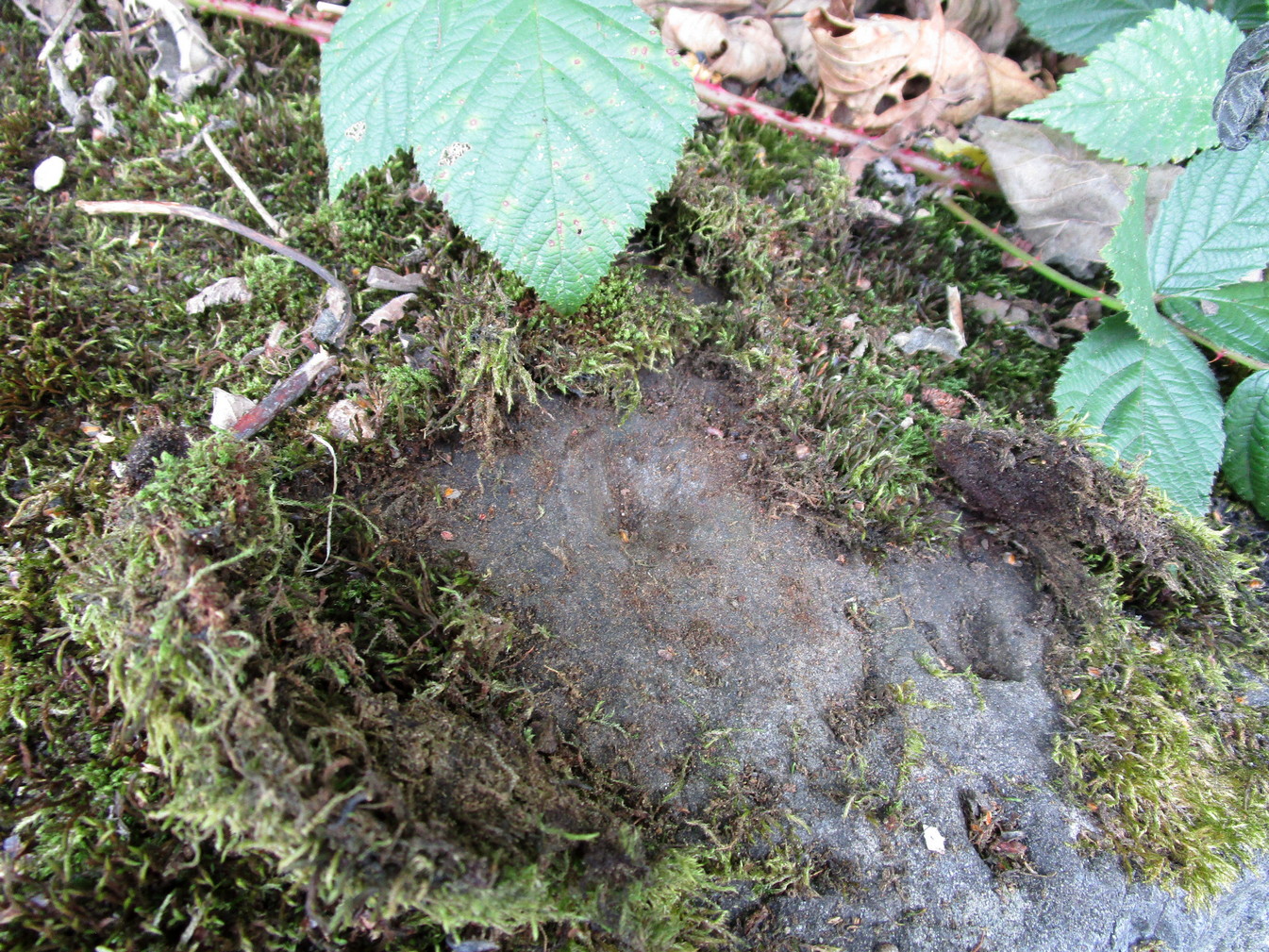
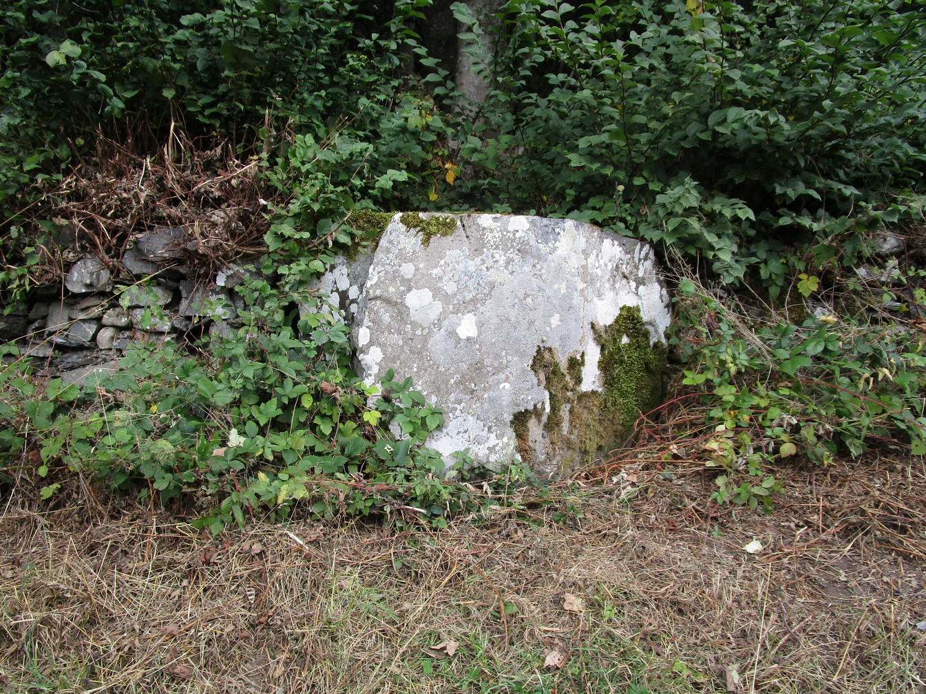
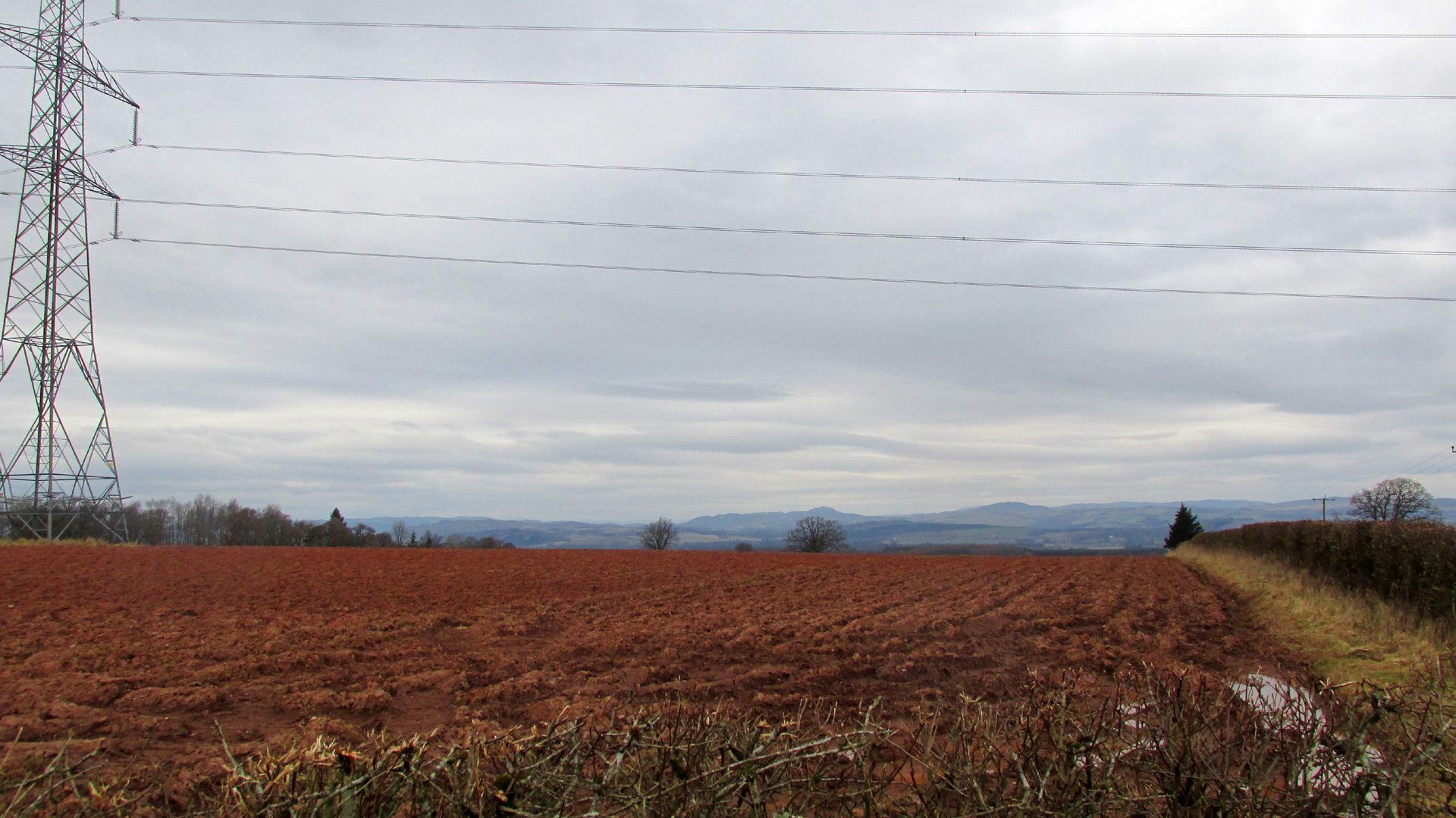
Looking north from the road the stones stood to the right of and beyond the pylon
Or as another writer puts it, they were; ‘dug around and under, and buried, in the agricultural improvement of theground’. For all we know from the written descriptions that have come down to us the stones may be prehistoric monoliths, with it seems only one of them carved. As they stood alongside the Roman road from Muthill to Kirriemuir, the moon and stars may have been cut by the Romans, or they could equally have been from the hand of a Pictish or later mediaeval mason. The field in which they stood was alternatively known as ‘Moonstone Butts’ or ‘Moonbutts’ – where the local archers practised.
Folklore
While the word ‘moonshade’ doesn’t appear in Jamieson’s Scottish Dictionary, nor the online Dictionaries of the Scots Language, the Oxford English Dictionary defines it as an obsolete word for ‘nightshade’, citing a quotation from Sir Francis Bacon’s Sylva Sylvarum of 1627:
‘The Ointment, that Witches use, is reported to be made, of the Fat of Children, digged out of their Graves; Of the juyces of Smallage, Wolfe- bane, And Cinquefoile; Mingled with the meale of fineWheat. But I suppose that the Soperiferous Medicines are likest to doe it; Which are Henbane, Hemlocke, Mandrake, Moone-Shade, Tobacco, Opium, Saffron, Poplar- Leaves.’
Given the stones are in the Perthshire witch country (the Witches Stone of Shakespeare’s Macbeth is only 2½ miles due south of here), this is nevertheless almost certainly a ‘red herring’, with the field deriving its name from the carvings on the stone. Only when we can again see the Moonshade Stones, ‘digged out of their grave’ will we be able to begin to understand them. So will there be any motivation to excavate them?
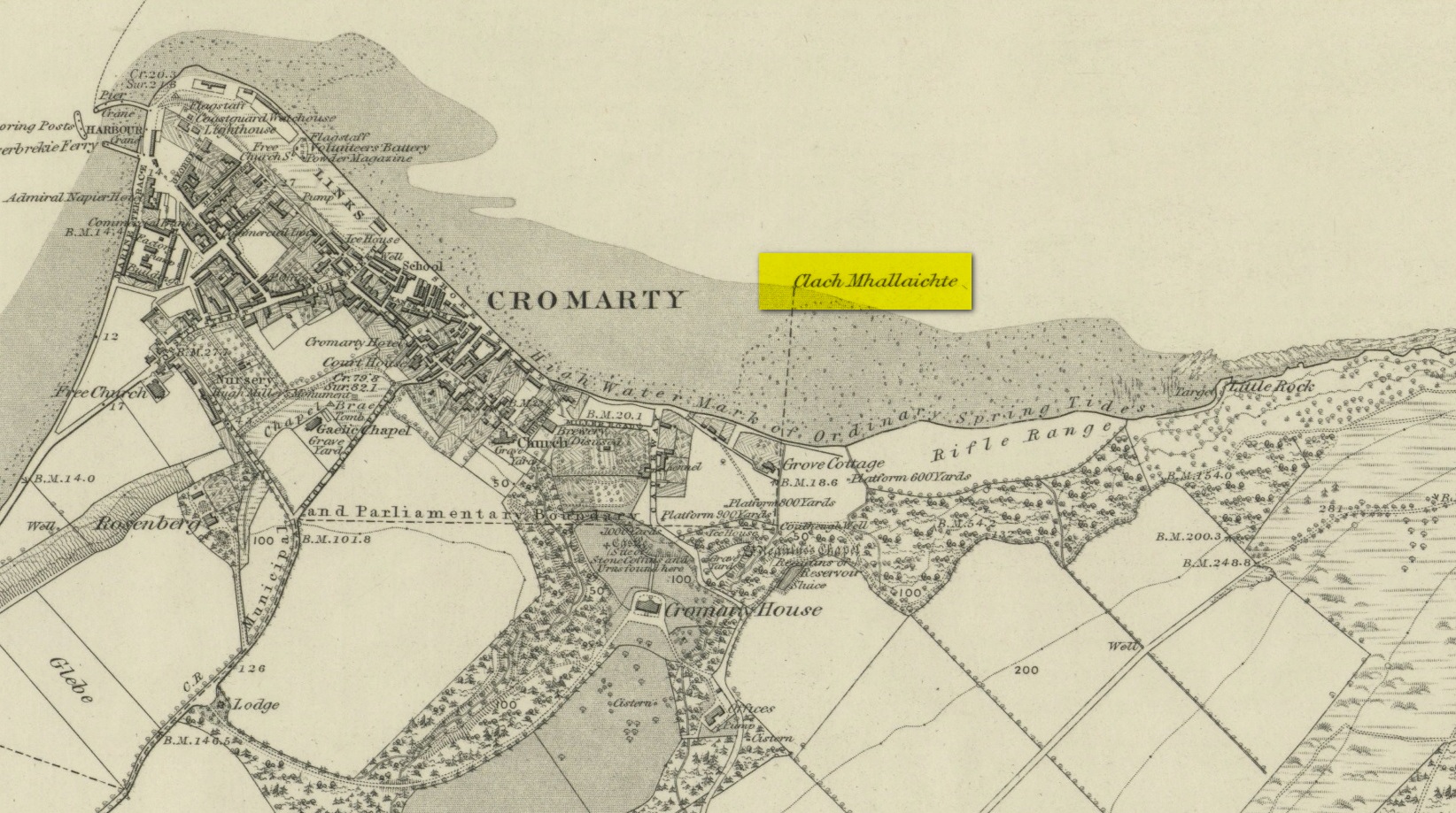
This large boulder found off the Cromarty coast, was highlighted on the 1880 OS-map of the region. It is one of the ancient boundary stones of the township.
Folklore
We know from the vast array on the folklore of stones that many were imbued with magickal abilities, some of which were witnesses to vows and others to make curses from. This large boulder off the coast of Cromarty was, according to Donald MacKenzie (1935), a place where the latter used to be done. He told us:
“At Cromarty there is a big boulder known as the Clach na Mallachd (‘Stone of Cursing’). Curses were delivered when an individual stood or knelt bare-kneed upon it.”
In an earlier account by the Ordnance Survey lads in one of their Name Books, they gave the following tale that had been narrated to them:
“A large stone Situate at the Low Water, and forming one of the boundary Stones of the burgh, the reason of its having this name is, that a young lad while Sitting on it was overwhelmed by the advancing tide and drowned, his mother when told of it, cursed the stone, hence the name Clach Mallach (Accursed Stone)”
References:
MacKenzie, Donald A., Scottish Folk-lore and Folk Life, Blackie: Glasgow 1935.
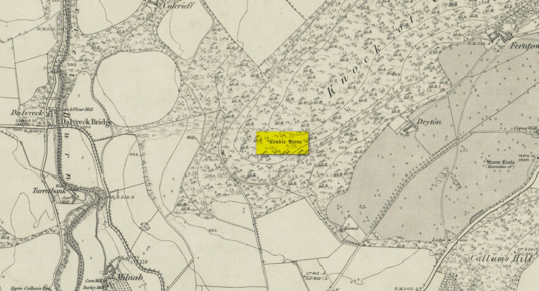
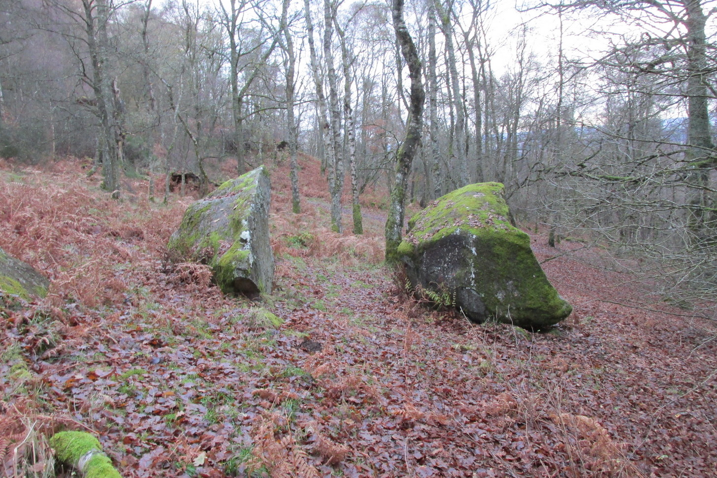
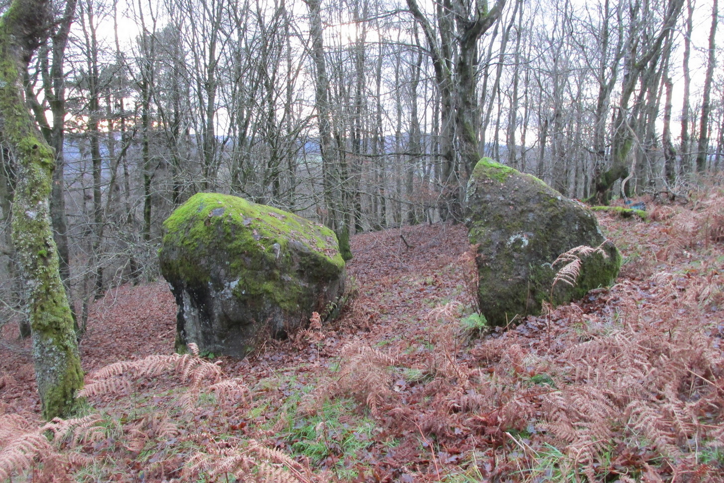
A bit troublesome to locate if you don’t know the area. Get into the town centre where the paved St George Square is by the main road. Cross the road and go up Hill Street, which runs straight into Ferntower Road. A few hundred yards up turn left up Ewanfield, all the way to the very end at Crieff Hydro. From here you’ll see the path uphill by the tennis courts. Walk up and past the holiday chalets until your hit the road that curls round the bottom of the woods. Go along until you find the car park and just above here by the roadside is a tourist board showing the Knock Walk footpath. The Cradle Stone is about 250 yards up the Knock Walk from here, 100 yards into the woods on the right.
Archaeology & History
This large broken boulder is the result of it once living further up the hillside. One of Nature’s great forces then kicked the olde fella and he rolled down the hill to its present position. It was mentioned in a detailed 19th century geological survey by Mr Thomson (1836), where he told:
“At Crieff, in Perthshire, there occurs a series of low hills running parallel to the Grampians. These hills consist of old red sandstone and greywacke. On one of them, the Cnock, the village of Crieff is built. Upon the south-east side of this hill, towards the southern extremity, not far from the summit, there are deposited a number of boulder stones of syenitic granite. The largest of these is called the ‘Cradlestone’. It is nearly spherical, quite smooth on the surface, and 29 feet in circumference. It has been split in two by lightning, (according to the tradition of the place,) and one of the fragments has made one complete revolution down the hill and then stopped. The weight of this boulder is about 30 tons. The nearest mountains of syenitic granite, are those in the neighbourhood of Bennevis, distant more than 60 miles north-west…”
The stone was subsequently entered in Fred Cole’s (1911) outstanding survey of the local megaliths, although acknowledged it has having no archaeological pedigree. The Cradle Stone, he wrote, is
“the appellation printed in Old English lettering on the Ordnance Map, given to one of two huge boulders difficult to find in the fir-woods at the western extremity of the Knock, and at a height of nearly 600 feet, midway between Knockearn House and Culcrieff. On visiting the site, the conclusion became apparent that these two blocks were merely natural curiosities, and had no interest for the archaeologist beyond the name.”
Folklore
In volume 10 of the New Statistical Account it was told how local folklore attested the Cradle Stone as being where the babies came from, perhaps intimating some fertility legend long since forgotten.
The main thing attached to this giant broken stone is the old folk-tale that used to be more well-known in the 19th century than it is today. It was narrated at length in Macara’s (1881) fine pot pourri of local histories and legends and which I hope you can forgive me citing in its entirity here:
“In the memory of men still living, two well-known weavers, named James Livingstone and James M’Laren, lived in Barnkettick, at the west end of the town. Livingstone was a thorough wag, and M’Laren was somewhat of a simpleton. Livingstone was in the habit of telling his neighbour all sorts of extravagant stories about ghosts and witches. The facility with which the latter fraternity could turn themselves into hares and scamper about was an accepted fact, which M’Laren as truly believed as his Bible.
“The Rocking or Cradle Stone on the brow of the Knock, behind the town, was supposed to be of Druidical origin, and for ages drew forth the fear and wonder of the natives. A belief prevailed that something valuable was buried in its foundation, and worth lifting, if it could only be got at. Livingstone having heard of “Whang, the Miller” directed McLaren’s attention to the subject of valuable treasure being beneath the cradle stone, which was greedily swallowed, and he expressed his astonishment that no one tried digging for it.
“Livingstone suggested that they both should try it, and divide the spoil. M’Laren agreed, and it was resolved to make the attempt that night after dusk. The necessary picks and spades were soon borrowed. Livingstone called on an acquaint- ance or two, and informed them of the “ploy,” and they readily agreed to arrange and have some fun at the “howking” of the treasure.
“The acquaintances were up at the spot early, with a view to set some snares for hares, so that the journey would combine pleasure with profit. They had also provided a few “squibs” for contingencies. At the time appointed the two weavers, with their implements on their shoulders, arrived at the stone and set to work. M’Laren did so with strong impressions of a coming calamity, which soon made him feel the greatest terror. Livingstone worked with a will, and upbraided M’Laren with cowardice.
“With that a strange, unearthly sound came up the hill, and on looking round, a ball of fire was seen careering through the underwood. M’Laren felt queerish and almost speechless. Another hissing sound was heard, and the strange fire came nearer. Livingstone still wrought on, telling M’Laren never to heed, as these things were only bits of falling stars. M’Laren thought otherwise. They were in the neighbourhood of Monzie, where it was certain there were plenty of witches, and it was evident something “no canny” was brewing. He would have given anything to have been at his loom.
“In an instant three or four fiery darts from different directions came hissing along, and darted through the heath at their feet. M’Laren was paralysed with fear. Livingstone ceased work instantly, and jumping out of the trench he made, yelled he smelt brimstone, rushed from the stone and was lost in the darkness. Poor M’Laren’s limbs trembled like a leaf and were scarcely able to support him. As he was trying to follow his companion, another fire shower rained about him, and down the hill he went like a deer, yelling on Livingstone to wait on him.
“As he neared the parks above Milnab, the hares acid rabbits were scampering in all directions, and a few found their necks in the snares, which caused them to squeal at the pitch of their voices too. M’Laren being now thoroughly convinced that the witches were let loose, speed was added to his limbs, and with supernatural fleetness he bounded over all obstructions and found himself in an instant or two in his room, and jumped into bed. A cold sweat broke out all over his body and his heart beat with sharp thuds, shaking the bed. It was some time ere he could collect his scattered senses, so as to realise whether or not he was dreaming. The moisture in his eyes caused every blink of the fire to appear like the horrid hissing fire darts of the Knock. After a time he fell into a stupor, the recent events being still vividly before his mind.
“His cronies on the Knock tumbled amongst the heather and broom, shouting with joy at the success of the scheme. After giving vent to their excited feelings they went back to the Cradle Stone and lifted the picks and spades, and on their way home went round the snares and found a good “take.” As they were killing the hares, Livingstone suggested that a live one be taken to M’Laren, which was readily agreed to. On reaching home, Livingstone slipped into M’Laren’s house, and all seemed at rest. Creeping quietly ben to Jamie’s end of the bigging, he tied the live hare to the foot of his bed. As he was retiring he jostled against the hen roost and set the cock a-crowing, which so far roused Jamie that he thought it was scarcely morning yet. The cock crowed away, and soon the neighbouring roosts bestirred themselves, and all the cocks in the neighbourhood returned the vocal sound, as if it were morning.
“Poor Jamie, on reflecting, resolved that if he got over the present raising of “Auld Clootie” scathless, he would pledge himself never to trouble him or his again. As he thus pondered he thought he heard a strange pattering on the floor, and an occasional slight pull at the bed. On straining his eyes and looking floorwards he saw something not unlike a reputed witch moving about the foot of the bed. On closer observation this was fully confirmed, and he instinctively roared for help. His daft brother was now roused, and he roared also, and the hamlet dogs lent a willing voice. The wags who had collected outside rushed in, and on putting some fir roots on the fire the blaze showed Jamie, nearly demented, in bed, with his wearing clothes still on, and some dogs entering the room set a-worrying the hare. At the sight of well-known faces Jamie jumped out of bed. So much excited that it was feared that the joke had been carried rather far. Livingstone was still equal to the occasion, and drawing a bottle of whisky from his pocket handed round a few glasses, and in a short time “they didna care for deils a boddle.” Jamie was advised to divest himself of his clothes and go to bed, which he did, and soon fell into a deep sleep, and awakened next morning not much the worse. The affair got wind, and many a country fireside was made merry by the story of the Cradle Stone treasure.”
Macara, Duncan, Crieff: Its Tradtions and Characters, D. Macara: Edinburgh 1881.
Thomson, Thomas, Outlines of Mineralogy, Geology and Mineral Analysis – volume 2, Baldwin & Cradock: Edinburgh 1836.
Acknowledgements: Big thanks for use of the 1st edition OS-map in this site profile, Reproduced with the kind permission of the National Library of Scotland.