St. Hilda’s Well, Whitby, North Yorkshire

Holy Well (destroyed):  OS Grid Reference – NZ 9006 1102

Archaeology & History

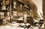
Virgin’s Pump, c.1890

This is one of at least five wells dedicated to St. Hilda in North Yorkshire that my old colleague Graeme Chappell has uncovered over his many years of research.  It’s sadly been destroyed, and accounts of it seem to be few and far between; but from the short description of it by Mr J.C. Atkinson (1894)—and helped out by its later title—we at least know where it once was.

In his account of the old roads in the village, Grape Lane was mentioned as far back as 1396, and close by, he wrote,

“is a spring called Seynt-Hild-keld, possibly where the so-called “Virgin pump” stands, or stood, not so very long since.”

This ‘ere “virgin pump” is shown in an old photo taken about 1890, just round the corner from Grape Lane where, today, is the car park on Church Street, opposite The Endeavour.

Folklore

St Hilda was a 7th century saint who was reputed to have founded Whitby Abbey.  Her festival date was November 17.

References:

  1. Atkinson, J.C., Memorials of Old Whitby, MacMillan: London 1894.

© Paul BennettThe Northern Antiquarian

Petrifying Well, Grosmont, North Yorkshire

Sacred Well:  OS Grid Reference – NZ 82844 06665

Archaeology & History

Petrifying Well on 1853 map

Petrifying wells are found across the British Isles and would be deemed as being medicinal, or curative at the very least.  In Jeremy Harte’s (2008) massive study, he infers that some of them will have been regarded as sacred or ‘holy’. Their ability to calcify objects would be seen as a very strange effect indeed!  Yet despite this Eskdale example being shown on the first OS-map in 1853, its history seems to have been forgotten.  Back then, you could find it on the east side of the Murl Slack Beck, nearly a mile north of Grosmont village.  I highlight the site in the hope that someone may be able to unearth something about its past and/or its present condition.

References:

  1. Harte, Jeremy, English Holy Wells – volume 1, Heart of Albion Press: Marlborough 2008.

© Paul BennettThe Northern Antiquarian


Pen Howe (2), Sleights Moor, Sleights, North Yorkshire

Tumulus:  OS Grid Reference – NZ 8566 0369

Archaeology & History

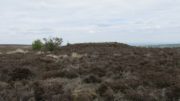
The low rise of Pen Howe-2

Prehistoric companion to the more pronounced Pen Howe (1) Bronze Age cairn just 20 yards to the west, this overgrown tumulus is hardly noticeable when the heather’s deep and is probably only of interest to dedicated antiquarians and geomancers.  Its position in the landscape, whilst not as prominent as its companion and the nearby Breckon Howe, would still have been important to its builders and the relative proximity of the two tombs may imply a continuity of tribal companionship in the Land of the Dead.  But hey! – that’s just a silly idea of mine! 🙂

Rising barely three feet above ground level, this is slightly smaller than Pen Howe (1), being just 13 yards across; and there is no indication that it has ever been dug into.

References:

  1. Elgee, Frank, Early Man in Northeast Yorkshire, Frank Bellows: Gloucester 1930.

Acknowledgements:  Big huge thanks to my Lindsay Mitchell for getting us up to see this old tomb (which is nearly as old as Linzi 🙂).

© Paul BennettThe Northern Antiquarian


Pen Howe (1), Sleights Moor, Sleights, North Yorkshire

Tumulus:  OS Grid Reference – NZ 85638 03722

Getting Here

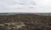
Pen Howe from the north

Along the A169 road between Sleights and Pickering, some two miles south of Sleights turn right as if you’re going to the tombs of Flat Howe and the Bride Stones, but just park up 80 yards along by the cattle grid.  From here, a fence runs southeast and the mound is on the near skyline, just over 100 yards away.  Just walk through the heather to reach it.

Archaeology & History

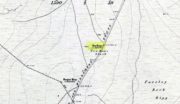
Shown on the first OS map of the area in 1853, this somewhat overgrown prehistoric tomb is one of two in close attendance to each other (see Pen Howe 2); and is some 435 yards (398m) away from the more prominent Breckon Howe tomb to the southwest.  Like others on Sleights Moor, no real archaeological attention has been paid here, with Frank Elgee (1930) only giving it the slightest mention in passing.

Pen Howe on 1853 map
Pen Howe, looking SE

Smaller than its nearby companions of Flat and Breckon Howe, the overgrown cairn raises about four feet above ground level and about 20 yards across.  Probably Bronze Age in origin, it has a slightly concave top that gives the impression that someone at sometime in the not-too-distant past has had a bittova dig here to see if there’s owt inside.  But we have no record of such a thing.

surmounted by a relatively recent boundary stone, sits at the highest point on the moors in these parts.  Despite this (as with others on these moors), very little has been written about the place and it has received only minimal attention in archaeology tomes.  Even the renowned pen of Frank Elgee (1912; 1930) gave it only passing mention.  Perhaps it aint a bad thing to be honest.

References:

  1. Elgee, Frank, Early Man in Northeast Yorkshire, Frank Bellows: Gloucester 1930.

Acknowledgements:  Big huge thanks to my Lindsay Mitchell for getting us up to see this old tomb and its companion.  (which is nearly as old as Linzi 🙂 )

© Paul BennettThe Northern Antiquarian


Robin Hood & Little John Stones, Whitby, North Yorkshire

Standing Stones (destroyed?):  OS Grid Reference – NZ 9171 0952

Also Known as:

  1. Robin Hood’s Pillars

Archaeology & History
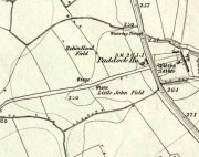
The 2 stones on 1853 map

The 2 stones on 1853 map

References to these old standing stones are scarce—at least in archaeology books anyway.  Even the usually diligent masters of Burl (1993) and Thom (1990) missed them!  But thankfully our folklorists and antiquarians with their keen interest in popular culture have written about these long lost monoliths, which could once be seen in fields just a mile or so south of Whitby town.

The earliest known account of the site is as the “Robyn-Hood-stone” in records dating from 1540 CE cited in the Cartularium Abbathiae de Whiteby (1881).  It was later described in land registers in 1713 and the fields in which they stood were—and still are—respectively known as Robin Hood’s Close and Little John’s Close.

These Whitby monoliths—like their namesakes in Northamptonshire— weren’t too big.  In Mr Young’s (1817) early description, when the stones were still visible, he told how Robin Hood’s stone was “a stone pillar about a foot square and four feet high”, and Little John’s Stone was “a similar pillar about two-and-a-half feet high.”  Mr J.C. Atkinson, the editor of the Cartularium (1881), also told that the two stones were “still in situ in the earlier part of the present century,” continuing:

“Both stones have now been removed, and are, I was informed, set up again near the enclosing fence of the field in which they stood. Almost beyond question , like the other monoliths of the district, they marked the site of ancient British interments.”

So—do the remains of these old stones still exist somewhere close by as J.C. Atkinson said, either in the walling, as a gatepost, or just pushed over and now covered in grass (like the long lost Thief Thorne standing stone near Addingham)?  Are any northern antiquarians living close by who might enable their rediscovery?

Folklore

A number of writers exploring the mythic histories of Robin Hood have included this site in their surveys, usually repeating the earlier creation myths about them that could be heard in popular culture.  The Whitby historian George Young (1817) told the tale:

“According to tradition, Robin Hood and his trusty mate, Little John, went to dine with one of the Abbots of Whitby, and, being desired by the Abbot to try how far each of them could shoot and arrow, they both shot from the top of the Abbey, and their arrows fell on the west side of Whitby Laithes, beside the lane leading from thence to Stainsacre; that of Robin Hood falling on the north side of the lane and that of Little John about a hundred feet further, on the south side of the lane.”

Whitby folklorist P.S. Jeffrey (1923) took this myth literally, saying how the distance of the arrows fired by the respective folk heroes was “scarcely credible, as the distance in each case is about a mile-and-a-half.”  However, the earlier historian Lionel Charlton (1779) thought the incredible feat quite credible!

The distance between the Abbey and the stones is 1.36 miles (2.2km); but it may be that the direction related in the tale was more important than the distance, as the alignment between the two sites runs northwest to southeast—or southeast to northwest, whichever you prefer!—and may relate to an early astro-archaeological alignment.  Might…..

References:

  1. Anonymous, “Robin Hood in Yorkshire“, in Yorkshire Folk-Lore Journal – volume 1, T.Harrison: Bingley 1888.
  2. Anonymous, “Whitby Arms,” in Yorkshire Folk-Lore Journal – volume 1, T.Harrison: Bingley 1888.
  3. Benedicti, Ordinis S., Cartularium Abbathiae de Whiteby – volume 2, Andrews: Durham 1881.
  4. Burl, Aubrey, From Carnac to Callanish, Yale University Press 1993.
  5. Charlton, Lionel, The History of Whitby and Whitby Abbey, T. Cadell: York 1779.
  6. Doel, Fran & Goeff, Robin Hood: Outlaw or Greenwood Myth, Tempus: Stroud 2000.
  7. Green, Barbara, The Outlaw Robin Hood – His Yorkshire Legend, KCS: Huddersfield 1992.
  8. Gutch, Mrs, County Folk-lore – volume 2: North Riding of Yorkshire, York and the Ainsty, David Nutt: London 1901.
  9. Jeffrey, P. Shaw, Whitby Lore and Legend, Whitby 1923.
  10. Mitchell, W.R., Exploring the Robin Hood Country, Dalesman: Clapham 1978.
  11. Parkinson, Thomas, Yorkshire Legends and Traditions – volume 2, Elliot Stock: London 1889.
  12. Thom, A., Thom, A.S. & Burl, Aubrey, Stone Rows and Standing Stones – 2 volumes, BAR: Oxford 1990.
  13. Young, George, The History of Whitby and Streoneshalh Abbey – volume 2, Clark & Medd: Whitby 1817.

© Paul Bennett, The Northern Antiquarian


Kendall Stone, Whitby, North Yorkshire

Cup-and-Ring Stone:  OS Grid Reference – NZ 94 06?

Also Known as:

  1. Kendall Stone

Archaeology & History

In James Simpson’s precursory essay (1866) to his monumental Archaic Sculpturings (1867), he details the former existence of a decent piece of prehistoric rock art, lost to us until very recently by the intrusive diggings of one Thomas Kendall of Pickering.  Simpson wrote:

“A large mass of sandstone in the moor above Robin Hood’s Bay, near Whitby, had some sculpturings upon it, part of which were split off by Mr Kendall of Pickering, in whose garden I have seen the slab of carvings which he thus procured.  Mr Kendall’s slab is about five feet long and two and a-half broad. Upon its surface are three or four isolated cups about an inch and a-half in breadth, and five or six others surrounded by ring-cuttings… Two or three of the ring-cuttings consist of single circles.  One consists of a triple circle and straight radial groove. The ends of the circles, as they reach the traversing groove, turn round and unite together, as in the horse-shoe pattern… The two remaining circles, which are respectively five inches and eight inches in breadth, and consist of cups surrounded by two and by three circles, are conjoined together by a long gutter.  The upper circle shows a single-and the lower a double horse-shoe pattern. In the uppermost or double circle the rounded ends of the rings are united and bestridden by a shallow right-angled line; and the ends of the lowest or triple circle are in part also conjoined by the gutter which runs from the double circle above, and by a cross straight line which runs off from it.  The circles are more imperfectly finished than usual, and at some parts present almost an appearance of being punched out rather than cut out.”

Cup-and-Ring Stone, once near Robin Hood's Bay
Cup-and-Ring Stone, once near Robin Hood’s Bay

In recent years, thanks to the cup-and-ring huntings of Chris Evans and  Graeme Chappell, the carving has re-emerged from its lost position and, it would seem, is located in someone’s garden in Pickering.  The carving is catalogued as Stone REM 1/P1 in Brown & Chappell’s (2005: 257) work on North Yorkshire rock art.  Hopefully, in the months to come, we’ll have a decent photograph and description of its present condition.  Fingers crossed!

References:

  1. Brown, P.M. & Chappell, Graeme, Prehistoric Rock Art in the North York Moors, Tempus: Stroud 2005.
  2. Simpson, J.Y., ‘On Ancient Sculpturings of Cups and Concentric Rings’, in PSAS volume 6, 1866.
  3. Simpson, James Y., Archaic Sculpturings of Cups, Circles, etc., upon Stones and Rocks in Scotland, England and Other Countries, Edmonston and Douglas: Oxford 1867.

© Paul Bennett, The Northern Antiquarian