Heugh Well, Blairgowrie, Perthshire

Healing Well:  OS Grid Reference – NO 17103 46984

Also Known as:

  1. Mineral Well

Archaeology & History

This little-known iron-bearing spring can still be found in the woodland known today as the Heugh of Mawse, a mile north of Blairgowrie.  It was included in the Object Name Book of 1863, where they referred to an earlier account in the New Statistical Account, which told that,

“On the south end of it is a chalybeate spring much resorted to by the people of the locality. “There are one or two chalybeate springs in the parish; but they have never been chemically analyzed. There is one very fine spring called the “Heugh Well” It springs from the face of the “Heughs of Mause” (a mortar cliff of singular appearance; which descends abruptly into the bed of the river with an almost perpendicular declivity of about 200 feet) and judging from its colour, contains a considerable quantity of ferruginous matter. The use of its water has been found to be very beneficial in cutaneous eruptions, & affections of the Stomach.””

Heugh Well on 1867 map

Subsequently highlighted on the 1867 OS-map, a singular footpath led to the site and no further.  It was mentioned by the regional historians J.G. McPherson (1885) and John MacDonald (1899), albeit briefly, where they respectively told that its waters were “formerly much resorted to by persons in the neighbourhood.”  It possessed considerable medicinal properties which, according to tradition, were “found very beneficial for skin diseases and derangement of the stomach”!  Doubtless such attributes will still be effective.

References:

  1. MacDonald, John A.R., The History of Blairgowrie, Advertiser Office: Blairgowrie 1899.
  2. McPherson, J.G., Strathmore: Past and Present, S. Cowan: Perth 1885.

© Paul BennettThe Northern Antiquarian

Skirtful Spring, Hawksworth Moor, West Yorkshire

Sacred Well:  OS Grid Reference – SE 13846 44288

Getting Here

Site shown on 1851 map

Easiest way to find this is from the Great Skirtful of Stones.  From here, follow the line of the fence 250 yards south, then climb over and walk dead straight south onto Hawksworth Moor for 150 yards.  You can clearly see the mass of reeds and marshy ground way before you reach it; just be very careful not to walk straight into the reeds or you’ll get sucked down into the waters—and it’s pretty dodgy if you walk into the wrong spot, with good old Jenny Greenteeth lurking beneath the surface!

Archaeology & History

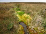
The Skirtful Spring

Highlighted on the 1851 OS-map of the area, this all-but-forgotten clear spring emerges a short distance south of the Great Skirtful of Stones and adjacent to the Hawksworth Moor cairnfield—a proximity that was probably not without meaning in prehistoric times.  Curious though it may sound, in traditional cultures across the world, water is as much an important ingredient in the cosmologies of the dead as it is in the land of the living. In earlier centuries this water-source was much more fast-flowing and wider than it is today and it would obviously have been vital for our prehistoric ancestors.  Its virtues and folklore have long since been forgotten.

© Paul BennettThe Northern Antiquarian

Holland’s Well, Smalley, Derbyshire

Healing Well:  OS Grid Reference – SK 4077 4436

Also Known as:  

  1. Holly Well

Archaeology & History

Hollands Well on 1881 map

Once visible near the middle of the village, references to this local water supply seem pretty scant.  According to Kenneth Cameron (1950) it gained its name from a local man called Robert Holland.  This may be the case; but there is a curious entry found in a notice regarding the Land Enclosures of Smalley from November 6, 1784.  In it we read that the land here was at that time owned by one Samuel Kerry (well known in the village as he built The Rose and Crown pub in 1768) who was living “upon the Common” and had “part of a croft” here.  Therein was mentioned a water source named the ‘Holly Well’ instead of the Holland Well.  I can only assume that the two are the same, as the proximity of them are very close indeed.  The account told that,

“a disused well in the triangular croft at the back of the sixth milestone in the village marks the site of (Samuel Kerry’s) original home, and he is said to have dug the “Holly Well” close by for brewing purposes, which has long supplied the vicinity with good water.”

The name ‘Holly’ may infer that a holly tree grew by the side of the well, and that the title ‘Holland’ was a corruption later grafted onto the site.  Are there any local historians out there who know more…?

References:

  1. Cameron, Kenneth, The Place-Names of Derbyshire – volume 2, Cambridge University Press 1950.
  2. Kerry, Charles, Smalley in the County of Derby, Bemrose: London 1905.

© Paul BennettThe Northern Antiquarian


Adam’s Well, Colinton, Edinburgh, Midlothian

Healing Well:  OS Grid Reference – NT 225 691

Archaeology & History

Unlike the Adam’s Well in Kent, deep daan saaaf, this northern site of the same name is not only long lost, but we can find no traditions relating it either—something of an oddity for these northern climes.  It could once be found in the open meadows east of Colinton, near where now the Redford Barracks exist and was a puzzle to the regional historian Stuart Harris (1996), who could find no early accounts of the site.  Although its name may relate to a local man called Adam, there are other examples of wells with this name from Kent to Scotland: the Kent example is deemed as an authentic holy well, whilst examples in Yorkshire and those in southern Scotland relate to the waters themselves being known as ‘Adam’s Ale’ or Adam’s Wine’—an old nickname for water itself!

References:

  1. Bennett, Paul, Ancient and Holy Wells of Edinburgh, TNA: Alva 2017.
  2. Harris, Stuart, The Place-Names of Edinburgh: Their Origins and History, Gordon Wright: Edinburgh 1996.

© Paul BennettThe Northern Antiquarian


Spring Stone Carving, Middleton Moor, North Yorkshire

Cup-Marked Stone:  OS Grid Reference – SE 11611 51610

Also Known as:

  1. Middleton Moor carving 483 (Boughey & Vickerman)

Getting Here

From Ilkley go up to Middleton and from there go up Harding Lane and, where the road bends left a track goes straight north onto the moors. Go up this until you’re onto the moor proper. Keep going until you’re following the line of walling, where a small stream is trickling right by your right-hand side. Follow this to its source a coupla hundred yards up. Stop!

Archaeology & History

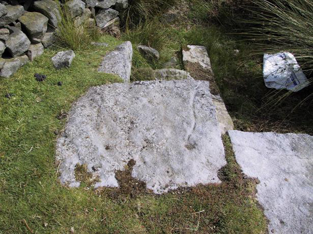
Middleton Moor CR483: single cup-and-line

First mentioned by Stuart Feather in 1965, this simple cup-marking has a long line squirming away to the edge of the rock on which it’s carved.  The cup-marking is some 3 inches across and about ½-inch deep, with the long line about 24 inches long.  There’s really nowt much to look at here unless you’re a real cup-and-ring freak — though note that the carving occurs on a broken piece of stone just where a spring of water emerges from the ground.  Some archaeo’s have a notion that sometimes our cup-and-ring stones have some sorta relationship with water — though they’re not into sticking their necks out and saying anymore than that!  And of course, some carvings obviously relate to water. This one here is a strong contender, with the long wiggly line perhaps representative of the stream running from its source, which itself is the cup-mark.

However, we might just aswell surmise that the carving here was executed by some bored teenager, just testing out his first antler pick, or flintstone, telling his mates, “I woz ‘ere!”

References:

  1. Boughey, Keith & Vickerman, E.A., Prehistoric Rock Art of the West Riding, WYAS 2003.
  2. ather, Stuart, ‘Cup and Ring Boulders,’ in the Cartwright Hall Archaeology group Bulletin, 10:7, July 1965.

© Paul Bennett, The Northern Antiquarian