Holy Ash Well, Bradford, West Yorkshire

Holy Well (destroyed):  OS Grid Reference SE 15942 34208

Also Known as:

  1. Ash Well
  2. Holy Well Ash Well
  3. Pin Well

Archaeology & History

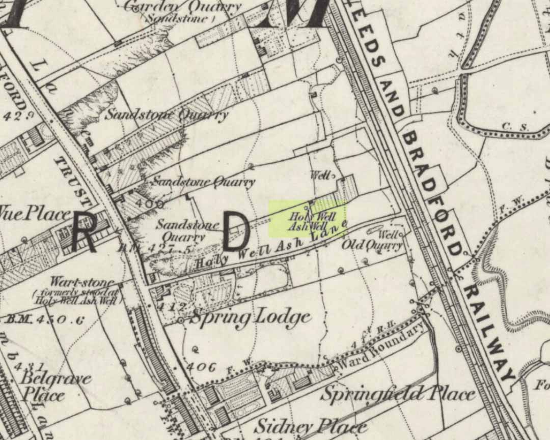
Holy Well Ash on 1852 map

Either right next to, or perhaps now beneath Bradford City’s Valley Parade football ground, was once a very important sacred well site.  Known as the Holy Ash Well and variants thereof, this healing spring was of considerable renown to people all around Bradford district in bygone days.  The site was illustrated on the 1852 OS map, and there was also a sacred stone adjacent to the well known as the Wart or Pin Stone, which had some animistic healing properties related the waters.

The old well was described by local historian Abraham Holroyd (1873) who said that:

“In Manningham Lane there is a fine well, in old deeds called Hellywell, i.e., holy well, in a field now called Halliwell Ash, now a stone quarry… Near this is the ancient Pin Stone.”

A few years later, in Robert Charles Hope’s (1893) monumental study, he described how,

“This holy well, not far from Manningham Lane, probably derived its name from having at some time been dedicated to some saint.  The inhabitants of Bradford were wont in ancient times to resort on Sundays to these wells as a common place of meeting, to drink of the waters and partake of their preternatural virtues.”

Which was another was of saying that he didn’t really know too much about the place!

The Bradford historian William Preston (1933) described this site in one of his early essays, where he informed us that local people knew the accompanying rock hereby as the Ash Stone, due to its proximity and ritual relationship to a great old ash tree (Fraxinus excelsior) that grew next to the well.  The mythic history of this particular tree should not be understated: it was a Creation deity par excellence in northern and Viking myths, but whatever old tales and power might once have been had here, in Bradford, they’ve long since been forgotten.  But it was the industrial historian William Cudworth (1896) who told the most of this all-but forgotten site, saying:

“On the sloping ground between Belle Vue and the Midland Railway there once existed a spring of water, supposed to have preternatural virtues. The name it bore within present recollection is probably a corruption of Holy-well. The holy wells of England as elsewhere had not all the same virtues attached to them. Some were blessed if used for baptisms, to others were attributed curative properties, especially for sore or weak eyes, while others were supposed to possess mystical powers, insomuch as any article dipped in them became charms or safeguards against witchery.  Any traditions associated with the spring at Halliwell (or Holywell) Ash are lost, but certainly in the early part of the present century the place was a favourite resort of the townspeople on Sundays.

“The derivation of the name is doubtful. In the survey of 1638 a close called ” Helliwell Ash” is mentioned as containing 2a. 3r. 26p., but without any indication as to its locality. The spelling of the name is of little moment.  Mr. James, in his “History of Bradford,” states that he had seen the place referred to in old deeds as “Helly-well.” By his will, dated May, 1685, Thomas Lister, of Manningham, devised to his two daughters, Juliana Lambrecht and Elizabeth Stapleton, equal shares in two closes of land called “Holywell Ash” and ” Delf Close,” besides other lands in Manningham. In the will disposing of the possessions of Juliana Lambrecht, her moiety of “Holywell Esh” was bequeathed to Francis Stapleton, her nephew.  In due course the lands in question were inherited by Francis Sharp Bridges, and have latterly belonged to Sir Francis Sharp Powell, M.P., in whose writings the form of spelling is given as ” Halliwell Ash.”

“Upon the ground in question there used to be a fine well of water issuing out of the higher ground, to which tradition assigned healing virtues. Might not the name of “holy” come from this circumstance?  Sufficient importance attaches to the tradition, however, to have led the farmers of the recent ordnance plan of Manningham to preserve the name, although the widening of the Midland Railway below Thorncliffe Terrace has almost obliterated the site.”

A more recent updated overview of the site was written by one of my old school-mates, Dave Pendleton (1997), who said of the place:

“Prior to 1886 the only feature of any real note in the Valley Parade environs was a holy well that emerged near the corner of the football grounds Midland Road and Bradford End stands; hence the road Holywell Ash Lane. Today the site of the well is covered by the football pitch.

Only the road name survives as a reminder of what was apparently one of the district’s foremost attractions. On Sundays and holidays people would gather to take the waters and leave pins, coins, rags and food as offerings to the spirit that resided in the waters.

Accounts suggest that the well was covered and had a great ash tree standing over it (hence ‘holy ash’). There was also a standing stone called the wart stone of unknown antiquity. The stone had a carved depression that collected water. It was believed that the water was a miraculous cure for warts. Indeed, as early as 1638 the Holy Well had been credited with healing powers.

The well suffered a decline in popularity during the late nineteenth century and its keepers resorted to importing sulphur water from Harrogate, which they sold for a half penny per cup. The well disappeared under the Valley Parade pitch during the summer of 1886 and the wart stone was moved to the top of Holywell Ash Lane – which then ran straight up to Manningham Lane. The stone was still there as late as 1911 but thereafter it seems to have disappeared into the mists of time.”

A night-club adjacent to the Valley Parade football ground—called Bibby’s—was said to have had an old well in its cellar, which the owner of the place, Mr Pearl Gladstone Minott, said was ‘haunted’.

Unfortunately I’ve not been able to find any old photos or drawings of this lost holy well – though I imagine that some local, somewhere must be able to help us out with this one.  Surely there’s more of this site hidden away somewhere….?

References:

  1. Bennett, Paul, The Old Stones of Elmet, Capall Bann: Milverton 2001.
  2. Cudworth, William, Manningham, Heaton and Allerton, W. Cudworth: Bradford 1896.
  3. Holroyd, Abraham, Collecteana Bradfordiana, Saltaire 1873.
  4. Hope, R.C., The Legendary Lore of the Holy Wells of England, Elliot Stock: London 1893.
  5. Pendleton, David & Dewhirst, John, Along the Midland Road, Bradford City AFC 1997.
  6. Preston, W.E., ‘Some Bradford Holy Wells’, in Bradford Antiquary, volume 7, 1933.

© Paul Bennett, The Northern Antiquarian 

St. Helen’s Well, Holbeck, Leeds, West Yorkshire

Holy Well (destroyed):  OS Grid Reference – SE 295 329

Archaeology & History

In the Holbeck area of Leeds, one of the three spa wells was previously patronised to this mythical saint, whose wells profuse in this part of the world.  St. Helen’s Well (later becoming the Holbeck Spa Well) was found at the appropriately named St. Helens Bridge.  Ralph Thoresby (1715) wrote of the place: a supposed medicinal holy well, it previously had a chapel by it, of which no trace is seen today. John Mayhall (1860) also mentioned this “medicinal well,” but told little more. It was Andrea Smith (1982), more than a century later, who wrote the most about the place:

“In connection with the well by St.Helen’s Bridge, Holbeck, (Thoresby) refers to “another ancient fabrik called St. Helen’s,” but there is a difficulty in deciding exactly what he means by ancient; it is taken here as meaning more than two hundred years old. This suggests, then, that by St. Helen’s Bridge there was once a well and chapel which gave rise to the dedication and which was probably a Medieval foundation, considering the popularity of St. Helen at that time.”

Both of these sites have long since disappeared. The well eventually became known as a local Spa Well, and was found to possess a high sulphur content.

References:

  1. Mayhall, John, The Annals of Yorkshire, Joseph Johnson: Leeds 1860.
  2. Smith, Andrea, ‘Holy Wells Around Leeds, Bradford & Pontefract,’ in Wakefield Historical Journal 9, 1982.
  3. Thoresby, Ralph, Ducatus Leodiensis: or the Topography of the Ancient and Populous Town and Parish of Leedes, Robinson & Holdsworth: Leeds 1816.

© Paul Bennett, The Northern Antiquarian

Barrow Well, Compton Martin, Somerset

Sacred Well:  OS Grid Reference – ST 537 573

Archaeology & History

This rather delapidated spring of water (there are actually two springs here) marks the western edge of the parish boundary, just on the south-side of the A368 road towards Ubley, on what Phil Quinn (1999) described as “a neglected triangle of shrubby ground.”  Its name derives from once being associated with a prehistoric tomb, or barrow, as the associated field-names of Barrows Orchard and Barrow Cross here indicates.  Sadly however, all remains of whatever tomb there once was appears to have gone.  Aerial imagery shows what may have been two or three barrows in the said field.

Folklore

A haunted site: the folklore here is akin to banshee-lore and similar mythic figures.  The fact that it marked the old boundary line between here and Ubley may have something to do with it.  Quinn (1999) says how,

“Local folklore states that the well was haunted by the ghost of a woman washing cabbages”!

But this vegetative lore is likely a mistranslation of a local dialect word.  Precisely what the spirit was supposedly ‘washing’ seems to have been lost in translation.

References:

  1. Quinn, Phil, The Holy Wells of Bath and Bristol Region, Logaston: Almeley 1999.

© Paul Bennett, The Northern Antiquarian

St. Patrick’s Well, Carrowreagh, Donegal

Holy Well:  OS Grid Reference – C 367 196

Folklore

To be found somewhere between the two outer embankments on the southern side of the legendary Grianan of Aileach, this — one of many St. Patrick’s Wells in Ireland — is typically attributed with healing properties.  It was described in Henry Morris’ (1938) survey (amongst others) as being the place where, in the 5th century when St. Patrick came here, Prince Eoghan was baptised and thereafter turned his back on the heathen gods of his ancestors for this new christian cult which was just growing at that time. (‘Eoghan,’ pronounced owen)  Thereafter other people were baptised by the waters from here, which in ancient days would have been the water supplies for those at the Grianan.

Henry Swan (1938) told that in previous times there once grew a legendary tree by this well, into which pilgrims inserted pins and other artefacts as offerings and to make wishes to the spirit of the waters. A similar thing (with the same underlying mythic structure) occurred at the tree and holy well of Loch Maree.

Up until quite recently, the well was very overgrown and in a condition that Rear Admiral Pascual o’ Dogherty called “disgusting.”  He called for renovation work and action to bring this ancient site back into good health, and thankfully, as a result of the man’s proclamations, St. Patrick’s Well here has been brought back into a good state of life.  Excellent stuff good sir!

References:

  1. Lacy, Brian, Archaeological Survey of County Donegal, DCC: Lifford 1983.
  2. Morris, Henry, ‘The Holy Wells of Inishowen,’ in H.P. Swan’s Book of Inishowen, Buncrana 1938.
  3. o’ Muirgheasa, Enri, ‘The Holy Wells of Donegal,’ in Béaloideas 6:2, 1936.
  4. Swan, Harry Percival, The Book of Inishowen, William Doherty: Buncrana 1938.

© Paul Bennett, The Northern Antiquarian

Jinny Well, Newchurch-in-Pendle, Lancashire

Sacred Well:  OS Grid Reference – SD 82377 39458

Getting Here

Easy to locate: it’s just by the roadside on the left-hand side of the road, Jinny Lane, coming out of the village, just after the last house where the field begins.

Archaeology & History

Nowt to write home about, as they say.  The waters here trickle from the earth into an old stone trough — but they don’t look too appetizing (even I didn’t have a drink, which is something of a rarity!).  Its the folktale accompanying this little site, giving a distinct hint of some heathen past, that I found intriguing.

Folklore

Here was once the spirit of a woman called Jinny – who gave her name to the road it’s on – that wandered betwixt the well and an old stone, once found further up the hillside (after a bitta digging, we found the remains of the old stone, previously an authentic monolith). It was said that if you wandered along the road on certain moonlit nights, her spirit would chase you. To make matters worse, the ghost was a headless one!

Jinny’s spirit originally resided, peacefully, in the broken old stone atop of the hill. At a certain time of the year, the spirit of the stone would venture downhill to drink from the waters here (much as we find at Rollright and other places). But one day a xtian priest came along and, because of its heathen association, broke the old stone in half and cursed the spirit which roamed between the sites. Thereafter, Jinny’s ghost wandered in torment, with her head hacked off, scaring people half to death when they saw her. And so, another priest was eventually called who, to the satisfaction of local people, eventually put Jinny’s ghost to rest, as they say. It seems to have been a successful ritual, as no-one has reporting seeing the headless ghost for many a long year.

References:

  1. Byrne, Clifford H., Newchurch-in-Pendle: Folklore, Fact and Fiction, Marsden Antiquarians: Nelson 1982.

© Paul Bennett, The Northern Antiquarian


St. Helen’s Well, Colne, Lancashire

Holy Well:  OS Grid Reference – SD 890 397

Getting Here

This site can be reached with relative ease from Colne’s train station by crossing the road and going up Bridge Street, turning immediately left along Shaw Street for several hundred yards until you reach Waterside Road on your left-hand side.  From here, as Mr Tom Sharples told, “St. Helen’s Well is presently within the area of overgrown and unmanaged scrub woodland adjacent to Waterside Road.”  Look around!

Archaeology & History

First described on the Megalithic Portal by the pseudonymous Brionnfhionn, this recently rediscovered holy well can be found on the southern side of Colne, at Waterside.  A few months after the MegPortal announcement, a more detailed overview of the site was published on GoogleDocs, from where Mr Tom Sharples has kindly allowed us to repeat the information that both he and Susan Bryant-Lauder compiled there.

The site was relocated after reference had been found in Geoff Crambie’s (1978) A Colne Festival, where he wrote:

“1935 saw the end of St. Helen’s Mill in Waterside.  Built by Nicholas England in 1835, it was named after the St. Helen’s Well nearby, which was reputed to have been named by the Romans.”

The local writer Dorothy Harrison (1988) also mentioned the site, though only in passing, when she told,

“Along with St. Helen’s Well, Buck Spout provided the main source of drinking water in Waterside.”

There has to be some more information about this little-known site hidden in some old Lancastrian history or folklore work, somewhere – surely!?

References:

  1. Crambie, Geoff, A Colne Festival, Turner & Earnshaw: 1978.
  2. Harrison, Dorothy (ed.), The History of Colne, Pendle Heritage Centre 1988.

© Paul Bennett, The Northern Antiquarian


Fairy Well, Barrow Gurney, Somerset

Sacred Well:  OS Grid Reference – ST 53243 68625

Getting Here

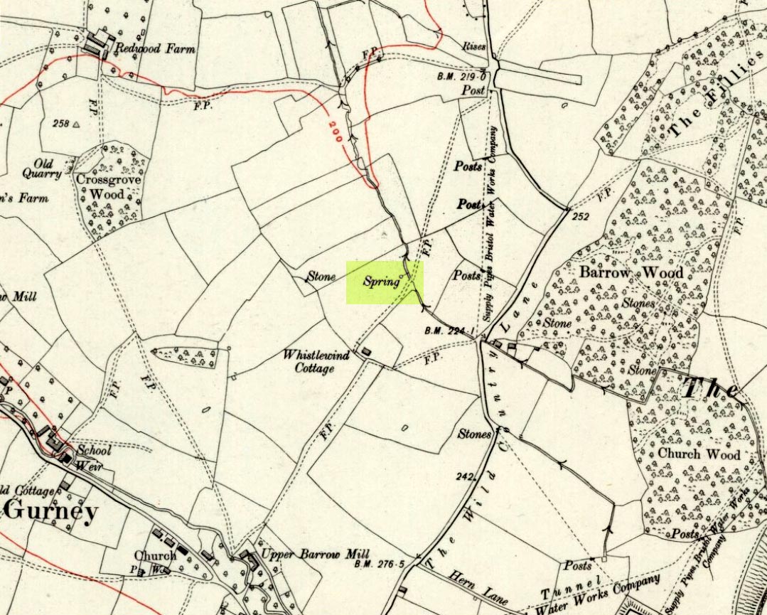
Fairy Spring on 1921 OS-map

Go up the nicely-named Wildcountry Lane at the staggered crossroads on the edge of Barrow Gurney for about a half-mile, watching out for the dip in the road where it crosses the stream.  Walk up the stream here for a coupla hundred yards, keeping your eyes peeled for the small spring on your left just past where a footpath crosses the stream.

Archaeology & History

Little of historical nature is known of this site, found in the dip near the stream, though it was much frequented in bygone centuries as a curative place for sore eyes.

Folklore

Although named after the little people, Phil Quinn (1999) wrote that,

“even the oldest villager cannot remember how the fairies became connected with this well.  All that is told is that the people would go to the well to bathe their eyes, for the water was believed to be good in the treatment of all eye complaints. A local woman remembers that her father, who worked the land in this neighbourhood, would always drink from the well using a cup which was never taken away or used for any other purpose.”

It is likely that the fairy association here derived from the proximity of a nearby prehistoric tomb, cairn or similar archaeological remain.  The aptly-named Barrow Wood immediately east and other ‘barrow’ place-names nearby would add weight to this notion. (faerie-lore has widespread associations with prehistoric tombs and similar relics)

References:

  1. Quinn, Phil, The Holy Wells of Bath and Bristol Region, Logaston: Almeley 1999.

© Paul Bennett, The Northern Antiquarian


Tobar na H-aoise, Iona, Argyll

Holy Well: OS Grid Reference – NM 2839 2525

Also Known as:

  1. Canmore ID 21613
  2. Pool of Healing
  3. Well of Age
  4. Well of Healing

Folklore

Although ascribed as a holy or healing well, this site is actually a curious natural water-filled depression near the top of Dun I, on the northern side of the island.  It is one of three magickal wells to be found hereby.  F.M. McNeill (1954) described this Well of Eternal Youth as having a fame that had spread far and wide, saying,

“Here, through ages past, pilgrims of each generation have lingered at the enchanted hour of dawn, ‘to touch the healing water the moment the first sun-ray quickens it.'”

In doing so, devotees would recover the energies of youth once more and live a longer healthy life.

References:

  1. Hannan, Thomas, Iona and some Satellites, W. & R. Chambers: London 1928.
  2. McNeill, F. Marion, Iona, Blackie & Sons: Glasgow 1954.

© Paul Bennett, The Northern Antiquarian


Peggy Well, Silsden, West Yorkshire

Healing Well:  OS Grid Reference – SE 0655 4413

Also Known as:

  1. Peggy Mawson’s Well
  2. Peggy’s Well

Getting Here

Peggy Mawson’s Well on 1853 map

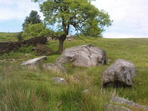
From Riddlesden, take the road up to the moorland and Rivock Edge.  When you reach the top (Silsden Road), turn left.  Go on for about 600 yards till you reach the lovely tree-hidden old cottages of Holden Gate, on your right.  Stop — and walk down the footpath opposite from here.  As the wall goes down, you’ll notice a stream in the next field to your left, emerging from a clump of large rocks.  That’s it! (there’s a footpath in the next field from the roadside)

Archaeology & History

Shown on the first OS-map as ‘Peggy Mawson’s Well,’ little else seems to known of this place; though it obviously got its name after the local lady, Peggy Mawson.  I can find no further information about this lady, nor why the site was named after her.  Any help here would be hugely appreciated!

Peggy Mawson’s Well – now drained-off through pipes

Sadly the waters from beneath the rocks have been channeled into a couple of pipes and the well no longer runs.  All that’s left is a small boggy region just in front of the boulders.  You have to walk about 100 yards further down the field where the water emerges from a modern pipe.  It doesn’t taste as nice as it originally did when coming straight from the ground, but it’s still quite drinkable (certainly beats any of the chlorinated stuff* that customers are forced to pay for, whether we want it or not – and most people don’t want it).

Folklore

This site has acquired modern folklore, but sadly no early traditions have been found.  Whelan & Taylor (1989) thought that Peggy Well’s “dedication suggests a connection with St. Margaret,” which unfortunately isn’t the case.  Several years later another writer, Val Shepherd (1994), spun the speculation even further, not checking the historical background to the site, and thought that “the well’s name may be derived from the water spirit, ‘Peg,’ who gave her name to other wells.”  Sadly neither idea holds any sway.

References:

  1. Shepherd, Val, Historic Wells in and Around Bradford, HOAP: Loughborough 1994.
  2. Whelan, Edna & Taylor, Ian, Yorkshire Holy Wells and Sacred Springs, Northern Lights: Pocklington 1989.

* Anyone know about this: surely because the water companies chlorinate and add other undesirable toxins into our tap water, what we’re actually drinking is a very weak solution and not actually water.  Isn’t that a trading standards violation?

© Paul Bennett, The Northern Antiquarian


St. Thomas’ Well, Cambusbarron, Stirlingshire

Holy Well: OS Grid Reference – NS 7790 9304

Archaeology & History

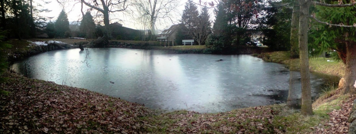
St.Thomas Well pond – on a freezing grey day!

Very close to the edge of the M9, this old water source is thankfully still visible, though not in its original state.  At the bottom of the ridge, loosely enclosed in the grounds of St. Thomas Well House, we find that the original well has been submerged into the pond which covers it.

Folklore

I’ve not yet found the mythic origins behind the dedication to this site, though St. Thomas’ Day is the winter solstice on December 21, and his mythic status was that of didymus, or twin.  In Yorkshire, folk customs surrounding this figure have been found to be inextricably intertwined with death rites, Robin Hood and shamanism!  But this Stirlingshire site is as yet silent.  The presence of numerous prehistoric burials very close by may have something to do with its dedication, as such sites would heighten the likelihood of there being ‘heathen’ practices close by, to which the said ‘St Thomas’—or one of his emissaries—could subdue with their christian figure.  But that’s pure speculation on my part…

References:

  1. Attwater, Donald, The Penguin Dictionary of Saints, Penguin: Harmondsworth 1965.
    Morris, Ruth & Frank, Scottish Healing Wells, Alethea: Sandy 1982.
  2. Fleming, J.S., Old Nooks of Stirling, Delineated and Described, Munro & Jamieson: Stirling 1898.
  3. Royal Commission on the Ancient & Historical Monuments, Scotland, Stirlingshire – volume 2, HMSO: Edinburgh 1963.

© Paul Bennett, The Northern Antiquarian