Our Lady’s Well, Liberton, Edinburgh, Midlothian

Holy Well:  OS Grid Reference – NT 2640 7008

Also Known as:

  1. Canmore ID 52100
  2. Lady’s Well

Archaeology & History

In Thomas Whyte’s (1792) lengthy survey of Liberton village, as it was in the 1790s, we come across what seems to be the earliest description of this long-lost sacrede site on the northwest side of the parish.  In writing of the beauty of the countryside hereby in those times, he told how,

“on the north by the rivulet called Braid’s-burn, near which there is a well which has the appellation…of the Lady’s or Virgin Mary’s well, famous for its large current, and the salubrity and lightness of its waters.”

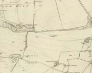
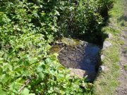
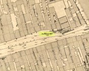
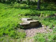
Site of Our Lady’s Well

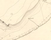
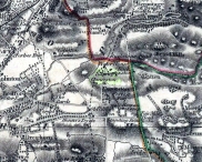
Our Ladys Well on 1855 map

Mr Whyte believed that its dedication to Our Lady went way back, probably before Liberton parish was given to St. Cuthbert in the 11th or 12th century (whose own holy well could once be found several miles north, near Leith).  Generally, wells that are dedicated to ‘Our Lady’, refer to the Virgin Mary; but prior to any christian affectation, the animistic genius loci of the waters would have been a local spirit.

It was visited and described by the Ordnance Survey lads in the Name Book of 1851, in which they said that Our Lady’s Well was,

“The site of a celebrated well situated in a hollow on the farm of Liberton Tower Mains, and dedicated to St. Mary, as it and the field is well known to be called to this day, “The lady’s Field” & Well”.  This well however about 50 years ago underwent a drainage during some improvements that were making on the land.  In its covered condition it takes a S.E. course till its Confluence with the Braid Burn where it is shown to this day as the water coming from the Lady’s Well, and from which a body of crystalized water flows copiously. It was supposed that a chapel was somewhere Convenient which gave rise to the name, but all traces have long since disappeared….”

“There is no tradition recorded among the County people as to whether this was a holy well, or resorted to for superstitious purposes. But it is well ascertained to have been once a remarkable well & an object well known and though now covered-in, the place is still well known, as is also the name.”

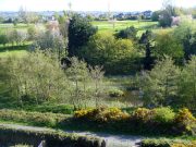
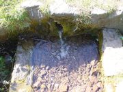
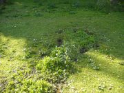
Although this holy well was shown on early and late 19th century OS-maps as ‘covered’,  trying to find its exact position today has proven difficult.  When Paul Hornby and I visited the site after some heavy rains in June, 2017, we found a large pool of water in the field exactly as shown on the old map.  This was, however, misleading, as the owner of the land and the Blackford Glen Western Riding school—a Mr John Fyfe—told us that they had, for years, always wondered about its exact position, but been unable to ascertain it with any certainty.  The pool in the field always appeared after the rains, he said.  He did tell us however, that many years ago when he was digging in order that the Braid Burn stopped flooding his property, he came upon a length of ancient piping running in the direction of the burn, some 5 or 6 feet down, whose use he could not ascertain—but which might have once conducted the waters from the Lady Well away.  No water was running through it though.

Near the middle of Liberton village a century or so ago, another holy well of the same name could once be seen less than a mile to the east.

References:

  1. Bennett, Paul, Ancient and Holy Wells of Edinburgh, TNA 2017.
  2. Good, George, Liberton in Ancient and Modern Times, Andrew Elliot: Edinburgh 1893.
  3. Walker, J. Russel, “‘Holy Wells’ in Scotland,” in Proceedings of the Society of Antiquaries of Scotland, vol.17 (New Series, volume 5), 1883.
  4. Whyte, Thomas, “An Account of the Parish of Liberton in Mid-Lothian, or County of Edinburgh,” in Archaeologia Scotica, volume 1, 1792.

Acknowledegments:  Huge thanks to John Fyfe and his wife for their help when we were exploring this site.

© Paul BennettThe Northern Antiquarian

Wells o’ Wearie, Duddingston, Edinburgh, Midlothian

Sacred Wells (destroyed):  OS Grid Reference – NT 2741 7241

Also Known as:

  1. Wells o’ Weary
  2. Well of Wery

Archaeology & History

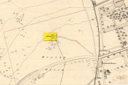
The precise spot for these “wells” is difficult to say today with any certainty, which is unfortunate as it was a renowned spot for a variety of reasons.  The wells were apparently disrupted and fell back into the Earth when the Industrialists dug their train-line into the south-side of Arthur’s Seat.  On the early maps, we can see several ‘troughs’, ‘pumps’ and ‘wells’—one or more of which are said to be the site (and which we base the OS grid-reference on, above).

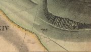
Site on 1821 Kirkwood map
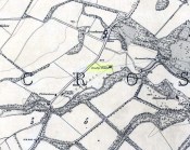
Wells o’ Wearie ponds

The Wells of Wearie were one of nearly a dozen sacred and healing wells surrounding legendary Arthur’s Seat at the edge of Edinburgh, and whose waters were also said to have supernatural properties.  Shown on James Kirkwood’s 1821 map of Edinburgh (left) as the ‘Well of Wery’, this curiously named site was renowned in earlier centuries as an excellent water supply for the local people — “to cure the weary traveller” for one.  Today, all we have left of them are the small ponds immediately below the road, next to the converted railway line path, just as you come out of the long tunnel.

Folklore

In Henderson & Cowan’s (2007) fine work on Scottish fairy lore, they outline the witchcraft trial of a local woman, Janet Boyman, who was said to have performed ritual magick at the Wells of Wearie.  They told:

“Jonet Boyman of Canongate, Edinburgh, accused in 1572 of witchcraft and diabolic incantation, the first Scottish trial for which a detailed indictment has so far been found. Indeed, it is one of the richest accounts hitherto uncovered for both fairy belief and charming, suggesting an intriguing tradition which associated, in some way, the fairies with the legendary King Arthur.  At an ‘elrich well’ on the south side of Arthur’s Seat, Jonet uttered incantations and invocations of the ‘evill spreits quhome she callit upon for to come to show and declair’ what would happen to a sick man named Allan Anderson, her patient.  She allegedly first conjured ‘ane grit blast’ like a whirlwind, and thereafter appeared the shape of a man who stood on the other side of the well, and interesting hint of liminality.  She charged this conjured presence, in the name of the father, the son, King Arthur and Queen Elspeth, to cure Anderson.  She then received elaborate instructions about washing the ill man’s shirt, which were communicated to Allan’s wife.  That night the patient’s house shook in the midst of a huge and incomprehensible ruckus involving winds, horses and hammering, apparently because the man’s wife did not follow the instructions to the letter.  On the following night the house was plagued by a mighty din again, caused, this time, by a great company of women.’”

The Wells were, in earlier centuries, a site where lovers and wanderers came to relax and dream. It was a traditional gathering spot — not just for witches! — and poetry was written of them – including this by A.A. Ritchie:

“The Wells o’ Wearie — 

Sweetly shines the sun on auld Edinbro’ toun.
And mak’s her look young and cheerie;
Yet I maun awa’ to spend the afternoon
At the lanesome Wells o’ Wearie.

And you maun gang wi’ me, my winsome Mary Grieve,
There’s nought in the world to fear ye;
For I hae ask’d your minnie, and she has gien ye leave
To gang to the Wells o’ Wearie.

O the sun w-inna blink in thy bonny blue een.
Nor tinge the white brow o’ my dearie.
For I’ll shade a bower wi’ rashes lang and green,
By the lanesome Wells o’ Wearie.

But Mary, my love, beware ye dinna glower
At your form in the water sae clearly,
Or the fairy will change ye into a wee wee flower,
And you’ll grow by the Wells o’ Wearie.

Yestreen, as I wander’d there a’ alane,
I felt unco douf and drearie,
For wanting my Mary a’ around me was but pain
At the lanesome Wells o’ Wearie.

Let fortune or fame their minions deceive,
Let fate look gruesome and eerie ;
True glory and wealth are mine wi’ Mary Grieve,
When we meet by the Wells o’ Wearie.

Then gang wi’ me, my bonny Mary Grieve,
Nae danger will daur to come near ye.
For I hae ask’d your minnie, and she has gien ye leave
To gang to the Wells o’ Wearie.”

References:

  1. Baird, William, Annals of Duddingston and Portobello, Andrew Elliot: Edinburgh 1898.
  2. Bennett, Paul, Ancient and Holy Wells of Edinburgh, TNA: Alva 2017.
  3. Carrick, John D. (ed.), Whistle-Binkie, or the Piper of the Party – volume 2, David Robertson: Glasgow 1878.
  4. Colston, James, The Edinburgh and District Water Supply, Edinburgh 1890.
  5. Henderson, Lizanne & Cowan, Edward J., Scottish Fairy Belief: A History, John Donald: Edinburgh 2007.
  6. Ramsay, Alexander, On the Water Supply of Edinburgh, Neill & Co.: Edinburgh 1853.

© Paul BennettThe Northern Antiquarian


Twentypenny Well, Duddingston, Edinburgh, Midlothian

Healing Well:  OS Grid Reference – NT 2815 7259

Getting Here


Site shown on 1852 map

From Duddingston, head along the Old Church Lane to the Delf Well, and from then to the Horse Well and, from here, walk along the small footpath that runs along the northwest side of Duddingston Loch.  Less than 100 yards past the Horse Well you’ll notice, on the left-hand side of the path, a stone trough with a fast flow of water running into it.  That’s the spot!

Archaeology & History

Another little-known and all but forgotten healing well, illustrated on the 1852 Ordnance Survey map of the area, but all history and traditions relating to the site are seemingly forgotten (surely not?).


The well at the path-side
The clear drinking water runs into the stone trough

The well originally appeared a little further up the slope, closer to the road in the brambles, but Time has brought the waters lower.  The name “twentypenny” is a curious one.  We know of many Penny Wells across the country: some (like the trees) are sites where coins were given to the spirits of the place as an offering for goodness or to heal a given affliction; others were so-named as the price of one penny was given for a draught of the waters.  Twenty pennies is something of an anomaly.  Somebody somewhere must surely know something?

References:

  1. Bennett, Paul, Ancient and Holy Wells of Edinburgh, TNA: Alva 2017.

© Paul BennettThe Northern Antiquarian


Tod’s Well, Comiston, Edinburgh, Midlothian

Healing Well (destroyed):  OS Grid Reference – NT 239 692

Also Known as:

  1. Three Foxes Well

Archaeology & History

Springs at Comiston, 1632 map

Springs at Comiston, 1832 map

A renowned site of once clear running water, the Tod’s Well got its name from being the abode of foxes many centuries ago.  It was one of the five well-known ‘Comiston Springs’ as they were known—each dedicated to a certain animal—but the eternally present water in this venerable landscape was corrupted from Nature’s course by the usual Industrialists as early as 1681, so as to feed the polluting edifice of Edinburgh city.  James Colston (1890) told how,

“The Town Council entered into a contract with a Dutchman, named Peter Bruschi (aka Peter Brauss) for the sum of £2,900, “to bring the water of Tod’s Well (Anglice fox) at Comiston to Edinburgh, in a leaden-pipe of a three-inch bore, to be laid one foot deep in the ground.””

When the local council upgraded the water supplies in 1820, this piping was replaced to feed the ever-needy merchants and marketeers.  In Hope & Telford’s (1813) survey, the water from here was described as “constantly pure” and “excellent.”

References:

  1. Bennett, Paul, Ancient and Holy Wells of Edinburgh, TNA: Alva 2017.
  2. Colston, James, The Edinburgh and District Water Supply, Edinburgh 1890.
  3. Harris, Stuart, The Place-Names of Edinburgh: Their Origins and History, Gordon Wright: Edinburgh 1996.
  4. Hope, Thomas C. & Telford, Thomas, Reports on the Means of Improving the Supply of Water for the City of Edinburgh, A. Constable: Edinburgh 1813.

© Paul BennettThe Northern Antiquarian


Horse Well, Duddingston, Edinburgh, Midlothian

Healing Well:  OS Grid Reference – NT 28198 72642

Getting Here

Horse Well on 1852 map

Get to the Delf Well from Duddingston and keep walking along the lochside road for 60-70 yards, where you go through the black metal gate in the fence on your left.  Walk down the slope just a few yards and (drought dependent!) you’ll see an initial damp patch where the well used to arise 150 years ago; just a few yards further down the slope is the more notable spring water of the Horse Well below you.

Archaeology & History

The site is shown on the 1852 map of the area where it was later “capped” and used by the old local water authority.  Thankfully the water has managed to escape and is once more feeding the birds and the land, running into the loch below.  When we arrived here, a crow was drinking from the waters.

Horse Well & its herbs

Although you’d expect that this was once a watering-place for horses, the name of the well may relate to the Scottish folk-name of the herb Veronica beccabunga, generally known as Brooklime or European Speedwell, but locally called Horse-well grass—some of which seemed to be growing in the watery spring amidst the other plants.  As a herb it was used in the treatment of scurvy.  The history of the well however, seems all but forgotten…

References:

  1. Bennett, Paul, Ancient and Holy Wells of Edinburgh, TNA: Alva 2017.
  2. Grant, William (ed.), Scottish National Dictionary – volume 5, SNDA: Edinburgh 1958.

© Paul BennettThe Northern Antiquarian


Fountain Well, Edinburgh, Midlothian

Healing Well:  OS Grid Reference – NT 26082 73692

Also Known as:

  1. Canmore ID 52238
  2. Netherbow
  3. Wellhead

Getting Here

Fountina Well on 1852 map

Fountain Well on 1852 map

Get onto the Royal Mile road (which comprises Lawn Market, High Street and Canongate) which runs down from the castle; and near the bottom of the High Street section (between North Bridge and St. Mary’s Street), on the left side of the road you’ll see a large upright monument which was formerly a stone drinking fountain.  You can’t really miss it!

Archaeology & History

Found just yards away from the house of the religious lunatic, John Knox, this is one of several wells that could once be found along the old High Street, or Royal Mile, near the middle of the city.  A fast-flowing spring of water was contained within this solid stone monument first built around 1675 by the King’s mason, Robert Mylne.  The fountainhead was rebuilt at a later date and it supplied water for the inhabitants of the old town.

Fountain Well, Edinburgh

Fountain Well, Edinburgh

Fountain Well, early 19th C

Fountain Well, early 19th C

It has a small semi-circular water trough at its western base and is ornamented on this and its eastern side with small mythical fauns, out of which water emerged.   The local council should ensure to make the well work again, giving people clean drinking water when they need it.

The local historian Stuart Harris (1996) puzzled over the origin of the name ‘Fountain Well’, wondering whether it related to a nearby mansion, but he wasn’t too clear in his description for those who live outside of the city, where this mansion was.  He wrote:

“It is…reasonable to suppose that the present well got its name from being in the general vicinity of the mansion, and that the mansion and the (Fountain) Close must have been named for another well, now lost, in the close or at its head.  It is suggested in Wilson (1891), but scarcely proved, that it was the Endmyleis Well…which is mentioned in…1567.”

Bereft of natural animism, the site is more likely to be of interest to architects than the usual hydromancers and their exploratory ilk…

References:

  1. Bennett, Paul, Ancient and Holy Wells of Edinburgh, TNA: Alva 2017.
  2. Colston, James, The Edinburgh and District Water Supply, Edinburgh 1890.
  3. Harris, Stuart, The Place-Names of Edinburgh, Gordon Wright: Edinburgh 1996.
  4. Wilson, Andrew P., Milestones in the Royal Mile, John McQueen: Galashiels 1947.
  5. Wilson, Daniel, Memorials of Edinburgh in the Olden Times – 2 volumes, Edinburgh 1891.

© Paul BennettThe Northern Antiquarian


Delf Well, Edinburgh, Midlothian

Healing Well:  OS Grid Reference – NT 28220 72715

Delf Well on 1852 map

Getting Here

From the south-side of Arthur’s Seat at Duddingston, along Duddingston Road West, turn west along Old Church Lane.  Where the houses finish there’s the loch on your left and the small car-park on your right.  From here, walk above the cars and onto the small footpath.  Barely 20 yards ahead, under the edges of the trees, a sealed oblong concrete water-hole is front of you.  That’s the spot you’re looking for.

Archaeology & History

Delf Well, covered

Only for the purists amongst you, the Delf Well has fallen prey to being capped and piped away so you can no longer drink here.  It is shown on the early 19th century maps of the area and was used as a water supply for the opulent South Lodge of Holyrood Park.  An old metal chain — remains of which are still attached to the covering stone — once had an old cup attached, to enable walkers to drink here.

References:

    1. Bennett, Paul, Ancient and Holy Wells of Edinburgh, TNA: Alva 2017.
    2. Harris, Stuart, The Place-Names of Edinburgh, Gordon Wright: Edinburgh 1996.

Paul BennettThe Northern Antiquarian


Crawley Spring, Glencorse, Midlothian

Healing Well (covered):  OS Grid-Reference – NT 23894 63346

Archaeology & History

Site of Crawley Spring on 1854 map

Site of Crawley Spring on the 1854 map

Once found flowing freely beneath the shadow of the prehistoric hillfort of Castlelaw, this all-but-forgotten site was thankfully recorded in Hope & Telford’s (1813) survey of Edinburgh’s natural water supply.  Mr Telford said how “This noble spring rises from the bottom of a bank, at the foot of the Castlelaw Hill, at the edge of a small, low, almost marshy meadow close by the Glencorse Burn, a little way below the bridge.”  Twelve years after writing this, the well had been blocked and a cistern built over it.

It was proclaimed by local people to be medicinal (though to what ailments, I cannot find), but there was an effective confirmation of some medicinal qualities in the waters following an analysis in 1810 when very tiny mineral elements were found.  Mr Telford (1813) explained:

“The water is perfectly transparent and colourless, free from every smell and taste and is of excellent quality.  It has, as is the case with almost all spring water, some matters dissolved in it, though in smaller quantities than common… This foreign matter consist of carbonate of lime, muriate of soda, and sulphate of lime, with an excessively minute portion of magnesium salt. The proportions of these ingredients, in each pound, are nearly:

Carbonate of Lime – 0.43 of a grain
Muriate of Soda – 0.10 of a grain
Sulphate of Lime – 0.90 of a grain
Sulphate of Magnesia – 0.05 of a grain

The carbonate of lime is dissolved by means of carbonic acid, which is not in greater quantity than is barely sufficient for the purpose.  All of these ingredients are in themselves innocent to the human body; and in the quantity in which they are present in the water, do not affect its goodness.  The water is perfectly soft and fit for washing, infusing tea and other domestic purposes.  The water, therefore, is exceptional in every respect.”

When it came to the Crawley Spring waters being used to feed the habits of Edinburgh city, there was considerable opposition by the land-owner and local people who were, correctly, concerned that that ecosystem here would be adversely affected if the waters were to disappear.  And so it was that Earth’s blood was taken from the land and the people and the animals, to benefit and feed the religion of Industrialism and ‘progress’ once more…

References:

  1. Bennett, Paul, Ancient and Holy Wells of Edinburgh, TNA: Alva 2017.
  2. Hope, Thomas C. & Telford, Thomas, Reports on the Means of Improving the Supply of Water for the City of Edinburgh, A. Constable: Edinburgh

© Paul BennettThe Northern Antiquarian


Adam’s Well, Colinton, Edinburgh, Midlothian

Healing Well:  OS Grid Reference – NT 225 691

Archaeology & History

Unlike the Adam’s Well in Kent, deep daan saaaf, this northern site of the same name is not only long lost, but we can find no traditions relating it either—something of an oddity for these northern climes.  It could once be found in the open meadows east of Colinton, near where now the Redford Barracks exist and was a puzzle to the regional historian Stuart Harris (1996), who could find no early accounts of the site.  Although its name may relate to a local man called Adam, there are other examples of wells with this name from Kent to Scotland: the Kent example is deemed as an authentic holy well, whilst examples in Yorkshire and those in southern Scotland relate to the waters themselves being known as ‘Adam’s Ale’ or Adam’s Wine’—an old nickname for water itself!

References:

  1. Bennett, Paul, Ancient and Holy Wells of Edinburgh, TNA: Alva 2017.
  2. Harris, Stuart, The Place-Names of Edinburgh: Their Origins and History, Gordon Wright: Edinburgh 1996.

© Paul BennettThe Northern Antiquarian


Stock Well, Glasgow, Lanarkshire

Healing Well (lost):  OS Grid Reference – NS 593 648

Also Known as:

  1. Ratten Well

Archaeology & History

This long lost well near the middle of Glasgow was known by this name as early as 1345.  Close to the River Clyde, a wooden structure was built around the well—a stock—and its waters were used by local fishermen.  A local fair used to be held hereby.  It has long since been built over and its original position no longer seems to be known.

Folklore

The old traditional tale behind this site was written in a short piece in the Scottish Journal of Topography oh so long ago now… One pseudonymous “R.M.S.” said that:

“Stockwell Street in the city of Glasgow, is pretty well-known, and everybody in the locality is aware of the ‘Ratten Well’ with its impure waters.  It is said that, in days of yore, when Sir William Wallace had occasion to be in that quarter, he and his party met a band of englishmen at the well.  A battle ensued, and the bodies of the englishmen, who were defeated, were thrown by the incensed Scots into the well.  “Stock it well! Stock it well” exclaimed Wallace, from which expression the street received its name.  So says tradition; and it is even yet believed that the bad quality of the water is owing to the putrefaction of the dead bodies of the englishmen.”

The one thing we can be certain about in this story, is that the Scots wouldn’t be stupid enough to dump dead bodies into their own fresh water supplies.  We must assume some englishman or dodgy corporation was responsible for that bit!

References:

  1. Bennett, Paul, Ancient and Holy Wells of Glasgow, TNA 2017.
  2. Brotchie, T.C.F., “Holy Wells in and Around Glasgow,” in Old Glasgow Club Transactions, volume 4, 1920.
  3. MacKenzie, Peter, Reminiscences of Glasgow and the West of Scotland – volume 1, John Tweed: Glasgow 1865.
  4. “R.M.S.”, “Stockwell Street, Glasgow,” in Scottish Journal of Topography, Antiquities & Traditions, volume 2, July 8, 1848.

© Paul BennettThe Northern Antiquarian