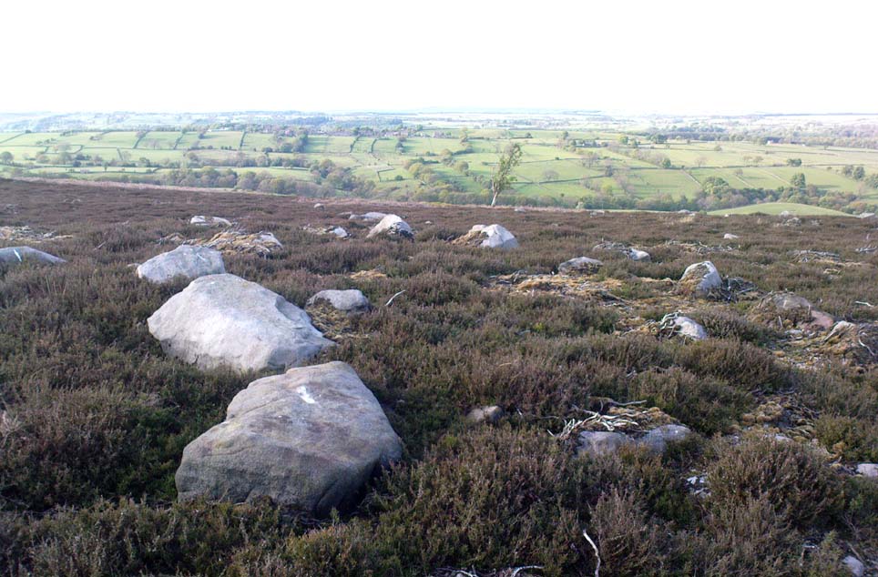
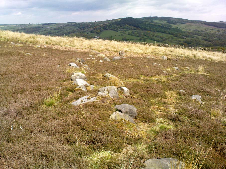
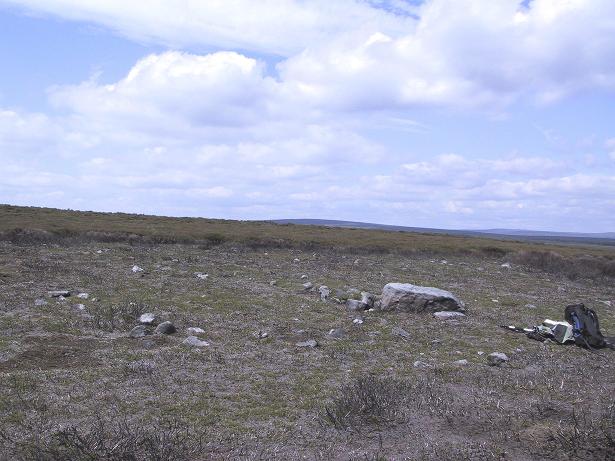
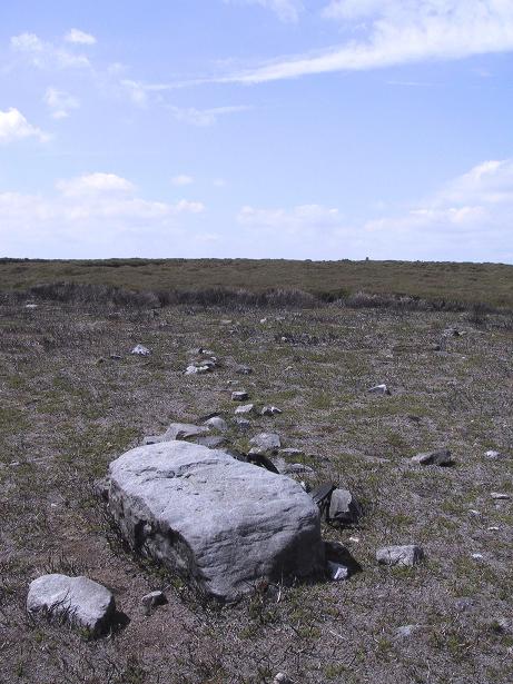
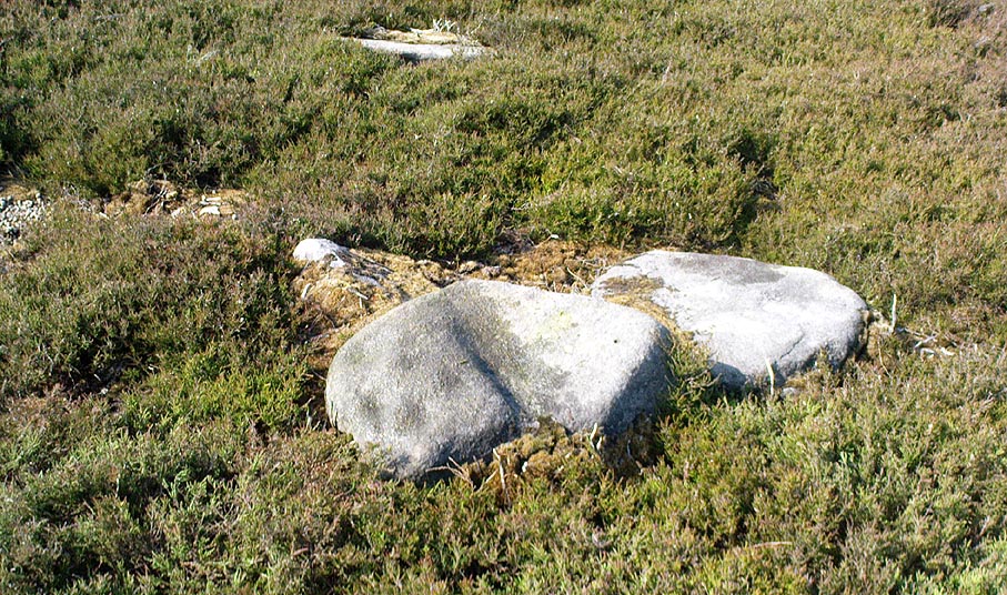
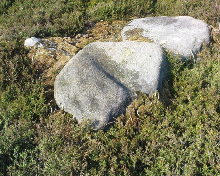
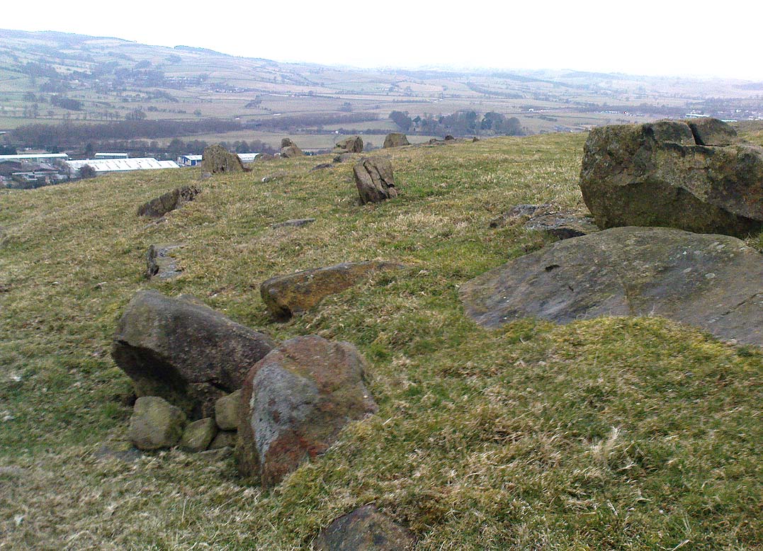
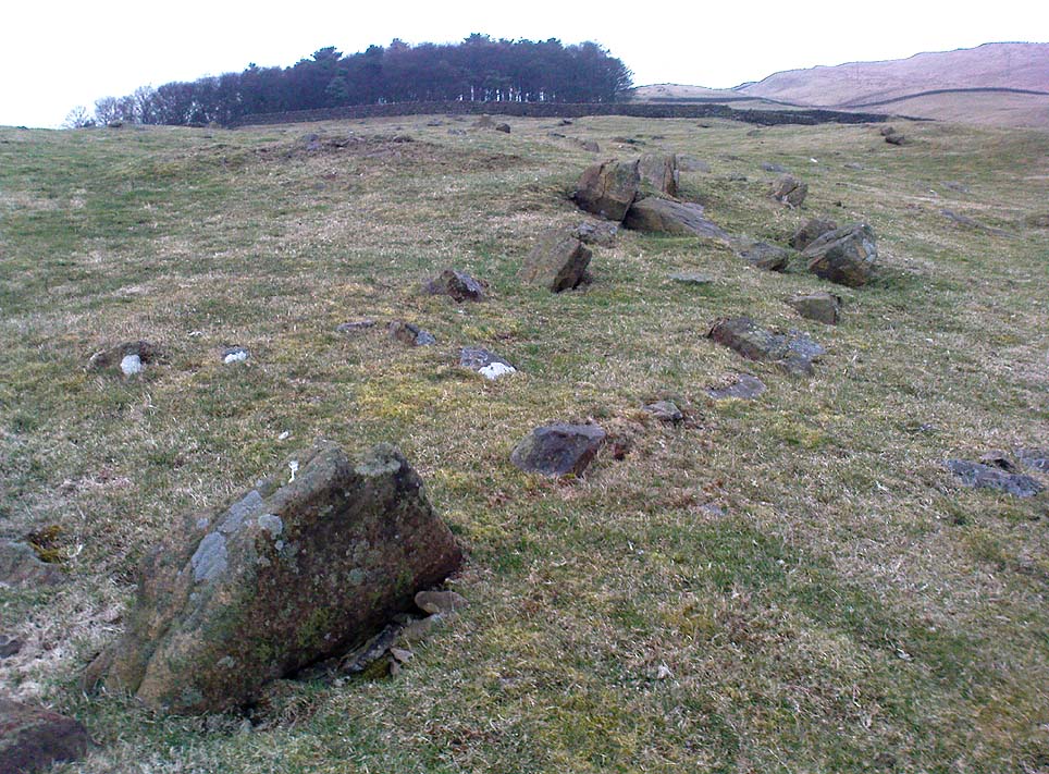
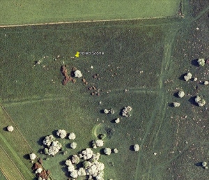
Torlery Edge, Malham Moor, North Yorkshire

Settlement:  OS Grid Reference – SD 898 653
Getting Here

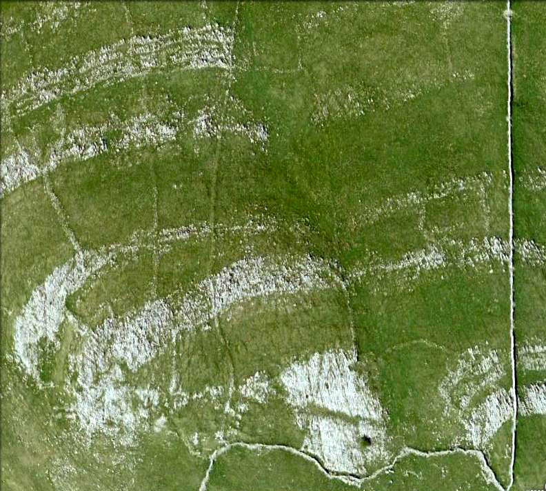
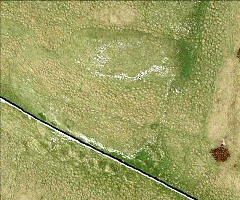
Torlery Edge from above

From Malham village, take the winding uphill road up Malham Rakes (not the Malham Cove road).  If you aint sure, ask a local.  Get to the top of the long winding road and,  a mile on, you meet with another single-track road on the top level known as Street Gate.  Stop here, then head across the grasslands on the left-side of the road, southwest.  There are a couple of footpaths running over the land here: I wouldn’t say it makes much difference which one you take as they take you in the right direction.  You’ll eventually meet the old craggy hilltop with the drystone walling down t’other side of it.  You’re here!

Archaeology & History

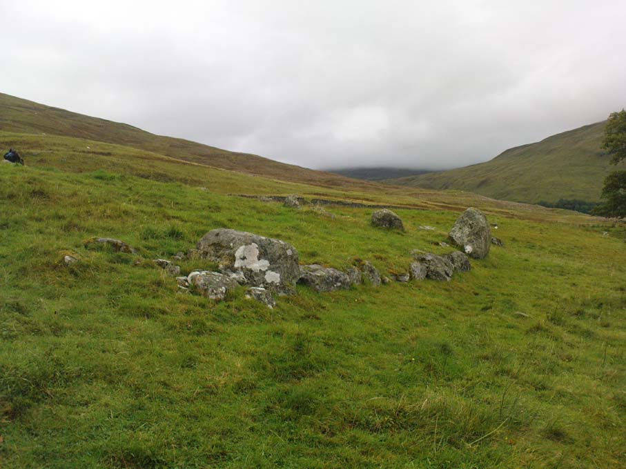
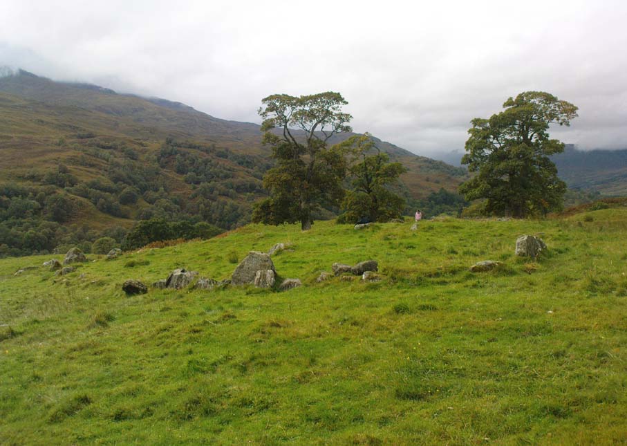
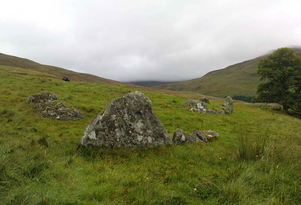
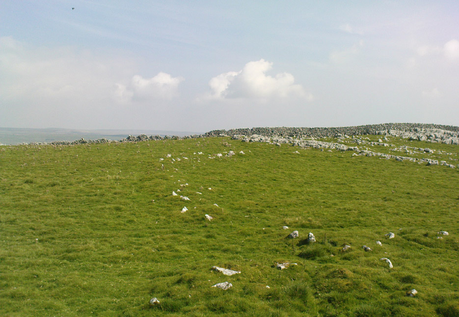
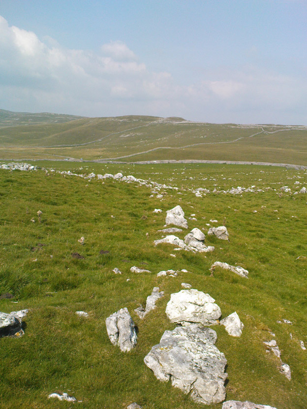
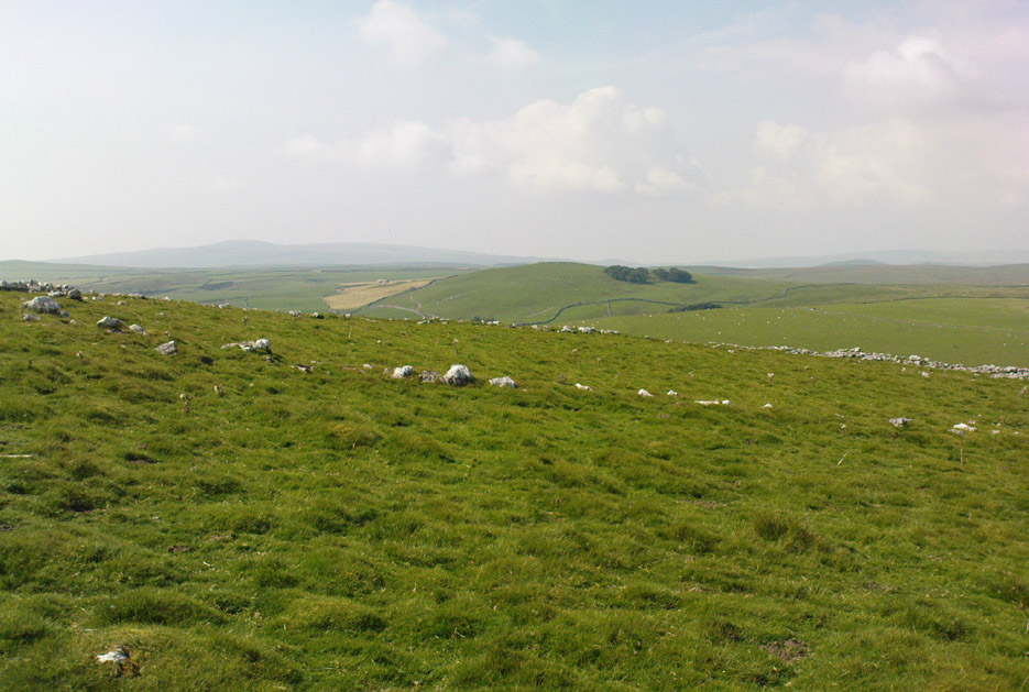
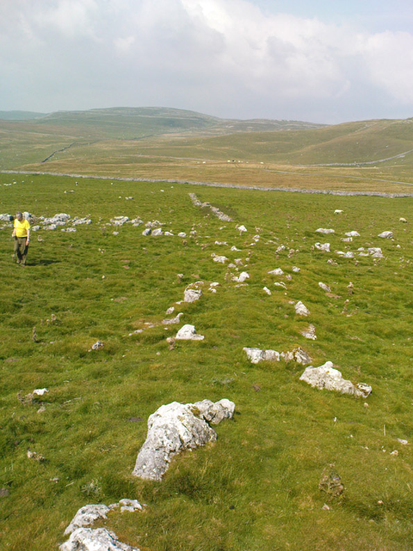
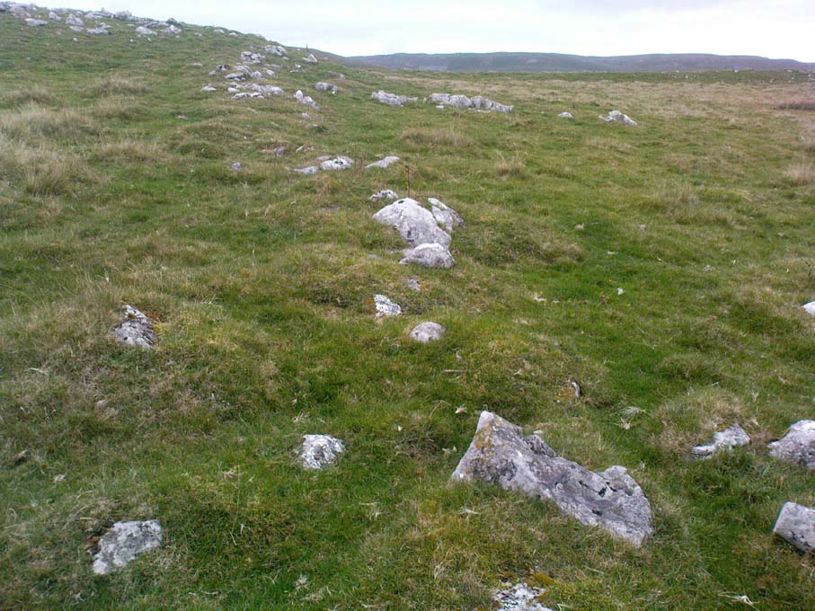
The history of this region seems to have been covered to a great deal by the likes of Arthur Raistrick and his mates, though I can’t find a specific entry in mi library about the remains we’re looking at here.  Surrounding the edges of the small hill, as can be seen in the aerial photo here, walling has clearly been built up around it, with considerable remains still visible at ground level, as indicated in the photos aswell.
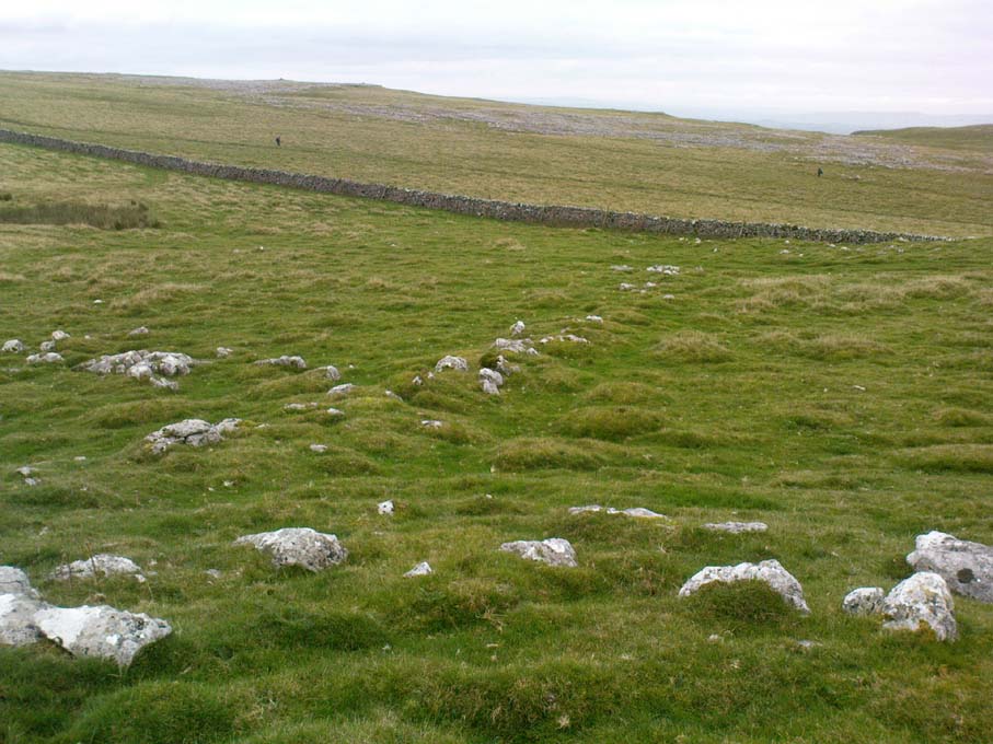
Eastern edges of enclosure
Eastern walls, looking north

A settlement or large stone-walled enclosure, lying primarily on the north side of the drystone wall, measures approximately 82 yards north-to-south, and roughly 78 yards (72m) east-to-west, with a rough circumference around the outer edges of its rough elliptical outlines of more than 270 yards (250m).  Along the walled edges can clearly be seen several ‘hut circle’ remains: one in particular at the northeastern side and, more prominently, at the southeastern side, are in reasonably good states of preservation.  The northeasterly hut circle measures approximately six yards across.  The stone walls of this circle are more than a yard wide.  The ‘hut circle’ on the southeastern corner are more prominent and is in a better state of preservation, but much of the structure has of course been ruined to build the adjacent, more modern, drystone walls.  This circular structure is larger than its counterpart on the northeast, measuring some 13 yards across.

The southern edge of the main settlement walling has been built up against and onto a large length of bedrock running roughly east-to-west.  This inclusion of local geological features within man-made settlements and houses is a feature found all over Malham Moor and adjacent areas, for many miles around here. (see the Hammond Close settlement, for example)  The southernmost section of the Torlery Edge settlement is in a reasonable state of preservation, as is the length of walling along its eastern edge.  Along the northern section of the settlement it seems that an internal enclosure feature has been built (“perhaps for cattle?” would be the archaeologists usual query); whilst the western edges are the least visible part of this monument.
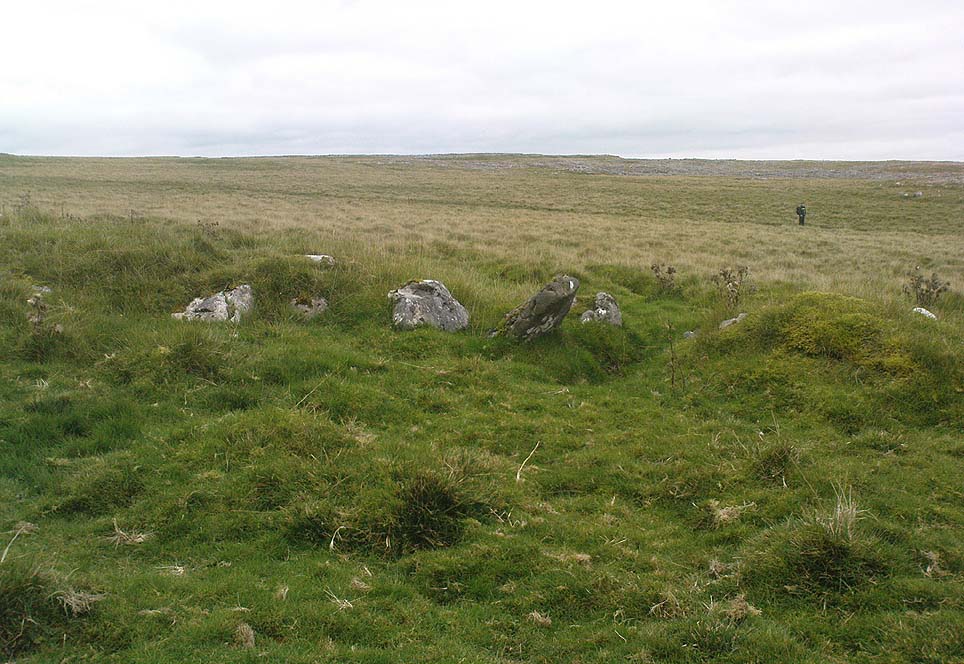
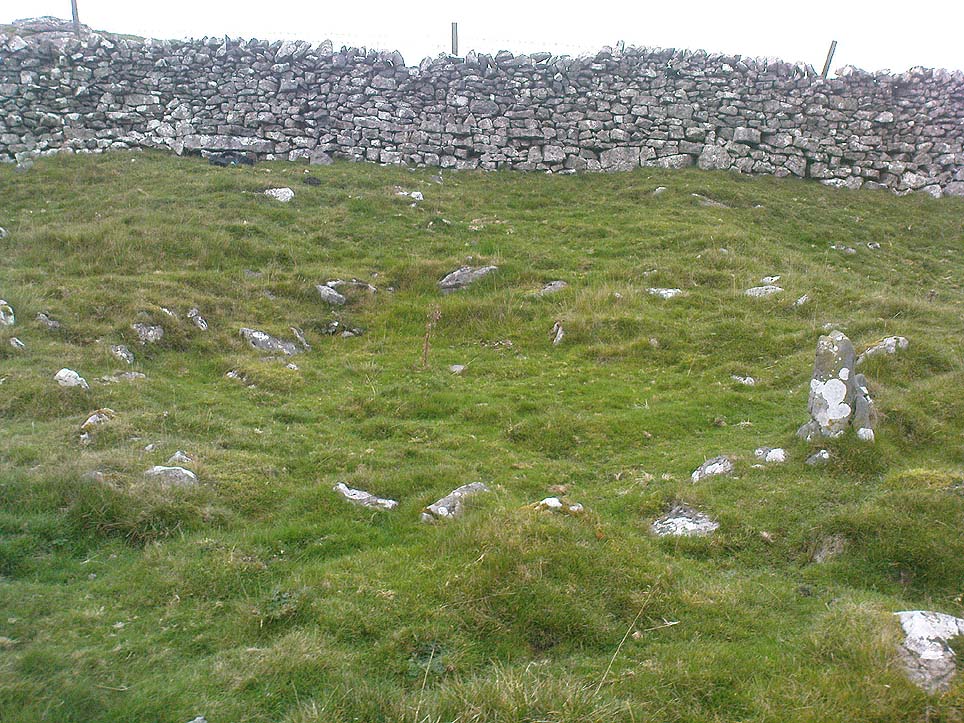
Hut circle on southern edges
Hut circle, looking north

If we now jump over the drystone wall running along the southern edges (and visible in the aerial photo above), we can see a series of six, perhaps seven, hut circles, all adjoining each other and running along the line of the wall.  Some of these are in a very good state of preservation and an excavation of these sites might prove fruitful. (unless it’s already been done – does anyone know?) Two of these hut circles have entrances clearly visible.  They are all roughly the same size and structure, with average diameters (from outer wall to outer wall) of 7 yards.  They consist of a rough ring of small upright stones, packed with smaller rocks and (in bygone times) peat and wood.  Sheltered from the north winds by the ridge above it and the extensive ancient enclosure walling (not the drystone, which in itself is very old), this row of prehistoric buildings were probably for members of the same tribal group.

Without excavation it’s difficult to date these hut circles, but they would probably have been used between the Bronze Age and Romano-British period.  There is every likelihood they were also used up to the medieval period, as this land was acquired (i.e. stolen) from local people by the Church and their law-bringers.  We know that much of the landscape hereabouts was possessed by Fountains Abbey in the 12th century, who made extensive use of the area for their cattle; and we find considerable evidence scattering these hills of medieval archaeological remains.

Although the site is catalogued as a separate site from, say, the settlement remains and enclosures we find at Combe Hill, Prior Rakes, New Close, and other field areas close by, this individual archaeological site must be assessed as part of a greater collective series of settlement remains hereby.  Instead of looking at this as an individual settlement, its relationship with the others in the vicinity needs re-evaluating and contextualizing and set within a wider and more realistic vision.  Whilst appreciating that detailed modern excavations have yet to be done in this region on a scale that is required (as with many of our northern archaeological landscapes), it is probable that this singular settlement was part and parcel of what was once a prehistoric city.

If you visit this particular site, spend a few days looking round at the many other settlements and prehistoric religious sites in the area.  And don’t forget to look and enquire as to why the Romans came and built a huge monument near the centre-edges of this domain of our prehistoric ancestors.  Tis a fascinating arena indeed…

References:

  1. Dixon, John & Phillip, Journeys through Brigantia – volume 2: Walks in Ribblesdale, Malhamdale and Central Wharfedale, Aussteiger: Barnoldswick 1990.
  2. Raistrick, Arthur & Holmes, Paul F., Archaeology of Malham Moor, Headley Bros: London 1961.

© Paul Bennett, The Northern Antiquarian

High Close Pasture, Grassington, North Yorkshire

Settlement:   OS Grid Reference – SE 003 652

Also known as:

  1. The Circus
  2. Druid’s Altar
  3. Druid’s Circle

Getting Here

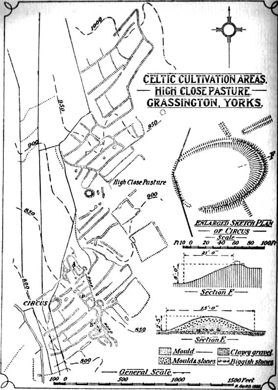
Curwen’s 1928 plan

Easy enough to locate.  In Grassington go up the main street a coupla hundred yards, turning left up past the small church, taking the footpath on your right heading up to the fields that stretch to the north.  Don’t mistake the remains of the medieval village that you’ll pass for the Iron Age and Romano-British site that we’re heading for, another coupla hundred yards up.  You’ll notice a lot of old low walling structures on the slopes heading up above you.  That’s the stuff!

Archaeology & History

Despite the industrial devastation of the landscape on the hills around here, this entire area still teems with prehistoric archaeological remains, making you wonder just how much more once existed in this region.  In bygone days Prof Anne Ross thought this region to be the capital of northern England in Iron Age days.  She could be right: in just about every nook and cranny of small valleys and rivulets we find evidence of ancient people everywhere for miles around, settlement upon settlement in every direction you take.  The remains found here at High Close Pasture typifying the examples any ardent antiquarian will come across in this region of upper Wharfedale.

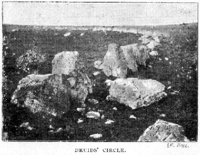
Druid’s Circle (Bogg 1904)
Earliest known photo in 1899

The settlement remains and ancient cultivations at High Close have been described by various writers over the last hundred years, with Edmund Bogg (1902) calling the most notable of the remains here the ‘Druid’s Altar’ (not to be confused with the other Druid’s Altar at nearby Bordley); a title that was similarly described as “The Druid’s Circle” when Eliot Curwen surveyed the area.  It is also locally known as ‘The Circus’, after it being a place where celebrated events once took place. This Druid’s Circle section is,

“an oval area 150 feet long by 75 feet wide. It consists of a bank surmounted by a single or double-row of flat-topped stones about one-and-half feet high by 2 feet wide… This may have been a communal meeting place of the Iron Age folk, who cultivated these fields, and who lived in isolated huts.” (Elgee & Elgee 1933)

The notion of the circle being a communal meeting place was echoed by Mr Curwen (1928) in his slightly more detailed description of this place.  He told that the interior of the Druid’s Circle had been levelled:

“It lies eight feet below the surrounding banks to the northeast and east, to which it rises with a gradient of 8 in 21.  The bank to the north is less high, while to the south and west  the arena, while seperated from it by the bank, is above the level of the sloping hillside.  The encircling bank is surmounted by a single (and) double row of stones for three-fourths of its extent.  These are apparent to the east and south, but are less so to the west, as along this side a stone wall has been built actually along the bank of the Circus; the stones belonging to this bank are, however, quite clear below the footings of the wall.  From northeast round by south to southwest the row of stones is double.  Those in the inner row, forty-six in number, stand some eighteen inches high; they are about two feet wide and are flat-topped, the line is almost continuous, and in parts the stones are placed edge to edge.  A second row of smaller stones backs the larger ones.  Entrance is obtained to the central level area by a gap to the southwest.  No fosse surrounds this earthwork.  To the southeast, a lynchet four feet high runs off it, while to the north a low stoney bank runs off in a NW direction, and one of the larger stony banks approaches to within a few feet of the northwest.”

In the fields above, particularly on the east and north of this notable ruined stone ring, the extensive “cultivation pastures” as they’ve been called, are evident all over the place.  Hut circles and copious other antiquities can all be found within a square mile of this spot.  If you like your Iron Age archaeology, this area will knock yer socks off!

…to be continued…

References:

  1. Bogg, Edmund, Higher Wharfeland, James Miles: Leeds 1904.
  2. Charlesworth, Miss D., ‘Iron Age Settlements and Field Systems,’ in Archaeological Journal, volume 125, 1968.
  3. Curwen, Eliot, ‘Ancient Cultivations at Grassington,’ in Antiquity, June 1928.
  4. Elgee, Frank & Harriett, The Archaeology of Yorkshire, Methuen: London 1933.
  5. Raistrick, Arthur & Chapman, S.E., ‘The Lynchet Groups of Upper Wharfedale, Yorkshire,’ in Antiquity, June 1929.
  6. Speight, Harry, Upper Wharfedale, Elliott Stock: London 1900.

© Paul Bennett, The Northern Antiquarian

Snowden Moor Settlement, Askwith, North Yorkshire

Settlement:  OS Grid Reference – SE 1785 5128

Getting Here

Travel along the Askwith Moor Road between Blubberhouses and Askwith (near Otley) and park-up at the large gritted parking post on the moor edge.  Walk straight onto Snowden Moor (east) and walk a few hundred yards north until you reach the brow of the small rounded hill, scattered with small stones and outcrop rock.  The settlement is all around you!

Archaeology & History

As we already know from earlier posts on TNA, this moorland region is rich in prehistoric remains, and the settlement that I’m about to briefly describe here is another excellent site – when you can see it!

‘Hut circle’ at the rocky knoll

My first exploration here was in the company of Graeme Chappell more than 20 years ago, where we tried locating remains that had been described by Eric Cowling (1946) during a foray taking photographs of the cup-and-ring stones nearby.  But due to an overgrowth of moorland vegetation at the time, the remains which Cowling described proved hard to find.  Years later when Richard Stroud and I visited the place in May 2005, all the heather had been burnt back and much of what looked like the remains of an entire prehistoric village was in plain view for us to see.  I was well impressed!  This occurred again last year, enabling the bunch of us who came here a few times to see even more of the place.  But — just like the newly discovered prehistoric settlement on Blubberhouse Moor a couple of miles north — once the heather grows back again you wouldn’t really think anything of worth was hidden here.   In archaeological terms however — despite the lack of references and research by those who are paid to be archaeologists — we have one helluva little-known prehistoric settlement, complete with walling, hut circles, village hall (!), tombs, cup-and-ring carving and more, much of it probably dating from the Bronze Age, but some of the sites here indicate it was also much in use during the Iron Age period aswell.

Probably the best place to start exploring here is on the large flat rock on the rounded knoll at the edge of the moor (SE 1785 5129) with a simple cup-mark saying ‘hello’ on its surface, looking east down into the Fewston Valley and across lower Wharfedale, then veering up towards the hills above Nidderdale.  The great prehistoric temple of Brimham Rocks is clearly visible from this spot aswell.  Upon this rocky hillock we have a veritable scattering of several large, earthfast boulders and smaller rocks, from where much of the settlement expands, mainly to the west through to the south, across the open moors in front of you.  On a clear day this is truly beautiful and quiet spot.

Line of ancient walling, running NE
Line of ancient walling, running SW

Just a couple of yards from the edge of the rocky knoll is a very good example of what would at first sight appear to a prehistoric hut circle.  Its position at the top of this rocky knoll however, implies an additional function other than a purely domestic one.  Also from here is a prominent long straight stretch of walling running roughly southwest for about 90 yards onto the moor, and also to the northeast, downhill off the moorland for some 30 yards before disappearing into undergrowth (we didn’t actually explore this lower section of walling running downhill, so there’s probably more to be found there).  This long section of walling, mainly comprising small stones and rubble, with a number of larger uprights defining much of its length, is just one of several stretches of walls that are clearly visible hereby.  There are also a number of other hut circles to be found scattered around this particular walled sections near the top of the rocky rise. When Eric Cowling (1946) came here he counted 10 of them here; but subsequent explorations have found at least 13 of them hereby.

Upper D-shaped enclosure
Overgrown D-shaped enclosure

One of the most notable remains here is the large D-shaped enclosure about 25 yards west of the rocky knoll.   This very impressive archaeological site was curiously not included in the Nidderdale Archaeological survey report of sites in this region.  Either they hadn’t done their homework correctly when they came here, or the heather must have been really deep; cos as you can see in the photo here, it’s a decent size!  I tend to see this large stone enclosure as a sort of tribal gathering building of sorts — a bit like a ‘village hall’ so to speak. If you get here and see it all in context, it makes a lotta sense (not that it’s right of course, merely an opinion).  With the exclusion of the Cowling D-shaped enclosure more than 80 yards east of here, this is the largest monument on this section of the moor, measuring some 45ft along the NW to SE axis and 20ft across the NE to SW axis.  The walling in parts is quite thick aswell and the stones making up the main north, east and southern edges are anything between 12 inches to 34 inches tall. Along its northeast edge is a curious stone, with what initially looked to be a most distinct cup-and-ring carving on the outer walling, but once we’d looked and looked again, saw it seemed to be one of the oddest light-created ‘carvings’ we’d ever seen! (i.e., it’s natural)

Denuded cairn? or denuded walling?
Another arc of walling (shit picture though – soz…)

A few yards from here, heading to the little peak close by, more walls emerge. On the small rise in the land about 30 yards west you’ll see an arc of stones running around the contour line of another hillock on the moor.  It’s difficult to say with any certainty, but a lot of this arc of stone is certainly man-made and at least Iron Age in date, perhaps earlier; but the line of stones itself may actually run all round the very edges of the hill on whose sides this section rests (see photo).  You get a distinct impression here that this small hill was actually sectioned off all the way round, so to speak, for some reason or other.  The remains of at least two small cairns can be found on the top of this small enclosed rise, close to one of which Boughey & Vickerman (2003) have designated there to be a cup-marked stone.  From this elongated hillock we look immediately northwest onto the flat moorland plain of the Snowden Moor necropolis …amidst which the hardworking Keighley volunteer Michala Potts recently found the Snowden Crags cairn circle.

Section of Snowden Carr settlement walling

Further down the moorland slope—a couple of hundred yards below Cowling’s D enclosure—are yet more remains, many of which lie outside the geographical boundaries of the “official” Scheduled Monument Record for this settlement (known as SMR 28065).  We’ve located several other cairns in relatively good states of preservation; more extensive lines of another walled enclosure (again in a large D-shape), as well as several cup-marked stones.

The Site and Monuments account of this place tells us simply:

“The monument includes a cairnfield and associated concentration of prehistoric features.  Included in the area are a large sub-rectangular enclosure, two smaller enclosures, at least 17 cairns of various sizes, several lengths of boulder walling, a hollow way, and at least 17 carved rocks. There is also a bare patch of ground on which lumps of lead slag survive. This was produced by medieval or earlier lead smelting.

“This concentration of prehistoric features is situated towards the north east edge of Snowden Carr, and measures c.426m x c.155m.  The cairns occur throughout the area and range in size from an elongated cairn 17m x 7m down to cairns c.4m in diameter. The cairns are best preserved in the north western part of the area. The large sub-rectangular enclosure has an earth and stone bank c.3m wide and c.0.6m high. The bank is double on the east side of the enclosure.  The two smaller enclosures have rubble banks 1m-2m wide and up to c.0.6m high.  They are more irregular in shape than the large enclosure.  The boulder walling consists of a number of approximately linear rubble banks 1m-2m wide. It is concentrated in the area immediately north west of the large enclosure, and in the area to its south. The boulder walls are interpreted as part of a field system contemporary with the large enclosure.  The hollow way is located within the southern group of boulder walls and may be contemporary with them. “

There is still a considerable amount of work that needs doing in and around this settlement complex and it seems any work here is gonna be done by the like of us amateur doods.  Archaeological officials don’t seem interested here.  I was informed by Neil Redfern of the archaeology department of English Heritage for North Yorkshire that they are unable to support any funding that might help towards any decent analysis of this important archaeological arena, nor do they consider the important cairn circle discovered a few months ago on the northern end of this settlement worthy of financial help either, which is of course very disappointing,* but typifies their lack of enthusiasm unless money comes their way.  And so this site profile entry will be added to gradually as our amateur team visit and uncover further aspects of this neglected prehistoric arena – such as the finding of another previously unrecorded ancient circle of stones not too far away!

References:

  1. Boughey, Keith & Vickerman, E.A., Prehistoric Rock Art of the West Riding, WYAS: Wakefield 2003.
  2. Cowling, Eric T., Rombald’s Way: A Prehistory of mid-Wharfedale, William Walker: Otley 1946.

Acknowledgements:  Many thanks for use of their photos to Graeme Chappell and Michala Potts.

* No doubt a church window somewhere will eat up a few thousand quid and weeks of their time to fit the little piece — along with all those prawn sandwich meetings that cost so much to endure.  Much more important!

© Paul Bennett, The Northern Antiquarian 
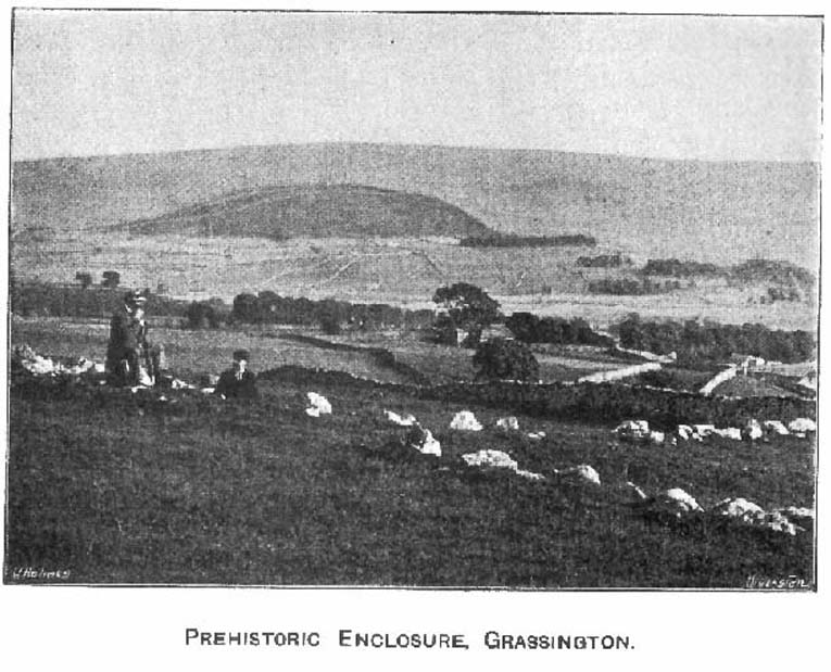

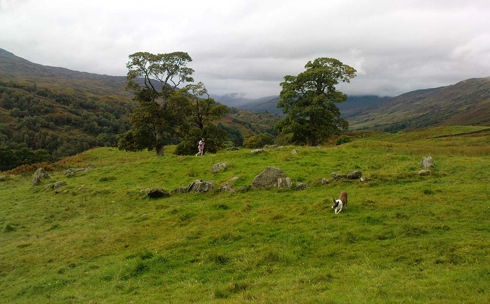
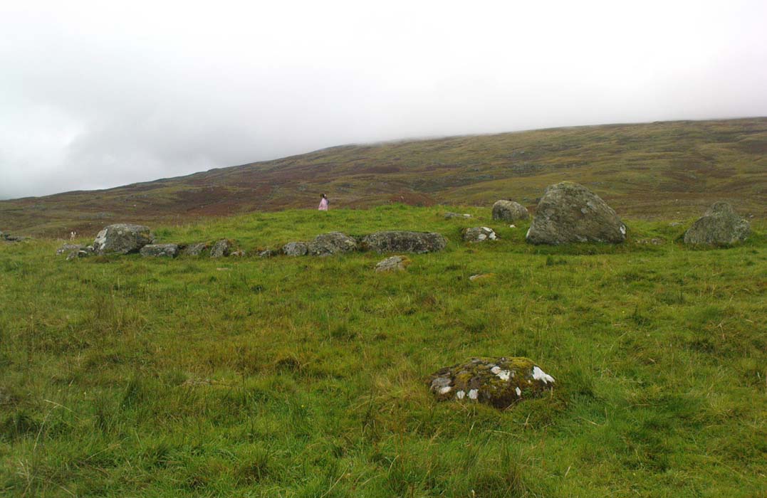
Tullich, Glen Lochay, Killin, Perthshire

Enclosure:  OS Grid Reference – NN 5235 3684

Also Known as:

  1. Tirai West
  2. Tullich East
  3. Canmore ID 78043

Getting Here

The ‘stone circle’ of Tullich!

Go through Killin past the Bridge of Lochay pub, turning immediately down the small lane by its side.  After about 3 miles you’ll cross over the small river past Duncroisk.  Keep going for another few hundred yards (if you reach Tullich you’ve gone too far), watching out for the gate on your left.  Walk up to the top of this field, over the wall and up again.  You’ll see a couple of tall trees with distinctive walling next to them, just on a ridge above you.  That’s where you’re heading!

Archaeology & History

This is a fine-looking example of a prehistoric enclosure, perched on the edge of one of the grassy knolls on the far western extremities of the deserted village of Tirai.  If you walk towards it from the derelict village east of here, the elliptical form of the site gives you the distinct impression that you’ve just chanced upon a seemingly unknown stone circle nestled upon the edges of this gorgeous Scottish glen; but this initial excitement is soon dispelled once you get into the heart of the site!

Southern line of walling
Looking east

Although you’ll find a couple of derelict post-medieval buildings on the western side of this structure, the lay-out of this monument would seem to be Iron Age origin, perhaps earlier.  It certainly has all the hallmarks of a walled structure from that period and typifies many others that I’ve explored down the years.

The eastern and southern sections of the walls are in very good states of preservation, although the ground has obviously grown up and around the bases of the stonework.  It has a total outer circumferences of about 95 yards (87m), with the many upright stones measuring between 12 inches to more than 3 feet in height.  The western section of the enclosure is mostly overgrown but easily traced on foot.  Near the centre of the site is a large flattish stone that gave the impression of having an oratory function from where one could speak to the rest of the people sat around the inner edges of the enclosure — but this was a purely subjective impression.

NE sections of enclosure
Outer section & ‘standing stone’

On the southern side of the elliptical structure is another, outer line of walling, or a stone alignment of some sort just a few yards long, consisting of just a few upright stones — one of which stands considerably taller than all the others hereby, giving the impression of a standing stone.  It has a large natural cup-marking on its southern face.

To my limited knowledge there’s been no excavations here, so one wonders whether or how or if the people of Tirai made use of this much earlier building.  The Canmore entry of the place tells:

“The N side of this enclosure is a low turf and stone bank of height 0.3m and is 20m long, spread to about 1.2m. The E side is outlined by large stones set on edge with no evidence of intermediate stone walling or turf. A bank of similar more continuous stone extends to the W from the S of the main enclosure down sloping ground. This type of walling is different from any other on Tirai. The large stones set on end have suggested a prehistoric date for this enclosure.”

References:

  1. Johnstone, A. & Wood, S., “Tirai (Killin Parish), Pre-Enclosure Settlements,” in Discovery & Excavation in Scotland, 1990.

© Paul Bennett, The Northern Antiquarian
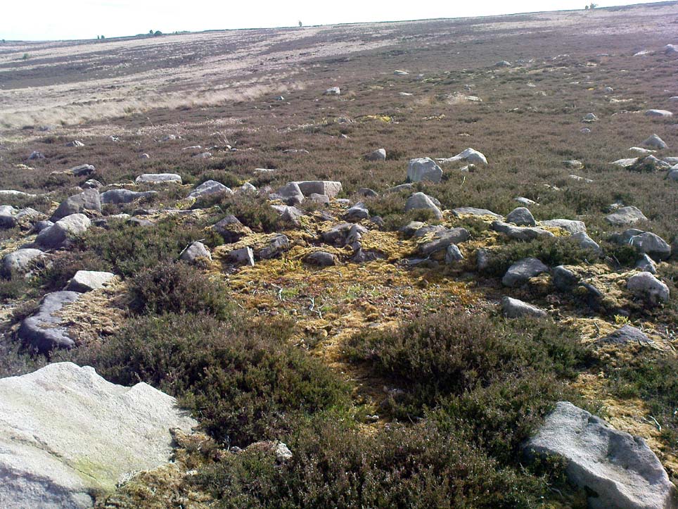

Hammond Close, Threshfield, North Yorkshire

Settlement / Enclosure:  OS Grid Reference – SD 9517 6488

Getting Here

Aerial view of site
Aerial view of site

Follow the same directions to reach the Bordley ‘circle’ (it’s actually a much denuded burial site).  Look up the hill (south) at the limestone escarpments above you, walk past the Hammond Close Stones and head up the slopes in front of you.  If you get to the top of the hill without noticing the extensive prehistoric walled structures you’ve passed, then start to slowly amble here and around the tops and the slopes you’ve just walked up.  They’re everywhere!

Archaeology & History

The grid reference here has to be considered as a general one.  The site we’re looking at, upon the tops of this wonderful limestone-enriched hill, is quite extensive and covers much more than the simple eight-figure grid ref I’m using to direct you here.  On the way up the slope from the Bordley ‘circle’ site, you’ll notice how the natural lines of limestone have been used to define lines of walling.  The remains of many smaller stones have been laid into the natural rock outcrops, and others set into the earth and sectioned off smaller enclosures within the greater whole.  It was obviously a huge and time-consuming exercise to create these large rocky sections, some of which appear to have actually been cut into the rock.  The aerial image here shows clearly the lines as they were laid out, intruding the extensive natural bedrock covering the landscape, not just here but much further afield.  Indeed, the large set of enclosures here at Hammond Field typifies dozens and dozens of other such sites in the hills north and west of here.

Enclosure walling running E-W
Topmost line of walling

The trouble with this and other sites in the Upper Wharfedale region is dating them.  Although we typically ascribe an Iron Age date to many of these settlements, we know that many of them were added to and maintained by peasants and farmers well into medieval times.  And why not!?  They’re excellent, solid and need little maintainance! The sections we’re looking at here in this particular site may have had their origins in the Bronze Age.  It seems a reasonable assumption considering the existence of the Bordley circle site and several other denuded burials along the same ridge at the bottom of the slope.  But the majority of the ‘enclosed’ sections running up and around this hill seem to have Iron Age and Romano-British stamps on them.  It’s likely that some of the ‘enclosed’ sections would have been constructed to keep cattle in, aswell as being living quarters for people.  At least one well-defined hut circle can be seen along the north-facing edge of the hill and, perhaps, even the fallen remains of a once upright standing stone.

The topmost part of the Hammond Close hill is all but surrounded by Nature’s limestone, with a large oval grassy region in the middle of it all; but on the eastern side of the hill, the natural limestone walls are lacking and so were supplemented by the work of people who built an additional protective line of walling, running north for some 45 yards from the small craggy ridge at the top, along the level, until it meets up with more natural limestone.  The man-made walling is built into this aswell.  Halfway along this length of north-south walling is another section, running to the east for nearly 40 yards before bending slightly for another 25 yards into yet more natural outcrop.

Partition walls on north slope
Stretches of walling: from ancient to modern

I could spend the next few paragraphs describing all the walled sections visible on this hill and down its edges, but don’t wanna bore you with the small detail of it all!  Aswell as that, if you climb over the eastern walls and walk a short distance across the rocky hill, you’ll start seeing other prehistoric settlement remains beneath your feet.  And on the hill across directly to your north, we find more extensive remains at the very large Lantern Holes settlement, dating again from the Iron Age, if not earlier.

The ancient remains are all over the place round here!  So those of you who love good outdoor wanderings, prehistoric archaeological sites and excellent views, give this place your attention!  It’s well worth it!

References:

  1. Dixon, John & Phillip, Journeys through Brigantia – volume 2: Walks in Ribblesdale, Malhamdale and Central Wharfedale, Aussteiger: Barnoldswick 1990.

© Paul Bennett, The Northern Antiquarian

Shooting House Hill, Askwith Moor, North Yorkshire

Settlement:  OS Grid Reference – SE 1711 5110

Getting Here

From the Askwith Moor car-parking spot, walk up the road (north) for 350 yards and go thru’ the gate on the left-side of the road, up along the track onto Askwith Moor.  To get to it, walk on the footpath towards the trig-point on Shooting House Hill from the Askwith Road.  Between 50-100 yards before the trig, walk into the heather to the right.  Just 5-10 yards off the footpath, it’s there!  If the heather’s grown back, don’t even bother looking for the place!

Archaeology & History

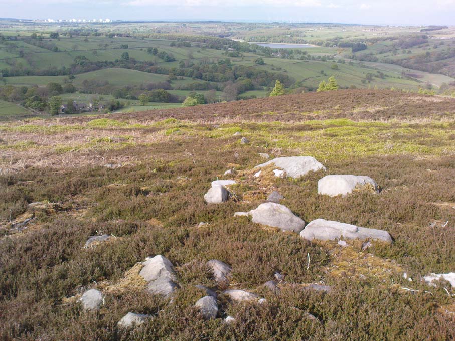
Although I add this as the remains of a small Bronze Age or neolithic settlement — which was found on August 3, 2005, in the company of Richard Stroud — subsequent walks up hereabouts in the surrounding heather has shown that, far from being a small independent site, it was part and parcel of a much greater prehistoric landscape all round here: with the remains on High Low Ridge immediately west; the cairnfields of Askwith Moor and Snowden Crags south and east; and numerous cup-and-ring stones scattered all over the place here.  It’s a veritable minefield of archaeological remains, from the mesolithic to the Iron Age all over these moors!

Barely visible remains of walling
More of the walling

We came wandering up here looking for another of Eric Cowling’s “lost circle” sites described in 1946, near Shooting House Hill, which Graeme Chappell and I looked for ten years previously without success. But on the August 2005 visit, much of the heather had been burned away.  Instead of the lost circle however (which remains unfound, though something suspiciously like it is close by) we came across a well-defined, though small settlement complex.  The walling of two well-defined near-rectangular structures emerge either side of a reasonably large boulder. Beyond these is further walling and what seems a well-defined hut-circle less than 10 yards away. Like many other sites on these moors, the walling seem to have been pretty much robbed for building grouse-butts. (hence the pictures here looking a bit sparse of stone!)  Subsequent investigation found more neolithic walling which ran into the deeper heather — so it has been difficult to work out the full scale of it all.

The landscape from here stretches way off. To the eastern horizon (not far away) is the legendary Almscliffe Crag, with the rising hills of Rombald’s Moor due south; whilst far to the sunsetting west rises the great contours of Pendle Hill, to which legend relates some of the witches of the Fewston Valley, a mile below…

References:

  1. Cowling, Eric T., Rombald’s Way, William Walker: Otley 1946.

© Paul Bennett, The Northern Antiquarian
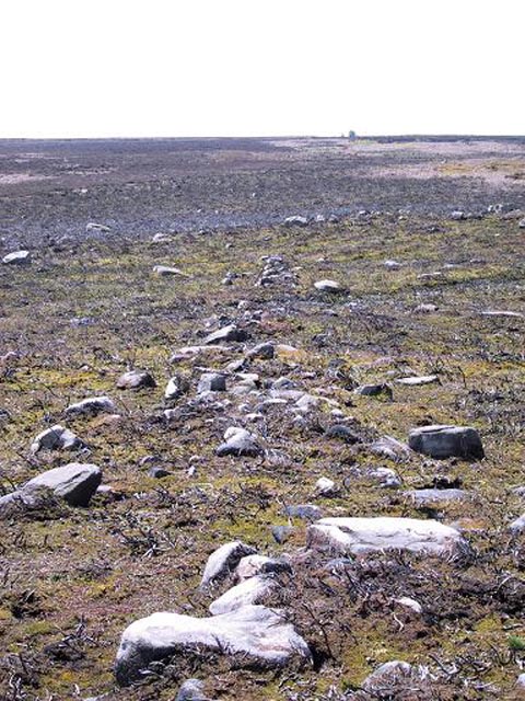

Step Stone, Snowden Crags, Askwith, North Yorkshire

Cup-Marked Stone:  OS Grid Reference – SE 17841 51306

Getting Here

Get to the Fence Stone carving and walk up to the top of the hill about 50-60 yards away.  Once on the long flat rock, walk less than 20 yards WNW until you see the stone in the picture.

Archaeology & History

So named due to it being shaped like a little singular step on a stone, this cup-marked carving was first found in the middle of May, 2010, around the same time Michala Potts located the Snowden Crags cairn circle.

Step Stone, Snowden Crags
Close-up of the cups

First described and illustrated on the Avebury Forum on June 3, 2010, this cup-marked rock is found in association with a number of (as yet) unexcavated prehistoric remains, close to some Iron- or Bronze Age walling and a distinct hut circle, close to one of the D-shaped enclosures 20 yards away.*  When I first found it there seemed to be just two simple cups on it, but upon viewing it several times over the last few weeks in differing lighting conditions, it seems there may be as many as 4 cups on the southwestern face of the rock.  In one of the images here, you get the impression that there could actually be five cups — but I’m gonna play safe and just say there are three such cups here.

* At least 3 large, prehistoric, D-shaped enclosures have been isolated on these moorlands, with diameters ranging between 15 and 80 yards.  None of these have yet to receive serious archaeological attention!

© Paul Bennett, The Northern Antiquarian

Horse Close Hill, Skipton, North Yorkshire

Enclosure / Settlement:  OS Grid Reference – SD 9966 5046

Also Known as:

  1. Cawder Hall Enclosure
  2. MNY21002
  3. Scheduled Monument 29151

Getting Here

From Skipton town centre follow the A6131 road south, out of town, for less than a mile, and turn left up Cawder Lane. Avoid following the road into the housing, instead bearing up the country lane to your left.  Just before reaching the farmhouses 200 yards up, note the stony hilltop above you on your left (up behind Horse Close Farm).  Walk up there for 250 yards NE and you’ll find it!

Archaeology & History

Horse Hill enclosure, looking west

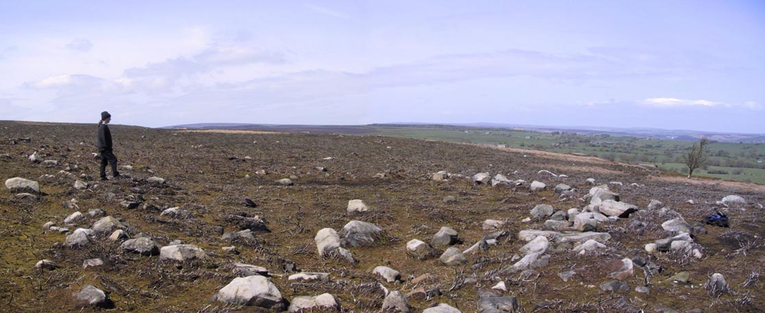
This is an impressive site.  I’d say very impressive! (but I’m easily pleased)  Oddly however, I can’t find a damn thing about this place in any of my archaeo-records and it appears (as far as I’m aware) that no survey has ever been made of it.  Which is bloody incredible!  Indeed, the only archaeological notes that appear to exist about this very impressive and well-preserved Iron Age enclosure, states, “Subcircular enclosed settlement on Horse Close Hill 250m north of Horse Close Farm.”  That’s it!  Nothing else!  So I’m afraid you’ve only got my crappy description of it to go on for the time being…

As the aerial image below shows, this is a large oval-shaped enclosure, defined primarily by an almost complete ring of double walling arranged around this hilltop site.  Measuring approximately 78 yards (71m) north-south, and nearly 75 yards (70m) along its longer east-west axis, with a circumference of about 235 yards (215m), many of the upright stones which define its edges stand between 1-3 feet in height.  Some of these stones have obviously been moved into position by the lads who built the structure, but the site has also taken advantage of a number of large earthfast boulders in its construction.

If you walk around the edges of the walled enclosure, almost every bit of it is clearly visible.  Between the defining inner and outer walling of the structure we find sections of the site packed with smaller stones, giving the impression that it may once have been filled all round, making the walls thick strong defensive ones.  But without a more detailed investigation, we’ll never really know…

Horse Close settlement, looking NE
Aerial view of enclosure

It is clearly very similar in structure, and probably date, to the well-known Brackenhall circle on Shipley Glen, near Baildon (though the nature of the Brackenhall site has long been a topic of controversy).  And, as with the Brackenhall site, a number of cup-and-ring stones are found close by — including the Great Wood Laithe carving in the field immediately below on the west side.  I’ve also found a similar structure to this on the hills above Steeton, a few miles to the south (though it’s not as well-defined as this one).

Although the site is mainly defined by its oval walling, we also find other stretches of walling that run outwards from the central site: one in particular running northeast for 35 yards out towards a small standing-stone further up the field.  Other curious earthworks and remains scatter the fields on the eastern sides of this main feature, which the helpful farmer here pointed out to us.

© Paul Bennett, The Northern Antiquarian

The Bastard, Campbeltown, Argyll

Hillfort / Dun:  OS Grid Reference – NR 7612 1220

Also Known as:

  1. Canmore ID 38722
  2. Dun Bastard

Getting Here

The Bastard on 1869 map

Pretty easy.  From Campbeltown, follow the coastal round south for about 8 miles, past the TV masts on the skyline and the hamlet of Feochaig, where you’ll see the large rounded hill on your left near the coast: that’s The Bastard!  Go onto the hill’s eastern sides and drop down the steep slope towards the large bend in the burn where its remains are on a ridge close to the cliffs overlooking the sea.  The ruins are pretty faint but if you scout around, you’ll find it.

Archaeology & History

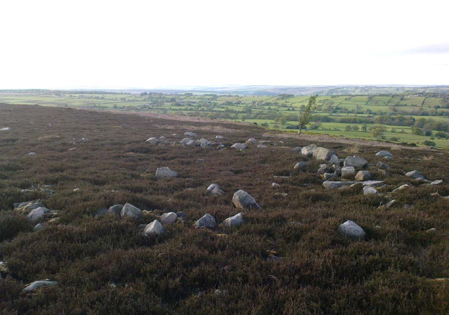
I couldn’t believe it when I found this one – so had to get the notes to the site and add what I could find!  When the fellas from the Scottish Royal Commission checked the place in 1960, they described,

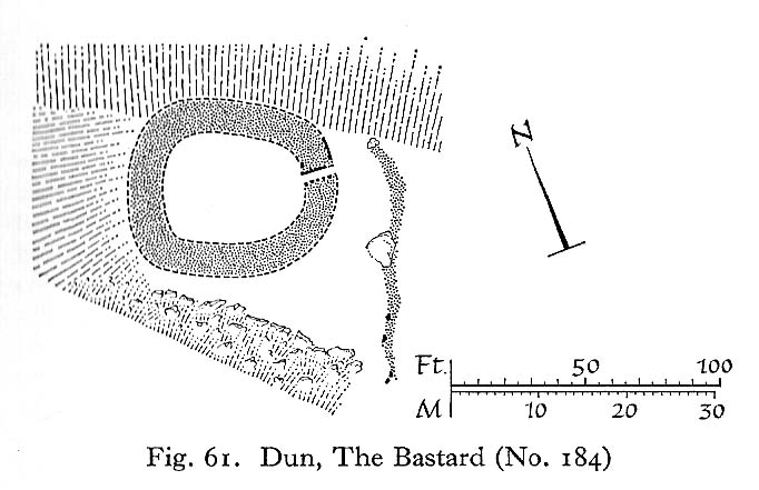
“On a narrow shelf halfway down the east flank of the hill named The Bastard there are the remains of a dun…  Oval in plan, the dun measures about 15m by 12m internally and is entered from the east, where a stretch of the outer face is visible. Here the wall is 4m thick on either side of a straight passageway, 0.9m wide, which exhibits no trace of door-checks.”

The Bastard (RCAHMS 1971)

There are other remains a few yards to the southeast of the main structure which are thought to be “remains of an outer wall…about 1.2m in thickness, which has been drawn across the shelf to provide additional protection for the entrance”, more probably from the weather conditions than invasive incoming humans.

To the immediate north we have a mythic-sounding Giant’s Seat (just above the natural arch) and west is the abode of the fairy folk – but I aint checked out the tales behind them yet.

References:

  1. Royal Commission Ancient & Historic Monuments, Scotland, Argyll – Volume 1: Kintyre, HMSO 1971.

© Paul Bennett, The Northern Antiquarian

Holed Stone, West Overton, Wiltshire

Enclosure & Stone:  OS Grid Reference – SU 1285 7151

Aerial image of site

Getting Here

Follow the same directions to reach the Polisher Stone at the top-end of Overton Down as it meets Fyfield Down. From here, walk down the slope for 100 yards or so where you’ll notice, just above the long grassy level, a line of ancient walling running nearly east to west.  It’s very close to the yellow marker in the attached aerial image shot to the right. If you walk along this line of walling you’ll find it.

Archaeology & History

Overton’s Holed Stone

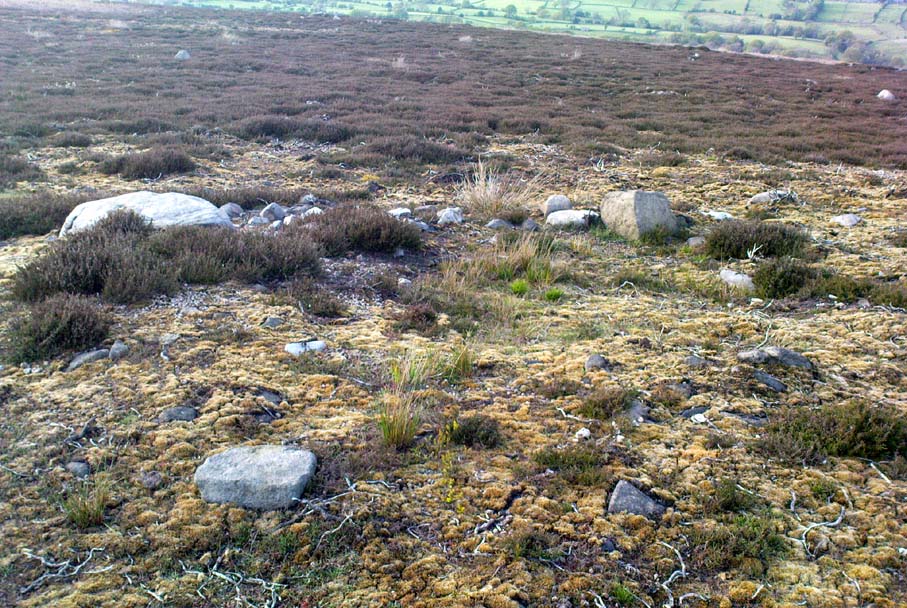
As I’ve only been here once, and briefly — under the guidance of the Avebury expert Pete Glastonbury — my bearings on this site may need revising.  There are two distinct sections of walling here: one has been excavated by Peter Fowler and his team; the other hasn’t. (correct me if I’m wrong Pete)  And in Fowler’s (2000) fine survey of this area he does not describe this very distinct holed-stone in the line of walling, or adjacent “linear ditch F4”, as it was called.  But then, many archaeologists don’t tend to find items such as these of any interest (unless their education stretches to other arenas, which isn’t usually the case). But the stone seems to be in a section of walling that isn’t in their survey; standing out in aerial imagery as a less well-defined, but still obvious line of walling that is closer to the fence, 70-80 yards north, with a decidedly Iron-Age look about it!

But, precision aside! — as you can see in the photos, the holed stone here isn’t very tall — less than 2 feet high; though we don’t know how deep the stone is set into the ground.  This spot is on my “must visit again” list for the next time we’re down here!

Folklore

Veritable vagabonds, Mikki, June, PeteG & Geoff, readying themselves for fertility rites!

There’s nowt specific to this stone, nor line of walling, nor settlement (as far as I know), but it seems right to mention the fact that in British and European folklore and peasant traditions, that holed stones just like the one found here have always been imbued with aspects of fertility — for obvious reasons. Others like this have also acquired portentous abilities; whilst others have become places where deeds and bonds were struck, with the stone playing ‘witness’ to promises made.

References:

  1. Fowler, Peter, Landscape Plotted and Pierced: Landscape History and Local Archaeology in Fyfield and Overton, Wiltshire, Society of Antiquaries: London 2000.

© Paul Bennett, The Northern Antiquarian