Easington Fell Ring, Newton, Lancashire

Enclosure:  OS Grid Reference – SD 7167 4911
Getting Here

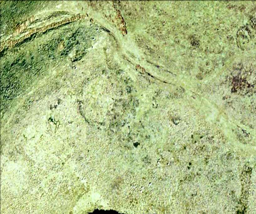
Aerial view of Easington Ring

Go through the gorgeous old village of Waddington northwards, uphill, along the B6478 road, towards the villages of Newton and Slaidburn; or, if you like, go from Newton village uphill southwards along the B6478 road towards Waddington.  Either way, when you reach the top of the moors, park up at the car-park beside the road where the view stretches for miles ahead of you.  Walk on the road for 100 yards, then take the boggy footpath left, going first down and over a stream, then up to the right (northeast) towards a small cairn on the near-horizon.  From the cairn-top you’ll notice a large moorland pond a hundred or so yards ahead of you.  Walk towards and past its left side and onwards again for the same distance until, in front of you (before a nearly-dried stream running downhill) keep your eyes peeled in the deep grasses on where you’ll see a very large ring raised in front of you, defined in parts by scatterings of rocks along the tops and sides.  You’re here!

Archaeology & History

This is an outstanding prehistoric site, all but lost in old literary records until relocated in recent years by Lancashire historian and writer, John Dixon.  However, its precise nature remains a bit of a puzzle.  When John took a small party of us to the site on June 16, 2011, there was a variety of ideas as to the precise nature of the place.
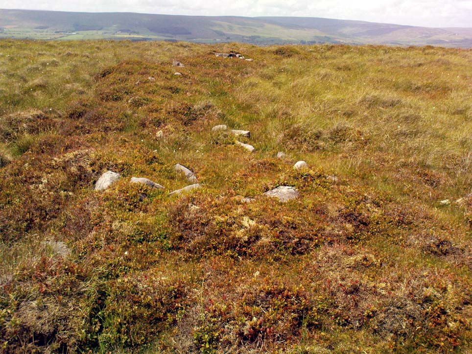
Southwestern arc of the Ring

Structurally similar to a number of prehistoric enclosures in the Pennine range, this very large near-circular monument consists primarily of a very large number of rocks and stones making up a thick outer wall, presently piled less than a yard high above the peat and approximately 6 feet wide on average.  From north-to-south, outer wall to outer wall, it measures more than 42 yards (38.5m) across; whilst measuring 41 yards (38m) east-to-west.  There are distinct entrances on its western and northern sides, and possibly another on the east.  Certain sections of the inner region are now somewhat boggy in parts, perhaps indicating there was at one time an internal spring of water.  A large singular stone is found on the inner eastern section, which may have been placed there deliberately.  On the northwestern inner-edge of the walling is a notable long wide stone which may have stood upright.

My first impression of the site told it to bet at least Iron Age in date, though more probably Bronze Age.  But without excavations, I could be talking bullshit!  It is an obvious enclosure of some sort, but there are no visible internal structures on the present ground level.  There are no notable internal or external ditches and banks, which may have given the site a ‘henge’ classification.  More work is obviously needed here before we can say what it is for sure.

Very little has been said of this huge ring in the past.  John Dixon’s research found the site briefly described in Greenwood & Bolton’s (1955) work, saying:

“On page 24 they refer to the above site thus: ‘There is also a rough stone circle on top of the fells above Easington, like the remains of an ancient fort (the ringwork)…'”

Also mentioning how Richard Rauthmell’s Antiquitates (1746) very briefly mentions the place aswell.  Apart from these passing remarks, John has found little else.

On other parts of this moortop we found scattered evidences of other early human remains (walling, cairns, hut circles), much of it unrecorded.  There may well be other important prehistoric remains hidden upon these hills…

References:

  1. Dixon, John, Slaidburn and Newton, Bowland Forest, Aussteiger Publications: Clitheroe 2003.
  2. Greenwood, Margaret & Bolton, Charles, Bolland Forest and the Hodder Valley: A History, privately printed 1955.
  3. Rauthmell, Richard, Antiquitates Bremetonacenses; or, The Roman Antiquities of Overborough, Henry Woodfall: London 1746.

© Paul Bennett, The Northern Antiquarian


Peg o’ Nell’s Well, Clitheroe, Lancashire

Sacred Well:  OS Grid Reference – SD 7355 4257

Also Known as:

  1. St. Margaret’s Well

Getting Here

Peg o’ Nells Well

The well is located in the grounds of Waddow Hall close by Brungerley Bridge, near Waddington, in the Ribble Valley. The hall is just off the B 6478 road about three-quarters of a mile south-east of Waddington village. It is on private land, but you can see the well by walking along a footpath at the western side of the hall running along the banks of the River Ribble at the southern side of the hall grounds.

Folklore

The legend originates from the 18th century although the well is a pre-Christian spring. According to this most often told ‘legend’ Peg O’ Nell was a servant girl at Waddow Hall.  However, she often fell out with her masters, the Starkie family, often quarreling with and being disobedient to them. One night, in particular, Peg had a blazing row with Mistress Starkie after saying she didn’t want to fetch water from the well; the mistress was so enraged that she shouted at the servant saying “I hope you fall and break your neck”. At a later date this came true when on a particularly icy night Peg went to fetch water from the well, but on her way there she slipped on some ice and fell into the River Ribble, at a treacherous spot, and did indeed break her neck. From that time on there seems to have been a curse on the Starkie family – anything and everything that happened at the hall was blamed on Peg, or her ghost, which was now haunting the house and grounds. Mistress Starkie became so fed up with the curse that she took an axe and chopped off the head of a statue that had earlier been placed beside the well in memory of poor Peg. Thinking that by doing this the curse would come to an end, and it seems to have done just that, because afterwards peace and quiet seems to have come upon the hall.

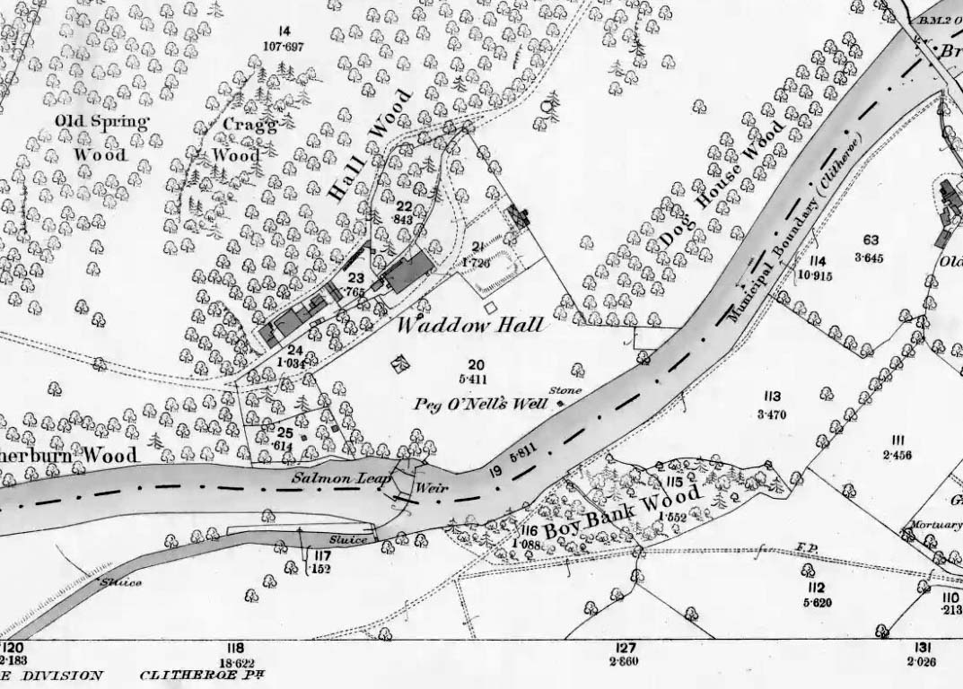
Peg o’ Nells Well on 1884 map

Another legend or tale says that Peg dwelt by the well, perhaps as a kind of sprite, but that she caused a local Puritan preacher to fall into the River Ribble.  As a punishment for this dastardly trick the head of the statue was chopped off.  Folklore says that a water spirit or “sprite” lived in the well which was connected underground to the nearby River Ribble.

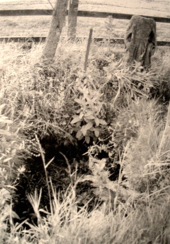
But the truth about this seems to be that the headless statue is that of St Margaret of Antioch who was beheaded for her faith in the early centuries of Roman rule. St Margaret’s feast day was on 20th July. Apparently, her statue was brought to Waddow Hall from either Sawley Abbey or Whalley Abbey where it had stood in its own niche, or possibly it came from a local Catholic church. The headless statue appears to be holding a bible in one hand; so it was probably placed at the side of the well in order to make the well holy and sacred to pilgrims who used to visit the site for healing purposes on the saint’s day. The head of the statue used to reside in an upstairs room at the hall, but it was lost for a time, only to be re-discovered and embedded into a wall at Brungerley farm not far from the bridge.

But we may never know what really did happen here because legend and folklore have become mixed in with other tales that may, or may not, be true. The holy well stands in a meadow in the hall grounds and is a square-shaped hollow in the ground where water still flows, possibly fed by the river close by. The statue still stands at the side; and fencing now surrounds this sacred site. The hall and grounds are still said to be haunted by a ghost, but whether it is Peg’s ghost we do not know, because this particular ghost is said to be hooded ? The curse itself used to claim a victim once every seven years; the screaming spirit of Peg would rise up from the murky waters of the river on stormy nights – an animal could apparently suffice as a victim, rather than a human.   This story was almost certainly made-up probably to frighten the Starkie family who it was originally aimed at.

Waddow Hall is now a Training and Activity Centre, but it used to be a Centre for girl guides and during the second world war it was an isolation hospital.

References:

  1. Bord, Janet & Colin, Sacred Waters, Paladin Books 1986.
  2. Hilton, J.A., “Return to Peggy’s Spout”, in NEM 70, 1997.
  3. Nelson, Carole, “Peg o’ Nell’s Well, Clitheroe, Lancashire,” in Source No.6, Summer 1998.
  4. Harte, J., “Death by Water – Rivers and Sacrifice,” in White Dragon 1998.
  5. Taylor, Henry, The Ancient Crosses and Holy Wells of Lancashire, Sherratt & Hughes: Manchester 1906.
  6. Whitaker, Terence W., Lancashire’s Ghosts and Legends, Robert Hale: London, 1980.

© Ray Spencer, 2011