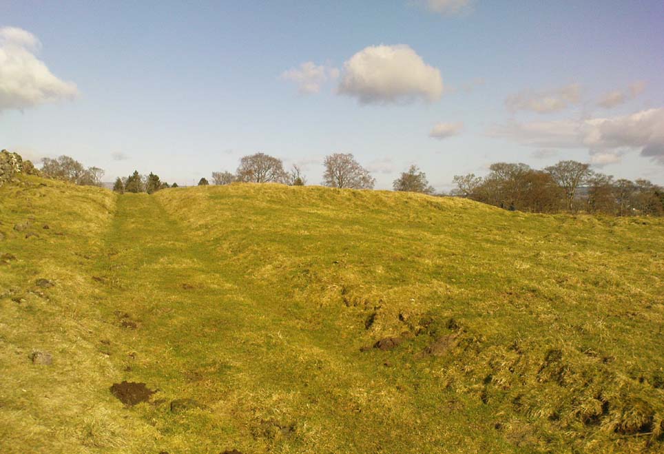
The Hades hill cairn/barrow is located high on the moors some 3 miles north-east of Whitworth and the smaller village of Facit, near Rochdale. Its exact location is close to a footpath halfway between Hades hill and Rough hill, though it is not mentioned on modern OS maps. It is quite difficult to get to so be ready for a long hard walk.
Archaeology & History
This small, low barrow or cairn — a couple of miles north of the little-known Man Stone — measures 15 metres north to south, 13 metres east to west and is 0.9 metres high (about 3 feet in height). But not a great deal can be seen today.
It was excavated in 1898 when a number of artefacts were discovered near the centre of the barrow. The most famous of these ancient artefacts was a Celtic two-tiered urn (of the Pennine type) which had rope imprints and chevrons; inside this urn were the burnt bones of a female, flints, a scraper and a fine pointed borer. Other stuff that came out of the barrow included animal bones, charcoal, flint implements and an arrow head. The urn was placed in the hands of The March Collection at The Rochdale Free Library (now known as Touchstones). A more recent excavation was carried out in 1982 but nothing was recorded at this time. In Dr Whitaker’s History of Whalley, he described there being “the remains of a large beacon, with the foundations of a large circular enclosure” on Hades Hill.
Take the road up to Brimham Rocks from Summerbridge; crossing the little crossroads, then keep your eyes peeled for the singular farmhouse on your right. Just beyond this, on your right, you’ll notice some small moorland opens up and reaches gently down the slope for some distance. Go along the footpath for 100 yards or so, then into the heather to your right, for 60 yards or so (as if you walking towards the farmhouse and small crags). This is where the following sites could be found. (when we visited Brimham recently, unfortunately sunfall stopped us having a proper wander here, so the status of the site/s remains unknown to us)
Archaeology & History
This little-known and possibly destroyed prehistoric site — less than a mile north of Standing Stone Hill and just a coupla hundred yards south of the legendary Brimham Rocks — has been described by several antiquarians from the early 19th century onwards. It’s an intriguing place, deserving of much greater antiquarian attention. Ely Hargrove (1809) appears to be the first who mentions prehistoric tombs here, though his sense of direction implies another site (unless he just got that part of it wrong?). Along with “several small tumuli or carns” near another section of Brimham Rocks themselves, he told there to be,
“Several large tumuli; one of which about 80 yards west of the great Cannon, measures 150 feet in circumference. It is worth remarking that the place where most of these tumuli are found is, at this day, called Graffa Plain, i.e., the Plain of Graves.”
These ‘tumuli’ were again mentioned briefly in passing by one ‘D.N.H.’ in the Gentleman’s Magazine of November 1823. The great Knaresborough historian William Grainge also described cairns here. They were then highlighted on the very first Ordnance Survey of the region in the 1850s and shown as “Supposed tumuli.” Eventually, at the turn of the 20th Century, they were explored at the behest of the local land-owner by Mr L.A. Armstrong. His description of what they found here is intriguing and well worth reproducing in full:
“By permission of the Right Hon. Lord Grantley, I was enabled to make a careful examination of two of the ancient burial mounds of ‘ Graff a Plain,’ Brimham Moor, on Tuesday, August 4th, 1908.
“Mound No. 1, of circular form, and about 12′ o” in diameter, is situated about 150 yards north-west of the first large group of rocks, upon the south-eastern boundary of the moor, and about 50 yards south-east of the trackway leading to ‘ Riva Hill Farm,’ and it occupies the summit of a slight hillock, upon a comparatively level portion of the heath, which rises rapidly to the south of it in a bold sweep, terminating in the outstanding rocks of Graffa Crags and Brimham Beacon.
“The entire absence of any heather upon the mound, and the profusion of bright green bilberry plants which covered it and at the same time rendered its outline more noticeable, told plainly of a different character of subsoil from that of the surrounding moor ; but prominent as the mound appeared, its actual elevation was deceptive, being barely two feet above the natural level, and the uneven character of the upper surface suggested previous disturbance to be more than probable. A few attempts to pierce the crown, however, proved it to be a cairn, constructed of large stones, and accounted for the prolific growth of the rock-loving bilberry which overspread it, as well as for the uneven character of the surface.
“The thick green covering was carefully stripped off in lengths and placed on one side, and the few inches of vegetable earth removed, revealing the cairn in an almost perfect state, formed of a series of large stones placed methodically in concentric rings, each stone slightly inclined towards the centre, and the whole mass interlocked together by their own weight. Large stones were placed around the outside forming the enclosing circle, which is almost invariably found in the case of earth-built tumuli, and a few of these had been visible before the covering was stripped.
“The construction of the cairn rendered it necessary to remove the stones from the outer ring first, and to work gradually towards the centre where the burial, if such existed, might be expected to lie. This proved no easy task, as the stones were so tightly wedged, and had each apparently been specially selected for the purpose. Almost without exception, they were about a foot in diameter, oblong or oval in form, and three to five inches in thickness, with flat surfaces and rounded edges. No marks of tools were visible on any, but all alike were either water-worn, or had been especially rubbed to their present form. The stone itself was the Millstone Grit of the surrounding moor, but fragments of stone of the form composing the cairn are not now to be found thereon readily, although a careful search might reveal such. Personally I am inclined to think that they have been transported from a considerable distance; that great care has been exercised in their selection is indisputable.
“When nearing the inner radius of the cairn, small fragments of charcoal were noticeable, but they were by no means in large quantities. There was also a layer of fine grey sand an inch or two in depth, which had apparently been spread over the natural surface of the ground, and the stones bedded therein. Sand of this kind is abundant in the vicinity of the rocks upon the moor.
“In the centre, large pieces of stone were piled around a rough circle of about 3′ 6” extreme diameter, and within these, large and small stones, all of the form previously noticed, were laid more or less upon their flat surfaces, and amongst them the grey sand and charcoal were very evident; pieces of the latter up to an inch square, being found.
“Upon the gradual removal of this central mass of stones, the presence of the unmistakable black ‘barrow earth’ became evident in a slight layer, perhaps an inch or an inch and a half in thickness, and spread over the whole area within the inner ring, the bottom of which had been paved with large flat stones. Amongst this earth very slight traces of a greyish white paste-like substance were”] visible, probably the decomposed remains of the bones after calcination. The deposit was carefully gathered together. Its removal bared the large stones forming the bottom of the grave, and these proved to be two in number, the largest being about 2′ o” across, and of a somewhat angular form ; strikingly different to those composing the cairn itself, for the edges were rough fractures, not rounded in any way. Apparently the surface soil had been removed from the ground upon which the cairn was built, for the upper face of the two stones forming the bottom was level with the natural ground surface adjoining, so far as could be ascertained, and these had apparently been laid down for the reception of the deposited remains.
“As there was every reason to believe that some portion of the ashes might have been placed in an urn, efforts were made to raise the stones above mentioned in hopes of a discovery. This was by no means easy, but by care and perseverance, it was at last accomplished, but only to meet with disappointment. Immediately beneath was a slight layer of ashes upon the natural ground surface, which latter showed very evident signs of fire, the bright yellow sand composing the substratum being calcined to a dark red colour for quite 2” in depth. This sand was very stiff and compact. The most diligent search failed to reveal any trace of a hole or other disturbance at any point, or of any implements which might have accompanied the body, either upon the surface or amidst the cairn.
“One stone found amidst those immediately covering the deposit, was remarkable because entirely different from all the remainder composing the cairn, and appeared to have been shaped with some definite object in view. It was a fragment of hard sandstone, in the form of a truncated pyramid, the sides and top being roughly fractured to shape, but the base was quite smooth, and bore marks of friction. The base measured 6″ x 5″, and the height about 4½”. This might have been used as a crushing and grinding stone for grain, or for rubbing purposes, but careful search failed to reveal its companion slab. With this exception, nothing was found that could be considered as having been fashioned for use, and there was nothing to throw any light upon the probable period of the cairn’s erection.
“The second tumulus examined is situated about 100 yards south-west of the first. It was of rather irregular shape, and appeared to have been somewhat disturbed, but the original diameter had probably been about 9′ o”. Upon examination, it also proved to be of the cairn type, and apparently similar to that previously opened, but it had been disturbed throughout at some distant period, and no trace of the deposit could be found, although the yellow sand forming the subtratum was noticeable, calcined over the whole area as before. There were also traces of charcoal. It is remarkable that amidst the smaller stones of this cairn another ‘ rubbing stone ‘ was found, almost identical with that in the former one, and similarly, this proved to be the only ‘ find ‘ of any description bearing certain traces of man’s handiwork.
“Although somewhat disappointing not to be able to assign the erection of these cairns to any definite period, yet their examination proves valuable for two reasons. First it places beyond any question the nature of the mounds scattered over this portion of Brimham Moor, which is known by the name of ‘ Graffa Plain,’ a name which the late Mr. William Grange translates as ‘ the place of graves ‘ — significant in itself, though he at the same time casts a doubt upon the formation of the mounds in question being anything other than natural. The identity of the grave mounds being established, they prove that a settlement of primitive man of no small magnitude must have been located somewhere in the vicinity.”
The word ‘graffa’ seems to be the plural for ‘graff’, which the english dialect magus, Joseph Wright (1900), convincingly assures us to derive from the old english, “græf, a grave, trench.” This seems confirmed by the common finding of ‘graff’ in regional dialects from Yorkshire, Lancashire and other northern counties, where it relates specifically to ‘graves.’ A variation on the word, as cited above, finds ‘graff’ occasionally relating to “a ditch or trench; a channel, cutting; a hole, pit or hollow.” The usually helpful A.H. Smith (1961-63) was curiously silent on this place-name; but local historians Grainge, Walbran and others tell us that Graffa Plain is simply “the plain of the graves.”
I know of no other accounts that have explored this site. Does anyone have any further information about this place?
References:
Armstrong, A. Leslie, “Two Ancient Burial Cairns on Brimham Moor, Yorkshire,” in The Naturalist, March 1909.
Hargrove, Ely, The History of the Castle, Town and Forest of Knaresborough, Hargrove & Sons: Knaresborough 1809.
Smith, William, “Yorkshire Place-Names,” in W. Smith’s Old Yorkshire – volume 1 (Longmans, Green & Co.: London 1881).
Wright, Joseph (ed.), English Dialect Dictionary – volume 2, Henry Frowde: London 1900.
Go west outta Stirling along the Cambusbarron road and along the Main Street until it meets up with Touch Road. Go along here for a couple of miles, past Touch House and Seton Lodge until you reach the small West Lodge cottage where the road bends. From here go left up the footpath onto the fields immediately south. About 200 yards on, where the field rises to the crest of the hill, you’ll note the small mound right next to the track. If you start walking back down the slope again, you’ve walked past it!
Archaeology & History
Possible peristalith ruins
There’s not too much to see here as the site is very much overgrown, but it’s in a lovely spot looking across to the Ochil Hills eastwards. And if records are anything to go by, it’s a pretty isolated prehistoric site with no companions close by — though a prehistoric food vessel was located a short distance to the east on the Touch House Estate grounds many years ago. It’s quite a large, roughly circular mound. Several long stones are visible, laid down, on top of its western side, which archaeologists believe may represent the remains of an encircling stone ring that was built to define the cairn. As far as I’m aware the site remains unexcavated and its condition is still much as it was when the Scottish Royal Commission fellas visited the place in 1956. Following their brief excursion, they later (1963) wrote the following notes:
“It is circular on plan, measures 65ft in diameter at the base and stands to a height of 2ft 6in. Now covered with fine pasture, it appears to have been formerly under cultivation, and the flat top measures 50ft in diameter. The mound may represent a denuded cairn and three earthfast boulders which protrude through the turf near the W edge may be the remains of a peristalith. The largest stone has a bench-mark carved on it (125.9).”
A later brief report by the Royal Commission (1979) commented that the site was a cairn measuring 20m across and 0.7m high.
References:
Royal Commission on the Ancient & Historical Monuments Scotland, Stirling – volume 1, HMSO: Edinburgh 1963.
Royal Commission on the Ancient & Historical Monuments of Scotland, Archaeological Sites and Monuments of Stirling District, Central Region, Society of Antiquaries of Scotland 1979.
Tumulus (destroyed): OS Grid Reference – SE 426 634
Also Known as:
Deuill Cross Hill
Devil’s Cross
Urn from Devil’s Cross tumulus
Archaeology & History
In Henry Smith’s wonderful Reliquiae (1852) on the history of Aldborough and district, this intriguingly named but forgotten site is given the greatest literary attention extant. Assumed by a couple of modern academics – without evidence – to have been little more than a natural hillock, this once great mound was undoubtedly an important burial place for some ancestral characters. Although its exact location is unknown (anyone out there know for certain?), it was said to have been located about 100 yards from where the old tracks crossed at Duel Cross.
First described by a Mr Urban in the Gentleman’s Magazine of June, 1787. He told it to be known as the Devil’s Cross and was a tumulus,
“whose elevation is about 18 feet, and circumference at the base 370 feet. It was broken into some time since to supply materials for the repair of the high road leading from Aldborough to York. The soil consists, first, of a black earth, and under that a red sandy gravel, human bones, some of which are entire, and urns of various sizes. The urns are composed of blue clay and sand, some ornamented and others quite plain; several Roman coins have also been found here.”
There were a great number of old urns found in the mound when it was dug into in 1756, leading Mr Urban to believe the site was used an ancient cemetery. Intriguingly he told that all of the urns and their ashes were found to have been placed on one side of the mound, with many human bones being deposited in another section, away from the urns. This, the finding of Roman coins next to the mound and the proximity of the Roman road led Mr Urban to believe the site was a Roman tumulus, though this seems unlikely. Years later, Henry Smith’s (1852) commentary on the Devil’s Cross hill led him to believe the mound was from a much earlier period:
“From a sketch of one of these, which is stated to have been nine inches high, there can be little doubt of these cinerary urns bring of the ancient British period, but from the great number of bones discovered, this tumulus was probably used as a cemetery during the Romano-British period, if not still later. Of its use in Roman times, evidence is unequivocally supplied in the numerous coins found here…”
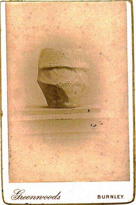
Carved stone figure (from Smith’s ‘Reliquiae’)
Not far from this long lost tumulus, a curious carved stone figure was located “among ancient foundations” in a cellar! Thought to be a local deity, it may have been a carved representation of whichever figure or spirit ancestor was buried in Duel Cross Hill — though we’ll never know for sure.
Folklore
Although archaeologically, etymologically and geomantically related to the nearby Devil’s Arrows at Boroughbridge a couple of miles up the road, there is nothing specific I can find of this once important tumulus. However the place-name in both forms, Deul and Deuill, refers to the pre-christian devil (from deofol, Old English, “devil”). This name may relate to the stone figure shown in the illustration, or of long lost heathen rites enacted here in bygone times. Any further info on this place is very welcome.
References:
Hargrove, E., The History of the Castle, Town and Forest of Knaresbrough, Hargrove & Sons: Knaresbrough 1809.
Smith, Henry E., Reliquiae Isurianae, J.R. Smith: London 1852.
‘Tumulus’ (destroyed): OS Grid Reference – SE 592 737
Archaeology & History
Bronze Age pottery (after YAJ 1963)
A curious entry inasmuch as it’s difficult to categorize the site correctly. Added to this is the fact that the place has been built over! But despite these misgivings (if that’s the right word!), the site’s deserving of a posthumous entry…
There used to be a curious-looking mound here, immediately east of Intake Lodge, that “was due to be bulldozed so that a field of rough pasture could be brought under cultivation”, killing the indigenous wildlife that was living here. However, before this was done, some inspectorate dood who worked for the Ancient Monuments Commission and the Ministry of Works “decided to excavate”, as he believed that an ancient burial mound was in the field. Mr I.M. Stead (1963) takes up the story, telling:
“”This mound was about 75ft by 90ft diameter and 6ft high, on ground sloping away to the south-east. It had every appearance of being a barrow.
“The excavation, in October 1961, was supervised by the writer (and) assisted by Mr A.L. Pacitto. A trench on the east side revealed layers of sand which appeared to be natural, and a second trench, on the west side, uncovered a capping of stone which confirmed that this was not a barrow. However, it seems that the writer was not the first person to mistake it for an artificial burial mound. A disturbed area in the centre, some 15ft diameter, where there had been an old water-tank, produced a fragment of Bronze Age pottery and a sherd from another Bronze Age vessel was found in a disturbance on the side of the mound. A small area near the centre was cleared in the hope of finding an undisturbed burial, but shortage of funds did not permit more extensive stripping. Judging from the type of pottery (see image) and its situation on the mound, there can be little doubt that one two occasions Bronze Age people placed secondary burials in the natural mound.”
This tells us that although the mound wasn’t a tomb or burial mound in a traditional religious sense, it was instead a sacred hill of the dead for the local people at one time or another in ancient days. And, if Mr Stead had been a decent archaeologist and continued to excavate here without pay (as he should do if he loves his subject), we may have found more beneath this now-lost sacred mound. Unfortunately this didn’t happen and we lost vital clues and information.
References:
Stead, I.M., “An Excavation at Yearsley, North Riding, 1961,” in Yorkshire Archaeological Journal, part 161 (volume 41), 1963.
This once-impressive Bronze Age tomb is now much denuded and stands besides the legendary Fleam Dyke. The name of Mutlow was first used to describe this site in the 1812 Enclosure Act and means, literally, an “Assembly Hill” or Assembly burial mound. Reaney (1943) told that it was situated “at the junction of the boundaries of Great Wilbraham (Staine Hundred), West Wratting and Balsham (Radfield Hundred) and Fulbourn (Flendish Hundred)”, and was obviously an important moot spot where local tribal and council laws were made.
The great Cambridge archaeologist, Tom Lethbridge (1957) briefly described the place in his fascinating survey of the nearby hill-figures, Gog and Magog, saying:
“The hill itself is a Bronze Age barrow which was dug by the Hon. R.C. Neville about a hundred years ago. In it were, amongst other things, glass beads brought to Britain from the eastern Mediterranean in the fifteenth century before the birth of Christ. The barrow, which was presumably the site of a moot in Saxon times, seem to have been used as a sighting point for the construction of the Fleam Dyke… A circular Roman building, either a temple, or possible a signal station, stood close to Mutlow Hill.”
Lethbridge pointed out that another lesser-known trackway — “known in Saxon times as ‘the Street'” — also passed here, saying:
“When the land is ploughed and the light is right, you can see the numerous dark lines on the soil, all converging on Mutlow Hill. These are the old hollow ways of the Icknield Way and the Street.”
Folklore
One legend here speaks of a golden chariot that is reputedly buried either inside, or near to the old tumulus. Lethbridge (1957) again told of hearing this tale, though narrated, “it was said to be buried in Fleam Dyke near Mutlow Hill.” When he asked a local lady about the tale,
“She replied that she had always heard that it was not in the dyke itself, but in the road which passed the dyke and went on to West Wratting and the southeast.”
References:
Lethbridge, T.C., GogMagog: The Buried Gods, RKP: London 1957.
Reaney, P.N., The Place-Names of Cambridgeshire and Isle of Ely, Cambridge University Press 1943.
Described in Walter Bennett’s (1946) magnum opus as a “stone circle” and repeated in Aubrey Burl’s (2000) magnum opus under the same category, the site here seems more likely to have been an old cairn circle, or perhaps even a simple tumulus — and a small one at that! It was first noted in June of 1842 when the antiquarian, Mr F.C. Spencer of Halifax, “had his attention called to a circle of stones in a field called Delph Hill Pasture by Jonas Lee, a Thursden farmer, and a somewhat noted character in his day” who knew the location very well. It didn’t take long for Mr Spencer to realise that this was “an ancient British barrow,” as he called it, and made plans to excavate the site soon after seeing it.
Following Spencer’s dig, a short account of the finds was made in the Gentleman’s Magazine, telling of the remains of this “small circle of stones” and the burials therein. The account said:
“The circle originally consisted of rock pillars (five of which remain) , standing about 18 inches above the surface, and being about 2 feet square. The diameter of the circle is about 5 yards. Mr Spencer directed an excavation to be made without delay, the result of which was the discovery of two very antique earthen urns, curiously marked, containing fragments of human bones, of small dimensions, mixed with charcoal and black mould. The tops of the vessels were covered with small flat slate-stones, but little larger than the urns, over which larger heavy stones were placed for their protection. The urns were found about 2 feet beneath the surface of the field, in the centre of the circle, embedded in soft clay, with many pieces of charcoal interspersed. About 300 yards from the barrow are the bold remains of a British circular camp…”
A few years later, Tattersall Wilkinson (1893) told that “three unglazed urns, with human remains and flint arrowheads” (my italics) were found at the locale. Curiously there has been some confusion as to the number of urns that were actually found at Delf Hill by different authors over the last 175 years (numbering between 1 and 3, depending on whose account you read!), but it would seem this has occurred due to the proximity of other tombs close by.
An excursion to Delf Hill a few years after Spencer’s first dig is described in an article by L. Clement (1874), where several members of a local history society reported that the mound here consisted of a “small circle of stones, seven in number, fourteen feet in diameter”, that probably surrounded the hillock. One of the stones had been knocked over and moved, so the group took it upon themselves to place the monolith back into what they thought was its original setting within the monument.
Tumulus (destroyed): OS Grid Reference – SE 094 242
Archaeology & History
Shaw Hill urn
The remains here have long since succumbed to that self-righteous advance of industrial civilization. Even when the Halifax historian John Watson (1775) first described what had been here, the burial mound had gone; but thankfully he was fortunate in getting details regarding the whereabouts and contents of the remains. Three burial urns were found next to each other — presumably in the same tumulus — one of which was in a reasonably good state of preservation, as shown from the illustration which I reproduce here. We have no description of the burial mound, only of the urns, of which Mr Watson told us:
“It was found, with two others, at the gates, at the bottom of the walk near Shaw Hill, leading to the house in Skircoat, called Heath. They lay in a line, one yard deep and one yard asunder, with their mouths downwards. This contained calcined bones, and dust; the two others were broken in pieces. It is eight inches deep, stands upon a bottom of four inches diameter and, where there is no moulding, is from twenty-one inches, or thereabouts, to twenty-three inches in circumference.”
It was of similar size and design to burial urns found at Tower Hill a couple of miles west of Halifax. In Prof Watson’s (1952) work on the prehistoric sites of Calderdale, he assigned this burial mound and pottery to have been from the Bronze Age.
References:
Leyland, F.A., The History and Antiquities of the Parish of Halifax, by the Reverend John Watson, M.A., R.Leyland: Halifax n.d. (c.1867)
Roth, H. Ling, The Yorkshire Coiners, 1767-1783; and Notes on Old and Prehistoric Halifax, F.King: Halifax 1906.
Watson, John, The History and Antiquities of the Parish of Halifax, T. Lowndes: London 1775.
Watson, Geoffrey G., Early Man in the Halifax District, HSS: Halifax 1952.
Cairns (destroyed): OS Grid Reference – SE 053 261
Archaeology & History
F.A. Leyland’s drawing of the urns
There’s really nowt to see around here nowadays (apart from a lovely view of the hills and the Calder valley), but it seems that not-too-long ago there were several burials in evidence upon this hill. F.A. Leyland (1867) gives a quite detailed account of the urns and their discovery, which have been variously thought of as Roman, then Saxon, then prehistoric — with them finally ascribed as Bronze Age in Watson’s (1952) survey of the region. Not too far away could once be found the legendary Robin Hood’s stone circle, which might have had some relationship with the burials here — though we’ll probably never know for sure! Leyland’s (1867) lengthy notes of this site told:
“An interesting discovery was made in…recent times, of a number of cinerary urns in the township of Warley. The site of the interments was at Tower Hill, a position on a line of military defences which extended from the entrenchments of Hunter’s Hill to Camp End in this township. The urns were found in the process of quarrying for stone; but, owing to the nature of the operations, and the unlooked for discovery of such relics as these or the total absence of all knowledge of their value, by the people employed, many similar remains are known to have been demolished as worthless objects.
“On one occasion, however, an urn, bleached by the tempests of an entire winter, was observed to protrude half its own bulk from the stratum of soil in which it had been originally buried.
“The curiosity of the labourers was excited, and the relic was removed. It was found to contain bones and ashes which the people, ever prone to the marvellous, held to be the remains of a child which had been destroyed by foul means and there buried. This opinion was noised abroad, and the true nature of the interment explained. We examined a fragment of this relic: it was rudely constructed of sun-burnt clay, and was grimed in the inside as if by the smouldering embers of the funeral pyre, and the smoking ashes of the dead, on their introduction to their narrow urn.
“This had been filled with these human exuviæ; and appeared to have been lined with moss mixed with fibres of plants which, after the urn had fallen in pieces, adhered firmly to its contents. It was thirteen or fourteen inches high, and was no doubt made by the hand alone. Within a few yards of this, another urn was found, containing bones and ashes, but so far decomposed as to preclude the possibility of its preservation: near the same place the smaller urn in our illustration was discovered buried in the dark soil peculiar to the locality; it was filled with calcined bones and ashes and, like the one found at Upleton—and in the possession of Dr Young of Whitby—had a small clay vessel placed within it, which is represented in our engraving. The urn was, moreover, protected by a lid, resembling the inverted stand of an ordinary flower-pot: the relic measured six inches high.
“During the winter of 1848, a date subsequent to the above discoveries, there was a fall of earth from the same spot, into the quarry at Tower Hill; the soil, thus precipitated from the moor, impeded the operations of the labourers; and, on its removal, the larger urn of our illustration was brought to light. This relic measured nine inches high and was twenty-two in circumference; but, in the rubbish, there were observed numerous fragments of other cinerary urns, and equally numerous relics of cremation.
“These discoveries lead one to one of two conclusions: either that Tower Hill was the field of some formidable engagement, in which numbers fell; or, that it was used as a place of frequent sepulture by the primitive inhabitants of the locality. It is not at all improbable that these urns were the produce of some local pottery, if not made by the same hand, as the one described by Watson (1775), the patterns indented on the two upper compartments of the smaller vessel being of the same kind, and occupying the same positions as the one referred to.
“The larger urn, as will be observed, is divided like the others into three compartments, the upper one standing out in relief, but having a different kind of decoration resembling herring-bone masonry; while the smaller one of our illustration, and that of Watson, are furnished with a zigzag design. But, although there is this slight variation in the upper moulding of the larger vessel, they all possess the lozenge-shaped decoration in their central compartments.”
We haven’t yet explored this site diligently and also know that if we have to await the slow hand of archaeology here we’d be waiting an aeon, but Tower Hill’s position in the landscape would tend to indicate the latter of Leyland’s earlier suggestions regarding the nature of the finds, i.e., the hill was a prehistoric graveyard, though of unknown size.
References:
Leyland, F.A., The History and Antiquities of the Parish of Halifax, by the Reverend John Watson, M.A., R.Leyland: Halifax n.d. (c.1867)
Roth, H. Ling, The Yorkshire Coiners, 1767-1783; and Notes on Old and Prehistoric Halifax, F.King: Halifax 1906.
Watson, John, The History and Antiquities of the Parish of Halifax, T. Lowndes: London 1775.
Watson, Geoffrey G., Early Man in the Halifax District, HSS: Halifax 1952.
An excellent passage grave tomb that’s been described by many historians over the last two hundred years, and was subject to a fine excavation in the first half of the 20th century. Ascribed as neolithic in origin, recent finds of human activity on the edge of the surrounding henge indicates people have been “up to things” hereby since at least 6000 BC. Deriving its name from “the mound of the black grove,” the site as we see it today has been much restored and is so different to when it was visited by Thomas Pennant and other antiquarians.
According to an anonymously written essay in Archaeologia Cambrensis in 1847, the site was first described by Henry Rowlands (1723) where, in relation to another site, he told were,
“the remains of two carnedds, within a few paces of one another: the one is somewhat broken and pitted into on one side, where the stones had been carried away; the other having had its stones almost all taken away into walls and hedges, with two standing columns erected between them.”
A somewhat more detailed description came from Thomas Pennant a few years later. He wrote:
“A few years ago, beneath a carnedd similar to that at Tregarnedd, was discovered, on a farm called Bryn-celli-ddu…a passage three feet wide, four feet two or three inches high and about nineteen feet and a half long, which led into a room about three feet in diameter and seven in height. The form was an irregular hexagon, and the sides composed of six rude slabs, one of which measured in its diagonal eight feet nine inches. In the middle was an artless pillar of stone, four feet eight inches in circumference. This supports the roof, which consists of one great stone near ten feet in diameter. Along the sides of the room was, if I may be allowed the expression, a stone bench, on which were found human bones, which fell to dust almost at a touch: it is probable that the bodies were placed on the bench… The diameter of the incumbent carnedd is from ninety to a hundred feet.”
Ground-plan
But the main excavation work at Bryn Celli Ddu was done in the late-1920s by W.J. Hemp (1930) and his team, who, as usual following such digs, ended up with just as many questions about the site as they had answers! One of the best descriptions of Hemp’s excavation work was by W.F. Grimes (1932) in an essay he wrote for the East Anglian Prehistoric Society where he gave the following detailed description of the finds:
“The cairn here was circular, with a chamber of some 160ft and an original maximum height of at least 12ft. The chamber is a polygonal structure of large stones augmented…with dry-stone walling, entered on the northeast side by a long passage built in the same way. Many of the stones had been dressed and in the chamber stood a single pillar which had been artificially rounded and smoothed, but which had never actually supported the capstone.
“These features had been more or less apparent for many years. But the reparation work soon showed that this was by no means all. In the first place, it was found that the chamber had been surrounded by four circles of standing stones. The first of these, around the outside of the mound at its base, had disappeared, although early accounts and a single hole found in the course of the work of excavation, are evidence of its existence. The second and third circles were found when the entrance to the passage wall was being cleared. Here the walls of the passage were found to merge into an outer circle of large stones and an inner of smaller, set close together and elaborately packed and sunk in a ditch six feet deep and eighteen wide, enclosing the chamber in such a way that passage, chamber and circles together form a gigantic unbroken spiral, with the chamber itself as an unbroken loop in it. The fourth and innermost circle was in the area enclosed by the ditch (which is represented on the plan by the shaded portion). This consisted of a number of stones of various sizes, irregularly placed and in some cases inclined outwards. Under some of them were deposits of burnt human bones. Lines connecting these stones diametrically were found to intersect at the centre of the monument, directly behind the chamber, and here was found a slab-covered pit which contained an elaborate filling whose purpose is unexplained. Beside the cover-stone of the pit was a second larger slab of grit, lying flat, the faces of which were covered with an elaborate and continuous pattern of spirals, scrolls and zig-zags. The position of this stone is shown beside the central stone on the plan. Of it purpose it can only be said that it was probably magical…
“As if the elaborate features already described thus badly were not enough, a uniform floor of purple clay was found to cover the old natural surface within the area enclosed by the ditch, and there were on the floor, in the ditch, and in many other places extensive traces of fire in the form of burnt patches, blackening and quantities of charcoal. In addition there were outside the entrance, a line of post-holes and remains of walls suggesting the former existence of some kind of forecourt crossed by a temporary barrier. Here also were traces of fire and of elaborate ritual. It must be emphasized of course, that all these features, with the exception of the outer circle of stones and the forecourt, had been completely concealed by the mound, so that they were not visible once the monument was completed… Moreover…the entrance to the chamber had been closed with an elaborate blocking which suggested that once closed the chamber had not been intended to be re-opened.”
Although many questions emerged following the excavation, perhaps that relating to the chronology and evolution of the site (after its ritual use) was most important. The site as we see it today sits within the confines of a henge monument (which should also be given an independent entry account) and once a stone circle. And although present day field evidence is inconclusive about which came first, archaeologists like Richard Bradley, Clare o’ Kelly and others are not without opinion. Bradley (1998) told:
“O’ Kelly argued that there had been two successive monuments on the site. The earlier one was a stone circle, enclosed by the earthworks of the henge. In a later phase this was replaced by a passage grave which was built over the surviving remains of the stone circle, its outer kerb being bedded in the ditch of the older monument.”
But Bradley himself doubts this for various reasons, himself interpreting,
“the sequence at Bryn Celli Ddu is to suggest that in its first phase it consisted of a circular unrevetted mound about 15m in diameter, containing a passage grave. Around the edge of this structure was a stone circle, and beyond that there was a quarry ditch. When the monument was enlarged, not on one occasion but twice, the passage was extended as far as the earlier ditch and a significantly larger mound was bounded by kerbstones.”
Though adding himself that there is also a trouble with this idea! As with many other sites, Bryn Celli Ddu appears to have been aligned to the summer solstice. This notion was first propounded by astronomer Sir Norman Lockyer (1909) in his hugely revised work on the astronomical function of megalithic sites. It was nearly 100 years before any archaeologist got off their backside and tested Lockyer’s original proposal and found the scientist to have been way ahead of them at their own discipline. Not unsurprisingly, archaeologist Mike Pitts (2006) was a bit slow in his gimmicky headline in British Archaeology, where he deemed Steve Burrow’s personal observation as “sensational.” Oh how common this theme seems to be in archaeology. Twenty years previously Miranda Green (1991) posited that the chamber alignment from Bryn Celli Ddu aligned towards “May Day sunrise” — which doesn’t seem to work. And on a similar astronomical note, archaeologist Julian Thomas (1991) thought that five post-holes found some five yards beyond the entrance were somewhat reminiscent of the “A” holes at Stonehenge and related to some lunar alignments, thinking that:
“It seems likely that (they) record a series of observations upon the rising of some heavenly body in order to ascertain its standstill position.”
A point that Clive Ruggles (1999) explored with a little scepticism, pointing out:
“The only possibility is the northern minor limit of the moon, and while the adjacent posts are ranged on the correct side to record the position, say, of the midwinter full moonrise in years before and after the minor standstill, many other interpretations of these posts are doubtless possible.”
There’s been lots written about this place and lots more could be added with various archaeologists showing their relative opinions about the place. But perhaps more worthwhile is a visit to the place, later on, when the tourists have fallen back under a starlit sky…
References:
Anonymous, “Cromlech at Bryn Celli Ddu, Anglesey,” in Archaeologia Cambrensis, volume 2, 1847.
Barber, Chris & Williams, John G., The Ancient Stones of Wales, Blorenge: Abergavenny 1989.
Bradley, Richard, “Stone Circles and Passage Graves – A Contested Relationship,” in Prehistoric Ritual and Religion, edited by Alex Gibson & Derek Simpson (Sutton: Stroud 1998).
Green, Miranda, The Sun Gods of Ancient Europe, Batsford: London 1991.
Grimes, W.F., “Prehistoric Archaeology in Wales since 1925,” in Proceedings of the Prehistoric Society of East Anglia, 7:1, 1932.
Hemp, W.J., “The Chambered Tomb of Bryn Celli Ddu, Anglesey,” in Archaeologia, volume 80, 1930.
Lockyer, Norman, Stonehenge and other British Stone Monuments Astronomically Considered, MacMillan: London 1909.
Lynch, Frances, Prehistoric Anglesey, Anglesey Antiquarian Society 1991.
o’ Kelly, Clare, “Bryn Celli Ddu: A Reinterpretation,” in Archaeologia Cambrensis, volume 118, 1969.
Ruggles, Clive, Astronomy in Prehistoric Britain and Ireland, Yale University Press 1999.
Thomas, Julian, Rethinking the Neolithic, Cambridge University Press 1991.


")
")
