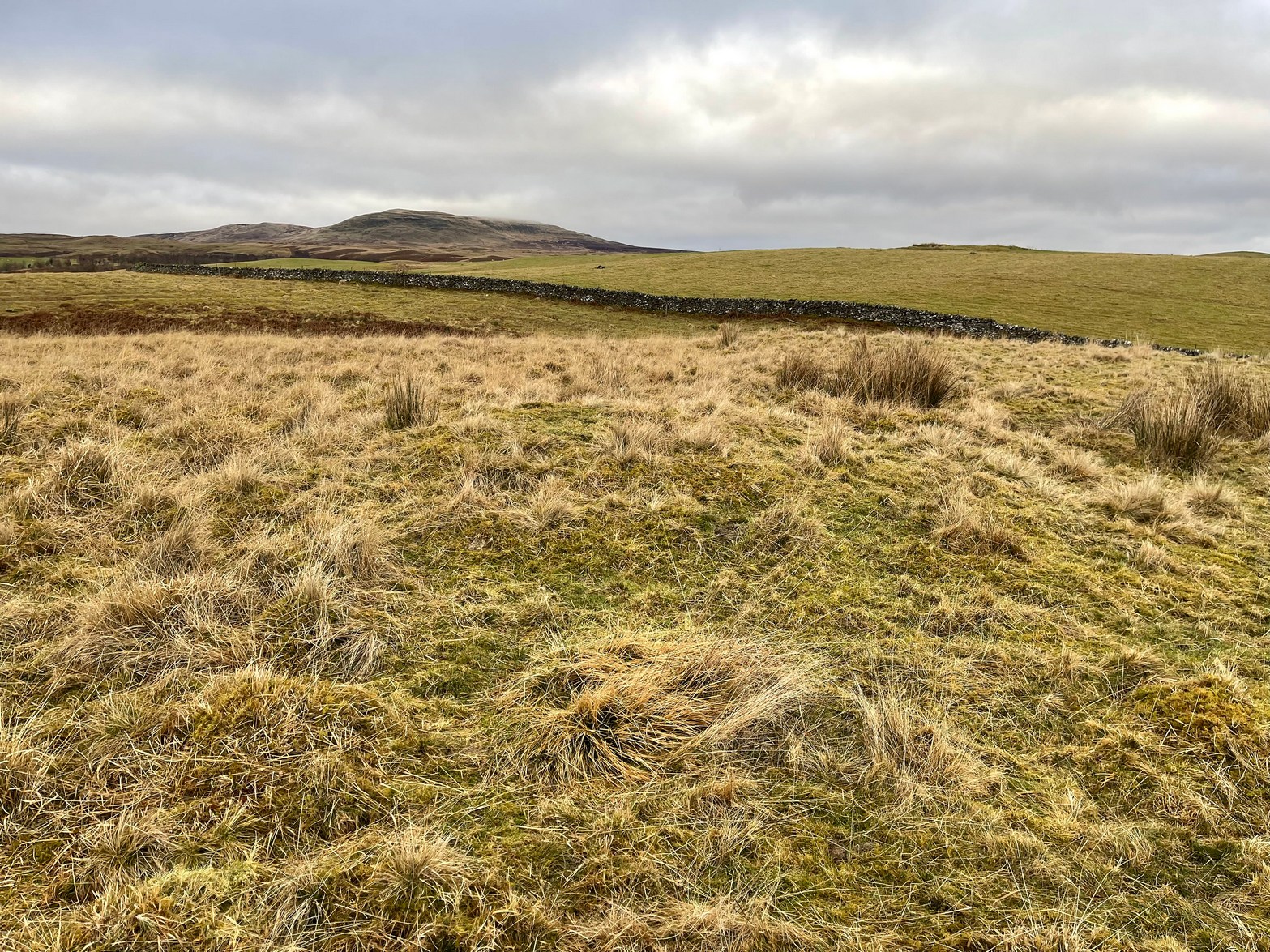
From Callander head east along the main A84 road and nearly 300 yards past the entrance to the Keltie Bridge caravan park, take the tiny road on your left (north) and barely 100 yards along turn right and go up here for exactly 1 mile. Walk up the track from here and follow the directions to find the Black Park (1) cairn; and then the nearby small Black Park (2) cairn. From here you need to walk north-east round the small rounded hillock in front of you, and cross a small burn (stream) up to the next small grassy rise. Altogether this is about 200 yards from the Black Park (2) cairn. On this grassy rise lives the Black Park (3) cairn!
Archaeology & History
As with its compatriot Black Park (2) cairn 200 yards southwest, this can be hard to see. It’s an overgrown small singular cairn (it looks like a tumulus now) of no great note to look at: probably the resting spot of an individual or just a small family. Measuring some 5-6 yards across and less than a yard high at the most, its easily missed unless you’re really mean to find it. More impressive are the ones on the hill immediately above you to the east. Head there next!
References:
Royal Commission Ancient & Historical Monuments, Scotland, Braes of Doune: An Archaeological Survey, RCAHMS: Edinburgh 1994.
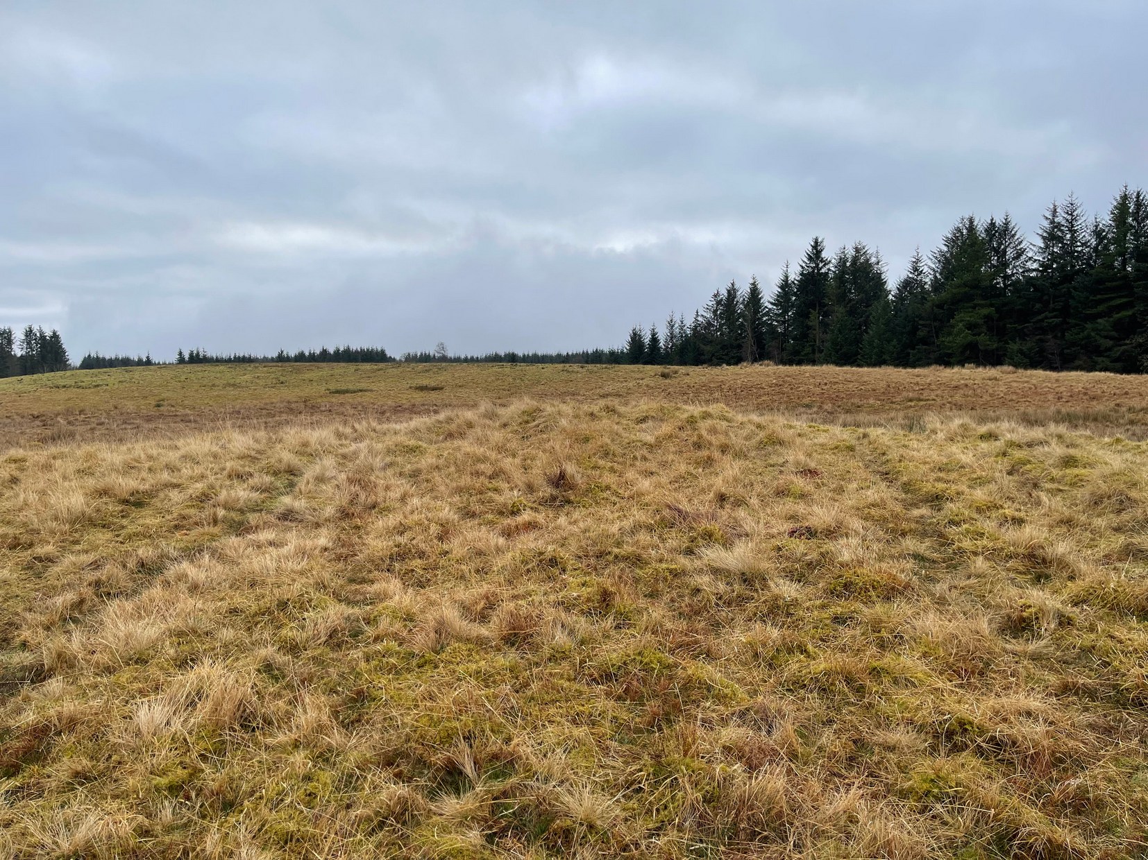
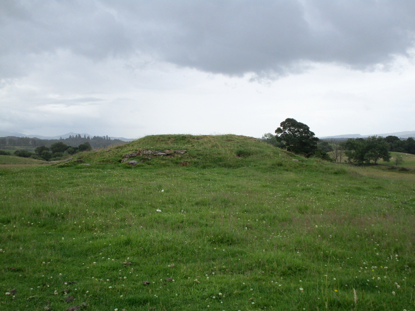
Take the same directions as if you’re going to visit the large Black Park (1) cairn, and from here look down the slight boggy slope to your right (east) and, across the other side of a small burn (stream) you’ll see a slightly raised grassy knoll. A curved dyke is to its left (west) side. You’re there!
Archaeology & History
This small cairn, barely two feet high at the most, and five yards across, is deemed as a possible Bronze Age cairn on Canmore and in the Royal Commission (1994) report of the area. There is certainly a pile of small stones here, but it may be a clearance cairn (I hope I’m wrong). Only an excavation will tell us for sure.
References:
Royal Commission Ancient & Historical Monuments, Scotland, Braes of Doune: An Archaeological Survey, RCAHMS: Edinburgh 1994.
Less than a mile east of Callander on the main A84 road, nearly 300 yards past the entrance to the Keltie Bridge caravan park, take the tiny road on your left (north) and barely 100 yards along turn right and go up here for excatly 1 mile (give or take a few yeards) where track goes into the forest on your left and you can park-up here. Walk up the track into the silence for just under a mile where, as the track splits and you kink to the right, a gate appears. On the other side of the gate, turn immediately left, almost walking back on yourself, just above the curving waters of a burn, through boggy reeds, keeping to the fence-line until, less than 300 yards along, you’ll reach what you’re looking for.
Archaeology & History
Black Park (1), looking W
This reasonably large cairn and its neighbours (Black Park [2], [3], [4] and [5]) would appear to be relatively new discoveries as I can find nothing about it prior to the Royal Commission’s 1994 survey. They are even absent from Moray MacKay’s (1953) excellent work on the area! Hence, descriptions of it are scant and visitors to the place are few indeed (we did meet a local who knew about the old tomb, but said that nothing was known about it); but it is, nonetheless, a fine, albeit denuded and very overgrown cairn, living today amidst a quiet mass of reeds and surrounded by boggy ground—so make sure you’ve got your boots on!
Internal line of stoneworkBlack Park (1), looking SE
At its height, today, it stands less than four feet tall and measures roughly 16 yards across at its widest. Through one section of the tomb there runs a raised line of stonework that almost looks like internal walling, which may have been where a chamber once existed. It’s been hollowed out by someone in the not-too-distant past but, as I said, there are no records of such a thing, so whether or not that was a chamber or merely a fortuituous collapse of stone in a straight line, we can’t really say. Along its more northern edges there seems to be a small raised wall of stone defining its edge, although once again it requires a more discerning examination to work out whether this is part of its original facade, or is a result of some of the stone mass falling to the edges.
Visit the old place and sit with its silence for a while…
References:
Royal Commission Ancient & Historical Monuments, Scotland, Braes of Doune: An Archaeological Survey, RCAHMS: Edinburgh 1994.
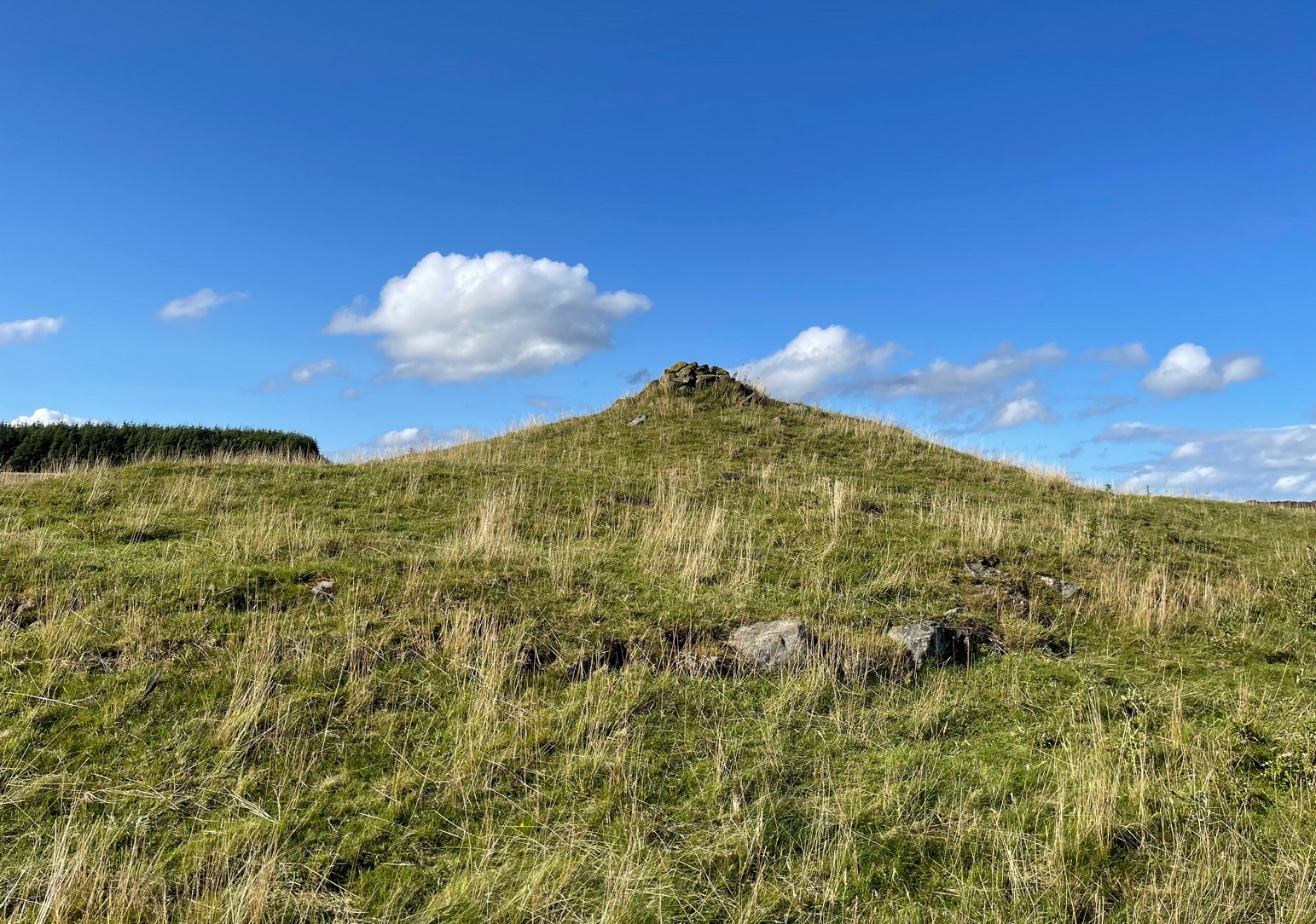
Make a day out for this one! You could, of course, go barely half-a-mile straight up the hill (southwest) from Ossian’s Stone in the Sma’ Glen below – but it’s steep as fuck and I know that most of you wouldn’t do it. So, park-up and take the gradual 3 mile walk into the mountains. Coming via Crieff, along the A85 road east, turn left up the A822 Dunkeld road at Gilmerton. 2½ miles on, you reach the Foulford golf course on the right-hand side of the road, whilst directly across the road a dirt-track leads you into the fields, past the large Foulford cup-and-ring stone. Keep along this track, bearing right just before Connochan Lodge and follow this dirt-track uphill on and on for another 2 miles where you’ll eventually see the cairn-peak in the distance. Another shallow track leads uphill after about 2 miles: we walked up to where the ground levels out, walked across the dodgy swamp-land and up again to the tomb. It’s well worth it!
Archaeology & History
Visible for many miles round here from the surrounding hills, this somewhat mutilated giant cairn, highlighted on the earliest Ordnance Survey map of the area in 1867, hasn’t fared well in archaeology tomes. Apart from a passing note in Margaret Stewart’s (1966) summary article on prehistoric remains in central Perthshire—where she erroneously told it to be 400 feet lower down that it actually is—almost nothing has been said of this place. Most odd.
Cairn spoil, looking SENew cairn atop of the old
Despite it being ransacked over the centuries, it was obviously of some considerable size in its early days. Today, surmounting it, is a very large walker’s cairn which, no doubt, has accrued some of its own foundations from the prehistoric tomb on which it sits. To the side of this recent cairn, another one is growing, thanks to stones brought from near and not-too-far. But the original creation can still be seen in outline and mass all around. Indeed, as you walk all round the modern cairn, you’re walking over much of the early collapsed stonework sleeping gently beneath the moorland vegetation, and once you walk away and below the cairn mass itself, looking back up at it you’ll notice the very ancient raised plinth of stone on which our modern one now lives.
Low walling on NW side
Its amorphous shape is somewhat amoeboid, measuring more than 22 yards across east-west, by 15 yards north-south, with a curious arc of low walling, very old indeed, on its northwestern side. Whether this walling outlines the original edge of the tomb, only an excavation will tell. The most notable remaining mass of ancient cairn material reaches out on its south-east to eastern edges, where some of it is beginning to fall away down the edge of the mountain slope.
Folklore
Local tradition assigns this cairn to be where the bones of the great hero-figure Ossian was removed to, when they were disturbed by the unruly mob of General Wade and his cohorts in the middle of the 18th century. Notes of the event were written at the time by one of Wade’s mob, a Captain Edward Burt, who told,
“the Highlanders, they assembled from distant parts, and having formed themselves into a body, they carefully gathered up the relics, and marched with them, in solemn procession, to a new place of burial, and there discharged their fire-arms over the grave, as supposing the deceased had been a military officer.”
This was essential, said Burt, as
Site shown on 1867 mapNew cairn on old, looking W
“they (the Highlanders) firmly believe that if a dead body should be known to lie above ground, or be disinterred by malice, or the accidents of torrents of water, &c. and care was not immediately taken to perform to it the proper rites, then there would arise such storms and tempests as would destroy their corn, blow away their huts, and all sorts of other mis-fortunes would follow till that duty was performed. You may here recollect what I told you so long ago, of the great regard the Highlanders have for the remains of their dead…”
Oral tradition tells us that this cairn, high above Ossian’s Stone, is where the rites occurred. It makes sense too.
References:
Finlayson, Andrew, The Stones of Strathearn, One Tree Island: Comrie 2010.
Acknowledgements:Huge thanks for use of the Ordnance Survey map in this site profile, reproduced with the kind permission of the National Library of Scotland.
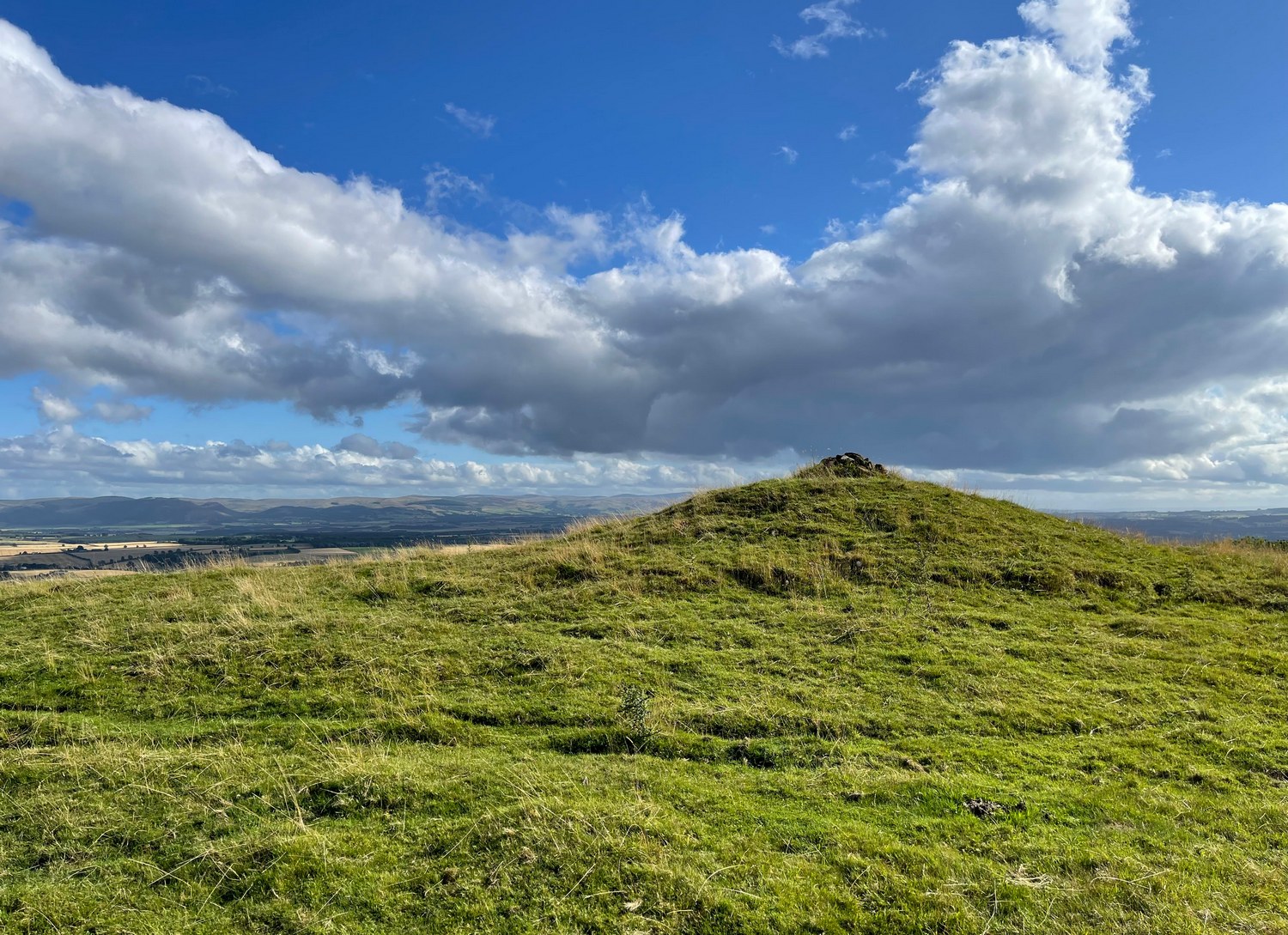
You need to hit the village of Fowlis Wester, which is easiest to approach from both east and west along the A85, between Crieff and Perth: nearly 3 miles east of Gilmerton and about 6½ mile west of Methven. Keep your eyes peeled and take the road up (north) where the large rounded tree-covered tumulus stands and up to the village. Go through the village and uphill for literally ½ a mile (veering sharp left at a junction) where a gate on your right leads into the fields. (a large parking spot is 300 yards further uphill) Walk ¼-mile east and through the other side of the small woodland, over the fence, you’ll see the mound of a typical tumulus. That’s it!
Archaeology & History
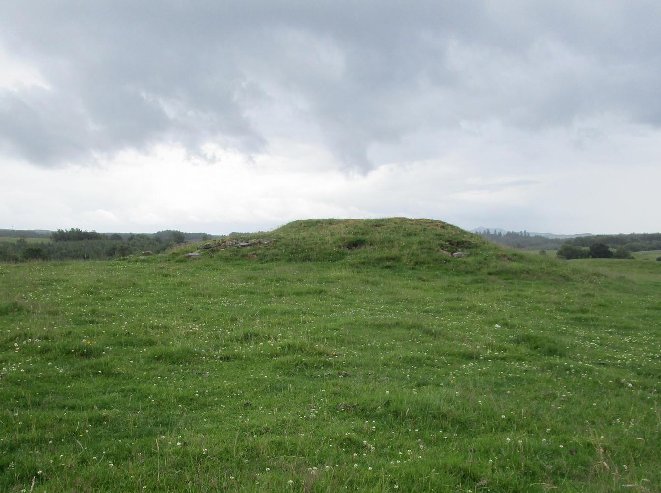
If you’re going to visit the megalithic remains of Fowlis Wester ¾-miles to the west, the antiquarians amongst you might as well give this old burial mound your attention too. It’s not grandiose by any means, but its position in the landscape is quite superb. It’s built upon a long geological promontory with extensive views that reach from south-east to south to south-west for many miles into the distance with the Ochils framing the majority of the southern horizon, but also with the notable pap of the West Lomond hill 20 miles to the south-east mimicking the shape of the tomb itself. It was obviously built here with the extended landscape having some ancestral importance. Visit it and see for yourself!
Despite being a notable mound, this tumulus-cum-cairn only seems to have been written about for the first time as recently as 1998, when archaeologist Ian Armit visited the site. Roughly circular in form, it’s about 12 yards across and more than six feet in height. A small pile of stones crowns the very top, placed here in much more recent times. At ground level on its northern side, an arc of low lying stones define the edge of the tomb. The stones probably continue all the way round the entire structure, but it’s overgrown by centuries of soil and vegetation and we lose sight of it as we walk round. When Mr Armit (1998) wrote about the site, he and colleague wrote:
Seat Knowe, looking NWSeat Knowe, looking north
“A grassed-over stony cairn lies on the highest point of Seat Knowe, a ridge commanding extensive views to the south. The cairn has a diameter of c.10m and is up to 2m high. A modern cairn occupies it summit. The low turf foundations of a rectilinear structure, some 6 x 8m, occupy its south flank, and thee are extensive cultivation and field system remains in the vicinity.”
Check it out! You won’t be disappointed.
Folklore
An interesting piece of relatively recent folklore about Seat Knowe, described in the Perthshire Name Book around 1862, told that,
“One of the Earls of Strathearn, desirous of having a church in the vicinity of his Castle, stood on an eminence, on which he had a summer seat, and resolved to erect it where the sun first shone, which was on the spot where it now stands.”
References:
Armit, Ian & Hall, M., “Seat Knowe (Fowlis Wester parish): Cairn,” in Discovery & Excavation Scotland, 1998.
Tumulus (destroyed): OS Grid Reference – NZ 6692 2154
Archaeology & History
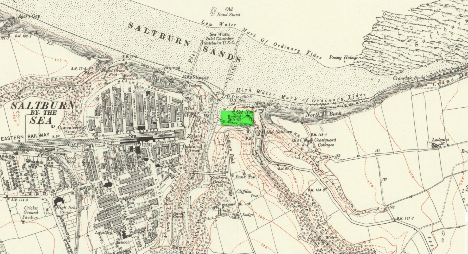
Location on 1930 OS-map
This long lost burial mound was first located by the local antiquarian William Hornsby in the early 20th century. It had been constructed close to the summit of the prominent rise of Cat Nab, immediately east above Saltburn. Its position was shown on the 1930 OS-map of the area. Destroyed by quarrying, it was thankfully excavated by Hornsby in 1913; and although his finds were never published, he left notes which told us that,
“there were two cremations and the sherds of at least three vessels: a collared urn, a pygmy cup and a vessel with an everted rim.” (Crawford 1980)
Crawford (1980) told that these finds could been seen in the Middlesborough Collection.
References:
Crawford, G.M., Bronze Age Burial Mounds in Cleveland, Cleveland County Council 1980.
Acknowledgements:Huge thanks for use of the Ordnance Survey map in this site profile, reproduced with the kind permission of the National Library of Scotland.
Cup-Marked Stones (lost): OS Grid Reference – SE 9657 8840
Archaeology & History
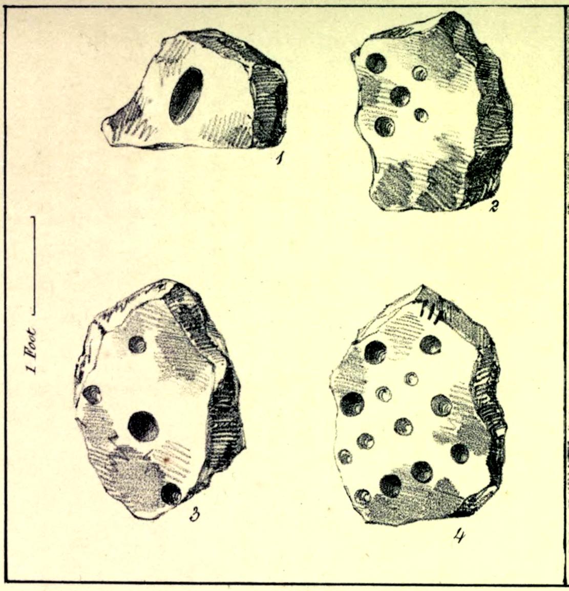
In the autumn of 1848, antiquarian John Tissiman (1850) and his associates took to uncovering two burial mounds amidst a large cluster of them on the eastern edge of West Ayton Moor. This one at Way Hagg was quite a big fella, measuring 36 yards across. When they cut into its northern edge towards the centre, 8-10 feet in, they came across an upright stone, nearly two feet high, on which five cup-marks had been cut. (see sketch, no.2) Slightly beyond this were three other stones (in sketch, nos.1, 3 & 4), each with cup-marks on them, beneath which was a tall urn. Whether or not the carvings had been deliberately positioned to cover the urn, we do not know. Nonetheless, we can be reasonably assured that these petroglyphs had some mythic association with death when they were placed here.
Tissiman gave us the following detailed measurements of the respective carvings:
“1: Nearly even surface. Length, from 16 to 18 inches; breadth, 10 to 20 ditto; depth, 8 to 9 ditto; with large oval hole cut in the centre, 7½ inches long, 4 inches broad, and 3½ inches in depth. On the opposite side are three holes, from 2 to 3 inches in diameter, and from 1 inch to 1½ deep. 2: Uneven surface. Length, 23 inches; breadth, 14 inches; depth, 13 inches; with five holes, from l½ to 3½ inches in diameter, and 1 to 1½ inches in depth. 3: Uneven surface. Length, 33 inches; breadth, 22 inches; depth, 10 inches, with four holes, the largest being 4½ inches in diameter and 3 inches deep; the others, from 1½ inches to 2 inches in diameter, and 1 to 1½ inches deep. 4: Uneven surface. Length, 27 inches; breadth, 23½ inches; depth, 10 inches, with 13 holes, from 1½ inches to 5 inches in diameter, and ¾ of an inch to 3 inches in depth; also three lines at the end of the stone.”
The carvings were included in Brown & Chappell’s (2005) fine survey, but they weren’t able to find out what happened to them after Tissiman’s excavation. They remain lost. If anyone has any information as to where they might be, please let us know.
References:
Brown, Paul & Chappell, Graeme, Prehistoric Rock Art in the North York Moors, Tempus: Stroud 2005.
Tissiman, John, “Report on Excavations in Barrows, in Yorkshire,” in Journal British Archaeological Association, April 1850.
Acknowledgements:Huge thanks for use of the Ordnance Survey map in this site profile, reproduced with the kind permission of the National Library of Scotland.
Tumulus (destroyed): OS Grid Reference – TQ 861 862
Archaeology & History
Somewhere beneath the modern housing estate immediately east of Chalkwell Park was once a large prehistoric burial mound. It was included in Wymer & Brown’s (1995) archaeological gazetteer (albeit at the wrong spot) without comment, but their reference led me to an early description of the place by Philip Benton (1867) whose description gave us the best info we have of the place. He wrote:
“To the east of the present mansion, at the north-west comer of a field called Fishponds, is a tumulus or mound, probably Celtic. This was first opened about thirty years ago, when bones, a few coins, and a piece of chain were discovered. Since which period about eight feet of earth has been removed from the summit, when more bones were found, but as they were not inspected by any one competent to give an opinion, it is impossible to say whether they were those of man or beast. The mound is still about four feet above the surrounding soil, and would probably repay further search.”
Wymer and Brown listed the site as being an “early Bronze Age” monument.
References:
Benton, Philip, The History of Rochford Hundred – volume 2, Harrington: Rochford 1867.
Wymer, J.J. & Brown, N.R., Excavations at North Shoebury, East Anglian Archaeology: Chelmsford 1995.
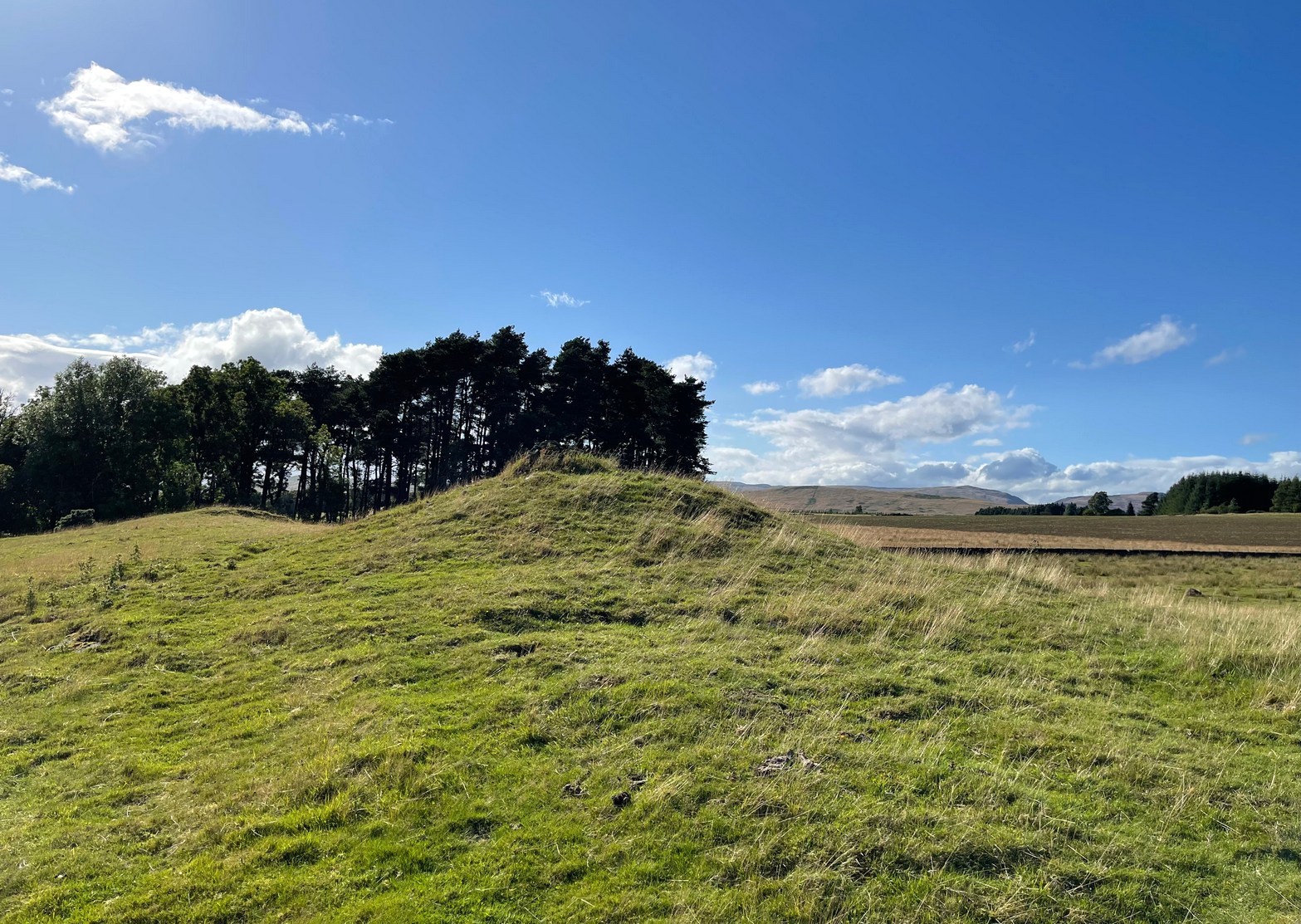
From Doune, take the A84 road to Callander. As you pass through the hamlet of Buchany, keep your eyes peeled a few hundred yards on as the road dips down and swerves gently right, for the road sign of Drumloist (or Moist as some locals keep amending!) which goes up to the right. It’s a small single track road that zigs and zags slowly uphill. After exact one mile you reach a small track on your right (there one left too). Carefully park hereby (don’t block the gate!). Across the road, go through the gate on your right and walk along the edge of the field until you reach the burn. Go across it, and then across the field, through the gate and you’ll see it ahead of you. In the tick season (summer) treat the brackens as possessed by a plague and avoid it!
Archaeology & History
Looking at its stony face
A curiously forgotten place, hidden from sight, this large rounded grass-covered mound with small upright stones around one side, seems timeless amidst the open fields. It seems alone, but the denuded chambered tomb of Ballachraggan is just visible 1.4 miles to the northwest on the near-horizon; and there’s a hidden cairnfield just a half-mile away. This cairn measures 18 yards (N-S) by 16 yards (E-W) and stands 7-8 feet high when you look at it from its southern side. The top of the mound is a mix of stone and grass with a slight dip in the middle, perhaps by someone in ages past digging, albeit only slightly—perhaps scared away by the old folk buried herein.
One of the most notable aspects of this site is the complete silence. On my last two visits hereby, a fusion of mists from the low cloud above and the breathing Earth below gave an atmosphere the likes of which lived when this tomb was first built. On one occasion hereby, no vehicles for several hours gave the silence a curious atmosphere (those of you who like sitting in the rain with the wilderness will know what I mean). To me this is a gorgeous site…
Cairn (destroyed): OS Grid Reference – NT 3071 7366
Archaeology & History
The only reference I can find of this long lost cairn is in William Baird’s (1898) massive history work of the area—but even in his day he reported that “it has long since disappeared.” He wrote:
“We have a curious reference in a charter of Kelso Abbey, granted about 1466, to a cairn of stones which stood near the south-east corner of the garden wall at Mount Lodge, Portobello. In the charter, where it is referred to as forming part of the boundary of the lands of Figgate, it is described as, ‘a certain heap of stones there deposited.'”
The cairn was likely of considerable size and, said Baird, “in all probability marked the site of an ancient place of sepulture.”
References:
Baird, William, Annals of Duddingston and Portobello, Andrew Elliot: Edinburgh 1898.