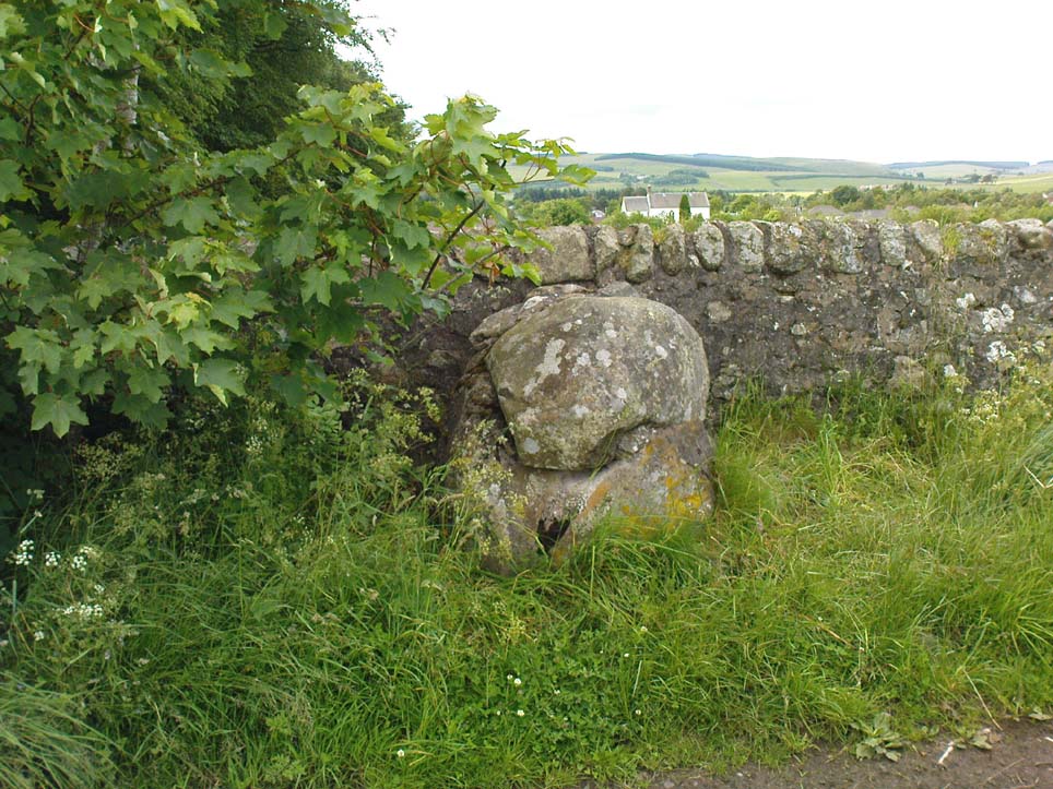
Clach nan Sul, Balquhidder, Perthshire

Cup-Marked Stone (destroyed):  OS Grid Reference – NN 5456 2084

Also Known as:

  1. Canmore ID 24150
  2. Stone of the Eyes

Archaeology & History
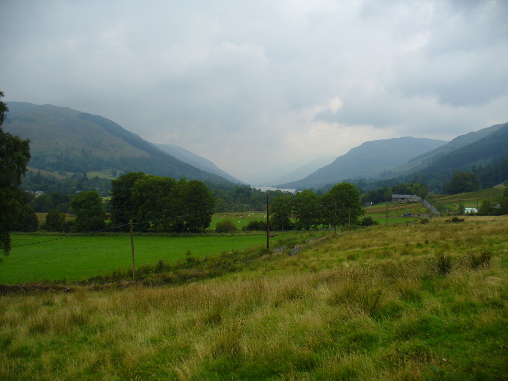
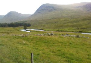
Looking down Balquhidder Glen from the Clach nan Sul's old home
Looking down Balquhidder Glen from Clach nan Sul’s old home

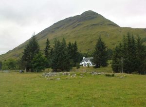
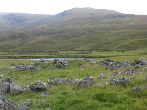
Apparently destroyed, although some remains of the stone were said to be seen in the walling by the roadside; but when visiting this spot a few days ago the summer vegetation had completely covered any potential finds here.  The stone fell foul of the usual self-righteous industrialists when the track alongside which it had sat for countless centuries was turned into a road and the stone was “blasted”.  It was found some 20 yards below the large cup-marked stone known as Wester Auchleskine, seen amidst the clump of rocks in the field above.

The stone was described in MacKinlay’s (1893) fine survey on Scottish holy wells due to the healing properties of the waters that collected into the rock basin here.  The earliest record of the site that I’ve found comes from the hallowed papers of the Scottish Society of Antiquaries, where—in J.M. Gow’s (1887) rambles just east of Balquidder—he told us the following:

“Going still further east to the first turning of the road beyond the farmhouse of Wester Auchleskine, and on the left-hand side, there used to be a large boulder with a natural cavity in its side, famous as a curing well for sore eyes.  This stone was called “Clach nan sul” (the Stone of the Eyes).  In 1878 the road trustees caused it to be blasted, as it was supposed to be a danger in the dark to passing vehicles.  Its fragments were broken up, and used as road metal.”

Whether or not the site known as the Priest’s Basin, or Basan an Sagairt—a couple of hundred yards west by the roadside—was of a similar nature, or an attempt by christians to draw people away from the old healing Clach nan Sul and use this other one instead, we do not know.  There are numerous accounts of other stones in this mountainous region of Scotland where rocks-with-hollows filled with water were attributed with healing properties, like the Whooping Cough Stone at Struan, the Measles Stone at Fearnan, and many others.

Folklore

The folklore described by Mr Gow was reiterated in MacKinlay’s (1893) survey. He also told how,

“The hollow in the Clach-nan-Sul at Balquhidder…contained small coins placed there by those who sought a cure for their sore eyes. Mr J. Macintosh Gow was told by some one in the district that ‘people, when going to church, having forgotten their small change, used in passing to put their hands in the well and find a coin.’  Mr Gow’s informant mentioned that he had done so himself.”

References:

  1. Gow, James M., “Notes in Balquhidder: Saint Angus, Curing Wells, Cup-Marked Stones, etc”, in Proceedings of the Society of Antiquaries Scotland, volume 21, 1887.
  2. MacKinlay, James M., Folklore of Scottish Lochs and Springs, William Hodge: Glasgow 1893.

© Paul Bennett, The Northern Antiquarian


St. Palladius’ Footprint, Camusvrachan, Glen Lyon, Perthshire

Legendary Stone:  OS Grid Reference – NN 62626 47685

Also Known as:

  1. Craig Dianaidh
  2. Rock of Safety

Getting Here

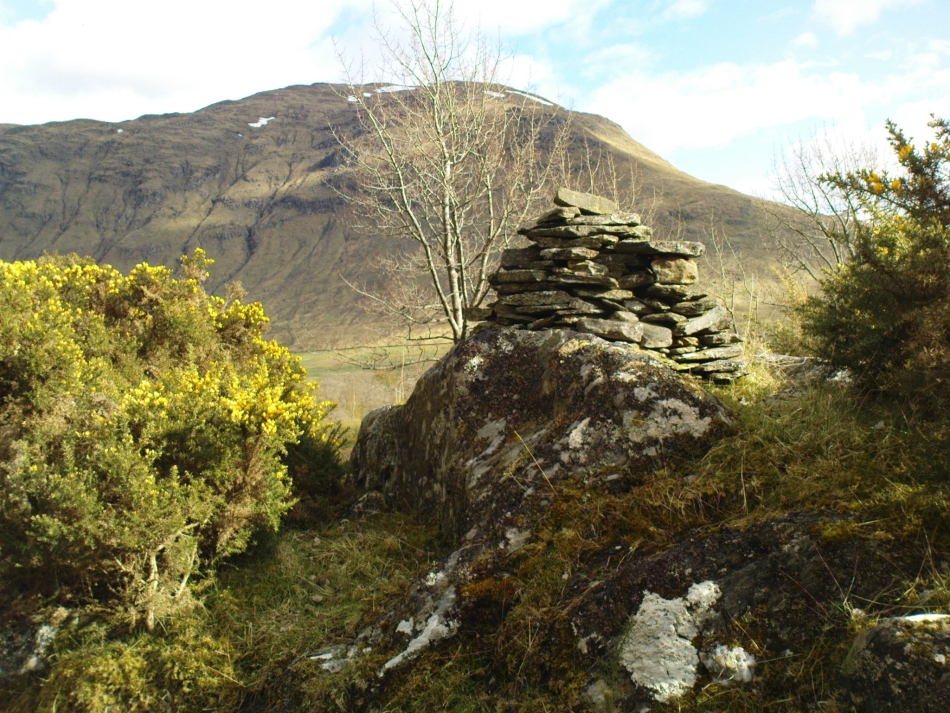
The rocky cairn of St. Palladius

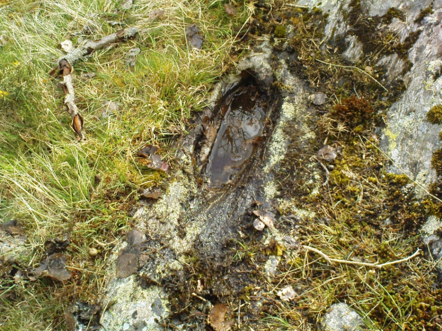
From Fortingall, get to the standing stone of Adamnan’s Cross a few miles down the stunning Glen Lyon.  Barely 100 yards before you reach the stone, notice the overgrown gorse-covered rocky rise across the road, just past Craigianie Farm.  As you climb to the top of this small rocky rise, you’ll see a cairn of stones on its top.  Just below it, into the solid rock, you’ll see a footprint-shaped hollow etched into the stone.  If it seems hidden, just keep looking – you’ll find it…

Archaeology & History

St. Palladius Stone, Glen Lyon

When Ratcliffe Barnatt (1944) visited Glen Lyon in the 1940s, this legendary rock was one of his stopping points.  “When we have passed by Ruskich and Slatich,” he wrote, “we come to that sacred spot, Craig Dianaidh, the Rock of Safety, where, until about 1480, solemn and judicial meetings were held.”  The old rock was known through recent ages, “as a preaching hill, a motehill and a justiciary court,” said Hilary Wheater (1981), and upon its top is the curious ‘footprint’ which Nature’s blood would fill on all but the hottest of summers.  It is this geological feature that gave the stone is name, long ago.

Of known historical events here, Wheater further told:

“It was on this rock…that the Baron Courts of Glenlyon were held.  Law and order was kept by regular courts held by the Chief or Landowner. The Baron-Bailiary of each area was appointed by Royal Charter.  Fifteen men were chosen as a jury and the laird or his baile presided.  To this court were brought all the problems and grievances of the people.  Here the miller accused several men of refusing to take part in the compulsory ‘hamganging’ of a new millstone; here a man was fined for brewing ale without a license; here a neighbour was accused of putting the ‘evil eye’ on the cow of the croft next door so it produced no milk; and here a man was prosecuted for ‘taking of ane sore horse of his to Rannoch in the summer of 1629 and putting on him ane great burder of timber, and letting him go through the wood where he stuck between two trees all night and the timber on his back.’  However, he was acquitted when he was able to prove that the horse was fit enough after this for another man to be able to take it to Edinburgh soon after.”

St Palladius Footprint

As well as being a moot site, it is more than probable that this footprint, like the one near the top of Dunadd in Argyll—and others scattering the Highlands and beyond—was an initiation stone, perhaps for local tribal elders or ancient kings.  Janet Bord (2004) writes about them as places of ritual inauguration in her survey of such places.

Folklore

The legendary site, looking south

This legendary rock would probably have had earlier mythic association than the one ascribing it to St. Palladius—but as yet I have found no written lore telling the nature of such a spirit, so would only perhaps discern the original genius loci by lengthy encounters with the rock in question, through mist and storm and wintry months, alone.  It is known in local folklore that Palladius was in fact an urisk: a solitary spirit of steep streams that few humans encounter due to their lonely habits amidst hidden abodes in dark and ancient gorges.  Such urisks dwelt in numbers amongst many of the steep falls in this landscape — and still do, if the words of old locals are to be believed. Here,

“St Palladius was a goblin saint, an urisk that dwelt in a mountain burn and was sanctified by the people.”

…and some rocks by the stream up the mountain immediately above this “footprint” was one of the places the urisk was known to dwell.

…to be continued…

References:

  1. Barnatt, T. Ratcliffe, The Road to Rannoch and the Summer Isles, John Grant: Edinburgh 1944.
  2. Bord, Janet, Footprints in Stone, Heart of Albion Press 2004.
  3. Fraser, Duncan, Highland Perthshire, Standard Press: Montrose 1969.
  4. Wheater, Hilary, Aberfeldy to Glenlyon, Appin Publications: Aberfeldy 1981.

© Paul Bennett, The Northern Antiquarian


Maiden’s Well, Glendevon, Perthshire

Healing Well: OS Grid Reference – NN 9703 0139

Also Known as:

1. Maiden Well

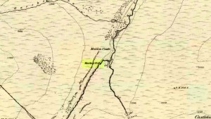
Maidens Well on 1866 map

Getting Here

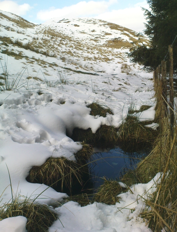
Follow the same directions as if you’re going to the Maiden Castle fairy hill.  About 100 yards before reaching the hill, on the right-hand side of the footpath between the tree-line and the small stream, you’ll see a small pool of water. This is Maiden’s Well.

Archaeology & History

Maiden's Well - and the fairy haunt of Maiden Castle hill behind
Maiden’s Well – and the fairy haunt of Maiden Castle hill behind

A mile northeast of the faerie-haunted Butter Well, just on the border of Clackmannanshire and Perthshire, we find this little-known magickal spring.  More than a century ago, the story of this remote well was heard about hundreds of miles away by one Rev. Andrew Clark of Oxford, “who heard it from the late sexton of the parish of Dollar, in the county of Clackmannan” and who then mentioned its existence to the great Victorian Celtic scholar John Rhys (1901), who subsequently wrote of it as being “a fine spring bordered with flat stones, in the middle of a neat, turfy spot”, close to the legendary faerie hall of Maiden Castle. The well itself has now given birth to a pool whose waters, so folklore and text ascribe, always provides good clear water even in the height of summer.

The local historian Hugh Haliburton (1905) told that the well obtained its name from a princess who was held captive in Castle Campbell in the valley to the southwest, and that she was sometimes allowed out of prison by her captors, to walk to the well and drink its waters.

Folklore

This tale has been mentioned by various historians and, no doubt, has some religious relevance to the faerie lore of Maiden Castle, close by, Bruce Baillie (1998) told:

“A story associated with it states that it is haunted by the spirit of a beautiful maiden which only appears at night and, should any male attempt to kiss her, coronary thrombosis occurs.”!

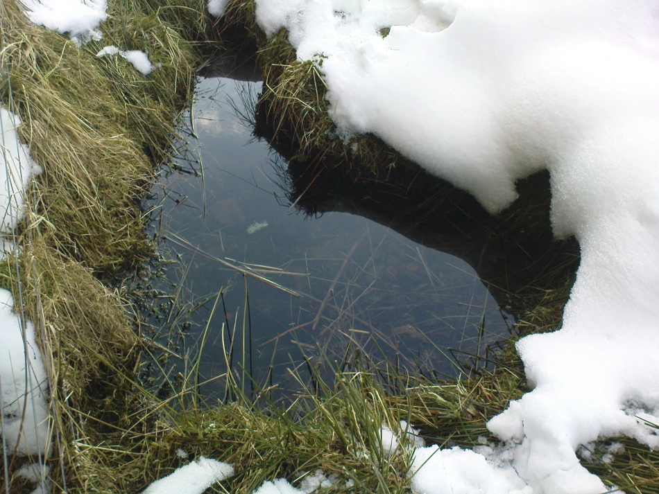
The Maiden's Well pool
The Maiden’s Well pool

Earlier accounts tell of magickal rites that could be used to invoke the beautiful maiden, but once again dire consequences may befall the poor practitioner.

To this day, local people visit the well and make offerings to the spirit of the waters, as you’ll see if you come here.  Some of the remains here are very old; and a visit not long ago indicated that offerings were made even when surrounded by depths of snow in the middle of a freezing winter.

References:

  1. Baillie, Bruce, History of Dollar, DMT: Dollar 1998.
  2. Fergusson, R. Menzies, The Ochil Fairy Tales, Clackmannan District Libaries 1985.
  3. Haliburton, Hugh, Excursions in Prose and Verse, G.A. Morton: Edinburgh 1905.
  4. Rhys, John, Celtic Folklore – Welsh and Manx: volume 1, Oxford University Press 1901.
  5. Watson, Angus, The Ochils: Placenames, History, Tradition, PKDC: Perth 1995.

© Paul BennettThe Northern Antiquarian


Fairy Stone, Fourstones, Northumberland

Legendary Stone:  OS Grid Reference – NY 893 680

Archaeology & History

Thought to have been destroyed in the 19th century, folklorists and historians alike didn’t seem to be able to locate this little-known folklore relic, which is still alive and well in one of the fields by the village.  The exact nature of the stone isn’t known for certain.  Legend reputes it to have been one of the four boundary stones which gave the village its name; it was also said that they were Roman altars and the Fairy Stone was one of them, which was moved from the village boundary during the Rebellion of 1715 and placed nearer the centre.

Folklorist M.C. Balfour (1904) seemed to think that stone had gone when he wrote about it.  Writing about it in the past tense, he told,

“The Fairy Stone however, certainly had an existence, for a person, 80 years of age, remembered its situation to the south of the village, near the old road, and that it was squared, and had a square “cistern hewn out of its top,” which was called the Fairy Trough, and traditionally said to have had a pillar fixed in it.”

But when former Ley Hunter editor Paul Screeton (1982) came looking for the stone in the late 1970s, he was fortunate in coming across an old local:

“Some time ago while looking for the Fairy Stone at Fourstones…I came across a farmer who pointed it out and remarked that a few years previously when the road was widened the local lengthsman made sure it was not destroyed, though it had to be moved a short distance.”

Folklore

Of the four boundary stones surrounding the village, they were “supposed to have been formed to hold holy water,” said Balfour (1904).  But the title Fairy Stone given to one of them had this tale to account for it:

“A couple of miles or more down the South Tyne is Fourstones, so called because of four stones, said to have been Roman altars, having been used to mark its boundaries. A romantic use was made of one of these stones in the early days of “The Fifteen.” Every evening, as dusk fell, a little figure, clad in green, stole up to the ancient altar, which had been slightly hollowed out, and, taking out a packet, laid another in its place. The mysterious packets, placed there so secretly, were letters from the Jacobites of the neighbourhood to each other; and the little figure in green was a boy who acted as messenger for them. No wonder that the people of the district gave this altar the name of the ‘Fairy Stone’.”

References:

  1. Balfour, M.C., Country Folk-lore volume 4: Examples of Printed Folk-lore Concerning Northumberland, David Nutt: London 1904.
  2. Screeton, Paul, “The Long Man of Wilmington,” in The Ley Hunter, no.92, 1982.
  3. Terry, Jean F., Northumberland Yesterday and Today, Andrew Reid: Newcastle 1913.
  4. Watson, Godfrey, Northumberland Place Names, Sandhill: Morpeth 1995.

Acknowledgements:  Big thanks to Paul Screeton for the grid-reference!

© Paul BennettThe Northern Antiquarian


Caisteal Nan Coin Dubh, Craobh Haven, Argyll

Dun:  OS Grid Reference – NM 8000 0763

Also Known as:

  1. Canmore ID 22744

Archaeology & History

Caisteal Nan Coin Dubh (after RCAHMS 1988)

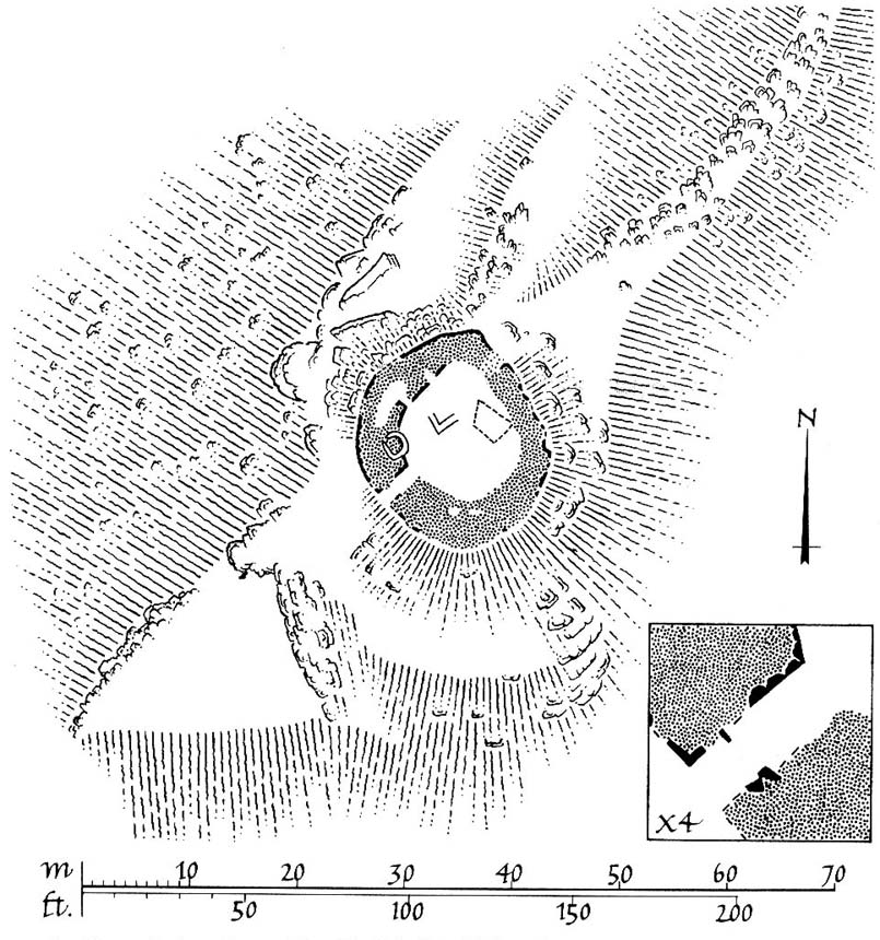
Up above the roadside leading down the gorgeous Craobh Haven road, we not only find remains of a previously unrecorded standing stone, but we see this little-known overgrown fort that has been described as a “galleried dun” by the Royal Commission (1988) lads.  Known in folk tradition as the “castle of the black dogs” and an important place in the great legends of the Finns, in archaeological terms the Royal Commission described the site as:

“Oval in plan, the dun measures about 13m by 10m within a wall which varies from 3m to 4m in thickness.  Considerable stretches of the outer face survive and on the N it rises to a height of 1.7m in ten rough courses; the inner face is less well preserved, but a long stretch is visible on the NW.  There are traces of a gallery within the thickness of the wall on the NW; it was entered through a narrow passage, the S-side wall of which it stands to a height of 0.4m in three courses.  A second break in the line of the inner face, 2.5m to the NE, is either another entrance to the gallery or the entrance to a second chamber.  Depressions in the thickness of the wall on the S may indicate the presence of yet another intramural feature.  The entrance to the dun lies on the WSW; it measures about 1m in width at the outer end, 1.8m at the inner end, and is checked for a door 1m from the exterior.  On the NE there is a short stretch of facing at right-angles to the line of the wall, and this may be a straight-joint similar to that at Castle Dounie…or one side of a postern gate. In the interior there are the remains of at least two animal-pens and a modern rectilinear cairn. There is no trace of the midden-deposit noted by Campbell & Sandemann to the W of the dun, and the cairns and stretches of field-walling on the N flank of the ridge are of relatively recent date.”

Folklore

Close to a little-known cailleach site, this ruined fortress was one of the many places which the illustrious historian and folklorist Archibald Campbell told about in his awesome series of Waifs and Strays of Celtic Tradition (1889).  The tale of the fort was known to local people as “The Fight between Bran and Foir and is as follows:

“The black dog, Foir, was the brother of Bran, the far-famed hound of Fionn. Foir was taken early from his dam, and was afterwards nurtured by a band of fair women, who acted as his nurses. He grew up into a handsome hound, which had no equal, in the chase or in fight, in the distant North. His owner, Eubhan Oisein, the black-haired, red-cheeked, fair-skinned young Prince of Innis Torc (Orkney ?) was proud, as well he might be, of his unrivalled hound. Having no further victories to win in the North, his master determined to try him against the strongest dogs in the packs of the Feinne.

“He left home, descended by Lochawe, and entered Craignish through Glen Doan. Before his arrival, the Fienne, after spending the day in the chase, encamped for the night in the upper end of Craignish. Next day Fionn arose before sunrise, and saw a young man, wrapped in a red mantle and leading a black dog, approaching towards him at a rapid pace. The stranger soon drew near, and at once declared his object in coming. He wanted a dog-fight, and so impatient was he to have it, and so restless by reason of his impatience, that he suffered not his shadow to dwell a moment on one spot.

“Fifty of the best hounds of the Feinne were slipped at last, but the black dog killed them all one by one. A second and then a third fifty were uncoupled, but the strange dog disposed of them as easily as he did of the first.

“Fionn now saw that all the dogs of the Feinne were in serious danger of being annihilated, and therefore he turned round and cast an angry look on his own great dog Bran. In a moment Bran’s hair stood on end, his eyes darted fire, and he leaped the full length of his golden chain in his eagerness for the fight. But something else besides the casting of an angry look was still to be done to rouse the fierce hound’s temper to its highest pitch.

“He was placed nose to nose with his rival, and then his golden chain was unclasped. The two hounds, brothers by blood, but now champions on opposite sides, at once closed in deadly fight; but for an adequate description of the struggle between them the reader must consult the bards. See the “Lay of the Black Dog”, in Islay’s Leabhar na Feinne, the McCallum’s Ancient Poetry, etc.

“The contest lasted from morning to evening, and victory remained, almost to the close, uncertain; but in the end Bran vanquished Foir, and, by killing the latter, amply revenged the death of the three fifties. The Feinne buried their own dogs, and the stranger, with a sore heart, laid his black hound in the narrow clay bed.

“This great dog-fight, so celebrated in Gaelic lore, is said to have been fought at Lergychony, in Craignish. It is further said that the place was called Learg-a-choinnimh, or the “Plateau of Meeting”, because it was there the two hounds met in fight. There are, of course, many other places in the Highlands which claim the honour of being the scene of this legendary contest.”

References:

  1. Campbell, Archibald, Waifs and Strays of Celtic Tradition – volume 1, David Nutt: London 1889.
  2. Royal Commission on the Ancient & Historical Monuments of Scotland, Argyll – Volume 6: Mid-Argyll and Cowal, HMSO: Edinburgh 1988.

© Paul Bennett, The Northern Antiquarian
Whooping Cough Stone, Struan, Perthshire

Legendary Rock: OS Grid Reference – NN 816 653

Getting Here

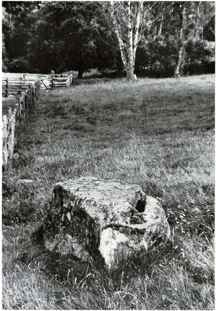
Old photo of the stone (after Duncan Fraser)

Up the A9 past Blair Atholl, a few miles later there’s the turning for Struan.  Scarcely a mile east of old Struan Church, head past the old farmhouse of Old Kindrochat and keep going eastwards along the edge of the trees for about 200 yards until you reach the sheepfold. There you’ll see a singular rock sitting alone by the fence. That’s it!

Archaeology & History

This little known healing stone was, at one time last century, of great repute in the Highlands. Today, very few people even know it exists. One of many rocks that were said to possess healing abilities, this one (obviously) was of great repute in the curing of whooping cough. But it wasn’t the rock alone that did the work here, for upon its edge was a small basin into which rainwater collected and this, when used correctly and in due accord with ancient ritual tradition, could enact the cure.  Mr Duncan Fraser said of this fascinating healing stone:

“The grey water-worn stone is about 4ft 6in long, 2ft 6in broad and 2ft high, with a deep gash on top, where the water lingers even in long dry spells. When full it holds about half-a-gallon. People were still coming here with their sick children as late as 1860 — and bringing a spoon made from the horn of a living cow. There was no cure without that.”

The ritual “spoon made from the horn of a living cow” was an important ingredient at another site with the reputation for curing whooping cough about 50 miles south of here, near Balquhidder. (see Whooping Cough Well, Killin)  What truly fascinates me is the origin of this stone and its medicinal virtues.  When  did the healing rites first start here – how long ago…?

References:

  1. Fraser, Duncan, Highland Perthshire, Standard Press: Montrose 1969.

© Paul Bennett, The Northern Antiquarian

Castle Hill, Culross, Fife

Hillfort: OS Grid Reference – NS 97105 89923

Getting Here

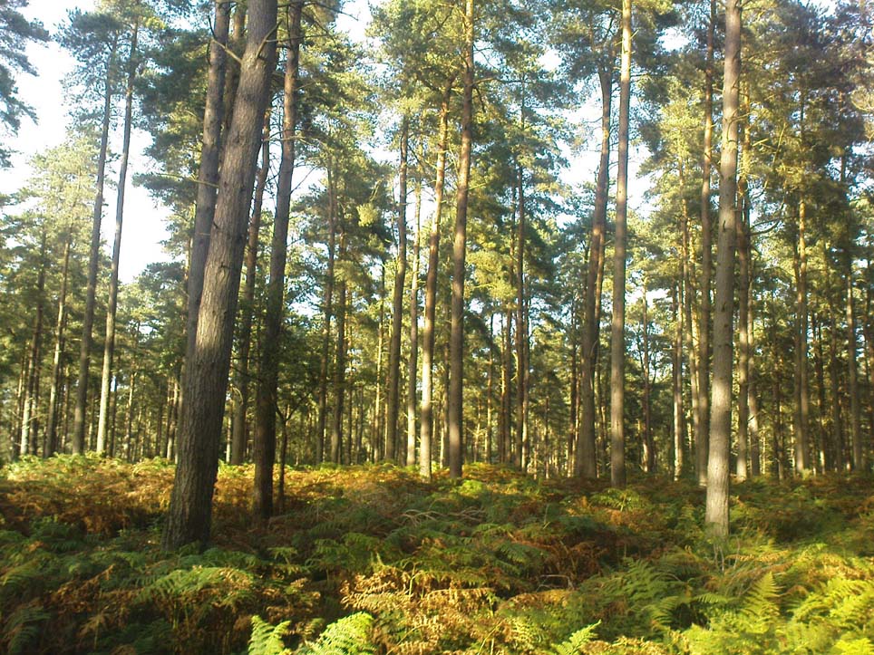
A gorgeous setting, in the trees

Take the A907 road between Clackmannan and Comrie and, close to Bogside Farm at the roadside, but on the other side of the road where the bridge crosses a burn, take the dirt-track uphill and into the woodland. About 300 yards up (before you hit the signs pointing you to the farm) , walk uphill into the trees on your left until the ground levels out. Look around! (and best visited between December and May, before the bracken covers the place)

Archaeology & History

Visiting this site is pleasure in itself. Situated in an open forest, with traditional pine trees in abundance, there are scattered amidst the edges of this large oval-shaped Iron Age structure, the aged boughs of ash and beech, centuries old, along its edges and throughout the woods. It is a truly superb setting! When visited by the Royal Commission lads in April, 1925, they found the remains here in good condition. A few years later in their impressive Inventory, they told:

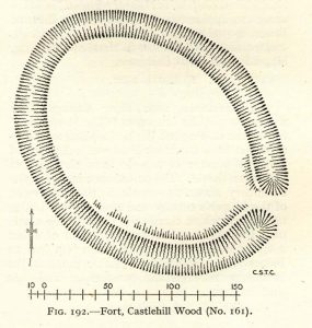
“In Castlehill Wood, about 250 yards to the southwest of Bogside Railway Station, and at an elevation of 200 feet above sea-level, is a small plateau of very regular oval form with its major axis northwest and southeast. It is surrounded by a single ditch, the well-marked enclosure thus produced having a maximum measurement of 185 by 135 feet. At the southeast the ditch has been left uncut in order to provide a passage for entrance. This passage has been about 20 feet wide, and at its inner end there are on either side faint traces of a low mound, which in all probability once ran right round the edge of the enclosure and which may have been palisaded.”

RCHAMS 1933 plan of site

Sadly when I came here a few days ago, much of the was very overgrown with bracken and other vegetation, making it impossible to see the site properly and preventing any decent photos. We’ll go back here in a few months time to get better images!

Folklore

This site was mentioned, albeit briefly, in David Beveridge’s (1885) magnum opus on the history of Culross.  With equal brevity he noted several standing stones in the region, saying how tradition afforded them a Danish origin.  This site was the same for

“a tradition prevails that after the battle of Inverkeithing the Danish army or a portion of it retreated to a station in the north of Culross parish, where they erected the earthwork or camp of Castlehill, still existing near the Burrowine Farm.”

References:

  1. Beveridge, David, Culross and Tulliallan: Its History and Antiquities – volume 1, William Blackwood: Edinburgh 1885.
  2. Royal Commission on the Ancient & Historical Monuments, Scotland, Inventory of Monuments and Constructions in the Counties of Fife, Kinross and Clackmannan, HMSO: Edinburgh 1933.

© Paul Bennett, The Northern Antiquarian

Caisteal Mhic Neill, Cashlie, Glen Lyon, Perthshire

Dun:  OS Grid Reference – NN 49036 41779

Also Known as:

  1. Caistealan nam Fiann

Getting Here

Site shown on 1867 OS-map

Truly remote, but easy to find once you’re nearing the western end of Glen Lyon. Going upstream, past Cashlie Dam, watch out for the well-preserved stone kiln on the left-hand side of the road, just before Cashlie house.  50 yards or further along, cross the road and in the field by the riverside, the circular mass of stones sorta gives the game away.

Archaeology & History

Shown on modern OS-maps as a ‘homestead’ and described variously by archaeologists and historians as a fort or a round-house, this is just one example of around twenty large prehistoric constructions that scatter the stunning mountainous Glen Lyon region which legend tells were the forts of the great hero-figure, Finn.  Three other constructions of the same nature are found just a few hundred yards further up the Glen from here.  Each is of roughly the same age and nature by the look of things.  Their walls are extremely wide and made up of very large rocks, which would have taken huge efforts to construct.

Caisteal Mhic Neill ruins, looking east
Caisteal Mhic Neill, with An Grianan behind

Highlighted on the 1867 OS-map as a “Tower”, the exact nature of this and its adjacent sites has yet to be academically ascertained, with the Canmore website ascribing the monument as a “settlement” – although, tradition tells them to be Scottish forts or duns, so we’ll stick with that until excavations tell otherwise!

The great Gaelic place-name master W.J. Watson (1912) told that:

“The fourth of the Cashlie towers is a few yards south of the road, right in front of Cashlie farmhouse, now a shooting lodge.  Though a quantity of large stones marks the site, the structure has been so badly knocked about that we found it impossible to take measurements sufficient for a plan. It was, however, apparently not circular, but rather oval. Its walls appeared to vary from about 9 feet to 12 feet 6 inches in thickness.”

Close-up of Caisteal walling

This is one of several other duns (or homesteads as the OS-map calls them) close to each other.

Folklore

Ascribed as one of Glen Lyon’s Caisteilean nam Fiann, or “castles of the Fiann”, Mr Watson (1912) again told how “there is a widely known saying, the earliest notice of which occurs in Pennant, who got it doubtless from the Rev. J. Stewart:

‘…Twelve castles had Fionn,
In the dark Bent-glen of the stones.'”

References:

  1. Gillies, William A., In Famed Breadalbane, Munro Press: Perth 1938.
  2. Watson, W.J., “The Circular Forts of North Perthshire,” in Proceedings of the Society of Antiquaries, Scotland, volume 47, 1912.

ACKNOWLEDGEMENTS:  Many thanks to Andy Sweet of Stravaiging Around Scotland, for pointing me to the W.J. Watson article.  And of course, a huge thanks to Marion—”I don’t have a clue where I am!”—Woolley, for getting us here….

© Paul Bennett, The Northern Antiquarian

Bull Stone, Crook of Devon, Kinross-shire

Legendary Rock:  OS Grid Reference – NT 03326 99712

Getting Here

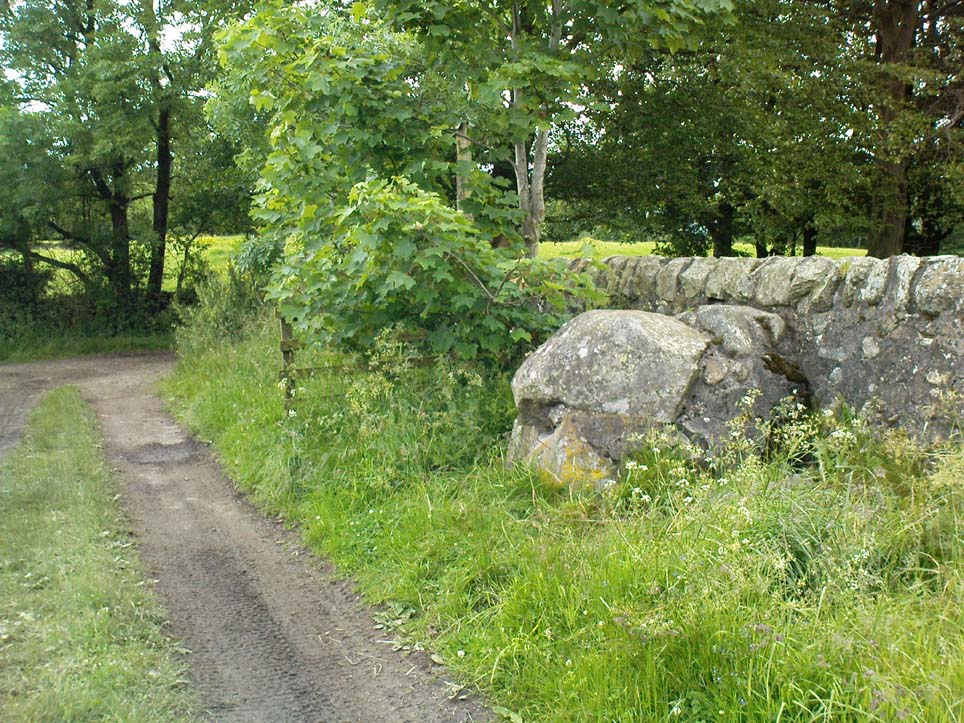
The Bull Stone rock, looking west

In the lovely village that is the Crook of Devon, go down Church Lane, past the houses, until you meet with the dirt-track on your left that runs straight up beneath a grove of trees heading into the green fields.  Go up here 100 yards until you meet another track that goes sharp left.  Just here, 10 yards along, a solitary tree sits by the wall; and just past it is a large boulder up against the walling.  This is the Bull Stone!

Archaeology & History

Bull Stone, Crook of Devon

If you didn’t know owt about this place, you wouldn’t even give it a second-thought.  A decent-sized rock, obviously broken-up and then plastered back together again, is innocuously resting up against the wall.  But it appears to have had some significance in bygone centuries, although its full story has yet to be recovered.  It was described in the Royal Commission (1933) report for antiquities, where they told:

“Built against the dike on the north side of an old roadway, half a mile to the south of Crook of Devon, is a huge sandstone boulder known as ‘The Bull Stone.’  It is probably an old boundary mark or, like the Leslie Stone…it may have some association with the old-time pastime of bull-baiting.  The stone was broken up a number of years ago, and the fragments were carted away to be built up in another dike hard by, but, in response to public agitation, they were returned to the original site and cemented together.  The boulder rises 3½ feet above ground and has a girth of about 13 feet at the base.  It is not set up vertically, but lies on its side.”

It may originally have been a standing stone as local lore tells that it once stood as high as a grown man, but is now only half that size.  It may have been one of the meeting places of the legendary witches at the Crook of Devon, but this is guesswork on my behalf (so best ignored!).

References:

  1. Royal Commission on the Ancient & Historical Monuments of Scotland, Fife, Kinross and Clackmannan, HMSO: Edinburgh 1933.

© Paul Bennett, The Northern Antiquarian

Acrehowe Cross, Baildon Moor, West Yorkshire

Cross (destroyed):  OS Grid Reference – SE 14390 40601

Also Known as:

  1. Rerehowe Cross

Archaeology & History

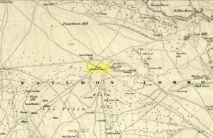
‘Rerehowe’ cross on 1852 map

Once found on the other side of the road from the prehistoric circle of Acrehowe Hill, this old cross was destroyed sometime in the first half of the 19th century by one of the stewards to the Lady of the Manor of Baildon, a Mr Walker.  It’s unlikely that Mr Walker would have performed this act without direct orders from the Lady of the Manor, so the destruction should really be laid at the feet of the land-owner, who’ve got a habit of destroying archaeological sites up and down the land, even today.

Found near the crown of a small hill on the horizon whether you’re coming from Eldwick- or Baildon-side, the cross was erected (probably between the 12th and 14th centuries) amidst a cluster of heathen burials and cup-and-rings, many of which would have been known by local peasants as having old lore or superstitions about them.  So the church commandeered this spot, desacralized it and no doubt enacted profane rites around it under the auspice of some spurious christian law.  They did that sorta thing with every non-christian site they ever came across—or simply vandalised it, much as many of them still do today.  Sadly we know not the exact history of the old cross: whether it was an old standing stone on the crown of this hill which they defaced and made into a cross, or whether they erected their own monument, we’ll never know.  But the idea of a once-proud monolith standing here is a strong possibility, considering its position in the landscape and the stone rings of Pennythorn and Acrehowe close by (cup-and-ring stones such as carving no.184 are also close by).

The cross itself once gained an additional incorrect title by the cartographers of the period, who named it Rerehowe Cross—but this was simply a spelling mistake and its newly-found title didn’t last long. The local industrial historian William Cudworth (1876) described the lost cross in his large work, where he told that,

“many of the inhabitants can remember and point out the exact spot where it stood, and no doubt could find some of the stones of which it was composed. It was destroyed by one of the overseers and a large portion of it used for fence stones.”

Harry Speight (a.k.a. ‘Johnnie Gray’) and others also mentioned the passing of this old stone, but give no additional information.

Folklore

In William Cudworth’s description of this site he told how “the village tradition is that it was put up in commemoration of a great battle that was fought on the Moor” at Baildon; but W.P. Baildon (1913) thought this was unlikely.  Instead, he cited an 1848 Name Book reference dug out by W.E. Preston, which told that on the summit of Acrehowe Hill,

“Here stood a cross which, according to traditional evidence was erected at the period that markets were held at Baildon, in consequence of a plague which prevented the country people from visiting the village with provisions, etc.  The site of its base is very apparent, being circular, about 8 feet in diameter.  A large flag stone  with the stump of the cross remaining in its centre, was pulled up and destroyed by Mr Walker (Baildon Hall) a few years since.”

References:

  1. Baildon, W. Paley, Baildon and the Baildons (parts 1-15), St. Catherines: Adelphi 1913-26.
  2. Bennett, Paul, The Old Stones of Elmet, Capall Bann: Milverton 2001.
  3. Colls, J.M.N., ‘Letter upon some Early Remains Discovered in Yorkshire,’ in Archaeologia, volume 31, 1846.
  4. Cudworth, William, Round about Bradford, Thomas Brear: Bradford 1876.
  5. Gray, Johnnie, Through Airedale from Goole to Malham, Walker & Laycock: Leeds 1891.

© Paul Bennett, The Northern Antiquarian