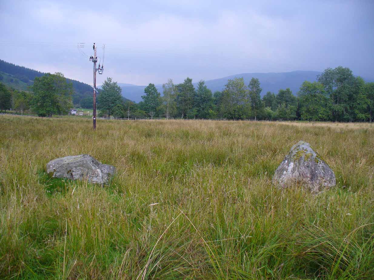
Old Wife’s Stone, Batley, West Yorkshire

Standing Stone? (destroyed):  OS Grid Reference – SE 2428 2329

Archaeology & History
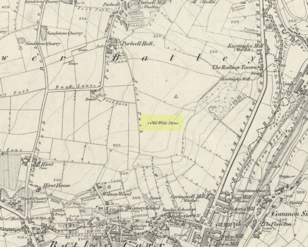
Old Wifes Stone on 1854 map

My first hint at the existence of this once valuable archaeological relic came as a result of me seeking out the history and folklore of some hitherto unknown, forgotten holy wells in the Batley and Dewsbury area.  I located the material I was looking for on the old wells, but my fortuitous discovery of this site, the Old Wife’s Stone, blew me away!

It was the place-name of ‘Carlinghow’ about one mile northwest of the grid-reference above that initially caught my attention.  From an antiquarian or occultist’s viewpoint, it’s intriguing on two counts: the first is the element ‘how‘ in Carlinghow, which can mean a variety of things, but across the Pennines tends to relate to either an ancient tribal or council meeting place, or a prehistoric burial cairn: an element that wasn’t lost in the giant archaeology survey of West Yorkshire by Faull & Moorhouse (1981).  But the first part of this place-name, ‘carling‘, was the exciting element to me; for it means ‘old woman,’ ‘old hag,’ ‘witch’ or cailleach!  The cailleach (to those who don’t know) was the prima mater: the Great Mother deity of our pre-christian British ancestors.  Meaning that Carlinghow hill was a hugely important sacred site no less—right in the heart of industrial West Yorkshire!  What is even more intriguing—or perhaps surprising—is that we have no record of such a powerful mythic creature anywhere in local folklore… Or so it first seemed…

Memory told me that no such prehistoric remains were recorded anywhere in that area—and certainly no prehistoric tombs.  I scoured through my library just to triple-check, and found the archaeological records as silent as I first thought.  Just to make sure I spent a day at the Central Library, where again I found nothing… So then I explored the region on the modern OS-maps, only to find that much of the area where the Carlinghow place-name existed was, surprisingly, still untouched by housing and similar modern pollutants. This was a great surprise to say the least.  And so to check for any potential archaeological sites which might once have been in the Carlinghow area, I turned to the large-scale 1850 OS-maps (6-inch to the mile).

This is when I came across the Old Wife’s Stone, marked in the middle of fields on the outskirts of old Batley.  There was no notice of it being a standing stone, or a simple boulder, or archaeological relic—nothing.  But its place-name compatriot of ‘Carlinghow’ was the rising hill about a mile to the northwest.  In days of olde, if Carlinghow was indeed the ‘burial tomb of the Old Woman’ or ‘meeting place of the cailleach’ (or whatever variants on the theme it may have been), it may have marked the setting sun on the longest day of the year if you had been standing at the Old Wife’s Stone – a midsummer sunset marker no less. (There are other ancient and legendary sites scattering northern England and beyond that are dedicated to the Cailleach, like the Old Woman Stone in Derbyshire, the Old Wife’s Neck in North Yorkshire, the Carlin Stone in Stirlingshire, the Old Woman Stone at Todmorden, Carlin Stone of Loch Elrig and many more.)

As if these curious ingredients weren’t enough to imply something existed in the heathen pantheon of Batley before the Industrialists swept away our indigenous history, we find echoes of the ‘Old Woman’ yet again, immediately east; this time where the animism of water and trees enfolded Her mythos in local rites and traditions, thankfully captured by the pens of several writers, and transmuted into another guise—but undeniably Her!  But that, as they say, is for another day and another site profile…
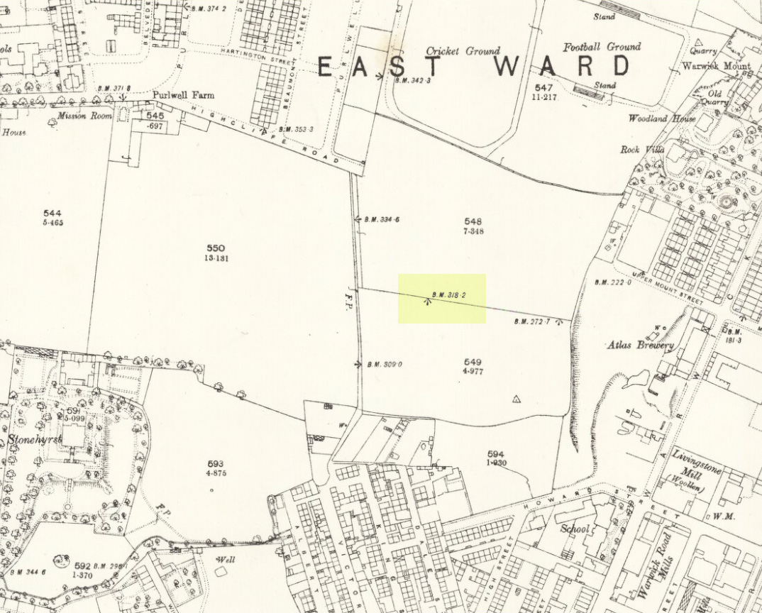
Position of stone in 1894

So is our Old Wife’s Stone (or for that matter, Carlinghow’s old tomb) still in evidence?  A school has been built where it was highlighted on the 1854 OS-map and, from the accounts of local people, seems to have long since disappeared.  The stone looks to have been incorporated into a length of walling, sometime between 1854 and 1888, and a bench-mark of “BM 318.2” carved onto it.  But when the Ordnance Survey lads re-surveyed the area in 1905, this had gone.  I have been unable to find any more information about this site and hope that, one day, a fellow antiquarian or occult historian might be able to unravel more of its forgotten mythic history.

References:

  1. Faull, M.L. & Moorhouse, S.A. (eds), West Yorkshire: An Archaeological Survey to 1500 AD – volume 1, WYMCC: Wakefield 1981.
  2. Goodall, Armitage, Place-Names of South-west Yorkshire, Cambridge University Press 1914.
  3. Keighley, J.J., ‘The Prehistoric Period’, in Faull & Moorhouse, 1981.
  4. o’ Crualaoich, Gearoid,  The Book of the Cailleach, Cork University Press 2004.
  5. Smith, A.H., English Place-Name Elements – volume 2, Cambridge University Press 1956.
  6. Smith, A.H., The Place-Names of the West Riding of Yorkshire – volume 2, Cambridge University Press 1961.
  7. Wright, Joseph, English Dialect Dictionary – volume 1, Henry Frowde: London 1898.

Acknowledgements:  Many thanks for the assistance of Simon Roadnight and Julia King in the Batley History Group.

© Paul Bennett, The Northern Antiquarian

Penny Well, Granton, Edinburgh, Midlothian

Healing Well:  OS Grid Reference – NT 2187 7654

Penny Well on 1853 map

Archaeology & History

On the 1853 Ordnance Survey map of Granton we are show the house and place-name of Pennywell with a ‘pump’ adjacent to it.  Sadly we don’t have as rich a history of the place as its namesake at Newington.  Its earliest written appearance seems to be in 1812.  A few years later, in the  Ordnance Name Book of the area, it was recorded that,

“Two cottages on the property of Sir John McNeil the name appears to be derived from a well which was formerly situated at the North east end of the houses where one Penny was paid for a draught of water.”

Remembered as a watering place for horses, the old Scots word ‘penny’ may be behind this old name, in terms of it giving the animals and locals their water supply.  Stuart Harris (1996) thought that this Penny Well may have been the long lost St. Columba’s Well in the parish of Cramond.

References:

  1. Bennett, Paul, Ancient and Holy Wells of Edinburgh, TNA 2017.
  2. Harris, Stuart, The Place-Names of Edinburgh: Their Origins and History, Gordon Wright: Edinburgh 1996.

© Paul BennettThe Northern Antiquarian


Lady Fife’s Well, Leith, Midlothian

Holy Well? (destroyed):  OS Grid Reference – NT 27534 75794

Archaeology & History

Despite this site having a number of albeit brief literary references, from the early 19th century onwards, the history and traditions of this Well are very scant indeed.  It figures in various texts that detail the historical ‘Battle of Leith’, but there is little additional information in such tomes.  Even local history works pass it by with brevity.

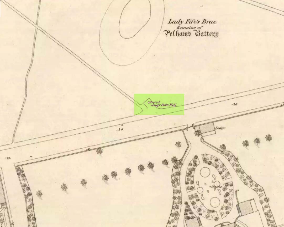
Lady Fifes Well on 1852 map
Lady Fifes Well on 1853 map

Its present name derives from the Countess of Fife who, in the 19th century, lived in the nearby mansion of Hermitage House (and who also grafted her name onto the nearby mound of Lady Fife’s Brae); but this title seems to have been grafted onto the earlier ‘Ladie Well’, implying it had a dedication to St. Mary or more probably an earlier heathen female spirit at the waters. Although it is shown on the OS-maps of 1852 and ’53, and described in Grant’s 1883 work as being there in his time, all subsequent maps after this date seem to indicate that it had gone.

All that we know is that the waters ran into a small stone trough and that Lady Fife enjoyed her evenings here, partaking of the waters.

References:

  1. Bennett, Paul, Ancient and Holy Wells of Edinburgh, TNA 2017.
  2. Campbell, Alexander, The History of Leith from the Earliest Times, William Reid: Leith 1827.
  3. Grant, James, Cassell’s Old and New Edinburgh – volume 3, Cassell, Petter Galpin: London 1883.
  4. Harris, Stuart, “The Fortifications and Siege of Leith,” in Proceedings Society of Antiquaries, Scotland, volume 121, 1991.
  5. Harris, Stuart, The Place-Names of Edinburgh: Their Origins and History, Gordon Wright: Edinburgh 1996.
  6. Hutchison, William, Tales, Traditions and Antiquities of Leith, Leith 1865.
  7. Maxwell, C.A., The Wars of England and Scotland, W.P. Nimmo: Edinburgh 1870.
  8. Russell, John, The Story of Leith, Nelson 1922.

© Paul Bennett, The Northern Antiquarian 

Ing Well, Allerton, Bradford, West Yorkshire

Healing Well (destroyed): OS Grid Reference – SE 1174 3443

Archaeology & History

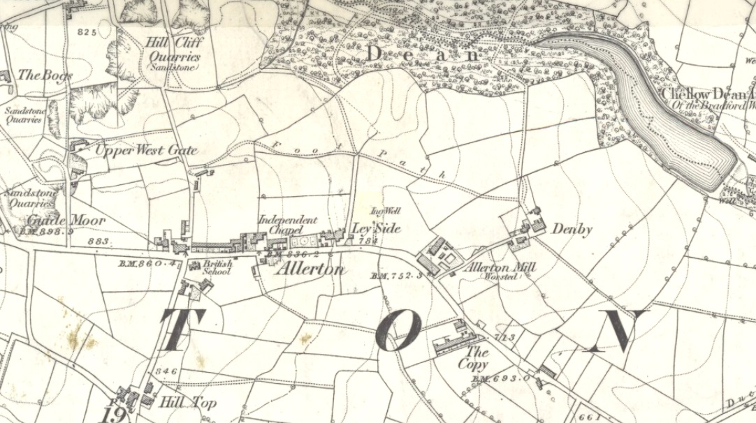
Ing Well on 1852 map

This ‘Well of the Meadow”, or Ing Well, is one of countless springs in and around the Bradford metropolis that have been destroyed by that thing they call ‘development’.  It was one of the main water sources for the villagers of Allerton village in the 19th century and earlier.  Highlighted on the 1852 OS-map of the region, a singular footpath once led to the waters and no further.  There appear to be no antiquarian or historical references detailing its traditions or medicinal qualities—unless of course, you know different.

The name Ing Wells is one of the most common of all titles given to water supplies in England, meaning having the same meaning and general history just about everywhere it occurs.  The place-name itself was given extensive attention in two separate studies by Eilert Ekwall (1962) and Sigurd Karlstrom (1927).

References:

  1. Ekwall, Eilert, English Place-Names in -Ing, Lund: Uppsala 1962.
  2. Karlstrom, Sigurd, Old English Compound Place-Names in -Ing, Lund: Uppsala 1927.

© Paul Bennett, The Northern Antiquarian


Ringstone, Torrisdale Bay, Farr, Sutherland

Legendary Rock:  OS Grid Reference – NC 69128 61741

Getting Here

The Ringstone, Torrisdale Bay

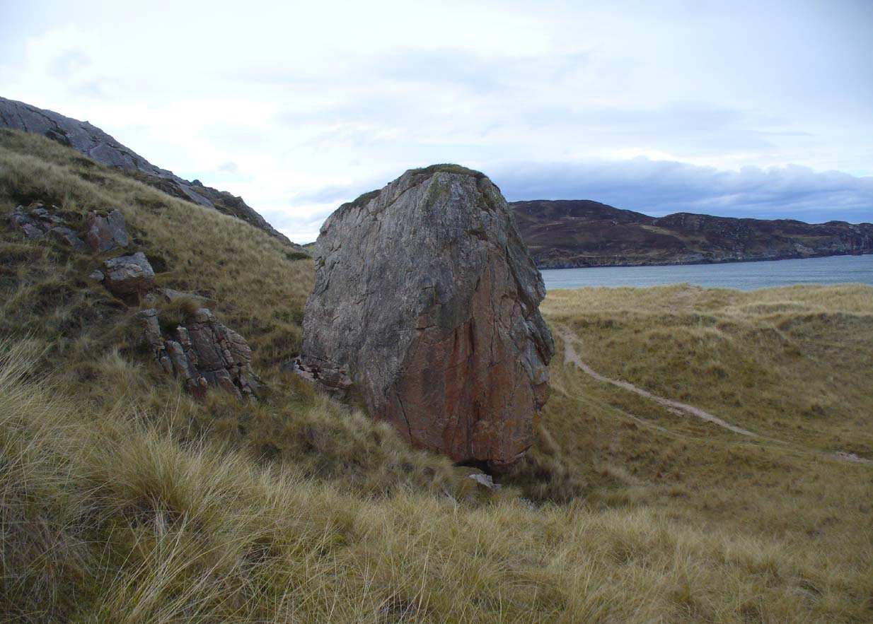
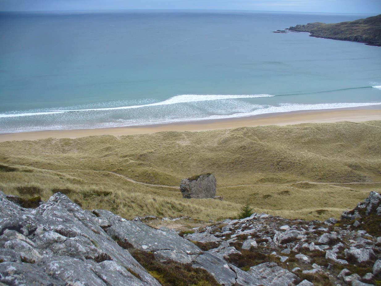
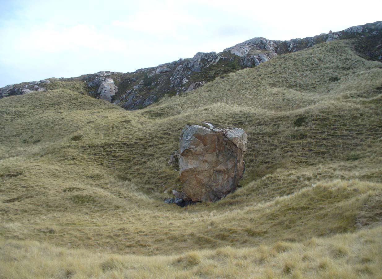
Along the A836 road between Tongue and Bettyhill, turn down towards Skerray at Borgie Bridge for 1.8 miles (2.87km) until you reach the little information sign at the roadside. Walk downhill and cross the little bridge and wander onto the west side of the beach.  You’re likely to end up daydreaming… so once you’ve re-focussed, head into the middle of the beach and walk up the steep-ish sand-banks to your right (south).  Once at the top, you’ll see a gigantic rock—the Ringstone—bigger than a house.

Folklore

This gigantic boulder is part of one of Sutherland’s archaic Creation Myths as they’re known: ancient stories recounted by archaic societies about the nature and origins of the world.  Such tales tend to be peopled by giants, gods, huge supernatural creatures, borne of chaos, eggs, darkness and primal oceans.  Thankfully we still find some examples of these tales in the northern and northwestern mountainous regions of Britain, as the Church and Industrialism never quite destroyed the hardcore communities—despite what they might like to tell you…

The face of the Ringstone
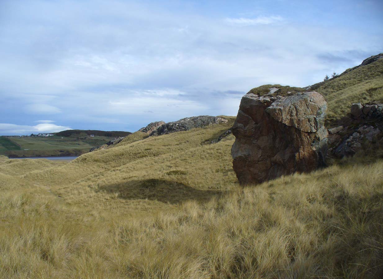
The Ringstone, gazing east

The following folktale of the Ringstone was thankfully preserved by the local school headmaster, Alan Temperley (1977), before it vanished orever from the oral traditions of local people (as is sadly happening in these mountains).  It typifies stories told of such geological giants from aboriginal Australia, to Skye, to everywhere that people have lived.  Mr Temperley wrote:

“Many years ago there were two giants, the Naver giant from the river at Bettyhill, and the Aird giant from the hill above Skerray.  Normally they got on quite well, but one afternoon they became involved in a heated argument about some sheep and cattle, and both grew very angry.  The Aird giant was standing on top of the hill above Torrisdale bay with the animals grazing around him, and the Naver giant stormed across the river to the beach below.

“Those are my sheep,” he roared up the hill.

“No they’re not,” the Aird giant said. “At least not all of them.”

“You stole them. You’re a thief!”

“No I didn’t. They came up here themselves. Anyway, you owe me fifty sheep from last year.”

“You’re not only as thief, you’re a liar!” shouted the Naver giant.  If you don’t send them down this minute, I’ll come up and see to it myself.”

At this the Aird giant gave a disparaging laugh and made a rude face, and picking up a great boulder flung it down the hill at his friend.

The Naver giant was speechless with fury, and picking the stone up himself, hurled it back up the hillside, making a great hole in the ground.

The Aird giant saw things had gone far enough.

“I’ll send them back if you give me that silver ring you’re always wearing,” he said.

“Never!” roared his friend, his face all red and angry.

“Suit yourself then,” said the Aird giant, and picking the stone up again he tossed it back down the hill.

For long enough the rock kept flying between them, and in time the giant from Naver grew tired, because he was throwing it uphill all the time.

“Will you give me the ring now?” said the Aird giant.

For answer the Naver giant tried one more time to throw the stone up the hill, but it only got halfway, and rolled back down to the shore.

“Come on,” said the giant from Aird, for he wanted to be friends again. “Give me the ring, and I’ll let you have it back later.”

“No!” said the Naver giant from the bottom of the hill.  “I’ll never give it to you!” His eyes began to fill with tears.

“Oh, come on, please!” coaxed the Aird giant. “Just for a week.”

“Never, never, never!” shouted the giant from Naver, and pulling the ring from his finger he threw it on the ground and jammed the great boulder down on top of it.  Then he sat down on top of the stone and stared out to sea.  Every so often he sniffed, and his friend, looking down at his broad back, saw him lift the back of a hand to his eyes.

They never made friends again, and after a long time they both died.

The ring is still buried under the stone, and so far nobody has ever been able to shift it.”

The giant’s face, in profile

When I got back from visiting this immense rock a few weeks ago, a local lady Donna Murray asked me if I’d seen the face of the giant in the rock.  I hadn’t—as I was looking to see if the name ‘Ringstone’ related to any possible cup-and-rings on its surface, which it didn’t (although I didn’t clamber onto the top).  But in the many photos I took from all angles, Donna pointed out the blatant simulacra of the giant’s face when looking at it from the east.

However, on top of the slope above the Ringstone (not the Aird side), I did find a faint but distinct ‘Ringstone’ carving (without a central cupmark).  Whether this ever had any mythic relationship to the tale or the stone, we might never know.  The rocky terrain above Aird now needs to be looked at…

References:

  1. Eliade, Mircea, Patterns in Comparative Religion, Sheed & Ward: London 1958.
  2. Long, Charles H., “Cosmogony,” in Eliade, M., Encyclopedia of Religion – volume 4, MacMillan: New York 1987.
  3. MacLagan, David, Creation Myths: Man’s Introduction to the World, Thames & Hudson: London 1977.
  4. Temperley, Alan, Tales of the North Coast, Research Publishing Company: London 1977.

Acknowledgments:  Massive thanks again to Donna Murray, for her help and for putting up with me amidst my wanderings up in Torrisdale and district.

© Paul BennettThe Northern Antiquarian 2017

Clach na Ba, St Fillans, Comrie, Perthshire

Legendary Rock:  OS Grid Reference – NN 70318 24159

Clach na Ba, from roadside

Also Known as:

  1. Stone of the Cattle

Getting Here

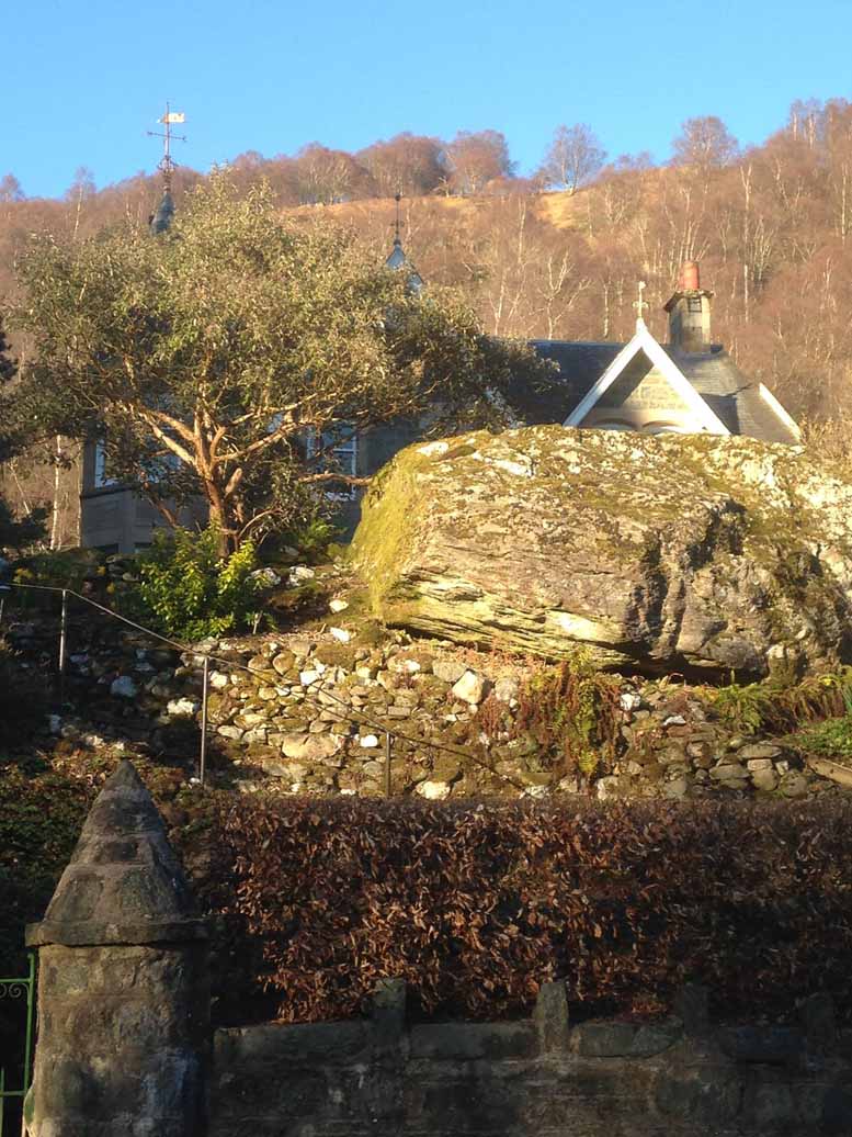
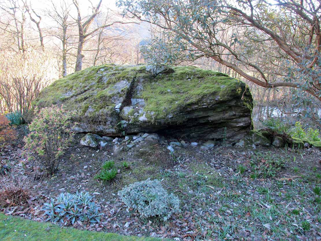
Along the A85 road at the east-end of Lochearnhead, head out of the village east towards Comrie. Just above the main-road, maybe 50 yards after passing the small road to St Fillan’s Golf Club, on the north side of the road you’ll see a huge boulder resting in the edge of the garden of the large detached house that was known as The Oaks.  That’s the fella!

Archaeology & History

Clach na Ba, from the rear

Almost fallen out of history, oral tradition has thankfully kept the name and brief history of this huge boulder alive.  Found in association with the prehistoric standing stones just yards away, the Clach na Ba lives beside the ancient drover’s road (and probable prehistoric route before that) just yards east of the old cottage known as Casetta.  This occupies a site where an old toll-house stood, and the drovers would have to stop and pay a toll before continuing onwards past the Clach na Ba, or Stone of the Cattle.

Folklore

When the drovers passed their highland cattle here, the animals rubbed themselves against the stone to ensure good health and fertility (as well as just having a good scratch, no doubt).

References:

  1. Porteous, Alexander, Annals of St Fillans, David Philips: Crieff 1912.

Acknowledgements:  With huge thanks to Nina Harris and Paul Hornby for the day out and for use of their photos in this site-profile; and to the lovely couple (we didn’t get their names – soz) who live in the house behind the Clach na Ba, for their help with the fascinating local history .

© Paul Bennett, The Northern Antiquarian

Clachan Aoraidh, Balquhidder, Perthshire

Stone Circle (ruins):  OS Grid Reference – NN 5389 2076

Also Known as:

  1. Canmore ID 24151
  2. Worshipping Stones

Getting Here

Clachan Aoraidh, looking W

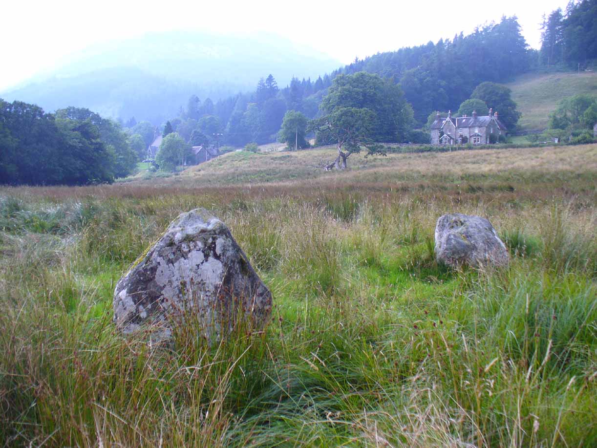
Along the A84 road betweeen Callander and Lochearnhead, take the small road west when you reach Balquhidder Station, towards Balquhidder village.  Go along here for 1½ miles (2.5km) as if you’re gonna visit the Puidrac Stone; but 200 yards past this, go through the gate on the south-side of the road into the boggy field for about 150 yards towards the River Balvag.  You’re looking for several stones, as in the photos.  You’ll find ’em. (you may get soaked though!)

Archaeology & History

The stones, looking NW

After many thousands of years, this innocuous-looking group of small stones found in the very boggy field immediately west of the Puidrac Stone looks nothing like it once did. Some modern academics would have you think there was nothing here of prehistoric interest, but oral tradition and earlier writings tell otherwise. Although not shown on the early OS-maps, it was first described in James Gow’s (1887) articulation on the antiquities of the area, in which he told:

“A short distance east from the present (Balquhidder) parish church, in the haugh below the manse, there are seven stones remaining of a circle which appears to have been about 30 feet in diameter; only one stone is in its original upright position, but there are fragments of others lying about; as usual, they are known as “Clachan-Aoraidh,” or worshipping stones, and are not likely to be disturbed during the lease of the present tenant.”

Looking E, with Puidrac Stone just visible left of telegraph post

A few years later when Thomas Ross (1919) visited the area with a Prof Cooper and others, they reported the single standing stone still in position and the anglicized name of the Worshipping Stones was still in evidence amongst locals.

Arc of fallen stones by the trees

Nowadays the site is in ruin.  Two of the stones stand out when the rushes aren’t too high, with one earthfast and its companion prostrate; but as you can see in the photo (right), there remains a sunken arc of two other stones laid down, running away from the larger ones, with a fifth overgrown and nearly covered by vegetation and the young trees.  In all probability, tradition is probably right here: this is the remains of a stone circle.

Folklore

The field in which these denuded megalithic remains are found, was, wrote Thomas Ross (1919),

“the site of a long-popular market called ‘Feill Aonghais’, i.e., St Angus’ Fair.  It was held, according to Mr Campbell, in May; according to Mr Gow, on “the Saint’s Day, the 6th of April.”  It was quite the custom…to hold a fair after divine service on the Patronal Feast. The folks came to “kirk and market” on the same day, and mixed good fellowship and manly sport with their worship and their business.”

If you were to hold a fair there nowadays, likelihood is it would get flooded!  Christian myths tell of a “St. Angus” taking over whatever the heathen traditions were in this domain, more than a thousand years back.

References:

  1. Gow, James M., “Notes in Balquhidder: Saint Angus, Curing Wells, Cup-Marked Stones, etc”, in Proceedings of the Society of Antiquaries Scotland, volume 21, 1887.
  2. Ross, Thomas, “Saint Angus’ Stone, Balquhidder,” in Transactions of the Scottish Ecclesiological Society, volume 6 – part 1, 1919.

© Paul Bennett, The Northern Antiquarian

Holy Well, Auchtertool, Fife

Holy Well:  OS Grid Reference – NT 20813 90189

Also Known as:

  1. Canmore ID 52985

Getting Here

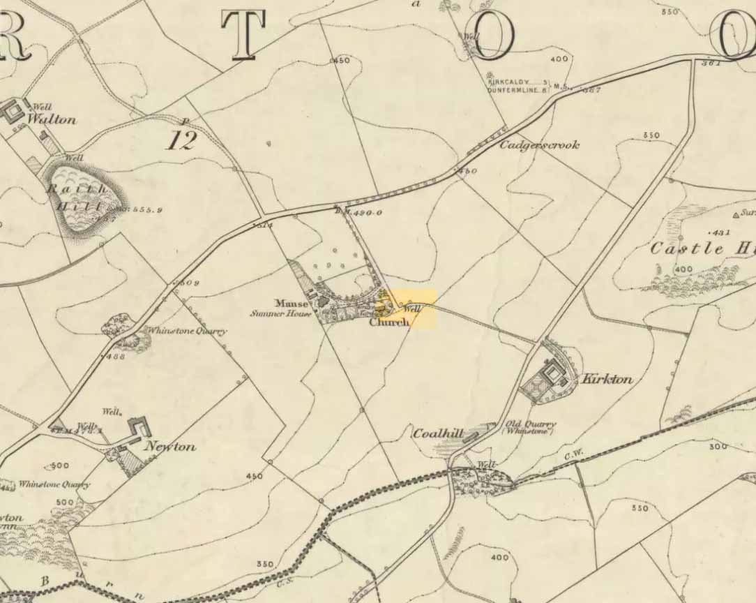
‘Well’ marked the spot in 1856

Along the B925 road between Dunfermline and Kirkcadly, ⅔ of a mile (1.07km) west of Auchtertool village, go down the small track leading down to the isolated church on the rise in some trees.  Walk through the churchyard and out the other side where a small footpath runs downhill.  50-60 yards along, by the walling, this holy well is/was said to be.

Archaeology & History

Both history and tradition are pretty shallow on this all-but-forgotten site, which Penny Sinclair guided us to see in the summer of 2016.  Sadly the entire area where the waters are reported to emerge were completely overgrown in nettles when we visited and, despite us trampling the Urtica down, we could find no remains of the spring. (the Church and its followers here should ensure that the well is properly maintained)

The greatest description of the site seems to be that given by William Stevenson (1908) in his rare work on the parish of Auchtertool.  He wrote:

“As you approach the Kirk of Auchtertool by the old road…you come upon a well by the wayside.  For many years it was the well that supplied the Manse with water, but it is now seldom used, even by the passing traveller.  There is a belief that at one time this well was what is known as a holy well.  Be that as it may, a friend of the late Rev. Walter Welsh, the late Dr Robert Wilson, caused a stone over the well to be inscribed with the following lines:

“Ye who the gently-winding path have trod,
To this fresh fount beside the house of God,
Taste the clear spring; and may each pilgrim know
The purer stream where living waters flow.””

The well was included in Ruth & Frank Morris’ (1982) survey, where they added that the waters from the well were “used in celebration of the mass.”

References:

  1. Morris, Ruth & Frank, Scottish Healing Wells, Alethea: Sandy 1982.
  2. Stevenson, William, The Kirk and Parish of Auchtertool, James Burt: Kirkcaldy 1908.

Acknowledgements:  Many thanks to Penny Sinclair for taking us to this locale.

© Paul Bennett, The Northern Antiquarian 

Colpy, Culsalmond, Aberdeenshire

Stone Circle (destroyed): OS Grid Reference – NJ 6411 3261

Also Known as:

  1. Canmore ID 18272

Archaeology & History

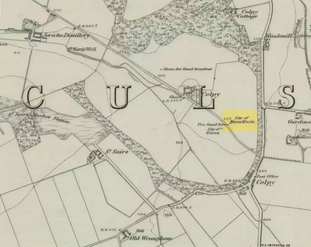
Colpy Circle site on 1868 map

Just like the stone circle a half-mile east at Kirkton of Culsalmond, nothing now remains of this megalithic ring.  It was first described very briefly by Rev. F. Ellis (1845) in the New Statistical Account as a “druidical temple”: one of two hereby, “on the farm of Colpie, although now almost obliterated. Several urns were dug up in making a road near one of them”—implying that one of them was a cairn circle or funerary monument of some kind.  This was subsequently affirmed on the early OS-map and then described in Fred Coles’ (1902) survey, where he wrote:

“Site of a stone circle, the road going to Jericho Distillery having been made through it, and, on the south side of this road, the site of a cairn. Within the possible diameter of the circle an urn was found.”

Folklore

A few hundred yards west of the circle an ancient fair used to be held, known as St Sair’s Fair, named after St Serf.  Although St Serf’s Day is July 1, early records show that the fair—held in a long field with the curious name of ‘St Sairs Market Stance’—was to be held on the Wednesday after the last Tuesday in June.  For a stone circle, this is too close to Midsummer to be a coincidence!  Early records show that the fair was granted in 1591 and subsequent years thereafter.

St Serf is a very peculiar mythological figure with quite shamanistic traits and tales around him.  In truth, many of these early saints were little more than lapsed shamans, utilising natural magick and medicine in the olde traditions, but which became grafted onto the incoming christian mythos.  The evidence for this is quite overwhelming!

References:

  1. Barnatt, John, Stone Circles of Britain – volume 2, BAR: Oxford 1989.
  2. Browne, G.F., On Some Antiquities in the Neighbourhood of Dunecht House, Aberdeenshire, Cambridge University Press 1921.
  3. Burl, Aubrey, “The Recumbent Stone Circles of North-East Scotland”, in Proceedings Society of Antiquaries, Scotland, volume 102, 1973.
  4. Burl, Aubrey, The Stone Circles of the British Isles, Yale University Press 1976.
  5. Burl, Aubrey, The Stone Circles of Britain, Ireland and Brittany, Yale University Press 2000.
  6. Coles, Fred, “Report on Stone Circles in Aberdeenshire (Inverurie, Eastern Parishes, and Insch Districts),” in Proceedings Society Antiquaries, Scotland, volume 36, 1902.
  7. Ellis, F., “Parish of Culsalmond,” in New Statistical Account of Scotland – volume 12: Aberdeen, William Blackwood: Edinburgh 1845.

© Paul Bennett, The Northern Antiquarian 

Wallace’s Oak, Larbert, Falkirk, Stirlingshire

Legendary Tree:  OS Grid Reference – NS 847 836?

Also Known as:

  1. Wallace’s Tree

Archaeology & History

The archaeology and traditions ascribed to this ancient tree (exact position unknown) is based on words that were first penned two hundred years ago.  It was thankfully recorded with a reasonable description when William Nimmo wrote about the great Sir William Wallace in the second edition of his Stirlingshire (1817) work.  Known about in oral tradition by local people, Nimmo told how:

“Torwood was a place where he and his party, when engaged in any expedition in this part of the country, often held their rendezvous, and to which they retreated in the hour of danger.  Here is still to be seen an aged oak, well known by the name of Wallace’s Tree; which seems to have been, even then, rotten and hollow within, and is said to have often afforded a lodging to him and a few of his trusty friends. It is supposed to have been one of the largest trees that ever grew in Scotland.  It is now almost quite decayed; but, from its ruins, appears to have been of an uncommon size. The remaining stump is no less than eleven or twelve feet in diameter. It stands upon the summit of a small eminence, which is surrounded on all sides by a swamp.  A rugged causeway runs from the south through the swamp, and leads up to the tree.  Some other vestiges of the stonework are discernible, surrounding the tree in a circular form, and leading to the conjecture that this oak is of a very high antiquity; and that, having been much frequented by Druidical priests, amongst whom the oak was sacred, the causeway had been laid for their approach to it, and the performance, underneath its branches, of religious rites.”

Nimmo may have a point here.  Not necessarily of druids (although druidic traditions and reality is known from many old tracts to have continued in many of the hidden places in Scotland), but certainly in relation to the paved track leading to a what may have been a recognised moot-hill, on top of which this great oak once stood.  Great trees and ancient meeting places were held in high esteem, not only in the legends of druidism and more established animistic pantheons, but in the recognised pragmatism of local tribal gatherings, in Scotland, Wales, England and in traditional cultures all over the world. (Gomme 1880) The traces of stonework leading to the hill strongly implies an archaeological site in the paving alone; but moreso, as an important site in the traditions of the Scottish people.  The fact that these stone ruins were still visible when Nimmo visited the site in the latter-half of the 18th century in the context he describes, implies it may have been the remains of a possible crannog; or a moot hill; or even, with its great oak surmounting, a sacred grove!  In my mind, it was probably being used as a gathering place long before William Wallace and his men gathered here…

In 1880, a 3rd edition of Nimmo’s Stirlingshire was published and edited by R. Gillespie.  Herein were additional notes about Wallace’s Oak that had been uncovered by Mr Gillespie.  Although he’d visited the place,

“Not the smallest vestige…of the Wallace oak remains. Even the ” oldest inhabitant” can say nothing of it save what he has gathered from tradition.  Sir Walter Scott, in his Tales of a Grandfather, speaks of having seen some of its roots eighty years ago; and recently we were shown a treasured morsel of the tree in the Chambers’ Institute at Peebles. Wallace, undoubtedly, often chose the solitude of the Torwood as a place of rest for his army, raised and roused to oppose the tyranny of Edward.  Here he concealed his numbers and his designs, sallying out suddenly on the enemy’s garrisons, and retreating as suddenly when afraid of being overpowered. While his army lay in these woods, “the oak” was his head-quarters. Within it, the illustrious hero generally slept, the hollow trunk being huge enough to afford shelter both to himself and one or more of his associates.”

When John Gibson (1908) came to write about it, he told that “Wallace’s Oak, which stood on another part of Woodside (low Torwood), has…vanished.” No roots, no lingering trunk—nothing.  But although the tree has long since gone, William M. Stirling pointed out in 1817 that,

“A young tree is pointed out in the neighbourhood, as having sprung from an acorn of Wallace’s Oak.”

If and when we can locate the old toll-house of Broomage at Larbert, we get much closer to identifying the exact location of this long lost oak.  Then, perhaps, a commemorative plaque should surely be placed there to remind people of their great history, and included on tours of sites relating to Sir William Wallace.

References:

  1. Gibson, John C., Lands and Lairds of Larbert and Dunipace Parishes, Hugh Hopkins: Glasgow 1908.
  2. Gomme, George L., Primitive Folk-Moots, Sampson Low: London 1880.
  3. Nimmo, William, The History of Stirlingshire (2nd edition), John Frazer: Stirling 1817.

© Paul Bennett, The Northern Antiquarian