Robin Hood wells are numerous in Yorkshire and Derbyshire, but finding them in this neck o’ the woods is unusual (a Robin Hood’s Farm can be found nearly 14 miles south). The waters here would have had obvious importance for local peasant folk in bygone centuries, perhaps with scatterings of Beltane and Midsummer rites hereby; but it seems that records are silent on such matters. The only reference I can find of this place is in Bracken’s (1860) fascinating work on Sutton Coldfield, where he told that,
“At the extremity of the parish, near Pype, a little field is still called the Bowbearer’s Croft. Tradition says two officers of the chase, bowbearers, had a lodge there; and that their duty was to guide the travellers across the wild country. A very old cottage, that had been well built, was removed from the croft in 1828. In that neighbourhood was a fountain, called Robin Hood’s well, now enclosed within the grounds of Penns, where the natural beauties of the situation have been judiciously displayed and improved by the taste of the late proprietor, Joseph Webster.”
Marshy ground to the east of Pype Hall fed the large pond, which is one contender for the site of this lost well. What has become of it? A search in the local library archives for any old manorial maps, or the field-name maps showing Bowbearer’s would prove truly helpful in relocating this site.
References:
Bracken, L., History of the Forest and Chase of Sutton Coldfield, Simpkin Marshall: London 1860.
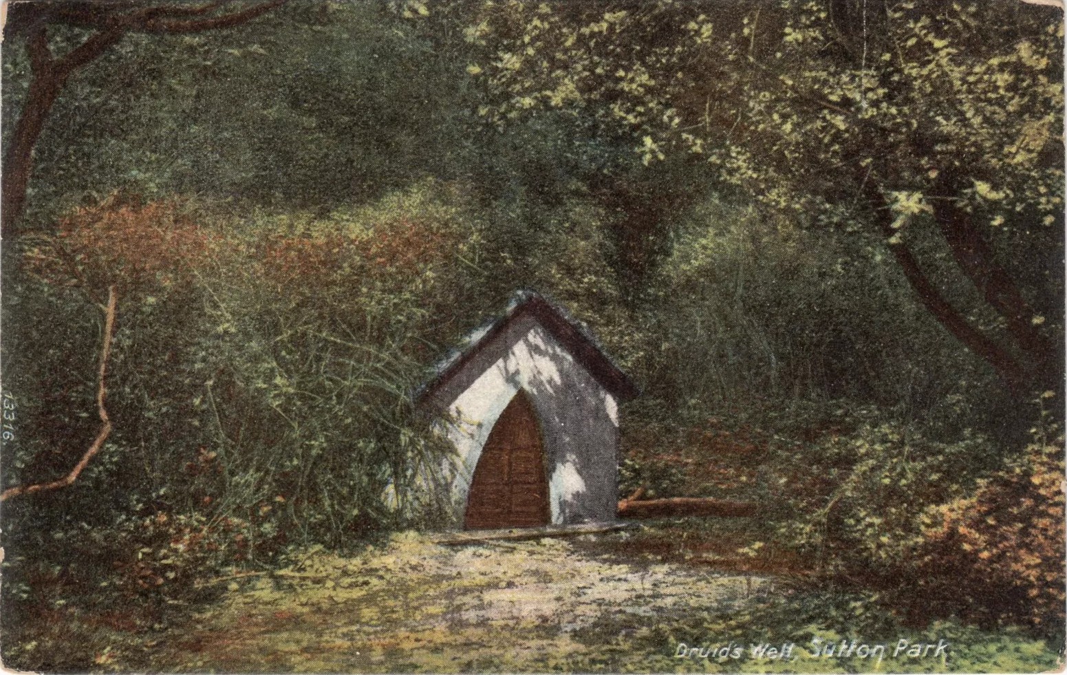
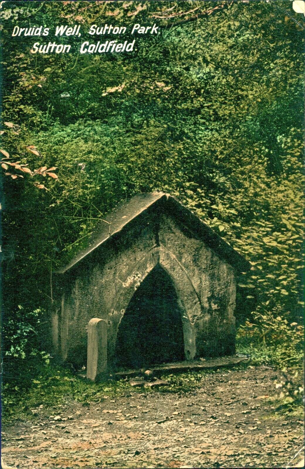
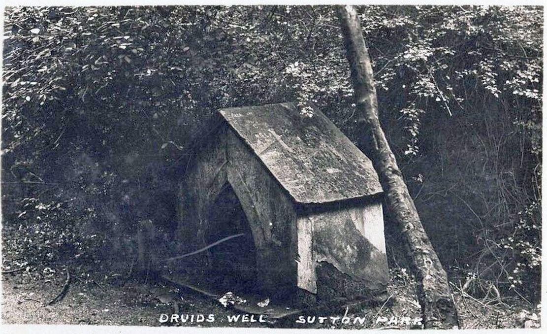
Highlighted on the 1884 Ordnance Survey map of the region and located beyond the far eastern end of Braceridge Lake, this legendary well has seen better days. A small well-house once covered the spring, but all we have left today is little more than a rectangular stone-lined concrete hole-in-the-ground where the waters collect (hopefully some local folk can bring it back to life). But in the 19th century it was well known, much frequented and maintained.
Not much seems to be known about its mythic history, as the traditions surrounding its dual pagan-christian dedication seem to have been forgotten. When the local writer Tom Burgess (1893) came to explore its history, he merely wrote:
“How it came to be called the Druids’ Well is not known, it is scarcely necessary to say that it can have no Druidical connection; it is very probable, however, that it was dedicated to Saint Mary long before the dam of Bracebridge Pool was made by Ralph Bracebridge in the reign of Henry V.”
Druids Well in 1917Druid’s Well in 1932
Jeremy Harte (2008) suggested that this well’s druidic association may have come from a local man, William Hutton who, in the middle of the 18th century, “speculated on a druid sanctuary near Sutton Coldfield.” But before Hutton, the 17th century Staffordshire topographer, Robert Plot, suggested that an arch-druid held residence on Barr Beacon, which is less than three miles west of here. This idea was echoed by Midgley (1904) who told that Barr Beacon “is supposed to have been a Druidical shrine.” Just over three miles to the northwest, the Druid’s Heath (a place-name derived, apparently, from an old family) at Aldridge also had its own array of folklore which, perhaps, may have had something to do with this well’s association. When Roy Palmer (1976) wrote about the Druid’s Well in his folklore survey, he told that Sutton Coldfield,
“is said once to have been the seat of the arch-druid of Britain; perhaps this was his well, which was later christianized.”
So much to choose from…
References:
Bord, Janet, Holy Wells in Britain – A Guide, HOAP: Wymeswold 2008.
Bracken, L., History of the Forest and Chase of Sutton Coldfield, Simpkin Marshall: London 1860.
Harte, Jeremy, English Holy Wells – volume 2, Heart of Albion press: Wymeswold 2008.
Midgley, W., A Short History of the Town and Chase of Suton Coldfield, Midland Counties Herald: Birmingham 1904.
Palmer, Roy, The Folklore of Warwickshire, Batsford: London 1976.
Acknowledgements:Huge thanks for use of the Ordnance Survey map in this site profile, reproduced with the kind permission of the National Library of Scotland.
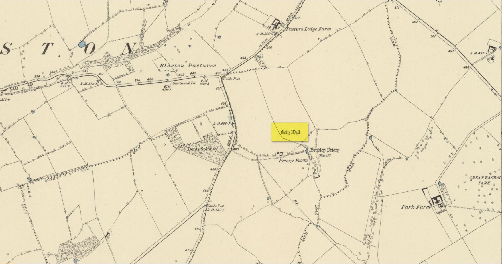
Holy Well (destroyed): OS Grid Reference – SP 8234 9542
Also Known as:
Our Lady’s Well
Archaeology & History
Site shown on 1885 map
There seems to be very little known about this site. It was located in fields just above the site of the Augustinian Priory of St Mary, founded in 1220 CE, where now is Priory Farm, but there seems to be no trace left of it. The great Leicestershire antiquarian John Nichols said the well had been dedicated to Our Lady, the Virgin Mary. This was echoed in John Curtis’ (1831) survey, who told that, “where the Priory formerly stood, a Dwelling House has been erected; and near it is a Well called Our Lady’s Well.” He told that it was deep and “walled below the surface.”
References:
Curtis, John, A Topographical History of the County of Leicester, W. Hextall: Ashby-de-la-Zouch 1831.
Rattue, James, ‘An Inventory of Ancient, Holy and Healing Wells in Leicestershire’, in Transactions Leicestershire Archaeological & Historical Society, volume 67, 1993.
Trubshaw, Bob, Leicestershire and Rutland’s Holy Wells, Heart of Albion: Nottingham 2024.
Acknowledgements:Huge thanks for use of the Ordnance Survey map in this site profile, reproduced with the kind permission of the National Library of Scotland.
About mile south of Northchurch, on the far side of the A41 dual carriageway, somewhere past the old crossroads (or perhaps even at the crossing) an ancient tree lived—and truly lived in the minds of local people, for perhaps a thousand years or so. Mentioned in the Lay Subsidy Rolls in 1307, the Cross Oak gave its name to the old building that once stood in the trees and the hill itself, at the place now known as Oak Corner. Whether or not a “cross” of any form was set up by this old oak, records are silent on the matter. Its heathen ways however, were pretty renowned! (a plaque should be mounted here)
Folklore
The first reference I’ve found of this place is in William Black’s (1883) folklore survey where he told that “certain oak trees at Berkhampstead, in Hertfordshire, were long famous for the cure of ague”—ague being an intense fever or even malaria. But a few years later when the local historian Henry Nash (1890) wrote about this place, he told that there was only one tree that was renowned for such curative traditions, that being the Cross Oak. He gave us the longest account of the place, coming from the old tongues who knew of it when they were young—and it had it’s very own ritual which, if abided by, would cure a person of their malady. “The legend ran thus”, wrote Mr Nash:
“Any one suffering from this disease was to proceed, with the assistance of a friend, to the old oak tree, known as Cross Oak, then to bore a small hole in the said tree, gather up a lock of the patient’s hair and make it fast in the hole with a peg, the patient then to tear himself from the tree, leaving the lock behind, and the disease was to disappear.
“This process was found to be rather a trying one for a weak patient, and by some authority unknown the practice was considerably modified. It was found to be equally efficacious to remove a lock of hair by gentle means, and convey it to the tree and peg it in securely, and with the necessary amount of faith the result was generally satisfactory. This is no mere fiction, as the old tree with its innumerable peg-holes was able to testify. This celebrated tree, like many other celebrities, has vanished, and another occupies its place, but whether it possesses the same healing virtues as its predecessor is doubtful. It is however a curious coincidence, that the bane and the antidote have passed away together.”
The lore of this magickal tree even found its way into one of J.G. Frazer’s (1933) volumes of The Golden Bough, where he told how the “transference of the malady to the tree was simple but painful.”
Traditions such as this are found in many aboriginal cultures from different parts of the world, where the spirit of the tree (or stone, or well…) will take on the illness of the person for an offering from the afflicted person: basic sympathetic magick, as it’s known. Our Earth is alive!
References:
Black, William G., Folk Medicine, Folk-lore Society: London 1883.
Frazer, James G., The Scapegoat, MacMillan: London 1933.
Jones-Baker, Doris, The Folklore of Hertfordshire, B.T. Batsford: London 1977.
Nash, Henry, Reminiscences of Berkhamsted, W. Cooper & Nephews: Berkhamsted 1890.
Acknowledgements:Huge thanks for use of the Ordnance Survey map in this site profile, reproduced with the kind permission of the National Library of Scotland.
Holy Well (destroyed): OS Grid Reference – SP 4506 4055
Archaeology & History
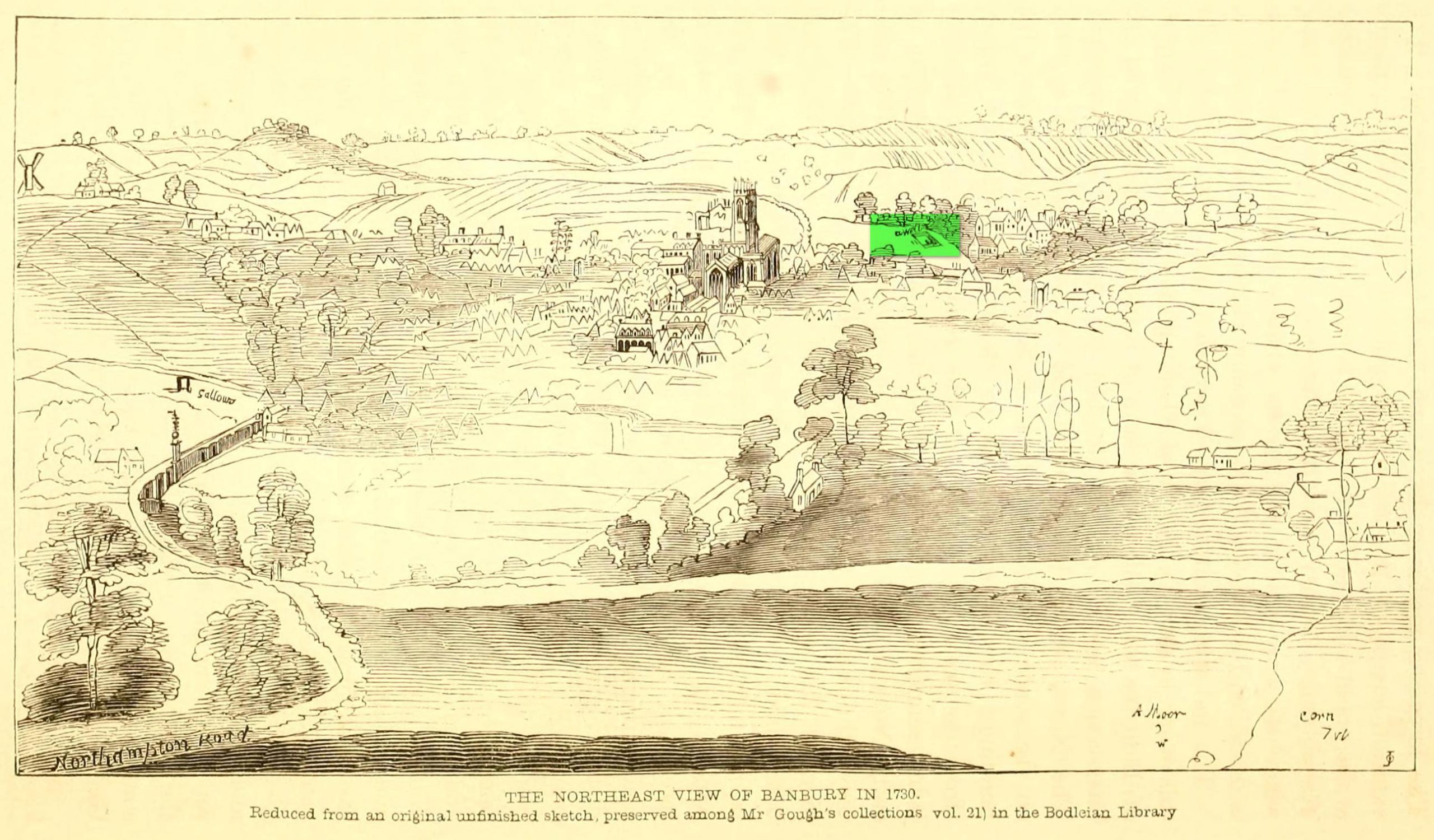
Well highlighted, in 1730
The holy well of Banbury seems to have been destroyed sometime in the second-half of the 19th century, when the industrialists built over the area. When the historian Alfred Beesley (1841) wrote about it, the waters were still running. He told it to be, “a chalybeate spring, well-known and still often visited, situated on the west side of the town, a little north of the footway leading to North Newington.”
The footpath is obviously long gone—as is the well. It’s iron-bearing (chalybeate) properties would have given the waters good fortifying properties, perhaps of some renown to local people yet, according to Mr Beesley, it was a slow-flowing spring. In his brief history of the site, he also gave us the results of a chemical examination of its healing waters, telling us:
“This is called St. Stephen’s Well in a plan of Sir John Cope’s property at Banbury made in 1764. It also appears prominently as “A Well ” in an unfinished view of Banbury made in 1730 (illustrated above)….
The water of this spring is perfectly clear and colourless, having a brisk and slightly chalybeate taste. The stone channel is coated with a light red deposit, and a scum of the same colour appears on the water in parts where stagnant. The spring discharges from half a gallon to one gallon in a minute. In 32 oz. of the water at 60° are,
Carbonic Acid gas, 5 cubic inches
Hydrochlorate Magnesia, 0.21 grains.
Chloride Sodium or common Salt, 0.54
Sulphate Lime, 1.5
Carbonate Lime, 3.8
Protoxide Iron, 0.024
Silica a trace
Total weight of solid contents – 6.074″
Folklore
St. Stephen is an odd character. His annual celebration or feast day in Britain is December 26. (in eastern countries it’s a day later) Rites connected to this character are decidedly heathen in nature. From the 10th century, in England, St Stephen’s Day has been inexorably intertwined with horses, bleeding them on his feast days, apparently for their own health. Water blessed by priests on this day would be kept for the year and used as a medicine for horses during that time. Also on this day, young lads would “hunt the wren” and, once caught, impale it on top of a long pole and take it from house to house. Despite this curious motif being a puzzle to folklore students, Mircea Eliade (1964) explained how this symbolism is extremely archaic and “the bird perched on a stick is a frequent symbol in shamanic circles.”
Eliade, Mircea, Shamanism – Archaic Techniques of Ecstasy, Princeton University Press 1964.
Harte, Jeremy, English Holy Wells – volume 2, Heart of Albion press: Wymeswold 2008.
Johnson, William P., The History of Banbury, G. Walford: Banbury 1860.
Acknowledgements:Huge thanks for use of the Ordnance Survey map in this site profile, reproduced with the kind permission of the National Library of Scotland.
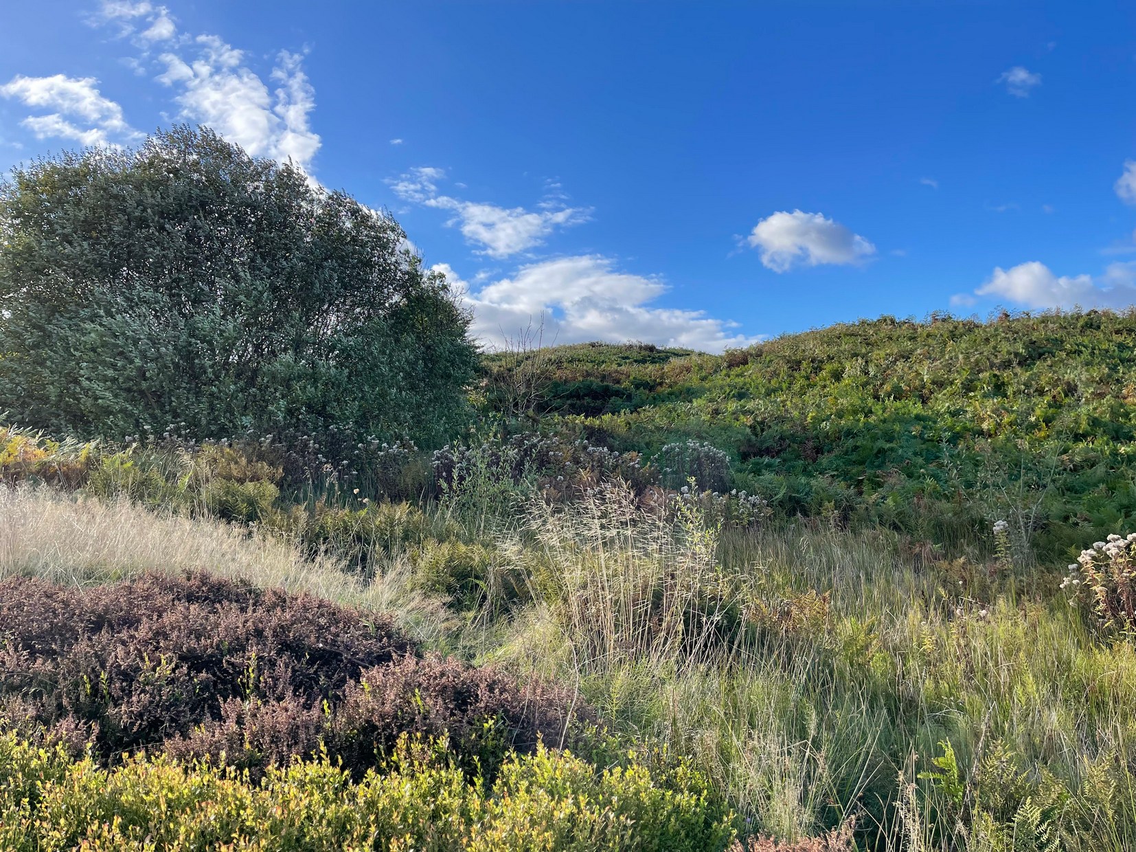
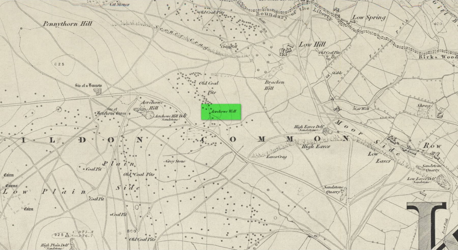
First illustrated on the 1852 Ordnance Survey map of the area and now only visible as a small marshy area, this once fast-flowing well gained its name from the old stone cross (very probably a standing stone before that) four hundred feet west of here, called Acrehowe Cross, now gone. It is possible that this ‘cross’ gave the well a local reputation as a holy well. A solitary path once led to the well, whose waters rise up through a coal seam giving the place its medicinal qualities, which have sadly been forgotten. Up and down this path towards Baildon village one would have regularly met a local character in the 19th century known as “Dinnis” (his real name was Joseph Halliday) who, along with his partner would take ‘kits’ (a large bucket with parallel sides) of water from the well into the village and sell it for a halfpenny each.
Site shown on 1852 map
Later in the 19th century, a cottage was built here (known as Acre Cottage) and gained its water supply from the well. This was curtailed with the construction of the Baildon Moor reservoirs by the roadside, which took the water from both here and the nearby Spink Well (over the hill on the far side of the golf course), leaving us with little more than the trickling water we see today, just a little further down from its original location.
References:
la Page, John, The Story of Baildon, William Byles: Bradford 1951.
Acknowledgements:Huge thanks for use of the Ordnance Survey map in this site profile, reproduced with the kind permission of the National Library of Scotland.
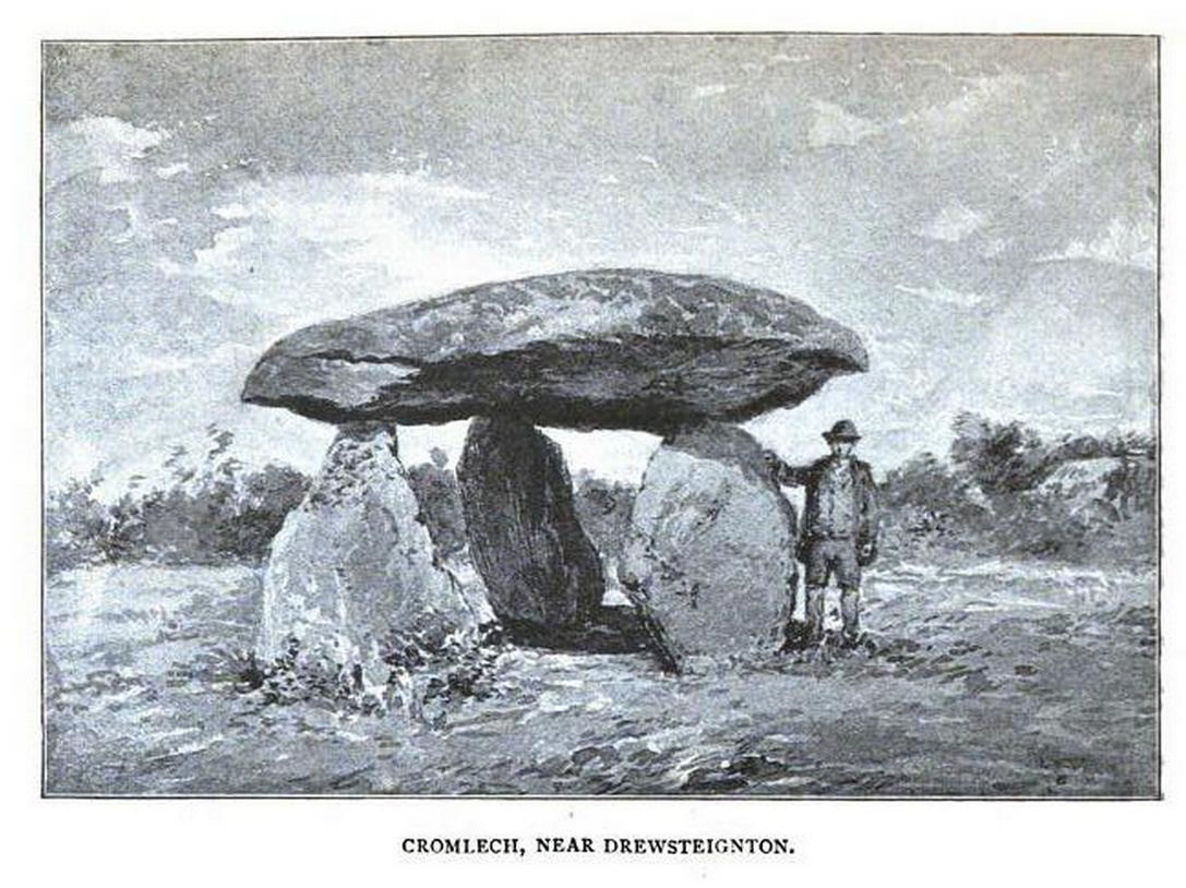
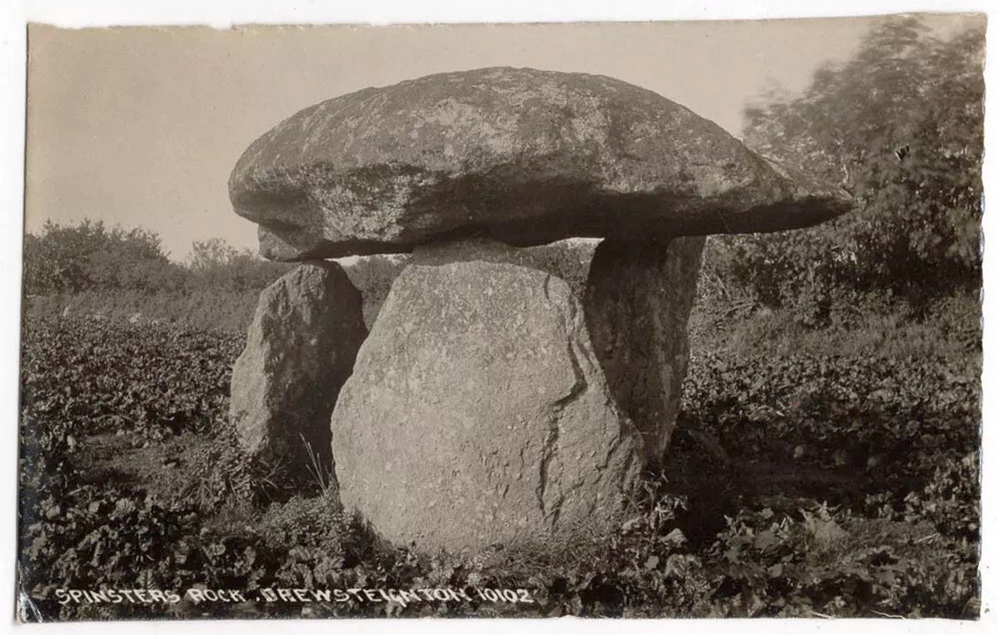
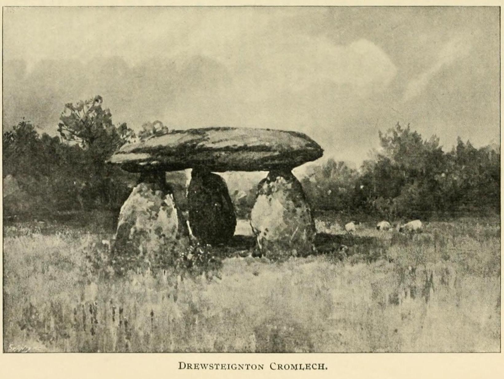
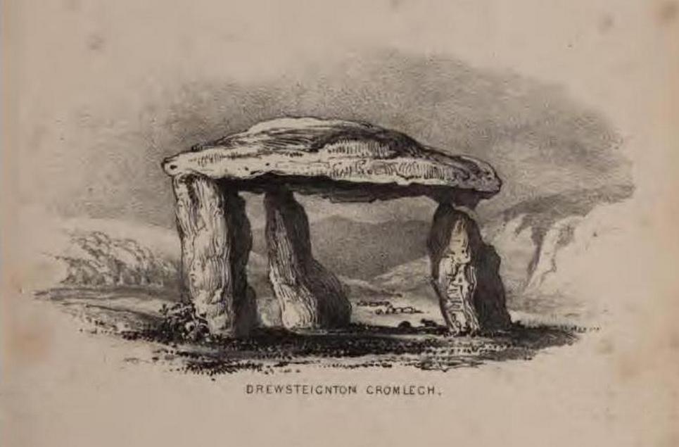
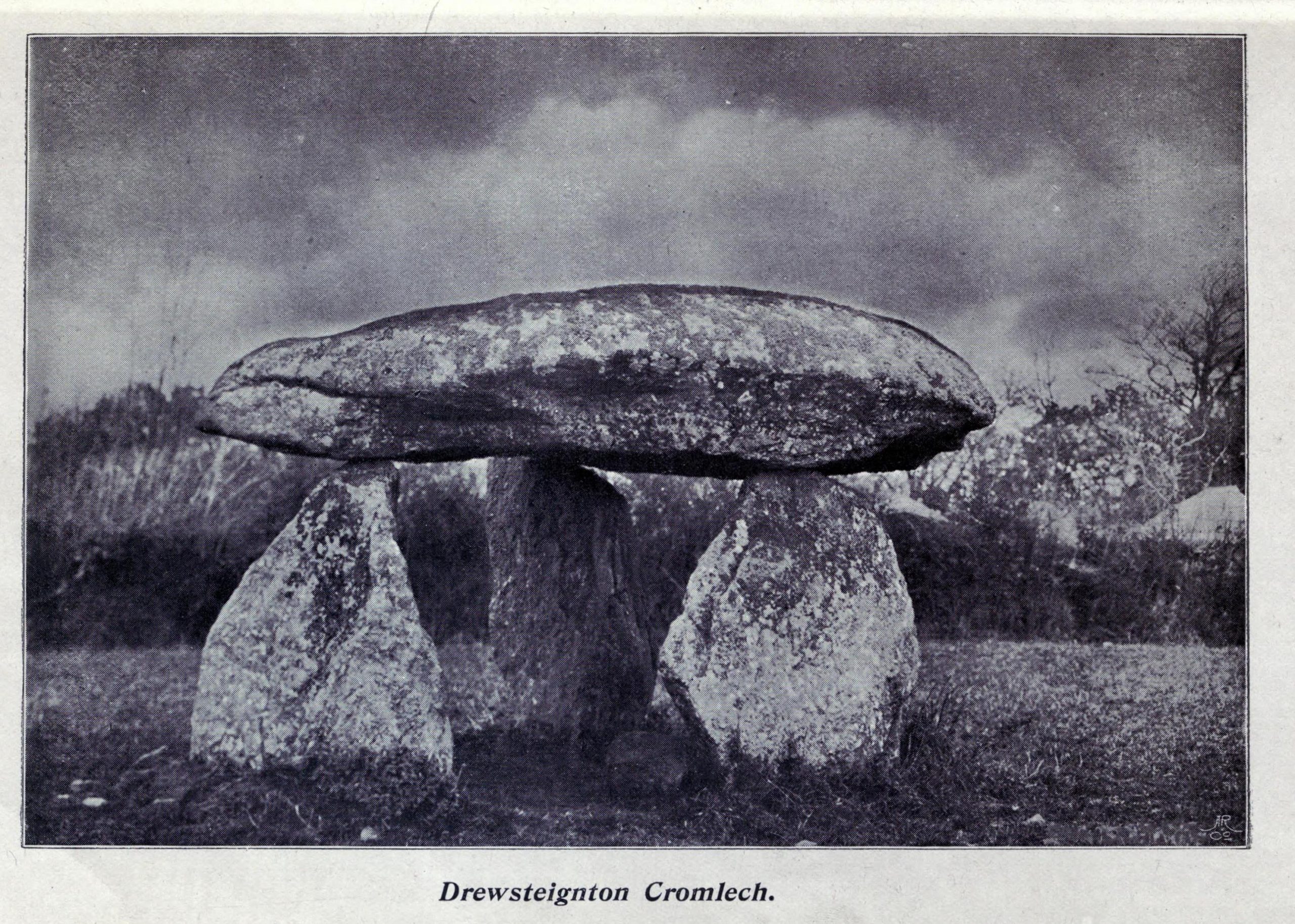
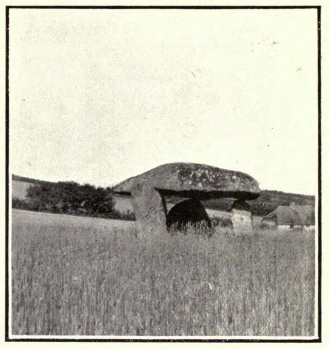
Highlighted on Benjamin Donn’s map of Devon in 1765, this impressive neolithic dolmen consists of three large granite support stones between 5 ft 7 in and 7 ft 7 in tall, surmounted by a large capstone measuring 15 feet by 10 feet. It collapsed in 1862 but was restored later the same year.
Folklore
In Murray’s (1851) Handbook for Travellers he told the following tale of the site:
This interesting old monument derives its name from a whimsical tradition that three spinsters (who were spinners) erected it one morning before breakfast; but “may we not,”* says Mr. Rowe (Peramb. of Dartmoor), “detect in this legend of the three fabulous spinners the terrible Valkyriur of the dark mythology of our Northern ancesters – the Fatal Sisters, the choosers of the slain, whose dread office was to ‘weave the warp and weave the woof of destiny.'”
Polwhele informs us that the legend varies, in that for the three spinsters some have substituted three young men and their father, who brought the stones from the highest part of Dartmoor; and in this phase of the legend has been traced an obscured tradition of Noah and his three sons.
.. The hill on which it stands commands an excellent view of Cawsand Beacon. About 100 yds. beyond the cromlech on the other (N.) side of the lane, is a pond of water, of about 3 acres, called Bradmere Pool, prettily situated in a wood. It is said to be unfathomable, and to remain full to the brim during the driest seasons, and some regard it as artificially formed and of high antiquity – in short a Druidical pool of lustration connected with the adjacent cromlech..
.. The country-people have a legend of a passage formed of large stones leading underground from Bradmere to the Teign, near the logan stone..
References:
Baring-Gould, Sabine, A Book of Dartmoor, London 1900.
Crossing, William, Gems in a Granite Setting, Western Morning News: Plymouth 1905.
Falcon, T.A., Dartmoor Illustrated, James G. Comin: Exeter 1900.
Murray, John, A Hand-book for Travellers in Devon & Cornwall, John Murray: London 1851.
Ormerod, G. Waring, Notes on Rude Stone Remains Situate on the Easterly Side of Dartmoor, privately printed 1873.
Page, John Lloyd Warden, An Exploration of Dartmoor and its Antiquities, Seeley: London 1892.
Worth, R. Hansford, Worth’s Dartmoor, David & Charles: Newton Abbot 1967.
Acknowledgements:Huge thanks for use of the Ordnance Survey map in this site profile, reproduced with the kind permission of the National Library of Scotland.
The exact location of this site seems privy to a select few and has remained that way since its existence appeared in print in the 19th century. It was first mentioned by Arthur Mitchell (1874) following a holiday that he’d had in the area in the early 1870s. He’d visited a petroglyph at Laggan with a Mr David Ross and when he returned home received a letter from him that told how,
“he had heard from Mr M’Bain of Auchterblair of two huge granite boulders, situated on a shelving rock over an abyss on the Loch Avon side of Cairngorm, with hand-made cups on them about a foot wide and correspondingly deep.”
They were subsequently visited by Thomas Wise (1884) a few years later, who told how these huge granite boulders were,
“20 feet in height,” upon which “there are four basins, 1 foot, or 1 foot and a-half long, and 6 inches wide at the top, rounding off to 1 inch in the bottom.”
Initially Mr Mitchell (1874) was cautious in associating these carved basins with cup-marked stones—and indeed, we concur with this—but seemed to have changed his opinion when he wrote about them a few years later (Mitchell 1881). But it’s the folklore attached to this site that intrigued him – and myself…
Folklore
The traditions attached to this site will be recognised by all students of animism and folklore. Arthur Mitchell (1874) was informed how the carved bowls in the stone helped infertile women and how “sitting on (them) is said to be efficacious in cases of barrenness.” Their importance was highlighted in the fact that there had been “pilgrimages to them undertaken within the memory of people still living.”
This was affirmed by Thomas Wise (1884) who told that,
“They are supposed to be efficacious in barrenness, and people still living remember pilgrims coming to sit upon them for some time, that they might obtain what they wished. A visit to them was by no means an easy task, as the ascent was difficult, and to sit on them required a steady head, as they are on the brink of a rock overhanging a precipice. These basins are the “woman’s stone” mentioned by Tennant. They are supposed to be the resting place or throne of a certain fairy queen; but however efficacious they may have been, they have lost much of their celebrity; and as the shepherd, who acted as guide to the pilgrims, is dead, and has left no successor, they are now rarely visited.”
Does anyone know the whereabouts of this heathen magickal site? If you happen to find it, see if you can get a good photo or two and let us know on our Facebook group.
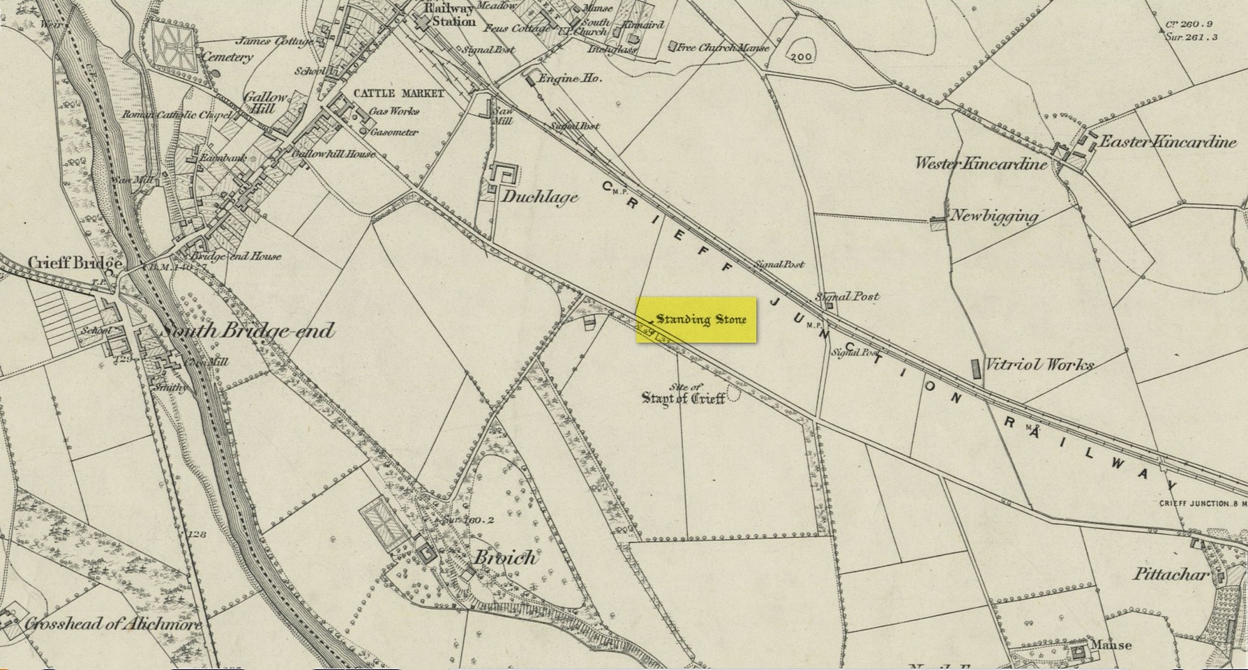
Standing Stone (destroyed): OS Grid Reference – NN 8655 2079
Archaeology & History
Site on the 1866 map
There is seemingly no trace left of this once impressive tall, slender standing stone that had lived for thousands of years on the south-side of Crieff. It was destroyed by some retard in the middle of the 20th century (anyone know their name?). Highlighted on the 1866 Ordnance Survey map of the area, it was visited and described by the late great Fred Coles (1911) when it still stood at the side of the road. He told that it was,
“In shape a narrow rhomboid at the base, this Stone rises to an acute angle at a height of 6 feet. Its longer axis is E.S.E. 52° by W.N.W. 52°, and in basal girth it measures 8 feet 11 inches.”
Coles’ 1911 sketch
Some 200 yards to the south-east there used to be the curiously-named Stayt of Crieff burial mound which had been used as a court hill for many centuries. This outlying standing stone may have been the “witness” on which oaths were sworn before the court. Sadly the history of the Stayt of Crieff mound is also somewhat sparse and it too has, appallingly, been destroyed. The destruction of these antiquities and their ancient traditions is nothing short of a fucking disgrace.
Finlayson, Andrew, The Stones of Strathearn, One Tree Island: Comrie 2010.
Acknowledgements:Huge thanks for use of the Ordnance Survey map in this site profile, reproduced with the kind permission of the National Library of Scotland.
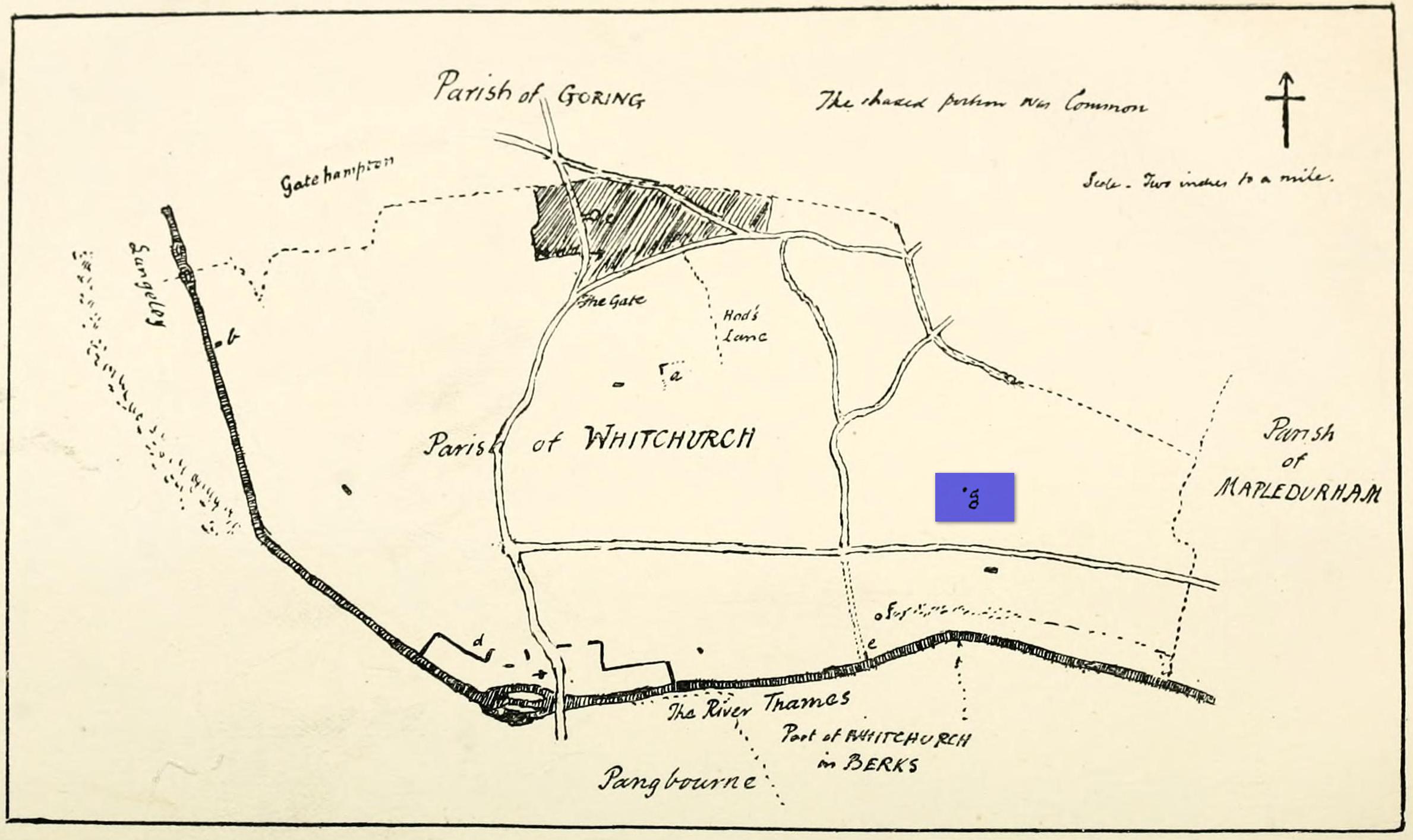
Maypole (destroyed): OS Grid Reference – SU 655 781
Archaeology & History
“g” marks the spot!
Very little is known about the history surrounding Whitchurch’s maypole that once stood more than a mile east of the village, somewhere in the woods immediately south of the present-day cannabis-growing Hempem Organics. (damn those hippies!) Mentioned in the Enclosure Acts of 1806 and 1813 as the “May Pole Ground”, the monument was mentioned in the Rev. John Slatter’s (1895) local history work and its approximate location was shown on a hand-drawn map he did of the area, in the grounds north of Hardwick House. He told us that it stood on “an elevated site” and conjectured that it might once have been a place of druidical worship!
“In the centre of the Hardwick property is a plot of ground called the Maypole Piece…. It is an open space, with a tree standing alone, where we may suppose the maypole formerly stood. There is a memorandum made by the last Mrs. Lybbe (nee Isabella Twysden) to this effect:
1713: A maypole set up on ye hill in ye straight way to Collinsend.”
In the event that you manage to discover anything else about the history of this maypole, let us know on our Facebook group.
References:
Gelling, Margaret, The Place-Names of Oxfordshire – volume 1, Cambridge University Press 1953.
Slattter, John, Notes on the History of the Parish of Whitchurch, Elliot Stock: London 1895.