Market Cross, Glastonbury, Somerset

Cross:  OS Grid Reference – ST 49875 38924

Also Known as:

  1. Glastonbury Cross

Archaeology & History

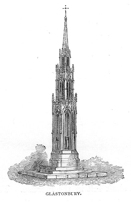
The present day Market Cross that stands in Glastonbury’s High Street, ornate though it may look, replaced a much earlier and more memorable monument.  The one we see today, said Charles Pooley (1877),

“at the junction of the four streets, was erected in 1846, after the design of B. Ferrey, Esq., at the instance and the cost of a private individual.  It is a Gothic pinnacled structure of a simple type, with no pretensions to elaborate architectural display.”
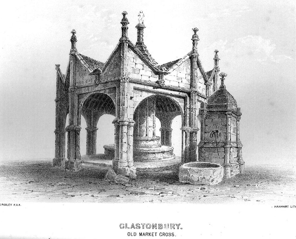
The ancient Market Cross
The new Market Cross

A very poor substitute for the cross that stood in its place in earlier centuries, from all accounts.  Before the modern spire was erected, an earlier, larger and more ornate structure — that seems to have been first described in John Leland’s classic Itinerary (1744 ) in the middle of the 18th century, simply as “the Market Crosse in the West Ende” — was the meeting point for the tradesmen and villagers of Glastonbury.  Although Rahtz & Watts (2003) followed Leland in giving only passing mention to this once ornate structure, thankfully a number of earlier antiquarians gave the old cross a bit more literary attention.  Mr Pooley (1877) again informs us:

“Warner, who was in Glastonbury in 1799, says, “In my way to the Abbey, I passed the Market Cross, and old polygonal structure, its apex crowned with a little naked figure, bearing strong marks, in its position and employment of that grossness of taste, in which the sculptors of the 15th century so frequently indulged.”

Other writers weren’t as puritanical in their descriptions.  In John Britton’s (1807) tour of the architectural curiosities of the region he remarked:

“Though a large and extremely curious structure…it is scarcely noticed in the topographical annals of the county; its history is, therefore, perhaps entirely lost.  Since the drawing was taken in 1802, the Cross had been suffered gradually to fall into ruins, part of the centre column then only standing.”  He continued: “There is something peculiarly unique in the shape and ornament of this building.  A large column in the centre, running through the roof, and terminating with a naked figure, clustered columns at each angle with odd capitals, bases, etc., and gables with pinnacles of unusual shape, all unite to constitute this one of the eccentricities of ancient building.  From the time of the Norman Conquest to the Dissolution of the Engilsh Monasteries, the varied and progressive styles of architecture are satisfactorily defined, and a very general uniformity prevails in all the buildings of particular eras; but the specimen before us differs from anything that we have yet met… In the year 1802 there was a mutilated inscription on it, with the year 1604, but we cannot say that this date refers to the time of its building.  There were also some armorial bearings carved on different parts of it.  Among these were the arms (a cross between two cups) of Richard Beere, the last Abbot but one of Glastonbury.  The presence of the canting device of Richard Beere would probably determine the date of its erection.”

Mr Pooley’s (1877) own description of the old cross told that,

“It was built of hewn stone on an octagonal plan, having clustered pillars ranged round a central column supporting the roof.  Three steps, the lower one benched, surrounded the base of the shaft, for the convenience of the market people.  The gables were terminated by moulded pinnacles, and the central shaft, which rose above the roof, was surmounted by a statue.  Adjoining the cross was an ancient conduit, having a vaulted roof, and supplied with water from a reservoir at the uper part of town.  These structures being in want of repair…it was determined to pull them down, which was done accordingly in the year 1808.”

So the next time anyone visits Glastonbury’s tall spired cross in the middle of the town, remember its old and much more ornate predecessor. Perhaps some of you arty-types down there could do a replica of the old thing with its naked figurines and resurrect it from its forgotten past…

References:

  1. Britton, John, The Architectural Antiquities of Great Britain, Longman, Hurse: London 1807.
  2. Leland, John, The Itinerary, James Fletcher: Oxford 1744.
  3. Michell, John, New Light on the Ancient Mystery of Glastonbury, Gothic Image: Glastonbury 1990.
  4. Pooley, Charles, The Old Stone Crosses of Somerset, Longmans, Green & Co.: London 1877.
  5. Rahtz, Philip & Watts, Lorna, Glastonbury: Myth and Archaeology, Tempus: Stroud 2003.

© Paul Bennett, The Northern Antiquarian


St. Margaret’s Well, Binsey, Oxford, Oxfordshire

Holy Well:  OS Grid Reference – SP 486 080

Archaeology & History

A sacred water source that is thought to have taken its name from the adjacent church of St. Margaret (makes sense!).  The site was described at some length in the fine work of Robert Charles Hope (1893), where he quoted extensively from earlier works:

At the west end of this chappel, about three yards distant, is the well or spring, antiently and to this day called St. Margaret’s Well, being the very same that she by her prayers at the building of the chapple opened. Of which heare a certaine old English poet, who in the life of St. Frideswyde in the legend of English saints, speaking of her various fortunes and of her passage from Bampton to this place, saith thus:

Ther fer with her [fellows.] she be laft ther
And to serve Jhesu Christ . a chapel leet [raise.]
Ther as is yit a fayr cort . and a cherche fayr and swete
Arerid in the honour . of her and Seynte Margrete
As this mayde [lived.] ther . in holy lyf and clene
The maydenes that were with her . gone hem ofte be [bemoan.]
That water was sum del to fer . hem ofte for smale dede
And cride on Seynt Friswid . that she schold hem therof [rid]
This mayde Seynt Friswid . bad our lordis sonde
That he water thorw his gras . hem sente ner honde
So sprong ther up a welle . cler [enough] and clene
That fond hem water inowf . tho dorst hem nought be mene
That beside the cherche is [it] . in the west syde
That mony a mon hath bote do . and that men seggeth wide.

Over St. Margaret’s Well was a covering of stone, and thereon on the front the picture of St. Margaret (or perhaps St. Frideswyde), pulled down by Alderman Sayre, of Oxon, a little before the late war, 1639.

To this well also and her image and certaine reliques in the chapple did the people come on pilgrimage with as great devotion to ease their burdened soules and obtaine resolutions of their doubts, as they would to an oracle.

And here, also, when those maimed and unsound folke had bin cured either by bathing in, or drinking of; this water, hang up their crutches as a speciall memorandum of their cured griefs. For which end and purpose there were severall preists that inhabited here appointed by the Prior of St. Frideswide’s purposely to confess and absolve those pilgrims.

Near to this place it was that the Lady Edyne, of Wynton, the widdow of Sir William Lancelot, knight, had a vision. (See Twyne, xxi., 199.)

The well wee find almost to the last frequented by superstitious people, and especially about a hundred years before the dissolution.  Soe much, that they were forced to enclose it–as in old time before, they had defended it–with a little house of stone over it with a lock and a dore to it. But all decaying and going much to ruine, at the suppression of St. Frideswyde’s Priory, was at last –I meane the little house–about twenty-five years agoe, pulled downe and quite taken away. Soe that now being overgrowne with nettles and other weeds, and harbouring frogs, snails, and vermin, scarce owneth the name of a well; noe more than the old and small building joyning to the north side of the chapple doth–as formally it did–a court.

The well is now in better condition. When I visited it on 25th October, 1887, the churchyard was tidily fenced and very neatly kept. At the well a descent of some five steps brought one to an arched vault, beneath which, in the centre of the flooring, was a round basin containing the water of the well, the surface of the water being about six feet below the level of the ground.  On the wall above the arch was this inscription:

“S. MARGARET’S WELL.

S. Margaretae fontem, precibus S. Frideswidæ (ut fertur) concessum, nquinatum diu obrutumque in usum revocavit T. J. Prout, Aed. Xti alumnus, Vicarius, A. S. MDCCCLXXIV.

At the time of the restoration of this well, an Oxford wit, having regard to its proximity to the church, suggested for an inscription:

Ariston men hydor
When you open your pew-door,
This may comfort supply
Should the sermon be dry.

(Ibid., pp. 323-328, et seq.)

Denham Tracts, p. 151: The well of St. Margaret or St. Frideswide, in Binsey churchyard, scarce two miles from Oxford, is supposed to have sprung from the prayers of St. Frideswide, and many in olden times consulted it as an oracle on the state of their burdened souls; maimed and sick persons drank and bathed in the waters, and were cured by them. The stone edifice was in the last century destroyed, but has been restored.

References:

  1. Hope, R.C., The Legendary Lore of the Holy Wells of England, Elliot Stock: London 1893.

© Paul Bennett, The Northern Antiquarian 

Hollin Tree Hill, Askwith Moor, North Yorkshire

Settlement:  OS Grid Reference – SE 1671 5067

Getting Here

Very troublesome to locate when the heather’s deep. To get here take the Askwith Moor Road heading north and park-up at the big gritted parking spot halfway along. Cross the road (west) and walk up a little and onto the moorland track.  When you hit the triangulation pillar, walk down (left) onto the moor, heading for the small rise in the land a few hundred yards away. Once there, start walking down its sloping south-face, watching for any evidence after 100 yards. Be vigilant!

Archaeology & History

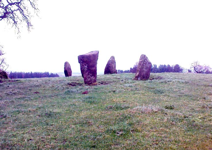
One of 4 hut circles in very good state of preservation

This small settlement was first found on 18 July, 2004, when a small group of us, in search of the troublesome Man Stone carving, were lucky to be on the moors shortly after the heather had been burnt back, amidst this archaeologically rich area of Askwith Moor, on the northern end of Hollin Tree Hill.

There were at least four hut circles found here (on the right of the track as you walk up the slope), with one in particular — the northernmost of the group — in a very good state of preservation.  This particular circle measured approximately 20 feet in diameter, with an entrance to the south side.  It is marked by a low earthfast boulder on the northeast side, visible even when the heather is deep.

Although we counted four such circles, it’s very likely that an intensive search would uncover more remains on this hillside.  In revisiting this site in October 2016, the heather had grown back over the entire complex and the circles were very difficult to see; but we were able to discern the one on the very top of the hill (the one in the photo).  The other hut circles, lower down the slopes, were notable only by zigzagging back and forth until we walked onto loose walling.

© Paul Bennett, The Northern Antiquarian

Nine Stones Close, Harthill, Derbyshire

Stone Circle:  OS Grid Reference – SK 2254 6264

Also Known as:

  1. Grey Ladies
  2. Hartle Moor Stone Circle

Getting Here

Nine Stones Close circle

From Bakewell take the A6 Matlock road, follow this till just past the signs for Haddon Hall where you take a right (the first major junction) for Youlgreave the B5056.  After about 1km take the first left over the bridge.  You then take the first right turn: a steep lane with restriction signs (don’t worry there’s access for cars but no wide vehicles). Take the first left you come to by the barn and then just follow the road, up through the woodland where the lane narrows then shortly after you’ll see Robin Hood’s Stride to your left.  Park a little way after the field gateway and look across the field to your left.  The stones are visible from the road.

Archaeology & History

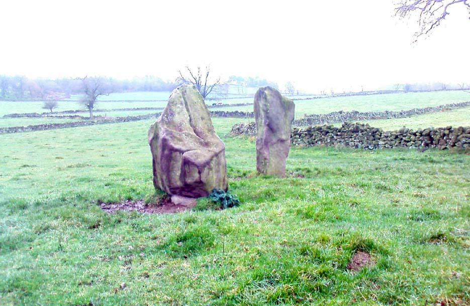
This is a fine-looking ring of stones — though perhaps the word ‘ring’ is slightly misleading here, as only four of (apparently) nine originals still remain and they are, by definition, more in a square-shape than a circle!  But it’s a lovely site.  When Geoff brought us here for the first time only last weekend, despite the dark clouds and cold grey day, along with the fact that we’d been sleeping rough the night before and got soaking wet through, there was a subtle feel to this place which my shivering senses still touched.  Only just though…!

Two southernmost stones

Mebbe it was the rising crags of Robin Hood’s Stride to its immediate south?  Or the quietly hidden companionship with other stones and sites in the locale?  I don’t really think so.  There was something a little more about its own genius loci that tingled very slightly on the rise in the field upon which the circle sits.  Some people would, perhaps, acquaint my sense of a subtle genius loci here to the various leys or ley-lines that have been drawn through here by other writers— but it wasn’t that.

When earlier writers came here, they too had various inspirations of differing forms.  John Barnatt’s (1978) early impressions of the place had him signing astronomical events in and around the remaining stones here, despite knowing that the site had been damaged.  In later years he revised his early notions — as most of us do as our perspectives are enriched — but the astronomy is still assumed here.  As Clive Ruggles (1999) told:

“Other rings are located where natural features coincide with astronomical events, such as Nine Stone Close in Derbyshire…from which the Moon at the southern major standstill limit, sets behind the gritstone crag of Robin Hood’s Stride to the SSW, between ‘two stubbly piles of boulders jutting up at either end of its flat top.'”

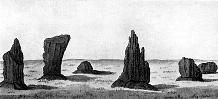
Major Rooke’s drawing of the Nine Stones Circle, c.1780

The stones that remain here are quite tall, between 6½ and 8 feet tall.  One of them seems to have originally been taken from a stream or river-bed.  They stand upon the small rise in the field and has diameters of 40 and 45 feet respectively.  Aubrey Burl described there being seven uprights still here in 1847, and the early drawing of the site near the end of the 18th century by Major Hayman Rooke highlights 6 stones around the spot where the circle now stands.  In J.P. Heathcote’s (1947) summary, he wrote that,

“Bateman, in his Vestiges, says an excavation in 1847 yielded some indications of interments in the form of ‘several fragments of imperfectly-baked pottery, accompanied by flint both in a natural and calcined state.’  In 1877, Llewellyn Jewitt and Canon Greenwell…turned their attention…to the Nine Stones.  They dug at the foot of the second highest stone and the Canon directed a good deal of digging within the circle, but nothing special turned up. The area in the circle is now quite level, but it is probable that there was, as Bateman says, a tumulus in the centre.”

This latter remark is the impression I got of the place.  Tis a really good little site.  All around here are a number of other sites: cup-marked stones, enclosures or settlements, prehistoric trackways, and more.

Folklore

One of the old names of this site was The Grey Ladies.  This came from the well known tale found at other sites across the world, that some ladies were dancing here at some late hour and were turned into stone.  A variation on this theme told how Robin Hood stood on the nearby rock outcrop to the south and pissed over the landscape here, “where seven maidens upon seeing it turned to stone.”  In this case, Robin Hood replaced an older, forgotten account of a giant, who forged the landscape and the sites around Harthill Moor.

Another tale — whose origins and nature are allied to that of the petrification of the Grey Ladies — narrated with considerable sincerity by local people, was that the circle was a place where the little people gathered and where, at certain times of the year, “fairy music and the sight of hundreds of dancing shapes around the stones” would happen.

Said by Rickman and Nown (1977) to be “Derbyshire’s most magical ancient site,” they thought the site was on a ley that linked up with Arbor Lowe, less than 5 miles west, crossing a couple of tumuli on its way.

References:

  1. Barnatt, John, Stone Circles of the Peak, Turnstone: London 1978.
  2. Burl, Aubrey, A Guide to the Stone Circles of Britain, Ireland and Brittany, Yale University Press 1995.
  3. Clarke, David, Ghosts and Legends of the Peak, Jarrold: Norwich 1991.
  4. Heathcote, J. Percy, Birchover – Its Prehistoric and Druidical Remains, Wilfrid Edwards: Chesterfield 1947.
  5. Rickman, Philip & Nown, Graham, Mysterious Derbyshire, Dalesman: Clapham 1977.
  6. Ruggles, Clive, Astronomy in Prehistoric Britain and Ireland, Yale University Press 1999.
  7. Thom, A., Thom, A.S. & Burl, Aubrey, Megalithic Rings, BAR: Oxford 1980.

© Paul Bennett, The Northern Antiquarian

St. Helen’s Well, Colne, Lancashire

Holy Well:  OS Grid Reference – SD 890 397

Getting Here

This site can be reached with relative ease from Colne’s train station by crossing the road and going up Bridge Street, turning immediately left along Shaw Street for several hundred yards until you reach Waterside Road on your left-hand side.  From here, as Mr Tom Sharples told, “St. Helen’s Well is presently within the area of overgrown and unmanaged scrub woodland adjacent to Waterside Road.”  Look around!

Archaeology & History

First described on the Megalithic Portal by the pseudonymous Brionnfhionn, this recently rediscovered holy well can be found on the southern side of Colne, at Waterside.  A few months after the MegPortal announcement, a more detailed overview of the site was published on GoogleDocs, from where Mr Tom Sharples has kindly allowed us to repeat the information that both he and Susan Bryant-Lauder compiled there.

The site was relocated after reference had been found in Geoff Crambie’s (1978) A Colne Festival, where he wrote:

“1935 saw the end of St. Helen’s Mill in Waterside.  Built by Nicholas England in 1835, it was named after the St. Helen’s Well nearby, which was reputed to have been named by the Romans.”

The local writer Dorothy Harrison (1988) also mentioned the site, though only in passing, when she told,

“Along with St. Helen’s Well, Buck Spout provided the main source of drinking water in Waterside.”

There has to be some more information about this little-known site hidden in some old Lancastrian history or folklore work, somewhere – surely!?

References:

  1. Crambie, Geoff, A Colne Festival, Turner & Earnshaw: 1978.
  2. Harrison, Dorothy (ed.), The History of Colne, Pendle Heritage Centre 1988.

© Paul Bennett, The Northern Antiquarian

Pitchfork Stone, Ilkley Moor, West Yorkshire

Cup-and-Ring Stone:  OS Grid Reference – SE 11496 46039

Also Known as:

  1. Carving no. 102 (Hedges)
  2. Carving no. 256 (Boughey & Vickerman)

Getting Here

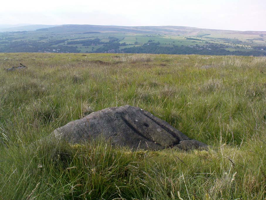
Pitchfork Stone, Ilkley Moor

Follow the directions for getting to the great Badger Stone carving.  From here, walk eastwards on the footpath for about 400 yards.  Hereabouts walk off the path and down the slope just a few yards and amble back and forth, checking the various stones. Keep doing this until you find it! (luckily, this stone’s marked on the OS-map)  There are several other reasonable carvings nearby on the same plain…the Green Gates Stone (or carving no.257) for one!

Archaeology & History

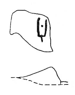
The Pitchfork Stone (after Hedges, 1986)

First found (or rather, recorded) by our old friend Stuart Feather and described in Bradford’s Cartwright Hall Archaeology Group’s Bulletin in 1961.  It’s status was all-but-secret until Hedges edited the Ilkley Archaeology Group’s Carved Rocks work in 1986.  The stone’s a simple design as the illustration shows: an urn-like vessel with a cup in the middle; but the attached groove at the bottom gave one anonymous chap (who dared to use the modern name of RombaldII!) the idea of it looking like a pitchfork – so the name sticks!

The enclosing “lines” that make up the pitchfork aspect of the carving are pretty enhanced (as we can see in the photograph here) and may, just may, be the result of a more recent petroglyphic artist.

References:

  1. Boughey, Keith & Vickerman, E.A., Prehistoric Rock Art of the West Riding, WYAS 2003.
  2. Feather, Stuart, ‘Mid-Wharfedale Cup-and-Ring Markings – Nos. 2 & 3, Ilkley Moor,’ in Bradford Cartwright Hall Archaeology Group Bulletin, 6, 1961.
  3. Hedges, John (ed.), The Carved Rocks on Rombalds Moor, WYMCC: Wakefield 1986.

© Paul Bennett, The Northern Antiquarian 

St. Lambert’s Well, Burneston, North Yorkshire

Holy Well:  OS Grid Reference – SE 3089 8496

Archaeology & History

The local historian, H.B. McCall (1910) described this ‘Saint Lambert’s fountain’, as it was first called, in his fine work on local churches, telling of its early description in the 12th century, saying:

“This is a very early mention of St. Lambert, the patron saint of the church and parish (of Burneston).  The fountain or well was probably situated in what is now the new portion of the churchyard, and the rivulet is now enclosed as a drain.  The name of the wapentake of Halikeld is said to be derived from St. Lambert’s Well at Burneston.”

I can find little else about these old healing waters.  Anyone got anymore info?

References:

  1. McCall, H.B., Richmondshire Churches, Elliott Stock: London 1910.

© Paul Bennett, The Northern Antiquarian 

St. Michael’s Well, Kirklington, North Yorkshire

Holy Well:  OS Grid Reference – SE 317 813

Getting Here

Having not been here, I can’t say for sure exactly where this forgotten site happens to live!  It may be the one shown on modern OS-maps, behind the old post office, on the west-side of the village, but I aint sure.  If any local people out there who can help us, we would be hugely grateful!

Archaeology & History

Not to be confused with the other St. Michael’s Well a few miles away in the village of Well, this is a little-known holy well that was described by the historian H.B. McCall (1910), who wrote:

“As Burneston had Saint Lambert’s Fountain, mentioned so early as the 12th Century, so Kirklington possesses its holy well, beside the old Mill House on the north side of the village.  Althoguh its name has now passed from the popular remembrance, it is provided in a lease of lands to Roger Croft, in 1628, that his cattle shall have right of access to go into the water near unto a spring called ‘Michaell-well’. both in winter and summer; and we are left in no doubt as to where the spring was situated, for Mrs Alice Thornton has recorded that her father brought water to the Hall in lead pipes from a cistern of the same metal, “near St. Michael’s Well near the mill-race.””

Does anyone know anything more of this all-but-forgotten site? 

A short distance to the north in the same village, another sacred water source known as the Lady Well can also be found.

References:

  1. McCall, H.B., Richmondshire Churches, Elliott Stock: London 1910.

© Paul Bennett, The Northern Antiquarian 

Druid’s Altar, Bordley, North Yorkshire

Ring Cairn:  OS Grid Reference – SD 94945 65270

Also Known as:

  1. Bordley Circle

Getting Here

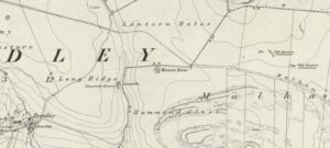
Druids Altar on 1852 map

From Threshfield, go up Skirethorns Lane for about 1/2 mile, where the lane takes a sharp right. Continue uphill for nearly 2 miles to a metal gate. Go through the gate, where you’ll see a pair of curious standing stones ahead of you, but instead walk about 250 yards along the line of the old field wall running to the west.  You’ll see on the modern OS-map that a ‘cairn’ is shown: this is where you’re heading!

Archaeology & History

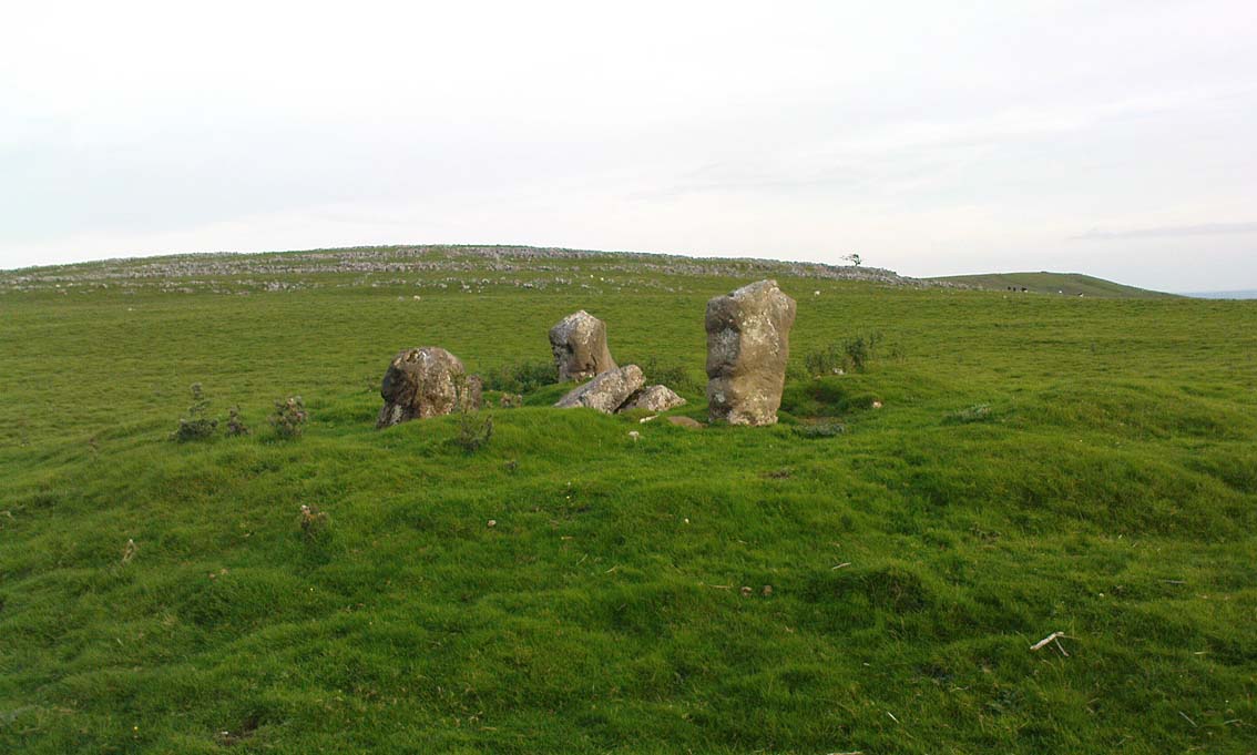
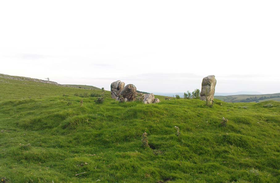
First highlighted on the 1852 OS-map of Bordley and district, this is a lovely site in a beautiful setting, surrounded by a veritable mass of other prehistoric remains at all quarters, including the large settlement of Hammond Close immediately south, the little-known settlement at Kealcup to the west, the Lantern Holes settlement up the hill immediately north, some standing stones due east, and much more.  Although it was described in Aubrey Burl’s Four Posters (1988) as just such a type of megalithic relic (a “four-poster stone circle”), an earlier description of the site from the mighty pen of Harry Speight (1892) told of a much more complete ring of stones, with trilithon to boot. He wrote:

“This prehistoric relic consists of a round stone and earthen mound, about 150 feet in circumference and 3 feet high, and was formerly surrounded by a circle of upright stones, only three of which are now left standing. On one side was a large flat stone resting upon two others, and known as the Druid’s Altar. On the adjoining land an ancient iron spear-head was found some years ago, and fragments of rudely-fashioned pottery have also from time to time turned up in the same neighbourhood.”

Edmund Bogg’s (1904) description following his own visit a few years later described this “remains of Druidical sacrifice” as consisting of,

“a mound some four feet high, and fifty yards round the outer rim. In the centre are two upright stones about four feet in length; and others nearly buried in the mound. Numerous stones from this circle have been used in building the adjoining walls.”

Bordley Circle, looking SE
Bordley Hill, looking south to Pendle Hill

A decade later another writer (Lewis 1914) merely copied what Speight and Bogg had recited previously. And whatever the modern books might tell of its status, I think we can safely assert that this was originally a much more substantial monument than the humble four-poster stone circle that meets our eye nowadays.  Our megalithic magus Aubrey Burl (1988) wrote the following on Bordley’s druidical stones:

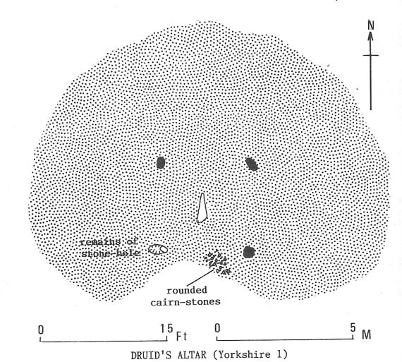
“On a circular mound 41ft (12.5m) across and 3ft (1m) high, three stones of local limestone form the corners of a rectangle 11ft 6in (3.5m) square, from which the SW stone is missing.  At its corner is ‘a stump, possibly the base of a prostrate stone,’ 5ft 10in (1.8m) long, now lying near the centre.  The tallest stone, 3ft 7in (1.1m) high is at the south-east.  The sides of the square are close to the cardinal points.  Between the SW and SE stones is a scatter of round cairnstones… Characteristically, the 4-Poster stands at the edge of a terrace from which the lands falls steeply to the west.”

Plan of the Druid's Altar (after Burl, 1988)
Plan of the Druid’s Altar (after Burl, 1988)

The Druid’s Altar seems to have originally been a large prehistoric tomb, perhaps even a chambered cairn.  Its situation in the landscape where it holds a circle of many outlying hills to attention, almost in the centre of them all, was evidently of some importance.  The only geographical ‘opening’ from here is to the south, where a long open valley widens to capture the grandeur of Pendle Hill, many miles away.  This would not have been insignificant.

We must also draw attention to what may be a secondary tumulus of similar size and form to the mound that the Druid’s Altar sits upon only some 25 yards to the west of the “circle”.  The shape and form of this second mound is similar to that of our Druid’s Circle — though to date, it seems that no archaeologist has paid attention to this secondary feature.  It measures some 21 yards (east-west) x 19 yards (north-south) in diameter and has the appearance of a tumulus or buried cairn.  The mound may be of a purely geological nature, but this cannot safely be asserted until the attention of the spade has been brought here.

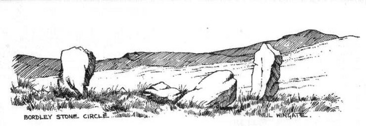
Druid's Altar, Bordley (drawing by Neil Wingate, 1976)
Druid’s Altar, Bordley (drawing by Neil Wingate, 1976)

Folklore

Although we have nothing directly associated with the circle, the surrounding hills here have long been known as the abode of faerie-folk.  Threshfield — in whose parish this circle lies — is renowned for it.  There have been accounts of curious light phenomena here too.  Modern alignment lore tells the site to be related to the peaked tomb above Seaty Hill, equinox west of here.

References:

  1. Bogg, Edmund, Higher Wharfeland, James Miles: Otley 1904.
  2. Burl, Aubrey, Four Posters: Bronze Age Stone Circles of Western Europe, BAR 195: Oxford 1988.
  3. Feather, S.W. & Manby, T.G., ‘Prehistoric Chambered Tombs of the Pennines,’ in Yorkshire Archaeological Journal, Vol 42, 1970.
  4. Lewis, A.L., ‘Standing Stones and Stone Circles in Yorkshire,’ in Man, no.83, 1914.
  5. Raistrick, Arthur, ‘The Bronze Age in West Yorkshire,’ in Yorkshire Archaeological Journal, Vol 29, 1929.
  6. Speight, Harry, The Craven and Northwest Yorkshire Highlands, Elliott Stock: London 1892.
  7. Wingate, Neil, Grassington and Wharfedale, Grassington 1977.

© Paul Bennett, The Northern Antiquarian

Morphing Stone, Dacre, North Yorkshire

Cup-and-Ring Stone:  OS Grid Reference – SE 18559 61795

Also known as:

  1. Snoopy Stone
  2. Eastwoods Rough Carving
  3. IAG 638a (Boughey)

Getting Here

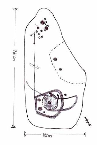
Mr Stroud's drawing of the stone
Mr Stroud’s drawing of the stone

Various ways to get here.  I s’ppose the easiest is from Dacre village.  If you go just past Sunny House, take the footpath on your right & walk along it, roughly straight across a number of fields, until you hit the footpath known as the Nidderdale Way.  The field you’re now in should be scattered with numerous rocks all over the place (if it aint, you’re in the wrong place), reaching down towards the trees.  Walk straight towards the trees for another 100 yards and the carving is somewhere hereabouts under your nose!  You’re very close! If, however, you decide to walk up the Nidderdale Way from Dacre Banks, the field you need is the one immediately to your right just before you reach the Monk Ing Road trackway.  The Tadpole Stone (or Eastwoods Rough II carving) is in the same field, close to the Nidderdale Way path — check that out aswell!

Archaeology & History

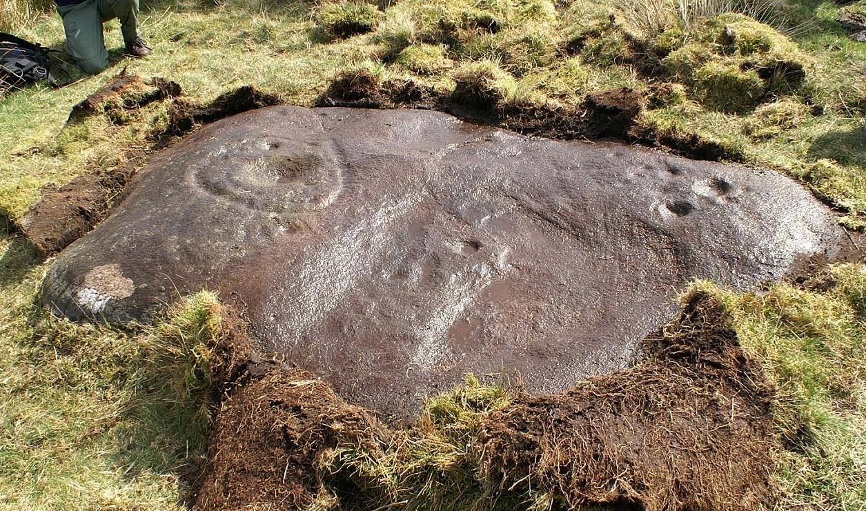
This is a large carving I found in April, 2006, in the company of rock-art student Richard Stroud (who sent us the pictures).  Twas in the midst of a fine day wandering about checking some of the ‘known’ sites in the area, when we happened across two or three previously unknown sites — and as the day wore on, just before we were gonna head for home, this little beauty poked the edge of its head out of the turf!  It had the pair of us in near rapture, with numerous “Wow’s” and excitable expletives coming from our mouths! We’re easily pleased us rock-art doods — but then it is a beauty when you first see it.

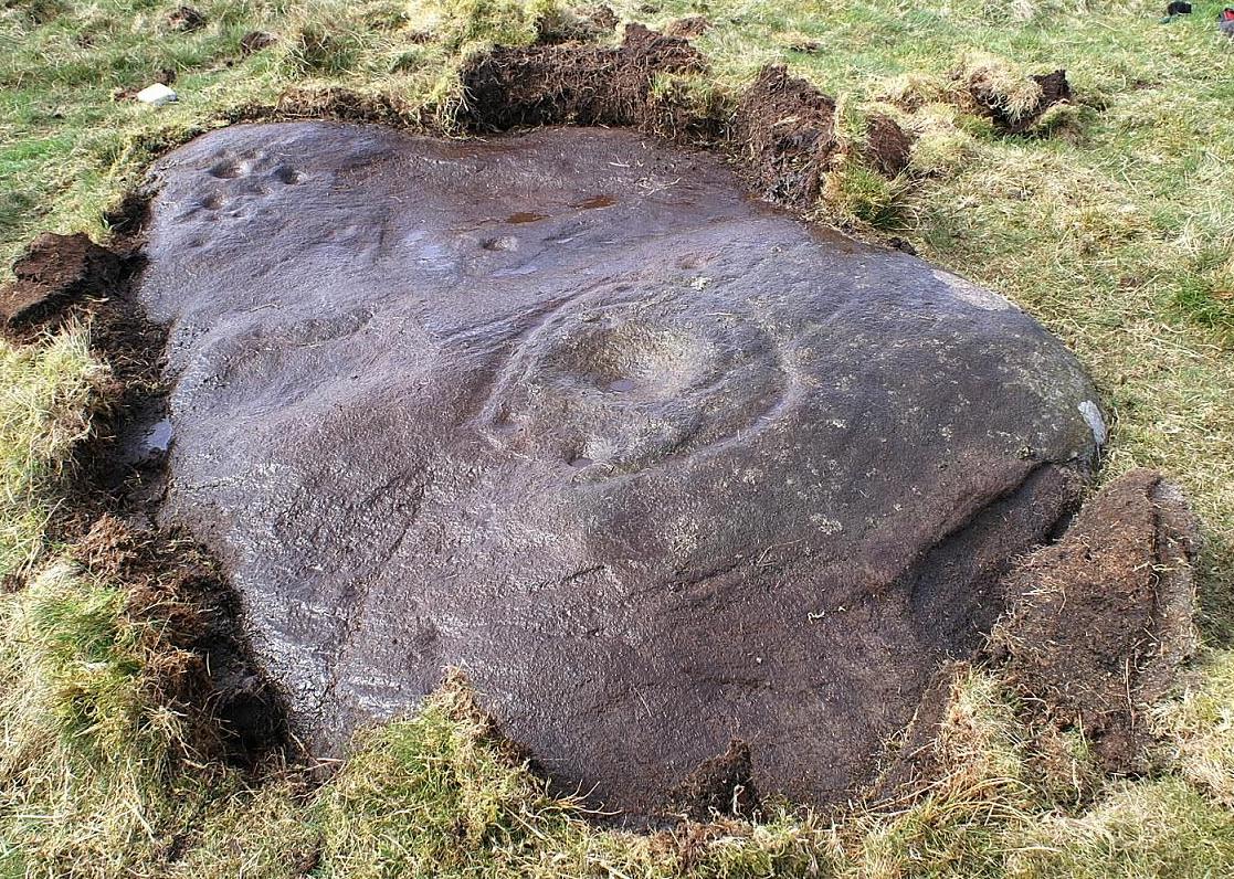
Morphing Stone carving (photo © Richard Stroud)
Morphing Stone, Dacre (photo © Richard Stroud)

We came here several times in the weeks following its initial discovery, and it seemed that on each visit, we found an additional aspect to the carving.  It seemed to keep changing each time we came here — hence the name ‘Morphing Stone’!

The prime feature in the carving is the very large oval-shaped ‘ring’ with huge carved bowl in the middle and several outlying cups-markings around it.  Although it’s not plain to see in the photos, there’s a large tongue-shaped protuberance jutting out from one side of the main ringed feature.  You can also see a small cluster of cup-marks on the top-right of the rock: from here — though it isn’t easy to see in the photo — a long straight line links up with the edge of the major central ring.  Other lines run off on the top of the main feature and there are several other cup-markings on different parts of the stone.  It’s obviously best to see the carving “in the flesh”, so to speak, to get a good impression of what it actually looks like.  And, to those of you who might wanna venture up here, there are several others nearby.

A year or two after rediscovering the carving, rock art student Keith Boughey (2007) described the stone, saying:

“Measuring 2.61m from N-S and 1.88m from W-E at its greatest extent, the carved surface carries quite a complex design… At its N end is a large cup/basin with an approximate diameter of 25-30cm, surrounded by a ring that may or may not be complete: 2 cups have been incorporated into the ring on its N and W side. W of this ring a groove leads off S to a further possible cup. On the E side of the large central cup are 3 further cups of varying size. These motifs are all enclosed within a wide groove, which forms almost a dome pattern. Out of the ring, a further groove runs NW out of the design, bisecting the enclosing groove, curving round to form a handle shape before running back in towards the large central cup. The groove shows signs of continuing E towards the edge of the stone. Just outside the W edge of the enclosing dome is one well-defined cup. S of this, in a slight depression, are 2 further cups of differing size. A straight groove appears to run SW out of the enclosing dome shape on its E side towards further motifs on the stone’s S side. The groove may run into an area of cup marks, but there appears to be a break before it continues. When exposed, the carvings looked quite fresh and sharp, suggesting that they had remained covered for some considerable time – possible since antiquity or at least from a time in the prehistoric past when cup-and-ring-markings had begun to lose their significance and were no longer required to be visible in the landscape.”

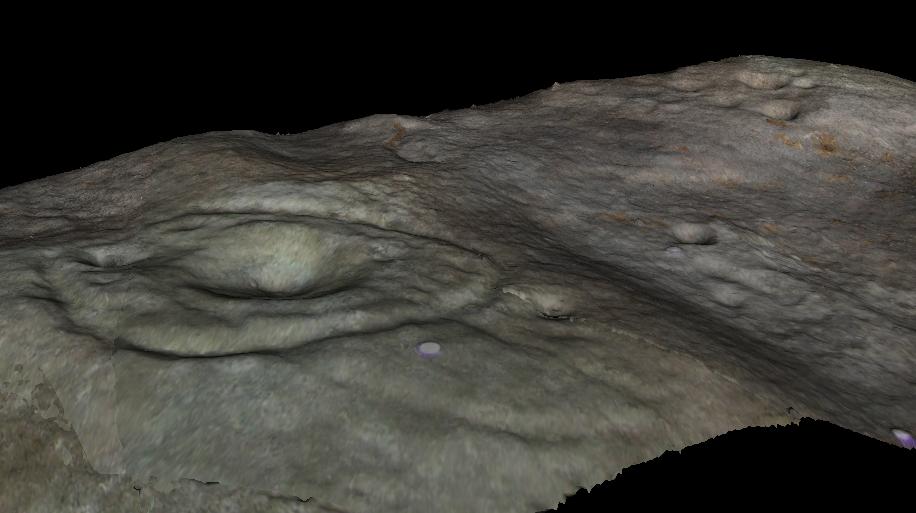
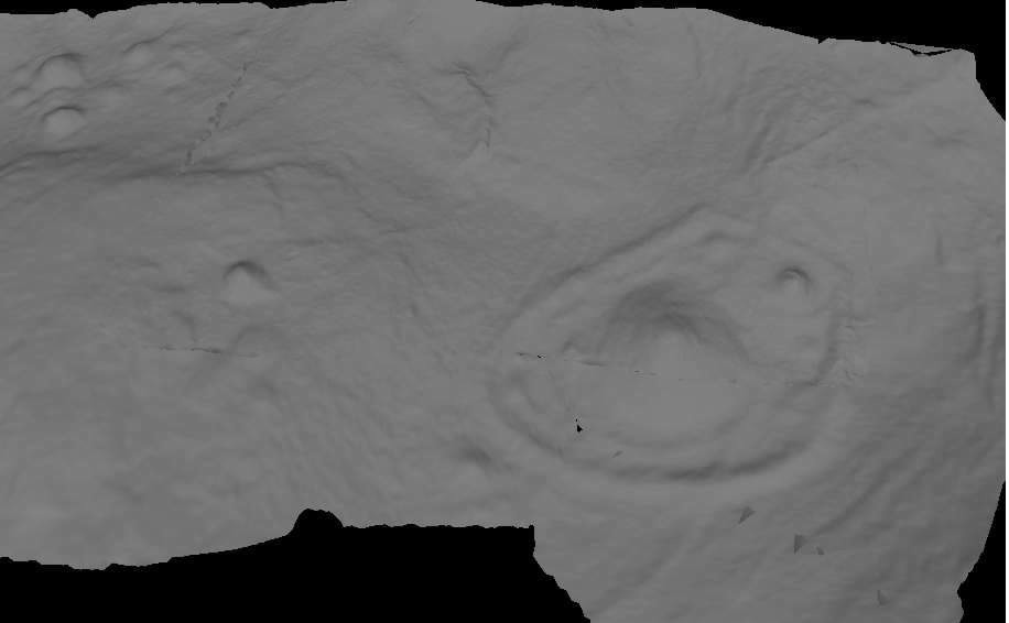
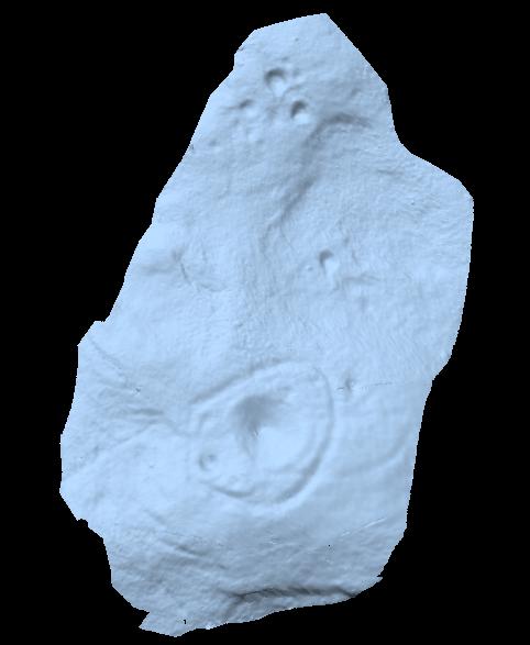
To those of you who like the new computer images of cup-and-rings, the three below are samples from a number of such images done after the stone had been discovered.  Intriguingly, the long line running between the cluster of cups to the large cup-and-ring doesn’t show up too well; but the barely perceptible line running out, zigzag-fashion, from the large central cup-and-ring, shows up much clearer than when looking with the naked eye.

                          Morphing Stone Nikon Morphing4
References:

  1. Boughey, K., “Prehistoric Rock Art: Four New Discoveries in Nidderdale,” in Prehistoric Research Section Bulletin, no.44, Yorkshire Archaeological Society 2007.

© Paul Bennett, The Northern Antiquarian