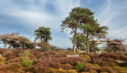
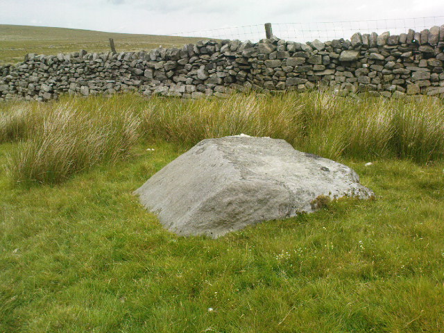
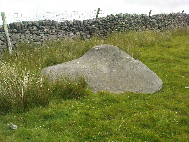
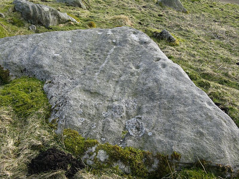
Raven Stones (east), Thruscross, North Yorkshire

Cup-Marked Stone:  OS Grid Reference – SE 12000 57932
Getting Here

Ravenstones (east)

Take the A59 road from Harrogate and Skipton and at the very top of the moors near the Gill Head Enclosures, take the small Kex Ghyll road up past the disused quarry works north for a mile or so. At the junction go left for about 1½ miles where, on your left, is Burnt House farm.  A hundred yards past here is a small spot to park on the right-hand side of the road, opposite the gate to Rocking Hall House (make sure you leave enough room for tractors to pass you!).  Across the road is the track to Rocking Hall and, 2 miles along the track, look out for the copse of trees ½-mile NE.  Head towards it and, as you get close to the wall, walk slowly downhill towards the stream where a single block of stone lives.  You’ll find it!

Archaeology & History
Design from above

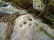
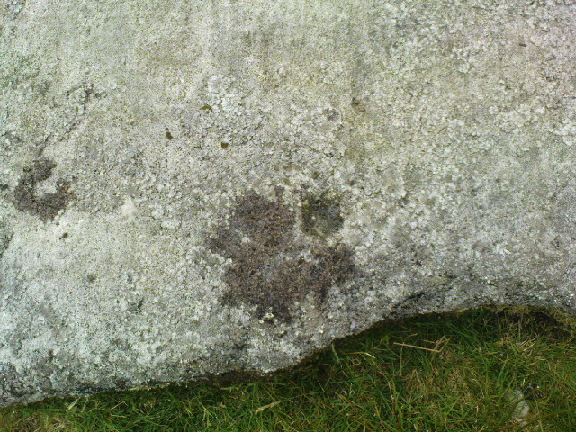
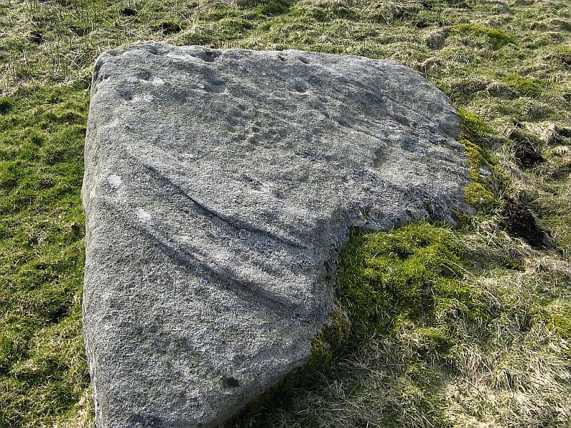
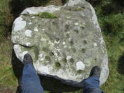
Rediscovered on Rocking Moor by Rod Chambers on August 15, 2023, this reasonably large sloping block of stone has between 21 and 24 cups cut quite deeply and scattered erratically into it, very similar to one some 200 yards to the northwest (Raven Stones carving 559).  It seems pretty obvious that some of these cups were Nature’s handiwork, but have been modified by human hands.   There’s nothing complex about it, but there may be a semi-circular arc around one of the cups, centre-left of the natural crack that cuts across the top of the stone, but this is very faint and could be just a trick of the eyes.  Going there at sunrise and wetting the stone might tell us for sure.

Acknowledgements:  Big thanks to Rod Chambers for use of his photo in this site profile.

© Paul BennettThe Northern Antiquarian

Raven Stones (562), Thruscross, North Yorkshire

Cup-Marked Stone: OS Grid Reference – SE 1194 5810

Getting Here

The Raven stone setting

Take the A59 road from Harrogate and Skipton and at the very top of the moors keep your eyes peeled for the small Kex Ghyll Road on your left(it’s easy to miss, so be diligent!).  It goes past some disused disused quarry and after a mile or so where you hit a junction, turn left, past the Outdoor Centre of West End and straight along Whit Moor Road.  About a mile past the Outdoor Centre go left down to Brays Croft Farm and over the ford, then keeping to the footpath up to the right (west) and note the clump of trees on the moors above you to the west.  That’s where you need to be.

Archaeology & History

Several of the cupmarks

Several natural basins that might have been worked in prehistoric times are accompanied by several distinct cup-marks near the middle-edge of the stone, in a rough triangular formation, with two others slightly more eroded a little further down the same side.  Boughey and Vickerman (2003) noted several other cupmarks on the rock, some distinct, some not so.

Adjacent to this carved stone is another naturally worn stone of some size, with incredibly curvaceous ripples over the top of the rock which, in all probability, possessed some animistic property to the people who carved this and other nearby carvings. Check the place out.  It’s a gorgeous setting!

References:

  1. Armstrong, Edward A., The Folklore of Birds, Collins: London 1958.
  2. Boughey, Keith & Vickerman, E.A., Prehistoric Rock Art of the West Riding, WYAS: Wakefield 2003.

© Paul BennettThe Northern Antiquarian 

Rocking Stone carving, Rocking Moor, North Yorkshire

Cup-and-Ring Stone:  OS Grid Reference – SE 11050 57852

Getting Here

Site shown on 1854 map

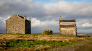
Visiting this site is a bittova walk across the moors, with probably the best route being along one of two footpaths from near the Outdoor Centre following (whichever is your preference) the moorland track or path westward onto the open landscape.  Tis a 2½ mile walk before you reach two large buildings stuck high up in the middle of nowhere.  Y’ can’t miss them.  Equally unmissable is the large blatant rocking stone between the buildings.  Gerron top of it!

Archaeology & History

Rocking Stone, in situ

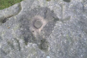
This impressive-looking rock that sits between the two buildings has a number of cup-markings of varying sizes across its topmost surface: some deep and some not-so-deep.  There are perhaps as many as 20 of them on different parts of the stone, but some have been intruded on by more recent graffiti.  On a recent visit to the site, photographer James Elkington and his young assistant MacKenzie, saw what looked like “a very faint ring around one of the cups” – which doesn’t surprise me.  On one section of the stone we see a fascinating series of natural curves and geological undulations, some of which may have been modified a long time ago when the cupmarks were etched.  But whether they were added to or not, it’s more than likely they’d have had some significance in the mythic nature of the rock.

The earliest description telling us that this possessed any prehistoric attributes seems to have been written by William Grainge (1871), in his huge work on the history of this region. He told that,

Faint ring highlighted
Some of the many cups

“This rock…is eleven feet in length, seven feet six inches in breadth, and two feet six inches in thickness.  The whole of the upper surface is thickly indented and grooved with cups and channels; the artificial character of which can be easily seen by anyone.  This logan rests upon a lower rock, the upper surface of which is about three feet above the ground, fourteen feet in length, and nearly the same in breadth.”

Folklore

Curvaceous nature & cups

Although this yummy-looking geological sight no longer rocks, it wasn’t always that way.  Indeed, according once more to the pen of Mr Grainge, although “it does not rock now, it has done so within living memory” – meaning that it would have been swaying at the beginning of the 19th century.  We can only take his word for it.  Also, as with many rocking stones the length and breadth of the land this, unsurprisingly it was adjudged to have been a place used by the druids.

References:

  1. Grainge, William, The History and Topography of Harrogate and the Forest of Knaresborough, John Russell Smith: London 1871.
  2. Tiernan, D., “King George V Visited in 1911,” on Teddy Tour Teas, 5 May, 2012.

Links:  

  1. Teddy Tour Teas

AcknowledgementsHuge thanks as always to James Elkington for use of his photos – as well as his partner in crime, Mackenzie Erichs.

© Paul BennettThe Northern Antiquarian


Raven Stones (559), Thruscross, North Yorkshire

Cup-Marked Stone:  OS Grid Reference – SE 11835 58006

Getting Here

Heavily cup-marked Raven Stone (after QDanT)

Take the A59 road from Harrogate and Skipton and at the very top of the moors near the Gill Head Enclosures, take the small Kex Ghyll road up past the disused quarry works north for a mile or so. At the junction go left, past the Outdoor Centre, thru West End up Whit Moor Road, then go left down to Brays Cross Farm and over the ford. Note the clump of trees on the moors to the west and take the path there. Once here, a large outcrop of rocks will be seen about 150 yards on the moor to the west. That’s the spot! Otherwise, follow the directions of the legendary wandering Teddy!

Archaeology & History

This dramatic looking outcrop of rocks rising out of the ground a half-mile due west of Bray farmhouse has long been known as the rocks of the ravens: oracular birds of ill-omen in all peasant traditions, yet carrier birds of shamans in their Underworld ventures, from accounts in Russia and Scandinavia, through the Scottish highlands and into Yorkshire’s northern hills, as folklore records show.  Whether such mythical figures used the Raven Stones here for such magick, we have no firm accounts; but the existence of the many cup-markings on this particular rock (and others in the outcrop) show that animistic traditions of some form or another occurred here in prehistoric times at the very least.

Looking across the stone
Looking down on the cups (after QDanT)

Records of this place as an archaeological spot are scant indeed.  It is passed with barely a mention by those Victorian antiquarian giants, Bogg, Grainge and Speight.  The rock art students Boughey & Vickerman (2003) give the wrong grid reference here, but added the site to their inventory, saying only that it is “long, low, exposed bedrock. 22-25 cups; some very weathered and smooth.”  A series of channels runs down the slope of the stone, but there are probably natural.  However, a cup-and-line does occur on the eastern side of the carving.

References:

  1. Armstrong, Edward A., The Folklore of Birds, Collins: London 1958.
  2. Boughey, Keith & Vickerman, E.A., Prehistoric Rock Art of the West Riding, WYAS: Wakefield 2003.

Links:  

  1. Teddy Tour Teas

Acknowledgements:  Huge thanks for QDanT & Teddy for the fine photos of the Raven Stone carving!

© Paul Bennett, The Northern Antiquarian 


Eller Edge (429), Pock Stones Moor, Thruscross, North Yorkshire

Cup-Marked Stone:  OS Grid Reference – SE 0902 6150

Also Known as:

  1. Carving no.429 (Boughey & Vickerman)
Eller Edge stone 429

Getting Here

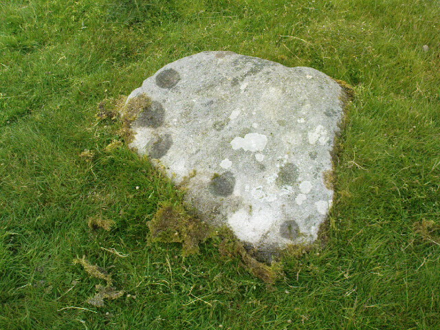
A slight walk to get here.  Follow the same directions as if you’re going to the Eller Edge 431 carving.  Once here, walk west as if you’re going into the middle of the field, keeping your eyes peeled about 20 yards along for a small-ish rounded stone with nice colours of lichen amidst the grasses.  If you’re patient, you’ll find it soon enough!

Archaeology & History

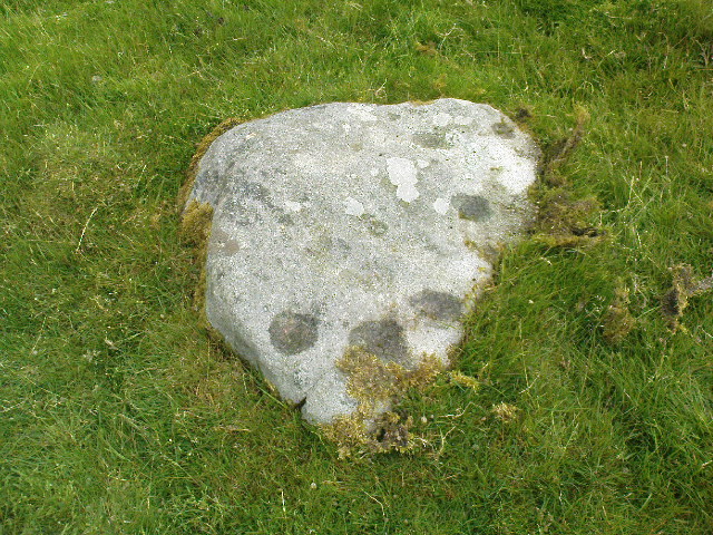
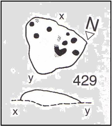
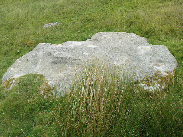
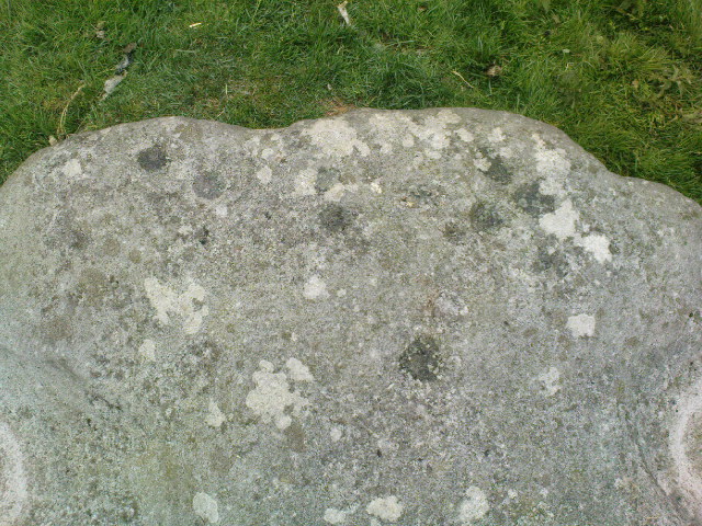
This is another simple cup-marked stone on the grassland ridge overlooking higher Wharfedale.  The carving here is a little clearer and more well-defined than that of its close neighbours, with a number of simple cups visible on its rounded surface.  We counted seven such cups on our cloudy-day visit, but Boughey & Vickerman (2003) thought there might be a little more, describing the stone simply:

from another angle
B & V’s drawing

“Small lichen-covered rough grit rock.  About eight cups and two depressions.”

A rubbing of this small stone (as practiced by English Heritage and rock art students alike) would prove useful in bringing out any other ingredients in the ancient design.  And whilst you’re in this field, have a look at the curious Spiral Stone and some of the other cup-markings close by.

References:

  1. Boughey, Keith & Vickerman, E.A., Prehistoric Rock Art of the West Riding, WYAS: Wakefield 2003.

Links:

  1. Eller Edge Rock Art – more notes & images

© Paul Bennett, The Northern Antiquarian


Eller Edge (424), Pock Stones Moor, Thruscross, North Yorkshire

Cup-Marked Stone:  OS Grid Reference – SE 08973 61487

Also Known as:

  1. Carving no.424 (Boughey & Vickerman)
Eller Edge carving 424

Archaeology & History

A slight walk to get here, but well worth it once you arrive!  Follow the same directions as if you’re going to the Eller Edge 426 carving.  Once you reach this stone, notice the larger rounded rock about 20 yards to your west, a bit further down the field.  You can’t really miss it!

Archaeology & History

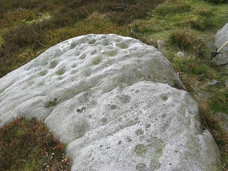
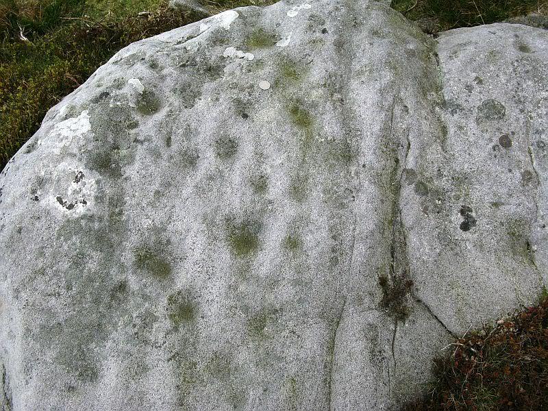
A large rounded stone just on the meadows before it begins to slope more steeply downhill, there are several of those large natural ‘bowls’ that we see on a lot of cup-marked and not-so-cup-marked stones in our northern hills.  These basins or bowls may, at times, may have had significance for our ancestors, but it’s the cluster of cup-markings on this stone which are of importance to us here.  There are perhaps as many as a dozen cup-marks here, all very well worn, and mostly to be seen on the eastern sides of the rock.  When I came here with Paul Hornby and QDanT a few months back, the cloud cover stayed with us all day, so I didn’t get any decent images of the carving.  Ne’er mind…

Close-up of faint cups

The stone was described by Boughey & Vickerman (2003) simply as:

“Very large, uneven, rough grit rock with face with scooped-out areas sloping down to grass.  Eleven possible cups and six basins.”

A plain carving, perhaps only of interest to the fanatics amongst you.  But if you do visit here, check out carving 432, 431, and others in the same field.

References:

  1. Boughey, Keith & Vickerman, E.A., Prehistoric Rock Art of the West Riding, WYAS: Wakefield 2003.

Links:

  1. Eller Edge Rock Art – more notes & images

© Paul Bennett, The Northern Antiquarian


Eller Edge (432), Pock Stones Moor, Thruscross, North Yorkshire

Cup-and-Ring Stone:  OS Grid Reference – SE 09078 61479

Also Known as:

  1. Carving no.432 (Boughey & Vickerman)
Carving 432, close to the wall

Getting Here

A slight walk to get here.  Follow the same directions as if you’re going to the Eller Edge 426 carving, but as you reach the field edge, walk up the slope (in the field itself) along the side of the wall.  You’ll pass rudimentary Carving 431 and about 30 yards further uphill this little fella will catch your eye!  You can’t really miss it.

Archaeology & History

Another basic cup-marked stone that’s probably only gonna be of interest to the purists amongst you.  A single cup-marking sits on the edge of a small patch of old dark lichen, although the rock art students Boughey & Vickerman (2003) reckon there could be another two on here—but I aint so sure misself.  The stone was described by them simply as:

“Medium-sized rectanguar rock of medium gritstone, with vertical edges except for finely striated sloping W side.  One cup near possibly quarried edge and perhaps two more.”

Single faint cup-mark

Another single cup-marked stone of the same size, type and quality as this one can be found on another stone not far from this stone, which aint in the Boughey & Vickerman survey.  There’s also evidence of ancient lines of walling close by, but with little surface clues as to its age.

References:

  1. Boughey, Keith & Vickerman, E.A., Prehistoric Rock Art of the West Riding, WYAS: Wakefield 2003.

Links:

  1. Eller Edge Rock Art – more notes & images

© Paul Bennett, The Northern Antiquarian


Eller Edge (431), Pock Stones Moor, Thruscross, North Yorkshire

Cup-Marked Stone:  OS Grid Reference – SE 09059 61506

Getting Here

From Appletreewick take the road east through Skyreholme and up Skyreholme Bank, bearing right at the fork in the tracks along the ancient Forest Road.  Keep going till you cross the Larnshaw Beck and keep walking along the track until it runs wallside.  Look over the wall and you’ll see this sloping-chair-shaped rock .  You’re here!

Cup-Marked stone 431

Archaeology & History

Worth looking at if you’re visiting the Spiral Stone of Eller Edge field and its large associate, but otherwise this cup-marked stone is probably only for the purist rock-art mad-folk amongst us!  There are what seem to be three decent cup-marks upon the sloping face of the rock here, with a possible pecked line to the side of two of them — though we have to consider the possibility that a geological condition is responsible for the easternmost cup.  Described in the Boughey & Vickerman (2003) survey simply as:

“Large triangular rock of smooth gritstone, quarried at SE and sloping into ground at W and N.  Three cups on top sloping face.”

Thirty yards up the slope along the wall-side you’ll find carving 432 with its single cup-marking.


References:

  1. Boughey, Keith & Vickerman, E.A., Prehistoric Rock Art of the West Riding, WYAS: Wakefield 2003.

Links:

  1. Eller Edge Rock Art – more notes & images

© Paul Bennett, The Northern Antiquarian


Eller Edge (426), Pock Stones Moor, Thruscross, North Yorkshire

Cup-and-Ring Stone:  OS Grid Reference – SE 08991 61486

Also Known as:

  1. Spiral Stone
Spiral Stone with cluster of cups (image © QDanT)

Getting Here

A slight walk to get here, but well worth it once you arrive!  From Appletreewick, take the road east through Skyreholme and up Skyreholme Bank track, bearing right at the fork in the tracks along the ancient Forest Road.  Keep going and after a couple of zigzags, you’ll cross the Larnshaw Beck.  Keep walking along the track until it runs wallside — and here, go straight down the field for 75 yards (best climbing over the rickety wooden bridge by the stream 50 yards back and walking up).  Although there are a number of other stones hereby, you can’t really miss this.

Archaeology & History

This carved stone and its close associates rest upon the green slopes overlooking the Blands Valley and further across upper Wharfedale and the lands beyond.  The majestic Simon’s Seat rises on the nearby western slope and there in the greater distance, once more reaches the sacred hill of Pendle, with whom so many other ancient sites commune within our northern lands.  It’s hard to say for sure that the Witch’s Hill was of little relevance to this and other stones, but only a fool would ignore the geomancer’s notes about this constant.

Eller Edge carving, looking south (image © QDanT)
Boughey & Vickerman’s drawing

The carving here doesn’t give much clues in any direct sense either.  We have an almost arrowhead-shaped rock with a dozen decent cup-marks or so cut along and near its western side; but the notable curiosity here is the small circular cluster of smaller cup-marks dotted in a near circular mass near the middle of the stone.

When Danny, Paul and I came here the other week, the initial impression of this cluster was one of a primitive solar symbol etched onto the rock; but the more we looked, the more it seemed that these small cups appeared to have been arranged in a very rough spiral lay-out.  Now I know that spirals are damn rare items in rock art (especially in this part of the world), but the more we looked and then subsequently checked Boughey & Vickerman’s (2003) illustration, the more evident it became.  Of course the ‘spiral’ could be merely fortuitous, but I’m not so sure misself.  In discussing this with our field archaeologist later, he suggested getting a rubbing of this part of the stone on his next visit.

The stone was first described by the petroglyph explorer Stuart Feather (1964) and later described by the rock art students Boughey & Vickerman (2004), simply as:

“Large, rough grit rock with face sloping SE down into grass at N.  About twenty cups to W, with three grooves at N corner and group of about twenty small cups at NE.”

A very intriguing carving.  And if you visit here, make sure you check out carving 424 and others in the same field.

References:

  1. Boughey, Keith & Vickerman, E.A., Prehistoric Rock Art of the West Riding, WYAS: Wakefield 2003.
  2. Feather, Stuart, “Appletreewick, WR,” in ‘Archaeological Register, 1963’, Yorkshire Archaeological Journal, volume 41, 1964.

Links:

  1. Eller Edge Rock Art – more notes & images

© Paul Bennett, The Northern Antiquarian