Carse Farm (south), Dull, Perthshire

Stone Circle:  OS Grid Reference – NN 8026 4847

Also Known as:

  1. Carse Farm II
  2. Tegarmuchd

Getting Here

Carse Farm Standing Stone

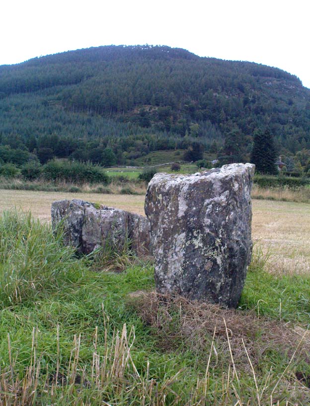
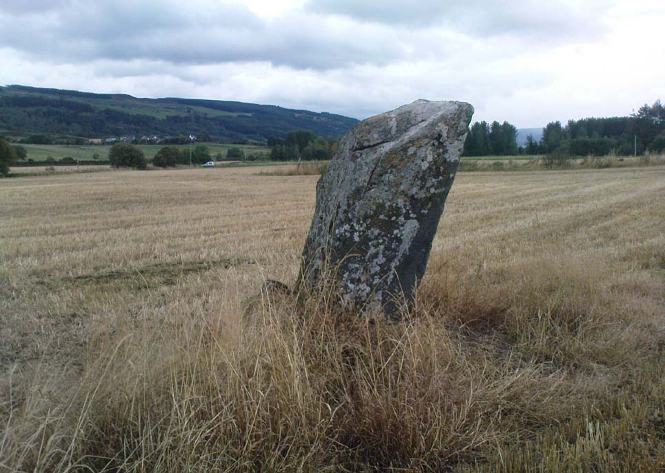
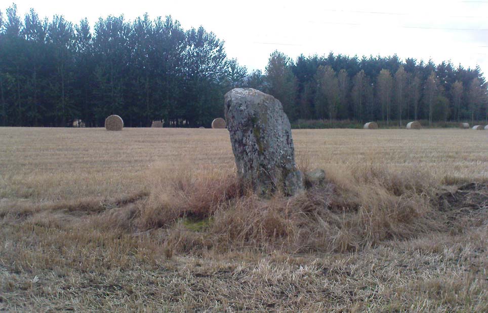
Pretty easy to find – assuming it aint at the height of summer and the crops are approaching maturity, otherwise you’re only gonna see its head!  But, this aside: from Aberfeldy, take the B846 road over the river bridge that bends you along the valley of the River Tay towards Appin of Dull.  After some 2 miles you’ll pass the right-turn up to Dull.  Go past this for another coupla hundred yards or so, watching out for the left-turn down towards the farmhouse of Carse and park up where you can (if you go past it, there’s the second turn up to Dull, again on your right, where you can turn round). As you walk down the track towards Carse Farm, watch out on your right in the field below Carse I, in the second field down.  You can’t really miss it. (and the farmer here is spot on if you ask to check the stone – as long as the crops aint growing)

Archaeology & History

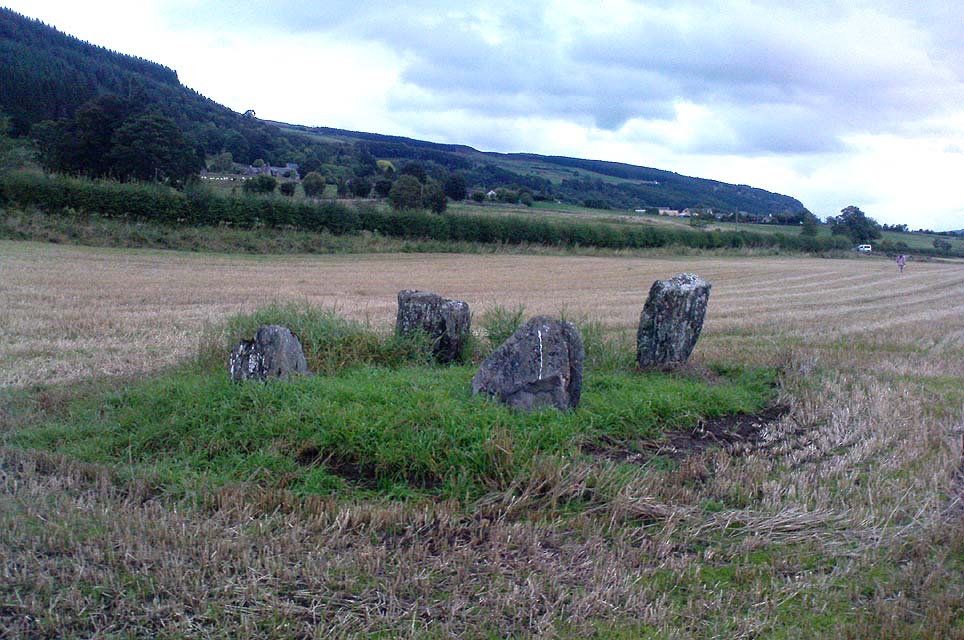
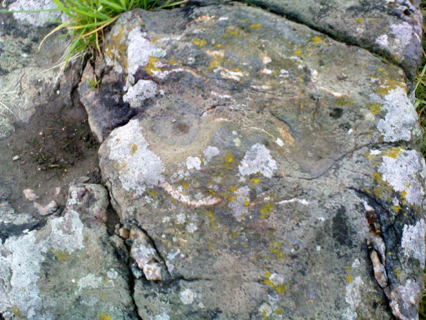
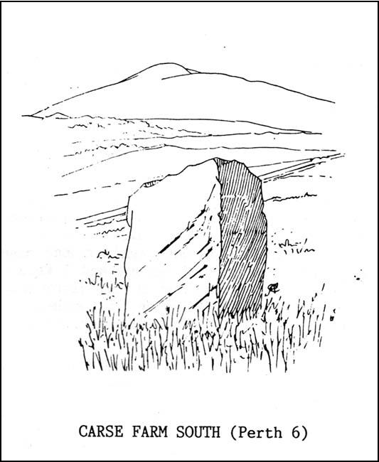
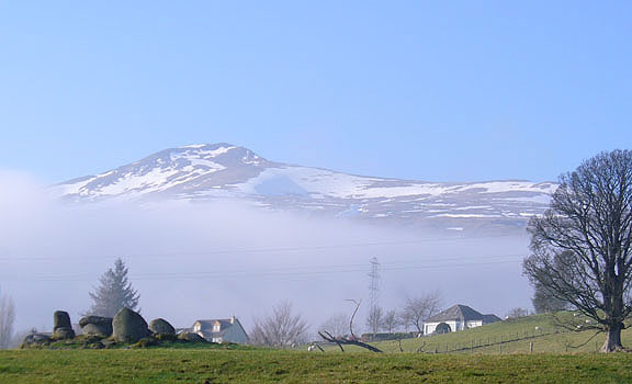
Although all that’s left of what is thought to have been a once proud stone circle is the singular upright standing stone in the middle of the field.  Aubrey Burl (1988) thought that this was one of the typical “four poster”rings that scatter our isles, but I’m not so sure misself.  There were other stones associated with the site when Burl described it, but these were covered over in our visit here a few months back — which is a pity, as two of the stones are reported as possessing cup-markings (if/when we revisit the site, I’ll try get some images of the respective stones and add them on TNA as individual carved stones).  The site gives the distinct impression of it having a funerary character of some sort and not a true stone circle — and this was strongly suggested by some of the finds inside the “ring”, described below.

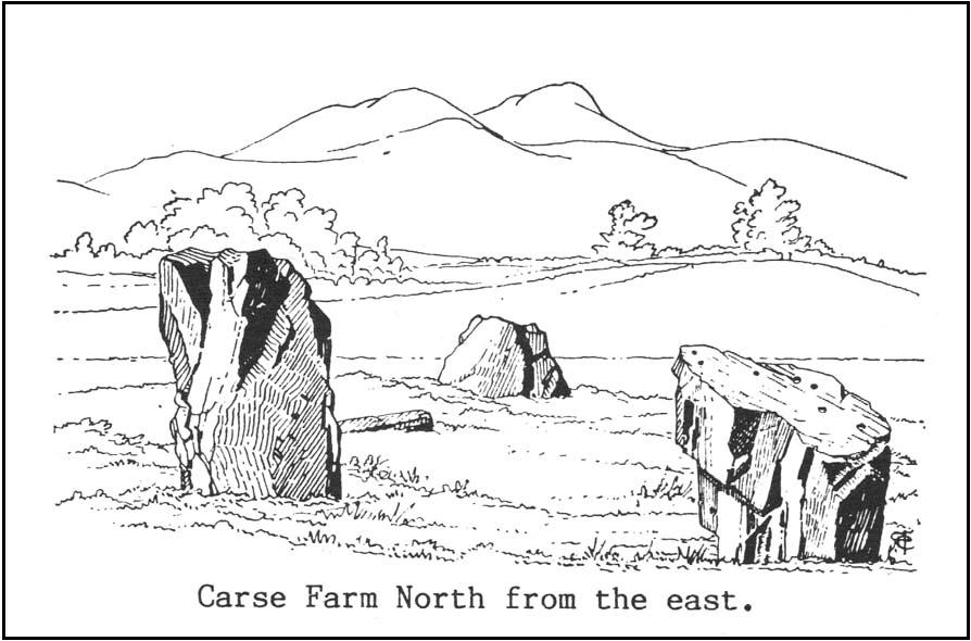
Fred Cole’s old drawing
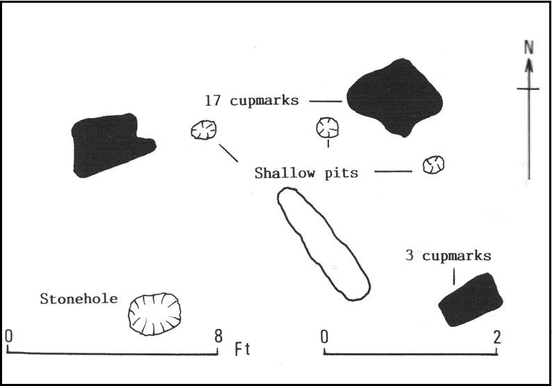
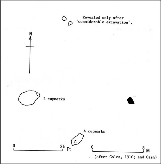
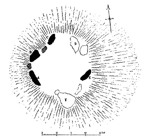
Aubrey Burl’s groundplan

Both this and its associated “circle” a few hundred yards away — known as Carse Farm north — sit on a flat level of ground in the Tay valley, with rounded hills all most sides.  This landscape setting was obviously of some importance to the people who put the circle here in the first place but, not living in the region, it’s difficult to assess the mythic relevance some of the hills will have obviously played in the siting of these stones.

In bygone days, it was reported that the much of the site was ploughed away due to agricultural excesses, so there was obviously much more to it in earlier centuries.  Describing the solitary stone that’s left today, along with the earlier excavation results, Mr Burl (1988) wrote:

“The stone still standing, of quartziferous schist, is 6ft 3in (1.9m) high.  Its longer faces are aligned NW-SE.  32ft 6in (9.9m) to its SW is a large prostate block, sub-elliptical and about 8ft long and 4ft 3in wide (2.4 x 1.3m).  It has probably fallen outwards. (my italics, PB)  If so, when standing near the top of its inner face were four cupmarks in a cross pattern.

“About 32ft ((9.8m) to its NW is a fallen and enormous schist slab, 11ft long and 5ft wide (3.4 x 1.5m).  It also appears to have toppled outwards.  Near the bottom of its inner face are two cupmarks.  The situation of these three stones suggests that they once stood at the corners of a rectangle some 32ft (9.8m) square, the pillars of a huge four-poster nearly six-times the national average and with an internal area ten times bigger than the small 4-poster (Carse Farm north, PB) just to its north.

“Excavation  in 1964 found the socket from which the great prostrate slab had been dragged… Cash (1911) had noted the presence of a small stone inside the ring about 20ft (6.1m) west of the standing stone.  It proved to be 4ft (1.2m) square with a carefull-dressed face.  It had been set upright, standing about 1ft 4in (41cm) above the ground.  Three sides of the worked face ‘had been carefully chiselled away to a straight edge.’ It may have been a slab lining the inner central space of a destroyed ring-cairn.  Burnt bone was found near it. There was also a rounded river pebble with a worked hollow on one side…”

Folklore

Carse Farm stone

Stewart (1964) described the site as having been “christianized” not long ago, by having the northernmost standing stone in the ring removed.  This is intriguing inasmuch as “north” is the place of greatest symbolic darkness in the pre-christian mythos, and represented death and illumination in magickal terms.  North was also the point taken by witches and shamans in their excursions into Underworlds, usually via the North Star, which tethered the Earth to the heavens (see Godwin’s Arktos [1993], and Grant, The Magical Revival [1973])  In the removal of this northern stone for the reasons given, that implies some magickal events or folklore were in evidence here when this took place.  Anyone got any further information along these lines, or has it long since been subsumed?

References:

  1. Burl, Aubrey, Four Posters: Bronze Age Stone Circles of Western Europe, BAR 195: Oxford 1988.
  2. Coles, Fred, “Report on Stone Circles Surveyed in Perthshire (Aberfeldy District),” in Proceedings of the Society of Antiquaries of Scotland, volume 44, 1910.
  3. Stewart, M.E.C., “Carse Farm 1 and 2,” in Discovery & Excavation, Scotland, 1964.

© Paul Bennett, The Northern Antiquarian


Murlaganmore, Killin, Perthshire

Cup-Marked Stone:  OS Grid Reference – NN 5402 3455

Also Known as:

  1. Morlagganmore

Getting Here

Murlaganmore02
Murlaganmore stone & setting

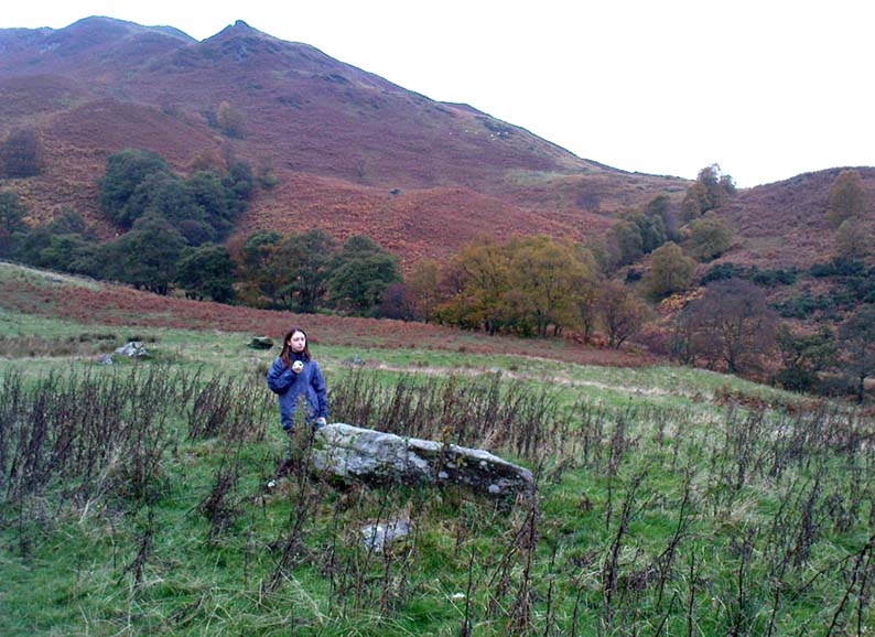
From Killin, take the Glen Lochay Road past the Moirlanich Longhouse, but keep on for another mile, and take the track on the left up to Murlaganmore cottages.  As the track turns right of the tree-line, cross the field (left) up towards the open gate as if you’re going to the Murlaganmore 2 carving, where you’ll see this large flattish rock in the grasses about 100 yards before it.

Archaeology & History

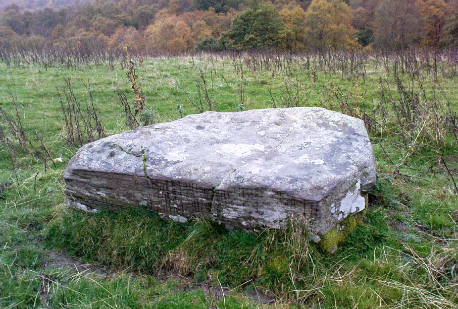
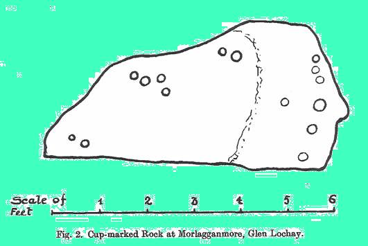
When we visited this old boulder last week, we had the misfortune of grey days and dark clouds throwing their faded light across this cup-marked rock, not really letting us see with any clarity the many cups which pepper (mainly) the edges of the rock.  But the cups are faded anyway, so accounts tell, and the 15 which we counted were same 15 recorded about 100 years ago in C.G. Cash’s (1912) survey.  There, he described this old stone as,

“about 200 yards south of the house, in the middle of the uppermost pasture. It is a large block of quartz schist stuck thick with garnets, and bearing fifteen cup-marks, only one of which — 3 inch in diameter and 1 inch deep — is really well defined, and several of which are faint.”

Murlaganmore03
Faint cups barely visible
Murlaganmore01
C.G. Cash’s early drawing

But despite the grey day (She was absolutely teeming with rain half of the time!), I found the setting here absolutely gorgeous, with the many shades of old trees and the clear blood of pure waters falling through the landscape.  And, without doubt, there are other carved stones nearby that have yet to capture the attention of surveyors.  You can smell them!

References:

  1. Cash, C.G., ‘Archaeological Gleanings from Killin,’ in PSAS 46, 1911-12.
  2. Royal Commission on Ancient & Historical Monuments, Scotland, The Archaeological Sites and Monuments of Stirling District, RCAHMS: Edinburgh 1979.

© Paul Bennett, The Northern Antiquarian


Creag na Cailleach, Killin, Perthshire

Sacred Mountain:  OS Grid Reference – NN 5640 3715

Also known as:

  1. Creag na Caillich

Getting Here

Another silly-sounding directional pointer!  Get to the now tourist-infested town of Killin (best in Winter, when the town is quiet and you get to know the locals a lot better) and travel through it as if you’re going to follow Loch Tay up its western side.  As you’re going out of the village towards the Bridge of Lochay Hotel (an excellent place), you’ll see an amphitheatre of mountains in the background.  The tallest of the hills on the left is where you’re heading.  Go straight up the hillside and follow your nose!

Creag na Cailleach, Perthshire
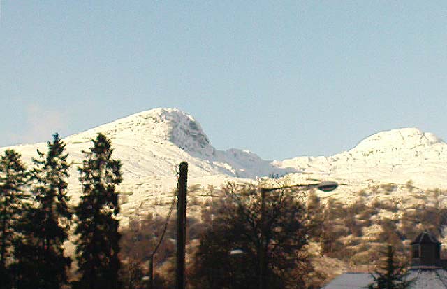
Creag na Cailleach, Killin

The hill guards the entrance to the legendary Glen Lochay (Valley of the Black Goddess).  There are many ways to climb her, but my first venture here took me up the waterfalls and steepish burn of Allt na Ceardaich.  Once on the level, I found myself surrounded by that amphitheatre I mentioned, from which – on my first visit – I took up the sheer face of this great mountain. (to be honest it’s nowt special if you’re into mountaineering and stuff) From the tops you’ve got a damn good view all round.  But respect this old hill, as danger awakens to idiots who would think themselves champions.

Folklore

Here, where axes were quarried by ancient man from beneath Her rocky slopes, this ‘Hill of the Old Woman’, or ‘Hag’, was one of the abodes of the primal Mother Goddess in olden times, so says her name.  Her ‘dark’ aspect seemed manifest one time when I climbed her with a rather stupid man in tow.  Following one of the streams back into the valley below, he thought it wise to copy my gazelle-nature as I sprang without thought, quickly, from rock to rock, bouncing at speed down the fast-flowing stream  (which takes a lotta weird practice and very strong ankles!), in spite of the advice to do otherwise – and in doing so he broke his leg in three places and, to make it worse, had to spend the night there in complete agony!

Don’t tell me there’s no ‘dark’ goddess to some of these great places!

Axe production has been found to have occurred as early as 2500 BC.  There have been numerous flint finds hereabouts aswell – but considering this is a mountain, you’d expect to find something on or about Her slopes!

I’ve just been back up here as the first good snow fell upon the hills and the white cover brought the elements out of her form in a way I’d not seen before.  Tis a wonderful place the Creag na Cailleach; and, it seems, a site that played a now forgotten part in the ancient name of the glen, Lochay, which was the living abode of the Black Goddess in more archaic days.  Twouldst be good to hear some of the authentic old stories from old locals that were once known of this ancient deity in the glens.  If anyone knows of such tales, let us know before they are lost forever…

References:

  1. Ritchie, P.R., ‘The Stone Implement Trade in Third Millenium Scotland,’ in Coles & Simpson’s, Studies in Ancient Europe, Leicester University Press 1968.

Acknowledgements:  Huge thanks to Lindsay Campbell for her hospitality, food and roof hereby.

© Paul Bennett, The Northern Antiquarian


Machuim, Lawers, Loch Tay, Perthshire

Stone Circle:  OS Grid Reference – NN 68201 40156

Also Known as:

  • Lawer’s Mill

Getting Here

From the north-end of Loch Tay at Kenmore, follow the road (A827) round down the lochside, through the village of Fearnan and then another 4 miles down.  If you park up at the pub at Lawers, walk back up the road for ½-mile, keeping your eyes peeled up the slope on the left where you’ll see the circle visible from the road.

Archaeology & History

Much has been said of this fine old place – also known as Lawer’s Mill – which seems to have been first described by Thomas Pennant in his rambling Tour in Scotland (1772).  The local writer William A. Gillies (1938) told that after

“a recent examination of the ground around the circle…suggests that at one time there was an outer circle of stones concentric with the existing one. Most of the stones were removed in order to make more of the field available for cultivation, but there are still large stones buried within a few inches of the surface.”

Folklore

In J. McDiarmid’s Folklore of Breadalbane (1910) he tells of a man from Killin who, on passing by this old circle, heard haunting fairy music.  Being inquisitive, he walked up to see what was going on and walked into the circle where the little people were playing.  He was obviously lucky and the faerie-folk enjoyed his company, for when he left he was given the gift of a strong, fast, white steed.

Solar folklore may be…?

References:

  1. Gillies, William A., In Famed Breadalbane, Munro Press: Perth 1938.

© Paul Bennett, The Northern Antiquarian


Clach-na-Cruich, Fearnan, Perthshire

Cup-Marked Rock:  OS grid reference – NN 71868 44743

Also known as:

  1. Canmore ID 25037
  2. Clach-na-Gruich
  3. St. Ciaran’s Seat
  4. Measles Stone

Getting Here

Pretty easy to get to.  It’s in one of the fields above the old farmhouse of Boreland on the western edge of Fearnan, a couple of hundred yards away on the other side of the road from the Clach an Tuirc.

Archaeology & History

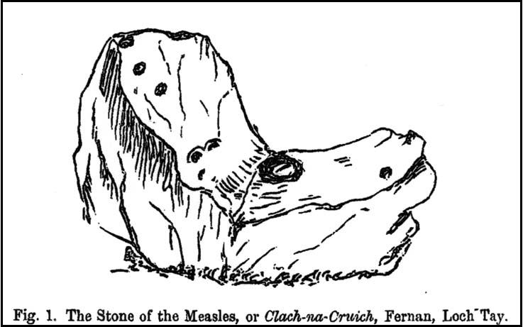
Clach-na-Cruich in 1884

In the field we find this great chair-shaped boulder with a great ‘bowl’ on it where the seating section is, and on its top and sides are a few cup-markings — MacMillan (1884) noted seven of them, two of which had half-rings around them, “associated together in a singular manner, and forming a figure like the eyes of a pair of spectacles.”

Folklore

Regarded in local legends to be an ancient initiation seat, this was taken over and ordained as being the seat of St. Ciaran at some time when the Celtic church started having influence up here.

The ‘seat’ of this great stone regularly fills up with rainwater and was, wrote William A. Gillies, “regarded as an effectual cure for measles, and there are persons still residing at Fearnan who were taken as children to drink from the water in the hollow of Clach-na-Gruich, the Measles Stone.”  His lengthy account of the site told:

“In the district of Breadalbane, Perthshire – which has in it the Pool of St Fillans, famous for its supposed power of curing mentally afflicted persons – there are two boulders with water-filled cavities, which have a local reputation for their healing virtues. One is at Fernan, situated on the north side of Loch Tay, about three miles from Kenmore. It is a large rough stone with an irregular outline, somewhat like a rude chair, in the middle of a field immediately below the farmhouse of Mr Campbell, Borland. The rest of the field is ploughed; but the spot on which it stands is carefully preserved as an oasis amid the furrows. The material of which it is composed is a coarse clay slate; and the stone has evidently been a boulder transported to the spot from a considerable distance.

“In the centre on one side there is a deep square cavity capable of holding about two quarts of water. I found it nearly full, although the weather had been unusually dry for several weeks previously. There were some clods of earth around it, and a few small stones and a quantity of rubbish in the cavity itself, which defiled the water. This I carefully scooped out, and found the cavity showing unmistakeable evidence of being artificial. On the upper surface of the stone I also discovered seven faint cup-marks, very much weather-worn; two of them associated together in a singular manner, and forming a figure like the eyes of a pair of spectacles.

“The boulder goes in the locality by the name of Clach-na-Cruich, or the Stone of the Measles; and the rain-water contained in its cavity, when drunk by the patient, was supposed to be a sovereign remedy for that disease. At one time it had a wide reputation, and persons afflicted with the disease came from all parts of the district to drink its water. Indeed, there are many persons still alive who were taken in their youth, when suffering from this infantile disease, to the stone at Fernan; and I have met a man not much past forty, who remembers distinctly having drunk the water in the cavity when suffering from measles.

“It is is only within the lifetime of the present generation that the Clach-na-Cruich has fallen into disuse. I am not sure, indeed, whether any one has resorted to it within the last thirty years. Its neglected state would seem to indicate that all faith in it had for many years been abandoned.”

References:

  1. Gillies, William A., In Famed Breadalbane, Munro Press: Perth 1938.
  2. MacMillan, Hugh, ‘Notice of Two Boulders having Rain-Filled Cavities on the Shores of Loch Tay, Formerly Associated with the Cure of Disease,’ in PSAS 18, 1884.

© Paul Bennett, The Northern Antiquarian