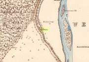
From Blairgowrie, take the A93 north road, ensuring that when you reach the Bridge of Cally after 5½ miles (9km), you take the right-turn up Glenshee (the Valley of the Faerie folk) and not the A924 Strathardle road. After about 5 miles, turn right up the small lane to Blacklunans after, once you’ve weaved past the River Shee and started uphill, a few hundred yards on keep yer eyes peeled on the fields to your left. If you hit the Glenshee EcoCamp, you’ve gone too far.
Archaeology & History
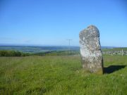
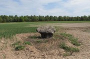
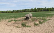
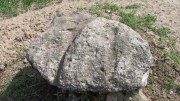
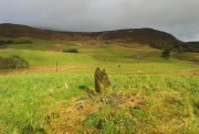
Borland Stone, looking west
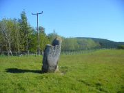
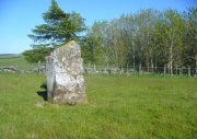
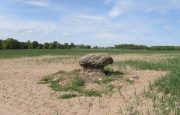
This small, out-of-the-way standing stone is set amidst a small mass of rounded stones—as if once part of a cairn—at the top of a small hillock that can easily be passed by if your nose isn’t working properly. Curiously isolated, the monolith seems more of an outlier to the Mount Blair hills immediately north and east; or perhaps the large settlement less than a mile south.
Very little seems to have been said about the stone, in literary terms at least. The Royal Commission (1990) lads merely told us that,
“This stone, which stands on the summit of a prominent knoll 300m SE of Borland farmhouse, measures 0.7m by 0.3m at the base and 1m in height.”
Stone aligned NNE to Tom Bealaidh
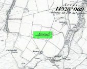
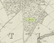
Nowt else! Although the stone was marked on the early 1900 OS-map, the small mass of loose stones at its base are more recently-worked than anything prehistoric and may simply be field clearance. The monolith itself could do with assessment to positively ensure its prehistoric veracity.
References:
Meikle, James, Places and Place-Names around Alyth, Alexander Gardner: Paisley 1925.
Royal Commission on the Ancient & Historical Monuments of Scotland, North-East Perth: An Archaeological Landscape, HMSO: Edinburgh 1990.
From Kenmore village on the north-side of the river, over the bridge, take the small road on your right towards Dull. After a very short distance the road runs alongside the woodland for nearly 1½ miles until, on your left, you’ll reach Drummond Cottage. Across from here a dirt-track takes you into the trees. Barely 100 yards along, watch for the overgrown path that runs down the slope on your left. At the bottom a small stream has several feeds – one of which is surrounded by a ring of bright quartz stones.
Archaeology & History
Shown on the early Ordnance Survey maps as An Tobar (meaing simply “a well”), this somewhat nondescript title betrays a much more colourful folk history, albeit dissolved by those common culprits of Church and disrespectful incomers (which shows little sign of diminishing).
Lara by the Well
Close-up of quartz surround
In the field immediately south, back up the slope above the well and through the trees, was once an ancient church whose existence has all but vanished. Hereby was held an ancient fair known as Feill nam Bann Naohm, or the Fair of the Holy Women, named after a group of nuns whose lived here, who William Gillies (1938) and others proclaim were the legendary Nine Maidens, whose dedications at wells, trees and other sites scatter Scotland. But the fair was ended in 1575 and moved to Kenmore; then, several years later in 1579, the church also moved onto Eilean nam Ban Naomh (NN 7664 4536) on Loch Tay.
The old well however, after being left by the descendants of the Holy Women or Nine Maidens, continued to be frequented by local people. Gillies (1938) wrote:
“The Holy Well of Inchadney is situated at the foot of the terrace, about five hundred yards to the north of the churchyard… Up to the middle of last century the well used to be visited by great numbers of people on the morning of Bealtuinn, the first day of May.”
In Ruth & Frank Morris’ survey (1981) they told how the site had become much overgrown and,
“The well was cleaned out in 1914 and among articles found was a stone 21 inches by 16 inches, with a rude St Andrew’s cross scratched on it, a George III farthing among other copper coins, a rudely made stone cup 2½ inches high and 7 inches in diameter, three metal buttons, a glass bead and six pins.”
No such offerings seemed in evidence when we visited a few weeks ago; but we were told that people are still seen visiting the well.
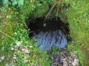
Looking into the pure waters
A small stone-laid footpath runs towards the adjacent burn from the circular well, which is almost completely surrounded by large quartz rocks. In the well itself was a small fish, showing how clean the waters are—or as would be deemed in times of olde: a ‘guardian’ of the waters.
We must also make note of the fact that, just two fields away to the north, according to the antiquarian Fred Coles (1910), a stone circle was once in evidence. This old well sat neatly between the sites of megalithic ring and church.
Folklore
In the field in front of the well, Hilary Wheather (1982) told that there once lived a legendary water bull, but she lamented on his passing. With the coming of the modern-folks and their unnatural ways,
“and having great timber lorries rumbling past your home every day is no fun for a peace-loving waterbull living in Poll Tairbh, the Bull’s Pool opposite the Holy Well. Gone are the days when he was the revered Spirit of the Meadow, passed with trembling and fear by all the young maids of the Parish lest he should jump out and carry them off to his watery lair. Half the calves of the area were sired by him and it was always easily seen which cow had the attentions of the Great Waterbull. Her calf was always the biggest and the best. But he hasn’t been seen by his pool for many a year…”
The waters are cited by Geoff Holder (2006) to be good for toothache.
Cup-and Ring Stone (destroyed): OS Grid Reference – NO 143 430
Archaeology & History
In John MacDonald’s History of Blairgowrie (1899), he describes a number of the prehistoric sites in the neighbourhood, including the cup-marked standing stone at nearby Glenballoch. However, one petroglyph that seems to have escaped the attention of all previous surveys was, “one unearthed in 1897 at Aikenhead,” southeast of Blairgowrie. Mr MacDonald described it as possessing “a large number” of cup markings “of various sizes.” But even in his day he reported that the carving had, “unfortunately, been destroyed.”
I can find no other references to this site. Is anyone aware of any, or know anything more about this lost stone?
References:
MacDonald, John A.R., The History of Blairgowrie, Advertiser: Blairgowrie 1899.
Standing Stone (destroyed): OS Grid Reference – NO 486 339?
Archaeology & History
The only reference I can find about this site is in A.J. Warden’s (1880) massive survey of the county of Angus—previously called ‘Forfarshire’—where, in his discussion of the hillforts of the area, he told us that,
“About a quarter of a mile distant from The Laws is the Gallow Hill of Ethiebeaton. In a field, a little to the south, there formerly stood a large upright stone called Tods Stone.”
All trace of it disappeared when quarrying operations were undertaken there, also destroying a number of prehistoric tombs close by. The monolith may have had some association with the tombs, but we cannot be certain.
The name of the stone,tods, probably derives from the word ‘foxes’, although we cannot be certain of this either, as there are a variety of other Scottish dialect words relating to ‘tod’that may have had bearing on the name.
If anyone has any further information about this long lost site, we would gladly welcome it.
References:
Grant, William (ed.), The Scottish National Dictionary – volume 9, SNDA: Edinburgh 1973.
Warden, Alex J., Angus or Forfarshire – volume 1, Charles Alexander: Dundee 1880.
One in a cluster of at least seven souterrains that could once be found to the east of Alyth, this was first described in notes by David Whyte in the 1845 New Statistical Account as being “about a mile to the south” of those at Barns of Airlie. Although Whyte told that the two places “are separated by a deep hollow but are within view of each other,” the explorer F.T. Wainwright (1963) was unable to locate the precise spot, despite several visits. Three earlier writers (Anderson, Jervise and Warden) merely echoed notes of there being a cluster of sites hereby and made no personal explorations of their own. Without the expertise of local people, the exact status of this underground chamber remains unknown…
Royal Commission of Ancient & Historicc Monuments, Scotland, The Archaeological Sites and Monuments of Scotland: Central Angus, RCAHMS: Edinburgh 1983.
Wainwright, F T., The Souterrains of Southern Pictland, RKP: London 1963.
This was one amongst a good cluster of souterrains that existed hereby, remains of which may still exist beneath the ground. It was rediscovered in the 19th century through a series of most curious events—owing more to the local belief in spirits and witches than any archaeological rationale. Mr A. Jervise (1864) told the story in his essay on Airlie parish:
“The circumstances which led to the discovery of one of these weems is curious. Local story says, that the wife of a poor cottar could not for long understand why, whatever sort of fuel she burned, no ashes were left upon the hearth; and if a pin or any similar article was dropt at the fireside, it could not be recovered. Having “a bakin” of bannocks, or oatmeal cakes, on some occasion, one of the cakes accidentally slipped from off “the toaster,” and passed from the poor woman’s sight! This was more than she was prepared for; and, believing that the house was bewitched, she alarmed her neighbours, who collected in great numbers, and, as may be supposed, after many surmises and grave deliberation, they resolved to pull down the house! This was actually done: still the mystery remained unsolved, until one lad, more courageous and intelligent than the rest, looking attentively about the floor, observed a long narrow crevice at the hearth. Sounding the spot, and believing the place to be hollow, he set to work and had the flag lifted, when the fact was disclosed, that the luckless cottage had been built right over an “eirde” house. The disappearance of ashes, and the occasional loss of small articles of household use, were thus satisfactorily accounted for; but, unfortunately, although the site of this weem remains, as well as that of another near the same place, both were long ago destroyed, and the materials of which they were constructed used for a variety of utilitarian purposes.”
Or to put it simply: right beneath the fireplace, a small opening into the souterrain below appeared, into which all things fell. F.T. Wainwright (1963) placed the position of the site “about 100 feet east of the road between Barns of Airlie and Brae of Airlie, about 200 yards from the former.” On the 1865 OS-map, this spot is marked with a small unnamed building. No excavation has ever been tried here
There are no remains left of this old ‘weem’, earth-house, or souterrain as they are now commonly known. It was one of at least seven separate souterrains beneath the fields between the Barns of Airlie and Brae of Airlie, but very little is now known of this one. The first and only real note of the site was given in Mr A. Jervise’s (1864) essay on the antiquities of Airlie parish. Nearly a hundred years later when F.T. Wainwright (1963) went to investigate any possible remains, he found very little, telling:
“A possible location for Airlie III…presented itself on 24 June, 1951, when Mr D.B. Taylor and I noticed a considerable number of boulders and slabs cast up in the field which lies over the wall from the entrance to Airlie I (souterrain). The farmer was aware that there was a heavy concentration of stones spread over an area of two or three thousand square feet, but he could add no further information. In 1951 we were not able to do more than record this possibly significant scatter of stones—it lies between 150 and 200 feet west from the present entrance of Airlie I on a bearing of 260º—and to note that it could very well indicate a souterrain settlement.”
Most of the scattered stone was subsequently removed for use in walling and no trace remains of the place.
Follow the same directions for the Croft Moraig stone Circle. Then check out the largest of the fallen or elongated stones on the northwest side of the ring, with a smoothed sloping surface, just at the side of the overgrown stone platform on which it rests. Y’ can’t really miss it.
Archaeology & History
When William Gillies (1938) wrote about the carvings at the Croft Moraig stone circle, he told how, previously, Fred Coles,
“noticed that several of the upright stones…show cup-markings on their perpendicular surfaces. Some of these are quite distinct, but others are so worn through weathering that they can only be traced with the fingers.”
This is one of them. Barely visible at the best of times, the cup-markings are faded and very hard to see unless daylight conditions are just right. As you can see in the photos, several distinct cup-like impressions are visible, but it only appears that two of them are cup-marks. The others seem to be more geophysical in nature – but I’d love to be wrong!
The great northern Antiquarian Fred Coles (1910) noted that this particular stone (stone D in his ground-plan of the circle) had “been polished by the sliding of generations of children”. This playful action on stones elsewhere in the UK and around the world sometimes relates to fertility rites (i.e., the spirit of the stone could imbue increased fertility upon the practitioner), but Mr Coles made no mention of such rituals here.
Gillies, William A., In Famed Breadalbane, Munro Press: Perth 1938.
Yellowlees, Sonia, Cupmarked Stones in Strathtay, Scotland Magazine: Edinburgh 2004.
Acknowledgements: Many thanks to hardcore crew for our various visits here: to Paul Hornby, Lisa Samson, Fraser Harrick, James Elkington, Penny & Thea Sinclair.
At Kirkton of Airlie, park next to the church and walk north eastwards along the track, past the houses ‘Crabra’ and ‘Cleikheim’ and the spring that once supplied the Holy Well will be seen on the opposite side of the burn in a small fenced off enclosure. To the north east of the enclosure is a small hillock known as St Medan’s Knowe.
Archaeology & History
According to the Ordnance Survey Name Books, St Madden’s Well was located in a hamlet called St Maddens, which has since been almost entirely destroyed. In the mid nineteenth century a number of stone coffins and pottery were recovered from around the site, and the well was described as,
“filled up and defaced, the spring…still to be seen issuing into the mouth of a covered drain that was made some few years ago”.
There are now two issues of water from the spring, while nothing now remains of the original well housing. An adjoining resident informed me that the local landowner had gone to some trouble to try to find any evidence of the well housing, but had found nothing.
As is often the case with these early mediaeval Scottish saints there is some confusion as to St Madden’s identity. To some writers his Saint’s day is accepted to be April 29th, and he has been identified as Saint Middanus, abbot of the monastery of Holywood, but Bishop Alexander Forbes considers he is more likely to have been a Bishop Medanach listed in the Dunkeld Litany.
To confuse things even more, J.M. MacKinlay (1904) wrote:
“The Hamlet of St Madden’s or St Medan’s in the parish of Airlie, where are also St Medan’s Well and St Medan’s Knowe, probably retains the name of St Modan, believed to have been a contemporary of St. Ronan. Skene says: ‘Modan appears in the Scotch calendars as an abbot on the fourth February, and as a bishop on the fourteenth November; but the dedications to him are so much mixed up together that it is probable that the same Modan is meant for both'”.
Andrew Jervise provides the following quote about St Medan:
“..bishop and confessor whose feast is held on 14th November was in great favour with King Conran c.503 – Coll. for Aberdeen and Banff.”
Whosoever St Madden was, his quadrangular bell was the subject of an extant fifteenth century deed whereby the bell with its appurtenant parcel of land was granted to the Countess of Moray as dewar (hereditary keeper of a Holy Relic with appurtenant land), together with “the infeftment being completed by (the Countess) being shut up in a house and then receiving the feudal symbols of earth and stone.” On the death and subsequent disposal of the estate of the last dewar in the nineteenth century, the bell was sold along with a load of rubbish, its true identity and value not being realised at the time.
References:
Andrew Jervise, The History and Traditions of the Land of the Lindsays, Edinburgh, Sutherland & Knox 1853.
Andrew Jervise, Epitaphs and Inscriptions from Burial Grounds and Old Buildings inthe North East of Scotland, Edinburgh, Edmonston and Douglas 1875.
James Murray MacKinlay, Influence of the Pre-Reformation church on Scottish Place-Names, Edinburgh and London, William Blackwood and Sons 1904.
Dom Michael Barrett, A Calendar of Scottish Saints, Fort Augustus 1919.
Bishop Alexander Forbes, Kalendars of Scottish Saints, Edinburgh, Edmonston and Douglas 1872.
Scotland’s Place Names
Andrew Jervise, Notice of Antiquities in the Parish of Airlie, Forfarshire, in Proceedings of the Society of Antiquaries of Scotland, June 1864
From Kenmore, take the minor road on the south-side of Loch Tay for 1½ miles (2.4km) until you reach the hamlet of Acharn. From here take the track uphill for ½-mile past the Acharn waterfalls and follow the same route to the Acharn Burn tumulus. Walk past here along the track and, just before you reach the wooded burn, bear right and walk uphill for nearly another half-mile, roughly parallel to the Allt Mhucaidh (Remony Burn). As you reach the proper moorland, you’ll see the stones rising up!
Archaeology & History
This is quite a spectacular site! Not for the size of the stones or the arrangement of the megaliths, but for the setting! It’s outstanding! When a bunch of us wandered up here a few months ago, snow was still on the peaks and Nature was giving us a real mix of Her colours and breath in a very changeable part of Her season. Twas gorgeous. Perhaps the setting was the thing which has kept the circle pretty quiet until recent years. It’s high up – and out of season the freezing winds and driving rains would keep all but the healthiest of crazy-folk away. We all only wished we’d have had more time here. But that aside…
Along with the changeable weather She gives up here, the literary-types have given this circle changeable names too. Nowadays known as the Acharn Falls stone circle, in truth that’s a mile away and lacks in both visual and geographical accuracy. ‘Greenland’ was the name cited when J.B. MacKenzie (1909) wrote about it more than a hundred years back, and it’s the name we find in Mr Burl’s (2000) magnum opus, despite him telling how “a local name for it is Auchliacha, ‘the field of stones'” (Burl 1995), so perhaps we should adhere to what the locals say (my preference generally).
The ring is in quite a mess, having had a drystone wall built through it in the last 100 years. No walling is shown on the early Ordnance Survey maps, so some local land-owners (an english incomer?) was probably responsible. The stones used to stand in parts of the ancient forest, which must have looked and felt quite something before they ripped the trees away. It was hiding away in the woods when J.B. MacKenzie (1909) came here, shortly after the “modern wall” as he called it, had been constructed through the circle. He wrote:
“Six stones remain on the site, of which four are still erect and in position, and two are prostrate, one of which has apparently fallen inwards and the other outwards of the line of the circle, the diameter of which, touching the inner sides of the stones still standing, is 27 feet 9 inches. Mr MacLeod has supplied the following dimensions of the several stones:
A — 6 feet 9 inches x 3 feet 6 inches, lying flat
B — 8 feet 4 inches, in circumference at ground level
——1 foot 7 inches, high above the ground level
C — 6 feet 10 inches, in circumference at ground level
——4 feet 0 inches, high above ground level
D — 6 feet 0 inches, in circumference at ground level
——4 feet 3 inches, high above ground level
E — 7 feet 8 inches x 4 feet 6 inches, lying flat
F — 9 feet 0 inches, in circumference at ground level
——5 feet 8 inches, high above ground level.”
The year after MacKenzie’s notes, the great Fred Coles (1910) paid a visit here. Noting how high it was in the landscape compared to other megalithic rings in the region (it’s the highest known circle, at 1240 feet up), he went on to give his usual detailed appraisal, telling:
“In a little clearing amid these woods on Craggan Odhar, but disfigured by a dike which separates some of the Stones from the others, stands this Greenland Circle of which the ground-plan is given…. The Stones are six in number, of which four are erect, and they all appear to be of the quartzitic schist. Some disturbance has occurred, and it seems probable that there were at least two more Stones originally, one between B and C at the spot marked with a cross, and the other similarly marked midway between D and E. There is, however, no vestige of any Standing Stone in the sides of the dike itself.
“On the south-west is Stone A, the tallest, with pointed top, 5 feet 7 inches in height, oblong in contour, and measuring at the base 9 feet 5 inches. Having several deep horizontal fissures, this Stone…bears an odd resemblance to masonry. The next Stone, B, lies prostrate, measuring 7 feet 9 inches by 4 feet, and about 1 foot in thickness above ground. The little oblong Stone, C, on the other side of the dike, stands only 1 foot 10 inches above ground, and probably is a mere fragment—the stump of a much larger block. At D the Stone is 4 feet 3 inches in height, and is a very narrow slab-like piece; Stone E, which has a decided lean over towards the interior of the Circle, is 4 feet 2 inches high, and is in basal girth 6 feet 6 inches. Like the others, it is angular and thinnish in proportion to its breadth. Stone F measures 8 feet 2 inches by 5 feet 2 inches, and its position, with the narrow end resting almost on the circumference, suggests, as in other cases, the probability that it was this narrow end which was buried when the Stone was erected. These blocks were most likely brought from the low cliffy ledges near, for, as the name ‘Craggan Odhar’ implies, the place was, before being planted, conspicuous for its Grey Crags.”
Although no modern excavation has taken place, when the brilliant local historian William Gillies (1925) first got round to exploring the circle, he remedied that situation. In probing the ground beneath the surface when the weather conditions allowed, Mr Gillies found that there seemed to have been more standing stones in the circle than presently meets the eye. He wrote:
“I paid several visits last summer to this lonely and elevated spot, and examined the ground for stones, where the wide spaces between those indicated on the plan (see Coles’ 1910 drawing, above) suggested that others might be concealed beneath the turf. There would appear to be three stones missing, which would make the circle to consist of nine in all when it was entire. With little trouble, at a depth of only 3 inches, I located a large flat stone measuring 5 feet 6 inches by 4 feet 8 inches. It had stood on the north-western arc of the circle half-way between the fallen stone on the west and the broken standing stone on the north-north-west. It had fallen outwards. The foundation of the wall, built probably some seventy years ago to enclose the plantation, rested on the edge of the stone. The ground along the circumference of the circle between the three stones on the eastern side was carefully probed, but the rod touched only small loose stones.
“I next turned up the centre of the circle, and at a depth of 5 inches below the surface came upon a dark deposit. It extended over a space of 2 feet square and was about 5 inches in depth. It was mixed with a white limy substance consisting of calcined bones, bits of which along with a sample of the dark substance I brought to the Museum. A bit of charcoal from the deposit revealed the lines of cleavage in the wood. There is no peat at the spot, although the elevation, which is at least 1200 feet, might suggest it. The surrounding soil is of a reddish colour, and quite unlike the deposit which must have been placed there, and which was probably a burial after cremation.”
Gillies was exemplary in his exploration of sites that were on the verge of disappearing from tongue and text and we remain incredibly grateful for his later exposition on the antiquarian remains and legends of this truly stunning landscape. In Aubrey Burl’s (1995; 2000) respective summaries of this stone circle, as well as that of John Barnatt (1989), they ascribe the situation of it originally having 9 stones, as Gillies suggested.
Visit this site! If you’re into megaliths, you’ll bloody love it!
References:
Barnatt, John, Stone Circles of Britain – volume 2, BAR: Oxford 1989.
Burl, Aubrey, A Guide to the Stone Circles of Britain, Ireland and Brittany, Yale University Press 1995.
Burl, Aubrey, The Stone Circles of Britain, Ireland and Brittany, Yale University Press 2000.
Money, Bob, Scottish Rambles – Corners of Perthshire, Perth 1990.
Acknowledgements: Many thanks to the unholy bunch who helped travel, locate, photograph and take notes on the day of our visit here, including Aisha, Lara & Leo Domleo; Lisa & Fraser; Nina and Paul. Let’s do it again and check out the unrecorded stuff up there next time!