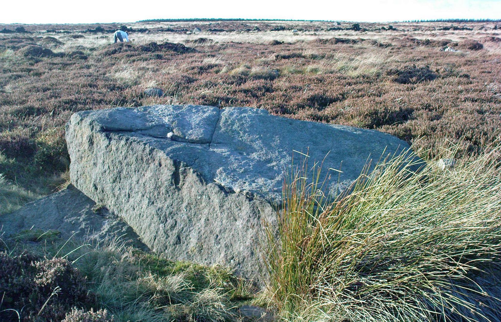
From East Morton, head up the winding Street Lane for just over a mile until, on your right-hand side, you hit the long straight Roman Road, or Ilkley Road as it’s known. Literally 690 yards (0.63km) up, on your left a footpath is signposted. Take the path alongside the wall, through the first gate (note the pile of stones at this gate, which are the remains of the destroyed Bradup stone circle) then keeping on for ⅓-mile till you reach another gate, then 200 yards to the next one where you reach the moorland proper. From here you need to walk through the heather, just over 300 yards southwest where you’ll reach this large rock. Y’ can’t miss it!
Archaeology & History
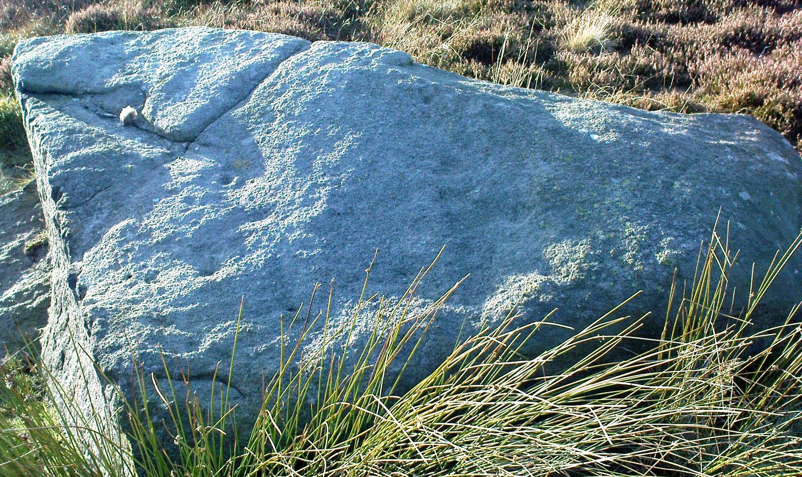
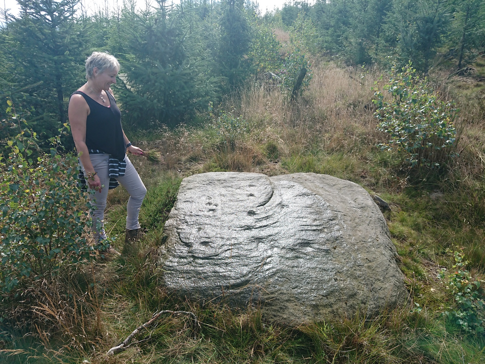
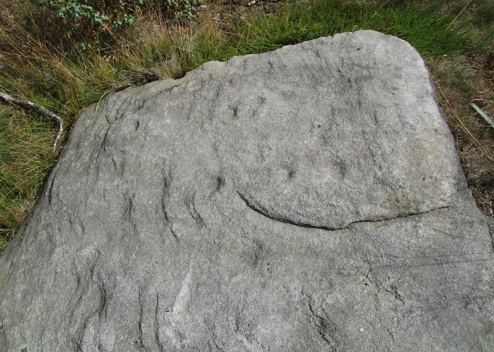
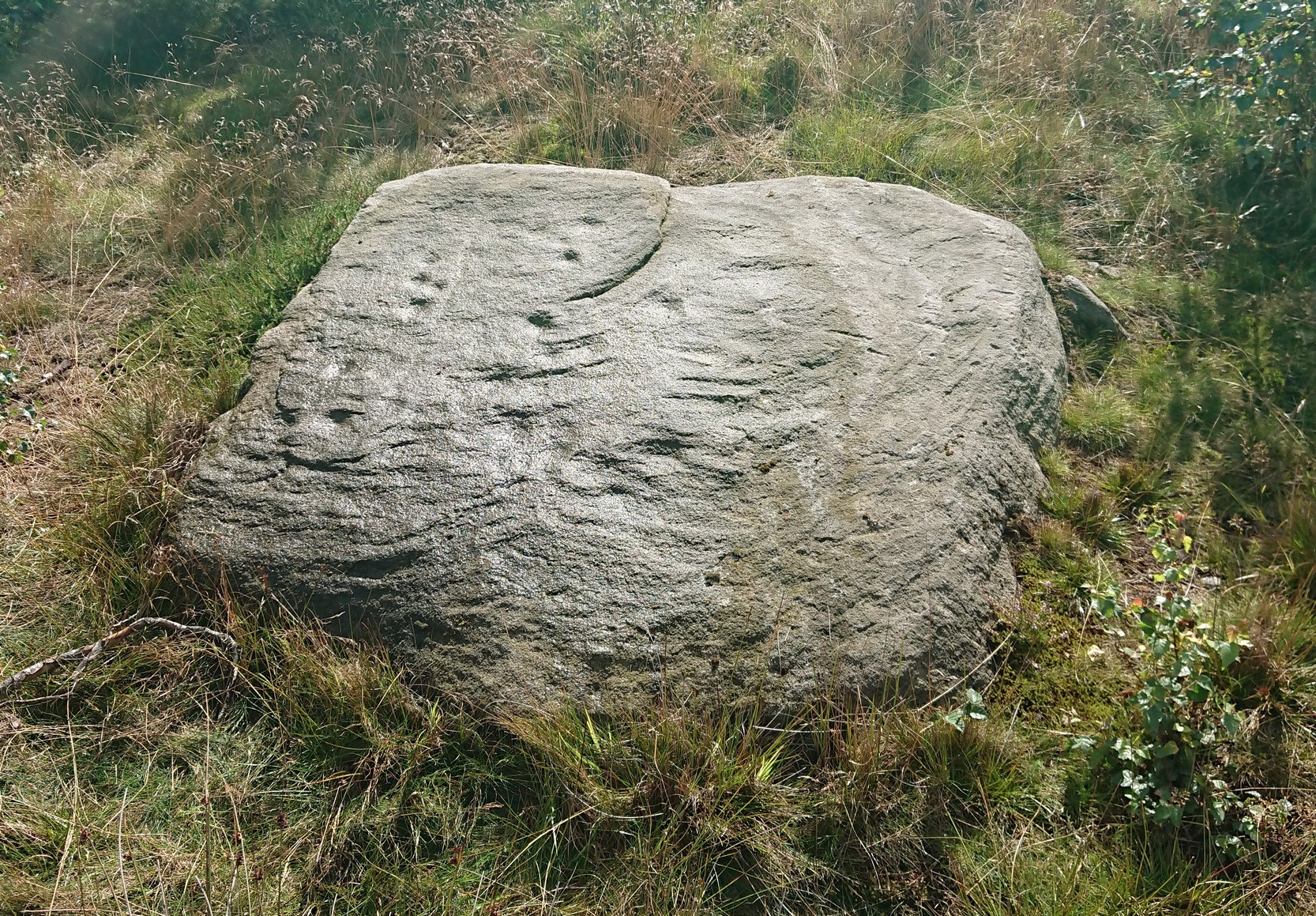
Looking down at the CnR
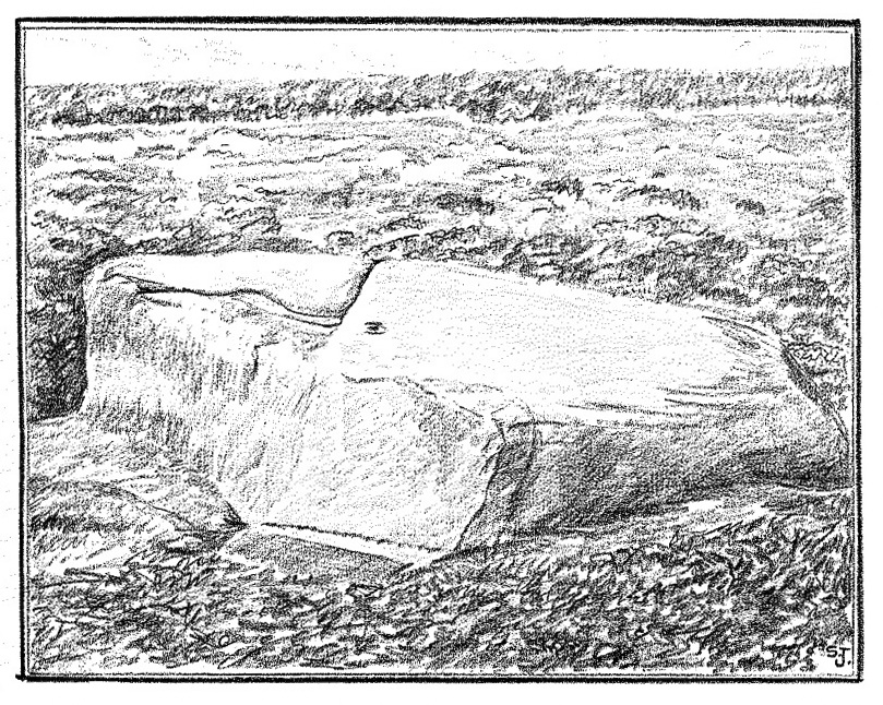
Considering the size of this stone, visitors might expect there to be more on it than there actually is; although a large section of it has been quarried off and there might have been more to it in earlier times. A basic cup-and-ring with one or two single cup-marks elsewhere on its surface, the carving was first described by Stuart Feather (1964) following one of his many rambles hereby, when he was checking out the Rivock carvings a short distance to the west (calling it the Rivock 18 stone). He wrote:
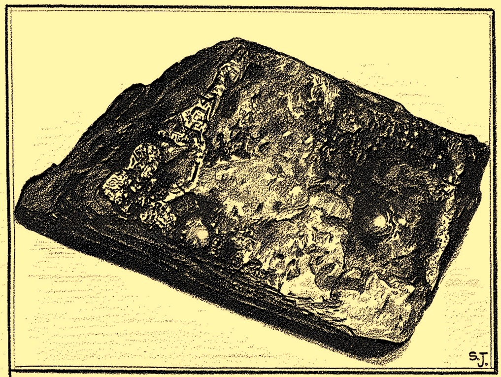
S. Feather’s 1964 sketch
“On the eastern edge of the Rivock plateau, about half-a-mile west of the stone circle at Bradup Bridge, is a cup-and-ring marked rock of a pronounced triangular shape. This at present measures 10ft by 8ft and is 3ft high at its western side… At some time in the past it has been quarried, probably to build part of the adjacent gritstone walls. The 8ft side of the rock has quite distinct drill marks visible…
Close-up of the CnR
The rock has…on its sloping surface a very fine cup-and-ring mark, the ring 6in in diameter around a cup 2in deep, all finely executed and well preserved. Running south from this cup-and-ring mark is a level area 3ft long and 5in wide, which ends alongside the ring at one end and at the quarried edge of the rock at the other. This is probably the former position of a fossil which has weathered out and its alignment onto the cup-and-ring may be due to the carving having been deliberately sited in juxtaposition to this very distinct natural feature. Only one other 2in deep cup remains on the surviving original portion of the rock; others may have been quarried away.”
References:
Boughey, Keith & Vickerman, E.A., Prehistoric Rock Art of the West Riding, WYAS: Wakefield 2003.
Feather, Stuart, “Mid-Wharfedale Cup-and-Ring Markings – no.18, Rivock”, in Bradford Cartwright Hall Archaeology Bulletin, 9:2, 1964.
Hedges, John (ed.), The Carved Rocks on Rombalds Moor, WYMCC: Wakefield 1986.
Cup-and-Ring Stone: OS Grid Reference – SE 0845 4529
Archaeology & History
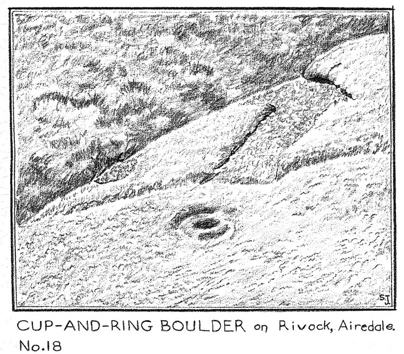
Discovered by Stuart Feather in the late 1950s, this was one of two carvings found very close to each other (see Bucking Hill 2) whose exact location are unknown (the grid-reference cited here is a reasonably accurate approximation). In his short article where he mentions the Bucking Hill 2 carving, he then told of,
Sid Jackson’s vague drawing of the carving
“the discovery a few yards away of a small stone bearing a cup-and-ring mark providing evidence for at least one other symbol from this small hill. This stone, only 14in long, 8in wide, and 6½in thick, has a cup 1¾in in diameter, ⅞in deep with a shallow channel 1½ long running from it.
“Round the cup, which is very symmetrical and has the pecking clearly defined, is part of a concentric channel which, if it were a complete circle, would have a diameter of 4in. The channel, which starts near to the small channel that runs from the cup, goes only halfway round the cup and is obviously unfinished. It is irregular in width and depth and in marked contrast to the workmanship of the cup.”
He then queries as to whether this small carved stone could have come off the larger cup-marked Bucking Hill (02) boulder close by. We may never know, but when we consider the lack of general erosion on this cup-and-ring (the pecking was still visible), it would obviously have remained upside-down in the peat for a few thousand years! There was an old cairn a short distance away on the top of Bucking Hill and it may have come from there. Anyhow, Mr Feather subsequenly took this portable carving home with him and it’s subsequently been donated to the Ilkley Manor House Museum where it should be visible. (can someone send us a photo so we can add it to the site profile?)
References:
Boughey, Keith & Vickerman, E.A., Prehistoric Rock Art of the West Riding, WYAS 2003.
Feather, Stuart, “Mid-Wharfedale Cup-and-Ring Markings – Nos 21 and 22: Bucking Hill, High Moor, Rombald’s Moor,” in Bradford Cartwright Hall Archaeology Group Bulletin, 9:5, 1964.
Hedges, John (ed.), The Carved Rocks on Rombalds Moor, WYMCC: Wakefield 1986.
Cup-Marked Stone: OS Grid Reference – SE 0844 4529
Archaeology & History
This was one of two carvings reported by Stuart Feather (1964) that were very close to each other (see Bucking Hill 3), both of which consisted of simplistic designs but which, he thought, may once have been part of the same rock. Its precise whereabouts are not known (the grid-ref is an approximation). He wrote:
“On the southern slopes of Bucking Hill, a fine gritstone rock 5ft 6in by 4ft 6in by 1ft 6in high, has a very clear cup-mark 2in in diameter and ½in deep carved 8in from the straight eastern edge of the rock.”
Feather thought that the edge of the rock had been cut and quarried for use in the boundary wall to the east. He may have been right.
References:
Boughey, Keith & Vickerman, E.A., Prehistoric Rock Art of the West Riding, WYAS 2003.
Feather, Stuart, “Mid-Wharfedale Cup-and-Ring Markings – Nos 21 and 22: Bucking Hill, High Moor, Rombald’s Moor,” in Bradford Cartwright Hall Archaeology Group Bulletin, 9:5, 1964.
Hedges, John (ed.), The Carved Rocks on Rombalds Moor, WYMCC: Wakefield 1986.
Cup-and-Ring Stone (lost): OS Grid Reference – SE 0828 4507
Archaeology & History
Described by Boughey & Vickerman (2003) as being located somewhere “below Dirk Hill Sike” in the Rivock woods plantation, this is (or was) a “medium, upstanding rock lying NW-SE (with) one possible heavily weathered large cup-and-ring: cup 75mm diam. and ring 200mm diam.” However, the authors give no references to this site, nor images, or notes as to who rediscovered this stone. In their survey they also included one of the Bucking Hill carvings twice, giving the impression that there was more here than had previously been reported. These errors have subsequently been repeated elsewhere on-line. In saying this, there are a number of rocks scattered in this area which may have had carvings on them, but it’s been heavily forested and, recently, the trees have been felled and so many of them will have been damaged, turned over, or simply destroyed as a result of the forestry shennanigans.
References:
Boughey, Keith & Vickerman, E.A., Prehistoric Rock Art of the West Riding, WYAS 2003.
Coming via the Keighley-Bingley (Airedale) B6265 road, go up to Riddlesden and then up the winding Banks Lane until you reach the T-junction. Turn left here and about 330 yards along, on the right-side of the road is a dirt-track. Walk up here, sticking to the track (not the footpath) towards the cliffs of Rivock ahead of you, going through the gate and into the Rivock woods area. 450 yards on from the gate, on your right you’ll pass the long straight line of walling running uphill and literally 275 yards further along the track from here, walk straight up into the trees for 20 yards where, just before the slope begins to truly veer into an “uphill” state, you’ll see the stone in question!
Archaeology & History
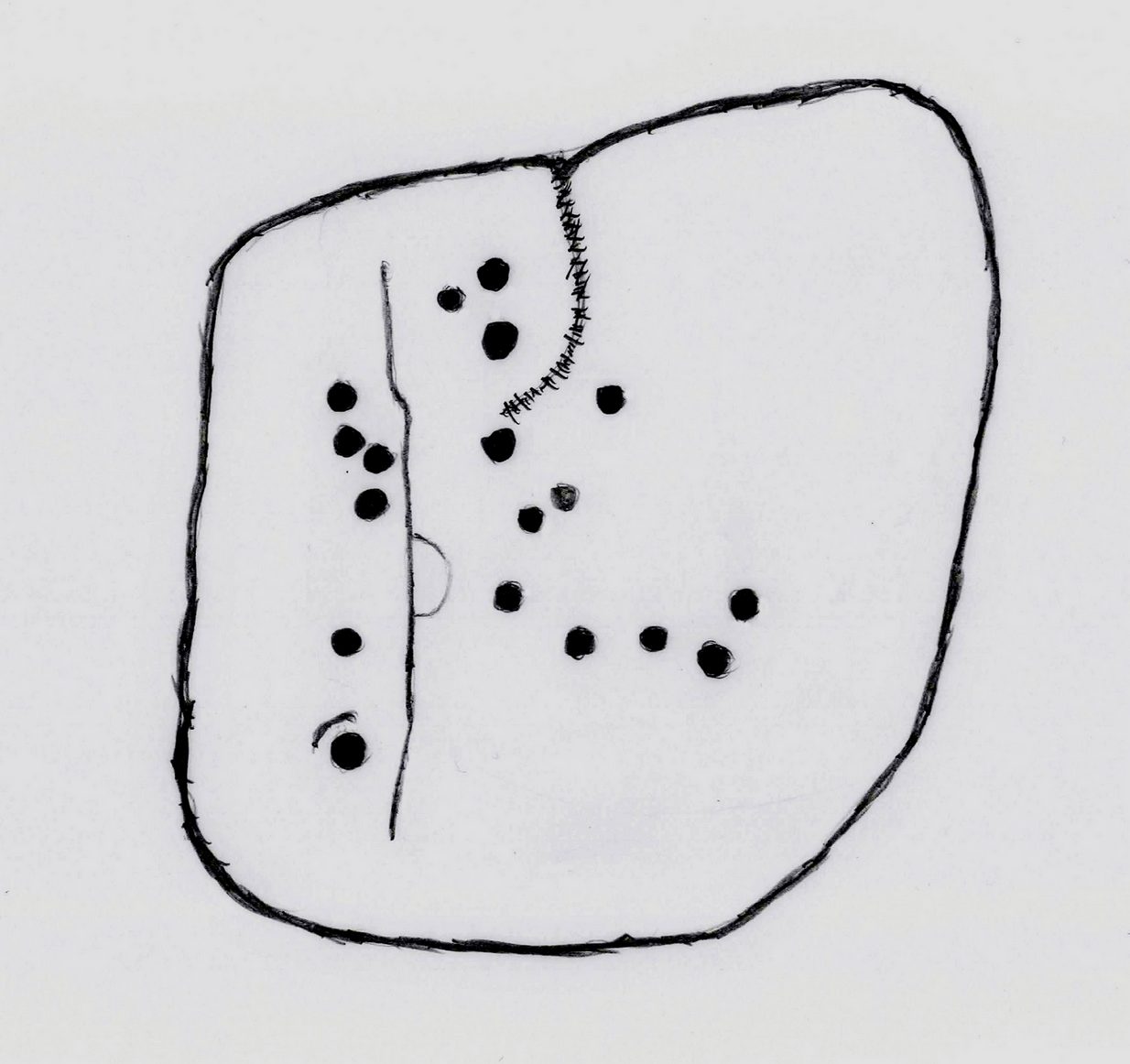
Cups on east-side of stone
In 1961 when Stuart Feather rediscovered this carving, the “rock was almost completely covered by a six-inch layer of peat and vegetation.” But, like all good rock art explorers, he slowly and carefully peeled it all back and brought back to light another one of Rivock’s olde stories. We know not what the story on the rock might tell, but it looks good nonetheless! Feather counted “several cups carved on it”, but a few more have ben discerned since then. When Boughey & Vickerman (2003) described it in their typically minimalist way, they told it be a “large square rock with surface in slope of hill. About nineteen cups.” Evocative stuff!
Sketch of basic designFaint line visible, left-side
When I first saw visited this carving as a young lad, the thing which stood out to me more than anything was the long but faint line that ran down one section of the stone. Added to this was an equally faint arc attached to the side of the line, like a “D” form. A few months later I did a sketch of it on my second visit, but I’ve looked and looked and seem to have lost it. (not good) The one I’ve done here is a recent one. As we can see, a series of cup-marks straddle each side of the D-line and are plainly visible, which implies that the line was carved much earlier than the cups. Of course, it’s possible that the cups were repeatedly forged over and over many times over a century or more and the D-line, for whatever reason, left untouched.
Another interesting aspect of this D-line is its repetition in the much more ornate petroglyph 35 yards to the east (presently known as Rivock 67 until we devise something more appropriate). The recently rediscovered Slinger Stone 100 yards south may also have the same feature, but this needs further surveying before we can say for sure.
References:
Bennett, Paul, ‘The Prehistoric Rock Art and Megalithic Remains of Rivock & District (2 parts),’ in Earth, 3-4, 1986.
Boughey, Keith & Vickerman, E.A., Prehistoric Rock Art of the West Riding, WYAS 2003.
Feather, Stuart, ‘Mid-Wharfedale Cup-and-Ring Markings: No. 14, Rivock,’ in Cartwright Hall Archaeology Group Bulletin, 7:1, 1962.
Hedges, John (ed.), The Carved Rocks on Rombald’s Moor, WYMCC: Wakefield 1986.
Acknowledgements: With thanks to Andy Roberts for giving this stone its modern name.
Of the “two stones bearing possible cup markings” mentioned in the Royal Commission (1978) survey of the area, this is one them – and it’s a dead cert, not a mere “possible.” It was rediscovered by Tom Welsh (1976) when he explored the large low-walled enclosure on this plateau. The carving is on a small rounded stone near the southern perimeter of the enclosure. Welsh described it as, “a boulder 48 x 35 x20cm, bearing six cups 45mm diameter, arranged five round a sixth, the pattern being 15cm across.”
A second cup-marked stone was also located “2.5m in from the last perimeter” bearing a single well-defined cup-mark more than an inch across. This seems to have been lost.
References:
Royal Commission Ancient Historical Monuments, Scotland, The Archaeological Sites and Monuments of Dumbarton District…, HMSO: Edinburgh 1978
Welsh, T.C., “Lang Craigs, Milton, Enclosure, Cup marks, Foundation, Mound, Platform”, in Discovery & Excavation Scotland, 1976.
Cup-and-Ring Stone (lost): OS Grid Reference – NN 880 252
Archaeology & History
A long lost carving, probably quite impressive in design, was recorded by John Laurie, schoolmaster in Monzie. He told us that,
“a large Druid stone with rude carving upon it lies on the side of the public road between the villages of Monzie and Keppoch. This stone was one of a Circle which Mr Monroe, the then minister, caused to be broken and dispersed.”
When Fred Coles looked for the remains of this “circle” at the beginning of the 20th century, he questioned Laurie’s location of the site, but found remains of one in an adjacent field consisting of two stones, but told that “on neither of them could we discern any carving of any sort.” It’s likely that the carving has been completely destroyed, or if we’re lucky it may be hiding in some nearby walling.
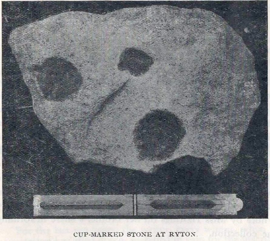
Cup-Marked Stone (removed): OS Grid Reference – NZ 1480 6417
Archaeology & History
Ryton cup-marked stone
In a short piece read before Newcastle’s Society of Antiquaries in 1942, a Mr Cocks (don’t laugh!) told that when a friend of his was clearing out an old land drain in his garden, he found this fragmented cup-marked stone, “which had been made use of as a corner slab on the drain”! It was located “about 40 yards south-west of Tweedy’s Buildings,” on the west side of town. Broken from a larger piece of stone, the attached photo here shows the simple design of the basic cup-marks, measuring respectively 2½, 2 and 1⅝ inches across. Mr Cocks told that “there are also two finger-tip hollows on the stone tone which or may not be natural. A dark line running between the cups is a natural fissure.”
Last we heard, the stone was living in a box somewhere in the archives at the Great North Museum, Newcastle.
References:
Cocks, W.A., “A Cup-Marked Stone at Ryton,” in Proceedings Society of Antiquaries Newcastle-upon-Tyne, volume X, no.2, January 1943.
Cup-and-Ring Stone (lost): OS Grid Reference – SE 0965 4797
Archaeology & History
In Ronald Morris’ (1989) gazetteer of British petroglyphs, he included this curious entry but gave no real details regarding its appearance or history. Listed by the Royal Commission lads, it would seem to have been located immediately south of the dismantled railway where it used to cross the Addingham-Ilkley road, but no one seems to have seen it either before or since Morris’ description. Any help regarding its whereabouts would be appreciated.
References:
Boughey, Keith & Vickerman, E.A., Prehistoric Rock Art of the West Riding, WYAS: Wakefield 2003.
Morris, Ronald W.B., “The Prehistoric Rock Art of Great Britain: A Survey of All Sites Bearing Motifs more Complex than Simple Cup-marks,” in Proceedings of the Prehistoric Society, volume 55, 1989.
Cup-Marked Stone (lost): OS Grid Reference – NO 074 458
Archaeology & History
In J. Romilly Allen’s (1882) lengthy essay on rock art in Scotland, he mentions a singular boulder that was “found by Dr Rattray” at Laighwood, near Butterstone—but, unlike him, he gave no further details regarding its appearance or exact whereabouts. It was included in the Royal Commission (1990) survey of the area, with no additional details. It remains lost. In the event that you manage to rediscover it, grab some good photos of it and stick ’em on our Facebook group. (the grid-reference to this site is an approximation)
Royal Commission on the Ancient & Historical Monuments of Scotland, North-East Perth: An Archaeological Landscape, HMSO: Edinburgh 1990.
Acknowledgements:Huge thanks for use of the Ordnance Survey map in this site profile, reproduced with the kind permission of the National Library of Scotland.