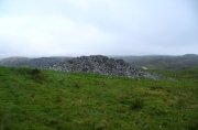
Farr Church, Bettyhill, Sutherland

Cist:  OS Grid Reference – NC 71455 62258 

Also Known as:

  1. Canmore ID 6360
  2. Chealamay

Getting Here

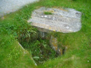
The cist in its new home

Dead easy.  From the top of the hill at Bettyhill, take the road east out of the village along the A836 Thurso road.  At the bottom of the hill, on your left, you’ll see the white building of Farr church Museum.  Walk to it and instead of going in the door, walk past it and round the back, or north-side of the church where, up against the wall, you’ll see this small stone-lined hole in the ground.  Y’ can’t really miss it.

Archaeology & History

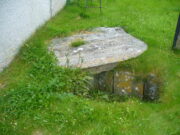
Originally located 7½ miles (12.1km) to the south at Chealamy (NC 7240 5017), in the prehistoric paradise of Strathnaver, it was uncovered following road-building operations in 1981 and, to save it from complete destruction, was moved to its present position on the north-side of Farr church museum.  It was fortunate in being saved, as it was covered by a large boulder which the road operators tried to smash with a large jack-hammer; but in breaking it up, they noticed a hole beneath it.  Thankfully, old Eliot Rudie of Bettyhill—a well respected amateur historian and archaeologist in the area—was driving past just as it had been uncovered by the workmen.  He recognised it as being a probable cist and so further operations were stopped until it was investigated more thoroughly.

The relocated cist

The cist—measuring some 4 feet long by 3 feet wide and about 1½ feet deep—contained the burial of what was thought to be a man in his mid- to late-twenties.  The remains were obviously in very decayed state and it was thought by archaeologist Robert Gourlay (1996), that the body itself had been “deposited in the grave (when it was) in an advanced state of decomposition.”  Also in the cist they found a well-preserved decorated beaker, within which Gourlay thought “probably contained some kind of semi-alcoholic gruel for the journey of the departed to the after-life.”

References:

  1. Gourlay, Robert, Sutherland – An Archaeological Guide, Birlinn: Edinburgh 1996.
  2. Gourlay, Robert B., “A Short Cist Beaker Inhumation from Chealamy, Strathnaver, Sutherland”, in Proceedings Society Antiquaries Scotland, volume 114, 1984.
  3. Gourlay, Robert & Rudie, Eliot, “Chealamy, Strathnaver (Farr) Beaker Cist”, in Discovery Excavation Scotland, 1981.

Acknowledgments:  To that inspiring creature Aisha Domleo, for her bounce, spirit and madness to get me up here; and for little Lara too, for meandering to the church museum where this cist can be seen; and to Eliot Rudie, who pointed it out to us.

© Paul BennettThe Northern Antiquarian


Fiscary Cairnfield, Bettyhill, Sutherland

Cairnfield:  OS Grid Reference – NC 7279 6232

Getting Here

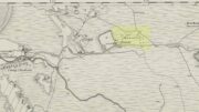
Tumuli on 1878 map

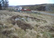
From Bettyhill, go out of the village along the A836 Thurso road for just over a mile.  You go uphill for a few hundred yards and just as the road levels-out, there’s the small Farr Road on your left and the cattle-grid in front of you.  Just before here is a small cottage on your left.  In the scrubland on the sloping hillside just below the cottage, a number of small mounds and undulations can be seen.  That’s it!

Archaeology & History

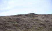
Although this place was highlighted on the first OS-map of the area in 1878, I can only find one modern reference describing this somewhat anomalous cluster of sites.  It’s anomalous, inasmuch as it doesn’t have the general hallmark of being a standard cairnfield or cluster of tumuli.  For one, it’s on a slightly steep slope; and another is that amidst what seems to be cairns there are other, more structured remains.  As I wandered back and forth here with Aisha, I kept shaking my head as it seemed somewhat of a puzzling site.  As it turns out, thankfully, I wasn’t the only one who thought this…

One of the ‘cairns’ from above
Profile of a typical cairn

In R.J. Mercer’s (1981) huge work on the prehistory of the region, he described the site as a whole as a field system comprising “enclosures, structures, cairns and field walls” and is part of a continual archaeological landscape that exists immediately east, of which the impressive Fiscary cairns are attached.  In all, this ‘cairnfield’ or field system is made up of at least 23 small man-made structures, with each one surviving “to a height of c.0.5m and are associated with 11 cairns from 2-6m is diameter.”

In truth, this site is probably of little interest visually unless you’re a hardcore archaeologist or explorer.

References:

  1. Mercer, R.J., Archaeological Field Survey in Northern Scotland – volume 2: 1980-1981, University of Edinburgh 1981.

Acknowledgments:  To the awesome Aisha Domleo, for her images, bounce, spirit and madness – as well as getting me up here to see this cluster of sites.

© Paul BennettThe Northern Antiquarian

Sarah’s Stone, Borgie, Tongue, Sutherland

Cup-Marked Stone: OS Grid Reference – NC 66791 60343

Getting Here

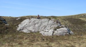
Sarah, on top of her stone!

There’s no simple way to reach here – but the landscape alone makes the journey worthwhile.  Roughly halfway along the A836 between Bettyhill and Tongue, take the minor road up to Borgie, past the recently revamped Borgie Hotel for half-a-mile (0.8 km) where, on your left, is Deepburn Cottage.  On the other side of the road, on your left, go through the gate and follow the path uphill. It curves up and to the right where you hit some overgrown walling.  Walk up and along this wall for nearly half-a-mile (it’ll feel like twice that!) and as you approach the crystal blue waters of Lochan a’ Chaorruin, veer right and start walking up the small Torrisdale Burn.  Less than 200 yards along, you’ll see the large isolated rock on your left.

Archaeology & History

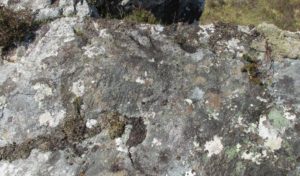
Cupmarks top & bottom
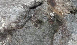
Single prominent cupmark

Previously unrecorded, this large boulder sitting above the edge of Torrisdale Burn was rediscovered by Sarah MacLean—hence its name—and has between five and nine cup-marks etched, primarily, on the topmost ridge of the rock.  Its eastern steep-sloping face also has a cup-mark near the middle top-half of the stone.  Apart from three of them (visible in the photos), the other cups aren’t very distinct and unless the lighting is right, you won’t see much here.  This one is probably gonna be of little interest unless you’re a real hardcore petroglyph freak.

Further up this tiny winding glen we reach the faint cup-marked Thorrisdail Stone and a little further on is the impressive ritual site of Allt Thorrisdail.

© Paul BennettThe Northern Antiquarian


Ribigill Souterrain, Tongue, Sutherland

Souterrain (missing):  OS Grid Reference – NC 5821 5471

Also Known as:

  1. Canmore ID 5354

Archaeology & History

The Royal Commission (1911) lads paid a visit to this site in June, 1909, after an earlier report—allegedly by James Horsburgh—told there to have been one close to the right-hand side of the road, but it has long since been forgotten.  The Commission lads told us simply,

“In a park about ¼-mile north of Ribigil farm-house is the site of an earth-house which was closed up many years ago.”

When I asked a number of local people about the place, they knew nothing of it; so I wandered around in the hope that I might find something.  All that I came across, close to where it was described, were two large flat stones covering a hole in the ground on the other side of the fence from the road.  A number of reeds were in the same field and I thought it must have been a well, but when I laid my ear to it, could hear no running water whatsoever.

References:

  1. Horsburgh, James, Notes of Cromlechs, Duns, Hut-circles, Chambered Cairns and other Remains, in the County of Sutherland“, in Proceedings Society of Antiquaries, Scotland, volume 7, 1870.

© Paul BennettThe Northern Antiquarian

Tongue House, Tongue, Sutherland

Chambered Cairn:  OS Grid Reference – NC 5926 5862

Also Known as:

  1. Canmore ID 5325

Getting Here

Tongue House chambered cairn amidst the trees

I approached this by walking along the B8438 road northwest out of Tongue village, towards the road-crossing over the Kyle of Tongue.  There’s a small tiny road on the right (easily missed) nearly a mile out, just as the road starts to bend, which leads you down to Tongue House.  Go along here for about 325 yards (300m) and just as the road bends to the left, walk into the woods. Keep straight forward, following the low-level stream, and when you see the buildings ahead of you, veer diagonally upslope until you hit the large Tongue Burn. Cross this and walk uphill to the tree-covered knoll ahead. You’re there!

Archaeology & History

…and again, looking north

From the descriptions I’d read of this site, I wasn’t expecting much at all—but it was much better than I anticipated, and in a beautiful woodland setting too.  Admittedly the site is much overgrown, but the overall size, edges and outline of the tomb is easily discernible.  In pacing across it, from outer-edge to outer-edge, it measured 18 yards by 19 yards across.  All round the edges are many overgrown tumbles of smaller rocks which obviously had been part of the cairn in previous centuries; but it is primarily defined by the larger earthfast rocks at the very top of the natural knoll in the trees, all of them covered in deep mosses.

The site was first mentioned in James Horsburgh’s (1870) survey of the region.  He explored a small section of the monument and, upon digging, found a chamber therein—defined by Audrey Henshall (1963) as “a single compartment chamber”—telling us:

“A little to the south of Tongue House, and near the fountain head that supplies it with water, there is the chamber of a cairn of the same description as that near Skelpick, but rather smaller; on clearing it out, I found that one of the large upright stones had two holes bored artificially a short way into each of its sides, but not quite opposite, the holes were about 3 inches diameter.”

However, these internal structures have not been seen since and in Henshall & Ritchie’s (1995) catalogue of Sutherland’s giant tombs, there is some confusion over the definition of the structure itself, questioning whether or not it was indeed a chambered tomb.

“The ‘chambered cairn’ is a circular stone structure overgrown with small trees and covered in leaf-litter and moss.  A kerb about 15m in diameter can be traced for much of the circuit.  The kerb is of unusually substantial and closely-set boulders which have the appearance of the base of a massive wall such as is inappropriate for a dun or a broch rather than a cairn.  The interior is filled with loose stones including some quite large boulders, roughly to the level of the top of the kerb.  There is no indication that these boulders have formed part of a neolithic chamber or that the structure was a cairn.  There seem to be three possibilities: that the structure is not Horsburgh’s cairn; that the structure is that which he investigated but that he was mistaken in regarding it as a chambered cairn; that the writers are mistaken in identifying the structure as a ruined broch or dun.”

Despite this, the general consensus today is that the monument is indeed a chambered cairn.

References:

  1. Henshall, Audrey S., The Chambered Tombs of Scotland – 2 volumes, Edinburgh University Press 1963 & 1972.
  2. Henshall, Audrey S. & Ritchie, J.N.G, The Chambered Cairns of Sutherland, Edinburgh University Press 1995.
  3. Horsburgh, James, Notes of Cromlechs, Duns, Hut-circles, Chambered Cairns and other Remains, in the County of Sutherland“, in Proceedings Society of Antiquaries, Scotland, volume 7, 1870
  4. Royal Commission on Ancient & Historical Monuments, Scotland, Second report and inventory of monuments and constructions in the county of Sutherland. HMSO: Edinburgh 1911.

© Paul BennettThe Northern Antiquarian


Modsary, Tongue, Sutherland

Hut Circle:  OS Grid Reference – NC 65189 61639

Getting Here

Faint outline of Modsary hut circle, across centre

Along the A836 between Tongue and Bettyhill—nearly 5 miles (7.75km) east of Tongue—take the minor road north to Modsary and Skerray.  Some 1.75 miles along you’ll notice an inland loch to your right, and where the loch finishes, take the minor track up on your right to Modsary.  Walk past the cottages, through the gate and walk diagonally left down onto the moor. A small cave is across in front of you. Head towards that, but on the flat-ish piece of heathland barely 50 yards before it, above the small burn, look around for the low circular walling.

Archaeology & History

This previously unrecorded prehistoric hut circle was rediscovered in May 2018 by Sarah Maclean of Borgie during a brief excursion here, looking at the ancient clearance village of Modsary (which appears to be Iron Age in origin).  In walking onto the moor, shortly before leaving me to my own devices, she pointed out this low ring of barely discernible stones, wondering, “is this another hut circle?” (there are some on the western-side of the road from Modsary)  It would certainly seem so!

Grass showing centre of hut circle

It is constructed upon what seems to be a natural platform of earth above the slow-running burn.  A low ring of stone walling defines the construction: visible in parts, covered in vegetation for the most.  With an entrance on its southeast, the ring measures roughly 9 yards by 10 yards in diameter; with its outer walls being less than 2 feet high all round; but the width of the walls in some places measures up to 3 feet across.  It is certainly man-made and is certainly olde.  It requires excavation to assess its original construction period, although based on others I’ve seen that have been dated, would seem to be Iron Age in origin.

From this to the small cave that I mentioned, a most peculiar rectangular stone construction is evident 2-3 yards below it; and heading 40 yards south, beneath a craggy hill, a line of ancient walling runs SE-NW, with a much overgrown semi-circular arc of large stones, seemingly artificial in nature.  It would seem there is a lot more hiding beneath the heather hereby than official records suggest…

Acknowledgements:  Massive thanks to Sarah Maclean for locating and showing me this site; and also to Donna Murray for giving me a base-camp. Huge huge thanks indeed.

© Paul BennettThe Northern Antiquarian

Talmine (west), Melness, Tongue, Sutherland

Settlement:  OS Grid Reference – NC 5764 6248 

Getting Here

Large arc of low walling, across upper-centre

Along the A836 road between Durness and Tongue, take the minor road north to Melness and Talmine. 400 yards or so past Talmine Stores shop, walk left up the track onto the moor. Half a mile on, walk straight uphill on yer right for about 150 yards until it levels out.  Look all around you!

Archaeology & History

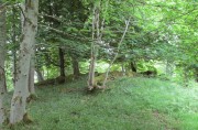
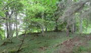
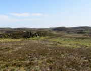
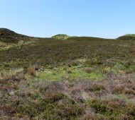
This is a fascinating new find, explored under the guidance of Sarah MacLean of Borgie.  After looking at the nearby cairnfield and hut circles to the southeast, our noses took us onto the hilltop, where an extravaganza of curved and straight walling, hut circles, denuded cairns, cists, possible chambered cairn remnants and even unrecorded stone rows had us almost bemused at the extent of the remains.  A lot of it has been severely damaged and robbed – but in the low vegetation scattering the hilltop, it became clear that a lot of activity had been going on in the ancient and perhaps not-too-ancient past, with a social and/or tribal continuity stretching way way back (as found at Baile Mhargaite near Bettyhill).

Straight line of low walling

As we walked up the unnamed hill (well, to be honest, we zigged and zagged, or bimbled, until we got to the top), above a line of prehistoric cairns on the slopes below, small lines of walling barely above ground-level stretched out before us.  Structurally akin to the neolithic and Bronze Age features found from northern England to this far northern region, they are low and deeply embedded in the peat, but are quite unmistakable.

In following the first real line of walling near the eastern edge of the hill, a flat panorama eventually opened up as we reached the top and there, in front of us, appeared arcs and lines of more walled structures, thankfully unobstructed by vegetation.  A few expletives came out of my mouth (for a change!) at the remains we could see right in front of us—and then we set walking in different directions and began to explore the remains beneath our respective feet.

The first main element on the southeastern top of the hill was a wide curvaceous arc of walling, undoubtedly prehistoric – in my opinion either Bronze Age or neolithic in origin.  As I was looking at this section, Sarah walked only a short distance to the northwest and, with some excitement in her tone called out, “there’s some here too!” And so we continued, back and forth to each other as we zigzagged across the tops.

Stone row or denuded walling?

Intersecting lines of walling

Much of what we found (as the photos show) were low lines of settlement walling—some dead straight, others curving to form denuded hut circles and larger domestic forms. A lot of the walls had been knocked down and scattered on the hilltop, making it troublesome at times ascertaining precisely what we were looking at: but a settlement or large enclosure it certainly is!

The south and western edges of the hill itself seemed to be marked by low sections of walling, again deeply embedded into the peat; and on the same two sides are what appear to be remnants of stone rows leading up onto the top.  As with other stone rows in this region, they are defined by low upright monoliths.  The one that runs north-south runs into a low section of walling that cuts right across the top of the hill and away into the deep peat, roughly NNE, where we lost sight of it (where some old peat-cutting is evident).  The stone row running up the western face of the hill seems to begin near the bottom of the slope and is defined by a leaning standing stone that Sarah found.  Looking uphill from this there’s a gap of roughly fifty yards, where a small stone sits on the near-horizon; and from this small stone is a clear line of small stones, ending (it seems) at a stone less than three feet tall.  Just past this is the denuded remains of what seems to be a cist and a small robbed cairn, clearly defined by a curious rectangle of base-stones, barely 5 feet by 3 feet wide.
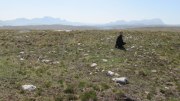
Intersecting arc & line of walling

Outline of robbed cairn?

My personal favourite of all the things on top of this hill has to be the small sections of interconnecting walling that we found on the more northern portion of the settlement.  At first glance, it seemed that we were just looking at a small hut circle; but then we realised this initial ‘hut circle’ was linked to a slightly larger ‘hut circle’, which was linked to another, all in a linear east-west direction (roughly).  As I saw looked at it from the western-side (looking east), Sarah was on its east looking west.  This difference in visual perspective gave us a wider view of what we were both looking at.  The easternmost section comprised of an arc of walling that joined into another ‘hut circle’, neither of which had axes any greater than 3 yards.  As we stepped further and further back from this, it seemed that other walled sections ran into it, expanding it into a form which I can only describe as a ‘stripped long cairn’, down to its initial architectural basis, upon which you’d construct the larger monument—but it was only 10 yards long at the most.  Most odd…  Sarah pointed out what may have been a stoned-lined trackway running parallel to this neolithic curiosum.  It still puzzles me as to what it may have been.

This short description doesn’t really do this site justice and, in truth, it needs a more competent survey than I could give it in just one short visit.  It’s very probable that a lot more is still to be found on these hills, from prehistoric all through to post-medieval (pre-Clearance) times.  So if you live in this part of Sutherland, get yer twitching noses and boots on and bimble with intent to find!  There’s still plenty of stuff hiding away…

Acknowledgements:  Huge thanks to Donna Murray of Borgie for putting me up (or should that be, putting up with me?!) and equally massive thanks to Sarah Maclean—also of Borgie—for guiding me up here and being an integral part of rediscovering this site. Without them both, this place would still be unrecognised. And thanks to Miles Newman too. 😉

© Paul BennettThe Northern Antiquarian


Manse Bridge, Melness, Tongue, Sutherland

Cairns:  OS Grid Reference – NC 5784 6229

Also Known as:

  1. Canmore ID 5385

Getting Here

2 cairns in line of 3, Manse Bridge (photo Sarah Maclean)

Along the A836 road between Durness and Tongue, take the minor road north to Melness and Talmine. 400 yards or so past Talmine Stores shop, walk left up the track onto the moor. Follow the track along as if you’re visiting the Talmine West settlement, but walk uphill onto the moor a hundred yards or so after the sheep-folds on your right.  Before the top of the hill, keep your eyes peeled for the heather-covered rocky mounds in the moorland scattered about. You’ll find them!

Archaeology & History

A cluster of prehistoric cairns—or a cairnfield as it’s known— is found on the moorland scattering the south and eastern edges of the unnamed hill immediately west of Talmine.  They can be pretty difficult to see when buried in heather, but they’re there!  When Sarah Maclean took us up to see them, three in particular stood out: seemingly along a deliberate line, perhaps parallel with either an old trackway or old walling on the south slope of the hill.

Central cairn in line of 3 (photo by Sarah Maclean)

Central cairn hollowed out (photo by Sarah Maclean)

The main three that we visited were pretty easy to locate, with many loose stones comprising the respective piles, standing about 3 feet high and some 3-4 yards across.  One of them (left) had been dug into, leaving a deep hollow in its centre, leaving it more exposed and visible than the others. There are other cairns on the slopes to the east, but none seemed to be as well-defined as the three here described.

In the same area are also a number of hut circles, much overgrown but still visible amongst the heather.

References:

  1. Welsh, T.C., ‘Manse Bridge – Small Cairns, Hut Circles’, in Discovery & Excavation Scotland, 1973.

Acknowledgements:  Huge thanks to Donna Murray of Borgie for putting me up (or should that be, putting up with me?!) and equally massive thanks to Sarah Maclean—also of Borgie—for guiding me up here and allowing us use of her photos to illustrate this site profile.

© Paul BennettThe Northern Antiquarian


Fiscary (4), Farr, Sutherland

Cairn:  OS Grid Reference – NC 72858 62620

Also Known as:

  1. Canmore ID 6437

Getting Here

Approaching Fiscary 4, north

Approaching Fiscary 4, north

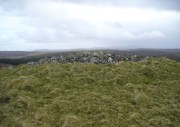
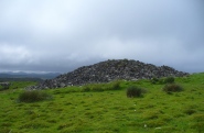
A mile east of Bettyhill on the A836 road, watch for the large piles of rocks up on the hill on your left (north).  Turn left on the tiny road past the first house for 150 yards and then on the track past the sheep-fanks through the gate and up the small hill.  The cairn is the smallest of the pile of rocks in front of you.

Archaeology & History

Of the four giant cairns clustered here at Fiscary, a mile east of Bettyhill, this one has received the least attention.  It is found amidst a massive cluster of archaeological remains running from the 19th century all the way back into the neolithic period. Quite impressive!

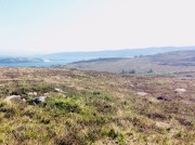
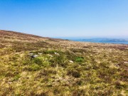
Sitting on top of the cairn the view is impressive: looking 360º with the Orkney islands s to the northeast, Durness and the rising mountains west and southwest, and endless craggy moorlands peppered with lochans driving in all directions to the south countless miles away.  This panorama of wilderness is something to behold…

Looking west out to sea

Looking west out to sea

Looking southwest

Looking southwest

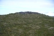
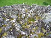
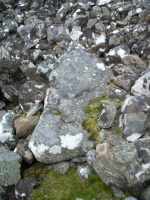
The tomb itself, with the acceptable scatter of fallen rocks to the edges, is nearly 50 yards in circumference, measuring more than 12 yards east-west and nearly 14 yards north-south, with the Earth covering the older rocks to the edges with more and more vegetation as the years pass.  It stands about 5-6 feet high with the typical internal mass of thousands of stones making up the cairn.  No known excavations have ever been made here.

In the otherwise superb Royal Commission (1911) survey of Sutherland, they only had scant information to say about this tomb, telling that,

“The fourth cairn…measures 28′ to 30′ in diameter and is about 6′ high.  There are no signs of chambers visible and the cairn has been a good deal dilapidated.”

Even when R.J. Mercer (1981) came to give this area greater attention, he passed by the Fiscary 4 cairn with equal brevity, noting simply its dimensions, elevation above sea level and the fact that it is a “circular cairn on crest of hill.”

The tombs of Fiscary 12 and 3 are very close by some beginning some 257 yards (235m) to the east.  I cannot recommend this entire complex highly enough!

References:

  1. Henshall, Audrey S., The Chambered Cairns of Sutherland, Edinburgh University Press 1995.
  2. Mercer, R.J. & Howell, J.M., Archaeological Field Survey in Northern Scotland – volume 2, University of Edinburgh 1981.
  3. o’ Reilly, Kevin & Crockford, Ashley, What to See Around Bettyhill, privately printed 2009.
  4. Royal Commission on Ancient & Historical Monuments, Scotland, Second report and inventory of monuments and constructions in the county of Sutherland. HMSO: Edinburgh 1911.

© Paul Bennett,  The Northern Antiquarian 2016

Fiscary (3), Farr, Sutherland

Cairn:  OS Grid Reference – NC 73222 62484

Also Known as:

  1. Canmore ID 6446
  2. Pict’s House

Getting Here

Fiscary 3 giant cairn, looking west

Fiscary 3 giant cairn, looking west

Along the A836 road from Bettyhill to Thurso, a mile east of the village keep your eyes peeled to your left (or to the right if you’re coming the other way!), looking north, and you’ll see some very large piles of stones a few hundred yards away. Go through the gate onto the rough grasslands and the first one you reach is the cairn in question. Y’ can’t miss it!

Archaeology & History

On 1878 OS-map as Picts House

On 1878 OS-map as Picts House

Close to the Fiscary 1 and Fiscary 2 tombs, this is the third and southernmost of the three giant cairns on this moorland hillside and is the second largest of the trio.  Curiously it was the only one highlighted by the Ordnance Survey lads in their cartographic analysis here in 1873—they somehow missed the others—when they told it to be a ‘Pictish House’, or broch.  A few years later when the Royal Commission (1911) fellas got their noses up here, they said that this,

“which is the most easterly, is circular in form, is about 68ft in diameter, and 15ft 6in to the apex, on which a small pile of stones has recently been erected.  The cairn does not appear to have been excavated, but the stones in several places have been pulled out, probably in attempts to discover the chambers or in pursuit of rabbits.”

Looking into its centre

Looking into its centre

Long stone at southern edge

Long stone at southern edge

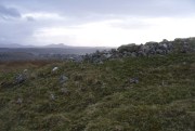
Considering the size of this giant cairn and its close association with is neighbours 150 yards northwest, I’m surprised at the lack of attention it’s been given.  Within the collapse of stones on its southern-side we find an elongated stone which seems to have stood upright at some point in the past, either at the very edge of the cairn, or just inside it.  It may even have been a covering stone to a collapsed entrance, but without an excavation we’re not gonna know for certain.

The fact that this cairn is on the slopes south of the crowning cairns of Fiscary 1 and Fiscary 2 implies that this was built some centuries later than them.  Also notable here is that the view to the north is blocked and we are instead only looking across a panorama east, south and west.

Folklore

Looking across into the east

Looking across into the east

Local tradition told that this was a Pict’s house, or broch (it may well have been) and is shown as such on the first Ordnance Survey account of the region in 1878.  Otta Swire (1963) told that this landscape was once peopled by giants who made the land and played a part in the creation of some of the giant tombs around here.  One time local school-teacher at Bettyhill, Alan Temperley (1977) also told us how the fairy folk lived close to the giant tombs of Fiscary.

References:

  1. Gourley, Robert, Sutherland: An Archaeological Guide, Birlinn: Edinburgh 1996.
  2. Henshall, Audrey S., The Chambered Tombs of Scotland – volume 1, Edinburgh University Press 1963.
  3. Henshall, Audrey S., “The Distant Past,” in The Sutherland Book (edited by Donald Omand), Northern Times: Golspie 1991.
  4. Henshall, Audrey S., The Chambered Cairns of Sutherland, Edinburgh University Press 1995.
  5. Lelong, Olivia C., “Writing People into the Landscape: Approaches to the Archaeology of Badenoch and Strathnaver,” University of Glasgow 2002.
  6. o’ Reilly, Kevin & Crockford, Ashley, What to See Around Bettyhill, privately printed 2009.
  7. Royal Commission on Ancient & Historical Monuments, Scotland, Second report and inventory of monuments and constructions in the county of Sutherland. HMSO: Edinburgh 1911.
  8. Sutherland, George, Folk-lore Gleanings and Character Sketches from the Far North, John o’ Groats Journal: Wick 1937.
  9. Temperley, Alan, Tales of the North Coast, Research Publishing Company: London 1977.

Acknowledgments:  HUGE thanks to Aisha Domleo and for getting me up here.

© Paul BennettThe Northern Antiquarian