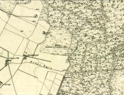
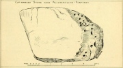
Trows Well, Birsay, Orkney Isles

Sacred Well:  OS Grid Reference – HY 26157 26838

Archaeology & History

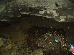
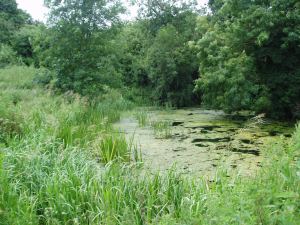
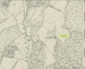
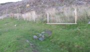
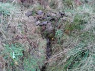
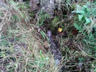
On the northwest side of the Loch of Boardhouse can still be found a spring of water which was, in bygone times, the abode of the supernatural creature known as the troll or trow.  The site is described in local place-name records and is located near the foot of a slope near Westerhouse, from where a small channel of water runs down into the Loch of Boardhouse about forty yards away. When it was last described in the 1960s, all folk memory of its heathen inhabitants had seemingly been forgotten and no folk-tales seem to have been recorded.  Thankfully, the Well itself is still shown to exist on modern OS-maps.

© Paul BennettThe Northern Antiquarian

Blakey Topping, Allerston, North Yorkshire

Sacred Hill:  OS Grid Reference – SE 8731 9377

Getting Here

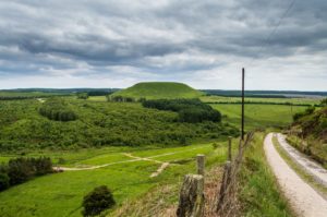
Blakey Topping (James Elkington)

From Pickering, take the A169 towards Whitby. When you get to the Car Park at the ‘Hole-of-Horcum’ – (you can’t miss it), park the car and walk North along the side of the road towards Whitby. After 60 yds, take the track East. Follow this for approximately a mile until the track splits. Take the concrete track left towards the farmhouse of ‘Newgate Foot’. Go through the yard past the house on the right, and you will come to a stream and a gate and there, ahead of you, rises Blakey Topping…

Archaeology & History

The giant hill of Blakey Topping was recorded as early as 1233 CE and in a simplistic style just means the ‘black mound’; but this derivation has additional ingredients, implying it as a ‘black meeting-place’ or moot.  Black in the etymological sense also implies ‘shining’ and it may also relate to the northern airt of black (meaning death, darkness, north, etc), when you’re stood at the ruined stone circle 400 yards to the south. But I’m speculating here…

Several 19th century antiquarians suggested there may have once been a cairn on top of the hill, but others who’ve explored this idea seem to have put it to bed.

Folklore

This great hill is well recognised amongst local people and, to this day, its animistic creation myths and other folklore elements are still spoken.  When the photographer James Elkington recently visited the nearby standing stones, he bumped into the old farmer who told him how his father had seen the faerie-folk on the hill many years back.  And its modern reputation as a gorgeous site adds to such lore, which dates way back.

In Frank & Harriett Elgee’s (1933) archaeology work, they narrated the old creation myth that local people used to tell of this great hill,

“A witch story related by a native 25 years ago attempts to explain two conspicuous natural features two miles apart on Pickering Moor; Blakey Topping, an isolated hill, and the Hole of Horcum, a deep basin-shaped valley. The local witch had sold her soul to the devil on the usual terms, but when he claimed it, she refused to give it up, and flew over the moors, with the devil in hot pursuit. Overtake her he could not, so he grabbed up a handful of earth and flung it at her. he missed his aim and she escaped.  The Hole of Horcum remains to prove where he tore up the earth and Blakey Topping where it fell to the ground.

“From our point of view the significance of this story lies in the fact that between the Hole and the Topping there is a Bronze Age settlement site at Blakey Farm, with its stone circle. The rough trackway leading from the Hole to the circle is known as the Old Wife’s Way, presumably also marking the witch’s flight. This, together with other Old Wife’s Ways, preserves as it were Bronze Age church tracks”.

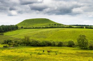
Looking up from the SW (James Elkington)

A relative variation on this tells that the Hole of Horcum was made by the local giant, Wade. He was having a row with his wife, Bell, and got so angry that he scooped out a lump of earth and threw it at her.  The huge geological feature known as the Hole of Horcum is the dip left where he scooped out the earth, and Blakey topping, the clod itself, resting in situ where it landed.  A christian appropriation of the story replaces Wade and his wife with their ‘devil’: a puerile element unworthy of serious consideration.

In more recent times, the old geomancer Guy Ragland Phillips (1976; 1985) found that a number of alignments, or leys (known as a ‘node’), centred on Blakey Topping: twelve in all, reaching out and crossing numerous holy wells, prehistoric tumuli, standing stones, etc.  The precision of the alignments is questionable, yet the matter of the hill being a centre-point, or omphalos, would seem moreso than not.

References:

  1. Elgee, F. & H.W., The Archaeology of Yorkshire, Methuen: London 1933.
  2. Phillips, Guy Ragland, Brigantia, RKP: London 1976.
  3. Phillips, Guy Ragland, The Unpolluted God, Northern Lights: Pocklington 1987.
  4. Smith, A.H., The Place-Names of the North Riding of Yorkshire, Cambridge University Press 1928.

Links:

  1. Mountains, Myths and Moorlands

Acknowledgements:  Big thanks to the photographer, James Elkington, for use of his photos in this profile. Cheers mate.

© Paul Bennett & James ElkingtonThe Northern Antiquarian


Jim Craven’s Well, Thornton, West Yorkshire

Sacred Well:  OS Grid Reference — SE 0967 3251?

Archaeology & History

Is this the site of the lost Jim Cravens Well on the 1852 map?

Another well with considerable supernatural renown was this little-known site near the old village of Thornton, on the western outskirts of Bradford.  We’re not 100% sure about its exact location, but the grid-reference cited here is of an old ‘Well’ that was highlighted on the first Ordnance Survey map of the region, at the end of solitary path which led to it and nowhere else.  Our only documentary information comes from Elizabeth’s Southwart’s (1932) fine old book on the folk life of the old village, as it once was.  At a place once known as Bent Ing Bottom, just south of the old village, is where it used to be known.  The name of this Well is also curious, as no historian has yet worked out who the ‘Jim Craven’ was, nor what his relationship to the site might have been.  It’s the folklore of it, however, which brings it the attention it deserves.

Folklore

In Elizabeth Southwart’s (1923) work, she told us that the place once known as “Bent Ing Bottoms have lost their romance.” She continued:

“Whether the golfers have driven it away—for the fields now form part of the Thornton Golf Links—or whether the advance of modernity in other forms is to blame, it is difficult to say.  Once they were the haunts of “Peggy-Wi-T’-Lantern” and the Bloody-tongue.  Peggy, a dame in a white mob cap, kilted skirt and white stockings, walked about with a lantern, enticing the unwary traveller to his doom.  She was given to wandering, for, they say, Jim Craven Well, half a mile away, was a place to be avoided after nightfall.

“The Bloody-tongue was a great dog, with staring red eyes, a tail as big as the branch of a tree, and a lolling tongue that dripped blood.  When he drank from the beck (known as the Pinch Beck, PB) the water ran red right past the bridge, and away down—down—nearly to Bradford town.  As soon as it was quite dark he would lope up the narrow flagged causeway to the cottage at the top of Bent Ing on the north side, give one deep bark, then the woman who lived there would come out and feed him.  What he ate we never knew, but I can bear testimony to the delicious taste of the toffee she made.

“When the dark was coming we used to sit on the filled-in pit, which makes a hump in the middle of the field, and wait for him.  The sun would sink redly, through the arches of the viaduct, the trees that lined the beck would grow an ever darker green until they became black, the beck would begin to gurgle and gulp in a queer way; and down in the hollow we would hear a whimper, a whine, a moan, a snarl.  Then, with scalps and spines playing queer tricks, we would wait and wait.  But none of our little band ever saw him, except one girl, and she saw him every time.

“One Saturday a girl who lived at Headley came to a birthday party in the village, and was persuaded to stay to the end by her friends, who promised to see her ‘a-gaiterds’ if she would.  As soon as the party was over the brave little group started out.  But when they reached the end of the passage which leads to the fields, and gazed into the black well, at the bottom of which lurked the Bloody-tongue, one of them suggested that Mary should go alone, and they would wait there to see if anything happened to her.

“Mary was reluctant, but had no choice in the matter, for go home she must.  They waited, according to promise, listening to her footsteps on the path, and occasionally shouting into the darkness:

““Are you all right, Mary?”

““Ay!” would come the response.

“And well was it for Mary that the Gytrash had business elsewhere that night, for her friends confess now that at the first sound of a scream they would have fled back to lights and home.

“We wonder sometimes if the Booody-tongue were not better than his reputation, for he lived there many years and there was never a single case known of man, woman or child who got a bite from his teeth, or a scratch from his claws.  Now he is gone, nobody knows whither, though there have been rumours that he has been seen wandering disconsolately along Egypt Road, whimpering quietly to himself, creeping into the shadows when a human being approached, and, when a lantern was flashed on him, giving one sad, reproachful glance from his red eyes before he vanished from sight.”

Southwart later tells us that the ghostly dog travelled into the north and vanished.  From the description she gives of the children walking their friend to “the end of the passage which leads to the fields, and gazed into the black well, at the bottom of which lurked the Bloody-tongue,” I can only surmise that the solitary well shown on the very first OS-map of Thornton at the coordinate given above is the place in question.

The ‘Bloody Tongue’ is first mentioned in Yorkshire folklore, I think, by Roger Storrs, in his article on holy wells in 1888, where he tells it to be one of the mysterious beings that live, usually at the bottom of the waters and almost universally used “to deter children from playing in dangerous proximity to a well.”

From the description of the waters turning red when the ghostly dog drank from it, we have a mythic account of when the waters occasionally turned red from the iron-bearing waters (chalybeate) which, obviously, wasn’t like this at all times.  Whether this was a sporadic, unpredictable flow of iron in the waters, or a cyclical pattern of the water-flows, we are not told (which would imply, moreso, that it was sporadic).  The folklore about this ghost and its appearance with another elemental creature along an old straight track running north from Upper Headley Hall to Thornton is intriguing—as in many old pre-christian traditions, North is the airt, or direction, representing Death; and black dogs are traditionally guardians of underworld treasures in the land of the Dead.  With the plethora of other animistic folktales once known in this district (boggarts or goblins were known in nearby woods, wells and farms) it is likely that the origin of such folklore dates way back into antiquity.

References:

  1. Bennett, Paul, Ancient and Holy Wells of West Yorkshire, forthcoming
  2. Southwart, Elizabeth, Bronte Moors and Villages: From Thornton to Haworth, John Lane Bodley Head: London 1923.
  3. Storrs, Roger, ‘Legends and Traditions of Wells,’ in Yorkshire Folk-lore Journal – volume 1 (ed. J. Horsfall Turner) 1888.

© Paul BennettThe Northern Antiquarian


Devil’s Well, Abernethy, Perthshire

Sacred Well:  OS Grid Reference – NO 19430 14758

Also Known as:

  1. Canmore ID 28084

Getting Here

Devil’s Well on 1860 map

From Abernethy village, go west along the A913 road for half-a-mile, then turn left up the long and winding Glenfoot road up the Abernethy Glen.  About a mile up on your left-side is Craigden Farm and, just a bit past this, the forestry plantation.  Just before the trees, cut up the field and head uphill, passing the near forest of gorse, until you reach the huge detached house of Turflundie.  In the field immediately east, right up against the barbed-wire fence where it meets the depleted forestry, a very small trickle of water emerges beneath a small pile of rocks.  You’re here!

Archaeology & History

Long since thought to have been lost, the trickling remains of this old Well of the Devil are, in fact, still running beneath the pile of stones just over the barbed-wire fence on the edge of the forestry section.  A cluster of other worn rounded rocks scatter the ground just to the rear of where the water first comes out of the ground, suggesting, perhaps, that a small well-house covered the spring; but this is me being speculative, as there’s no mention of this in the early writings of the Ordnance Survey lads, nor is one shown on the first OS-map of the area in 1860.  And you’ll see on the OS-map how the well is slightly lower than where it presently trickles, but this is down to the fact that the source of it was piped-off at sometime in the not-too-distant past, as evidenced by remains of such piping laying just over the barbed-wire fence close to the source.  In truth, unless you’re hardcore, there’s very little to see.

Folklore

The trickling waters are on the other side of this fence

The dedication of this water-site to the christian ‘devil’ is obviously a corruption of its original traditional name, which may have simply been to the Bodach, or ‘Old Man’ in Gaelic and northern British lore.  The bodach‘s consort is the great prima Mater of the northern realms known as the Cailleach, but I can find no dedication to Her anywhere nearby.  The best we have are the ‘Witches Graves’ a half-mile to the northwest, below the edge of the geological ridge overlooking Abernethy, where folklore tells us 22 women were murdered and buried by the local christians several centuries ago.

In the Ordnance Name Book of 1859, they recorded that,

“A small Spring well on the farm of Turflundie, so called from the mark of a cloven hoof on a near, supposed to have been made by his Satanic majesty when he stopped to quench his thirst at this well during some of his midnight rambles.”

There’s no apt word that follows the word “near”, but assume it was meant to be a “stone,” although we could find no such stone close by and there are no known petroglyphs that could account for that ingredient.

References:

  1. Morris, Ruth & Frank, Scottish Healing Wells, Alethea: Sandy 1982.

© Paul BennettThe Northern Antiquarian


Fairy Well, Logie, Stirlingshire

Sacred Well:  OS Grid Reference – NS 8135 9804

Also Known as:

  1. Canmore ID 47123
  2. Hielantman’s Well
  3. Highlandman’s Well
  4. Holy Well

Getting Here

Fairy Well, emerging from wall

Fairy Well, emerging from wall

From Stirling, take the A9 to Bridge of Allan, turning right at the roundabout along the A907 for less than a mile, then turning left at the next roundabout up the A91.  A half-mile down, at the small roundabout, bear left and first right, up to Logie Church.  Keep going all the way up this steep winding road, turning right at the junction.  Go along here for a quarter of a mile and park up at the roadside.  Walk along a bit further where the road has a bittova sharp bend.  The sound of the stream coming out of the small glen is obvious.  Walk past this and, on the right-hand side of the road, past the stream, you’ll find a water source emerging from the boscage of an overgrown wall.  Keep looking.  It’s damn close!

Archaeology & History

In the 1792 Statistical Account of this northeastern edge of Stirling, moving into the ancient parish of Logie, we were given an early brief account of this all-but-forgotten sacred water source which, thankfully, still runs fine water to this day.  It was described in tandem with the ancient Hill of the Picts called Dunmyatt, more than a mile to the east; but,

“About half-a-mile from the foot of this hill…is a very fine well, which issues from more than sixty springs, that rise through the sand and channel.  It is called the Holy Well, and is said to have been much resorted to by the Roman Catholics.”

Close-up of the running waters

Close-up of the running waters

In R.M. Menzies (1905) magnum opus on the parish of Logie, he told that it “was popularly known as ‘the Heilantman’s Well’, a possible reminiscence of the ’15 where the battle of Sheriffmuir was fought nearby.”  This tradition is echoed by several local historians; though Angus Watson (1995) wonders whether it’s ‘Highlandman’s Well’ name (and its variants) is “perhaps more likely to the use of the well by Highland drovers.”  It’s in the perfect spot too!

When the Royal Commission (1963) lads visited the place in 1952, they described the well to have “been filled up.”  Thankfully today, the old well emerges out of the overgrown remains of an old wall, the waters of which still run fast and free and into the larger stream ahead of it.  The waters are fine and clear, and tasted cold and refreshing when I drank some a few days ago.  It’s an excellent spot to quench the thirst after a day out in the Ochils.

Folklore

Of the various titles given to this old water source, the more popular choice in recent years has been to call it the Highlandman’s Well.  However, local lore had always known it to be a place where the little people had acquaintance and it seems more vital to maintain its old folk-name.  In R.M. Menzies (1912) rare work on the folklore of the region, he told us the story behind the name:

“Once upon a time, when people took life more leisurely, and when the wee folk frequented the glens and hills of Scotland, there was one little fairy whose duty it was to look after certain wells renowned for their curative properties.  This fairy was called Blue Jacket, and his favourite haunt was the Fairy Well on the Sheriffmuir Road, where the water was so pure and cool that nobody could pass along without taking a drink of the magic spring.  A draught of this water would have such a refreshing effect that the drinker could go on his journey without feeling either thirsty or hungry.  Many travellers who had refreshed themselves at the Fairy Well would bless the good little man who kept guard over its purity, and proceed upon their way dreaming of pleasant things all the day long.

“One warm day in June, a Highland drover from the Braes of Rannoch came along with a drove of Highland cattle, which he was taking to Falkirk Tryst, and feeling tired and thirsty he stopped at the Fairy Well, took a good drink of its limpid water, and sat down beside it to rest, while his cattle browsed nearby.  The heat was very overpowering, and he fell into a dreamy sleep.

“As he lay enjoying his noonday siesta, Blue Jacket stepped out from among the brackens and approaching the wearied drover, asked him whence he came.  The drover said:

“‘I come from the Highland hills beside the Moor of Rannoch; but I have never seen such a wee man as you before.  Wha’ may you be?’

“‘Oh,’ said the fairy, ‘I am Blue Jacket, one of the wee folk!’

“‘Ay, ay man, ye have got a blue jacket, right enough; but I’ve never met ony o’ your kind before. Do ye bide here?’

“‘Sometimes; but I am the guardian of the spring from which you have just been drinking.’

“‘Weel, a’ I can say is that it is grand water; there is no’ the likes o’t frae this to Rannoch.’

“‘What’s your name?’ asked the fairy.

“‘They ca’ me Sandy Sinclair, the Piper o’ Rannoch,’ was the reply.

“‘Have you got your pipes?’ asked Blue Jacket.

“‘Aye, my mannie, here they are.  Wad ye like a tune?  Ye see there’s no’ a piper like me in a’ Perthshire.’

“‘Play away then,’ said Blue Jacket.

“Sandy Sinclair took up his pipes and, blowing up the bag, played a merry Highland reel.  When he finished, he was greatly surprised to see above the well a crowd of little folk, like Blue Jacket, dancing to the music he had been playing.  As he stopped they clapped their little hands and exclaimed, ‘Well done Sandy! You’re the piper we need.’

“Thereupon Blue Jacket blew a silver whistle, which he took from his belt, and all the wee folk formed themselves into a double row.  Blue Jacket then took the Highland piper by the hand, led him to the front of the procession, and told him to play a march.  Sandy felt himself unable to resist the command of the fairy, and, putting the chanter into his mouth, blew his hardest and played his best, marching at the head of the long line of little people, who tripped along, keeping time to the strains of the bagpipes.  Blue Jacket walked in front of the piper, leading the way in the direction of the Fairy Knowe.

“Sandy Sinclair never marched so proudly as he did that day, and the road, though fairly long, seemed to be no distance at all; the music of the pibroch fired his blood and made him feel as if he was leading his clansmen to battle.   When the Fairy Knowe was reached, the wee folk formed themselves into a circle round the little hill, and sang a song the sweetest that ever fell upon the ears of the Highlandman.  Blue Jacket once more took his whistle and, blowing three times upon it, held up his hand, and immediately the side of the knoll opened.  Bidding the piper to play on, Blue Jacket led the procession into the interior; and when all were inside, the fairies formed themselves into sets, and the piper playing a strathspey, they began dancing with might and main.

“One dance succeeded another, and still Sandy played on, the wee folk tripping it as merrily as ever.  All thoughts of Sandy’s drove had gone quite out of his head, and all he thought of now was how best to keep the fairies dancing: he had never seen such nimble dancers, and every motion was so graceful and becoming as made him play his very best to keep the fun going.  Sandy Sinclair was in Fairyland, and every other consideration was forgotten.

“Meanwhile his cattle and sheep were following their own sweet will, the only guardian left to take care of them being his collie dog.  This faithful animal kept watch as well as he could, and wondered what had become of his master.  Towards evening another drover came along with his cattle for the same tryst.  He knew the dog at once, and began to pet the animal, saying at the same time, ‘Where’s your master, Oscar? What’s become o’ Sandy?’

“All the dog would do was to wag his bushy tail, and look up with a pleading air, as if to say, ‘I don’t know; will you not find him?’

“‘My puir wee doggie, I wonder what’s come over Sandy?  It’s no like him to leave his cattle stravaiging by the roadside.  Ay ay man; and at the Fairy Well too!  Indeed, this looks unco bad.’

“The newcomer, who was also a Highlander, made up his mind to spend the night with his own drove and that of Sandy Sinclair, thinking that the missing man would turn up in the morning.  But when the morning came there was no sign of Sandy.

“Taking Sandy’s collie and leaving his own dog in charge of the combined droves, he said, ‘Find master, Oscar!’  The wise beast sniffed around for a little and then trotted off in the direction taken the day before by Sandy Sinclair and the fairies.  By and by they reached the Fairy Knowe; but there was nobody there as far as the drover could see.  The dog ran round and round the knoll, barking vigorously all the time, and looking up into the face of the drover as if to say, ‘This is where he is; this is where he is.’  The drover examined every bit of the Fairy Knowe, but there was no trace of Sandy Sinclair.  As the drover sat upon the top of the Fairy Knowe, wondering what he should do next, he seemed to hear the sound of distant music.  Telling the faithful dog to keep quiet, he listened attentively, and by-and-by made out the sound of the pibroch; but whether it was at a long distance or not, he could not be certain.  In the meantime, the dog began to scrape at the side of the mound and whimper in a plaintive manner.  Noticing this, the drover put his ear to the ground and listened.  There could be no mistake this time: the music of the pibroch came from the centre of the Fairy Knowe.

“‘Bless my soul!’ exclaimed Sandy’s friend. ‘He’s been enticed by the fairies to pipe at their dances.  We’ll ne’er see Sandy Sinclair again.’

“It was as true as he said.  The Piper of Rannoch never returned to the friends he knew, and the lads and lasses had to get another piper to play their dance music when they wished to spend a happy evening by the shore of the loch.  Long, long afterwards, the passers-by often heard the sound of pipe music, muffled and far away, coming from the Fairy Knowe; but the hidden piper was never seen.  When long absent friends returned to Rannoch and enquired about Sandy Sinclair, they were told that he had gone to be piper to the wee folk and had never come home again.”

The Fairy Knowe is the large prehistoric burial mound, neolithic in origin, found 1.08 miles (1.74km) west of the Fairy Well, above Bridge of Allan—and an absolute must to visit for any lovers of fairy lore!

References:

  1. Fergusson, R. Menzies, Logie: A Parish History – volume 1, Alexander Gardner: Paisley 1905.
  2. Fergusson, R. Menzies, The Ochil Fairy Tales, David Nutt: London 1912.
  3. Royal Commission on the Ancient & Historical Monuments Scotland, Stirling – volume 2, HMSO: Edinburgh 1963.
  4. Watson, Angus, The Ochils – Placenames, History, Tradition, Perth & Kinross District Libraries 1995.

© Paul BennettThe Northern Antiquarian


Bogle Bush, Collace, Perthshire

Legendary Tree:  OS Grid Reference – NO 19 32

Also Known as :

  1. Bogle Busk
  2. Bogle Buss

Archaeology & History

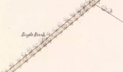
1867 Map Bogle Bush

The site on the 1867 OS Map

Perusal of a 25″ OS map of  1867 shows, in almost microscopic lettering, a feature marked ‘Bogle Bush’.  I transferred the approximate location onto a modern map and set off to make a field visit, honestly not expecting to find anything almost a century and a half later.

Bogle bush 1

The Bogle Bush

As I walked down the designated road I was drawn to an ancient multi branched or trunked tree, the trunks held together by a hefty iron band. The band had been placed there many years ago as it was being absorbed by the growth of the tree. Unlike the other trees in the road the foot of this tree had crocus and grape hyacinth in flower, as if deliberately planted.

The band was forged and fitted by Kinrossie Blacksmith and Kirk Elder David Gray at the end of the nineteenth century, following the collapse of one of the three trunks then standing.

Bogle Bush 2

The band holding the tree together

The online Ordnance Survey Name Books for Perthshire, compiled prior to the survey of the 1867 map, list Robert Millar of Flowerdale, Mr James Stewart of Kinrossie and Mr Fraser of St Euchans as the informants that ‘This name is applied to a Birch Tree situated on the north side of the road leading from Saucher to Kinrossie. Mr Millar says that there is a superstitious tradition existing in the locality that Bogles have been seen &c at this tree’.

Whether Mr Millar and his co-informants were trying to mischievously mislead the (probably) English Ordnance Survey officials, we will never know, but the tree is in fact a Sycamore! And the 1901 25″ OS map shows the tree as the ‘Bogle Busk’.

Folklore

There has been speculation that the Bogle Bush may have long forgotten links with Macbeth whose fortess at nearby Dunsinnan Hill overlooks it, adding the rider that Sycamores only live 200 years or so before falling and then regenerating on the same spot, implying that a mother tree could have been on the same spot in Macbeth’s time.

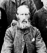
David Gray, Blacksmith and Kirk Elder of Kinrossie.

David Gray, Blacksmith and Kirk Elder of Kinrossie.

Local folklore states that ‘a great calamity will befall Kinrossie’ should the Bush collapse. The tree is a local icon that’s ‘aye been there’ according to a local resident and it seems to be a local geo-caching site, judging by the small container of ‘stuff’ hidden in a plastic container underneath a couple of pieces of bark at the base of the trunk on my visits.

Please note that if you decide to visit, this is not a wishing tree, so do not hammer coins into the bark or suspend rags from the branches. Respect the Bush and the local people to whom this is an iconic tree.

My thanks to local resident Morag Hislop for leading me to further information on this site.

References:

  1. Scotland’s Place Names
  2. Collace Parish Millenium Committee, Off The Main Road, 2nd edition: Kinrossie District Recreation Club, 2010

 © Paul T. Hornby, The Northern Antiquarian


Na Clachan Bhreige, Kirkibost, Strathaird, Skye

Stone Circle:  OS Grid Reference –  NG 5432 1768

Also known as:

  1. The False Stones
  2. Na Clachan Breitheach
  3. Strathaird Circle

Getting Here

Way off from seemingly anywhere this one – on the southern foothills of the great Cuillins, by the western edge of a seemingly unnamed loch. (most unusual) Take the Elgol road (A881) south from Broadford, nearly to its end, keeping an eye out for Kirkibost a few miles from the very end of the road. Just past here, stop and walk the track west to Camasunary a half-mile along, through the small forestry-bit, then follow the line of the trees north and keep going a bit more till y’ reach the nice stream that feeds that unnamed loch. Cross the stream!

Archaeology & History

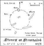
Alexander Thom's 1967 drawing

Alexander Thom’s 1967 drawing

A fascinating little site this one! Perhaps consisting of as many as eight stones at one time, only three stand visible today.  Alexander Thom (1967) reported finding other stones in this circle “being buried in the peat, but prodding revealed their position roughly” — as shown on his drawing here.  There may at one time have been as many as eight stones here, but the site itself is quite small, making a ring of stones only 21-feet across (or 8 megalithic yards as Thom had it).  The ruinous state of the site was put down to the stupidity of the Church of Scotland issuing “instructions that all stones in Skye were to be thrown down” a few centuries back.

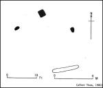
Aubrey Burl's later 'four-poster' summary

Aubrey Burl’s later ‘four-poster’ summary

Aubrey Burl reported that “there were once at least 4 stones here, the tallest being of 6ft 6ins (2m) high,” and wondered whether this was one of the many ‘four-poster’ stone circles that scatter Scotland and elsewhere.  An issue he seemed comfortable to proclaim a few years later in his survey of such sites. (Burl 1988) Of those stones still standing, the tallest is just 5 feet high; but there’s the impressive 11½-foot long monolith laying on the southeast edge of the ring!  Mr Burl also pointed out that some

“casual digging  inside the ring around 1860 uncovered a blackpolished stone about 1½ ins (4cm) long, ‘somewhat resembling a small pestle.’”

I found the proximity of the Cille Mhaire burial ground a mile west of here more than a bit intriguing (though didn’t have time to assess its geomantic relationship further).  And the reported presence of prehistoric cairns nearby imply that the Na Clachan Bhreige ‘circle’ had some relationship with death and burial.

Folklore

The folkname of ‘The False Stones’ comes from that well-known tale of the site “supposedly being the remains of three men turned into stone for deserting their wives.”  Something which Otta Swire (1964) thought was likely told by christian converts.  It would have probably replaced an earlier tale of the stones being the site where some ancestral spirits lived.  Swire also told that,

“these were once, if tradition is to be believed, Stones of Wisdom who could both foretell the future and show justice as between man and man.”

Burl (1988) also points out how,

“The name, Na Clachan Bhreige, has been variously pointed translated as ‘the judicial stones’, a place where medieval law courts were held, as in several other Scottish rings.  It has also been interpreted as ‘the stone of lies, or falsehood.’”

References:

  1. Burl, Aubrey, Four Posters: Bronze Age Stone Circles of Western Europe, BAR: Oxford 1988.
  2. Grinsell, L.V., Folklore of Prehistoric Sites in Britain, Hale: Newton Abbot 1976.
  3. Swire, Otta F., Skye: The Island and its Legends, Blackie & Sons: Glasgow 1961.
  4. Thom, Alexander, Megalithic Sites in Britain, Oxford University Press 1967.
  5. Thom, A., Thom, A.S. & Burl, Aubrey, Megalithic Rings, BAR: Oxford 1980.

© Paul BennettThe Northern Antiquarian


Witches Stones, Kirkton of Auchterhouse, Angus

Cup-and-Ring Stones (lost):  OS Grid Reference – NO 345 392

Also Known as:

  1. Canmore ID 31908
  2. Greenfield Knowe
  3. Greenford Knowe
  4. Sidlaw Hospital
  5. Spittal Stones

Archaeology & History

1843 map showing the 'Stone'

1843 map showing the ‘Stone’

We have no precise location for this carving, nor several of its petroglyphic relatives who lived within this arena for countless centuries until (you guessed it!) the advance of the Industrialists brought their profane ways to the region, with the usual disregard for local people and their unwritten traditions.   Which is a great pity, for there were obviously some old stories and important archaeology hereby.  Aubrey Burl (1988) for one, thought this cup-and-ring carving may have played its part in being one of the stones in a larger “four-poster” stone circle, although local history accounts tell that it was part of an impressive prehistoric tomb.

One of the Witches Stones

One of the Witches Stones

The Witches’ Stone we see illustrated here was one of at least two carvings in a cluster of stones.  The great J. Romilly Allen (1881) wrote about the it, although it seems he never visited the site himself.  Instead, his description came from that of a colleague, a Mr W. McNicoll, who told him that at the position marked on the early OS-map as a single “Stone” that was “Remains of a Druidical Altar” there were in fact

“two in number: one, an upright pointed stone, 5ft by 2ft by 3ft 6in high; ans the other lying 3ft 6in to the southwest, 7ft 6in by 5ft by 2ft 6in thick.  The latter has fifteen cups, varying from 2 to 3in in diameter; one with a single ring carved on the sloping face at the south end of the stone.  It lies horizontally and has two hollows, worn at the ends where the cups are, by the toes of persons climbing onto the top.  The ground under this stone has been partly removed and it appears to rest on two others; but the whole appears to be natural and not a cromlech or rocking stone.”

Folklore

One of the Witches Stones

One of the Witches Stones

Reference was made to this “Witches Stone” in the 1860 Object Name Book of the region, where it was said to have been part of a larger group, “considered to have been used by the Druids as a place of worship.”  This catch-all phrase of druidic relevance should be translated as “local traditional importance” where animistic rites of some sort would have occurred.  Certainly we find the usual reverence or fear in the local tale told by Mr Hutcheson (1905) which he thankfully recorded following his visit to the site:

“Here…occupying a small knoll known locally as Greenfield Knowe, towards the western end of the plateau…two upright standing stones of boulder character formed a conspicuous feature.  They were, if tradition be accepted, the survivors of a larger group.  The same tradition records that the farmer of Greenfield Farm, requiring stones for the erection of dykes, removed some of the standing stones from Greenfield Knowe.  He, however, speedily found unexpected difficulty in carrying out his intentions.  The dykers whom he had employed absolutely refused to use the stones, alleging they would thereby bring misfortune upon themselves and families, , and threatened, rather than risk such calamities, to throw up the job.

“While in this quandry the farmer, it is said, had a vision: a ghostly figure appeared to him, and in a hollow voice warned him against interference with he stones on Greenfield Knowe, and concluded by the adjuration, “Gang ower the howe t’ anither knowe.”  Needless to say, the farmer lost no time in obeying his ghostly visitor.  Next morning he carted back the stones he had removed and sought material for his dykes elsewhere.”

This is probably the same tale, slightly reformed, which the local historian W.M. Inglis (1888) described, when he told that,

“About the beginning of the present century, when a worthy old parishioner was having some repairs carried out upon his house, he removed a few of the large stones with the intention of having them built into the walls.  Throughout the night, however, an eerie feeling came over him, his conscience was on fire, he could get no rest.  Accordingly he got out of bed, yoked his horse into the cart, and like a sensible man replaced yjr sacred stones where he found them, went home, and thereafter slept the sleep of the righteous.”

…to be continued…

References:

  1. Allen, J. Romilly, “Notice of Prehistoric Remains near Tealing, in Forfarshire” in Journal of British Archaeological Association, volume 37, 1881.
  2. Burl, Aubrey, Four Posters: Bronze Age Stone Circles of Western Europe, BAR 195: Oxford 1988.
  3. Hutcheson, Alexander, “Notice of the Discovery of Stone Coffins at Auchterhouse,” in Proceedings of the Society of Antiquaries, Scotland, volume 39, 1905.
  4. Inglis, W. Mason, Annals of an Angus Parish, John Leng: Dundee 1888.

© Paul BennettThe Northern Antiquarian


Holy Well, Longthorpe, Peterborough, Northamptonshire

Holy Well:  OS Grid-Reference – TL 1678 9815

Also known as:

  1. St. Cloud’s Well

Getting Here

From Thorpe Green, Longthorpe, then take the Larklands road.  Once a copse of trees appears at the front near a T-junction, the well can be accessed to the side of this wood.

Archaeology & History

The well was enclosed in grounds belonging to St John family, an estate laid out in a style similar to the pleasure gardens of Vauxhall. Within these grounds was an 18th century summerhouse, which has now vanished. A distillery was established here by a Doctor Skirmshire, who lived at Longthorpe, for making ‘considerable quantities of lavender and peppermint, cultivated in adjacent fields..’ (Arrowsmith n.d.).

Sadly, there appear to be no ancient records which justify ascribing an ancient date to the Holy Well complex. Indeed, it would appear to be contemporary with the summerhouse. Perhaps it was built to provide a folly-hermitage to support the legend? It is said that the summerhouse was demolished in the mid-ninteenth century because of the disorderly proceedings undertaken in it by visitors from Peterborough! According to Thompson (1913), the dressed stone was used for the kitchen floor of the nearby Manor House.

Thompson gives a plan of the well along with an accurate description, which luckily does not differ from the sight which greets the visitor today (although there is now an ugly metal gate on the structure):

‘The subterranean chambers constitute a medley of design and structure; they are not caves, although now underground, but were apparently first built….

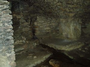
The walls and domed roofs consist of undressed stone. The passage from the pool runs in a direction of N 60 W, and is some six feet long. The entrance being two feet four inches wide by five feet high. The first chamber or antechamber is mostly to the left and nearly at right angles to the passage; it is approximately ten feet by eight feet. In this there is a window high up, evidently a more recent introduction, for the frame is of dressed stone, and the rough stone roof cuts across it, so that external appearance rather than internal use would appear to have been the dominating factor in its design. On the opposite wall of the window is a doorway, and at one time evidently a door, for one stone jamb of dressed stone is left. This doorway opens into the very irregular second or main chamber, roughly twenty feet long, by fifteen feet wide near the widest part. Immediately within the doorway is a well, with dressed stone curb, of three feet internal diameter, and exactly above, in the roof is another smaller circular opening lined with dressed stone as though arranged to draw water from the well from the mound above without going into the chamber, but this is not now open. The well is now choked with stones, but the water used to overflow from the well and run down the passage way to the pool outside, it now flows out oat a lower level leaving the passage way dry. Immediately on the right, after entering the large chamber is am opening leading to a third chamber, smaller, crudely oval, but an indescribable shape, approximately eight to nine feet one way by twelve feet another.

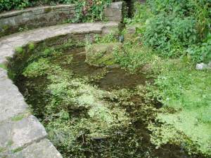
Comparing Thompson’s description and the photograph, one can note a few differences, the main one being that the site in general has become noticeably overgrown. The wall which appears to run along one side has become overgrown and derelict, the pool overgrown, and rubbish-strewn. Within the structure, the curbed well has gone and now one can see the water bubbling from the rock.

Folklore

One side of this is the opening, now blocked up, to a supposed underground passage to Peterborough Cathedral, by which the monks of the Abbey of Burgh, were said to come and bathe in the pool….

To the left of this large chamber, on entering the latter, is a recess some fifteen feet wide and nine feet deep, with a floor consisting essentially of two steps, both apparently of ‘live’ rock, i.e. rock in situ; the upper step being the wider and more like a dais. There is a rather small opening high up on the outer wall of this recess, some five feet from the dais, and is about seventeen inches wide by twenty two feet high, but goes four feet or more in the thickness of the wall or mound without providing an external opening.’
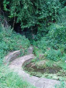
OLYMPUS DIGITAL CAMERAThe site’s greatest fame stems from the tunnel mentioned above by Thompson, which is said to run from the Holy Well to the Abbey at Peterborough. A blocked-up doorway in the third chamber is described as the entrance to this tunnel, although one can imagine that the nature of the whole edifice would lend to such a belief. Certainly records show that the Abbey was supplied by a conduit at the Infirmary end of the Chapel of St Lawrence. However, it is more likely that this took its waters from the St Leonard’s Well at Spital, whose water also filled the Boroughbury Pools and Swan’s Pool.

Yet records show that the Abbey was interested in the site. During Abbot Godfreys tenure, in 1130s the following document states:

Amos ejus viii inclusat porceum Burgi Sumptus iiij I lb: xv sol. Item feat fossutum salveunium inter Thorpe fen et le Dom Sumptus xx sol‘.

Anon 1904-6
OLYMPUS DIGITAL CAMERA OLYMPUS DIGITAL CAMERA OLYMPUS DIGITAL CAMERA


This enclosure cost four pounds and fifteen shillings. Under Abbot Gyerge another document notes the extent of this land (Halywelle), of four acres, three rood and twenty pearches, which until the building of the estate remained the same (Anon 1904-1906). Yet neither of these documents explicitly refers to the laying of a conduit.

The only possible justification for this belief came in November 6th 1964, when workmen, excavating to set up telephone kiosks beside the old Guildhall on Cathedral square, unearthed an underground passage. This continued for twenty five feet under church street, and ran parallel to land belonging to the Almoner’s Garden that was exchanged in the 1194-1200 agreement between the Abbot and the Vicar of Burgh and Longthorpe.  Unfortunately, the underground passage turned out to be some kind of eighteenth century fire precautions.
OLYMPUS DIGITAL CAMERA OLYMPUS DIGITAL CAMERA OLYMPUS DIGITAL CAMERA

Much of the site’s folklore and history derives from a story entitled The Knight of the Red Cross, a story based in the twelfth century, in Richard I’s reign. There is some confusion about the place where this work is published. Thompson (1913)  in his Peculiarities of water and wells states that it is contained within a work called Wild flowers gathered: original pieces in prose and rhyme, printed by J. S. Clarke, with no author or date; whereas  Arrowsmith (n.d) states it comes from a similarly titled, A list of wild flowers found in the neighbourhood of Peterborough, by F. A. Paley. Arrowsmith further notes that the work is advertised on the back of the same author’s Notes on twenty Parish churches round Peterborough, published in 1859. Unfortunately, I have been unable to trace either of these to confirm which is the right source. How much the story is based on any ancient account is unclear. It may be ‘faction’ or fiction, a problem of course with many sites. The applicable parts are produced below as Thompson (1913) notes:

“There is a beautiful spot, called Holywell, in the neighbourhood of Peterborough, well known, and much frequented by the inhabitants. The road lies through a pleasant park, where stands an ancient edifice belonging to the Fitzwilliam family, called Thorpe Hall… After passing the front of this mansion, turn to the left, by the stables and outer buildings will lead, through a white gate, to a small green field from whence this picturesque little spot is seen, with its ivy clad walls, and its dark cypress and yew trees, casting their gloomy shadows around. Passing some broken steps which form the entrance, a shady path conducts to a modern niche, supported by two pilasters, over a slab pavement to a stone basin about six feet in depth and thirty in circumference. This is constantly supplied with clear water, running from the mouth of a subterraneous passage which connects Holywell with the cathedral of Peterborough. An artificial mound of earth is thrown up above this cavity, which is covered with creepers, ground-ivy and a few wild flowers.

Contiguous to the basin are some small fish ponds, partially shaded by beautiful trees; and the green rushes which grow at their bank form undisturbed retreat in which the moor-hen builds her solitary nest. A little further on is a piece of an old pillar, which is gracefully overhung with a wreath of ivy… An old wall surrounding Holywell on two sides, in which traces of windows and doorways are still discernible, is the last feature we shall mention.”

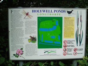
Arrowsmith (n.d) states that these pools have been called ‘Monk’s Stew Ponds’ or ‘Paradise Ponds’, although Arrowsmith considers that the long distance from the Abbey makes it unlikely, as the Abbey was close to good fishing waters  He continues, ‘The waters of this well were formerly in high repute, and were much frequented by those who came on pilgrimages’

Its waters, according to Thompson (1913), are said to be slightly ferruginous, though he detected no sign of it, and nor did I. It was also thought to be efficacious for gout, rheumatism, skin diseases, and good for eyes.

It was believed that a Hermit, called St Cloud, lived at the site. Thompson (1913) continues, quoting J. S. Clarke, that he was ‘of great celebrity, whose pious councils and paternosters were generally in request amongst all pilgrims who visited the spot.’

Some authorities, such as Arrowsmith, have identified this hermit as St Botolph, who is said to have lived within a mile of his chapel during its construction on the Thorpe Avenue site. He is associated with other wells, such as that at Hadstock, Essex, so it is not impossible.

References:

  1. Anonymous, “Holywell,” in Fenland Notes and Queries6, pp.22-4, 1904-6
  2. Arrowsmith, A. L., Longthorpe and its Environs: Microcosm of a Village, privately published: no date.
  3. Bord, J. and C., Sacred Waters, Granada: London 1985.
  4. Thompson, B., “The Peculiarities of Water and Wells,” in Journal of Northants Natural History Society and Field Club18(135), 1913.

Extracted and edited from the original post – Holy & Healing Wells

© R.B. Parish, The Northern Antiquarian


Hawklemass Well, Whittingham, Northumberland

Healing Well:  OS Grid Reference – NU 0683 1228

Archaeology & History

Hawklemass Well on 1866 map

Hawklemass Well on 1866 map

References to this site seem very scarce.  A well is highlighted on the 1866 OS-map of the region close to the spot which D.D. Dixon (1895) said it was found, “near to the Howbalk Lane end, where is also the Hawklemass Stile and Hawklemass Well.”  A stone trough could once be seen here, but its presence today needs to be confirmed by local researchers.  The site is listed in Binnall & Dodds (1943) survey, but with no additional comments to those made by Mr Dixon.

Folklore

The historian D.D. Dixon (1895) told that the village of Whittingham only had one ghost, but it was known as the “Hawklemass Ghost” and was occasionally encountered at the Hawklemass Well:

“This was a place never passed after nightfall by the youth of the village without feeling an eerie, creepy sensation, and with many a furtive glance on either side.  This unearthly visitant, in its gambols and uncanny pranks, was said to rattle the chain by which it was supposed to be bound in a fearsome manner.  It was usually seen or heard by persons who, having lingered long at the village inn, could say with Tam o’ Shanter,

“While we sit bousing at the nappy,
An gettin’ fou and unco happy,
We think na on the lang Scots miles,
The mosses, waters, slaps and styles,
That lie between us and our hame.”

One Saturday night many years ago—perhaps fifty—a poor fellow on his way from Whittingham to Glanton fel into the roadside at Hawklemass, where he was found, quite dead, the next morning by some persons on their way to Glanton meeting.  This sad affair may have given rise to the tradition of the Hawklemass Ghost.”

The name of the old lane at whose junction the Hawklemass Well once flowed, ‘Howbalk Lane’, may derive from a lost tumulus, as the word how (and its variants) regularly relate to prehistoric mounds in our more northern climes.  Such an ancient tomb, close to the well, may be the origin of the ghost story.

References:

  1. Binnall, P.B.G. & Dodds, M.H., “Holy Wells in Northumberland and Durham – part 2”, in Proceedings of the Society of Antiquaries Newcastle-upon-Tyne, 10:2, 1943.
  2. Dixon, David Dippie, Whittingham Vale, Northumberland, Robert Redpath: Newcastle 1895.

Acknowledgements:  With thanks to Gill Rutherford for prompting me to finish this; and to Claire Heron for the OS-map reference.

© Paul BennettThe Northern Antiquarian