St. John’s Well, Berkhamsted, Hertfordshire

Holy Well (destroyed):  OS Grid Reference – SP 9848 0822

Also Known as:

  1. St. James’ Well

Archaeology & History

Site shown on 1897 map

Shown on the early Ordnance Survey maps of the town, Berkhamsted’s holy well was a place of some renown in bygone centuries.  Today it is barely remembered.  It was initially dedicated to St. James, as it was associated with a chapel dedicated to that saint close by, but it had a change of name when the legendary Brotherhood of St. John the Baptist became the new caretakers, so to speak.  As a result of this, its history can be a little confusing to some folk!

In the late 12th century, pagan worship at this site came to the attention of Hugh of Grenoble, the Bishop of Lincoln, who visited the place to stop local folk performing their animistic practices (although the exact nature of such rites were not described, sadly).  It didn’t work, obviously; as once the bonkers bishop had gone, local folk would have continued in their old ways, no doubt wondering who the hell the odd incomer had been who was telling them to stop doing what they had always done here at the cost of no one.  And so the waters continued to be used under the mythic cover of old St James—for the time being at least.

The well later became a centre of pilgrimage and and a hospital was been built close by dedicated to St James, where leprosy was treated and the curative waters from this well were used.  St James’ Day was July 25 and an annual fair was held in Berkhamsted thanks to a Royal Charter of James I in 1619.  Hertfordshire traditions relating to St James Day are described in Miss Jones-Baker’s (1974) fine survey on the customs of the county.  But change was a-coming when a local monk had a dream that the waters of this “pagan spring” needed to be blessed and dedicated to the virtues of St. John the Evangelist and a shrine built where pilgrims could worship and be healed.  And as Jones-Baker (1977) told us,

“The water of St John’s Well were thought to cure a variety of diseases; among these leprosy and scrofula (the King’s Evil) as well as sore eyes.  There was also a persistent belief that clothing washed in its waters would impart good health to the wearers.”

In the period when the Protestant Reformation occurred, the well and its immediate surrounds apparently became derelict and overgrown.  The Old Ways returned and local folk began to visit the waters again at night and the animistic rituals that would have been taken to other secret places returned to St. John’s Well.  In this period a local physician, a Dr. Woodhouse, used the sacred waters as part of magickal rites to exorcise evil spirits!

In spite of the local authorities declaring in 1865 that the water was “unfit for drinking”, local folk later told otherwise.  Its waters were still being used in the 20th century and its traditions no doubt retained.  As the local writer Dora Fry (1954) told us:

“The families dwelling in the cottages at the Bulbourne end of the lane, just below St John’s Spring, were all remarkably healthy… Some time after the town got its first waterworks (and) the local authorities declared that the well’s water was to be used only for the gardens… but I remember as a child drinking the water from the main spring and its coolness and freshness were delectable on a hot summer afternoon.”

The well was still visible up until the 1930s, when its waters ran down a shallow channel along St John Well’s Lane, but then a shop was built above the site and the well has been lost forever.

References:

  1. Bord, Janet & Colin, Sacred Waters, Granada: London 1985.
  2. Chauncy, Henry, The Historical Antiquities of Hertfordshire – volume 2, J.M. Mullinger: Bishops Stortford 1826.
  3. Cobb, John W., Two Lectures on the History and Antiquities of Berkhamsted, Nichols & Son: London 1883.
  4. Fry, Dora, “St. John’s Well,” in Hertfordshire Countryside, volume 8, 1954.
  5. Harte, Jeremy, English Holy Wells – volume 2, Heart of Albion press: Wymeswold 2008.
  6. Jones-Baker, Doris, Old Hertfordshire Calendar, Phillimore: London 1974.
  7. Jones-Baker, Doris, The Folklore of Hertfordshire, B.T. Batsford: London 1977.
  8. Page, William (ed.), Victoria History of the County of Hertford – volume 2, Archibald Constable: London 1908.
  9. Salmon, N., The History of HertfordshireDescribing the County and its Monuments, London 1728.

Acknowledgements:  Huge thanks for use of the Ordnance Survey map in this site profile, reproduced with the kind permission of the National Library of Scotland

© Paul BennettThe Northern Antiquarian

Dun Osdale, Dunvegan, Skye

Broch:  OS Grid Reference – NG 24162 46424

Also Known as:

  1. Canmore ID 10832

Getting Here

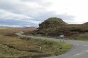
Dun Osdale, by the roadside

From the A863 Dunvegan road, a mile south of the village turn onto the B884 road at Lonmore, making sure you veer right after a few hundred yards and head towards Glendale.  About a mile along, on the left-hand side of the road, note the small rocky crag that begins to grow just above the roadside.  At the end of this crag you’ll see a huge pile of rocks, seemingly tumbling down, just by a small T-junction to Uiginish.  You can’t really miss it.

Archaeology & History

Listed as one of the duns, or fortified prehistoric structures in Skye by the old writer J.A. MacCulloch (1905), the rediscovery of this broch was, said A.A. MacGregor (1930), one that “became historical only within living memory.”  I find that hard to believe!  The Gaelic speakers hereby merely kept their tongues still when asked, as was common in days of olde—and it was a faerie abode….
Looking at the SW walling
Looking at the SE walls

Once you go through the gate below the broch, the large boggy area you have to circumnavigate is the overflow from an ancient well, known as Tobar na Maor, where Anne Ross said, “tradition that the stewards of three adjacent properties met there.”  This well was covered by an ancient Pictish stone (now in Dunvegan Castle), which may originally have been associated with the broch just above it.  When I visited the site with Aisha and Her clan, we passed the overgrown well and walked straight up to the broch.

Despite being ruinous it is still most impressive.  The massive walling on its southwestern side is still intact in places; but you don’t get a real impression of the work that went into building these structures until you’re on top.  The walls themselves are so thick and well-built that you puzzle over the energy required to build so massive a monument.  And Scotland has masses of them!
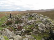
Aisha in the broch
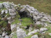
Small internal chamber

The site was surveyed briefly when the Ordnance Survey lads came here in 1877, subsequently highlighting it on the first OS-map of the area.  But it didn’t receive any archaeocentric assessment until the Royal Commission (1928) lads explored the area some fifty years later.  In their outstanding Inventory of the region they described Dun Osdale in considerable detail, although kept their description purely architectural in nature, betraying any real sense of meaning and history which local folk must have told them.  They wrote:

“The outer face of the wall of the broch for a great part is reduced to the lower courses, but on the west-southwest a section still maintains a height of about 7 feet; on the south-side, although hidden by fallen stones, it is about 4 to 5 feet high, and on the northeast there is a very short section 3 feet in height.  The stones are of considerable size and laid in regular courses.  In the interior a mass of tumbled stone obscures the most of the inner face of the wall, but on the south and northwest it stands about 8 feet above the debris.  The broch is circular with an internal diameter of 35 feet to 35 feet 6 inches, and the wall thickens from 10 feet on the north to 13 feet 7 inches on the south. The entrance, which is one the east, is badly broken down, but near the inside has a width of 3 feet 2 inches, and appears to have been 2 feet 10 inches on the outside; it has run straight through the wall without checks.  In the thickness of the wall to the south of the entrance is an oval chamber measuring 10 feet long by 4 feet 9 inches broad above the debris with which it is half-filled.  The roof has fallen in, but the internal corbelling of the walls is well displayed.  The fallen stones no doubt still cover the entrance, which has probably been from the interior.  Within the western arc of the wall, nearly opposite the main doorway, is another oval cell 12 feet in length and 4 feet 6 inches in breadth over debris, with a doorway 2 feet 9 inches wide; its outer and inner walls are 5 feet 9 inches, and 2 feet 6 inches respectively.  The roof od this chamber has also collapsed, but from the masonry which remains in position it must have been over 6 feet in height.  Immediately to the west of the cell near the entrance are exposed the left jamb of a door and a short length of a gallery 3 feet 6 inches wide in the thickness of the southern wall, which probably contained the stairs, as traces of a gallery at a higher level than the oval chambers are seen here, the inner wall being about 3 feet and the outer 8 feet thick. Parts of a scarcement 9 inches wide can be detected on the northwestern and southeastern arcs.”
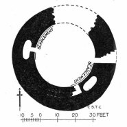
Dun Osdale plan (RCAHMS 1928)
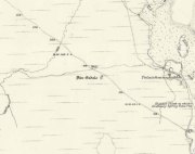
Dun Osdale on 1881 map

Measurements and architectural tedium aside, the broch is worthwhile for anyone interested in our ancient mythic past, not least because of its position in the landscape and its visual relationship with other sites of the same period nearby.  As well as that, there are unrecorded ancient sites still hiding in these olde moors…

Folklore

Tradition tells that Dun Osdale was used as a watch-tower by the tribal folk—which seems quite credible.  But the original inhabitants of Duirinish, the sith or fairy folk, were also said to live here.  It’s one of several places in Duirinish where the legendary Fairy Cup of Dunvegan was said to have come from.  Otta Swire (1961) told its tale:

“One midsummer night a MacLeod, searching for strayed cattle, stayed late on the moor.  In the moonlight he saw the door of Dun Osdale open and the little people come out, a long train of them, and began to dance on the green grass knoll nearby.  Fascinated, he watched, forgetting everything but the wonderful dance. Suddenly he sneezed.  The spell was broke.  The dance stopped.  MacLeod sprang up to fly, but the fairies were upon him and he was dragged, willy-nilly, into the dun.  Inside, as soon as his eyes grew accustomed to that strange green light associated with fairyland, he beheld a pleasing sight.  A great banquet was spread on a large table carved from a single tree: on it were vessels of gold and silver, many of them set with jewels or chased in strange designs.  His fairy ‘hosts’ led him to the table, poured wine into one of the beautiful cups and, giving it to him, invited him to toast their chief.  Now this man’s mother was a witch, so he knew well that if he ate or drank in the dun he was in the Daoine Sithe’s power for ever.  He lifted the cup and appeared to drink the required toast, but in fact skilfully let the wine run down inside his coat.  As soon as his neighbours saw the cup was half empty, they ceased to bother about him but went off on their own affairs or to attend the banquet.  Thereafter MacLeod watched for a chance of escape and, when one offered, slipped quietly through the door of the dun and away, carrying the cup with him.

“The fairies soon realised what had happened and started in pursuit, but he was already across the Osdale river and in safety.  He hurried home, told his mother the story, and showed her the cup.  Being a wise woman she realised the peril in which he undoubtedly stood and at once put her most powerful spell upon him to protect him from the arts of the Daoine Sithe, warning him seriously never to leave the house for a moment without getting the spell renewed.  But she forgot to put a protecting spell upon the cup also.  The fairies soon discovered the exact state of affairs and immediately laid their own spell upon the cup, a spell so powerful that all who saw the cup or even heard of it, were seized with an overmastering desire to possess it, even if such possession involved the murder of the holder.

“For a year, all went well and thanks to his mother’s care the young man went unharmed.  Then he grew careless and one day ventured out without the protecting spell.  A one-time friend, bewitched by the cup, had been awaiting just such a chance and immediately murdered him and went off with the prize.  The fairies, their revenge achieved, took no further interest in the matter, but MacLeod of MacLeod did.  The boy’s mother hurried to him with her story, and he at once gave orders that the murderer be found and brought to justice.  He was duly hanged and the trouble-making cup, now free of enchantment, passed into the possession of the chief and can still be seen in (Dunvegan) castle.”

References:

  1. Donaldson-Blyth, Ian, In Search of Prehistoric Skye, Thistle: Insch 1995.
  2. MacCulloch, J.A.,  The Misty Isle of Skye, Oliphant, Anderson & Ferrier: Edinburgh 1905.
  3. MacGregor, Alasdair Alpin, Over the Sea to Skye, Chambers: Edinburgh 1930.
  4. Royal Commission on Ancient & Historical Monuments of Scotland, Inventory of Monuments and Constructions in the Outer Hebrides, Skye and the Small Isles, HMSO: Edinburgh 1928.
  5. Swire, Otta F., Skye: The Island its Legends, Blackie & Sons: Glasgow 1961.

Acknowledgements:  Eternally grateful to the awesome Aisha Domleo and Her little clan for getting us to this ancient haven on Skye’s endless domain of natural beauty.  Without Her, this would not have been written.  Also, accreditation of early OS-map usage, reproduced with the permission of the National Library of Scotland.

© Paul BennettThe Northern Antiquarian


St. John's Well, Isle of May, Fife

Holy Well:  OS Grid Reference – NT 65858 99107

Also Known as:

  1. Pump Well

Archaeology & History

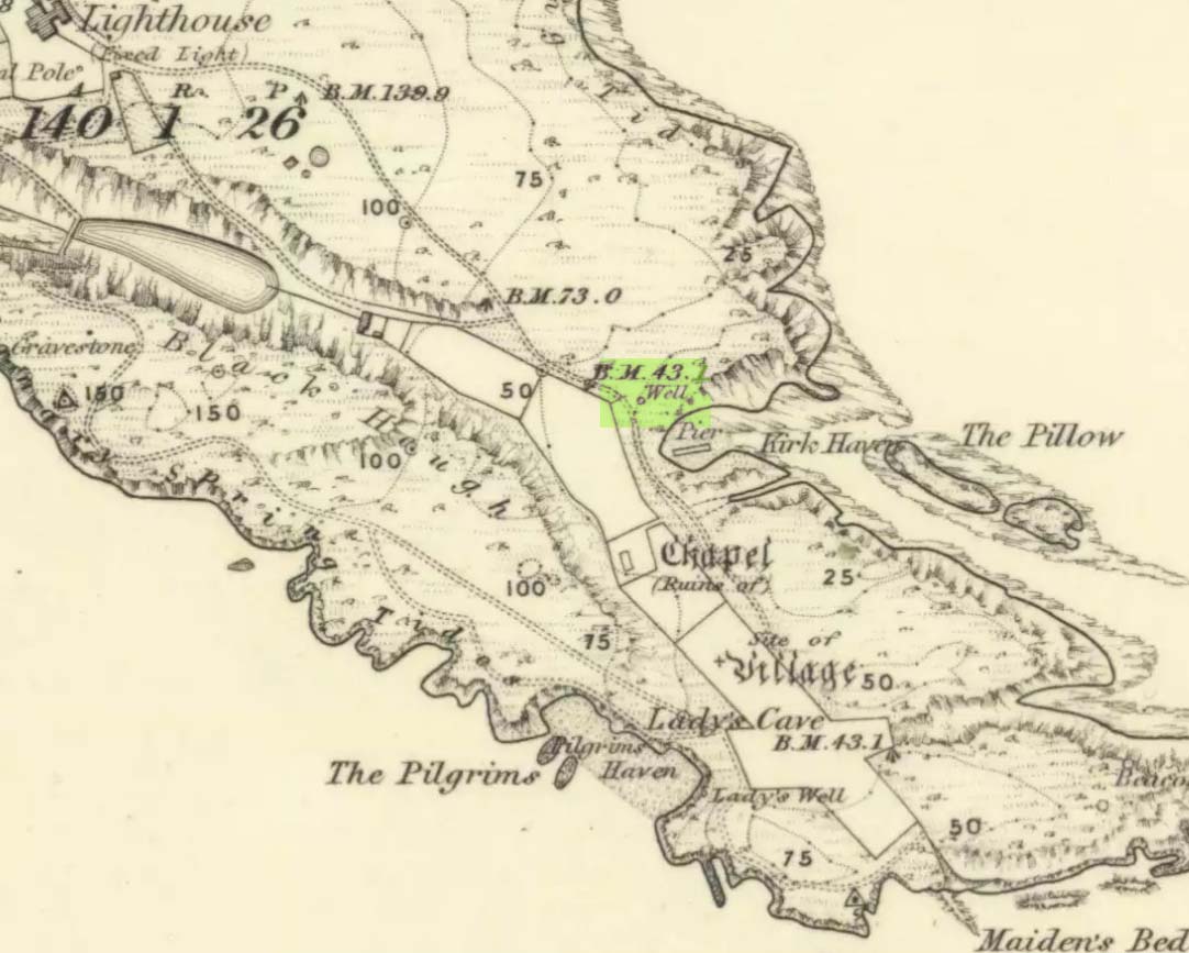
St John’s ‘Well’ on 1855 map

This seems to be the only ‘St John’ dedication on the Isle of May: a small island littered with more saint’s names, seemingly, than Iona and Lindisfarne combined!  Illustrated on the 1855 OS-map, without name—and on the present-day large-scale OS-maps too, 20 yards or so from its 1855 position—the standard archaeo-historical records say nothing of the place.  Thankfully antiquarian and folklore accounts have preserved evidence of its title.  When the Victorian traveller Thomas Muir (1868; 1883) visited the Isle of May, he told how the islanders struggled to maintain a good water supply during a drought there in the 1860s.  St. John’s Well was, he told,

“A pump standing by the path above Kirk Haven. The water good, but a little brackish. During all the drought of this summer we pumped water out of this well to supply our cattle.”

After Æ. J.G. Mackay’s (1896) visit to the island he told that here, along with the other holy wells on May,

“their brackish waters have lost the magic virtue they were credited with in early christian, possibly in pagan times.”

In more recent times it was described in W.J. Eggeling’s (1985) natural history survey.  St. John’s Well was,

“the well within the high, cylindrical, whitewashed wall-surround lying across Haven Road from the Coal House. Also known as the Pump Well.  It is a guiding mark for boats entering Kirk Haven.”

Folklore

St. John’s Day (June 24) was the christian name given to the traditional Midsummer Day, or days, around which good heathen festivals occurred; but we can find no ritual accounts of activity specific to this Well. Help!

References:

  1. Dickson, John, Emeralds Chased in Gold; or, The Isles of the Forth, Oliphant: Edinburgh 1899.
  2. Eggeling, W.J., The Isle of May, Lorien 1985.
  3. Mackay, Æ. J.G., A History of Fife and Kinross, William Blackwood: Edinburgh 1896.
  4. Muir, Thomas S., The Isle of May – A Sketch, Edinburgh 1868.
  5. Muir, Thomas S., Ecclesiological Notes on some of the Islands of Scotland, David Douglas: Edinburgh 1883.
  6. Simpkins, John Ewart, Examples of Printed Folk-lore Concerning Fife, with some Notes on Clackmannan and Kinross-shires, Sidgwick & Jackson: London 1914.

© Paul Bennett, The Northern Antiquarian 

Colpy, Culsalmond, Aberdeenshire

Stone Circle (destroyed): OS Grid Reference – NJ 6411 3261

Also Known as:

  1. Canmore ID 18272

Archaeology & History

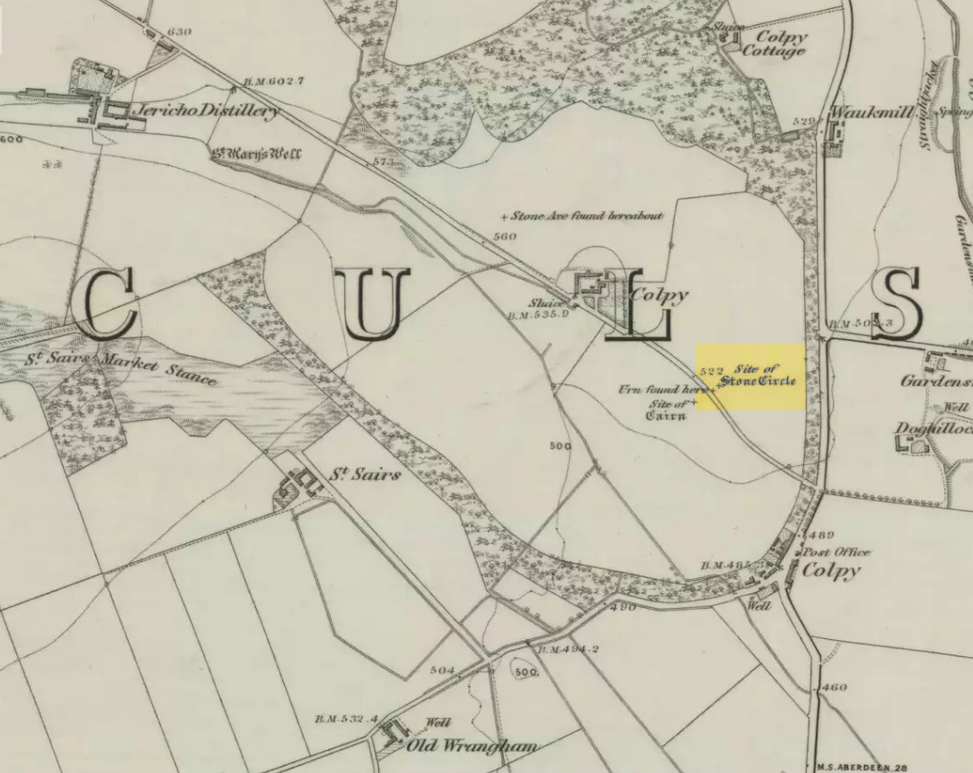
Colpy Circle site on 1868 map

Just like the stone circle a half-mile east at Kirkton of Culsalmond, nothing now remains of this megalithic ring.  It was first described very briefly by Rev. F. Ellis (1845) in the New Statistical Account as a “druidical temple”: one of two hereby, “on the farm of Colpie, although now almost obliterated. Several urns were dug up in making a road near one of them”—implying that one of them was a cairn circle or funerary monument of some kind.  This was subsequently affirmed on the early OS-map and then described in Fred Coles’ (1902) survey, where he wrote:

“Site of a stone circle, the road going to Jericho Distillery having been made through it, and, on the south side of this road, the site of a cairn. Within the possible diameter of the circle an urn was found.”

Folklore

A few hundred yards west of the circle an ancient fair used to be held, known as St Sair’s Fair, named after St Serf.  Although St Serf’s Day is July 1, early records show that the fair—held in a long field with the curious name of ‘St Sairs Market Stance’—was to be held on the Wednesday after the last Tuesday in June.  For a stone circle, this is too close to Midsummer to be a coincidence!  Early records show that the fair was granted in 1591 and subsequent years thereafter.

St Serf is a very peculiar mythological figure with quite shamanistic traits and tales around him.  In truth, many of these early saints were little more than lapsed shamans, utilising natural magick and medicine in the olde traditions, but which became grafted onto the incoming christian mythos.  The evidence for this is quite overwhelming!

References:

  1. Barnatt, John, Stone Circles of Britain – volume 2, BAR: Oxford 1989.
  2. Browne, G.F., On Some Antiquities in the Neighbourhood of Dunecht House, Aberdeenshire, Cambridge University Press 1921.
  3. Burl, Aubrey, “The Recumbent Stone Circles of North-East Scotland”, in Proceedings Society of Antiquaries, Scotland, volume 102, 1973.
  4. Burl, Aubrey, The Stone Circles of the British Isles, Yale University Press 1976.
  5. Burl, Aubrey, The Stone Circles of Britain, Ireland and Brittany, Yale University Press 2000.
  6. Coles, Fred, “Report on Stone Circles in Aberdeenshire (Inverurie, Eastern Parishes, and Insch Districts),” in Proceedings Society Antiquaries, Scotland, volume 36, 1902.
  7. Ellis, F., “Parish of Culsalmond,” in New Statistical Account of Scotland – volume 12: Aberdeen, William Blackwood: Edinburgh 1845.

© Paul Bennett, The Northern Antiquarian 


Newtyle, Dunkeld, Perthshire

Standing Stones:  OS Grid Reference – NO 04489 41057

Also Known as:

  1. Doo’s Nest
  2. Druid’s Stones
  3. New Tyle

Getting Here

Newtyle’s standing stones

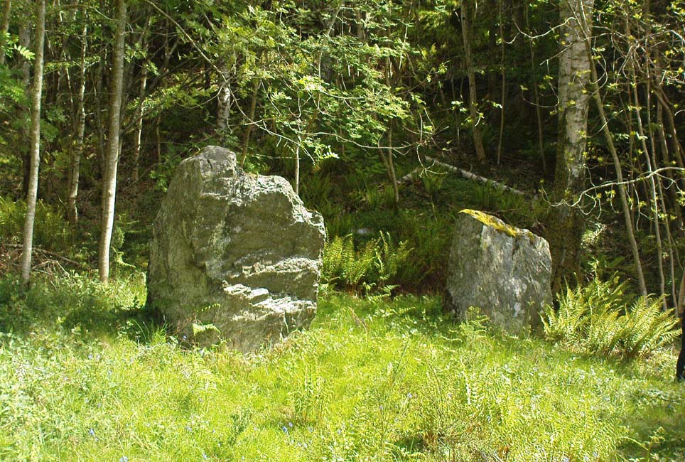
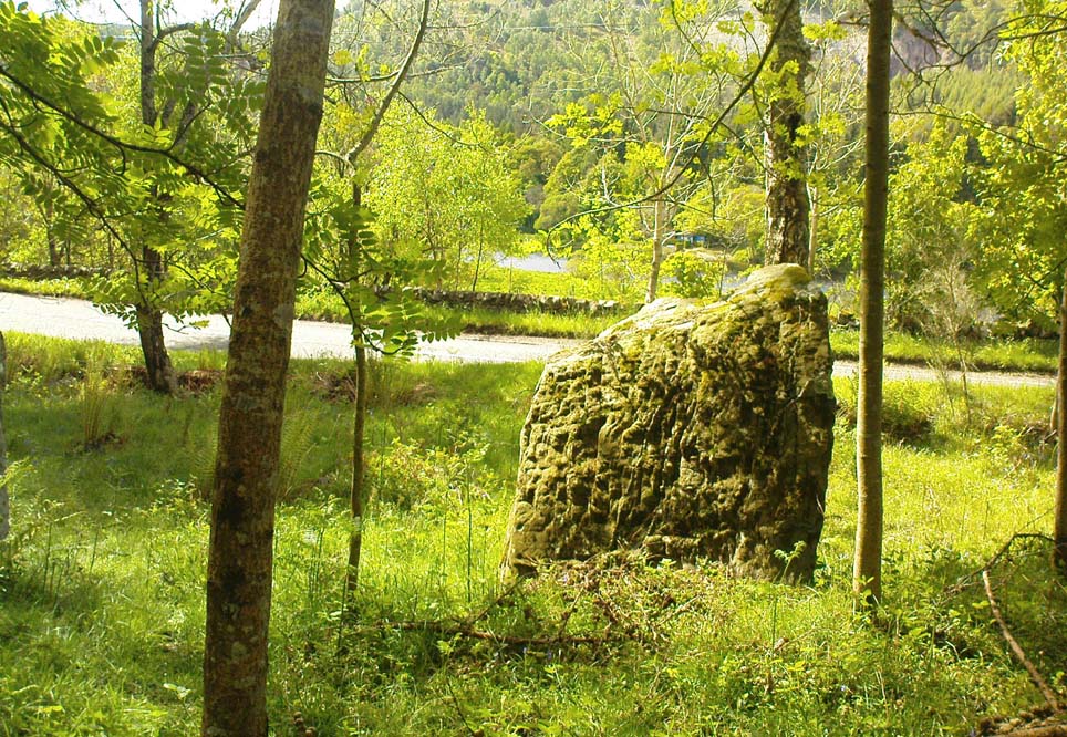
From Dunkeld travel southeast on the A984 road to Caputh and after about 1½ miles, set back a few yards from the road amidst the trees below the Newtyle Quarries (whose mass of slate and loose rocks cover the slopes), you’ll see these two large monoliths.  There’s nowhere to park here, but there’s a small road a coupla hundred yards before the stones aswell as a space to park on the verge by the side of the road a few hundred yards after them.  Take your pick!

Archaeology & History

When we visited these two tall standing stones a few weeks ago, guerilla archaeologist Hornby and I were a little perplexed at the state of these stones, wondering whether they were a product of the fella’s who dug the quarries above here, or whether they were truly ancient.  It seems the latter is the consensus opinion!

They were described by the great Fred Coles (1908) in one of his lengthy essays on the megaliths of Perthshire, where he thought the two stones here were all that remained of a stone circle that once stood on the flat, above the River Tay, but whose other stones “were destroyed in the making of the road” which runs right past here.  Not so sure misself!  He told that,

“An old cart-track runs up between the stones, leading from the main road…up to the quarry. The mean axis of the two stones runs N 13° W and S 13° E (true), and although their broader faces do not point towards the centre of a circle on the west, it is certainly much more probable that the other stones were on this side, the lower and flatter ground, than on the east, where the ground slopes and is more broken and rough.

“Both stones are of the common quartzose schist, but they differ considerably in shape.  A is 6 feet 7 inches high at the north corner, but only 4 feet 10 inches at the south, and its vertical height at the east is only 3 feet.  The basal girth is 13 feet 3 inches, and in the middle 15 feet 9 inches.  The broad east face measures 5 feet.  Stone B is level-topped and 5 feet in height; it has a basal girth of 12 feet 4 inches, and at the middle of 11 feet 8 inches.  Its two broad faces are of the same breadth.”

Little else was said of the two stones for many years and, to my knowledge, no real excavation has been undertaken here.  But when Alexander Thom (1990) visited the site he found that,

“This two stone alignment showed the midsummer setting sun.  The south stone may possibly, by itself, have shown the setting Moon at major standstill.”

Aubrey Burl’s description of the stones was succinct and echoed much of what Coles had said decades earlier, telling:

“Two very large stones stand only 9 feet (2.7m) apart in an unusually closed-in environment for a Perthshire pair.  The ground rises very steeply to the east.  To the west the stones overlook the valley of the River Tay.

“Both are of local quartzoze schist and are ‘playing-card’ in shape.  As usual it is the westernmost stone that is taller, 7ft 2in (2.2m) in height.  Its peak tapers almost to a point.  Conversely, its partner is flat-topped and only 4ft 9in (1.5m) high.  The pairing of such dissimilarly shaped stones has led to the interpretation of them as male and female personifications.”

Alex Thom’s groundplan
Back of the smaller stone

Burl’s latter remark thoughtfully recognises that such animistic qualities are found in many other cultures in the world and this ingredient was also an integral part of early peasant notions in Britain; therefore such ingredients are necessities to help us understand the nature and function of megalithic sites.  We must be cautious however, not to fall into the increasingly flawed modern pagan notion of such male and female ‘polarizations’, nor the politically-correct sexist school of goddess ‘worship’ and impose such delusions upon our ancestors, whose worldviews had little relationship with the modern pagan goddess fallacies, beloved of modern Press, TV shows and pantomime festival displays.

Folklore

In Elizabeth Stewart’s history of Dunkeld, she narrates the tale told by an earlier historian who told that,

“these two upright stones at the Doo’s Nest, but says they are supposed to mark the graves of two Danish warriors returning from the invasion of Dunkeld.”

References:

Burl, Aubrey, From Carnac to Callanish, Yale University Press 1993.
Coles, Fred, “Report on Stone Circles Surveyed in Perthshire – Northeastern Section,” in Proceedings of the Society of Antiquaries, Scotland, volume 42, 1908.
Stewart, Elizabeth, Dunkeld – An Ancient City, Munro Press: Perth 1926.
Thom, A., Thom, A.S. & Burl, Aubrey, Stone Rows and Standing Stones – 2 volumes, BAR: Oxford 1990.

© Paul Bennett, The Northern Antiquarian