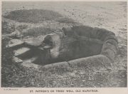
St. Patrick’s Well, Old Kilpatrick, Dumbartonshire

Holy Well (destroyed):  OS Grid Reference – NS 4631 7307

Also Known as:

  1. Trees’ Well

Archaeology & History

Photo of the Well in 1893

Sadly there are no longer any remains of this holy well which was found, “beside the church dedicated to St Patrick — which was said to be built on soil brought from Ireland in honor of its patron,” wrote John Bruce in 1893.  He told that its waters had “been used until lately from time immemorial by the villagers, but now has been found unfit for use and consequently ordered to be closed up.”  Although its waters were used for baptisms, he made no mention of any medicinal repute, which it surely would have possessed.

Site of well on 1939 map

The original position of the well, according to Mr Bruce, was “adjoining the church” but, according to the Ordnance Survey lads, when they came here in 1963 they located a drinking fountain on the other side of the road about 80 yards to the west and designated that as being St Patrick’s Well.  The place had earlier been given a wooden sign saying “St Partrick’s Well.”  Local tradition attributes St. Patrick as originally coming from this village, whose saint’s day is March 17.

The place was also known as Trees’ Well, suggestive, perhaps, of a local person, although I can find no reference as to who or what that might have been.

References:

  1. Bruce, John, The History of the Parish of West or Old Kilpatrick,  John Smith: Glasgow 1893.

Acknowledgements:  Huge thanks for use of the Ordnance Survey map in this site profile, reproduced with the kind permission of the National Library of Scotland

© Paul BennettThe Northern Antiquarian

St. Helen’s Well, Maybole, Ayrshire

Holy Well (covered):  OS Grid Reference – NS 31322 13423

Archaeology & History

Site on the 1860 OS-map

In spite of this site being covered over some time in the 1950s, it is still retained on the modern Ordnance Survey maps.  It was shown on the first one in 1860, but its literary history goes back much further.  We find it described by the Minister for Maybole — one William Abercrummie — in his short 17th Century work named A Description of Carrict.  He noted several springs in Maybole township, with this one of possessing the usual hallmarks of both christian and peasant customs alike:

“Another spring there is called St. Helens well or by a curt pronuntiation St. Emus for St. Antonies well, it is about a myle and ane halfe from Mayboll on the road to Aire a litle north of Balachmont.  It is famous for the cure of unthriving children, to which at the change of the quarter especially at May-day there is a great resort of people from all quarters, and at a good distance.”

This piece was repeated in several 19th century works, including one by William Roberston (1891), who commented on the traditions themselves, saying:

“This can unquestionably be traced as a remnant of the ancient superstition that miracles were wrought at Holy Wells; which all the anathemas of the Reformed Kirk could not for a time obliterate from the minds of the common people.  The records of the Kirk-session bear witness to the prevalence of applying to Saints’ Wells for the cure of bodily infirmities on stated occasions; particularly, when the Saint or Angel was understood to ‘move the waters.’  Pins, pieces of the dress of the patient, or such small trifles, were left at the well – the remains, no doubt, of the offerings formerly made to the Clergy – and in token that the disease was transferred from the sufferer to the rags, thus offered to the Genius loci.  Numerous traces of this prevailing superstition could easily be cited.”

When the Ordnance Survey dudes wrote about the site in the Name Book in 1857, all they could tell us was that it was, “a beautiful spring of excellent water” but was said to have “no medicinal properties.”

Despite this sacred well now being covered over, there is surely a case to be made here for it to be restored back to its former glory, for all to visit and see.  Local historians, pagans and Christians alike — join forces and gerrit sorted!

References:

  1. MacKinlay, James M., Folklore of Scottish Lochs and Springs, William Hodge: Glasgow 1893.
  2. Mitchell, Arthur (ed.), Geographical Collections Relating to Scotland Made by Walter Macfarlane – volume 2, T. & A. Constable: Edinburgh 1906.
  3. Robertson, William, Historic Ayrshire; Being a Collection of Historical Works Treating of the County of Ayr, Thomson Brothers: Edinburgh 1891.
  4. Walker, J. Russel, “‘Holy Wells’ in Scotland,” in Proceedings of the Society of Antiquaries of Scotland, vol.17 (New Series, volume 5), 1883.

Acknowledgements:  The map accompanying this site profile is Reproduced with the kind permission of the National Library of Scotland

© Paul BennettThe Northern Antiquarian

Overlee, Clarkston, Renfrewshire

Souterrains & Settlement (destroyed):  OS Grid Reference – NS 577 572

Also Known as:

  1. Canmore ID 43802

Archaeology & History

Overlee Farm in 1896 – no remains highlighted

This was an astonishing-sounding place, little-known beyond the pages of specialist historians.  It has been described in modern terms as simply “subterranean structures”, “weems”, or “prehistoric underground houses”; but were this site still in evidence it would be a huge attraction!  From the literary descriptions we possess, the extensive remains found and destroyed sound very much like the much-visited fogous found throughout Cornwall, or more commonly known as ‘souterrains’ in Scotland—although there’s no mention of the place in Wainwright’s (1963) singular study on such monuments.  Despite this, here, on the south-side of modern Clarkston, it seems we once had a Renfrewshire equivalent to the prehistoric Cornish village and fogous known as Carn Euny.

The first known account of this site was written by James Smith (1845) in the survey for the New Statistical Account, who thankfully gave us a reasonably lengthy account of what was once here.  He told:

“About thirty years ago, on the farm of Overlee, which lies on the north bank of the river Cart, in the south-west angle of the parish, Mr Watson, the proprietor, on removing the earth from a quarry which he wished to open, discovered a great many subterraneous houses ranged round the slope of a small swelling hill. Each house consisted of one apartment, from eight to twelve feet square. The sides, which were from four to five feet high, were faced with rough undressed stone, and the floors were neatly paved with thin flag stones which are found in the neighbourhood.  In the centre of each floor was a hole scooped out as a fire-place, in which coal-ashes still remained, and seemed to indicate that their occupiers had left the place on a sudden.  That coal and not wood or peat had been employed as fuel, seemed at first an argument against the antiquity of the houses, until it was remembered that many seams of coal crop out on the steep banks of the river in the immediate vicinity, which may have been picked out for firing by the aboriginal inhabitants, as is still done to a limited extent by a few of the poorer classes in the neighbourhood. Near the fire-places were found small heaps of water-worn pebbles, from two to three inches in diameter, the use of which it is difficult to conjecture. They may have been used as missiles for attack or defence in the rude warfare of ancient days, or more probably they served the purposes of an equally rude system of cookery, by which meat was prepared for being eaten by heated stones placed round it, as is still done in many of the South Sea islands.  The floors of the houses were covered to the depth of about a foot with a rich black vegetable mould, which was in all likelihood the decayed remains of the roofs mixed with soil filtered from the surface.  As was gathered from the different appearances of the soil, in and over them, the houses were partly excavated from the hill and partly built above ground, and a level approach to the entrances was dug out of the slope.  The number discovered amounted to forty-two, of which thirty-six formed the arc of a lower and larger circle, and the remaining six, also circularly ranged, stood a little higher up the hill.  The writer is informed that the ruins of villages of a similar description have been discovered in several parts of Scotland; and there is an account of one very much the same as the above, recorded in the third volume of the Transactions of the Antiquarian Society of Scotland.  About twelve querns or small hand-mills were found near the site of these houses, and a grave lined with stone containing a rude urn filled with ashes.  These latter relics, however, may have belonged to a still distant but less remote antiquity. The old castle of Lee or Williamwood was erected near the place, and it is not improbable that, in procuring materials for the building from the freestone, of which the hill consists, the soil, which for so many centuries concealed the remains of the village, was thrown down upon it. Several years ago, the proprietor, in clearing away the old foundations of the castle, which interfered with the rectilineal operations of the plough, found within the square which they enclosed many human bones, which he avers were of almost superhuman magnitude.

“If the natives of the village, described above, deserted their homes hastily, as may be conjectured from the fact of the fuel remaining on their hearths, it may have been in terror of the Romans—one division of whose invading army must have passed not far from the place. In a direct north-east line from this hill, without any intervening eminence, and at the distance of about two miles, there are still very distinct traces of a small Roman encampment on the summit of a hill, the name of which, from the circumstance, is Camp Hill…”

Although the modern official description of these remains is simply that of “a settlement”, the idea that some of the remains here were souterrains seems beyond doubt.  The comparison James Smith makes with remains that were found shortly afterwards that were “very much the same”, unearthed at Cairnconon—or the West Grange of Conon, as Canmore call it—northwest of Arbroath, confirms this idea.

Just over a decade after Mr Smith’s initial account, the Glaswegian historian James Pagan (1856), in his huge History of Glasgow, included another description of the place from the pseudonymous 19th century writer “J.B.”  In what were called Desultory Sketches, much of what he wrote merely echoed the original notes by Smith, but they are still worth repeating:

“Specimens of the winter houses, or weems, were to be seen, till recently, in our own district, at Cartland Craigs, near Stonebyres, on the Clyde; and one very interesting example of the pit-houses was revealed in 1808, on the farm of Overlee, near Busby, in the vicinity of Glasgow.  The following particulars regarding these were communicated to the writer of this sketch, by the parish minister of Cathcart, who had his information from an eye-witness.

“While the farmer was removing soil to get at freestone, for building a new steading, he came on a cluster of subterranean aboriginal huts. They were forty in number, and ranged round the face of the hill on which the farm-house of Overlee now stands. These huts were of the most primitive kind. They were mere semicircular pits, cut out of the hillside, with a passage to the door, also dug out of the slope, on a level with the floor, as indicated by the different colour of the soil. Each consisted of one small apartment, about twelve feet square, five feet high, and faced with stone. The floors were neatly paved with thin flag-stones, found in the neighbourhood. In the centre of each was a hole for a fireplace, in which ashes were still visible. Near the fireplace were small piles of water-worn stones, two or three inches in diameter, probably for cooking food, by placing heated stones round it, as is yet done by some of the islanders in the Pacific Twelve hand-querns of stone for grinding grain were found in the houses. At a short distance, a grave was discovered, lined with stone, and containing rude urns filled with ashes, thus indicating that the inhabitants of this primitive cluster, near what is now Glasgow, burned their dead. Unfortunately, the whole of these curious pit-houses were ruthlessly destroyed.

“In some of the weems and pit-houses, small groups of pretty oyster-shells have been found, perforated with small holes, as if they had been strung together, and formed an ornamental necklace—shall we say for the lady-savage of that distant epoch?  In others were discovered bodkins and skewers, made of horn, probably to hold together the folds of the wild beasts’ skins forming the savages’ winter covering; the bones of oxen, neatly notched, as if for ornament; bowls made of stone, the hollow having been drilled out by the circular action of another stone, sharper and harder, aided by the grit of sand (one of which is now before me); arrow-heads and lances formed of flint or bone, some of the former of which I happen to possess; —nay, swords have been found, fashioned from the bone of a large fish! Heavy oaken war-clubs, too, must not be omitted from this curious catalogue.”

Although highly unlikely, there is the remote possibility that some remains of these underground ‘houses’, or souterrains, could possibly still be unearthed hereby.  In recent years we’ve encountered a number of good farmers and land-owners who’ve told us about souterrains beneath their fields that are not in any record-books.  Intriguingly, each one asked us, “who are you working for?” – and when we’ve assured them that we have nothing to do with the ‘official’ bodies, they’ve opened up and showed us.  In one instance, a land-owner in Angus told us how he was farming the field as he’d always done, “when my tractor fell into a huge hole in the ground – and there was another souterrain!”

Why am I telling you this?  Well, if you’re a local, maybe get round to Overlee and ask around some of the olde local people.  You never know what you might find!  And we could perhaps try find more about the other souterrain which the pseudonymous ‘J.B.’ said was “at Cartland Craigs, near Stonebyres, on the Clyde.”

References:

  1. McBeath, H.D., Walks by Busby and Thorntonhall, with Historical Notes on the Area, EKDC: East Kilbride 1980.
  2. Pagan, James (ed.), Glasgow, Past and Present – volume 2, David Robertson: Glasgow 1856.
  3. Ross, William, Busby and its Neighbourhood, David Bryce: Glasgow 1883.
  4. Smith, James, “Parish of Cathcart,” in New Statistical Account of Scotland – volume 7: Renfrew, William Blackwood: Edinburgh 1845.
  5. Stuart, John, “Notice of Underground Chambers recently Excavated on the Hill of Cairn Conan, Forfarshire,” in Proceedings Society of Antiquaries, Scotland – volume 3, 1862.
  6. Wainwright, F T., The Souterrains of Southern Pictland. RKP: London 1963.

© Paul BennettThe Northern Antiquarian


Craigenfeoch, Johnstone, Renfrewshire

Cup-and-Ring Stone:  OS Grid Reference – NS 4361 6173

Also Known as:

  1. Canmore ID 43233
  2. Craigton Woods Carving

Getting Here

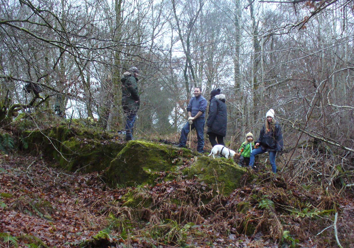
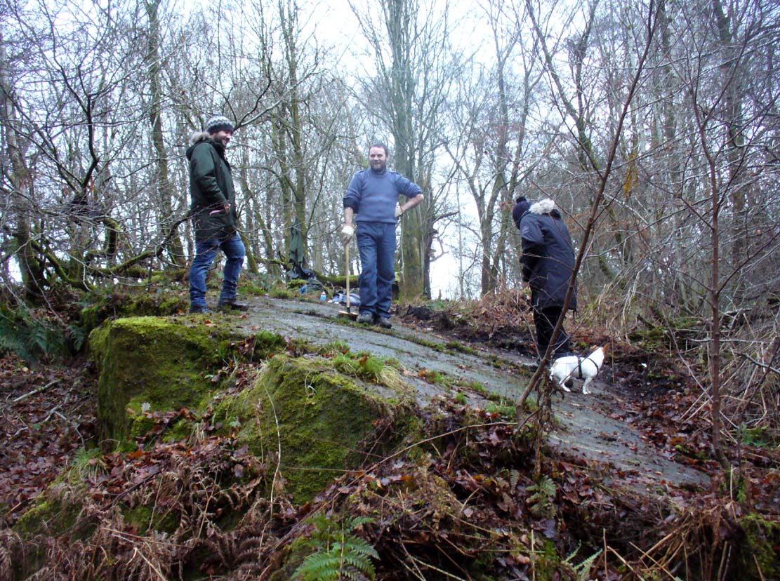
The TNA Rock Art Team on site
The TNA Rock Art Team on site – Fraser, Frank, Lisa, Leo & Aish

Get yourselves to Johnstone or Elderslie (which just about fuse into each other) and off the B789 road, make your way to Johnstone Castle football ground on Auchenlodment Road and go uphill, past the housing estate, until the fields open up on either side. 350 yards further, woodland appears.  Go past the hair-pin kink in the road and, 50 yards or so past this, walk into the trees on your right.  About 20 yards in, a large sloping rock face is what you’re looking for… (there’s a decent car-park on the left-hand side of the road 400 yards further along if you’re driving here)

Archaeology & History

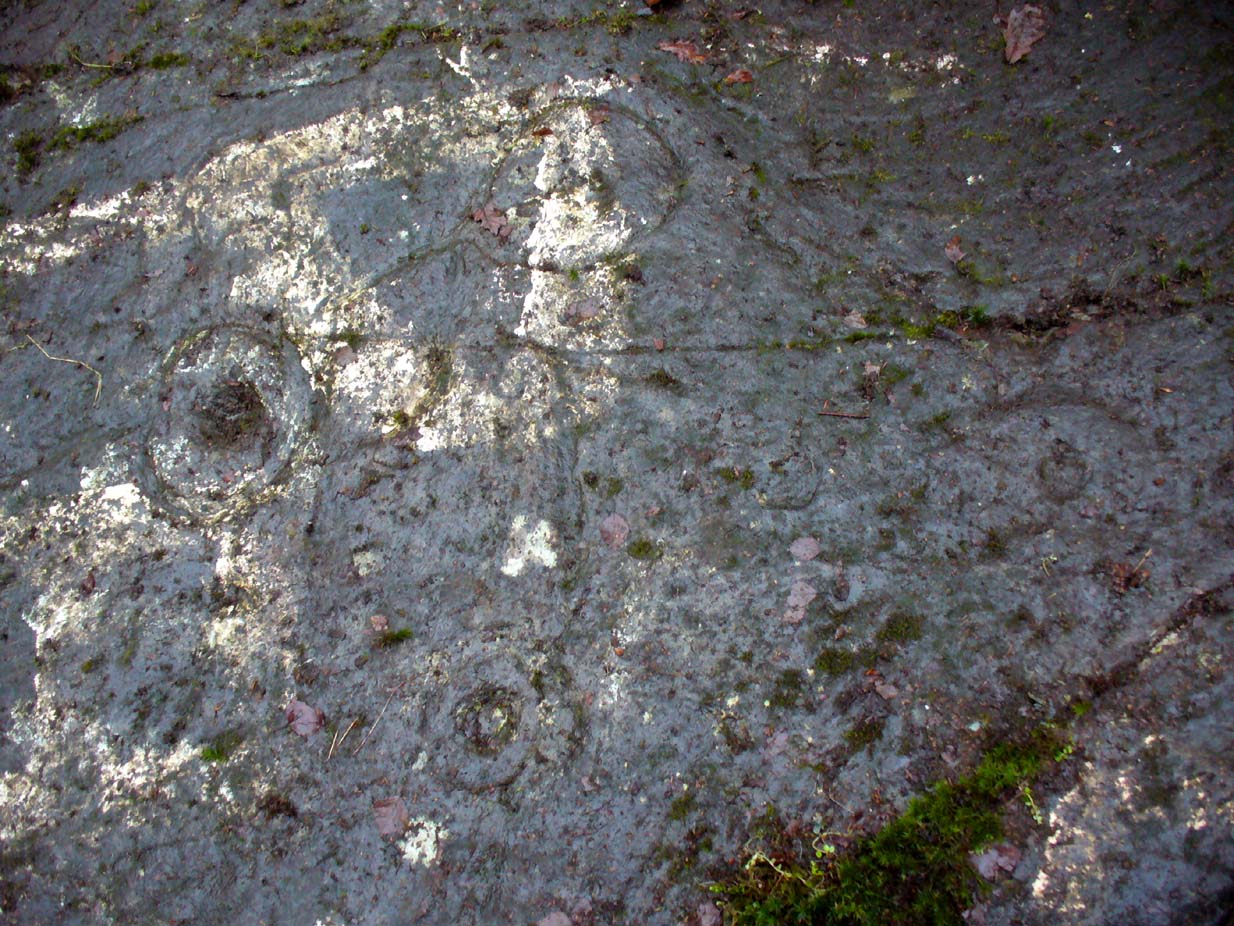
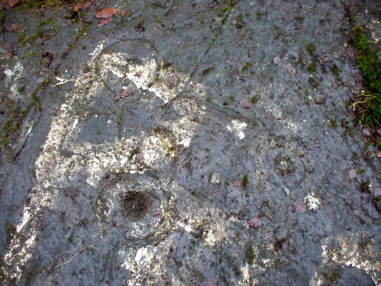
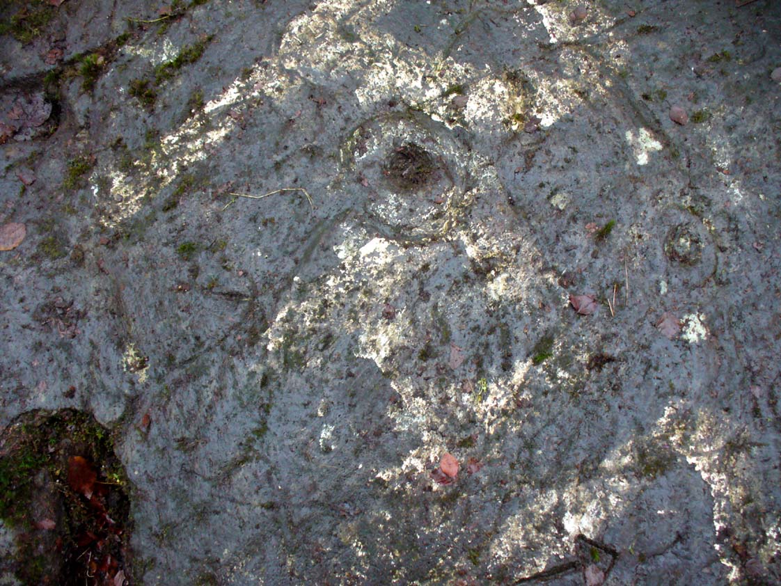
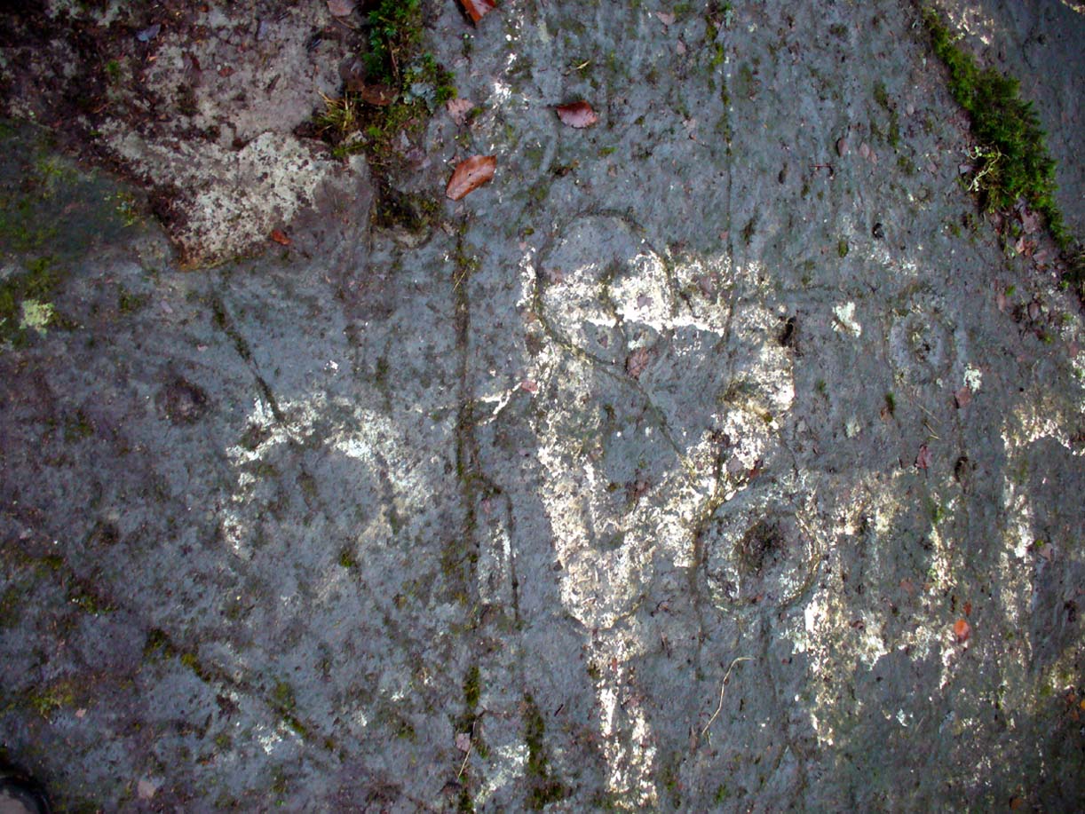
4 cup-and-rings in poor light

A seemingly solitary but vandalised petroglyph at the top of the Craigton Woods above Johnstone Castle estate: vandalized by the industrialists, whose quarry cut into a once larger rock, at whose edges cup-markings exist and whose design extended much further onto the now-vanished rock.  The carving was also painted onto by some ignorant bastard many years ago (as the photos show); and one of the cup-and-rings here has either been damaged or isn’t prehistoric.  The paint was daubed onto the stone in the 1960s and is shown in one of Ron Morris’ (1981) several descriptions of the site; and whilst it interferes with the design, it hasn’t damaged it anything like as badly as the industrialists have done.

Craigenfeoch cup-and-rings

Vandalism aside: it’s still quite an impressive carving, albeit hidden in the shadows of the surrounding trees. The design has been etched onto a large rock, some 35 feet long and perhaps up to 10 feet across, sloping at an angle of about 30-35° down (slippery when wet, as we all found out!).  When we visited the site a few days ago, low cloud and mist didn’t really allow us a decent inspection of the site.  But what we did find was more than our predecessors….

James Kirkwood (1938) gave the first literary account of the site—and in some detail. When he found the place it was “mostly covered with vegetation”, much like we found it on our visit.  He wrote:

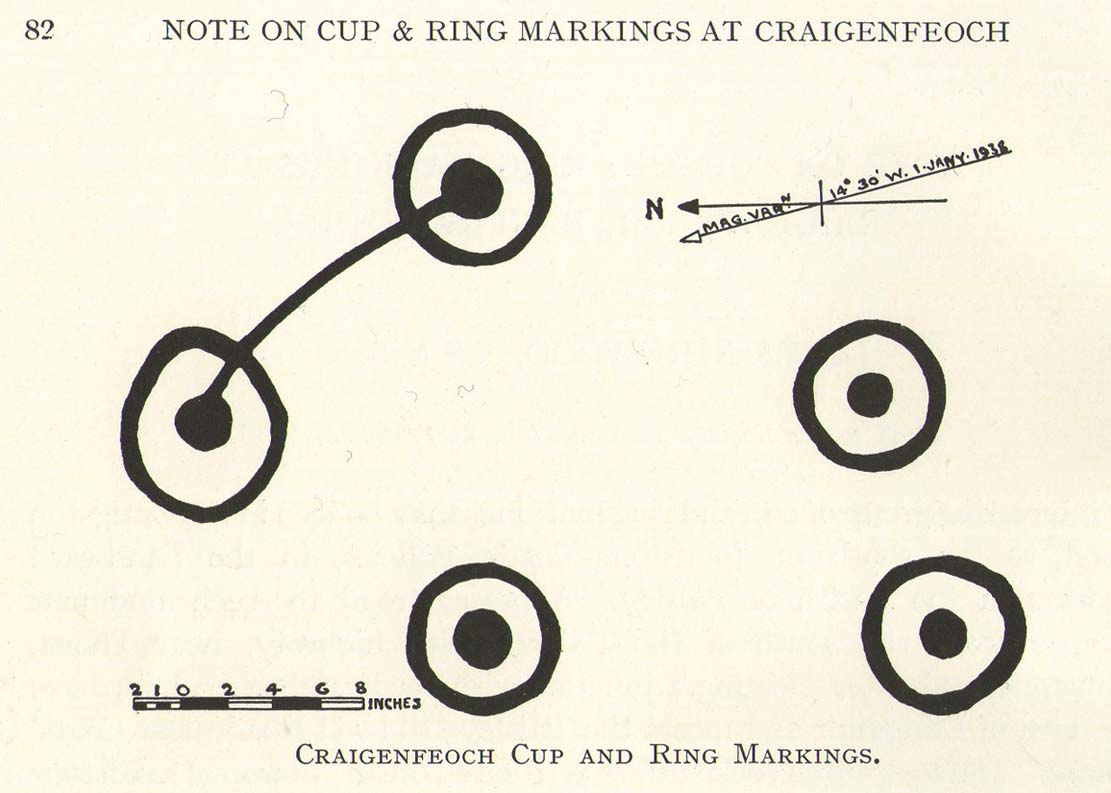
“The group of markings comprises five cups, each surrounded by a single encircling ring, whole lay-out being contained in an area of about 9 square feet.  The setting corresponds almost exactly with the four cardinal points of the magnetic compass.  The cup and ring to the north is the best preserved, the cup being 2½ inches in diameter and cut to a depth of 1 inch; the ring is somewhat elliptical, measuring 8½ and 7½ inches on its major and minor axes.  A channel or gutter connects this cup with that within the eastern ring.  The remaining cups vary from 2 inches to 2½ inches in diameter, and the rings from 6½ to 7 inches diameter.  It is significant that the east and west cups are equidistant from the north one at about 15¼ inches; they are also equally spaced from the southeast cup at 19½ inches, and this latter dimension measures the distance from the west to the southwest cup. The four cups and rings on the main cardinal points are all moderately distinct, but the southwest sculpturing can only be very faintly discerned.”

James Kirkwood's drawing
James Kirkwood’s drawing
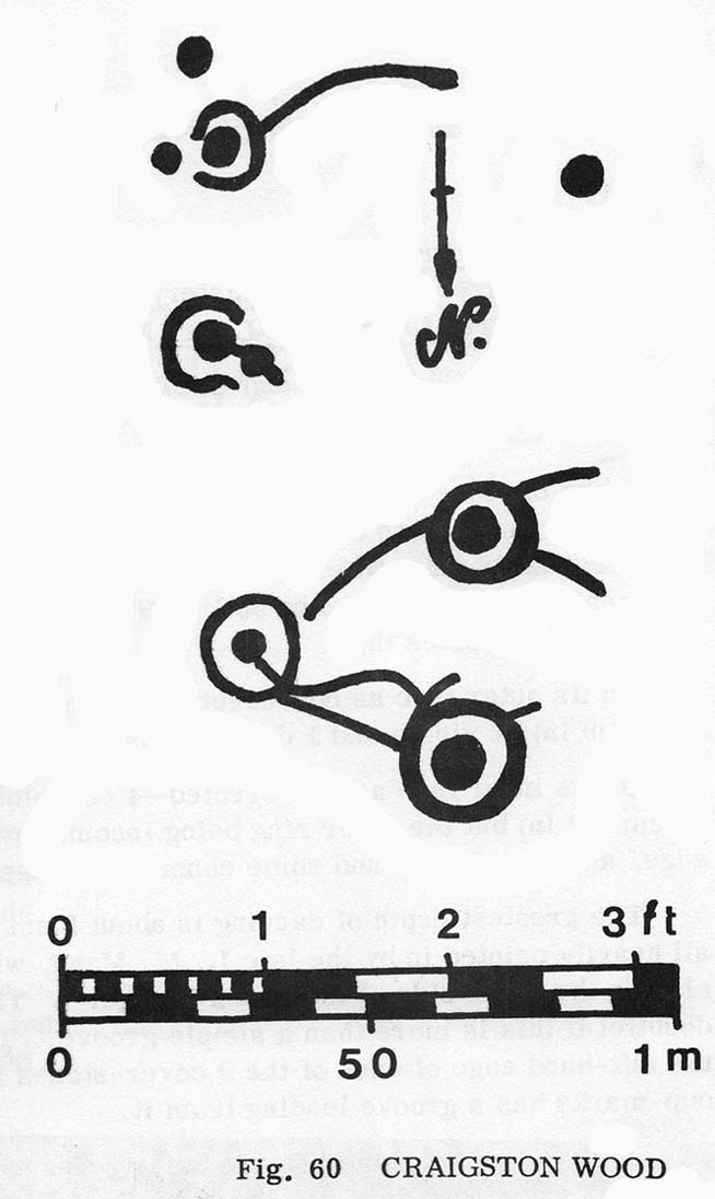
Ron Morris' sketch
Ron Morris’ sketch

Kirkwood’s fascination with the alignments and measurements betwixt certain elements on the petroglyph was something of a fad at the time (resurfacing with some vigour in some quarters today), but is likely to have little if any authentic relevance with the animistic dynamics implicit in the function of the design.

When Ronald Morris (1981) entered the carving into his Southern Scotland survey, he made the now standard bland description of the carved elements:

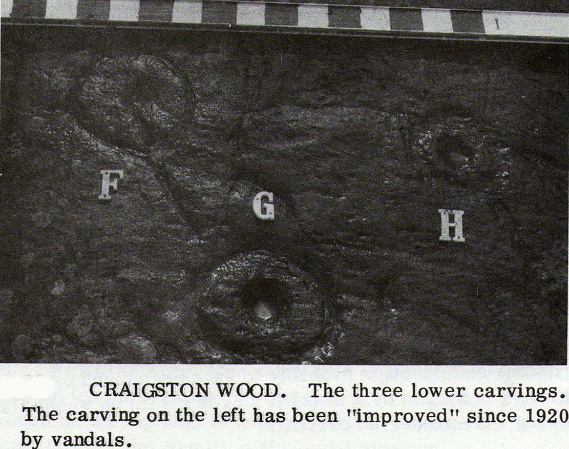
“At least 5 cups-and-one-complete-ring (some ovoid), at least one with a long wavy groove downhill from the ring, and at least 5 cups, some of which may have been ringed.  The ring marked ‘F’ in the (black-and-white photo, below) has been ‘improved’ since 1934 — the author has an older photograph showing it similar to the others.  The 2 upper rings can only be seen just after sunrise, when wet—they are much weathered.  Greatest ring diameter – 17cm (7in) and carving depths up to 2cm (1in).”

Fraser, Frank & Lisa at work

A good drawing of the carving would be worthwhile (are there any rock art-ists out there wanna join us on our next visit?), as the archaeological blandness never does petroglyphs descriptive justice.  Ostensibly, from the bottom slope of the elongated stone—below where Fraser, Frank and Lisa are standing, right—a number of geophysical marks run across the stone.  You can see in the photo how several geophysical ‘lines’ cut across the rock at an angle, roughly parallel, marked by the green vegetation.  One of these is a small natural tunnel hole running through the stone, possibly made by the softer rock of a fossilized tree root or branch which has since disintegrated over time.  Just above this ‘hole’ the carvings begin.

Cup-and-ring & carved line
Outer cup, 'fan' & CnRs
Outer cup, ‘fan’ & CnRs

A number of possible cup-marks are overshadowed by the definite series of well eroded cup-and-rings (at least four of them) all close to each other, with lines connecting some to the others, including one which runs down to the tunnel hole.  Some other lines on this part of the rock may or may not be geophysical (is there a geologist in the house!?).  Close to the edge of the stone (where Fraser stands in the photo above) a singular cup-mark has been etched within a series of five lines, like an open fan, that all run to a point at the entrance of the natural tunnel in the stone.  We were unsure as to whether these lines were natural or man-made (we need that geologist!); but it should be noted that an element very similar to this ‘fan’ of lines occurs in a carving near Killin, Perthshire, which we have yet to fully excavate—and in the Killin example the lines reach out from a central point like spokes on a bike wheel to an entire surrounding ring of cup-and-rings!  Intriguing…

R.W.B. Morris early photo

One of the cup-and-rings in this cluster has clearly been either vandalized or else carved within the last century, as the erosion on it is wholly different to the rest, and the angle of the cuts into the stone shows clearly that a metal tool has made it.  However, as Ron Morris stated above, this was apparently not the case with this ‘ring’ when he visited it in 1934 (it would be good to see the photo which he says shows its original state).

Faint cup-marks halfway up

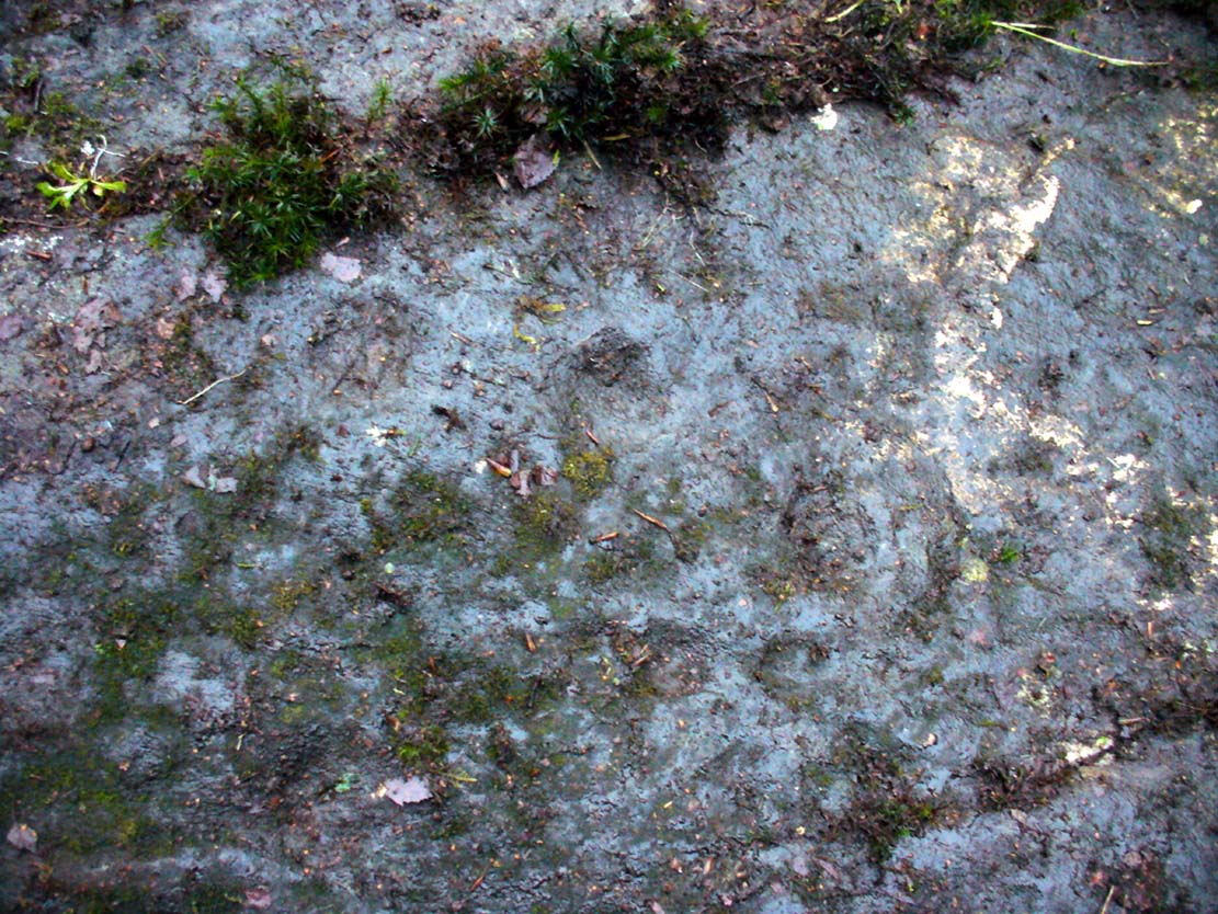
Further up the slope of the rock we reach a near-parallel row of natural cracks across the stone.  Inside this, about halfway along, a cluster of well eroded cup-marks exist—at least four of them.  One of them has either a curved line arching out of it, or a semi-circular arc.  Above the parallel cracks there is a large and very well eroded cup which, from differing angles, appeared to have faint sections of a ring around it, but we all agreed this was more a Rorschach response in our respective feeble minds!

We need to visit the site again in much better weather to gain a more accurate picture of the entire design.  It appeared there were other elements to be seen here, but the lighting conditions were working against us that day…. That’s our excuse anyway!

References:

  1. Kirkwood, James, “Notes on Cup and Ring Markings at Craigenfeoch, Renfrewshire”, in Transactions of Glasgow Archaeological Society, 9:2 (New Series), 1938.
  2. Morris, Ronald W.B. & Bailey, Douglas C., “The Cup-and-Ring Marks and Similar Sculptures of Southwestern Scotland: A Survey,” in Proceedings of the Society of Antiquaries, Scotland, volume 98, 1966.
  3. Morris, Ronald W.B., “The Cup-and-Ring Marks and Similar Sculptures of South-West Scotland,” in Transactions of the Ancient Monuments Society, volume 14, 1967.
  4. Morris, Ronald W.B., The Prehistoric Rock Art of Southern Scotland, BAR: Oxford 1981.

Acknowlegdments:  With huge thanks to what Nina Harris called “the TNA rock art team” – Aisha Domleo (and Leo), Nina Harris, Frank Mercer, Lisa Samsonowicz & Fraser Harrick.

© Paul Bennett, The Northern Antiquarian 


Shawfield, Rutherglen, Glasgow, Lanarkshire

Tumulus (destroyed):  OS Grid Reference – NS 6041 6297

Also Known as:

  1. Canmore ID 45108

Archaeology & History

Close to the ancient boundary of north Lanarkshire—if not actually on it—and looking down on the River Clyde, was once a prehistoric burial mound, probably Bronze Age in nature.  Described first of all in David Ure’s (1793) early survey of Rutherglen, he told that:

“A tumulus of earth, supposed to have been originally a burying place, was lately demolished in the estate of Shawfield, a few yards from Polmadie; and the place where it stood converted into a mill-dam.  None of its contents attracted the particular attention of the workmen employed in removing it.”

The site was subsequently referenced in Hugh MacDonald’s (1860) excellent work, but no remains of it now exist.

References:

  1. Macdonald, Hugh, Rambles round Glasgow, John Cameron: Glasgow 1860.
  2. Royal Commission Ancient & Historical Monuments of Scotland, Lanarkshire: An Inventory of the Prehistoric and Roman Monuments, HMSO: Edinburgh 1978.
  3. Ure, David, The History of Rutherglen and East Kilbride, Glasgow 1793.

© Paul Bennett, The Northern Antiquarian


St. Mungo’s Well, Glasgow Cathedral, Lanarkshire

Holy Well:  OS Grid Reference – NS 6025 6558

Archaeology & History

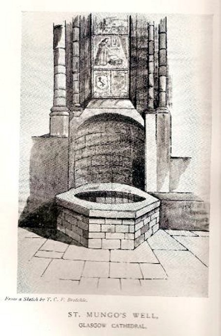
St Mungos Well, Glasgow cathedral

Not to be confused with the sacred well of the same name found along Gallowgate a short distance to the south, the waters of this ancient well have sadly fallen back to Earth.  The structure built above it, however, is thankfully still preserved inside the Cathedral, as visitors will see.

Folklore and history accounts tell its dedication to be very early – and the tale behind the erection of the cathedral is closely associated with the waters themselves.  Indeed, if the folklore is accepted, we find merely a transference of early animistic ideas about the death of an ancestor placed onto this early Saint, with a simple association in the formula of:  tomb, holy site and architectural form.  It could almost be Bronze Age in nature!

The lengthiest (and best) description of St Mungo’s Well was by Mr Brotchie (1920) in a lecture he gave on the city’s holy wells in April 1920, which was thankfully transcribed by the local history society.  He told us:

“It seems to me that Glasgow in a very particular degree is a case that illustrates emphatically the existence of the early cult of the sacred fountain (sketch attached)… How came it to be there? In itself it represents the very beginning of Glasgow.  It was to the little spring on the hillside overlooking the Molendinar that there came the earliest of christian missionaries, Ninian. All that we know of Ninian is from the account of Jocelin, the monk of Furness, who tells us that “ane holy man Ninian cam to Gleschu or Glasgow in the third century”, and made his cell on the banks of the Molendinar. When Kentigern or Mungo came to Glasgow in the sixth century, he made his settlement near a certain cemetery, which had long before been consecrated by St. Ninian, and which at the time when Jocelin wrote (twelfth century), was “encircled by a delicious density of overshadowing trees.”  The crypt of the Cathedral—in reality an under church of extraordinary beauty of design and magnificence of mason work—is the shrine of St. Mungo, who is buried there, and the whole design of the lower church shows that the architect who in 1230 planned the building…built his scheme up with the idea of providing a shrine for the saint’s tomb and his holy well.

“The well is in the lower eastern corner of the church just opposite to the chapter house.  John Hardying, the chronicler, who visited Scotland in 1413, states that St. Mungo’s shrine was then the centre of the life of Glasgow.  In 1475 James III, on account of his great devotion to St. Kentigern, granted three stones of wax yearly for the lights at the tomb of the saint in the cathedral, near his holy well.

“St. Mungo adopted this well from the pagans of the district and changed its purpose from evil to good.  Beside it he erected in 560 his little wattle hut where he died.  He was buried inside it, and when the great cathedral was built the holy well was included within its walls…

“St. Mungo’s Well was a place of pilgrimage to the early christian fathers, and we find it described as “an idolatrous well” in 1614.  In 1579 we have a public statute prohibiting pilgrimages to wells, and in 1629 the Privy Council denounced these pilgrimages in the strongest terms, it being declared that for the purpose of “restraining the superstitious resort of pilgrimage to chapels and wells, which is so frequent and common in this kingdom, to the great offence of God, scandall of the kirk, and disgrace of his majesties government,” that commissioners cause diligent search in “all such pairts and places where this idolatrous superstition is used, and to take and apprehend all such persons of whatever rank and qualitie whom thay sall apprehend going on pilgrimage to chapels and wells.”  That decree was issued under the Dora of 1629.  But all in vain.  The custom of visiting chapels and wells had become a habit – and habits, as we all know, though easily formed are difficult to break.  The wells continued to be visited by stealth if need be.”

References:

  1. Bennett, Paul, Ancient and Holy Wells of Glasgow, TNA 2017.
  2. Brotchie, T.C.F., “Holy Wells in and Around Glasgow,” in Old Glasgow Club Transactions, volume 4, 1920.
  3. Davidson, Nevile, The Cathedral Church of St. Mungo, Bell & Bain: Glasgow 1957.
  4. Walker, J.R., ‘”Holy Wells” in Scotland”, in Proceedings of the Society of Antiquaries, Scotland, volume17, 1883.

© Paul Bennett, The Northern Antiquarian


Boydstone Road, Eastwood, Glasgow, Renfrewshire

Standing Stone (destroyed):  OS Grid Reference – NS 540 607

Also Known as:

  1. Canmore ID 44370 
  2. Kennishead

Archaeology & History

There is very little known of this once proud standing stone, said by one writer to have been about 12 feet long: six-feet of it in the ground and the other six-feet above ground.  A decent monolith by anyone’s standard!  But some dickheads forty years or more ago thought it a good idea to destroy the site, or as it was diplomatically put, “was removed in advance of road widening.”  Vandalism no less – though it’s demise was recorded by the Department of the Environment  “on behalf of the Inspectorate of Ancient Monuments.” (DES, 1973)

A local journalist called Andrew McCallum described the site in his unpublished manuscript on the history of the parish of Mansewood, telling it to be near Cowglen:

“near Boydstone Road, midway between Kennishead and Barrhead Road.  6 feet above the ground, and at least as many below.  Age and purpose are unknown.”

Some thirty years later, Miss Adamson (1973) told us that,

“The straight-sided block had its base set on yellow sandstone. Immediately above the bedrock small stones and earth had been packed against the W and N faces of the standing stone. On top of the packing were two boulders set at right angles to wedge the sides of the stone. No burials or cremations were found.”

Though on this latter remark we have to consider the possibility that the standing stone may once have accompanied a burial, as the nearby place-name ‘Carnwadric’ indicates a cairn, or burial site.  A field-name survey of the immediate region may prove valuable.

References:

  1. Adamson, H., “Glasgow: Boydstone Road – Standing Stone,” in Discovery & Excavation in Scotland, 1973.

© Paul Bennett, The Northern Antiquarian