Lauder Common, Lauder, Berwickshire

Cairn:  OS Grid Reference – NT 49340 46162
Getting Here

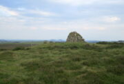
Modern cairn on the old one

Take the B6362 high road between Lauder and Stow and, regardless of which direction you’re coming from, when you reach the top heights of the moorland road with views all around, you need to keep your eyes peeled for where a dirt-track runs south and, diagonally across the road on its north side, is a dirt-track-cum-parking-spot (if you came from Stow, you should’ve already noticed the cairn on the skyline on your way up).  There’s a hut circle in the heather by the parking spot.  From here, just walk over the heather nearly 300 yards north.  Y’ can’t really miss it.

Archaeology & History
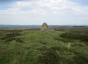
Looking to the southeast

The first thing that you see as you approach here is a modern cairn which is sat upon the more ancient and completely overgrown one.  You can’t really see the “ancient” section of it until you walk round to its more northern side, where you’ll then notice how the new cairn has been built on top of a small but artificial rise in the ground, about ten yards across.  This is the original ancient cairn.  Sections of the ground have come away on its southern side, revealing a scattered mass of loose stones.  It doesn’t seem to have been excavated but has all the hallmarks of being typically Bronze Age by the look of it.  Of particular note is the superb view from here, not least towards the legendary Fairyland of the Eildon Hills, standing out clearly about 10 miles to the south…

© Paul BennettThe Northern Antiquarian

Lauder Common, Lauder, Berwickshire

Hut Circle:  OS Grid Reference – NT 49490 45962

Getting Here

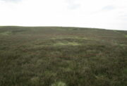
Take the B6362 high road between Lauder and Stow and, regardless of which direction you’re coming from, when you reach the top heights of the moorland road with views all around, you need to keep your eyes peeled for where a dirt-track runs south and, diagonally across the road on its north side, is a dirt-track-cum-parking-spot.  Park up here and walk 10 yards or so into the heather on your left.  You’re probably stood at the side of it!

Archaeology & History

Hut circle (ringed) looking N

A very distinct, but isolated hut circle can be seen here when the heather is short.  It’s most notable by seeing the slightly elevated circular rise in the ground with the rough ring of long grasses in the middle of it.  To be honest, unless you’re a mad archaeo-geek into these sort of things, it’s not gonna send a rush of blood to your head.

Probably constructed in the Bronze Age, it’s a plain little thing about six yards across, making it suitable for perhaps just a couple of folk to have lived in.  The overgrown walling is very low (between 12-18 inches high) and about a yard wide all the way round it.  The main thing that you’ll get from this place is not only the sense of isolation, but the beautiful view…

© Paul BennettThe Northern Antiquarian

Bishop’s Well, Stow, Midlothian

Holy Well (destroyed):  OS Grid Reference – NT 4598 4454

Archaeology & History

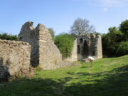
At the edge of the ruins known as the Bishop’s Palace, up the slope behind the ruined church in Stow, could once be seen the waters of the Bishop’s Well which, wrote Thomas Wilson (1924), fed the palace hereby and was used by the clergy.  Apart from a barely discernible circular depression at the edge of the old manse ruins, no trace of this site remains.

References:

  1. Royal Commission Ancient & Historical Monuments, Scotland, Inventory of Monuments and Constructions in the Counties of Midlothian and West Lothian, HMSO: Edinburgh 1929.
  2. Wilson, Thomas, The Stow of Wedale, Aberdeen Newspapers 1924.

© Paul BennettThe Northern Antiquarian