Reap’s Cross, Heptonstall Moor, West Yorkshire

Cross:  OS Grid Reference – SD 94360 30269

Also Known as:

  1. Long Stoop
  2. Ralph’s Cross

Getting Here

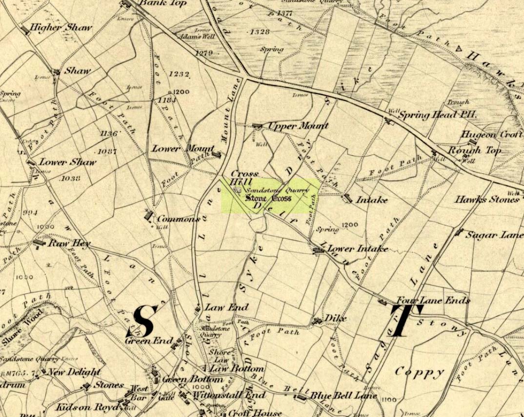
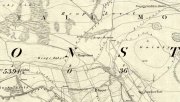
Reaps Cross on 1851 OS-map

Reaps Cross on 1851 OS-map

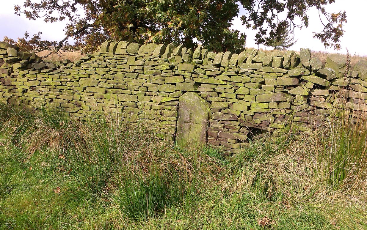
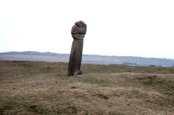
From Hebden Bridge go up the Heptonstall road, going round the village and onto and through Slack, keeping straight on the road until it goes uphill for a short distance, then levels out; then watch out for the small right-turn at Colden and the single-track road heading to a dead-end.  Go right to the end, the very end, and go through the gate and walk up the track onto the moor.  As you reach the ridge and the moorlands open up before you, note the small ‘standing stone’ on your right, about 10 yards off-path— and there, 100 yards the opposite direction to your west, the tall upright Reaps Cross is sat on the moortop.  Y’ can’t miss it!

Archaeology & History

Found in the middle of a beautiful nowhere not far from the prehistoric standing stone on Standing Stone Hill, this old tall monolith was said to have stood as a marker beside the old road which ran from Halifax over the moors to Colne, until the more recent Widdop Road became the more preferred route.  Known locally as the Long Stoop, in 1900 George Tyack said of it,

“This stone, which is composed of millstone grit, lay for a long tine broken and overthrown, but has in recent years been replaced on its original site and restored.  It is a simple Latin cross standing twelve feet high amidst the heather of the Yorkshire moors.”

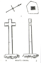
Longbottom's 1897 sketch

Longbottom’s 1897 sketch

Waddington's 1884 sketch

Waddington’s 1884 sketch

Shortly before Tyack’s description, the local historian John Longbottom (1897) wrote a series of articles on the old stone crosses of the region and gave us this old sketch of the site (right).  Even in his day the cross had been “wilfully thrown down” (probably by the screwy Puritans at that time), but a short time later it had been “repaired and restored to its original position.”  In Longbottom’s day there were short ‘arms’ extending outwards from near the top of the obelisk, defining it as a distinct ‘cross’, but these have subsequently been lost following further local demolition attempts. He told how,

“Reaps Cross is known locally to shepherds, gamekeepers and farmers at ‘T’ Long Stoop’, and…apart from its religious associations, it forms an important landmark, now as in ancient times, to many a poor weary traveller crossing the dreary and lonesome hills between Lancashire and Yorkshire.”

The cross keeps getting knocked over, by both lightning and idiots of various persuasions; but thankfully the old fella keeps getting resurrected and put back in its place. It’s history is a curious one.  When Clifford Byrne (1974) wrote about the site in his unpublished survey, he told how

“This cross appears to be of medieval origin and…in 1973 the monolith lay broken, one section lying in the grass, whilst the other section still stood in the pedestal.  It is seen to have been broken once before, for the remains of iron clamps are seen on both sections.  The arms have been broken off in some age… A local farmer insisted that the correct name was Ralphs Cross not Reaps Cross, and it should be noted that a section of moor at Widdop (the valley with the high cliffs) is named after a Ralph.”

Standing some 12 feet tall, this is the highest of all the crosses in West Yorkshire and obviously some considerable work went into its creation all those centuries ago.  Nobody is sure when it was first made, but the educated guess is 12th century.  Why it was erected here, way off from anywhere in the middle of the wild moors, is equally puzzling.  It may have had something to do with the nearby medicinal springs; it may have been as a guide-post to travellers—”to Rastric Greave”, according to Waddington (1884); it may have marked an ancient religious route; or it may have distracted people away from the prehistoric upright that gave its name to Standing Stone Hill, a short distance to the west  We simply don’t know.  It’s well worth visiting though, as the moorland landscape up here is truly expansive and civilization seems thankfully centuries away…

Folklore

Local tradition told that the cross marked an old corpse route, along which the dead were carried before being buried at Heptonstall.  Here at Reaps Cross, the bodies were rested by the weary travellers.  If this is true, it is probable that the ancient standing stone more than half-a-mile to the west once had something to do with such old rites and routes.

References:

  1. Bennett, Paul, The Old Stones of Elmet, Capall Bann: Milverton 2001.
  2. Byrne, Clifford, A Survey of the Ancient Wayside Crosses in North-East Lancashire, unpublished MS, 1974.
  3. Longbottom, John, “Ancient Crosses in Halifax Parish – Part 2,” in Halifax Naturalist, 2:8, June 1897.
  4. Taylor, Henry, The Ancient Crosses and Holy Wells of Lancashire, Sherratt & Hughes: Manchester 1906.
  5. Tyack, George, The Cross in Ritual, Architecture and Art, William Andrews: London 1900.
  6. Waddington, J. Arthur, “The Crosses in and Around Burnley,” in Transactions of the Burnley Literary & Scientific Club, volume 1, 1884.

© Paul BennettThe Northern Antiquarian


Lytham Cross, Lytham, Lancashire

Wayside Cross: OS Grid Reference – SD 3603 2718

Getting Here

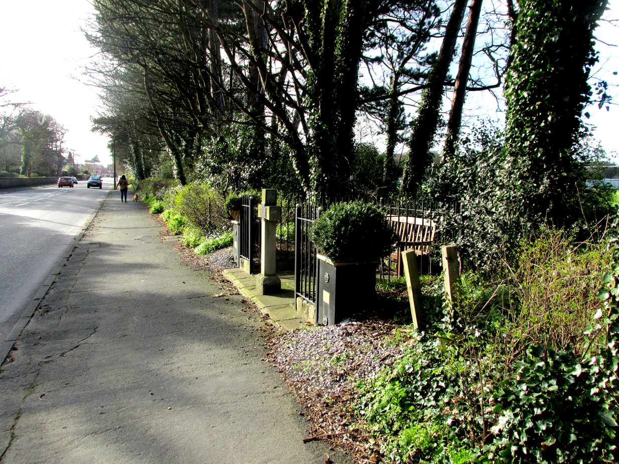
Roadside position of the cross

The cross is situated in a small railed enclosure adjoining the pavement on the North side of Church Road on the west side of Lytham, opposite Lowther Gardens.

Archaeology & History

Henry Taylor (1906), author of The Ancient Crosses And Holy Wells Of Lancashire, writes:

“The old market place of Lytham is triangular in shape…Church Road leads out of it, and not far from the church the pedestal of an ancient cross was at one time to be seen. The words ‘Site of Benedictine Priory’ occur on the map close to Lytham Hall, indicating the position of this small religious house, dedicated to SS Mary and Cuthbert, and subject to Durham.”

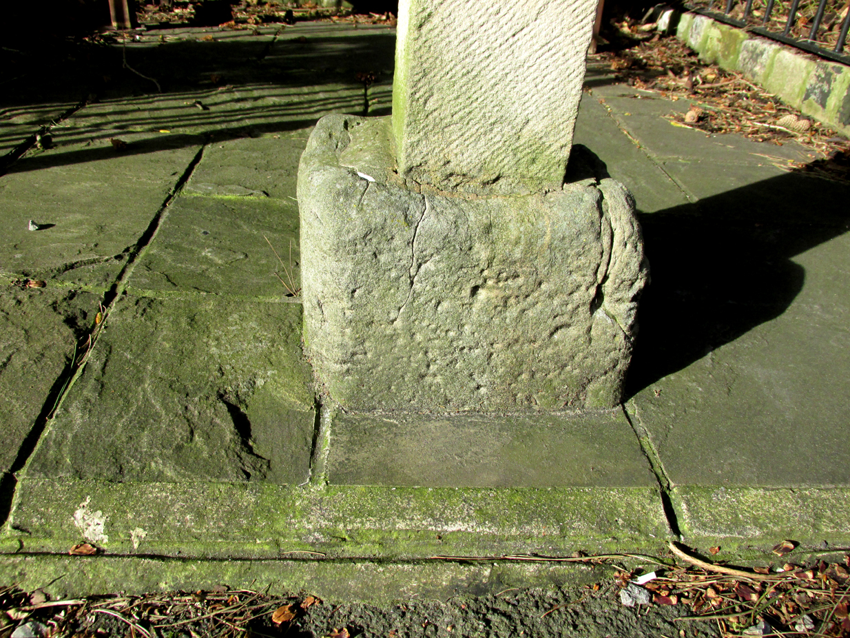
The mediaeval base set into the pavement in 2009

Lieutenant-Colonel Fishwick writes in his History of the Parish of Lytham:

“Not far from the Parish church on the road to Blackpool is still to be seen the stone socket of a cross, and tradition says that it marks one of the resting places of the body of St. Cuthbert when carried to Durham”

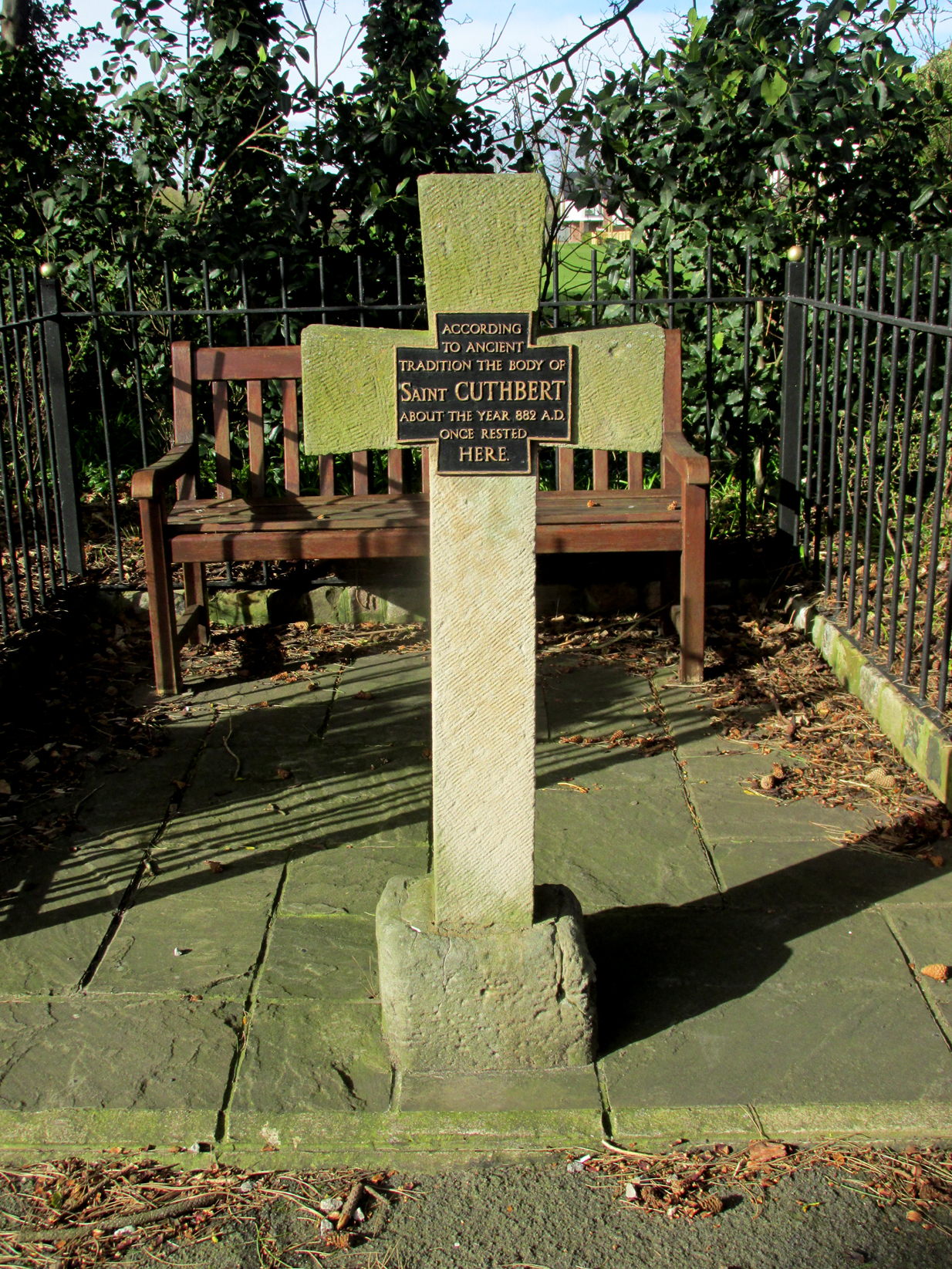
All that survives of the mediaeval original is the socketed base, into which a modern carved stone cross has been inserted. A bronze plaque attached to the cross reads:  “According to ancient tradition the body of St Cuthbert about the year 882AD once rested here.”

The modern cross with its bronze plaque.

It is not known whether the destruction of the original cross was the handywork of the local ‘Cross Smasher’ Rev. Richard Wilkinson.

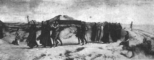
According to an online source, The Very Reverend Monsignor Gradley commissioned a painting by Charles E. Turner entitled: ‘The Monks of Lindisfarne arriving at Lytham with the body of St. Cuthbert, A.D. 878’, intended to be hung in St Joseph’s Seminary, Upholland.  Gradley wrote in the October 1889 edition of Merry England magazine:-

” In 875 Halfdene invaded Bernicia, the northern portion of Northumbria, . . . Lindisfarne was no longer a safe place for the monks, and they dared no longer expose their great treasure, the relics of St. Cuthbert, to the ruthless impiety of the northern hordes, With their Bishop Eardulf they set out on a weary pilgrimage of seven years.… From Yorkshire they proceeded to Lancashire, and as we find that the holy relics rested at Mellor, near Blackburn, we may suppose they would journey through Ribblesdale, passing on their way the ruined city of Bolmetonacae, the modern Ribchester. They were a numerous company, for besides the venerable Bishop Eardulf there were the Abbot of Carlisle, the monks of Lindisfarne, and many of the natives of that island. In going to Lytham it is probable the party would pass through Preston, where a few houses had gathered about the church built in honour of St. Wilfrid, the great contemporary of St. Cuthbert.

‘The Monks of Lindisfarne arriving at Lytham with the body of St. Cuthbert, A.D. 878’, by Charles E. Turner.

Their way from Preston to Lytham lay through a country abounding in forest and fen. But they would have the advantage of the old Roman road as far as Kirkham. However, the pilgrims met with a hospitable reception, and to this day Lytham is the seaside home of St. Cuthbert on our western coast.”

A small plaque on an adjacent bench records that the cross was re-dedicated by the Very Reverend Michael Sadgrove, M.A., Dean of Durham on Sunday 6th September 2009.

References:

  1. Taylor, Henry, The Ancient Crosses and Holy Wells of Lancashire, Manchester, Sherratt and Hughes, 1906.
  2. Fishwick, Lieutenant-Colonel, The History of the Parish of Lytham in the County of Lancaster, Manchester, The Chetham Society, 1907.
  3. Gradley, Most Reverend Monsignor, Article in the October 1889 edition of Merry England magazine, abstracted by www.amounderness.co.uk

Acknowledgements:  With thanks to Sue Ybarras for directing me to this site.

© Paul T. Hornby, The Northern Antiquarian 2017


Eaves Green Cross, near Goosnargh, Lancashire

Cross (ruins):  OS Grid Reference – SD 56770 37765

Also Known as:

  1. Historic England Monument No. 42651
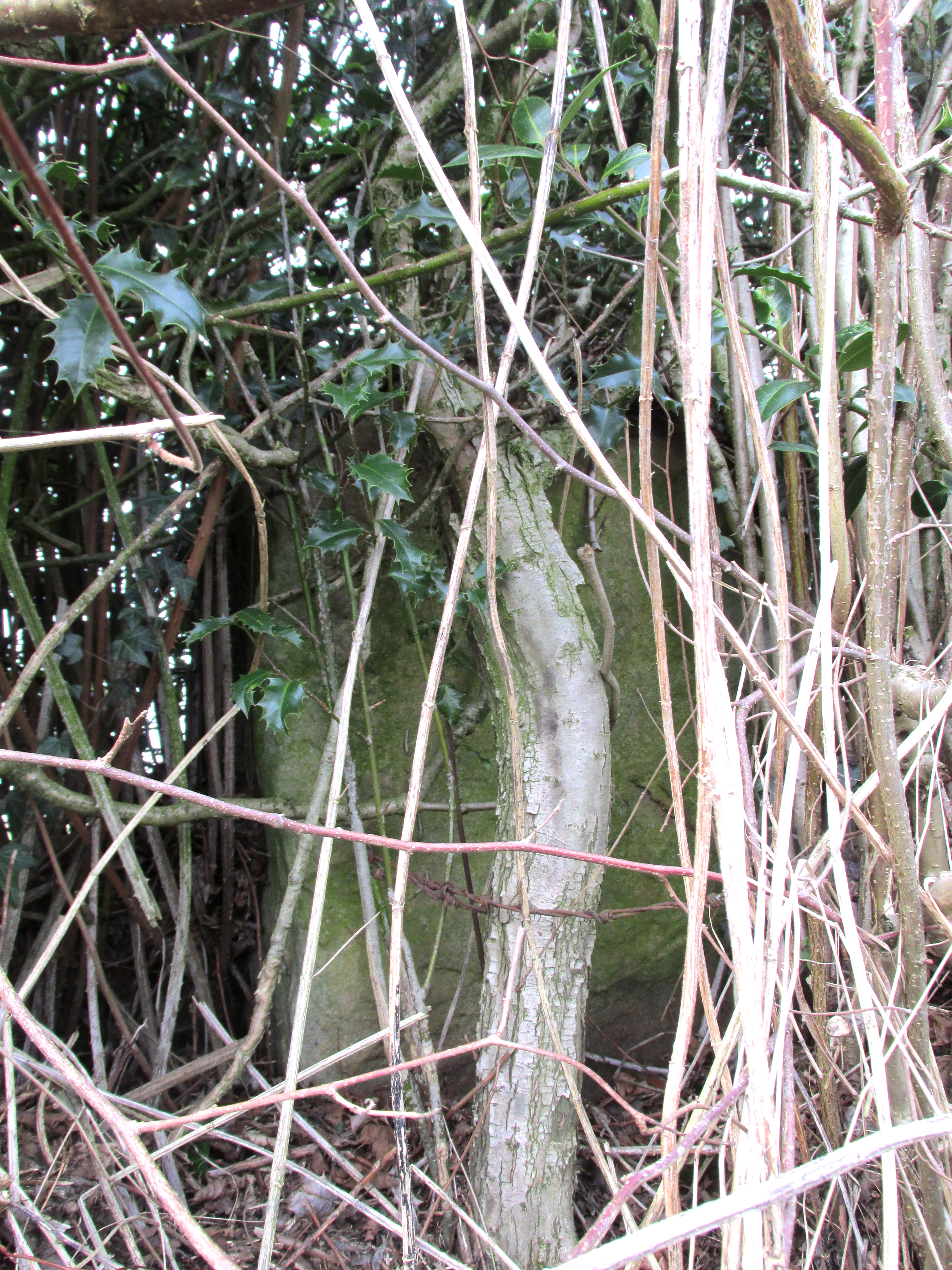
Just visible in the hedge…

Getting Here

Travelling east out of Goosnargh on the B5269, go straight ahead onto Camforth Hall Lane, follow it northwards and take the left fork at Stump Cross onto Eaves Green Lane, and a lane will be seen on the left signposted Eaves Green. Walk along this lane and a white Snowcemmed house, ‘Bridle Mount’ will be seen on the left. The cross base will be found deep in the holly hedge opposite the driveway to the house.

Archaeology & History

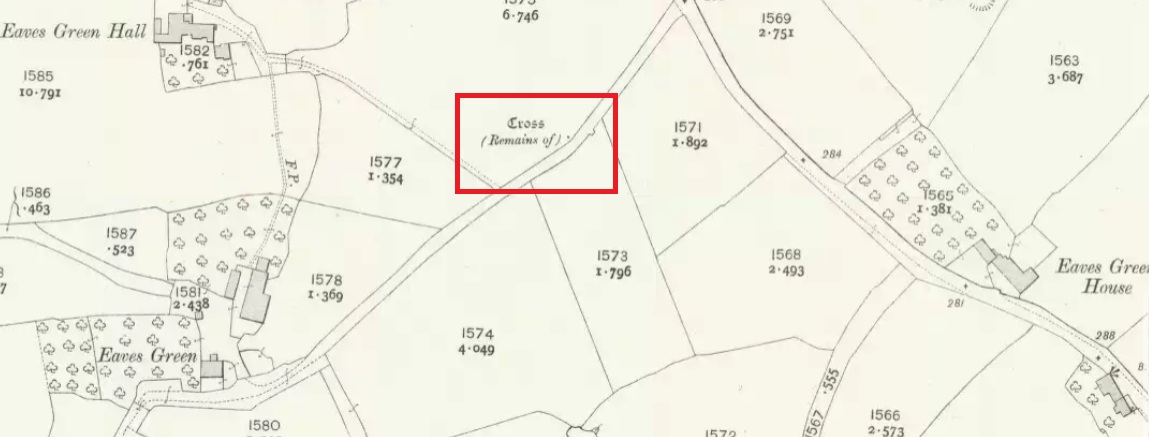
This cross was not mentioned in the 1906 edition of Henry Taylor’s Ancient Crosses and Holy Wells of Lancashire, but was nevertheless marked on the 1910 25″ OS map (the earliest at my disposal) as “Cross (Remains of)”

The 1910 25″ OS Map

In 1958, the Ministry of Works Field Investigator commented: “The socket stone of a probable way-side cross situated on rising ground in a pasture field adjoining a lane. It measures 0.8m by 0.7m and is 0.9m high with a socket 0.2m by 0.15m and 0.2m deep. There are no traces of a cross or shaft.”

To locate the Cross, turn round 180º from this spot.

The current official description describes the remains as “Now missing”…

Well, no! – the intrepid TNA investigator has located it, buried deep in the boscage of a holly and ivy hedge, but he was lucky that the hedge had been very recently trimmed and he made his visit in late winter…

The Cross is registered on the Milestone Society Repository under reference: LAPR_GOO02.

©Paul T. Hornby 2017 The Northern Antiquarian


Tom Cross, Colne, Lancashire

Cross:  OS Grid Reference – SD 92102 43175

Also Known as:

  1. Copy House Cross

Getting Here

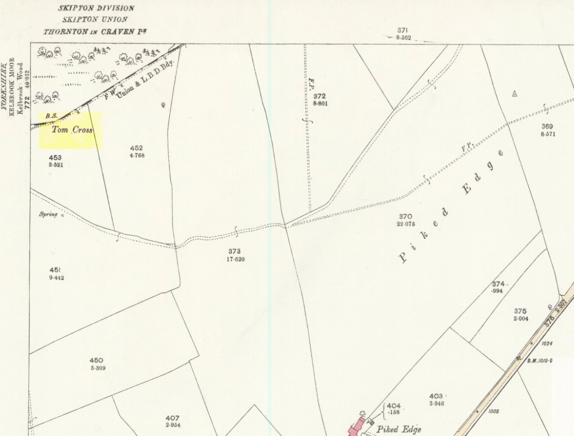
Tom Cross on 1892 map

Follow the same directions as if you’re visiting the Dissenter’s Well.  The cross stands right next to it!

Archaeology & History

This is one of two old stone crosses with the same name within a mile of each other (the other could be found in the walling along Warley Wise Lane).  Included in Taylor’s (1906) stunning magnum opus on the wells and crosses of Lancashire, the site was mentioned in a boundary dispute in the year 1592.  He told how a local man called Mr Carr said,

“John Parkinson, ‘of the age of ffour score and thirtiene year or thereabouts’ stated that Tom Cross and the Graystone were by credible report the boundaries, as well of Lancashire and Yorkshire, as of the manors of Colne and Cowling.”

Years later when Clifford Byrne (1974) surveyed the crosses of East Lancashire, he gave us more details about the site, saying:

“Tom Cross is built into the wall hard by Copy House Farm… At the foot of the Copy House Cross is a well, carved out of a solid block of stone.  The water apparently trickles into the well from a spring at the back of the wall , and the overflow spills into the field.  The top section of the cross is missing, probably it was vandalized at the time of the Reformation or some time afterwards.  It appears that the well was used and probably laid down by the Congregational Church dissenters from the late 17th century.  At that time, a law was passed, soon to be repealed, which decreed that every man should attend his Parish Church.  This meant that those who wished freedom to practise religion in their own form had to firstly attend the Parish Church and then hold a meeting privately afterwards.  At that time, and under those circumstances, it was obviously sensible to meet far away from the Parish Church, and apparently Tom Cross was chosen to meet this need.  The children of the Dissenters would be privately baptised in this well at the foot of the monolith into which, a cross was deeply incised.

Tom Cross is mentioned in a lawsuit in the year 1592 and a map exists dated slightly earlier which shows another cross in the area on Greystone Moor near Blacko…”

Tom Cross stone
Tom Cross stone

Byrne suggested that the name ‘Tom Cross’ relates to a boundary cross, but this is not substantiated in local dialect or place-name surveys (who say nothing!).  Instead, Joseph Wright (1905) gives us the possibility of Tom being simply, “a kind of rock”; although a variety of other associations relate it children’s games, customs and goblins. The word may derive from the Gaelic ‘tom’, relating to a mound, or clump, or knoll in the landscape (Watson 1926).  I’d go for one of these misself.  Makes sense.

References:

  1. Byrne, Clifford H., “A Survey of the Ancient Wayside Crosses in North East Lancashire,” unpublished manuscript, 1974.
  2. Taylor, Henry, The Ancient Crosses and Holy Wells of Lancashire, Sherratt & Hughes: Manchester 1906.
  3. Watson, W.J., The Celtic Placenames of Scotland, Edinburgh 1926.
  4. Wright, Joseph (ed.), English Dialect Dictionary – volume 6, Henry Frowde: Oxford 1905.

Acknowledegments:  Big thanks to Chris Swales for guiding me to the site; and to the old Teddy Man, Danny Tiernan.

© Paul Bennett, The Northern Antiquarian 

Coombe Hill Cross, Wycoller, Lancashire

Cross:  OS Grid Reference – SD 95586 38608

Also Known as:

  1. Combe Hill Cross

Getting Here

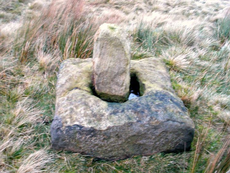
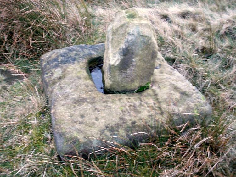
Coombe Hill Cross, Lancashire (photo credit, Ray Spencer)

Along the high moorland road between Laneshaw Bridge up towards Oakworth, on the Lancashire side of the moors a half-mile before reaching the Watersheddles reservoir, past the derelict pub until you reach the isolated Coombe Cross farmhouse on the tops.  Across the road from here is a boggy footpath leading onto the moors.  Walk on here for 100 yards, where the path bends left and another footpath veers up higher onto the moors.  Walk up here for 20 yards and you’ll see the small monolith 10 yards away in the grassy heaths on your left.

Archaeology & History

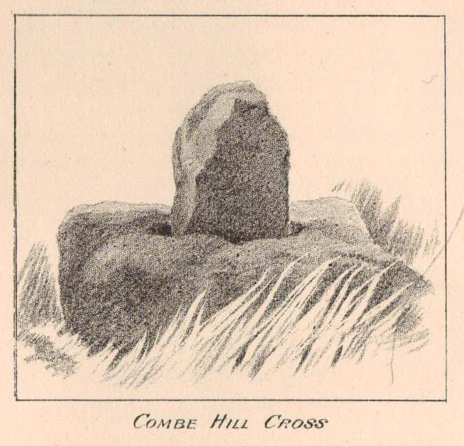
Taylor's 1906 drawing
Taylor’s 1906 drawing

Found on the old route between the counties of Yorkshire and Lancashire, this little-known wayside cross has seen better days.  Found in relative isolation from other monuments by the ancient trackway (Herder’s Cross is a mile WNW, and the curious Water Sheddles Cross a mile east), its history is quiet and it was ignored in the general surveys of such monuments by Rimmer (1875), Tyack (1900) and Vallance. (1920)  Thankfully the giant survey of Henry Taylor (1906) did not forget it—although he seemed to know little of its story, merely telling us,

“The base-stone and part of the upright shaft of this cross stand about one hundred yards in a south-easterly direction from (Far Combe Hill Cross)… Two hundred yards south of the Combe Hill Cross occur the words, ‘Cross Bent.'”

Coombe Hill Cross (photo by Ray Spencer)

The near-square stone base—about 3 feet by 3 feet—is commonly ascribed as medieval in origin and it’s thought that the remaining upright cross-stump—over 2 feet high—is probably not the original one. When fellow antiquarian Ray Spencer visited the site recently, he reported there to be “a faint inscription on the base saying COMBE HILL CROSS.”

The most detailed account of this monument was to be found in Clifford Byrne’s (1974) unpublished paper on the antiquities of the region, where he wrote:

“The pedestal of this cross with a piece of stone sitting in it which may or may not be part of the original monolith is situated on a wayside hillock… On passing the Herders Inn above Emmot, scrutiny of the left hand side of the road at the top of the next rise ahead opposite a white farmhouse will show what looks like a stumpy finger pointing to the sky.  Close inspection will show that at the site sits the pedestal of a cross, apparently settled on two steps.  Note that the pedestal and the supporting stones beneath have a remarkable resemblance to Carlton Cross which stands on Cross Green between Tom Cross Ainslack and Carleton village near Skipton.  It may be that both monoliths were erected by the same hands.  Whether the supporting blocks beneath the pedestal were for purposes of kneeling, or merely to stop the edifice sinking into the moor is…open to dispute.  An ancient track passes the cross site where it splits into two: one going east towards Keighley and  the other going south towards Haworth by Watersheddles Cross.  A continuation of the track westwards travels along the foot of Boulsworth Hill past Iron Age burials,* along a fine set of pack horse setts, past standing stones, old lime kilns, and eventually leaving behind some remains of the Wycoller Vaccary stones near Antly Gate Farm.  It tops the brow of a hill and drops down through Thursden by the Cold Well itself a a little green gate in the reservoir wall. Marquis of Colne suggested that the Combe Hill Cross dates from the time of King Stephen in the 12th century, but does not say on what he based his surmise…. If the origin of the stone is dated correctly, it has stood near Colne for over 800 years.”

References:

  1. Byrne, Clifford, A Survey of the Ancient Wayside Crosses in North-East Lancashire, unpublished 1974.
  2. Taylor, Henry, The Ancient Crosses and Holy Wells of Lancashire, Sherratt & Hughes: Manchester 1906.

These Iron Age burials may be Bronze Age as we have found remains of several hut circles dating from that period in this area. PB.

AcknowledgementsHuge thanks to Ray Spencer for use of his photos and additional data for this site profile.

© Paul Bennett, The Northern Antiquarian

Mount Cross, Cornholme, Todmorden, West Yorkshire

Cross:  OS Grid Reference – SD 91460 27280

Also Known as:

  1. Idol Cross

Getting Here

Mount Cross, near Cornholme

The site can be approached by going up the almost hidden long steep winding lane off the A646 in Cornholme; but if you don’t know the area it’s probably best approached from the well known Bride Stones, above Todmorden.  From here, go west along the road running 100 yards or so above the Bride Stones, past the old pub, past Hawk Stones farm, and turning left downhill about a quarter-mile on.  A coupla 100 yards down, there’s a track to your left.  As you start walking along you’ll see a standing stone on the grassy rise in front of you on your left.  That’s it!

Archaeology & History

Mount Cross on 1848 map

Said by local writer Geoff Boswell (1986) to be “the oldest religious memorial in Todmorden,” this old stone, more than 4-feet tall, is still in good condition and can be found beside the Old Causeway: a prehistoric trackway running between Lancashire and Yorkshire which is said by archaeologists to have been an old, but established trade route.  It was suggested by some to have been erected as a cross as early as the 7th century.  Generally known as the Mount Cross, it is also known as the Idol Cross, as legend reputes it to have been the site of pagan practices; hence its repute as being haunted. Its alleged heathen history is probably true (history records describe an old “rude stone” that was once found beneath the legendary Bride Stones nearby, which was moved many centuries back).

The Calderdale Council website tells that,

“Towards the bottom of the shaft on the NE side are what appears to be extremely faint traces of vine-scroll decoration which would suggest a fairly early date for the cross, possibly tenth or eleventh century. The irregularity of the carving overall tends to indicate that the cross is no earlier.”

Folklore

Said to have stood upon or beside a small tumulus until the 20th century. Jessica Lofthouse (1976) reported that a local farmer said of this stone. “Queer things happened here long since. They worshipped idols here.” Locally attributed to be haunted, the old stone was said to have a history of “uncanny happenings.”

…to be continued…

References:

  1. Bennett, P., The Old Stone Crosses of West Yorkshire, unpublished MS, 1995.
  2. Boswell, Geoff, On the Tops around Todmorden, Delta G: Todmorden 1986.
  3. Lofthouse, Jessica, North Country Folklore, Hale: London 1976.

© Paul Bennett, The Northern Antiquarian


East Riddlesden Cross, Keighley, West Yorkshire

Cross:  OS Grid Reference – SE 079 421

Archaeology & History

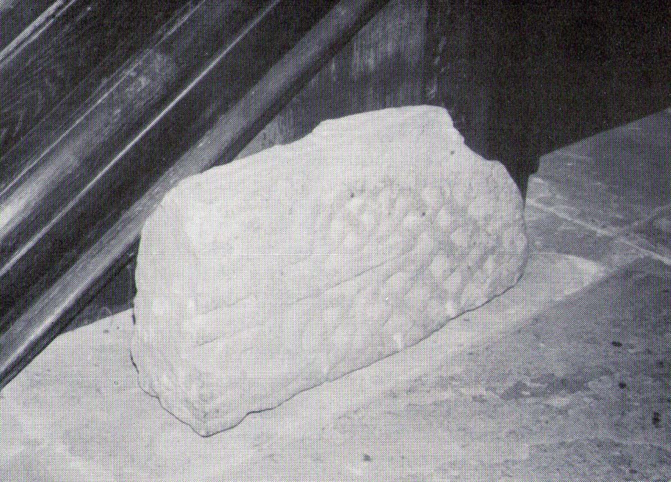
A little-known early christian relic found in the driveway to East Riddlesden Hall was saved and propped up in the stable floor at the back.  In 1984 however, the National Trust got round to moving it and bringing the relic to greater public attention by putting it on display in the great hall of the building. (I think you’ve gotta pay to go in and see the stone these days – which is a bittova pain if you just want to examine the carving)

Old photo of the carved stone (after Margaret Faull)

Measuring just 1 foot across and 2 feet high and carved on all sides, the design is all too familiar to those of you exploring early christian or late-Celtic art forms.  Executed sometime between the 5th-10th century, on the main face of the cross we have the traditional ‘Celtic’ interlacing, with a bird-figure emerging on or around an early ‘cross’ symbol.  There are a variety of interpretations of this, but none relate to any modern christian mythic structures.  Indeed, we should cautiously reflect on the more pre-christian nature of this design: carved as it was at a time when the spirit of the natural world (animism) was endemic amongst all people.  This carving would in some way reflect such implicit subjectivity, though perhaps have had emergent ideals relevant to the christian cult within it.  However, we should be cautious about this christian idea, despite it being much in vogue by prevailing groups of consensus trance historians.

References:

  1. Faull, Margaret L., “The Display of the Anglo-Saxon Crosses of the Keighley Area,” in Transactions of the Ancient Monuments Society, New Series no.30, 1986.

© Paul Bennett, The Northern Antiquarian

Mitton Church Cross, Great Mitton, Lancashire

Cross:  OS Grid Reference – SD 7154 3896

Getting Here

Great Mitton Churchyard Cross (after ‘QDanT’)

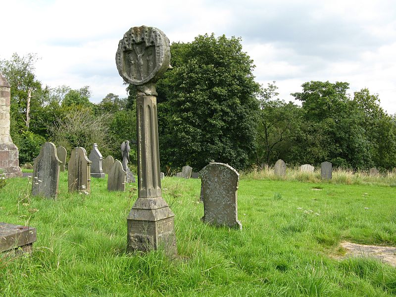
Take the B6246 road northwest out of Whalley, or else east from Hurst Green, until you hit the little village of Great Mitton, with its churchyard in the middle.  Go into the churchyard and you’ll find this weird-looking cross!

Archaeology & History

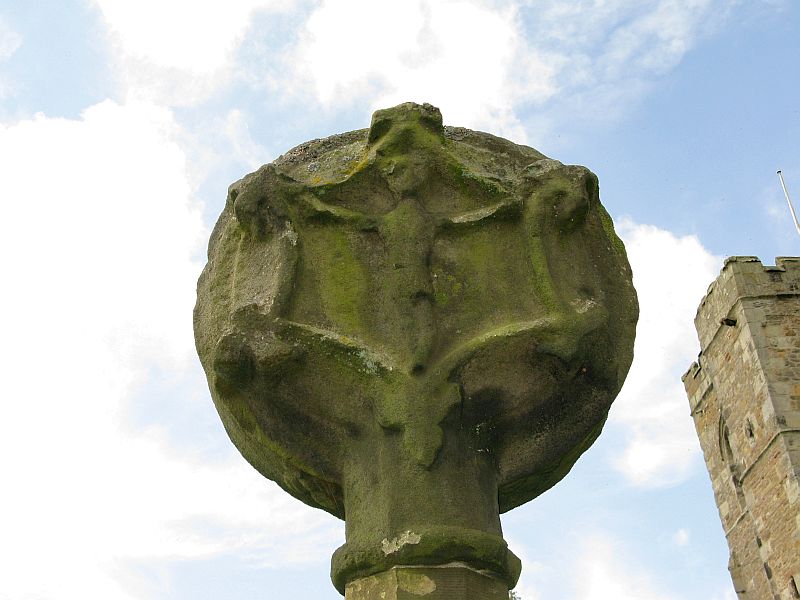
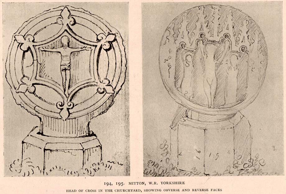
The curious-looking upright in the churchyard here has a mixed history by all accounts.  The oldest portion of the cross is universally ascribed to be the top section, rediscovered when it was dug up “shortly before 1801.” (Ackerley 1947) It possesses a carving of the crucifixion on one side, and some curious figures carved on the other, which some ascribe to being Jesus, but could well be the triple female element which would still have been prevalent in peasant culture at the time it’s thought to have been carved.  The original shaft carrying the ‘cross’ had long since been destroyed and so, according to Jessica Lofthouse (1946),

Carved crosshead (© ‘QDanT’)
Early drawing of cross-head

“In 1897 it was ‘re-erected to commemorate the 1300th anniversary of the reintroduction of christianity into Britain,’ with the new shaft we see today.  This is the oldest relic in Mitton.”

In J. Buckler’s early 1841 drawing of both sides of the carved cross-head we can see in greater detail the nature of the medieval rock art and this was described in Aymer Vallance’s (1920) decorative analysis of carved crosses in England.  He told that

“the cross-head at Mitton, Yorkshire…is peculiar inasmuch as the crucifixion is sculptured on both faces, but in totally different fashions.  That on the west face has the arms stretched horizontally, within a sexfoil frame, and might well be of the thirteenth century.  Whereas the sculpture on the east face, though much more weatherworn, is of a style that could not have been designed before the fourteenth, or perhaps even the fifteenth century.  The arms of the Christ in this instance are drawn upwards in an unusually oblique direction.  It is impossible that these two representations could have been executed at one and the same date.  The circular outline of the head, too, is peculiar, and suggestive rather of a gable-cross than of a standing cross.  Possibly the west face only was sculptured in the first instance, for a gable-cross, the sculpture on the east face being added later in order to adapt the stone for the head of a churchyard cross.”

Although I’ve gotta say that the three carved figures with the upright arms strikes me more as three females than any crucified character and may be an early depiction of the three Mary’s.

One of the early ministers at Mitton church was none other than John Webster, who wrote the highly influential work, Displaying of Supposed Witchcraft, which denounced much of the Church’s obsession and murder of countless people under the auspice of some spurious devil and demonological bollocks which, even today, some still suffer to endure.   Webster was only at Mitton for a few years, before moving into deeper Yorkshire and setting up at Kildwick.

References:

  1. Ackerley, Frederick George, A History of the Parish of Mitton, Aberdeen University Press 1947.
  2. Lofthouse, Jessica, Three Rivers, Robert Hale: London 1946.
  3. Vallance, Aymer, Old Crosses and Lychgates, Batsford: London 1920.

Links:

  1. Pictorial Journey of East Lancashire Crosses

© Paul Bennett, The Northern Antiquarian

Withgill Cross, Great Mitton, Lancashire

Cross:  OS Grid Reference – SD 7060 4062

Getting Here

Withgill cross location (after QDanT)

From Great Mitton village, go up (north) the slightly winding B6243 road for a mile, then take the left turn up the minor country lane, for about 300 yards, till you reach a tiny crossroad of tracks, one leading down to Scott House and the other up to Withgill Farm.  Stop here!  You’re damn close.  From what our man ‘QDanT’ says, this is now to be found behind the hedge by the roadside, on the side of the road where the track runs up to Withgill Farm, tucked low and overgrown close to the ground.  Good luck!

Archaeology & History

Described by Mr Ackerley (1947) as being found

“in the coppice beside the gate to Withgill is the base of another road-side cross,”

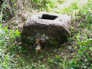
Cross-base (after QDanT)

all but overgrown by ivy and lost to the causal eye.  Thankfully our man Danny got on his bike and found the remains of the little fella, all-but invisible beneath the vegetative growth!  Beneath the vegetation, John Dixon told there to be “some interesting 17th century graffiti,” but there’s not much that remains of the old cross.

Folklore

There is a curious story about a legendary church that was once supposed to have been up the track on the hill just above here at the farm.  The story goes,

“that when Mitton church was built, it ought to have been built on Withgill Knowle: that there was a church somewhere about there, and that the stones from it were carted down to Mitton in one night and used in building the present church.”

This bitta folklore is a motif found commonly at prehistoric sites, where stones from our ancient places were uprooted and moved (destroyed) to give way to the new christian mythos.  To my knowledge, no such prehistoric sites are known hereby.  Mr Dixon – over to you dear sir!

References:

  1. Ackerley, Frederick George, A History of the Parish of Mitton in the West Riding of Yorkshire, Aberdeen University Press 1947.

Links:

  1. Pictorial Journey of East Lancashire Crosses
  2. Teddy’s Exploration of the Withgill Cross Base

© Paul Bennett, The Northern Antiquarian

Maen Achwyfan, Whitford, Flintshire

Cross: OS Grid Refence – SJ 129 788

Also Known as:

  1. The Stone of Lamentation
  2. St Cwyfan’s Stone

Getting Here

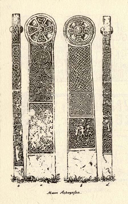
Maen Achwyfan Cross (after J.O. Westwood)

Go north on the A5026 from the town of Holywell for about 3 miles; at the hamlet of Lloc take the turning first right towards Trelogan village for another mile – the ancient cross stands in the corner of a field at the junction of 3 roads at the turning from Whitford to Trelogan, halfway between Whitford and Sarn. The cross can also be reached via Pantasaph from the A55.

History

The cross probably dates from 1000 AD and is said to be the tallest wheel-headed cross in Wales, standing at 11 feet 3′ in height. The metal fence surrounding the cross spoils the monument quite a bit, but it is there for security reasons.  It is richly decorated on all sides and on the cross-head. Much of the decoration is Celtic in origin, but there are also Viking influences here, probably Northumbrian. On the south face there is a human figure standing on a serpent that has associations with the Norse god Odin; also a three-legged horse that may also be connected to Odin. The north-west face has Celtic pattern-work in the form of the letter “X” and below that another figure (naked) holding a spear. The north-east face is rather eroded, but there is some Celtic-style decoration. There is more knotwork and chainwork elsewhere on the cross with other animal figures.  The wheel-head has a distinctive central boss and a four star-shaped cross radiating from the boss.

Folklore and Legend

The cross is also called ‘The Stone of Lamentation’ because penances were carried out at the cross in the Middle Ages. This act would have concluded with weeping and the ‘act of contrition’ by pilgrims visiting the site whilst making their way between St Winifred’s Well and St David’s.  Legend says that St Cwyfan, a local 7th century Celtic saint preached on this site and set-up the cross – hence the name, Maen Achwyfan.  One local legend tells us that Queen Boudica fought her last battle against the Romans close by in the fields called ‘Cydio ar Leni’ or ‘The fields of the seizing legions’.  During the Middle Ages the monks of Basingwerk Abbey preached at the cross and also set up a chapel for pilgrims just to the south at Whitford.

References:

  1. Allen, J. Romilly, “Celtic Crosses of Wales”, in Archaeologia Cambrensis, 1899.
  2. Owen, Rev. Elias, Old Stone Crosses of the Vale of Clwyd and Neighbouring Parishes, Bernard Quaritch: London & Oswestry 1886.
  3. Sharkey, John, Celtic High Crosses of Wales, Carreg Gwalch: Llanrwst 1998.
  4. Westwood, J.O., Lapidarium Walliæ – The Early Incised and Sculptured Stones of Wales, Oxford University Press 1879.

Copyright © Ray Spencer 2011