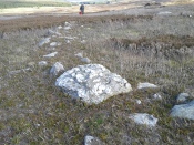
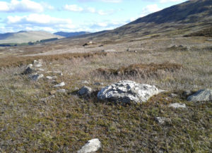
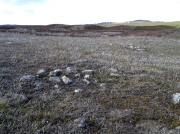
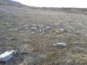
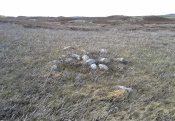
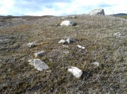
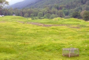
Tom-a-Clachan, Kirkmichael, Perthshire

Stone Circle (destroyed):  OS Grid Reference – NO 0808 5985

Archaeology & History

Kirkmichael parish was an area that was described by George Chalmers (1887) as possessing “a vast body of Druid remains,” there being “a number of Druid cairns in the vicinity of Druidical circles.”  As we know, the term ‘druid’ has long fallen out of favour; and with it in this area, the sites themselves have taken a similar fate.

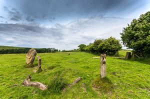
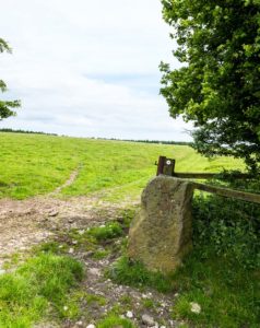
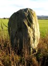
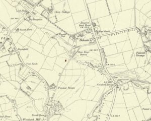
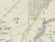
Found just south of the village, on raised ground 100 yards west of the river, this stone circle is not listed in any of the archaeological catalogues, but its existence was thankfully recorded in one of the essays by regional historian Charles Fergusson.  He told us that,

“one of these Druidical circles stood at Tom-a-Chlachan — the Hillock of Stones — where the Manse of Kirkmichael now stands, and there two thousand years ago our rude ancestors worshipped, according to their faith, in their circle of stones; and there, as elsewhere, when the pioneers of Christianity came to the district, they found it expedient to place their new church where the old circle of stones had stood, so the first church of St Michael was reared where the old clachan stood, on what the natives already considered holy ground.”

In the same tradition (but this time, without the destruction), on the other side of the River Ardle from here, what was once known as a heathen well later became known as the Priest’s Well.

References:

  1. Chalmers, George, Caledonia – volume 1, Alexander Gardner: Glasgow 1887.
  2. Fergusson, Charles, “Sketches of the Early History, Legends and Traditions of Strathardle and its Glens – part 5,” in Transactions of Gaelic Society Inverness, volume 21, 1899.

© Paul BennettThe Northern Antiquarian


Longbarrow Field, Timble, North Yorkshire

Cairn (lost):  OS Grid Reference — SE 18 53

Archaeology & History

Described in the Field Lore of Timble village by William Grainge (1895) are the names and short histories of some of the local place-names—with this in particular standing out like a veritable sore thumb!  Quite plainly, as Grainge told us,

“The name ‘Longbarrows’ is indicative of some burial mounds of a very early day.  None exist at present.  The land is under the plough, and is about the best in the township.”

But I cannot locate the position of this long-lost site and it’s not shown on any of the early OS-maps hereby.  Grainge said that the land on which it once stood was owned by a local farmer called Charles Dickinson, who leased it out to others.  He wrote:

“Dickinson had in Longbarrows 3 roods* and 23 perches*, and William Jackson’s share in Longbarrows was 1 acre, 3 roods and 21 perches.  Besides these, John Ward of Nether Timble had 1 rood and 17 perches int he same field, a long narrow slip without fence, between Dickinson’s and Jackson’s lots.”

Does anyone know where this was?  One of my suspects is the gathering place of the Fewston witches, a half-mile south of the village; but no remains of anything can be found there today and I may just be barking up the wrong tree.

The area south and west of here is rich in little-known prehistoric heritage, from the cairn-fields of Askwith Moor, the cairn circle at Snowden Crags, the settlements of Snowden Carr and the extensive petroglyphs all over the place!  Giants cairns of the early Bronze Age and neolithic period were also once more numerous upon the moors to the west and south, so the former existence of a long barrow in Timble wouldn’t necessarily be too unusual.  But where was it?!

References:

  1. Grainge, William, The History and Topography of the Townships of Little Timble, Great Timble and the Hamlet of Snowden, William Walker: Otley 1895.

*  A rood is an English unit of area, equal to a quarter of an acre or 10,890 square feet; a perch was a more variable unit of measure, being lengths of 1612, 18, 21, 24 and 25 square feet.

© Paul BennettThe Northern Antiquarian 

Stone Rings, Pannal, North Yorkshire

Stone Circle (destroyed):  OS Grid Reference – SE 308 527

Archaeology & History 

‘Stone Rings’ place-names on the 1910 OS-map

The plurality of the place-name implies that there was more than one circle, but we don’t that know for sure either!  But if there was more than one, it is more likely they were cairn circles than traditional free-standing stones circles.  But once again, we simply don’t know….No remains exist of the “stone rings”—or rings of stone—that once stood here in bygone centuries.  The only remains left are in the place-names of the stream and roads hereby, highlighted on several of the early OS-maps: Stone Rings Lane, Stone Rings Beck and the Stone Rings Quarry—the latter of which is probably the reason why there is nothing to be seen here anymore. But we don’t know for sure.

The grid-reference given here is an approximation.

References:

  1. Smith, A.H., The Place-Names of the West Riding of Yorkshire – volume 5, Cambridge University Press 1961.

© Paul BennettThe Northern Antiquarian


Glen Cochill Circle (01), Little Dunkeld, Perthshire

Hut Circle:  OS Grid Reference – NN 90324 41487

Getting Here

Glen Cochill Circle - No.1

Glen Cochill Circle – No.1

Take the same directions to reach the impressive Carn Ban prehistoric tomb.  From here, walk along the winding track past the giant cairn onto the moors for about 350 yards, until the track goes dead straight and heads NNW uphill.  Walk up here for another 350 yards keeping your eyes peeled on the rounded pyramidal hill with the large rock on top.  The circle is 20 yards off the track as you head up to the pyramidal hill stone.

Archaeology & History

Although this site is mentioned in notes by the Scottish Royal Commission and highlighted by Ordnance Survey, information thereafter is pretty scarce.  Which is surprising when you check this place out first-hand.  It’s bloody impressive!  David Cowley (1997) describes the area, but not in much detail.

Northern arc of walling

Northern arc of walling

Eastern arc of walling

Eastern arc of walling

The circle seems to have been rediscovered first of all by the dowser J. Scott Elliott (1964), who thought it was a cairn circle – which is understandable.  However, it has been classified by the Royal Commission lads as a “hut circle”, so we’ll stick with that for the time being.

An entrance to the circle doesn’t stand out.  There may be one on the southeastern side, but this isn’t clear; and what looked like a possible entrance on its northern edge was discounted, as a larger stone blocked this on the outside.  There was no immediate evidence of any internal structure, no hearth, no tomb – merely a small stone at its centre, deeply embedded in the peat.  This may, however, cover a central cist – which would make this a cairn circle and not a large hut circle.  But that’s guesswork on my behalf!

Arc of ring from east to south
WNW arc of walling

Never excavated, what we’ve got here is a very well-preserved, large ring of stones, more typical of Pennine and Derbyshire ring cairns than any standard hut circles.  But this is Scotland we’re talking about!  This impressive ring measures outer-edge to outer-edge 12 yards in diameter (north-south), by 11 yards (east-west), with the stone walling that defines the ring being between 3 and 4 feet across all round, and between 1-2 feet high.  And it’s in damn good nick!  More similar in structure to the likes of Roms Law, a number of notably large stones define the edges, but many hundreds of smaller packing stones build up the ring walls.  Of the larger rocks in the ring, the most notable one is a large white quartz crystal stone on its NNE side.

Quartz rock reflects the sun, looking W

Quartz rock reflects the sun, looking W

It’s an impressive site whatever it may be! – in very good condition for its age (Bronze Age by the look of it) and, whilst still visible above the heather, well worth checking out if you like your stone circles and prehistoric rings.  The small prehistoric graveyard 30-40 yards south and east, plus the extensive settlement systems all over these moors are all worth exploring if you visit this place.

References:

  1. Cowley, David C., “Archaeological Landscapes in Strathbraan,” in Tayside & Fife Archaeological Journal, volume 3, 1997.
  2. Scott-Elliot, J., “Kinloch House, Amulree,” in Discovery & Excavation in Scotland, 1964.
  3. Scott-Elliot, J., Dowsing – One Man’s Way, Neville Spearman: London 1977.

Links:

  1. Canmore notes on Glen Cochill

Acknowledgements:  Many thanks to Mr Paul Hornby for his help, as usual.  Cheers fella!

© Paul BennettThe Northern Antiquarian


Glen Cochill Cairnfield (01), Little Dunkeld, Perthshire

Cairns:  OS Grid Reference – NN 9035 4145

Getting Here

Two of at least five cairns hereby

Two of at least five cairns hereby

Take the A826 road south out of Aberfeldy, uphill, till you reach the White Cairn or Carn Ban, then follow the dirt-track for 700 yards onto the moors until you reach the Glen Cochill Circle 1.  From here, look at the large stone atop of the very notable rounded hillock barely 50 yards east (at NN 90367 41478) and meander on the slopes immediately below it on the south and west.  If the heather’s grown back, you don’t stand a chance!

Archaeology & History

As far as I’m aware, despite there being some brief notes of cairnfields in and around the rich prehistoric arena of Glen Cochill, I can find no data indicating that the five small single cairns a short distance south and southeast of the Glen Cochill Ring (01), have been described before.

Cairn 1 - looking north

Cairn 1 – looking north

Cairn 2 - looking north

Cairn 2 – looking north

Deeply embedded into the peat, they are only visible when the heather has been burnt away, as highlighted in the accompanying photos.  Each cairn is of roughly the same size and structure: 2-3 yards across and only a couple of feet above ground-level, consisting of the traditional small rounded stones, each probably constituting a single burial or cremation.

Cairn 4, below the hilltop rock

Cairn 4, below the hilltop rock

Of at least five cairns that we found here (there may be others beneath the covering heather), it was very notable that they’re on edges of a rounded pyramidal hillock, whose top is surmounted by a large pointed stone – probably a glacial erratic.  We looked at this rock in the hope of finding some cup-markings, but there were none.  However, it seemed as if the cairns and this crowning stone were related to each other, as if rites for the dead were proclaimed here for those in the tombs.  It may sound silly, but go there and take a look at it yourselves – before the heather grows back.  Just as a priests today, and shamans throughout history, have used an altar or plinth to make commemorations to the dead, so this crowning stone may equally have been used.  It makes sense.  And, as if to add validating ingredients: if we look east, past the crowning stone and across the River Cochill, we see the great rocks in the forest known as Creag a Bhaird, or the Crag of the Bard, from whence orations and tales were known to be told… But that’s another site with its very own story…

Acknowledgements:  Once again, thanks must be given to Mr Paul Hornby for his help in finding these sites.

© Paul BennettThe Northern Antiquarian


Cupar Stone Circle, St. Martin’s, Perthshire

Stone Circle (ruins):  OS Grid Reference – NO 15958 31227

Also Known as:

  1. Canmore ID 28632

Getting Here

The stone circle on 1867 map

Follow the same directions as if you’re visiting the Witches Stone of St. Martin’s.  On the way up the long dirt-track, just where the track has levelled out above the slope, keep your eyes peeled on the left (west) for a line of large long boulders on the other side of the barbed-wire fence, laid down, just at the edge of the field.  That’s what’s left of the place!

Archaeology & History

This site is in a sad state of affairs and no discernible ‘stone circle’ of any form can be seen here.  The stones that constituted the megalithic ring were uprooted and dumped at the side of the huge field sometime in the latter-half of the 20th century.  The site is shown clearly on the early OS-maps but at some point in more recent years, the land-owner here (I presume) uprooted the stones and dumped them at the field-side, where they remain. Not good.

Cupar Stones from the track

One of the stones here bore the curious name ‘Cupar’, which probably relates to it being a place where criminal trials were held, or justice dispensed. (Grant 1952)  Traditions such as this were enacted at other megalithic rings and ancient sites in earlier times.

The first mention of the circle I can find is in the old Name Book of 1865, which informs us:

“Three large boulders set up edgeways, and part of a circular earthen bank.  There is no local tradition regarding the stones but the Rev Park believes them to be the remains of a Druidical Temple. The name Cupar Stone is not well known locally but still appears on the estate map.”

Cupar Stones at field-edge

It originally stood on the edge of the large flat plateau, just at the point where the land slopes down to the south, with the curious Witches Stone of MacBeth on the same level plateau just over 400 yards to the north.  This small monolith may have been a deliberate outlier from the ring, perhaps relating to the calendrical airt of death (the direction ‘north’ commonly denotes Death in pre-christian cultural cosmologies).  But we know little else about the ring.  In Margaret Stewart’s (1965) notes about the site, she indicated that some of the stones were still standing when she saw them, saying how the “largest remaining stones are to the south and west.”  They’re not anymore!

Postulating it as a possible ‘four-poster’ stone circle (a dubious one, he said), Aubrey Burl (1988) told us:

“In the south corner of a partly cleared wood…there are three large stones, two of them fallen. They are in a roughly straight line running NNE-SSW.  Nearby is a fourth prostrate stone in a boundary wall.  Stewart (1965:21) suggested that they had once formed a ring approximately 24ft 6in (7.5m) in diameter. Different opinions have been that if there had been a circle, it was probably larger.”

In light of the near-complete destruction of the Cupar stone circle, I feel that note should be made of a somewhat worrying trend, not only here, but many other prehistoric sites in the country.  In the site profile Canmore has given the Cupar stone circle, its destruction and vandalism has been termed “agricultural improvement”, as if to sound ‘acceptable’ and that it’s OK to destroy stone circles – which it plainly is not!  If you or I were to do such a thing, we’d be arrested!  We need to make sure that, as individuals and organizations, we treat what some term “agricultural improvement” for what it is: vandalism (usually by rich tory land-owners who give back-handers, or similar things, to make sure the official paperwork looks OK).  I know a lot of archaeologists agree with this too, but cannot speak out for fear of losing their jobs.

References:

  1. Barnatt, John, Stone Circles of Britain (2 volumes), BAR: Oxford 1989.
  2. Burl, Aubrey,  The Stone Circles of the British Isles, Yale: London 1976.
  3. Burl, Aubrey, Four Posters: Bronze Age Stone Circles of Western Europe, BAR 195: Oxford 1988.
  4. Burl, Aubrey, The Stone Circles of Britain, Ireland and Brittany, Yale University Press 2000.
  5. Grant, William & Murison, David D., The Scottish National Dictionary – volume 3, SNDA: Edinburgh 1952.
  6. Royal Commission on the Ancient & Historical Monuments Scotland, South-east Perth: An Archaeological Landscape. RCHAMS: Edinburgh 1994.
  7. Stewart, Margaret E.C., “Excavation of a Circle of Standing Stones at Sandy Road, Scone, Perthshire“, in Transactions & Proceedings Perthshire Society Natural Science, volume 11, 1965.

© Paul BennettThe Northern Antiquarian


Clachaig, Glen Lyon, Perthshire

Stone Circle (destroyed):  OS Grid Reference – NN 583 468

Also Known as:

  1. Canmore ID 24237
  2. Kerrowmore

Archaeology & History

Upright slab in graveyard

Upright slab in graveyard

In a discussion about the ancient chapel to St. Eonan (the local name in these parts for Adamnan) that once existed near the Bridge of Balgie in Glen Lyon, the local historian Duncan Campbell (1886) informed us that,

“St. Eonan built his chapel near the only stone circle in Glenlyon.  The stones of this circle have been removed within my memory.  The place is called Clachaig.”

The same writer (Campbell 1888) later told how its remains were still visible around 1848 CE.  Campbell’s (1910) later memoirs also mentioned his childhood recollections when the stone circle was in situ, telling that the

“place above the churchyard to Clachaig, named so, the Place of Stones, (was) because the old Druidic stone circle was there.”

We don’t know exactly where the megalithic ring stood; and although modern analysts think the site may have been underneath the invading forestry commission plantation, local lore puts it closer to the graveyard above Kerrowmore.

Enhanced image of curious near-circular form close by

Enhanced image of curious near-circular form close by

A local dowser thinks that the upright slab in the graveyard at Kerrowmore may be the one remaining stone left here after the circle’s destruction.  A quick meander back and forth on a rainy day here, on the geological ridge at the back (south) of Kerrowmore, found only a curious near-circular earthwork that might have been the original site, but it may be fortuitous. A nearby rock outcrop known as “Coill a’ Bhaird” may have been related to the circle.

Folklore

A local man (thanks Tom) said how tradition tells that some of the stones from this circle were taken and used in making the drive to Meggernie Castle last century.

References:

  1. Campbell, Duncan, The Lairds of Glenlyon, Cowan: Perth 1886.
  2. Campbell, Duncan, The Book of Garth and Fortingall, Northern Counties Newspaper: Inverness 1888.
  3. Campbell, Duncan, Reminiscences and Reflections of an Octogenarian Highlander, Northern Counties Newspaper: Inverness 1910.
  4. Stewart, Alexander, A Highland Parish; or, The History of Fortingall, Alex MacLaren: Glasgow 1928.

© Paul BennettThe Northern Antiquarian


Harlaw Stones, Balerno, Midlothian

Standing Stones (destroyed):  OS Grid Reference – c. NT 178 655

Archaeology & History

We are uncertain about the nature and form of what was once known to be “a group of five standing stones” near the destroyed giant cairn of Harlaw, west of Balerno (which was probably built near the old trig-point at NT 1783 6594).  This cluster of standing stones may have been the remains of a stone circle or a possible megalithic stone row, and it’s even been postulated as a line of possible boundary stones—but this is most unlikely.

The only known reference of the site comes from the New Statistical Account in 1845 which told:

“About a quarter of a mile to the south of the large cairn were five very tall and large stones set perpendicularly in the Earth.”

They were destroyed around the same time as the cairn in the early 1800s. Until we find further information, its exact status remains unknown. (Kaledon Naddair – are you out there?)

References:

  1. Baldwin, John & Drummond, Peter, Pentland Place-Names, FotP: Edinburgh 2011.
  2. Dixon, Norman, The Place-Names of Midlothian, University of Edinburgh 1947.
  3. Harris, Stuart, The Place-Names of Edinburgh: Their Origins and History, Gordon Wright: Edinburgh 1996.
  4. McLean, Adam, The Standing Stones of the Lothians, Megalithic Research Publications: Edinburgh no date (c.1978).

© Paul BennettThe Northern Antiquarian


Kipps, Linlithgow, West Lothian

Stone Circle (destroyed):  OS Grid Reference – NS 9909 7387

Also Known as:

  1. Canmore ID 47920

Archaeology & History

Site shown on 1856 map

In an Address to the Scottish Society of Antiquaries in the middle of the 19th century, Sir James Simpson (1862) pointed out the outright destruction and vandalism that incoming land-owners (english mainly, and probably christians too) had inflicted on the monuments of the Scottish people.  Stone circles and two cromlechs, he said, that had existed in this part of West Lothian for thousands of years, were recently destroyed when Simpson was alive.  One of them was here at Kipps.  He told:

“In 1813 the cromlech at Kipps was seen by Sir John Dalzell, still standing upright.  In describing it, in the beginning of the last century, Sir Bobert Sibbald states that near this Kipps cromlech was a circle of stones, with a large stone or two in the middle; and he adds, “many such may be seen all over the country.”  They have all disappeared; and latterly the stones of the Kipps circle have been themselves removed and broken up, to build, apparently, some neighbouring field-walls, though there was abundance of stones in the vicinity equally well suited for the purpose.”

Simpson suggested, quite rightly, that efforts should be made to resurrect the old monument.  In his day the fallen remnants of the ‘cromlech’ that had stood inside the circle were still in evidence and it was highlighted on the early OS-map of the region; and when the northern antiquarian Ratcliffe Barnett (1925) came walking here earlier in the 20th century he told he could still see “the remains of an ancient cromlech, which stood within a circle of stones.”  Around the same time, the Royal Commission (1929) lads looked for these remains but seemed to have gone to the wrong site, “a quarter-mile northwest of Kipps Farm”, where they nevertheless found,

“a tumbled mass of boulders containing about thirty stones, one being erect; they vary from 6 by 3 by 1½ feet by 4 by 3 by 2½ feet, and are probably the remains of a cairn.”

When the renowned chambered tomb explorer Audrey Henshall (1972) followed up the directions of the Royal Commission, she was sceptical of giving any prehistoric provenance to the rocks there, describing them simply as geological “erratics.”

The very place-names Kipps may derive from the monument, for as Angus MacDonald (1941) told, “the word seems to come from Gaelic caep, ‘a block’”, but the word can also mean “a sharp-pointing hill, a jutting point, or crag on a hill”, and as the house and castle at Kipps is on an outlying spur, this could be its meaning.

Folklore

Local lore told how lads and lassies would use the stones as a site to promise matrimony with each other, by clasping their hands through a gap on the top boulder.  Using holes in or between stones to make matrimonial bonds, where the stone is the witness to the ceremony, occurs at many other sites and became outlawed by the incoming christian cult, which took people away from the spirits of rock, waters and land.

References:

  1. Barnett T. Ratcliffe, Border By-Ways & Lothian Lore, John Grant: Edinburgh 1925.
  2. Duns, J., “Notes on a Burial Mound at Torphichen, and an Urn found near the ‘Cromlech’ at Kipps, Linlithgowshire”,  in Proceedings of the Society of Antiquaries, Scotland, volume 12, 1878.
  3. Henshall, Audrey S., The Chambered Tombs of Scotland – volume 2, Edinburgh University Press 1972.
  4. Lewis, A.L., “The Stone Circles of Scotland,” in Journal Anthropological Society Great Britain, volume 30, 1900.
  5. MacDonald, Angus, The Place-Names of West Lothian, Oliver & Boyd: Edinburgh 1941.
  6. Royal Commission on the Ancient & Historical Monuments, Scotland, Midlothian and Westlothian, HMSO: Edinburgh 1929.
  7. Simpson, James Y., “Address on Archaeology,” in Proceedings Society of Antiquaries, Scotland, volume 4, 1862.

Acknowledgements:  Accreditation of early OS-map usage, reproduced with the permission of the National Library of Scotland.

© Paul BennettThe Northern Antiquarian


Glesart Stanes, Glassford, Lanarkshire

Standing Stones:  OS Grid Reference – NS 73609 46916

Also Known as:

  1. Avonholm
  2. Canmore ID 45595
  3. Glesart Stones
  4. Struthers Burial Ground
  5. Three Stones

Getting Here

Glesart Stones on 1864 map

From the roundabout in Glassford village, head west down Jackson Street along the country lane of Hunterlees Road.  About 600 yards on, turn right at the small crossroads (passing the cemetery on yer left) for about half-a-mile, before turning left along a small track that head to some trees 400 yards along.  Once you’ve reached the trees, walk uphill and follow the footpath to the right, keeping to the tree-line.  It eventually runs to a small private graveyard. You’re there!

Archaeology & History

Glesart Stones,
looking west

In the little-known private graveyard of the Struthers family on the crest of the ridge overlooking the River Avon and gazing across landscape stretching for miles into the distance, nearly a mile east of Glassford village, several hundred yards away from the Commonwealth graveyard, a cluster of yew trees hides, not only the 19th century tombstones, but remnants of some thing much more archaic.  Three small standing stones, between 2½ and 4 feet in height, hide unseen under cover of the yews, at the end of a much overgrown ancient trackway which terminates at the site.  They’re odd, inasmuch as they don’t seem to be in their original position.  Yet some form of archaic veracity seems confirmed by the weathered fluting: eroded lines stretching down the faces of two of the taller stones and, more importantly, what seem to be cup-markings on each of the monoliths.

Cup-mark atop of east stone

Easternmost stone

The tallest stone at the eastern end of the graveyard has a deep cup on its crown.  This may be the result of weathering; but we must exercise caution with our scepticism here.  Certainly the eroded lines that run down this stone are due to weathering – and many centuries of it; but the peculiarity is that the weathering occurs only on one side.  This implies that only one side of the stone was open to the elements.

Central cup-marked stone

‘X’ carved atop of central stone

The second, central stone of the three, is slightly smaller than the first.  Unlike the eastern stone, its crown has been snapped off at some time in the past century or so, as evidenced in the flat smooth top.  But along the top are a series of small incised marks, one of which includes a notable ‘X’, which may have been surrounded by a circle.  A second fainter ‘X’ can be seen to its side, and small metal-cut lines are at each side of these figures.  Another small section of this stone on its southern edge has also been snapped off at some time in the past.  The most notable element on this monolith is the reasonably large cup-mark on its central west-face.  It is distinctly eroded, measuring 2-3 inches across and an inch or more deep.  Its nature and form is just like the one in the middle of the tallest of the standing stones at Tuilyies, nearly 31 miles to the northeast.

Western smallest stone

The Three Stones

The smallest of the three stones is just a few feet away from the central stone.  To me, it seemed oddly-placed (not sure why) and had seen the attention of a fire at its base not too long ago.  On its vertical face near the top-centre of the stone, another cup-marking seems in evidence, some 2 inches across and half-an-inch deep—but this may be natural.  The Glasgow archaeologist Kenneth Brophy reported that on a recent visit, computer photogrammetry was undertaken here, so we’ll hopefully see what they found soon enough.

There is some degree of caution amongst some archaeologists regarding the prehistoric authenticity of the Glesart Stanes – and not without good cause.  Yet despite this, the seeming cup-marks and, particularly, the positioning of the stones in the landscape suggest something ancient this way stood.  The stones here are more likely to be the remains of a once-larger monument: perhaps a cairn; perhaps a ring of stones; or perhaps even an early christian site.  At the bottom of the hill for example, just 350 yards below, is a large curve in the River Avon on the other side of which we find the remains of an early church dedicated to that heathen figure of St. Ninian (his holy well close by); and 300 yards north is the wooded Priest’s Burn, whose history and folklore seem lost.

The Glesart Stanes were the subject of an extended article by M.T. M’Whirter in the Hamilton Advertiser in 1929 (for which I must thank Ewan Allinson for putting it on-line).  He wrote:

“Situated on the highest hill-top on the estate of Avonholm, north to the house of that name, is the private burial ground of James Young Struthers… Situated within the burial ground are three upright flagstones of a dark brown colour, rough and unhewn,  Each stone is facing the east, and placed one behind the other, though not in a straight line, and the space between the eastern and the middle stone is eight feet, and the space between the middle and the western stone is seven feet.  The stone flags vary in measurement, the eastern stone being the greater, standing four feet three inches high, three feet eight inches broad, and one foot thick.  The middle stone is three feet high, three feet ten inches broad, and nine inches thick; and the western stone is three feet high, four feet broad and ten inches thick.  The two outer stones bear no letters, figures or marks, but the centre stone has rudely sculptured on the top-edge the Roman numerals IX, and on the western side of the stone there is a cup-shaped indentation about two inches in diameter.  A groove 26 inches in length extends from the top of the stone to below the level of the cup indentation.  The groove is deeper at the top, but gradually loses in depth towards the bottom end.  I have seen grooves similar to above by the friction of a wire rope passing over a rocky surface.  The numerals, cup indentation and groove do not appear to be part of the original placing of the stones and, if a cromlech, then in the centuries that have gone, the stones becoming exposed to view by the removal of the mound, would invariably have led to a search for stone coffins or urns, yet no discovery of either has ever been recorded.”

Indeed, Mr M’Whirter was sceptical of them being part of a prehistoric burial site, preferring instead to think that a megalithic ring once stood here.  He continued:

“From an examination of the three stones, I am convinced that they form a segment of a circle, and assuming that nine additional stones complete the circle, it would enclose a space of roughly one hundred feet in circumference, with each stone facing an easterly direction.”

But we might never know for certain…. The only other literary source I have come across which describes the site is that by the local vicar, William Stewart (1988), who told us that:

“The stones stand erect, six feet apart, three rough slabs of coarse-grained sandstone, three feet high, three feet broad and six inches thick, free of any chisel marks.  Two have their back to the east, the third, oblique to the others, has its back to the south-east, thus there is no suggestion of a stone circle.  There are vertical grooves on two of the stones, while the centre stone has a cupmark, below which is a faint circle, one foot in diameter.  They stand at the end of a long narrow strip of land with low earthen walls on either side, perhaps an old agricultural field division, and they gave their name ‘Three Stanes’, to a now partly-lost road which eventually reached The Craggs and ended as Threestanes Road in Strathaven…”

The Three Stones

The “faint circle” described by Mr Stewart is barely visible now.  And the idea that these “three stones” gave their name to the farmhouse and road of the same name at the other side of Strathaven, three miles west, seems to be stretching credulity to the limits.  Surely?

Folklore

In 1845, Gavin Laing in the New Statistical Account for Lanarkshire told that:

“These stones are known simply as the “Three Stones”. There is a tradition in the neighbourhood that three Lords were buried here, after being killed while looking on at a Battle. The stones are about 3½ feet high and about as thick as flag stones. They stand upright being firmly fixed in the ground.”

The stones and their traditional origin were also mentioned in Francis Groome’s Ordnance Gazetteer (1884), where he echoed the 1845 NSA account, but also added:

“Three tall upright stones are here, and have been variously regarded as Caledonian remains, as monuments of ancient noblemen, and as monuments of martyrs.”

Then at the end of the 1850s, when the Ordnance Survey lads came here, they reported,

“Three high stones stand upright on a small eminence upon the lands of Avonholm, respecting their origin there are various opinions. They are probably the remnants of Druidical superstition.”

References:

  1. Groome, Francis H., Ordnance Gazetteer of Scotland – volume 1, Thomas C. Jack: Edinburgh 1884.
  2. M’Whirter, M.T., “The Standing Stones at Glassford,” in Hamilton Advertiser, 1929.
  3. Stewart, William T., Glasford – The Kirk and the Kingdom, Mainsprint: Hamilton 1988.
  4. Wilson, James Alexander, A Contribution to the History of Lanarkshire – volume 2, J. Wylie: Glasgow 1937.

© Paul BennettThe Northern Antiquarian