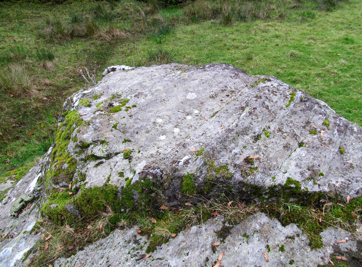
Broadgate, Strathblane, Stirlingshire

Chambered Cairn (destroyed):  OS Grid Reference – NS 5674 7938

Also Known as:

  1. Canmore ID 44453

Archaeology & History

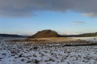
A once-impressive large prehistoric long cairn could be found close to the grid-reference given here, whose existence and destruction was recorded, thankfully, by local antiquarians in the 18th and 19th centuries respectively.   There are remains of other prehistoric sites in and around the spot—including the standing stones of both Broadgate Farm and Strathblane Church—close to which Mr J.G. Smith (1866) described,

“towards the end of last century a mound was levelled at Broadgate near this spot, and many stone coffins, each containing an urn full of earth and burnt bones, were found.”

Smith himself refers to the lengthier description of the mound’s destruction in Ure’s History of Rutherglen (1793), in which the site was described as

“an ancient burying place, the origins of which is unknown, was 60 yards in length, 14 feet in height, and of a considerable breadth.  It was composed of gravel, and lay east and west.  In the bottom were a great many coffins of stone, placed in a row, and separated from one another by a single flag.  Every coffin contained an urn, that was full of earth and burnt bones.  Beside each urn was a pillar about 3 feet in height, and 8 inches in thickness.  They were fragments of basaltic five-sided columns, a few rocks of which are found in the parish.  Most of the pillars are built in a dyke adjoining to the church.  The urns on being touched fell in pieces.”

Due to the seemingly extravagant lay-out of this cairn, Audrey Henshall (1972) took the site to be a chambered tomb of some considerable importance.  She was probably right!  In her magnum opus (1972) on the subject she wrote:

“The description of the ‘cists’ suggests a segmented chamber of Clyde type, but the mound composed of gravel (instead of being a cairn) suggests a natural feature.  A long mound, probably natural, exists on Broadgate Farm in which a restricted excavation produced a cist of Bronze Age type. Possibly the Strathblane mound was similar; it may have contained a segmented chamber (…where a chamber has been built into a natural mound), or it may have contained cists of later type for single burials.”

Subsequent explorations by the Royal Commission (1963) and local historians to find any remains of the site have proved fruitless.

References:

  1. Henshall, Audrey S., The Chambered Tombs of Scotland – volume 2, Edinburgh University Press 1972.
  2. Royal Commission on the Ancient & Historical Monuments Scotland, Stirling – volume 1, HMSO: Edinburgh 1963.
  3. Scott, J.G., “Inventory of Clyde Cairns,” in Megalithic Enquiries in the West of Britain,Liverpool University Press 1969.
  4. Smith, John G., The Parish of Strathblane, James Maclehose: Glasgow 1886.
  5. Ure, David, The History of Rutherglen and East Kilbride, Glasgow 1793.

© Paul BennettThe Northern Antiquarian


Boreland Hill, Kincardine, Stirlingshire

Standing Stone:  OS Grid Reference – NS 72346 99409

Also Known as:

  1. Blair Drummond Stone
  2. Canmore ID 46064

The standing stone

The standing stone

Getting Here

Along the A84 Stirling-Doune road, watch out for the minor Cuthill Brae road to the caravan park.  A couple of hundred yards before reaching the entrance to the caravan park, note the copse of trees more than 200 yards north, on the left, across the field. Walk into the trees and, near the centre, you’ll see the upright stone.

Archaeology & History

Looking to the west

Looking to the west

On the very top of this flattened tree-covered hill between Doune and Stirling, a single upright monolith more than 5½ feet tall quietly rests, seemingly forgotten by just about everyone.  The stone was marked on the earliest OS-maps in the 1860s, though in non-antiquated lettering, as if to question its archaic veracity—and this has continued to the present day, with the likes of Hutchison (1893) and Canmore upholding it as little more than a geological erratic.  Yet as our photos here show, this stone has much greater credibility as an authentic standing stone than Nature’s handiwork.

In Mr Hutchison’s (1893) article on the megalithic remains of the area he said of this stone:

“This is a very fine boulder of Highland grit, stranded on a gravel mound near the official residences on the Blair Drummond estate.  The knoll is wooded, leaving a clear space in the centre for the stone.  It would thus appear to have been thought worthy of preservation for some reason or other.  It has no appearance however, of having been erected as a standing stone.  It measures about 6 feet in height, and 12 feet at its widest circumference.”

Looking northwest-ish

Looking northwest-ish

Looking northeast-ish

Looking northeast-ish

The position of the stone is intriguing, giving a 360° view through the trees to a much greater vista all round, and this does seems to be quite deliberate.  In all honesty, this does look like an authentic standing stone, contrary to the earlier views cited.  A large prehistoric tumulus occurs only 400 yards to the south (recently damaged and built onto by the present land-owner) and other standing stones are in the area.

There are a number of scratch marks on the upright faces of the stone, no doubt caused by the forestry actions here over the last century.  No modern excavations have occurred here.

Folklore

A couple of centuries ago, the New Statistical Account told that,

“a very vague tradition represents it as having been a place of religious worship in superstitious times. There are no other remains near to confirm this opinion; but whether it be correct or not, it is evident that its site is a very important one, and may have been useful as a signal station, as it commands a view not only of the road across the Moss of Kincardine, but also of the line of Roman stations along the Forth and Teith in the direction of the camp at Ardoch.”

References:

  1. Bennett, Paul, The Standing Stones of Stirling and District, TNA: Stirling 2020.
  2. Hutchison, A.F., “The Standing Stones of Stirling District,” in The Stirling Antiquary, volume 1, 1893.

© Paul BennettThe Northern Antiquarian


Nether Glenny (35), Port of Menteith, Perthshire

Cup-and-Ring Stone:  OS Grid Reference – NN 56425 02099

Also Known as:

  1. Canmore ID 24041
  2. Menteith 26
  3. Nether Glenny 19

Getting Here

Archaeology & History

Netherglenny 35 stone

Take the same directions as if you’re visiting the nearby Nether Glenny 2 cairn. Once here, walk less than 100 yards further down into the same field, north, roughly parallel with the fencing.  You’ll reach several large rocks, and the elongated one on the slight rise closer to the fence is the one you’re after.  You’ll find it!

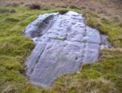
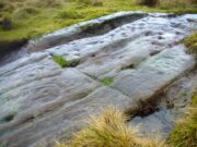
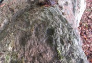
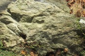
This is one in a number of impressive cup-and-ring stones scattered along this grassy ridge overlooking the Lake of Menteith and the Gargunnock Hills to the south.  Petroglyph lovers amongst you will love it!  And it seems that with each and every analysis, the carvings gives up more and more of its ancient symbolism.  When it was first described (in a literary sense) by Maarten van Hoek (1989) he told it to be:

“Irregular outcrop with at least 72 single cups; 3 cups with 2 rings; 6 cups with 1 ring and 2 possible horse-shoe rings only.”

But when Kaledon Naddair (1992) visited the site a few years later he amended this initial description, telling us how,

“Further temporary turf removal extended the total to 124 solo cups, and 9 cups with 1 ring, and 5 cups with 2 rings.”

Cups & rings & cups….
Western side of carving

Naddair’s description is closer to our own inspection, although I think that a small number of the ‘cups’ are natural.  Other features that we’ve found occur on the more western side of the rock.  A faint partial-double-ringed cup is accompanied a few inches away by a carved element that seems to have been unfinished.  An initially indistinct circle, faintly pecked, has internal lines at the quadrants, akin to an early cross form.  A line emerges from this symbol which also seems to have been slightly worked.

Subsequent investigations of this carving has uncovered much more which, to be honest, requires almost an entire re-write of this profile……

…to be continued…

References:

  1. Brouwer, Jan & van Veen, Gus, Rock Art in the Menteith Hills, BRAC 2009.
  2. Naddair, Kaledon, “Menteith (Port of Menteith parish): rock carvings”, in Discovery & Excavation Scotland, 1992.
  3. van Hoek, Maarten, “Menteith (Port of Menteith parish) rock art sites”, in Discovery & Excavation Scotland, 1989.

© Paul BennettThe Northern Antiquarian


The Green, Glen Lochay, Killin, Perthshire

Cup-Marked Stone:  OS Grid Reference — NN 53976 35248

Also Known as:

  1. Canmore ID 274203
  2. Falls of Lochay

Getting Here

The cliff-face and its ledge

Going out of Killin towards Kenmore on the A827 road, immediately past the Bridge of Lochay Hotel, turn left. Go down here for just over 2 miles and park-up where a small track turns up to the right (half-mile before the impressive Stag Cottage carvings), close to the riverside and opposite a flat green piece of land. Notice a small cliff-face just over the fence by the road and a small ledge about 3 feet above ground level. That’s yer spot!

Archaeology & History

Deep & shallow cups together

Rediscovered by rock art student George Currie in 2004, this small, little-known and unimpressive cup-marked site was carved onto a rocky ledge just off the roadside down Glen Lochay.  Comprising of at least three very distinct cup-marks—two next to each other on the far-right of the ledge and the other on the nose of the rock—at least another three more shallow cups are on the same surface. What looks like an unfinished cup, or deliberately etched crescent-Moon-shaped cup, has been cut into the same ledge a yard to the left of the prime cluster.

In Currie’s (2004) brief description of the site, he told:

“Ledge, 1m above ground level on a rock face; four cups, 50 x 25mm, 45 x 15mm and two at 40 x 10mm.”

Looking down at rock surface

Curious crescent-shape ‘cup’

It’s unusual in that the cups have been carved onto a small ledge that’s too small to stand upright on.  Whilst not without parallels, it’s an odd position to find petroglyphs and begs the question, “why here?” when there are other rocks close by that are easier and more accessible.

References:

  1. Currie, George, “Falls of Lochay (Killin parish): Cup-Marked Rocks”, in Discovery & Excavation Scotland, volume 5, 2004.

© Paul BennettThe Northern Antiquarian


Judge’s Cairn, Dunblane, Perthshire

Cairn:  OS Grid Reference – NN 73944 05618


Also Known as:

  1. The Big Cairn
  2. Canmore ID 24661
  3. Dalbrack

Getting Here

Judges Cairn, looking west

Along the A820 road between Dunblane and Doune, from the Dunblane-side, take the very first minor road on your right a few hundred yards after you’ve come off (or over) the A9 dual-carriageway.  Go all the way to the very top of this long and winding road for several miles, until you reach the gate which prevents you going any further. Walk up the slope on your left (west) and you’ll see the large grassy mound a coupla hundred yards ahead of you. That’s it!

Archaeology & History

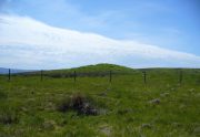
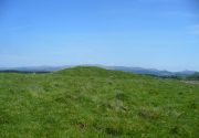
Highlighted on the first Ordnance Survey map of the area in 1862, this is a large rounded prehistoric cairn of some considerable size, whose position in the landscape allows for an impressive 360° view way into the distance in several directions—a deliberate ingredient, no doubt, when it came to building this probable tomb.  I say “probable”, as there has never been a dig (not an ‘official’ one anyway) into the heart of this overgrown rocky mound.

Looking SE into the Ochils
Judges Cairn on 1862 map

More than 60 feet in diameter at its greatest and 6 feet high, with a circumference of 67 yards (61m), the top of the mound has been disturbed and, clearly, has been dug into at some time in the distant past—but archaeohistorical accounts are silent on this matter.  The first description of the Judge’s Cairn seems to have been in Peter Stewart’s (1839) notes on the local antiquities of Dunblane, where he described it most simply as:

“The Judges Cairn, yet undispersed, a circular heap of rough mountains stones covered with furze, on the farm of Bowie, barony of Kilbride.”

Along with the Ordnance Survey lads who came here in 1862, all subsequent visits gave rise to only short notes about the place.  Odd, considering its size and distinct vantage point.  And yet it remains hidden from view unless you come from the north, from whence that archetype of a fairy mound raises itself above Nature’s fair body into the eyes of any ambling wanderer…. A wonderful place to sit and dream for a while…

Folklore

Judges Cairn, looking NE

We enquired with a local whose family had been resident here since the mid-18th century about the name and folklore of the site, but he said he knew of nothing.  However, in earlier times it was said to be a place where the local sheriff held court and dispensed justice.  Mr Mackay (1984) told that the site “has been connected with the Judge’s Seat at Severie” nearby.  It seems possible that, as “it is just outside the parish boundary” between Doune and Dunblane, this may have been a moot site in ancient times, from whence laws were dispensed.  Old perambulation records may, perhaps, prove fruitful…

References:

  1. Barty, Alexander, The History of Dunblane, Eneas MacKay: Stirling 1944.
  2. Mackay, Moray S., Doune – Historical Notes, Forth Naturalist: Stirling 1984.
  3. Royal Commission on the Ancient & Historical Monuments of Scotland, Archaeological Sites and Monuments of Stirling District, Central Region, Society of Antiquaries of Scotland 1979.
  4. Shearer, John E., “Prehistoric Man and Prehistoric Remains in Britain,” in Transactions of the Stirling Natural History & Archaeological Society, 1907.
  5. Stewart, Peter G., Essay on the Dunblane Mineral Springs, Hewit: Dunblane 1839.

© Paul BennettThe Northern Antiquarian


Cromlix Lodge, Dunblane, Perthshire

Long Cairn:  OS Grid Reference – NN 7617 0671

Also Known as:

  1. Bracklin Burn
  2. Canmore ID 73465

Getting Here

Long line of the cairn, looking S

Long line of the cairn, looking S

Take the B8033 north out of Dunblane and, immediately out the other side of Kinbuck, as you cross the river, take the first track on your left to Cromlix.  Keep right along here to Cullings and beyond, till you reach the edge of the forestry plantation.  Go left instead of going into the trees and, instead, follow the edge of the woodland for about 750 yards.  You’ll see the land rise up on the other side of the stream and the huge length of stones thereby.  That’s it!

Archaeology & History

Main axis of the cairn

Main axis of the cairn

Not included in any major archaeology tomes, this giant long prehistoric pile of rocks—probably constructed in neolithic times—sits along the edge of a natural ridge, out of sight of all but the lone wanderer and the birds.  Aligned ESE to WNW, this huge monument measures more than 61 yards (56m) in length and is 12 yards across at its present widest section.  Much of the tomb has been severely robbed for stone in making the local walling: two of which emerge out of the structure itself—one running directly downhill from its larger eastern edge, and a more extensive wide line of walling running west and northwest for quite some distance.  This western section of walling has the hallmarks of being constructed as far back as the Iron Age, which may be when the initial destruction of the chambered cairn first started.  But, until we get an excavation here, we won’t know for sure.

Portion of the central mass of stones

Portion of the central mass of stones

Western wall leads to the cairn

Western wall leads to the cairn

The next closest tomb of any great size is the Judge’s Cairn, 1½ miles (2.4km) to the southwest.  Clusters of smaller single cairns exist about nearly a mile northwest, with prehistoric settlement traces accompanying them—but nothing seems in immediate attendance to this Cromlix giant.

Other sites, obviously, await discovery in this area.  We know that a spring of water roughly 50 yards east of here was used by so-called ‘witches’ in earlier centuries, for both healing and sympathetic magick.  Whether this tradition ever had any relationship with the cairn is difficult to say.


References:

  1. Royal Commission Ancient & Historical Monuments of Scotland, Braes of Doune: An Archaeological Survey, Edinburgh 1994.

© Paul BennettThe Northern Antiquarian


Dumgoyach Stones, Strathblane, Stirlingshire

Standing Stones:  OS Grid Reference – NS 53269 80727

Also Known as:

  1. Canmore ID 44605
  2. Dungoiach
  3. Duntreath

Getting Here

Approaching Dumgoyach Hill

Approaching Dumgoyach Hill

You can either find your way to Duntreath Castle on the western edges of Strathblane and walk SW straight up the steep grassy slope next to the wooded Dumgoyach Hill; or… From Carbeth, north along the A809, turn right up the B821 Ballachalairy Yett road for 1km and park where the path of the West Highland Way runs onto the hills. Follow this path for nearly ½-mile and where the path splits, bear left.  Keep walking downhill for a few hundred yards, then go off-track towards the copse of trees. Climb over the gate and onto the grassy plain between this copse and the huge rounded Dumgoyach Hill.  The stones are very close indeed…

Archaeology & History

This is a truly stunning site – not as much for the megaliths that are here, but for the setting in which they’re held.  “Magnificent” is the word that rolled out of my mouth a number of times; whilst respected activist and ‘Organic Scotland’ creator Nina Harris said, quite accurately, “it’s Caras Galadhon in Lothlorien!” (or words to that effect) – and she hit the nail much better than I did!

Royal Commission 1963 sketch

Royal Commission 1963 sketch

Dumgoyach Stones (by Nina Harris)

Dumgoyach Stones (by Nina Harris)

A short line of large standing stones remains here, both upright and leaning, running NE-SW for 7 yards: seemingly a part of some other much larger monument in times long past—although very little else remains.  The stones are set upon a rise of land, quite deliberately in front of Dumgoyach Hill (or Lothlorien, as Nina called it) almost as a temple or site of reverence.  You’ve gotta see it to appreciate what I’m saying!  Like some gigantic tree-covered Silbury Hill, the standing stones on this ridge possess an undoubted geomantic relationship with this rounded pyramid, all but lost in the sleep of local myths and land.  A few yards away from the line of stones there is a slight rise in the land, seemingly giving weight to the idea that something else was living here: an architectural feature that Aubrey Burl (1993) thinks might have been “the facade of a chambered tomb” (neolithic in origin) and not merely a megalithic alignment.  He may be right…

Close-up of the megaliths

Close-up of the megaliths

Described briefly in J.G. Smith’s (1886) magnum opus on the Strathblane parish, antiquarian accounts of this impressive site seem curiously rare.  One of the earliest recognised accounts was done by the Royal Commission (1963) lads who measured the site up with their usual diligence.  Although getting the alignment of the stones wrong, the rest of their survey seems pretty accurate. They told that,

“There are five standing stones (A-E) arranged in a straight line… Three of the stones (A, B and C) are earthfast, while the other two (D and E) are recumbent.  Stone A is of irregular shape and leans steeply towards the N.  The exposed portion measures 4ft in height, 2ft 6in in breadth and 1ft 2in in thickness.  Stone B stands upright, 6ft NE of A.  It is a pillar of roughly rectangular section with an irregularly pointed top, and measures 5ft in height by about 2ft 6in in thickness.  Stone C, also irregular in shape, 11ft 6in NE of B, is inclined so steeply to the NNE that it is almost recumbent.  It measures 4ft 4in in height, 2ft 6in in breadth and 1ft in thickness. The remaining two stones lie on the ground between B and C.  Stone D measures 5ft 5in in length, 3ft in breadth and 1ft 6in in thickness while stone E, which rests partly on D, measures 7ft 10in in length, 3ft 9in in breadth and 3ft in thickness.”

Aubrey Burl’s (1993) description of the site—which he called Blanefield—is another good synopsis of what is known historically and astronomically about the site.  Assessing them in his detailed work on megalithic alignments, he said that,

“At Blanefield near Strathblane in Stirling a big stone, its longer sides aligned east-west, stands at an angle amongst a southwest-northeast line of four others, fallen, of which one just off the line seems to have been added this century.  The setting has been presumed a collapsed four-stone row.  Known also as Duntreath and Dumgoyach, the setting is slightly concave.

“‘This ruinous alignment indicates notches to the northeast and these show approximately the midsummer rising sun.’ ‘The standing stone has a flat face exactly aligned on a hill notch to the east,’ quite neatly in line with the equinoctial sunrises.  These astronomical analyses would seem to confirm that Blanefield was undoubtedly a row set up by prehistoric observers to record two important solar events.

“Excavation in 1972 discovered signs of burning, flints and charcoal that yielded a C-14 assay of 2860±270 BC (GX-2781), c. 3650 BC, a time in the Middle Neolithic when chambered tombs were still in vogue, but an extremely early date for any stone row.  This, coupled with Blanefield’s isolated position for a row in central Scotland, raises doubts about its origins.

“It is a lonely megalithic line, those nearest to it being over forty miles (64km) to the west in Argyll.  Straddling a ridge overlooking the Blane Water it is arguable that the stones are relics of the crescent facade of a Clyde chambered long cairn with an entrance facing the southeast….”

Dumgoyach Stones, with Dumgoyne to the North

Dumgoyach Stones, with Dumgoyne to the North

However, there was once another stone row close by, known as the old Stones of Mugdock.  Burl then cites the proximity of four nearby neolithic long cairns not too far away, with the Auchneck tomb just 3½ miles (5.6km) to the west; although it seems that Nina Harris may have discovered another one, much closer still (TNA will have a preliminary report on this in the coming months).

Folklore

Local legend reputes that King Arthur was up and about in this part of the world, fighting in a battle nearby.  And in J.G. Smith’s (1886) excellent work on the parish of Strathblane, he told that,

“The standing stones to the south-east of Dungoyach probably mark the burial place of Cymric or Pictish warriors who fell in the bloody battle of Mugdock.”

References:

  1. Burl, Aubrey, From Carnac to Callanish, Yale University Press 1993.
  2. Feachem, Richard, Guide to Prehistoric Scotland, Batsford: London 1977.
  3. Heggie, Douglas C., Megalithic Science: Ancient Mathematics and Astronomy in Northwest Europe, Thames & Hudson: London 1981.
  4. MacKie, Euan W., Scotland: An Archaeological Guide, Faber: London 1975.
  5. Ritchie, J.N.G., “Archaeology and Astronomy,” in Heggie, D.C., Archaeoastronomy in the Old World, Cambridge University Press 1982.
  6. Royal Commission on the Ancient & Historical Monuments Scotland, Stirling – volume 1, HMSO: Edinburgh 1963.
  7. Smith, John G., The Parish of Strathblane, James Maclehose: Glasgow 1886.
  8. Thom, Alexander, Megalithic Sites in Britain, Oxford University Press 1967.
  9. Thom, A., Thom, A.S. & Burl, Aubrey, Stone Rows and Standing Stones – volume 1, BAR: Oxford 1990.

Acknowledgements:  A huge thanks to Nina Harris, of Organic Scotland, for both taking me to these stones and sharing her photos for this site profile.  Cheers Nina!

© Paul BennettThe Northern Antiquarian


Moirlanich (1), Killin, Perthshire

Cup-Marked Stone:  OS Grid Reference – NN 56404 34148

Getting Here

‘Moirlanich 1’ stone

Take the same directions as if you’re going to the nearby Moirlanich 2 Carving (about 550 yards down Glen Lochay, on the north side of Killin). In the same field, about 150 yards northwest of Moirlanich 2, you’ll see another large rock close to the wall.  That’s the spot!

Archaeology & History

Cup-marks highlighted

Looking down upon the River Lochay, with views east and west along the glen, here we find a carved rock that’s probably of interest only to the petroglyphic purists amongst you.  Two simple cup-markings, about 5 inches apart, can be seen etched into the slightly sloping southern-face of this small rocky outcrop.  The sacred mountain of the Creag na Cailleach rises to the immediate north.

© Paul BennettThe Northern Antiquarian

Moirlanich (2), Killin, Perthshire

Cup-Marked Stone:  OS Grid Reference – NN 56522 34078

Getting Here

‘Moirlanich 2’ Stone

From Killin, take the A827 road out of the north side of the village, turning left down Glen Lochay just before the Bridge of Lochay Hotel.  500 yards along the single-track road you’ll reach the electricity station. Just past this, in the field on your right, a large rock stands out just a few yards away. Go through the gate and walk to the spot!

Archaeology & History

Highlighted cup-marks

This is a simple cup-marked stone, perhaps used in ages gone by as a look-out spot by villagers.  Only for the petroglyphic purists amongst you, this carving consists of just five cup-marks on the topmost section of the flat stone, with four of them roughly in a line and a solo one (the most pronounced of the them all) a few inches south of the row.  The cup-marked Moirlanich 1 stone can be seen in the same field, 150 yards (137m) to the northwest.

© Paul BennettThe Northern Antiquarian

The Crofts, Doune, Perthshire

Cists (destroyed):  OS Grid Reference – NN 7247 0188

Also Known as:

  1. Canmore ID 24760

Archaeology & History

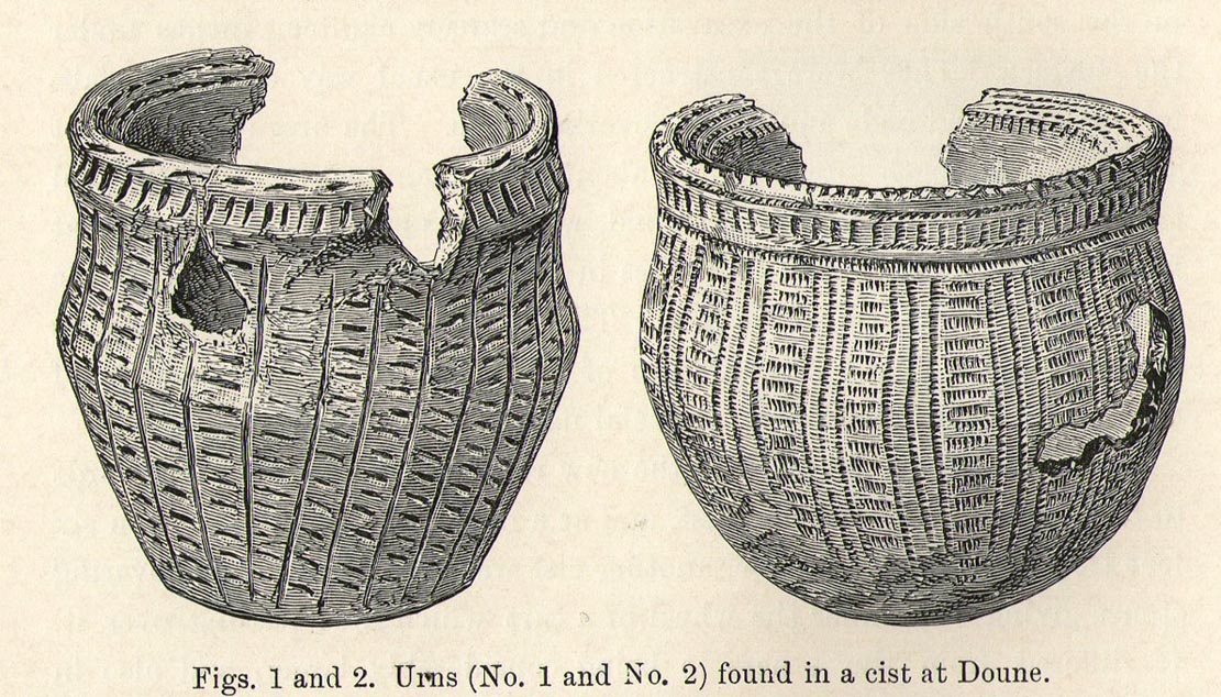
Urns in The Croft cist, Doune

Somewhere in the woodland park, before the area was “ruined”, as Moray Mackay (1984) put it, by “sand and gravel workings”, and within 100 yards of the re-positioned Trysting Stone, there once remained the ruins of ancient tombs—probably neolithic or Bronze Age in nature.  The ‘cists’ as they’re known (stone-lined graves), were described in several short articles at the beginning of the 20th century, shortly after their rediscovery.  Drawing upon the initial article by Joseph Anderson (1902) in the Scottish Antiquaries journal, W.B. Cook (1904) wrote:

“The doubling of the (railway) line from Dunblane to Callander has necessitated the altering of a road at the Crofts, Doune, and on Tuesday, 8 May, while digging, the navvies came across two stone cists containing bones.  The cists were made of stone slabs.  On Thursday, the men came on another cist about five feet from the surface. It was 3 feet long and 2½ feet broad, composed of round stones, and a quantity of bones were found in it, and also an urn. Unfortunately a cart-wheel passed over the urn, smashing it.  The pieces were, however, carefully collected and cemented and they are now in the possession of Mr Smith, Clerk of Works to the Caledonian Railway Company, Doune.  One of the cists first found was quite empty, but the other contained a large number of human bones, the largest about 1½ inches long.  The coffins were about 15 inches from the surface, and lay from east to west.  They measured 2 feet 9 inches in length, and in breadth and depth about 18 inches. They are constructed of local stone, and near the spot there has been a dyke running from the burgh to the sand holes, as the foundation was visible when the soil was being removed.  Some of the stones indicate that a house might have stood near the spot, but there had been no public burying-place nearer than at Kilmadock and at the little chapel of Inverardoch previous to 1784.”

In Mr Joseph’s (1902) article, he told us there wasn’t one, but two urns which, after some considerable effort, were reconstructed.  I’m not a great lover of urns misself, although when found in conjunction with the dead, we must ask, what was in them (if anything) when they were placed with the deceased?  Food? Herbal beverages? Shamanic potions?  In this case, we don’t know; and so all we are left with is Mr Anderson’s description of them:

“Urn No.1 is of the usual type of the so-called ‘food-vessel’, 4¾ inches in height by 5 inches in diameter at the mouth, the lip slightly bevelled inward, and the whole exterior surface ornamented. The ornamentation consists entirely of lines impressed into the soft clay with what seems to have been the roughly broken end of a small twig about ⅛-inch in diameter.  On the level of the lip there are two parallel lines of short scorings going completely round the upper surface. On the exterior surface there is a kind of slightly concave collar half an inch in width immediately under the brim, which is ornamented with short perpendicular indentations about a quarter of an inch apart. Underneath the collar the vessel expands slightly to the shoulder and then contracts to a flattened base of three inches in diameter. The part above the shoulder is slightly concave externally, but the scheme of decoration above and below the shoulder is the same, consisting of a series of short impressed lines scarcely half an inch in length ranged round the circumference in horizontal rows about a quarter of an inch apart, and crossed perpendicularly by lines about half an inch apart, not impressed, but scored into the clay. The perpendicular lines above the shoulder are more divergent than those below the shoulder, which converge towards the bottom in consequence of the tapering form of the lower part of the vessel. The paste is coarse, and mixed with small stones; the wall of the vessel is about a quarter of an inch thick, and the colour a reddish brown on both the exterior and interior surfaces, but quite black in the fractures exposing a section of its thickness.

“Urn No.2 is of the same wide-mouthed, thick-lipped form of the so-called food vessel type, 5 inches high and 5½- inches in diameter at the mouth. The lip is bevelled inwards, and the general shape of the vessel somewhat resembles that of No. 1, except in the lower part, which, instead of tapering to a flat bottom, narrows from the shoulder in a much more gradual curvature to the bottom. The ornamentation also is much more elaborate, though partaking of the same general character, inasmuch as it is a scheme of impressed markings, in bands arranged alternately in vertical and horizontal directions and covering the whole exterior surface of the vessel. On the bevel of the rim is a horizontal band of three lines of impressed markings, surmounted on the upper verge of the rim by a row of shallow oval impressions less than ⅛ of an inch apart. Under this there is a horizontal band of impressed markings as with the teeth of a comb, and below that the general scheme of ornament is carried out in alternate bands of about half an inch in width, running vertically from collar to base. The one set of these bands consists of three parallel rows of impressions of about ⅛ of an inch in width, and ⅛ of an inch apart, which seem to have been produced in the surface of the soft clay by a comb-like instrument, while the other set of bands has been produced by marking the spaces between the triple bands in the same way with a similar instrument, but placing the lines horizontally and closer together.”

A short distance from here, more cists were found. It’s possible that a prehistoric graveyard this way lay, countless centuries ago…

Folklore

Moray Mackay (1984) reports that the Doune fairs used to be held here.

References:

  1. Anderson, Joseph, “Notices of Cists Discovered in a Cairn at Cairnhill, Parish of Monquhitter, Aberdeenshire; and at Doune, Perthshire,” in Proceedings Society of Antiquaries, Scotland, volume 36, 1902.
  2. Cook, W.B. (ed.), “Antiquarian Find at Doune,” in Stirling Antiquary, volume 3, 1904.
  3. Mackay, Moray S., Doune Historical Notes, Forth Naturalist & Historian: Stirling 1984.
  4. Royal Commission Ancient & Historical Monuments, Scotland, Archaeological Sites and Monuments of Stirling District, Central Region, Edinburgh 1979.

© Paul Bennett, The Northern Antiquarian