Wallace’s Stone, Dunblane, Stirlingshire

Standing Stones / Stone Row:  OS Grid Reference – NN 83259 02293

Also Known as:

  1. Lairhill Stones

Getting Here

Follow the same directions as to reach the cup-marked Sheriffmuir Carving, which is just a coupla hundred yards away to the southwest.  On a clear day you can see this standing stone from the pub by the roadside, a few hundred yards away!

Archaeology & History
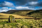
Wallace Stone (photo credit – James Elkington)

This is alleged to be just one standing stone in a straight line of five once-upright monoliths.  Starting at the southwestern end of this row we have the 7ft-long cup-marked Sheriffmuir Carved stone — which certainly looks as if it stood upright in the not-too-distant past — and as we move up the line we pass another that’s been split in half.  Another earthfast-looking rock is the next contender, before we reach our famous Wallace Stone, standing upright and proud on this moorland ridge.  It’s about 6ft tall and 3ft across at its widest and certainly acts as a marker for the line of stones that allegedly stood upright here.  And if we walk just a bit further up we have another big stone laid on the ground which is alleged to be a part of the same alignment.
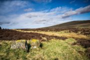
The split stone (photo credit – James Elkington)

If it is an authentic megalithic row, it’s not included in either the Thoms’ (1990) two-volume work on the subject, nor Aubrey Burl’s (1996) compendium a few years later.  And though the alignment looks good, I’ve found ones just like this in the Pennines where we have just one upright left and then a line of other seemingly prostrate stones running dead straight either side of the singular upright (and have kept mi gob shut about ’em for sensible reasons), so I’m not too sure what to think.

But, alignment aside, the Wallace Stone itself is a damn good standing stone and well worth checking out.  It’s highly probable that other prehistoric remains still lurk, undiscovered, amidst these heaths…like the lost stone circle to be found nearby…

Folklore

A slight variation on a theme about this spot:  in both accounts the stone was named after the legendary Scottish independence fighter, Sir William Wallace.  The folklore tells that he and his fighting clans gathered here in 1297 preceeding the Battle of Stirling Bridge; whilst the variation tells that the stone here was actually erected around that time to commemorate the event.  This tale was first narrated by a local story-teller called Blind Harry and was found by local historian A.F. Hutchinson (1893) to be a case of mistaken identity!

References:

  1. Burl, Aubrey, From Carnac to Callanish: The Prehistoric Stone Rows and Avenues of Britain, Ireland and Brittany, Yale University Press 1993.
  2. Heggie, Douglas C., Megalithic science: ancient mathematics and astronomy in north-west Europe, Thames & Hudson: London 1981.
  3. Hutchinson, A.F., “The Standing Stones and other Rude Monuments of Stirling District,” in Transactions of the Stirling Natural History and Antiquarian Society, 1893.
  4. Royal Commission on the Ancient & Historical Monuments of Scotland, Archaeological Sites and Monuments of Stirling District, Central Region, Society of Antiquaries of Scotland 1979.
  5. Thom, A., Thom, A.S. & Burl, Aubrey, Stone Rows and Standing Stones – 2 volumes, B.A.R.: Oxford 1990.

Acknowledgements:  Big thanks as always to James Elkington for use of his photos in this site profile – prints of which are available from the man himself!

© Paul Bennett, The Northern Antiquarian

Murlaganmore, Killin, Perthshire

Cup-Marked Stone:  OS Grid Reference – NN 5402 3455

Also Known as:

  1. Morlagganmore

Getting Here

Murlaganmore02
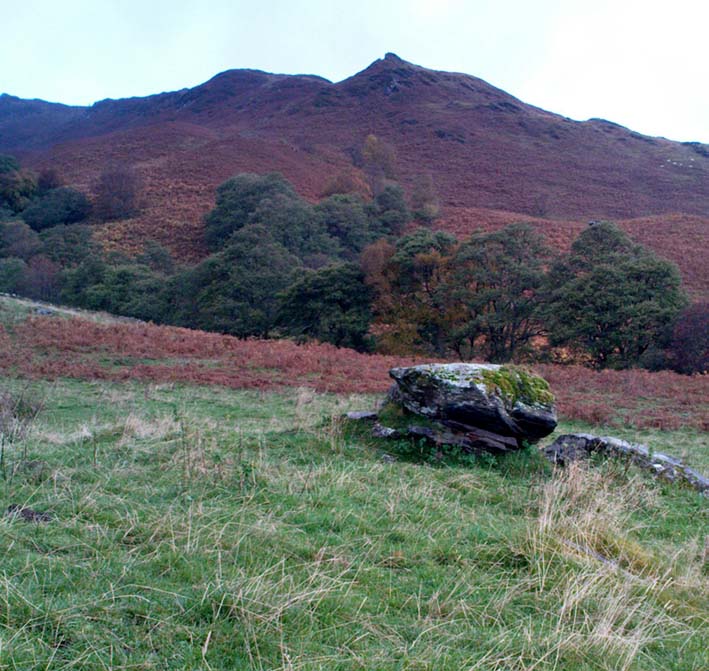
Murlaganmore stone & setting

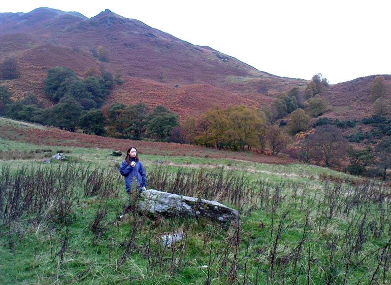
From Killin, take the Glen Lochay Road past the Moirlanich Longhouse, but keep on for another mile, and take the track on the left up to Murlaganmore cottages.  As the track turns right of the tree-line, cross the field (left) up towards the open gate as if you’re going to the Murlaganmore 2 carving, where you’ll see this large flattish rock in the grasses about 100 yards before it.

Archaeology & History

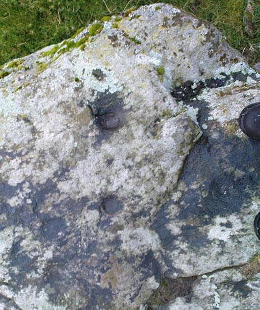
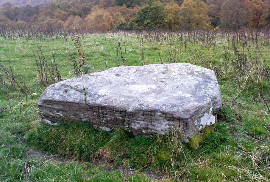
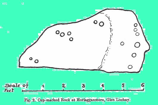
When we visited this old boulder last week, we had the misfortune of grey days and dark clouds throwing their faded light across this cup-marked rock, not really letting us see with any clarity the many cups which pepper (mainly) the edges of the rock.  But the cups are faded anyway, so accounts tell, and the 15 which we counted were same 15 recorded about 100 years ago in C.G. Cash’s (1912) survey.  There, he described this old stone as,

“about 200 yards south of the house, in the middle of the uppermost pasture. It is a large block of quartz schist stuck thick with garnets, and bearing fifteen cup-marks, only one of which — 3 inch in diameter and 1 inch deep — is really well defined, and several of which are faint.”

Murlaganmore03
Faint cups barely visible
Murlaganmore01
C.G. Cash’s early drawing

But despite the grey day (She was absolutely teeming with rain half of the time!), I found the setting here absolutely gorgeous, with the many shades of old trees and the clear blood of pure waters falling through the landscape.  And, without doubt, there are other carved stones nearby that have yet to capture the attention of surveyors.  You can smell them!

References:

  1. Cash, C.G., ‘Archaeological Gleanings from Killin,’ in PSAS 46, 1911-12.
  2. Royal Commission on Ancient & Historical Monuments, Scotland, The Archaeological Sites and Monuments of Stirling District, RCAHMS: Edinburgh 1979.

© Paul Bennett, The Northern Antiquarian

Murlaganmore 2, Killin, Perthshire

Cup-Marked Stone: OS Grid Reference – NN 5395 3455

Getting Here

Murlaganmore 2 - 01
Murlaganmore 2

Take the same direction to reach the Murlaganmore Footprint, continuing up past the cottages. 100 yards on, where there’s a bend in the track, cross the field on your left and go thru the gate higher up the slope.  Stick to the small rough ‘path’, past the Murlaganmore 1 carving for nearly 100 yards, where a small rocking-stone-like rock is ahead of you. That’s it!

Archaeology & History

Close-up of cup-marks

This stone’s in a lovely setting, with the craggy rise of Creag Mhor and the waterfall of Airigh an Fhraoich up the rich coloured slope behind it.  But the carving here is a simple one, with perhaps only 2 cup-markings etched on the stone’s upper surface, as the photo here shows.  Tis a lovely setting though, and there are other carved rocks living nearby which aint yet seen the pages of any record-books.

It was first mentioned in C.G. Cash’s (1912) essay on the antiquities of Killin and district, who told that here was “one well-cut cup, 3 inches in diameter and 1½ inches deep, and also a doubtful or faint one.”  The carving was later listed in the Royal Commission’s Stirling District report (1979) as simply “a boulder bearing cup-marks.”

References:

  1. Cash, C.G., ‘Archaeological Gleanings from Killin,’ in PSAS 46, 1911-12.
  2. Royal Commission on Ancient & Historical Monuments, Scotland, The Archaeological Sites and Monuments of Stirling District, RCAHMS: Edinburgh 1979.

© Paul Bennett, The Northern Antiquarian

Murlaganmore Footprint, Killin, Perthshire

Carved Rock:  OS Grid Reference – NN 54321 34840

Also Known as:

  1. CEN 16 (Morris 1981)
  2. Murlaganmore 3

Getting Here

From Killin, take the small road to the Moirlanich Longhouse, but keep on for another mile. Just before the road crosses the river, stop! In the fields above you to the left are a few trees and some rocks. Walk uphill till you’re nearly level with the cottages at Murlaganmore (the gate’s about 10-15 yards away) just above the gorze bushes and check out the long rock.  If you can’t see it at first, bimble about till you find it. You’re just about on it!

Archaeology & History

Murlaganmore footprint02
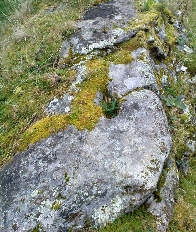
Murlaganmore’s ‘Footprint’ carving – probably Nature’s artwork

Although shown on modern OS-maps as a ‘Sculptured Rock’ and included in the Canmore survey, when we visited this site a few days ago I have to say that unless evidence to the contrary can be obtained, this ‘site’ should be declassified as an archaeological remnant of the prehistoric period.  It appears to be natural — though could have had some agricultural purpose or origin in centuries past.

The ‘footprint’ appears to have been described first of all by F.W.L. Thomas (1879) in his essay on the inaugural seat of Kings at Dunadd, where a similar footprint is found at the top of the fort.  Thomas thought that this curious footprint could have had a similar function — though even folklore hereabouts seems silent on such a matter.  The site is included in Ron Morris’ 1981 survey, where he too described it as “probably natural but just possibly man-improved.”

References:

  1. Morris, Ronald W.B., The Prehistoric Rock Art of Southern Scotland, BAR: Oxford 1981.
  2. Thomas, F.W.L., ‘Dunadd, Glassary, Argyllshire: The Place of Inauguration of the Dalriadic Kings’, in Proc Soc Antiq Scot, vol.13, 1879.

© Paul Bennett, The Northern Antiquarian

King’s Park, Stirling, Stirlingshire

Cup-and-Ring Stone:  OS Grid Reference – NS 7837 9299

Also known as:

  1. CEN 12 (R.W.B. Morris survey, 1981)

Getting Here

King's Park cup-and-ring, Stirling
King’s Park cup-and-ring, Stirling

Not too hard to find really.  On the far western edge of the King’s Park golf course, head for the highest point where the small cliffs drop down.  From here, walk down the footpath on the slight slope south, just below where the small copse of trees are, and you’ll see the singular small flat stone in the grasses near the footpath you’re walking along.  If you can’t find it – look around!

Archaeology & History

A little-known but fascinating isolated carving, first described by David Morris at the sixth meeting of the Stirling Natural History and Archaeological Society in 1901.  It is found on the western edge of the town, above the rocky edges not far from the pond of St. Thomas’ Well on the far edge of the golf course.  Morris’ finding was written up in their fine journal, where he wrote:

“In the King’s Park, about 50 yards east of the cliff where a seat overlooks the Douglas Terrace sand quarry, there is a smooth surface of rock showing through the turf, measuring two-and-half feet by one-and-half feet… On it is a cup-shaped hollow, outside the rim of which is a well-marked hollowed ring, beyond which is another faintly marked, concentric circular groove.  The cup-mark measures one-and-a-half inches across; the inner rim of the first circle is 4 inches, and the outer rim is 6 inches in diameter.  The outer circle, if complete, would be 9 inches in diameter.  The depth of the central hollow is half-an-inch, and of the inner groove fully one-quarter of an inch.  The markings are plainly artificial…”

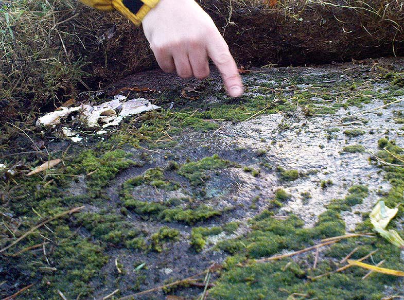
King's Park CR - central design, with finger pointing to northernmost cup!
King’s Park CR – central design, with finger pointing to northernmost cup!

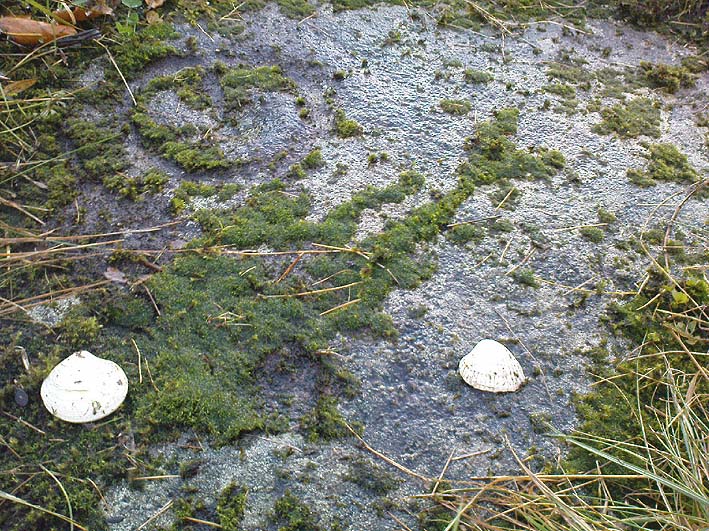
In good sunlight, it is obvious that the carving is a fine example of a double-ringed cup-and-ring carving – though the outer ring may not be complete.  The Scottish Royal Commission lads told that “this rock outcrop bears three cup marks” – one of which has the rings surrounding it.  In the first photo here, the southernmost cup-marking is highlighted in the centre of the two shells which were on the rock when we arrived.

However, there’s definitely more to this carving than previous investigations have outlined.  It seems that the northernmost cup-mark has a ring and a possible outer-ring.  There is also a distinctive linear carving, which at first seems like a primitive triangle, just below the southernmost cup – as we’ve tried illustrating here in the photo which Mikki Potts took.  It’s faint, but once you see it, it’s obvious that it’s there.  Other faint lines of similar nature also seem apparent near the northernmost cup-marking, but we will have to wait for rubbings and further visits in better light to ascertain the full image on this rock.  Well worth checking out if you like your rock art! (can any of you Scottish rock-art fanatics have a closer look at this? – take a rubbing of it and see what other aspects are on this design)

Faint linear carvings on southern portion of the rock

One other thing which seemed apparent when we were here: this site has all the geomantic hallmarks of accompanying a burial at some time in the ancient past.  Its isolation here is unusual and the carving is only 50 yards from the highest point hereabouts, where you have 360-degree views all round, typifying the position of many prehistoric tombs.*  Does anyone know about such features, or have records of any field-name surveys taken, which might confirm or deny this thought?  Twouldst be good to know!

References:

  1. Feachem, Richard, Prehistoric Scotland, Batsford: London 1963.
  2. Morris, David B., “Cup and Ring Marked Rock Surface in King’s Park,” in Stirling Natural History & Archaeology Society Transactions, 1900-1901.
  3. Morris, Ronald W.B., The Prehistoric Rock Art of Southern Scotland, BAR 86, Oxford 1981.
  4. Royal Commission on the Ancient and Historical Monuments of Scotland, Stirlingshire – 2 volumes, HMSO: Edinburgh 1963.
  5. Royal Commission on the Ancient & Historical Monuments of Scotland, Archaeological Sites and Monuments of Stirling District, Central Region, Society of Antiquaries of Scotland 1979.

* Since writing the above, thanks the correspondence of Paddybhoy, we’ve learned that there definitely were prehistoric tombs close by; one being just at the bottom of the ridge below the carving, on Douglas Terrace.  Records describe several other prehistoric tombs nearby at Birkhill House, the Birkhill Sandpit and Coneypark Nursery.  However, I still think it most probable that there were other tombs and more rock art, probably along the edges of King Park, aswell as the Cambusbarron plain.  These need locating.

© Paul Bennett, The Northern Antiquarian