Crosley Wood, Gilstead, Bingley, West Yorkshire

Enclosure / Settlement:  OS Grid Reference – SE 1186 3859

Getting Here

Along the main Aire Valley road (A650) between Cottingley and Bingley, turn right by Beckfoot Grammar School and wander along and up the winding road, over the canal bridge where the Fisherman’s pub is on Primrose Lane.  On the slope above you amidst the scatter of trees on the left-hand side of the road is this Romano-British site (the map below should help).  Check it out!

Archaeology & History

Excavated in the 1960s by the archaeologist P. Mayes, this little-known but reasonably well-preserved enclosure-cum-settlement comprises of a large oval of stone walling, double in places, about 200 feet across at its widest point.
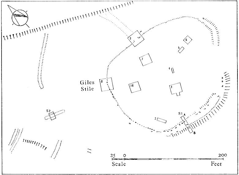
Crosley Wood ground plan (YAJ 42, 1967)
Crosley Woods map (YAJ 42, 1967)

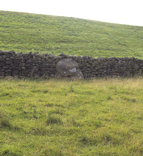
Thought to have been constructed sometime between the Iron Age and Romano-British period, for some reason one of the stones on the western edge has long been given the name of the ‘Giles Stone’ or Stile — though nobody knows for certain why.  It’s about three-feet tall with a smaller upright by its side.  Any other remains that might once have been here were destroyed by the housing estate that sits above here.  When Mr Mayes (1967) and his associates did their work here, cutting across sections of the walling, he told:

“The best preserved section of wall was amongst the trees on the lines of the south wall of the enclosure and included the boulders of both the inner and the outer faces of the wall.  A trench 6ft by 38ft was laid out at right angles to it.  The turf was removed showing the boulders of the wall with the smaller stone filling between them.  On either side of the wall was a relatively small quantity of loosely tumbled stones, the angle of rest of which suggested the wall as their source of origin… Careful examination of the wall filling failed to show any sign of post settings.”

Mr Mayes said that it was “doubtful whether the Crosley Wood site, dated by one pot to the late 3rd or early 4th century AD, was ever conceived of as an occupation site.”  In reference to his excavations he continued, “Certainly no evidence of settled living was found” here, concluding:

“It seems probable that the main enclosure at Crosley Wood served as a cattle pound; its defensive potential being invalidated by the scarp to the north, whilst the short stretches of external walling are all that remains of a rectilinear field system for arable or pastoral farming.”

References:

  1. Mayes, P., ‘Excavations at Crosley Wood, Bingley,’ in Yorkshire Archaeology Journal, volume 42, 1967.

© Paul Bennett, The Northern Antiquarian


Crooked Stane, Elvanfoot, Lanarkshire

Standing Stone:  OS grid reference – NS 96590 15333

Also Known as:

  1. Canmore ID 47316

Archaeology & History

Described by Tam Ward and Douglas Graham (1989) as “the only surviving standing stone in Clydesdale” (which isn’t quite true), this lovely looking monolith, leaning to one side, appears to have several cup-markings on its surface, but they’re actually Nature’s handiwork. The stone aligns to the hill a short distance north, Bodsbury Hill, upon which a fortress was later built sometime in the Iron Age.

I must have a wander round this region sometime: there’s some very attractive place-names nearby crying out for archaeo-attention to rub myself up and down upon!

References:

  1. Royal Commission on the Ancient & Historic Monuments of Scotland, Lanarkshire: An Inventory of the Prehistoric and Roman Monuments, HMSO: Edinburgh 1978.
  2. Ward, Tam & Graham, Douglas, Ancient Monuments of Clydesdale, CDC: Lanark 1989.

© Paul Bennett, The Northern Antiquarian


Cnoc na Carraigh, Gigha, Argyll

Standing Stone (destroyed): OS grid reference – NR 6426 4817

Also Known as:

  1. Canmore ID 38540

Archaeology & History

The Scottish Royal Commission (1971) reported a very large

“standing stone that stood 185m NNW of Achmore House (that) was removed at the beginning of the 19th century. It was reported that is measured 4.9m in height (16ft), 1.2m in breadth and 0.2m in thickness.”

A prehistoric cairn seemed to have accompanied this monolith—as reported by Thomas Pennant in 1772—but it too has been destroyed.  Pennant told us how the monolith was,

“a great rude column, sixteen feet high, four broad and eight inches thick.”

Not bad at all!  It was still extant, although leaning to the southwest in the year 1790 (OSA 1791-9); appearing to have been removed about 1800.  No trace of it remained when the Ordnance Survey lads looked here in 1869.

References:

  1. Royal Commission for Ancient & Historical Monuments of Scotland, Argyll – volume 1: Kintyre, HMSO 1971.

© Paul Bennett, The Northern Antiquarian


Barrnacoilich, Armaddy Castle, Argyll

Standing Stone:  OS grid reference – NM 794 164

Getting here

This old stone is another one tucked away, but not too far south of Oban.  Take the Kilninver road and keep heading southwest, past Loch Seil.  Instead of following the road right, to Clachan and then onto Seil Island, bear left and towards Armaddy Castle.  Where the single-track road turns into the woodland towards the castle, the track keeps on into the rocky hills.  Keep going for about another 500 yards.  You’re nearly there!

Folklore

By the coast just north of Loch Melfort, near the hamlet of Degnish, is the grand old Armaddy Castle. On the other side of the trees from here, to the east, Scottish writer and folklorist A.A. MacGregor tells there to be an old standing stone. In his Ghost Book of 1955, he tells the tale of a local man called Donald MacDougal who, returning home after his day’s work at the castle, crossed over the old burn of Eas nan Caerdach where the standing stone can be found, just past the bend in the track.

On reaching it, Donald became aware of a strange light a short distance in front of him. Thinking at first it was the lamp of his co-worker making for the Home Farm, he walked past the stone – but it wasn’t until he got home himself and found he was alone that he questioned what on earth he’d seen! Upon asking other people in the neighbourhood, it was found that other locals had seen the same light, traversing the land from the old standing stone along the footpath to the farm.

References:

MacGregor, Alasdair Alpin, The Ghost Book, Robert Hale: London 1955.

© Paul Bennett, The Northern Antiquarian


Standing Stone, Foulridge, Lancashire

Standing Stone:  OS grid reference – SD 8803 4316

Also Known as:

  1. Lark Hill Stone
Possible Standing Stone in walling close to Standing Stone Road crossroads
‘Standing Stone Road’ monolith

Getting Here

From Foulridge go west up the long windy road (B6251) till you hit the old crossroads near the top.  Turn right and go on till you hit the modernised farmhouse on your right, where you’ll notice a modern upright stone in the entrance.  You need to go back about 70 yards and you’ll see this old stone in the wall.

Archaeology & History

"Standing Stone Road' stone!
“Standing Stone Road’ stone!

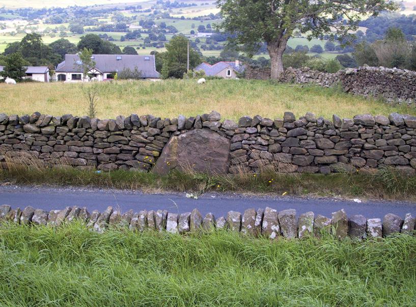
Less than a mile northwest of Foulridge along the southern stretch of the Whitemoor Reservoir, on the northern outskirts of Colne, we find the intriguingly-named ‘Standing Stone Lane’ — which seems to indicate that at some time in the not-too-distant past, an old monolith could be found hereabouts.  The old maps show the boundary line turning at right angles just near the crossroads, which is where I thought we might locate some remains of an old standing stone.  But it wasn’t to be.  Instead, we need to travel about 100 yards west along the single-track road, just below the reservoir — and there, in the walling, plain for all to see, is what may be the old standing stone which gave the road its name.  I found this site in early July 2008, and although we can’t be 100% certain, it’s not too bad a good contender as the monolith which first gave the road its name.  Does anyone know anymore about it?

More probably though (and this is what ‘feels’ right): the original stone which gave the road its name was much bigger than this little thing, but was probably destroyed when the reservoir here was constructed.  How much d’ y’ wanna bet!?

© Paul Bennett, The Northern Antiquarian