Cross Gates Cross, Slaidburn, Lancashire

Wayside Cross (base): OS Grid Reference – SD 70039 53609

Also Known as :

  1. Historic England ID 1163860
  2. Pastscape ID 44742

Getting Here

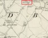
The Cross shown on the 1850 6″ OS Map

Take the Town End Road out of Slaidburn, and turn right along Wood House Lane at the Gold Hill junction, continue past the entrance to Myttons Farm on the right, and the cross base will be seen on the right next to the gateway just before the sharp left hand bend.

Archaeology & History

Only the socketed red sandstone base of this mediaeval wayside cross survives. It is unusual in that it has carved decorative fluted corners. It has an OS bench mark carved on its north face and has suffered recent damage to one of the corners, probably from a grass  cutter.  It is beside the old salt road over Salter Fell from Bowland into Lancashire and the Lune Valley.

There is one surviving complete cross and a cross base at the other end of the salt road, south of Hornby.  Wood House Lane was known as Cross Lane when the 1850 6″ OS map was printed. It is a Grade II listed building and is described in the citation as:

“Base of cross, probably medieval, sandstone. Of irregular shape with a rectangular socket in the top.”

Three views of the Cross base

Folklore

The farmer of the adjoining land told me that a local elder had told him that the smashed remains of the Cross had been built into an adjoining dry stone wall, which, if this is correct, may indicate
destruction of the Cross at a comparatively late date.

Note:  the monument is in the historic county of the West Riding of Yorkshire.

© Paul T. Hornby 2020


Skelshaw Ring, Easington, Lancashire

Enclosure:  OS Grid Reference – SD 7194 5037

Archaeology & History

Faint outline of oval remains

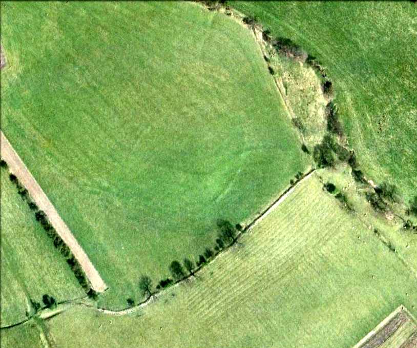
Very little can be seen of this once large oval-shaped prehistoric enclosure, a mile south of Slaidburn, on the level below the rise towards Easington Fell.  Few archaeologists know about the site and there has been little written about it.  Although very little of it is visible at ground level today, three-quarters of the site is vaguely discernible from the air and on GoogleEarth, as the photo here shows.  The Skelshaw Ring was described in Greenwood & Bolton’s Bolland Forest (1955), where they said, “The late Colonel Parker (Browsholme Hall) claimed to have found a good specimen of an ancient earthwork above Easington Green. Unfortunately, this has been ploughed over during the last war (WWII).” And little else appears to have been said of the place until the Lancastrian writer John Dixon (2003) wrote about it.  More recently John said the following about the site:

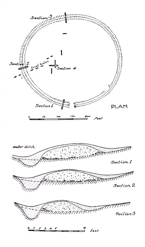
Skelshaw Ring plan (after Dixon 2003)

“This oval earthwork, 320 ft. diameter, crowns a small hill on the general slope of the east bank of Easington Beck. It consists of a ditch and bank with a gateway through the bank and a causeway across the ditch on the west side. Inside the bank and ditch the ground rises gently into a rounded hill so that most of the inside of the earthwork is well above the level of the bank.

“During the spring of 1934 a preliminary excavation of the site was undertaken by the late Dr. Arthur Raistrick. Three sections were cut through the ditch and bank and the inner area was briefly explored.

“Although nothing was obtained to date the earthwork, the sections did show the ordered structure of the site and proved the presence of large floors that may well have been the site of huts.

“This site may be compared with the large ringwork at Fair Oak Farm, SD 648 458, as both have a similar size and the same features are displayed. Bleasdale Circle, SD 577 460, is a slightly smaller ringwork, but I consider all three monument (plus: Easington Fell Circle [no:2] SD 717 492 ) to have the same origins.

“These earthworks represent the first settlements of a people determined to tame, settle and cultivate the landscape. What we observe at Skelshaw is the possible farmstead of an extended family unit, part of a clan that worked the land here some 4000 years ago in what is referred to as the Bronze Technology Period.”

References:

  1. Dixon, John, Slaidburn and Newton, Bowland Forest, Aussteiger Publications: Clitheroe 2003.
  2. Greenwood, Margaret & Bolton, Charles, Bolland Forest and the Hodder Valley: A History, privately printed 1955.

© John Dixon & Paul Bennett, The Northern Antiquarian