Snowden Moor Settlement, Askwith, North Yorkshire

Settlement:  OS Grid Reference – SE 1785 5128

Getting Here

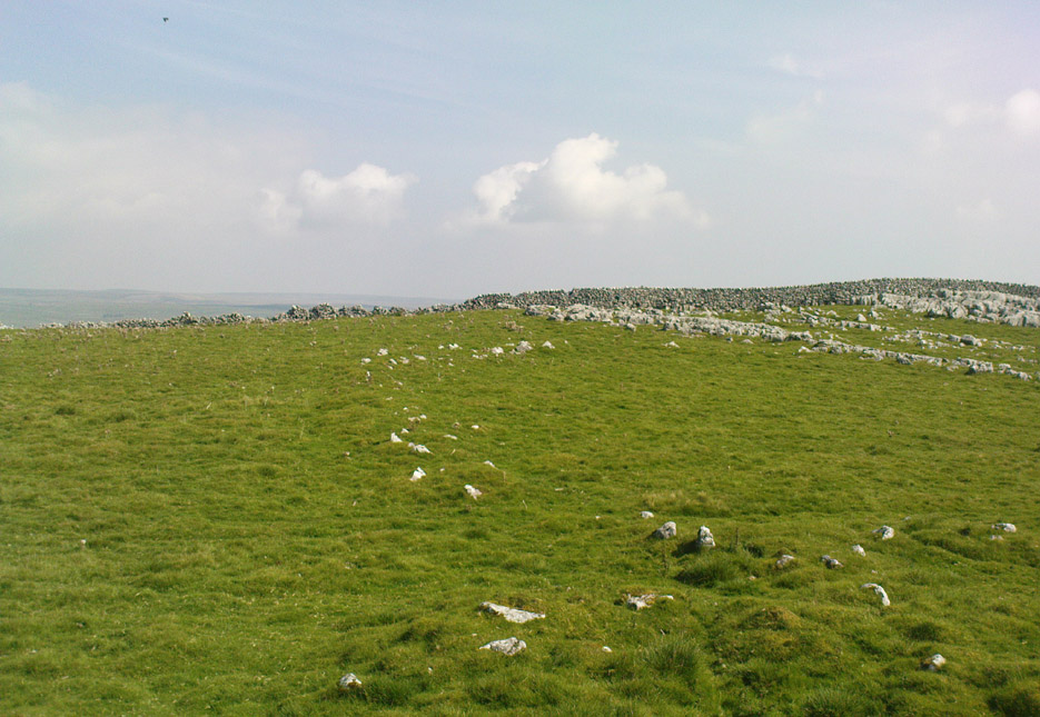
Travel along the Askwith Moor Road between Blubberhouses and Askwith (near Otley) and park-up at the large gritted parking post on the moor edge.  Walk straight onto Snowden Moor (east) and walk a few hundred yards north until you reach the brow of the small rounded hill, scattered with small stones and outcrop rock.  The settlement is all around you!

Archaeology & History

As we already know from earlier posts on TNA, this moorland region is rich in prehistoric remains, and the settlement that I’m about to briefly describe here is another excellent site – when you can see it!
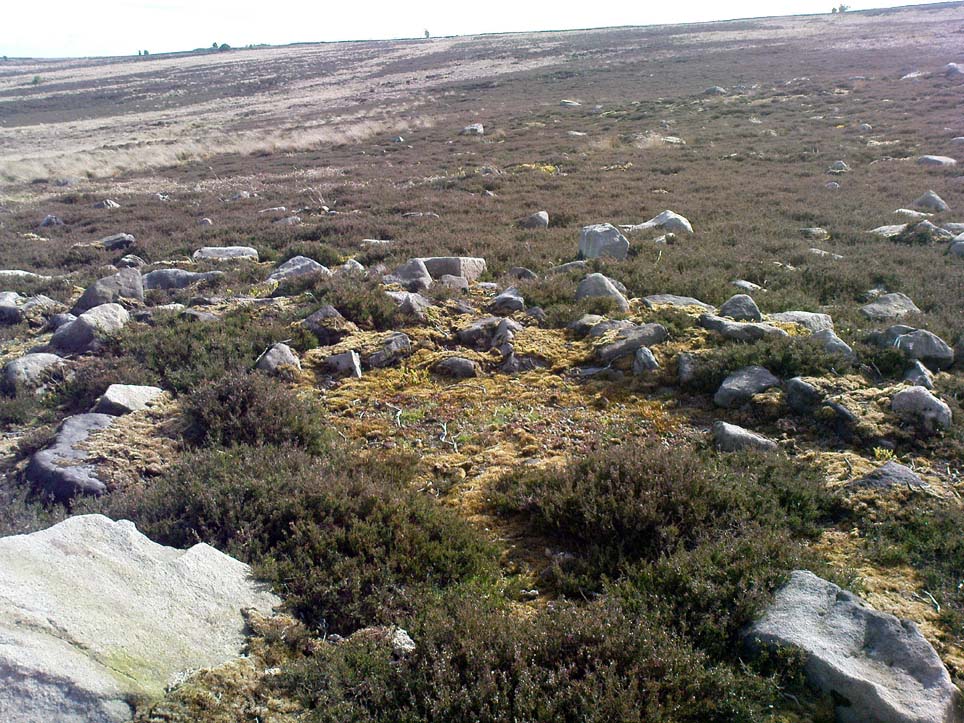
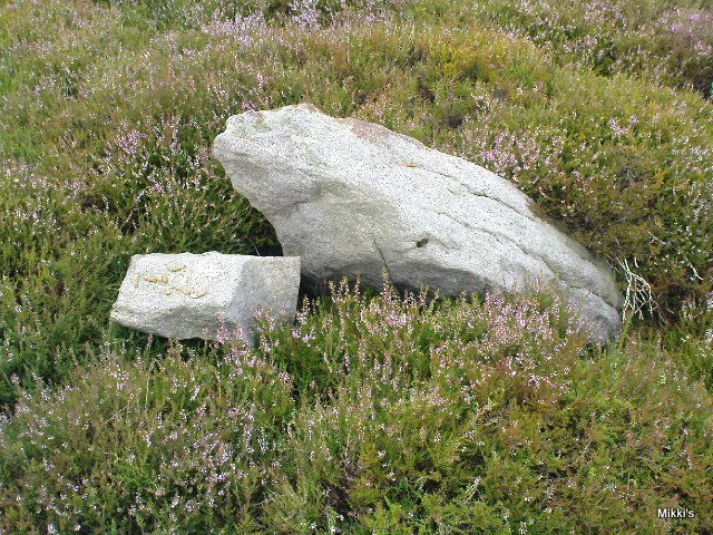
‘Hut circle’ at the rocky knoll

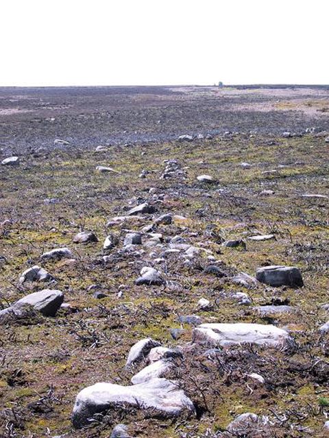
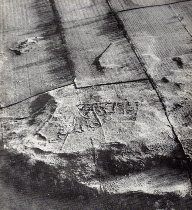
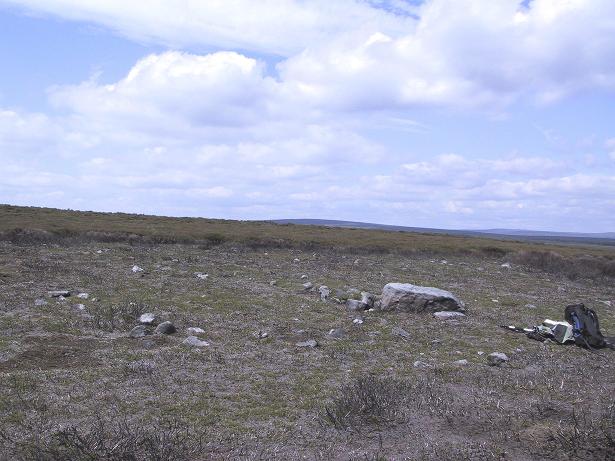
My first exploration here was in the company of Graeme Chappell more than 20 years ago, where we tried locating remains that had been described by Eric Cowling (1946) during a foray taking photographs of the cup-and-ring stones nearby.  But due to an overgrowth of moorland vegetation at the time, the remains which Cowling described proved hard to find.  Years later when Richard Stroud and I visited the place in May 2005, all the heather had been burnt back and much of what looked like the remains of an entire prehistoric village was in plain view for us to see.  I was well impressed!  This occurred again last year, enabling the bunch of us who came here a few times to see even more of the place.  But — just like the newly discovered prehistoric settlement on Blubberhouse Moor a couple of miles north — once the heather grows back again you wouldn’t really think anything of worth was hidden here.   In archaeological terms however — despite the lack of references and research by those who are paid to be archaeologists — we have one helluva little-known prehistoric settlement, complete with walling, hut circles, village hall (!), tombs, cup-and-ring carving and more, much of it probably dating from the Bronze Age, but some of the sites here indicate it was also much in use during the Iron Age period aswell.

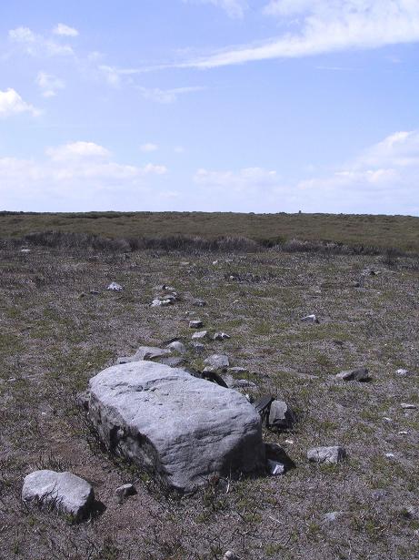
Probably the best place to start exploring here is on the large flat rock on the rounded knoll at the edge of the moor (SE 1785 5129) with a simple cup-mark saying ‘hello’ on its surface, looking east down into the Fewston Valley and across lower Wharfedale, then veering up towards the hills above Nidderdale.  The great prehistoric temple of Brimham Rocks is clearly visible from this spot aswell.  Upon this rocky hillock we have a veritable scattering of several large, earthfast boulders and smaller rocks, from where much of the settlement expands, mainly to the west through to the south, across the open moors in front of you.  On a clear day this is truly beautiful and quiet spot.
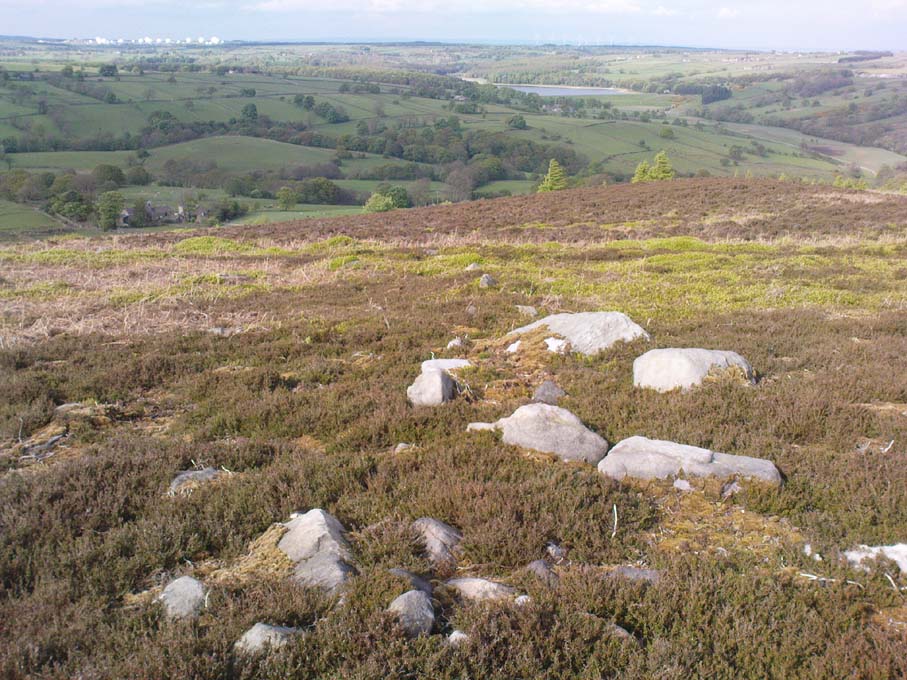
Line of ancient walling, running NE
Line of ancient walling, running SW

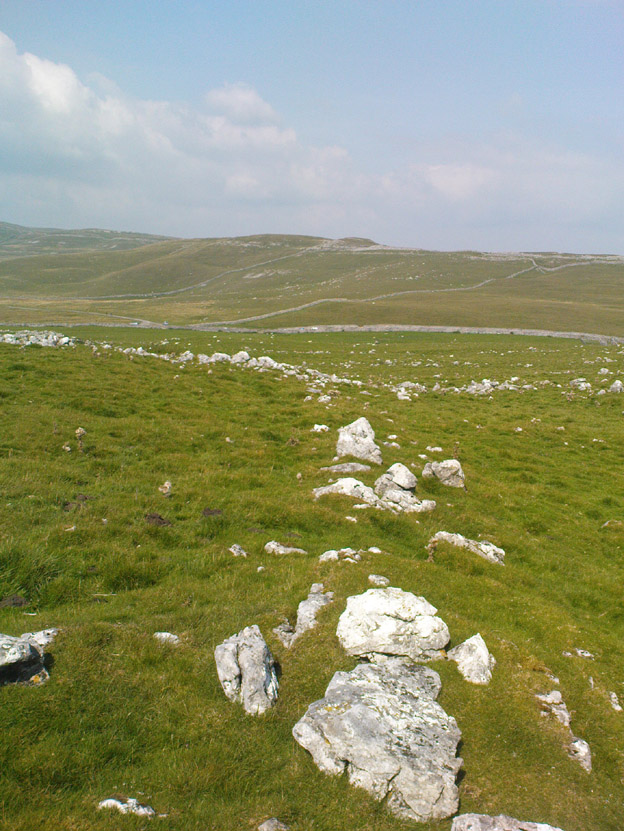
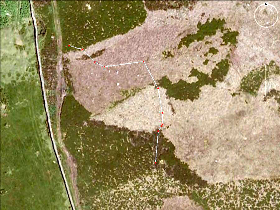
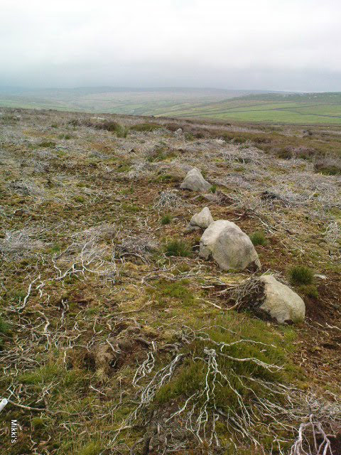
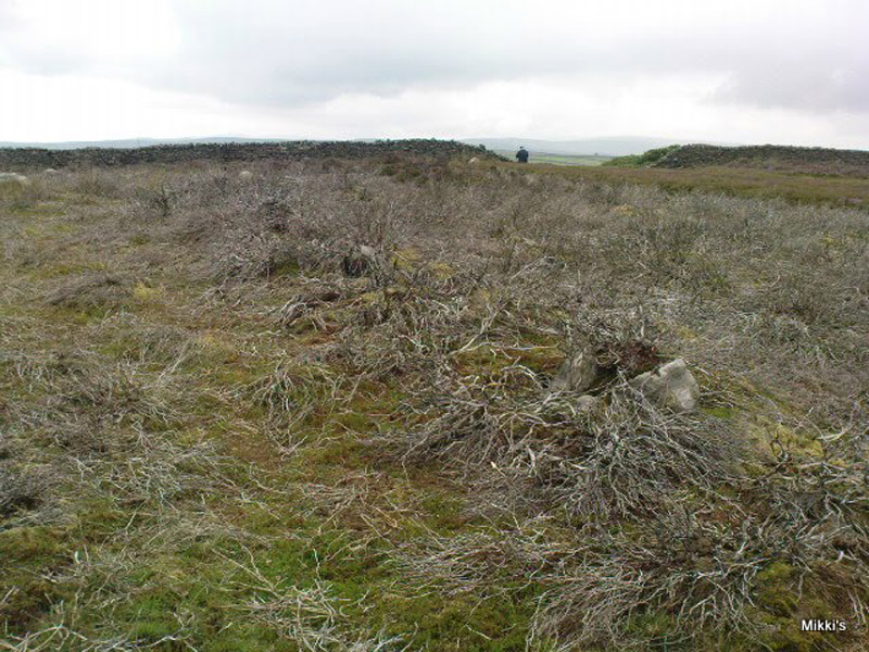
Just a couple of yards from the edge of the rocky knoll is a very good example of what would at first sight appear to a prehistoric hut circle.  Its position at the top of this rocky knoll however, implies an additional function other than a purely domestic one.  Also from here is a prominent long straight stretch of walling running roughly southwest for about 90 yards onto the moor, and also to the northeast, downhill off the moorland for some 30 yards before disappearing into undergrowth (we didn’t actually explore this lower section of walling running downhill, so there’s probably more to be found there).  This long section of walling, mainly comprising small stones and rubble, with a number of larger uprights defining much of its length, is just one of several stretches of walls that are clearly visible hereby.  There are also a number of other hut circles to be found scattered around this particular walled sections near the top of the rocky rise. When Eric Cowling (1946) came here he counted 10 of them here; but subsequent explorations have found at least 13 of them hereby.
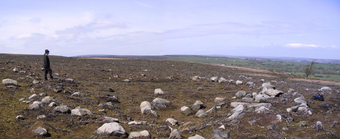
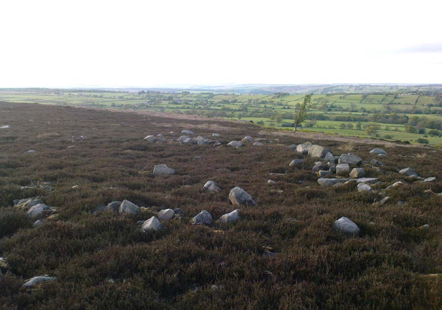
Upper D-shaped enclosure
Overgrown D-shaped enclosure

One of the most notable remains here is the large D-shaped enclosure about 25 yards west of the rocky knoll.   This very impressive archaeological site was curiously not included in the Nidderdale Archaeological survey report of sites in this region.  Either they hadn’t done their homework correctly when they came here, or the heather must have been really deep; cos as you can see in the photo here, it’s a decent size!  I tend to see this large stone enclosure as a sort of tribal gathering building of sorts — a bit like a ‘village hall’ so to speak. If you get here and see it all in context, it makes a lotta sense (not that it’s right of course, merely an opinion).  With the exclusion of the Cowling D-shaped enclosure more than 80 yards east of here, this is the largest monument on this section of the moor, measuring some 45ft along the NW to SE axis and 20ft across the NE to SW axis.  The walling in parts is quite thick aswell and the stones making up the main north, east and southern edges are anything between 12 inches to 34 inches tall. Along its northeast edge is a curious stone, with what initially looked to be a most distinct cup-and-ring carving on the outer walling, but once we’d looked and looked again, saw it seemed to be one of the oddest light-created ‘carvings’ we’d ever seen! (i.e., it’s natural)
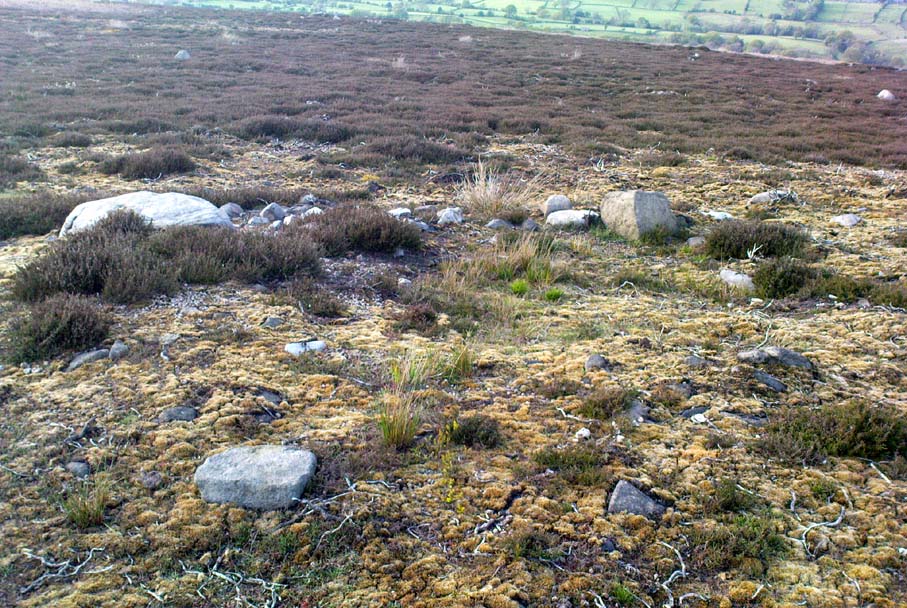
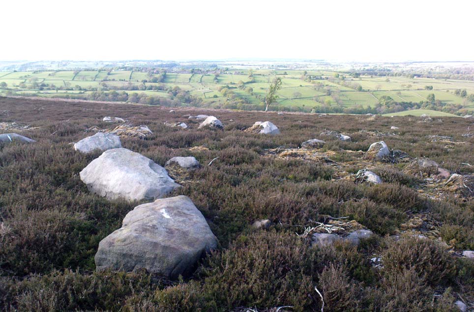
Denuded cairn? or denuded walling?
Another arc of walling (shit picture though – soz…)

A few yards from here, heading to the little peak close by, more walls emerge. On the small rise in the land about 30 yards west you’ll see an arc of stones running around the contour line of another hillock on the moor.  It’s difficult to say with any certainty, but a lot of this arc of stone is certainly man-made and at least Iron Age in date, perhaps earlier; but the line of stones itself may actually run all round the very edges of the hill on whose sides this section rests (see photo).  You get a distinct impression here that this small hill was actually sectioned off all the way round, so to speak, for some reason or other.  The remains of at least two small cairns can be found on the top of this small enclosed rise, close to one of which Boughey & Vickerman (2003) have designated there to be a cup-marked stone.  From this elongated hillock we look immediately northwest onto the flat moorland plain of the Snowden Moor necropolis …amidst which the hardworking Keighley volunteer Michala Potts recently found the Snowden Crags cairn circle.
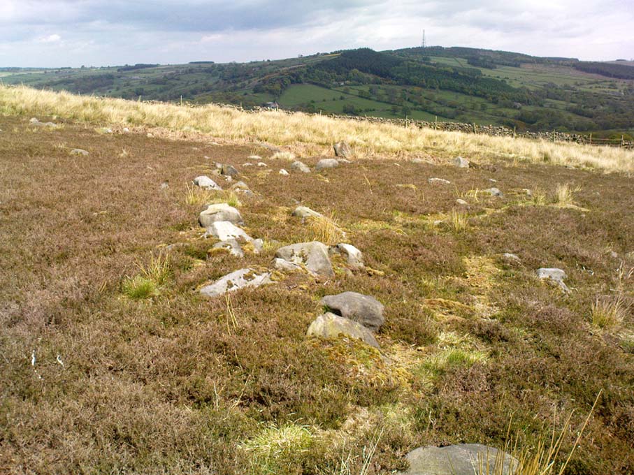
Section of Snowden Carr settlement walling

Further down the moorland slope—a couple of hundred yards below Cowling’s D enclosure—are yet more remains, many of which lie outside the geographical boundaries of the “official” Scheduled Monument Record for this settlement (known as SMR 28065).  We’ve located several other cairns in relatively good states of preservation; more extensive lines of another walled enclosure (again in a large D-shape), as well as several cup-marked stones.

The Site and Monuments account of this place tells us simply:

“The monument includes a cairnfield and associated concentration of prehistoric features.  Included in the area are a large sub-rectangular enclosure, two smaller enclosures, at least 17 cairns of various sizes, several lengths of boulder walling, a hollow way, and at least 17 carved rocks. There is also a bare patch of ground on which lumps of lead slag survive. This was produced by medieval or earlier lead smelting.

“This concentration of prehistoric features is situated towards the north east edge of Snowden Carr, and measures c.426m x c.155m.  The cairns occur throughout the area and range in size from an elongated cairn 17m x 7m down to cairns c.4m in diameter. The cairns are best preserved in the north western part of the area. The large sub-rectangular enclosure has an earth and stone bank c.3m wide and c.0.6m high. The bank is double on the east side of the enclosure.  The two smaller enclosures have rubble banks 1m-2m wide and up to c.0.6m high.  They are more irregular in shape than the large enclosure.  The boulder walling consists of a number of approximately linear rubble banks 1m-2m wide. It is concentrated in the area immediately north west of the large enclosure, and in the area to its south. The boulder walls are interpreted as part of a field system contemporary with the large enclosure.  The hollow way is located within the southern group of boulder walls and may be contemporary with them. “

There is still a considerable amount of work that needs doing in and around this settlement complex and it seems any work here is gonna be done by the like of us amateur doods.  Archaeological officials don’t seem interested here.  I was informed by Neil Redfern of the archaeology department of English Heritage for North Yorkshire that they are unable to support any funding that might help towards any decent analysis of this important archaeological arena, nor do they consider the important cairn circle discovered a few months ago on the northern end of this settlement worthy of financial help either, which is of course very disappointing,* but typifies their lack of enthusiasm unless money comes their way.  And so this site profile entry will be added to gradually as our amateur team visit and uncover further aspects of this neglected prehistoric arena – such as the finding of another previously unrecorded ancient circle of stones not too far away!

References:

  1. Boughey, Keith & Vickerman, E.A., Prehistoric Rock Art of the West Riding, WYAS: Wakefield 2003.
  2. Cowling, Eric T., Rombald’s Way: A Prehistory of mid-Wharfedale, William Walker: Otley 1946.

Acknowledgements:  Many thanks for use of their photos to Graeme Chappell and Michala Potts.

* No doubt a church window somewhere will eat up a few thousand quid and weeks of their time to fit the little piece — along with all those prawn sandwich meetings that cost so much to endure.  Much more important!

© Paul Bennett, The Northern Antiquarian 

Castercliff, Nelson, Lancashire

Enclosure:  OS Grid Reference – SD 8850 3840

Also Known as:

  1. Caster Cliff

Getting Here

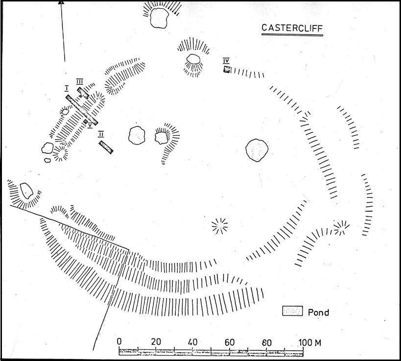
Castercliff hillfort plan (after D.G. Coombs)

From Colne train station, cross the road and go along Bridge Street and where it meets Knotts Street follow it all the way up into the countryside and, bending to the right, uphill again until it levels out.  The farmhouse a few hundred yards ahead of you (just off Southfield Lane) at the bend in the road is where you’re heading.  There’s a track on your right, just before the farm.  Go on this and look into the field immediately right.  The undulations and earthworks are the remains of this old hillfort!

Archaeology & History

This old site was constructed some 850 feet above sea level, overlooking the valley of Colne immediately west and giving commanding views of the outstretched landscape towards the sacred Pendle Hill and beyond for many miles.  The place was described as early as Castell Clif in 1515, and then again as Castyclyff in 1533, meaning simply the “castle on a cliff” or high verge as it is here.  Yet despite its early appearances in literary studies, the first real work to explore this monument doesn’t appear to have been done until one J.A. Plummer carried out work on the site between 1958-60.  However, Plummer died before being able to publish his findings in full.   Ascribed variously as a settlement, an enclosure, and generally in the archaeological fraternity as a hillfort, the first detailed published description of the site was done by Forde-Johnston (1965), where he told:

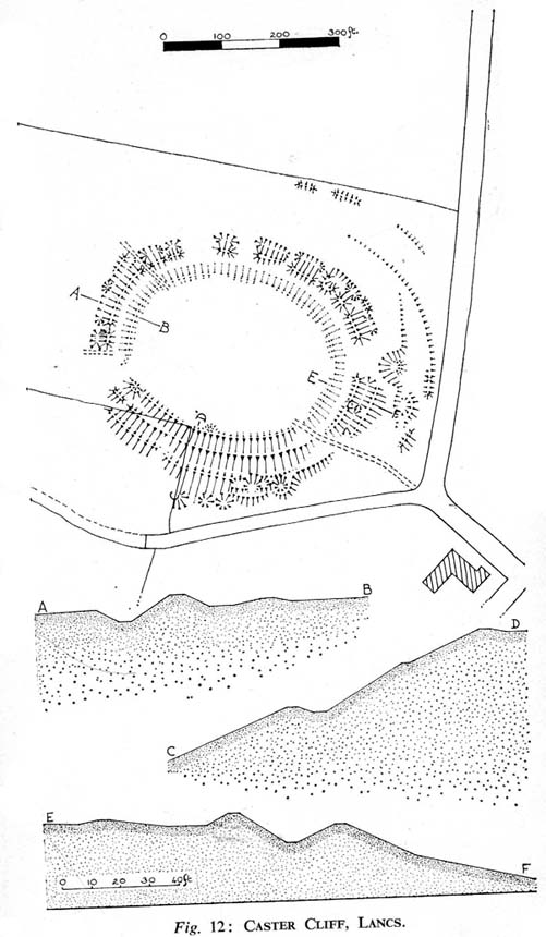
Forde-Johnston’s early plan

“The hillfort is a very regular oval in shape and encloses an area about 350ft long and 250ft wide.  The overall dimensions are 550ft by 450ft.  The site has been affected by quarrying on the south and east and there are a number of gaps in the defences on the northern and western sides.  The character of the remains differs in various parts of the site, but the general pattern appears to be as follows.  The innermost line of defence is represented by a very slight bank or, in many places, only a very shallow scarp which can be traced round the whole circuit of the site… The second or middle bank is the most prominent or substantial of the three.  It has considerable gaps in its length, but the various portions are all of much the same character — it rises between 3 and 5ft above the interior and falls about 9ft to the ditch bottom.  On the south side the middle rampart takes the form of a scarp about 10ft high, immediately below the scarp of the inner rampart.  The third, outermost bank is, in fact, a counterscarp bank to the second ditch.  It does not exist as a continuous bank around the whole of the site, but there are sections of it on the northern and eastern sides.  On the eastern and northeastern sides, from which approach was easiest, there appear to have been additional outer defences, situated about 70ft forward of the counterscarp bank.  These outer defences now take the form of a scarp about 4ft high curving round the eastern and northeastern sides for about 250ft.  At the southern end there is an inner scarp, forming a bank, and a little to the south, is a detached portion of bank.  There are other short detached sections of bank on the northern side which are presumably to be connected with these outer defences.”

When Mr Plummer did his excavation here a few years before, one section of the site was examined and, thanks to the survival of an interim report he did — described by D.G. Coombs (1971) — we know the following of what he did:

“His work was concentrated in the northwest corner of the site where he cut a trench through the defences.  Outside the counterscarp bank, which was not continuous, there was a bedding trench, packed with stones and containing charcoal.  The ditch, which was rock-cut and flat-bottomed, had a homogenous fill.  The rampart itself showed timber supports at the front and back with traces of stone revetting at the front and some distance from the timber uprights.  The rear of the rampart was marked by a line of stones.  Behind this rampart the site had been extensively disturbed and here he claimed to have found traces of primitive iron-smelting furnaces constructed from stones packed and sealed with loose black earth.  A single post-hole beneath the rampart was suggested to belong to an earlier phase.”

Though we have to note here that Mr Plummer believed that the iron furnace remains were actually medieval in date, but that the embanked settlement itself was Iron Age and “that the collapse of the fort could be dated between 60-90 AD.”  When Mr Coombs and his team came back here in 1970 to re-examine the works of both Plummer and Forde-Johnston, they confirmed some of their earlier finds, but uncovered additional finds at what they called this “once great fortress.”

Folklore

In Robert Lord’s (1976) superb imaginary piece on what he calls the Pendle Zodiac (a zodiac allegedly forged into the landscape in ancient times, in the manner of the famous and equally imaginary Glastonbury zodiac), a section of the deity Diana is made up of this prehistoric earthwork:

“The lower edge of the cap (on her head) coincides with a minor road between Colne, skirting the Iron Age Castercliffe hill-fort, above Nelson, as far as Catlow.”

…to be continued…

References:

  1. Coombs, D.G., Interim Report: Excavation at Castercliff, Nelson, Lancs., Unpublished Report 1971.
  2. Ekwall, Eilert, The Place-Names of Lancashire, Manchester University Press 1922.
  3. Forde-Johnston, The Hill-Forts of Lancashire and Cheshire, Lancashire & Cheshire Antiquarian Society 1962.
  4. Pennick, Nigel & Lord, Robert, Terrestrial Zodiacs in Britain, Institute for Geomantic Research: Bar Hill 1986.

© Paul Bennett, The Northern Antiquarian

Tullich, Glen Lochay, Killin, Perthshire

Enclosure:  OS Grid Reference – NN 5235 3684

Also Known as:

  1. Tirai West
  2. Tullich East
  3. Canmore ID 78043

Getting Here

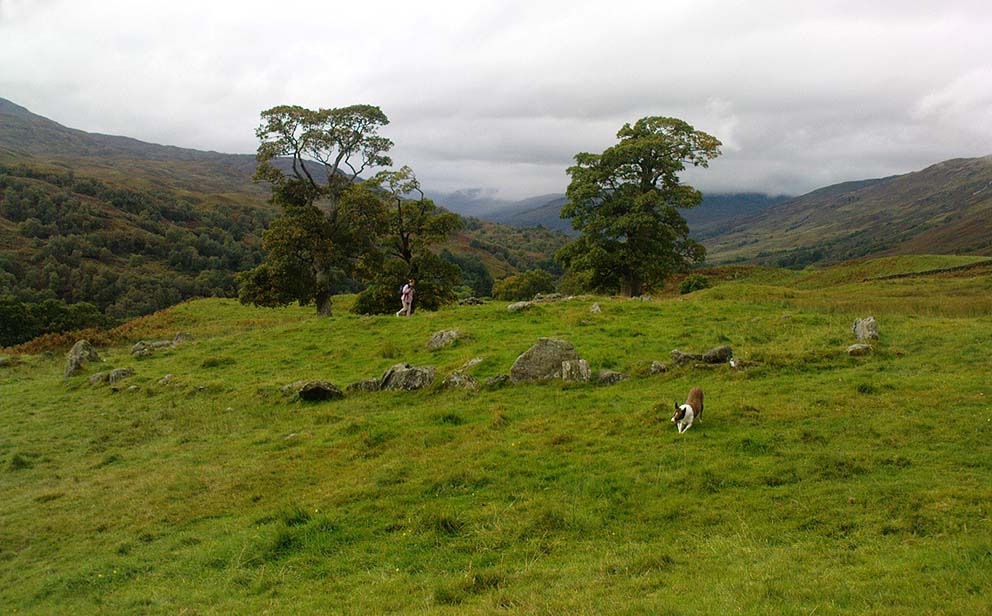
The ‘stone circle’ of Tullich!

Go through Killin past the Bridge of Lochay pub, turning immediately down the small lane by its side.  After about 3 miles you’ll cross over the small river past Duncroisk.  Keep going for another few hundred yards (if you reach Tullich you’ve gone too far), watching out for the gate on your left.  Walk up to the top of this field, over the wall and up again.  You’ll see a couple of tall trees with distinctive walling next to them, just on a ridge above you.  That’s where you’re heading!

Archaeology & History

This is a fine-looking example of a prehistoric enclosure, perched on the edge of one of the grassy knolls on the far western extremities of the deserted village of Tirai.  If you walk towards it from the derelict village east of here, the elliptical form of the site gives you the distinct impression that you’ve just chanced upon a seemingly unknown stone circle nestled upon the edges of this gorgeous Scottish glen; but this initial excitement is soon dispelled once you get into the heart of the site!

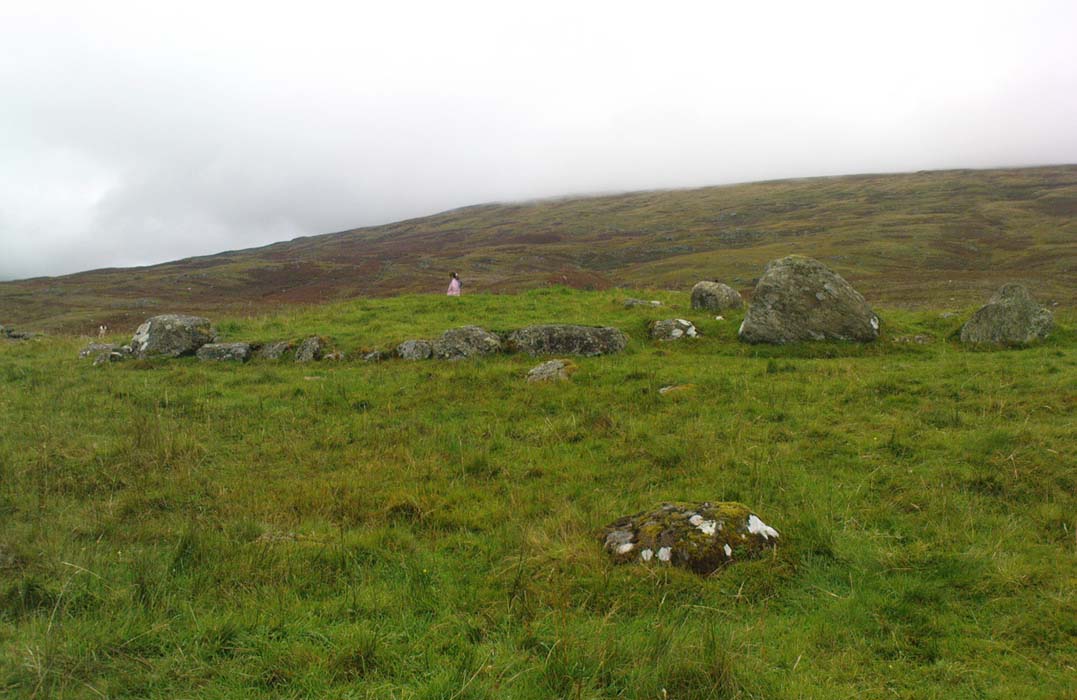
Southern line of walling
Looking east

Although you’ll find a couple of derelict post-medieval buildings on the western side of this structure, the lay-out of this monument would seem to be Iron Age origin, perhaps earlier.  It certainly has all the hallmarks of a walled structure from that period and typifies many others that I’ve explored down the years.

The eastern and southern sections of the walls are in very good states of preservation, although the ground has obviously grown up and around the bases of the stonework.  It has a total outer circumferences of about 95 yards (87m), with the many upright stones measuring between 12 inches to more than 3 feet in height.  The western section of the enclosure is mostly overgrown but easily traced on foot.  Near the centre of the site is a large flattish stone that gave the impression of having an oratory function from where one could speak to the rest of the people sat around the inner edges of the enclosure — but this was a purely subjective impression.

NE sections of enclosure
Outer section & ‘standing stone’

On the southern side of the elliptical structure is another, outer line of walling, or a stone alignment of some sort just a few yards long, consisting of just a few upright stones — one of which stands considerably taller than all the others hereby, giving the impression of a standing stone.  It has a large natural cup-marking on its southern face.

To my limited knowledge there’s been no excavations here, so one wonders whether or how or if the people of Tirai made use of this much earlier building.  The Canmore entry of the place tells:

“The N side of this enclosure is a low turf and stone bank of height 0.3m and is 20m long, spread to about 1.2m. The E side is outlined by large stones set on edge with no evidence of intermediate stone walling or turf. A bank of similar more continuous stone extends to the W from the S of the main enclosure down sloping ground. This type of walling is different from any other on Tirai. The large stones set on end have suggested a prehistoric date for this enclosure.”

References:

  1. Johnstone, A. & Wood, S., “Tirai (Killin Parish), Pre-Enclosure Settlements,” in Discovery & Excavation in Scotland, 1990.

© Paul Bennett, The Northern Antiquarian

Hammond Close, Threshfield, North Yorkshire

Settlement / Enclosure:  OS Grid Reference – SD 9517 6488

Getting Here

Aerial view of site
Aerial view of site

Follow the same directions to reach the Bordley ‘circle’ (it’s actually a much denuded burial site).  Look up the hill (south) at the limestone escarpments above you, walk past the Hammond Close Stones and head up the slopes in front of you.  If you get to the top of the hill without noticing the extensive prehistoric walled structures you’ve passed, then start to slowly amble here and around the tops and the slopes you’ve just walked up.  They’re everywhere!

Archaeology & History

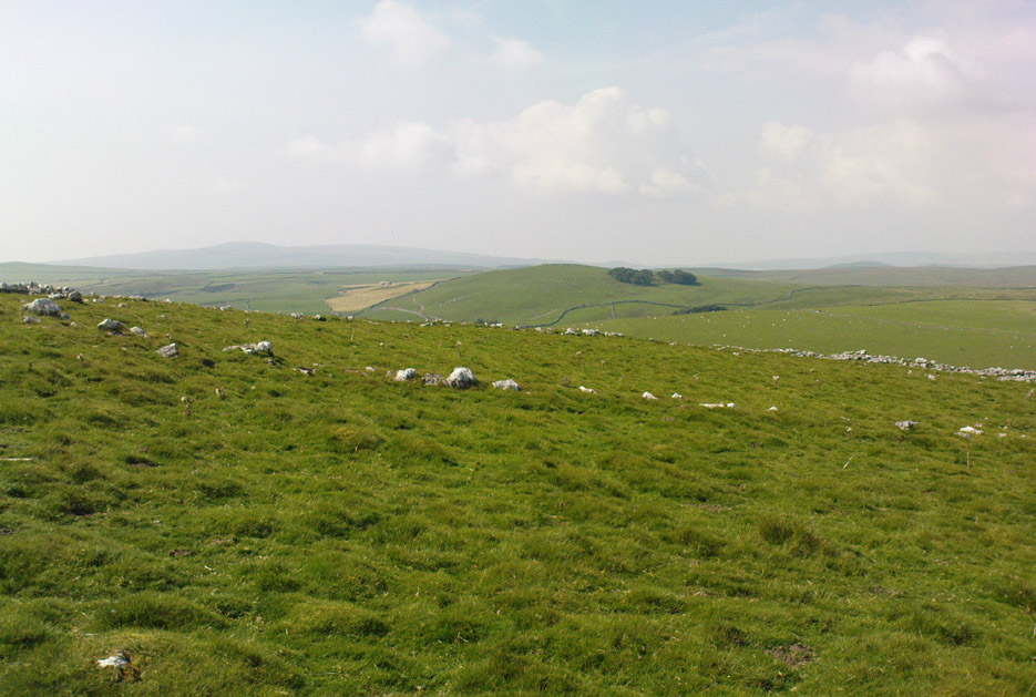
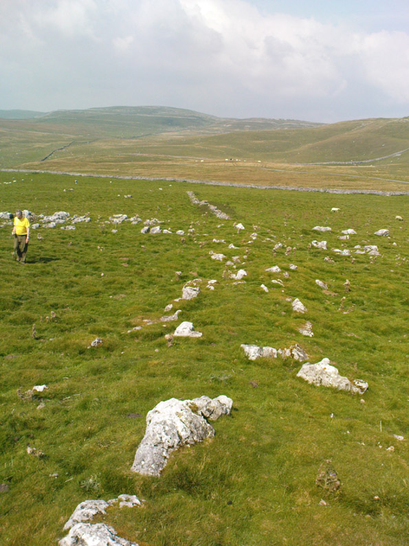
The grid reference here has to be considered as a general one.  The site we’re looking at, upon the tops of this wonderful limestone-enriched hill, is quite extensive and covers much more than the simple eight-figure grid ref I’m using to direct you here.  On the way up the slope from the Bordley ‘circle’ site, you’ll notice how the natural lines of limestone have been used to define lines of walling.  The remains of many smaller stones have been laid into the natural rock outcrops, and others set into the earth and sectioned off smaller enclosures within the greater whole.  It was obviously a huge and time-consuming exercise to create these large rocky sections, some of which appear to have actually been cut into the rock.  The aerial image here shows clearly the lines as they were laid out, intruding the extensive natural bedrock covering the landscape, not just here but much further afield.  Indeed, the large set of enclosures here at Hammond Field typifies dozens and dozens of other such sites in the hills north and west of here.

Enclosure walling running E-W
Topmost line of walling

The trouble with this and other sites in the Upper Wharfedale region is dating them.  Although we typically ascribe an Iron Age date to many of these settlements, we know that many of them were added to and maintained by peasants and farmers well into medieval times.  And why not!?  They’re excellent, solid and need little maintainance! The sections we’re looking at here in this particular site may have had their origins in the Bronze Age.  It seems a reasonable assumption considering the existence of the Bordley circle site and several other denuded burials along the same ridge at the bottom of the slope.  But the majority of the ‘enclosed’ sections running up and around this hill seem to have Iron Age and Romano-British stamps on them.  It’s likely that some of the ‘enclosed’ sections would have been constructed to keep cattle in, aswell as being living quarters for people.  At least one well-defined hut circle can be seen along the north-facing edge of the hill and, perhaps, even the fallen remains of a once upright standing stone.

The topmost part of the Hammond Close hill is all but surrounded by Nature’s limestone, with a large oval grassy region in the middle of it all; but on the eastern side of the hill, the natural limestone walls are lacking and so were supplemented by the work of people who built an additional protective line of walling, running north for some 45 yards from the small craggy ridge at the top, along the level, until it meets up with more natural limestone.  The man-made walling is built into this aswell.  Halfway along this length of north-south walling is another section, running to the east for nearly 40 yards before bending slightly for another 25 yards into yet more natural outcrop.

Partition walls on north slope
Stretches of walling: from ancient to modern

I could spend the next few paragraphs describing all the walled sections visible on this hill and down its edges, but don’t wanna bore you with the small detail of it all!  Aswell as that, if you climb over the eastern walls and walk a short distance across the rocky hill, you’ll start seeing other prehistoric settlement remains beneath your feet.  And on the hill across directly to your north, we find more extensive remains at the very large Lantern Holes settlement, dating again from the Iron Age, if not earlier.

The ancient remains are all over the place round here!  So those of you who love good outdoor wanderings, prehistoric archaeological sites and excellent views, give this place your attention!  It’s well worth it!

References:

  1. Dixon, John & Phillip, Journeys through Brigantia – volume 2: Walks in Ribblesdale, Malhamdale and Central Wharfedale, Aussteiger: Barnoldswick 1990.

© Paul Bennett, The Northern Antiquarian

Barrasford Common, Barrasford, Northumbria

Settlement:  OS Grid Reference – NY 9212 7538

Also Known as:

  1. Toddle Crags Settlement
  2. Gunnerton Settlement

Archaeology & History

Aerial view of settlement, 1967 (courtesy, Antiquity journal)

Some of the extensive remains of an Iron Age settlement on the northeastern edges of Barrasford Common, on the edge of Toddle Crags a couple of miles north of Chollerton, are thankfully still visible, despite the increased quarrying operations taking their toll on other (now lost) prehistoric sites between the little villages of Gunnerton and Great Swinbourne.  The remains of earthworks and walling are clearly visible at ground level, despite being overgrown.

The archaeologist J.K. St. Joseph (1970) described them in a short piece in Antiquity journal more than 40 years ago, saying:

“The site as first described by the reverend G. Rome Hall (1876) in the course of a survey of settlements around Birtley and Barrasford, made a century ago.  It is the easternmost of three settlements that he noted on the crags east of Gunnerton, and his sketch-plan shows rather irregular enclosures within which appear a dozen hut-circles, between 27ft and 15ft…in diameter according to his account.  The western of the three settlements was subsequently excavated by Rome Hall about 1880, and re-examined in 1941 by Mr A.H.A. Hogg (1942), who was able…to show that the period of occupation fell within the Roman Age. Mr Hogg refers to the earthworks illustrated (above) as ‘a very large settlement, much robbed.’

“…The site consists of a roughly square enclosure, 300ft across, or a little more, defined by a low bank… The SW and SE sides are straight: on the other two sides the boundary mark conforms to the cont0urs of the ground.  The enclosure is subdivided, and evident traces of hut circles and of more rectangular-shaped buildings are still to be seen.  Some of the small compounds may be pens for stock, and the general impression conveyed by the earthworks is of a settlement that has developed over a period of time, additions and rebuildings being involved.  It is thus a notable example of the rectangular settlements of the Roman Iron Age, which occur widely in south Northumberland, as Mr G. Jobey has demonstrated.  The earthworks compare well in point of weathering, at least in an aerial view, with the best preserved of the Iron Age settlements on the moors in the north of the county.”

The writer notes how the this settlement had evidence of continued human use all the way from the Iron Age to perhaps as late as the 18th century!  This isn’t too unusual.  The best example I’ve yet to come across is the little-known settlement complex in the far north, on the small plateau known as Baile Mhargaite near Bettyhill, Sutherland, where a living community began in the neolithic period and only came to an end with the Highland Clearances two hudnred years ago!

References:

  1. Hall, George Rome, “Ancient British Remains near Birtley and Barrasford, North Tyne,”  in Archaeologia Aeliana, Volume 7, 1876.
  2. Hogg, A.H.A., “The Native Settlement at Gunnar Peak,” in Archaeologia Aeolina, Volume 20, 1942.
  3. St. Joseph, J.K., “Air Reconnaissance: Recent Results 19,” in Antiquity no.173, March 1970.

ACKNOWLEDGEMENTS:  Many thanks to Antiquity Journal for use of the photo.

© Paul Bennett, The Northern Antiquarian 
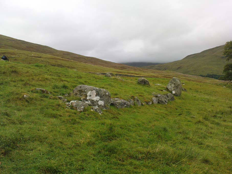

Dumpit Hill Enclosure, Hebden, North Yorkshire

Enclosure / Settlement:  OS Grid Reference – SE 02884 64062 —  NEW FIND

Getting Here

Line of enclosure walls

Follow the same directions to get to the Dumpit Hill A stone circle; but instead when you get to the point where you need to walk off-track and into the heather to get to the circle, keep walking up the dirt-track for about another 200 yards, watching diligently thereby for a reasonable sized, fallen, “standing-stone”-like character just yards into the heather on your right (on your left, there’s a U-shaped dip where the wall is).  This is the northern edge of the walled enclosure.  From this fallen ‘standing stone’ follow the overgrown walling along carefully into the heather along and down the slight slope.  You’re now either on the very edge, or perhaps going into the middle of the enclosure.  Look around!

Archaeology & History

East section of walling

There’s no previous written history of this site, discovered for the first time last week on our sojourn to the Dumpit Hill stone circles, by Michala Potts.  She didn’t seem too excited by it at the time, but an amble back to what she’d found got me going! (easily done) With the help of the heather being burned away, open and exposed was a distinct line of prehistoric walling — perhaps Bronze Age, perhaps later.  It’s hard to tell.

Structurally similar to the enclosure walling at Horse Close and Rough Haw, either side of Skipton, a few miles to the south, here we have about 100 yards of walling seeming to enclose the eastern side of the small hilltop, but running into the heather on its southern edge and the moorland track on its northern side, where it disappears again, leaving no trace of what one would assume would be a consistent western section.

From the grid reference for the site, the line of walling runs northwards for about 20 yards before taking a very slight shift in direction for another 20 yards.  Here the walling goes to the left (west) for another 20 yards, before edging slightly northwest and back into the heather.  A section of the walling is visible at each end, though we lose any accurate trace of it after a short distance in the long heather.  However, at the northwestern point in the enclosure walling, a very distinct long stone about 4 feet high leans at an angle in the ling.  It seems apparent that this stone at one point in the not-too-distant past stood upright, making it the tallest stone here.

Northern section of walling
Fallen monolith?

What may be other features can be seen inside this enclosure section: a possible hut circle and other portions of walling were noted.  However, we didn’t spend much time exploring the site in detail, so there is a high probability of other prehistoric remains in and around this enclosure awaiting discovery.  The site’s proximity to the stone circles of Dumpit Hill A and Dumpit Hill B should be noted; along with what the North Yorkshire’s Historic Environment Officer, Robert White, said were “three, possibly four small circular enclosures (about 9m in diameter)” a short distance away.  A further survey of the site is necessary to enable us a better picture of what we’re looking at here.

© Paul Bennett, The Northern Antiquarian
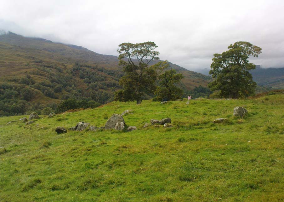

Shooting House Hill, Askwith Moor, North Yorkshire

Settlement:  OS Grid Reference – SE 1711 5110

Getting Here

From the Askwith Moor car-parking spot, walk up the road (north) for 350 yards and go thru’ the gate on the left-side of the road, up along the track onto Askwith Moor.  To get to it, walk on the footpath towards the trig-point on Shooting House Hill from the Askwith Road.  Between 50-100 yards before the trig, walk into the heather to the right.  Just 5-10 yards off the footpath, it’s there!  If the heather’s grown back, don’t even bother looking for the place!

Archaeology & History

Although I add this as the remains of a small Bronze Age or neolithic settlement — which was found on August 3, 2005, in the company of Richard Stroud — subsequent walks up hereabouts in the surrounding heather has shown that, far from being a small independent site, it was part and parcel of a much greater prehistoric landscape all round here: with the remains on High Low Ridge immediately west; the cairnfields of Askwith Moor and Snowden Crags south and east; and numerous cup-and-ring stones scattered all over the place here.  It’s a veritable minefield of archaeological remains, from the mesolithic to the Iron Age all over these moors!

Barely visible remains of walling
More of the walling

We came wandering up here looking for another of Eric Cowling’s “lost circle” sites described in 1946, near Shooting House Hill, which Graeme Chappell and I looked for ten years previously without success. But on the August 2005 visit, much of the heather had been burned away.  Instead of the lost circle however (which remains unfound, though something suspiciously like it is close by) we came across a well-defined, though small settlement complex.  The walling of two well-defined near-rectangular structures emerge either side of a reasonably large boulder. Beyond these is further walling and what seems a well-defined hut-circle less than 10 yards away. Like many other sites on these moors, the walling seem to have been pretty much robbed for building grouse-butts. (hence the pictures here looking a bit sparse of stone!)  Subsequent investigation found more neolithic walling which ran into the deeper heather — so it has been difficult to work out the full scale of it all.

The landscape from here stretches way off. To the eastern horizon (not far away) is the legendary Almscliffe Crag, with the rising hills of Rombald’s Moor due south; whilst far to the sunsetting west rises the great contours of Pendle Hill, to which legend relates some of the witches of the Fewston Valley, a mile below…

References:

  1. Cowling, Eric T., Rombald’s Way, William Walker: Otley 1946.

© Paul Bennett, The Northern Antiquarian
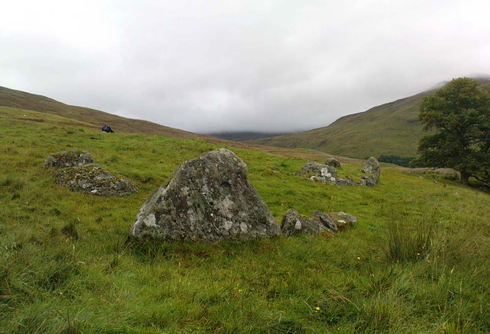

Rough Haw, Flasby, North Yorkshire

Hillfort:  OS Grid Reference – SD 963 558

Also Known as:

  1. MYD1636

Getting Here

Travel up the B6265 (Skipton to Grassington road) for a mile, watching on the small hills on your left (western) side, and then take the left turn up to Sandy Beck. You can’t miss the place!

Archaeology & History

Rough Haw, looking west

My first view of this place was from the hills east of here, atop of one of the great rock outcrops on the edge of Embsay Moor. The very first impression it gave me was – “That’s a bloody hillfort!”: an obvious worked rounded hill, with ridges typical of such monuments.  Subsequent investigation found that there were extensive remains of walling, more typical of the Iron Age period than the neolithic (which some modern archaeologists have proposed), clearly visible around the edges of this great hill.  The structure of the site is similar in size and design to the remains at the nearby Horse Close Hill above Skipton, aswell as another (officially unknown) site closer to Keighley.  A large overgrown cairn rests on the southern side of the hill, seemingly more of archaic import than a mere clearance or marker point. But I may be wrong…

Very notable at this site are the profusion of springs emerging from all round Rough Haw: the blood of seven such water sources comes from its edges on all sides and would obviously have been of some importance here.

References:

Dixon, John & Phillip, Journeys through Brigantia – volume 1: Walks in Craven, Airedale and Wharfedale, Aussteiger Publications: Barnoldswick 1990.

Links:

  1. Out of Oblivion: Rough Haw Archaeological NotesAn archaeocentric description of this little-known site, ascribing it as perhaps Bronze Age, perhaps Neolithic.

© Paul Bennett, The Northern Antiquarian
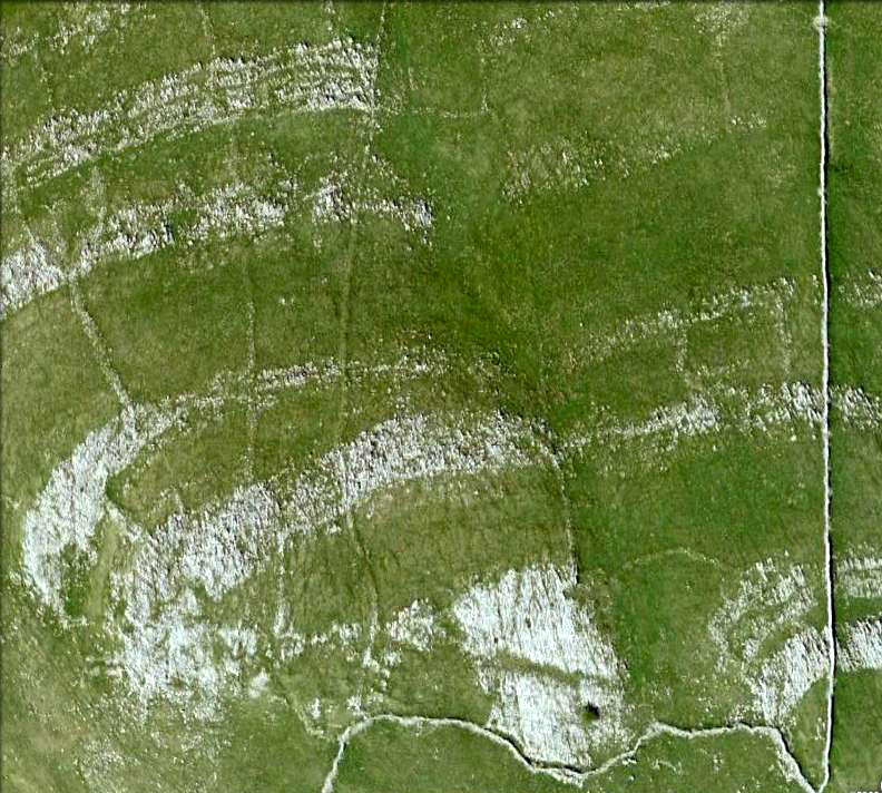

Castle Hill, Kirklees, Brighouse, West Yorkshire

Enclosure:  OS Grid Reference – SE 173 216

Getting Here

Along the Brighouse to Mirfield A644 road, a half-mile east of M62’s junction 25 on Wakefield Road, note the woodland on your left-hand side, above the walling.  Although on allegedly private land, you can approach by hopping over the wall by the main road into the woods. Wander up the slope until it levels out and, just at the edge of the tree-line, past the brilliant overgrown folly amidst a mass of rhododendrons, you’ll see the denuded edges of this earthwork.  Though you might need a bitta patience seeking it out…

Archaeology & History

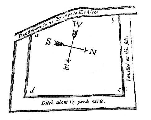
Very first sketch of this site (John Watson, 1775)

The remains of this low earthwork is found on the private land of Kirklees Hall and appointment is supposed to be made to explore, both this and the more famous Robin Hood’s Grave, a few hundred yards away. But if you can’t be bothered with that and find this little-known earthwork, you’ll see that it’s roughly squared in shape, though pretty overgrown.  In Bernard Barnes’ survey (1982) he described it as a “square or five sided enclosure, 2-3 acres in size, with bank and external ditch”, wondering whether it was used to enclosure cattle and stretching its possible origin between the Iron Age to the medieval.

Although the classical Roman archaeologist Ian Richmond (1925) believed the site to be from that period, the archaeologist J.J. Keighley thought that the site was “more likely to be Iron Age than Roman.”  He wrote:

“The earthwork in Kirklees Park is a square or five-sided enclosure with bank and external ditch… The site lies on Richmond’s trans-Pennine route.  According to Armitage and Montgomerie, the earthwork is 0.5 hectares in area, but it is actually nearer 0.8 to 1.2 hectares.  They compare its construction with the fort at Wincobank (South Yorkshire), stating that the bank on the counterscarp when excavated, revealed “a very rudely composed wall of undressed dry stone.”

Earlier local writers such as John Watson (1775) — whose early sketch of the site is reproduced above — and others also opted for the Roman date.  But, unless you’re a bit of an earthwork fanatic, this site may not be too much your cuppa tea. If you are gonna check this out though, make sure you check out Robin Hood’s old tomb in the trees not far away. Very odd.

References:

  1. Barnes, Bernard, Man and the Changing Landscape, Merseyside County Council & University of Liverpool 1982.
  2. Keighley, J.J., “The Prehistoric Period,” in West Yorkshire: An Archaeological Survey to AD 1500 (WYMCC: Wakefield 1981).
  3. Richmond, I.A., Huddersfield in Roman Times, Tolson Memorial Museum: Huddersfield 1925.
  4. Watson, John, The History and Antiquities of Halifax, J. Lowndes: London 1775.

© Paul Bennett, The Northern Antiquarian

South Kirkby, South Yorkshire

Hillfort / Settlement:  OS Grid Reference – SE 435 104

Getting Here

From the South Kirkby library, go west along Hague Lane and take the left turn up Homsley Lane on your left after  a few hundred yards (keep your eyes peeled!).  Go up here, past the housing estate, and where the trees begin on your left at the top of the Hilltop Estate, go thru them and as you emerge out the other side, the earthworks are all around you.  In fact you’re just about in  the middle of this hillfort-cum-settlement!

Archaeology & History

W.S. Banks (1871) gives an early description of this site, although he thought it to be Saxon in nature.  He told that,

“About half-a-mile east of Ringston Hill, in a field between Quarry-road and Hornsley-road, is the site of a supposed Saxon camp, as it is called on the ordnance map — a large enclosure containing above three acres of land.  It slopes to the north, and is now rough and uneven, and has been cast into ‘lands.’  The mound on the east, west and south is still very distinct.  The northern side is much lower than the other and a ditch is cut across at that part…”

And in Banks’ day, as he told, “the history of it is not known.”  But this site was later declared as a hillfort – a Brigantian one at that – for the first time by the director of Wakefield Museum, Mr F. Atkinson, following some excavation work here in 1949.  Nothing much was found apart from,

“pieces of decayed and burnt sandstone and medieval pottery sherds,” though he still concluded the site to be Iron Age. Although little of its original form can now be seen due to extensive damage, infra-red aerial photography showed “traces of a five-sided annexe to the northwest, the line of the ploughed-out rampart to the south-southwest, and a possible defended entrance to the south.”

The same aerial survey also found another enclosure to the east of the hillfort.

…to be continued…

References:

  1. Banks, W.S., Walks in Yorkshire: Wakefield and its Neighbourhood, Longmans Green & Co.: London 1871.
  2. Keighley, J.J., ‘The Prehistoric Period,’ in Faull & Moorhouse’s, West Yorkshire: An Archaeological Survey, I, WYMCC: 1981.

© Paul Bennett, The Northern Antiquarian