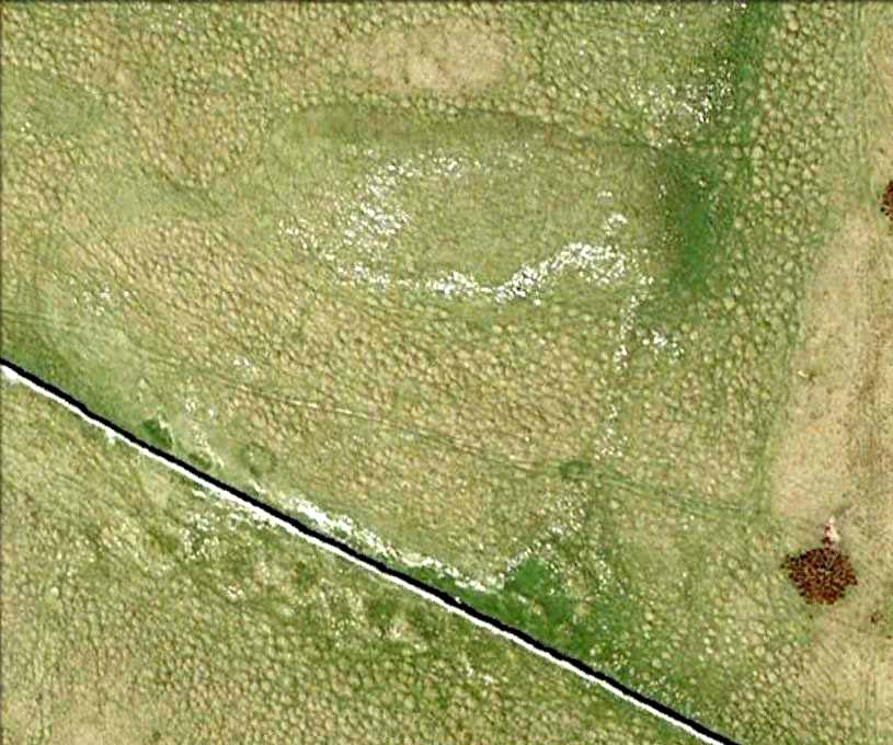
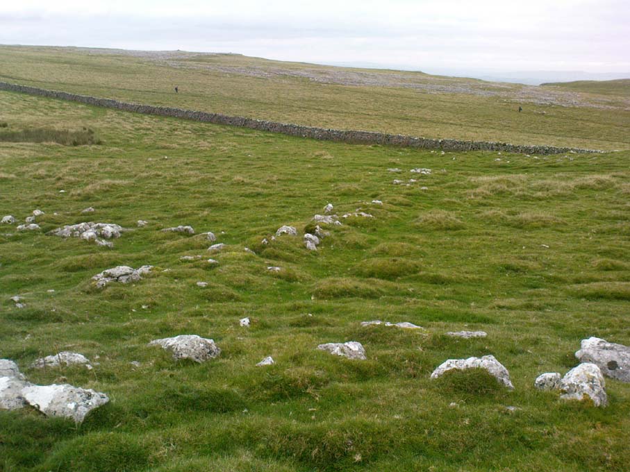
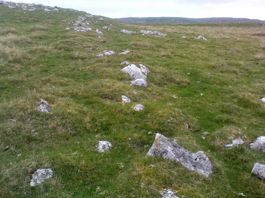
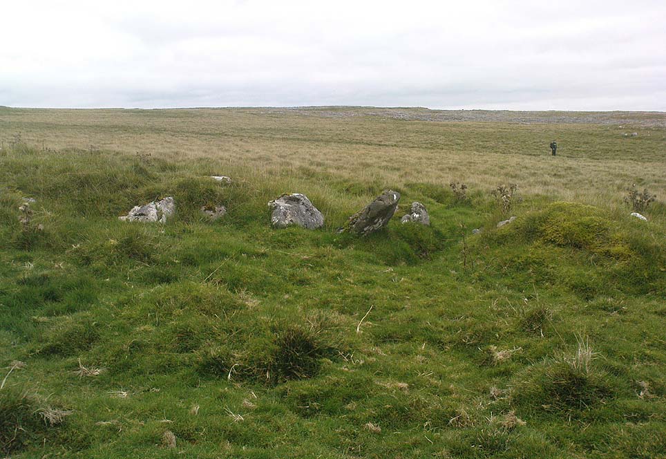
Broadbank Earth Circle, Thursden, Burnley, Lancashire.

Enclosure: OS Grid Reference — SD 9024 3522

Also Known as:

  1. Burwains Enclosure
  2. Burwains Camp

Getting There

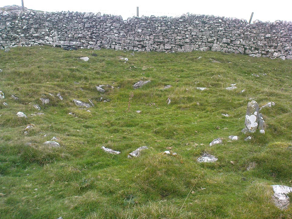
From Nelson town centre go north east towards Catlow, turning left near the Shooters Arms public house, then turn right again to the Coldwell Activity Centre.  Carry on towards Thursden Valley till you see the World War 2 pillbox on the right.  Here turn right and after 300 yards a picnic site and carparking area is reached along the Briercliffe road. On the opposite side of the road over a wall and barbed wire is Broadbank Earth Circle, though unfortunately there is not much to see there today. 

Archaeology

First excavated in 1950 by the Archaeology Department of Liverpool University and again in the 1960s, the earthworks here stand at 1,147 feet above sea-level (350m). The site comprises of an earth circle 150 feet (46m) in diameter which encloses an inner ditch 1 foot (30.5cm) deep and 10 inches (25.4cm) across. The bank was composed of boulder clay thrown out from the ditch. A hearth was found below the bank at the eastern end.  Some rough flint and chert flakes were also found together with a stone axe of Langdale origin. This is four-and-half inches or 11.4cm wide.  It has a curved cutting edge and a thin rounded head. Its surface is ground smooth but there is no evidence of polishing.

The earthworks at Broadbank have suffered through farming activity over many centuries and the earthen circle is now difficult to see at ground level, though the inner ditch is still visible. The low hillside or, what look like ramparts, at the northern end by the pillbox are probably not in any way connected, though this low bank may have added to the building of the bank. Archaeologists consider the site to be of Iron Age origin.

References:

  1. Liverpool University Archeology Department, Report and pamphlet, 1950.
  2. Powell, J.G.E., “Excavations of a Circular Enclosure at Broadbank, Briercliffe, Lancs,” in Transactions of the Historical Society of Lancashire & Cheshire, 104, 145-151.

Copyright © Ray Spencer, The Northern Antiquarian 2011


Ivy Chimneys, Witham, Essex

Settlement (destroyed):  OS Grid Reference – TL 811 136

Archaeology & History

Sadly this site has been built over, as happens so much down south it seems (regional archaeo’s, architects, councillors and businesses are very much in each other pockets – even those who allege ‘pagan’ allegiances to ancient sites – hence the demise of ancient sites). Which is a pity, as it sounded a decent spot!  Essex county council employee, Robin Turner, forwarded a summary of the findings from the site to The Prehistoric Society following an assessment prior to its destruction at the end of the 1970s.  The brief account of what was there told:

“A small area of the site contained part of an Iron Age settlement, probably of village proportions.  Three hut circles, two possible hut circles and two square four-post structures were found, as well as a number of ditched enclosures.  The main settlement area was enclosed by a multi-phased series of associated palisades and ditches, the earliest of which had a causeway and external protective fence, which may have served as a defended entrance.  One of the four-post structures, c.3m square, lay immediately inside the gap, and may have been a gatehouse or lookout.  Three main areas were enclosed outside the settlement and are thought to have represented a stock enclosure, a working area and a field.  Some evidence of pottery production, weaving, thatching and metalworking was found.  The presence of unusually large quantities of deer and dog remains may have had some religious significance which carried on into the Roman period.”

Turner and his team “hoped to investigate the insdie of the settlement area more thoroughly in 1980,”but I aint been able to get a copy of the report.  There was also found remains of a Roman temple here, including artifacts that were thought to have been offerings to the gods or local spirits.

References:

  1. Champion, T.C., (ed.), “Summary Excavation Reports,” in Proceedings of the Prehistoric Society, volume 46, 1980.
  2. Turner, Robin, “Excavations of an Iron Age Settlement and Roman Religious Complex at Ivy Chimneys, Witham, Essex, 1978-83,” East Anglian Archaeology Monograph no. 88, 1999.

© Paul Bennett, The Northern Antiquarian


Townhead, Rothesay, Isle of Bute, Argyll

Settlement (destroyed):  OS Grid Reference – NS 086 635

Archaeology & History

Pottery remnants

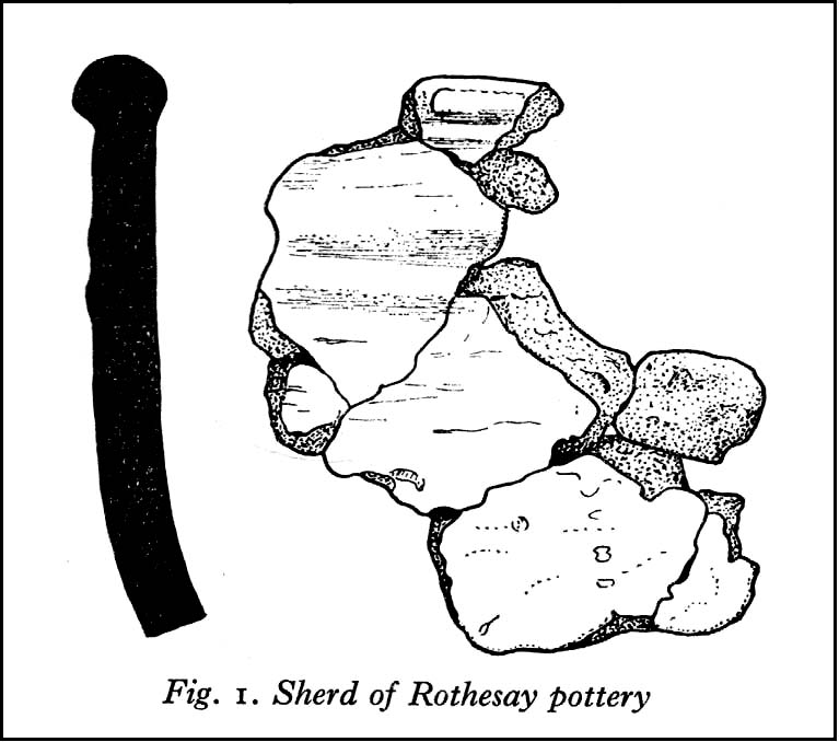
Somewhere beneath the modern cemetery and adjacent factory close to St. Mary’s church on the southern outskirts of Rothesay, right by the roadside, was once an important prehistoric settlement.  All remains of the site however, have long since been destroyed.  An axe that was found here was held in the local museum.  There are several scattered accounts of the place, one of which was written by J.G. Scott (1968), who reported that,

“between 1914 and 1929, a series of finds — pottery, a polished stone axehead, a saddle quern, hearths and remains of shallow trenches — was made at Townhead…at a now disused gravel pit.  Excavations in 1929 revealed several slots in the original gravel surface, which suggested the remains of sleeper beams for wooden buildings.  All the pottery recovered was neolithic… Amongst it were sherds of two vessels of Rinyo-Clacton ware.  Most of the rest of the pottery…showed well-developed rims, often thickened and bevelled externally and sometimes everted.  This pottery recalls the Abingdon style of southern Britain, and has been termed Rothesay ware by the writer.

“Sherd from one of these Rothesay vessels were associated with charcoal, possibly from a hearth, with hazel-nut shells and small fragments of bone.”

Scott told that radiocarbon analysis dated the finds  at around 2120 BC.  A couple of hundred yards away are the enclosed remains of St. Mary’s Holy Well, whose waters may well have been of magickal repute all those centuries ago…

References:

  1. Scott, J.G., “A Radiocarbon Date for a West Scottish Neolithic Settlement,” in Antiquity journal, volume 42, no.168, December 1968.

© Paul Bennett, The Northern Antiquarian


Duncroisk Burn, Glen Lochay, Killin, Perthshire

Cup-and-Ring Stone:  OS Grid Reference – NN 5281 3635

Also Known as:

  1. Canmore ID 24177
  2. CEN 19 (Morris)
  3. Duncroisk 2 Carving (Canmore)
  4. Tirai Wall Carving
  5. Tullich (Morris)

Getting Here

A ring of cups, encircling cups

Go thru Killin and, just past the Bridge of Lochay hotel, take the tiny road on your left.  Go down here for 3 miles till you pass the gorgeous Stag Cottage (with its superb cup-and-rings in the field across the road) for another 300 yards, past Duncroisk Farmhouse set back on your right, then over the small river bridge.  Just over the bridge there’s a gate on your left.  Go thru this and up the track until you get to another large gate.  Go thru this, then walk immediately left where you’ll notice a large-ish boulder sat on the nearby slope ahead of you in a part of some very old walling.  That’s your target!

Archaeology & History

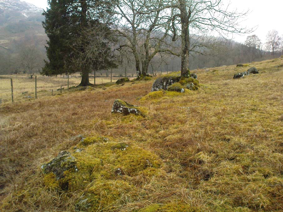
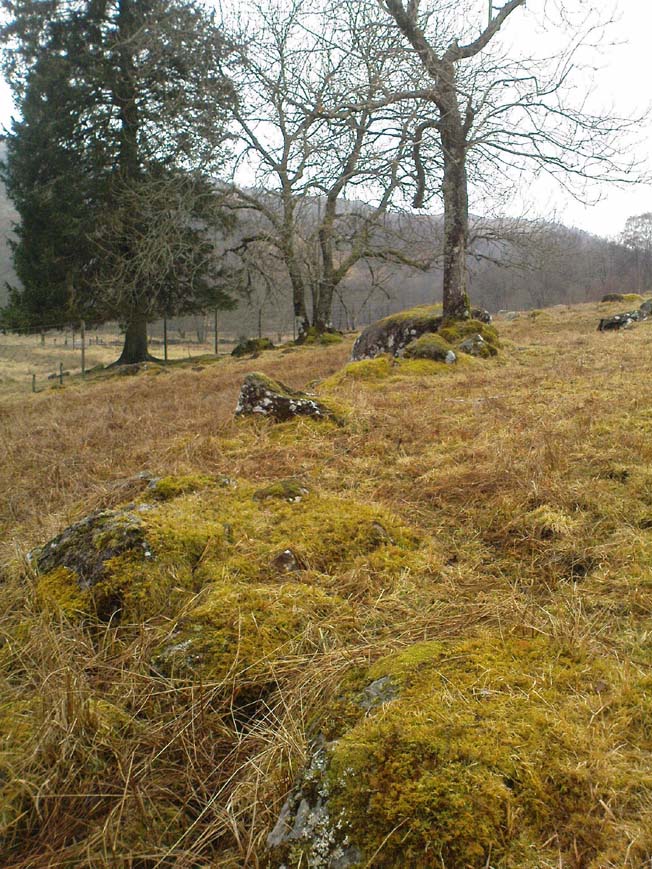
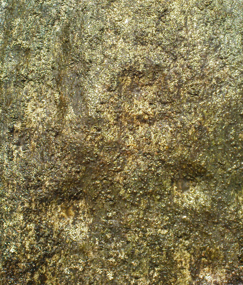
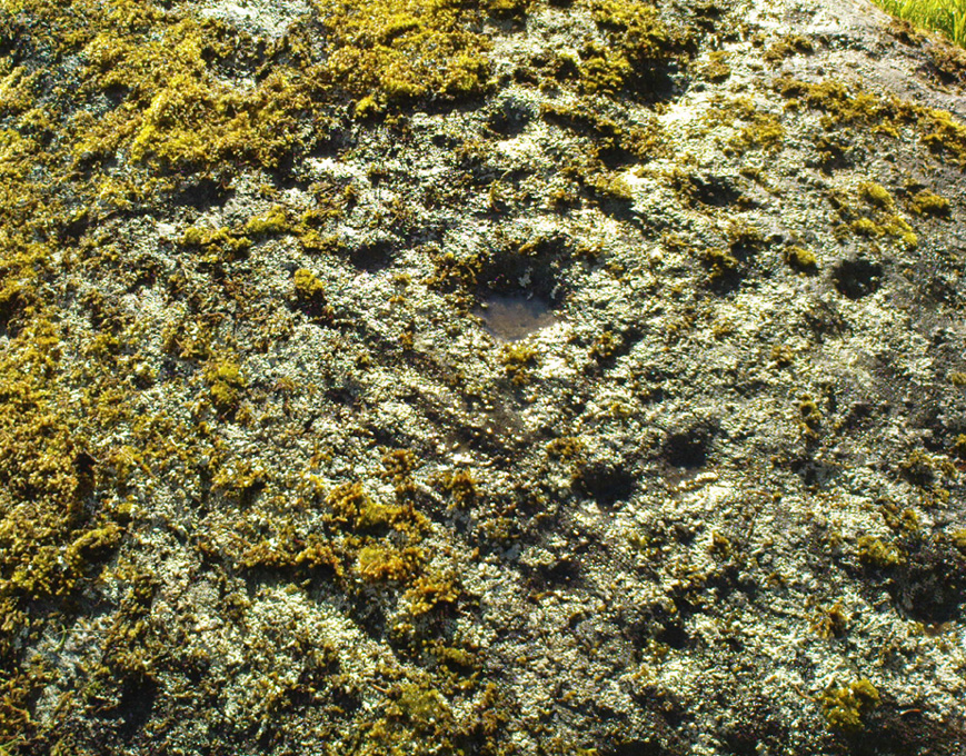
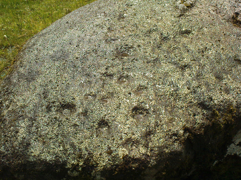
The title of this carving is slightly misleading, as the stone concerned is about 50 yards west of the fast-running burn.  But it’s pretty easy to locate.  When we visited the stone recently, as the photos show, the rock was all-but covered in a beautiful patchwork of lichen and moss, inhibiting the visibility of a quite impressive carving.  But we have to let this be.

The carving’s on the big rock by tree, in the walling
Line of walling clearly evident

The carved rock plays an important part in a line of ancient prehistoric walling, which looks Iron Age in nature, but without an excavation we’ll not know for certain.  The walling is quite extensive and is an integral part of the extended derelict village of Tirai, with its standing stones and other monuments.  This begs the questions: was the carving executed before or after the walling was created?  Was the stone carved in traditional neolithic/Bronze Age periods and later accommodated into the walling?

Even in the grey overcast light of a winter’s day when we first visited here, many cups were clearly visible on the rock’s surface, but they were difficult to contextualize in terms of artificial and natural aspects of the stone.  Later visits here at the end of Spring enabled a much better assessment — though capturing the surrounding “rings” proved difficult.  The carving is shown highlighted on Ron Morris’ (1981) map of the cluster of Duncroisk carvings, and described as a:

“domed schist boulder, 2½m by 2m, 1¼m high (8ft x 6ft x 4ft).  On its top, mostly where sloping…are: 2, and possibly 3, cups-and-one-ring, much weathered and only visible when wet in very low sun, probably un-gapped, and at least 32 cups.  Diameters up to 17cm (6½in) and depths up to 1cm.”

But this is only half the story.  Despite what Mr Morris and the more recent Canmore records tell us about this carving, there are in fact at least 52 cups on the surface of the rock, at least two of which have definite ring-like forms around them.  The largest of the cups has linear features around a large section of it, but to ascribe these elements as ‘rings’ is also stretching it a bit — as one of the photos here clearly shows.  The ‘ring’ consists more of two separate straight lines with curvaceous ends: more like a right-angled carving with a swerve than any traditional ring.  It’s a quite unique feature by the look of things.

Faint cup-and-ring and cups…and…
Cups & right-angled lines

The majority of the carved cups and lines occur on the eastern side of the boulder, with only a few singular cups almost fading their way onto its western sloping sides.  And of primary visual interest are the swirl of cups that surround two small cups at the ESE corner of the rock.  These give the impression of running into another swirl of cups that hedge their ways around the edges of the largest cup-and-right-angled-lines, until bending back up and along the southern-side of the stone.  This possibly deliberate sequence of cups then continues in roughly the same form back upwards to near the top-middle of the rock and onto a complete cup-and-ring.  Just above the top of this runs a short pecked line just detached from the cup-and-ring, but of obvious mythic relevance in the story which this carving once told.

RWB Morris’ sketch of the design

It’s an absolutely fascinating carving which gives the distinct impression of narrating a myth of journeying, by either a person, tribes or ancestral beings.  Of course we’ll probably never know for sure what story it once told; but its tale may have been known by the people of the once proud village of Tirai which was only destroyed a couple of centuries ago, along whose fallen walls this great stone still rests within…

And finally, for those students exploring the potential relationship that cup-and-rings may have with water: please note that in wet conditions, a spring of water emerges right underneath the very base of this large rock.

…to be continued…

References:

  1. Morris, Ronald W.B., The Prehistoric Rock Art of Southern Scotland, BAR 86: Oxford 1981.
  2. Royal Commission on the Ancient & Historical Monuments of Scotland, Archaeological Sites and Monuments of Stirling District, Central Region, Society of Antiquaries of Scotland 1979.

© Paul Bennett, The Northern Antiquarian


Beckhampton Penning, Avebury, Wiltshire

Stone Circle (destroyed):  OS Grid Reference – SU 0986 6713

Archaeology & History

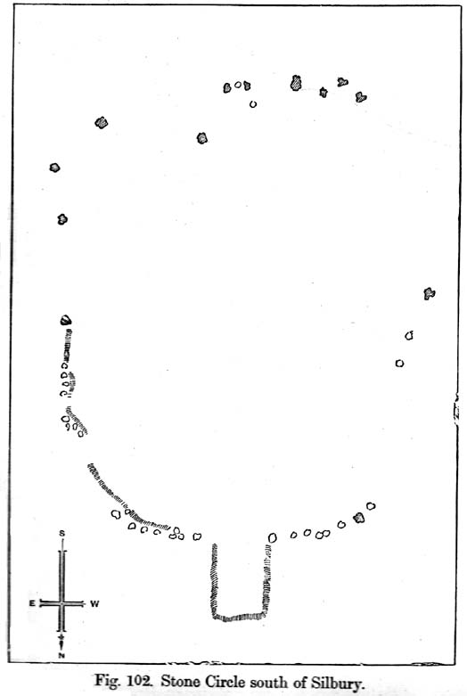
Smith’s plan of the site

This all-but-destroyed megalithic ring is all-but-unknown in most of the archaeological gazetteers — including even Burl’s (2000) magnum opus!  But we know it was there.  And according to the Avebury authority Pete Glastonbury , there “are a couple or three small stones buried on the hill but nothing else to see.”  Which is a pity, as the site sounds like it was something to behold in bygone times.  Although it seems to have been described initially by the legendary druidical antiquarian, William Stukeley, a more lengthy description followed in the 19th century by the reverend A.C. Smith (1885), when he and a friend took it upon themselves to cut back some of the turf that was covering a number of stones — and they weren’t to be disappointed!

The site itself appears to have stood right on the southern boundary line of Avebury parish, meaning that the site could have been named and cited on any early boundary perambulation records that might exist of the parish. (do any of you Wiltshire folk have access to any such old records?)  But if there are no such early accounts, the earliest record we’ll have to stick with is good old Mr Stukeley (1743), who only gave it a passing mention, saying:

“Upon the heath south of Silbury was a very large oblong work like a long barrow, made only of stones pitch’d in the ground; no tumulus.  Mr Smith before-mentioned told me his cousin took the stones away (then) fourteen years ago, to make mere (boundary, PB) stones withal.  I take it to have been an Archdruid’s, tho’ humble, yet magnificent; being 350 feet or 200 cubits long.”

Nearly 150 years later Reverend Smith gave us a more detailed account, and ground-plan, describing the place as,

“a stone circle, of considerable dimensions, though imperfect and formed of very small sarsens, but which I believe to have been in some way connected with Abury.  Though it appears to have been mentioned by Stukeley one hundred and fifty years ago, it had been long since buried, and completely forgotten till I was fortunate enough to discover it by digging in the year 1877.  I was led to the discovery by the suspicious look of certain stones which, though scattered in no regular form, appeared as if they might have once stood erect, in some sort of order, on the segment of a large circle.  I had often stopped to examine them as I wandered over that part of the downs; till at last previous suspicions ripened into conviction, as closer observation revealed sundry other stones just showing above the ground, and there also seemed to be faint indications of a trench, all pointing, with more or less accuracy, to the supposed circle.  Not to dwell upon the details of the investigation, which, however, were of singular interest to me, the result was that (with the permission of both owner and occupier of the land, and assisted by Mr William Long), I probed the ground in every direction, and uncovered the turf wherever a stone was found: and on our first day’s work we unearthed no less than twenty-two sarsen stones, all forming part of the circle, and lying from two to twelve inches below the surface.  These stones were all of small size, some of them very small, but that they were placed by the hand of man in the positions they now occupy, in many cases nearly touching one another, and that they formed part of a large circle or oblong, admits, I think, of no doubt.  I say part of a circle, because, though the northern, southern and eastern segments are tolerably well defined, I could find scarcely a single stone on what should be the western segment to complete the circle.  That the area thus enclosed is not insignificant will appear from the diameter (in length, or from north to south, 261 feet; and in breadth, or from east to west, 216 feet).  Again, its position (due south of Silbury, and within full view of it, as well as the Sanctuary on Overton Hill, and with Abury immediately behind Silbury, due north of it, from which also Silbury is equidistant) seems to intimate that it may have had some connection with the great temple.”

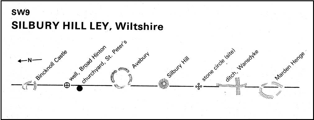
A ley running through the circle (image courtesy Paul Devereux)

Smith then proceeded to query the nature of the monument, commenting on how Sir John Lubbock and members of the British Archaeological Association were intrigued by the remains, but a little perplexed and unable “to form any opinion” as to the exact nature of the site.  But this didn’t stop mythographer and historian Michael Dames (1977) who, in his classic Avebury Cycle, suggested that the site “marked the navel of the landscape goddess” in the region.

The site didn’t go unnoticed in Devereux and Thomson’s (1979) classic Ley Hunter’s Companion, where it plays an important point along a ley that runs north-south for 13 miles between Bincknoll Castle at the north, to Marden Henge at the south.  Such an alignment had been noted much earlier by other archaeologists and historians.

The site does look strange for a stone circle in Smith’s ground-plan and has more the hallmarks of a type of enclosure or settlement of some sort.  It certainly wouldn’t be out of place, design-wise, as a prehistoric settlement in our more northern climes.  However, without further data it seems we may never know the true nature of this old stone site…

References:

  1. Dames, Michael, The Avebury Cycle, Thames & Hudson: London 1977.
  2. Devereux, Paul & Thomson, Ian, The Ley Hunter’s Companion, Thames & Hudson: London 1979.
  3. Glastonbury, Pete, “Silbury ‘stone circle’ Query,” private comm., March 6, 2011.
  4. Smith, A.C., A Guide to the British and Roman Antiquities of the North Wiltshire Downs, Wiltshire Archaeological & Natural History Society 1885.
  5. Stukeley, William, Abury, A Temple of the British Druids, W. Innys & R. Manby: London 1743.

© Paul Bennett, The Northern Antiquarian


Martinsell Hill, Oare, Pewsey, Wiltshire

Hillfort:  OS Grid Reference – SU 1764 6396

Also Known as:

  1. Martin’s Hill

Archaeology & History

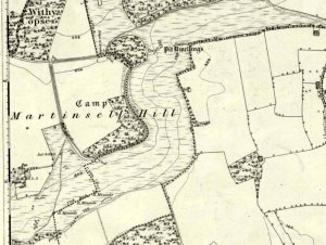
Martinsell Hill on 1888 map

The second highest of Wiltshire’s prehistoric camps or hillforts, Martinsell Hill was described as early as the 13th century as ‘Mattelsore’ and was known in local dialect and literary forms as variants around the word mattels, until the 16th century, when the title became altered in literature and for the first time became known as ‘Martinshall’ (and variants thereof), which has stuck ever since.  As the etymologists Gover, Mawer & Stenton (1939) proclaimed,

“the first element (mattels, PB) must be associated with the old english name for the camp which stands on top of it: the Mætelmesburg of the Pewsey charter” —

A.C. Smith’s old map

Which the authors think derived from “Mætelmesora, i.e., ‘Mæþelhelm’s bank'”, being the name of a tribal leader or elder who gave his name to the hill upon which the fort was built.  Margaret Gelling echoes the sentiment in her Place-Names in the Landscape, but we must keep in mind that such derivation is still a quite speculative etymology and one which doesn’t seem to be able to be proven (as yet!).

The hillfort and its remains were described in some detail in the second volume of Colt Hoare’s classic Ancient Wiltshire (1819: 107), where he wrote:

“Martin’s Hill or Martinshal Hill is in North Wilts what Long Knoll near Maiden Bradley is in South Wilts, ‘collis longe spectabilis’.  This elevated point commands a most advantageous prospect of the rich vale that separates the northern and southern districts of our county, , and is rendered interesting to the antiquary by an extensive earthenwork that crowns the summit of the hill.  Its form resembles an oblong square on all sides, except towards the east, where it bends inward in order to humour the natural shape of the hill.  Its area, which is in tillage, comprehends thirty-one acres; and as several entrances have been made through the ramparts for the convenience of agriculture, it is difficult to ascertain on which side were the original approaches to the camp.  This hill, in its formation, presents a peculiarity rather contrary to the usual system of nature, by rising in height towards the east, where a bold and tremendous precipice of smooth turf shelves down from the summit to the base of the hill.  This eminence is more remarkable for the rich and extensive prospect which it affords than for the plan of its entrenchments, which consists of a single vallum and fosse.  Not having discovered by digging any certain marks of ancient populations within its area, I am inclined to think that it may be considered as an asylum to which the Britons, who were very numerous in its environs, sent their families and herds in times of danger: the single vallum and ditch prove its British origin, and the great extent of its area seems to warrant this conjecture.”

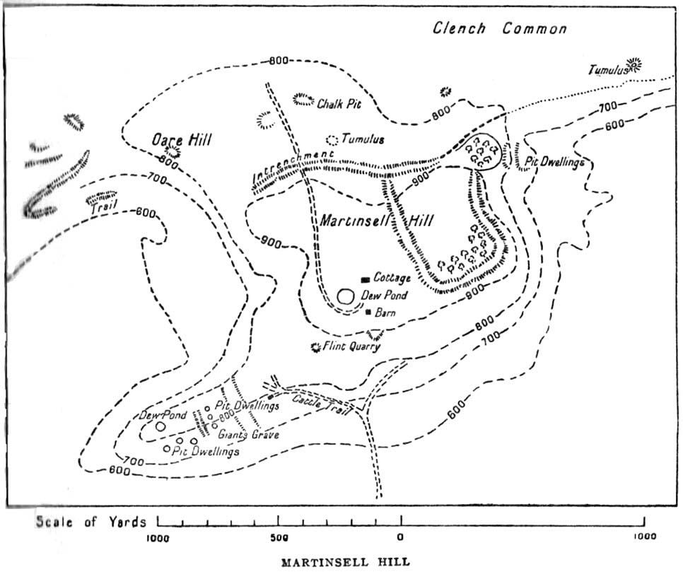
Hippisley Cox’s ground-plan

This aint a bad assumption for a fella who wrote this 200 years ago without the aid of excavation or modern archaeocentric analysis.  But we can see that Hoare was utilizing that dying virtue of common sense here, and find that much of what he said remains the echoed narrative of modern archaeologists who, I believe, still aint done a detailed excavation on the site themselves. (weird for down South!)  Later in the 19th century, when the reverend A.C. Smith (1885) visited and wrote about the hillfort, he added little to Hoare’s earlier words.  And the descriptive narrative of the site remained roughly the same (Massingham’s intriguing ascriptions aside!) even after a small excavation was undertaken in 1907, which found very little.  Hippisley Cox (1927) passed this way in his fine travelogue of ancient roads and trackways in Wessex, describing the enclosed top of this hill as

“the site of a complete neolithic settlement, including dew-ponds, a cattle compound, a flint quarry, lynchetts, dicthes of defence and deep cattle tracks formed by much going and coming of beasts from the valley.”

He may have been right!  In more recent times Geoffrey Williams (1993) describes the Martinsell hillfort, which again only gives slightly more info than Colt Hoare’s 1819 narrative.  The site covers 32 acres in size, is roughly rectangular in form, measuring roughly 330 yards (302m) across east to west, and 480 yards (439m) north to south.   There appears to be at least one entrance on its northeastern edge.

Folklore

What seems to be a survival of prechristian sun lore is found in one or two of the events that used to happen upon and around Martinsell.  A number of local history books give varying descriptions of the events here, but Devereux and Thomson (1979) condense the information nicely, telling us that

“The camp seems to have been a focus for curious Palm Sunday ‘games’ in past centuries, one of which involved a line of boys standing at intervals  from the base to the summit of the hill.  Using hockey sticks, they then proceeded to knock a ball in succession up the hill to the top.  Another activity was the throwing of oranges down the hill slopes with boys going headlong after them.  Evene more strangely, local youths used to slither down the escarpment on horses skulls.”

Mythographer and writer Michael Dames (1977) thought that such festive activities on and around the hill related to remnants of ancient goddess worship here.

Ley line running from Martinsell (image courtesy Paul Devereux)

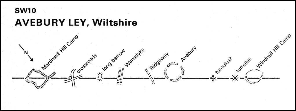
In Paul Devereux & Ian Thomson’s (1979) ley hunter’s guide, the Martinsell Hill site stands at the beginning of a ley, which then runs northwest for more than seven miles, eventually ending at the well known causewayed enclosure of Windmill Hill — but not before passing by the Avebury stone circle and several prehistoric tombs on route.  This ley is a simple alignment between sites (as the ‘discover’ of leys, Alfred Watkins described them) and has nothing to do with the modern contrivance of energy lines.

…to be continued…

References:

  1. Bradley, A.G., Round about Wiltshire, Methuen: London 1948.
  2. Dames, Michael, The Avebury Cycle, Thames & Hudson: London 1977.
  3. Devereux, Paul & Thomson, Ian, The Ley Hunter’s Companion, Thames & Hudson: London 1979.
  4. Gomme, Alice B., “Folklore Scraps from Several Localities,” in Folklore Journal, 20:1, 1909.
  5. Gover, J.E.B., Mawer, A. & Stenton, F.M., The Place-Names of Wiltshire, Cambridge University Press 1939.
  6. Harding, D.W., The Iron Age in Lowland Britain, RKP: London 1974.
  7. Hoare, Richard Colt, The Ancient History of North Wiltshire, Lackington, Hughes, Mavor & Jones: London 1819.
  8. Massingham, H.J., Downland Man, Jonathan Cape: London 1926.
  9. Partidge, T.B., “Wiltshire Folklore,” in Folklore Journal, 26:2, 1915.
  10. Smith, A.C., A Guide to the British and Roman Antiquities of the North Wiltshire Downs, Wiltshire Archaeological & Natural History Society 1885.
  11. Williams, Geoffrey, The Iron Age Hillforts of England, Horace Books 1993.

© Paul Bennett, The Northern Antiquarian


Lantern Holes, Bordley, North Yorkshire

Settlement:  OS Grid Reference – SD 9528 6574

Getting Here

Aerial view of settlement

Follow the same directions to get to Bordley’s Druid’s Altar circle.  Where the little rough car-parky-bit happens to be by the cattle-grid, look up the sloping field where the wall runs up in a line and follow it up on foot.  A coupla hundred yards up you’ll see a small craggy outcrop in front of you and another line of drystone walling in the corner.  Just below this craggy outcrop you’ll notice a raised embankment comprising a line of small rocks running along the edge of the hill.  This is the first bitta prehistoric walling that makes up a part of the settlement system.  From hereon, follow y’ nose along and up the hill and look around.  The settlement’s all around here!

Archaeology & History

This is quite an extensive area of prehistoric (seemingly Iron Age) enclosures on the top and around the edges of the unnamed rocky peak at the top of the large open Lantern Holes field.  I’m not aware of any excavation work that may have taken place at this site, so please excuse me of any errors in the description that follows. (if anyone’s got an excavation report of the site, I’d love to read it!)

As with the many other settlements and enclosures in this region, much of it comprises of extensive stonework built up into and against the geological limestone bedrock either side of this hilltop site.  Huge lines of prehistoric walling, measuring anything between one and three yards across, runs for hundreds of yards in and around this set of enclosures.  We also find several distinct and well-preserved examples of old hut circles (one of which appears to have been re-used as a sheep shelter in more recent centuries) dotted around the edges and in the middle of larger sections of enclosed stone walls.  This is all very impressive when you consider it was done a coupla thousand years back!

Walled enclosure on south side
Walling along SW edges

Very similar in design to the prehistoric settlement enclosures on the other (south) side of the valley at Hammond Close Pasture, above the Druid’s Altar, though more extensive.  Measuring roughly 340 yards (311m) along its longer southeast-northwest axis, and nearly 280 yards (254m) from east-to-west, the uppermost parts of the site have at least seven separate large elliptical ‘enclosures’ built within the rocky enclaves, made up of typical Iron Age wall systems: a series of large upright monoliths packed up by smaller packing stones all along the length of the walling (using a system that still prevails today in drystone walling techniques on our upland moors).  A couple of the photos here illustrated the walling very well and give you an idea of what to look out for if you’re out wandering the region, looking for old sites.

Although the walling we see today is barren and easy to spot, remember that in the time when people built these great structures, you wouldn’t have been able to see them, as they’d have been deliberately covered over and camouflaged with dressed earth and plants.  In watching people emerging from these enclosures, you’d have got the distinct impression that they literally came out of the hill itself: a motif well-known to folklorists in relation to the origin of faerie-folk and other ‘little people.’

We need to go back up here and explore this settlement a bit more, as there’s tons more to be seen.  And if anyone knows of any surveys that have already been done of this site, it’d be good to read the reports, preliminary or otherwise.  A rough-camping weekend is planned on the tops at the break of Spring – so contact us if you’re into joining us for the amble.  I reckon there’s gonna be other sites hidden in the landscape up here that even Arthur Raistrick missed out on!

…to be continued…

References:

  1. Raistrick, Arthur & Holmes, Paul F., Archaeology of Malham Moor, Headley Bros: London 1961.

© Paul Bennett, The Northern Antiquarian


Torlery Edge, Malham Moor, North Yorkshire

Settlement:  OS Grid Reference – SD 898 653

Getting Here

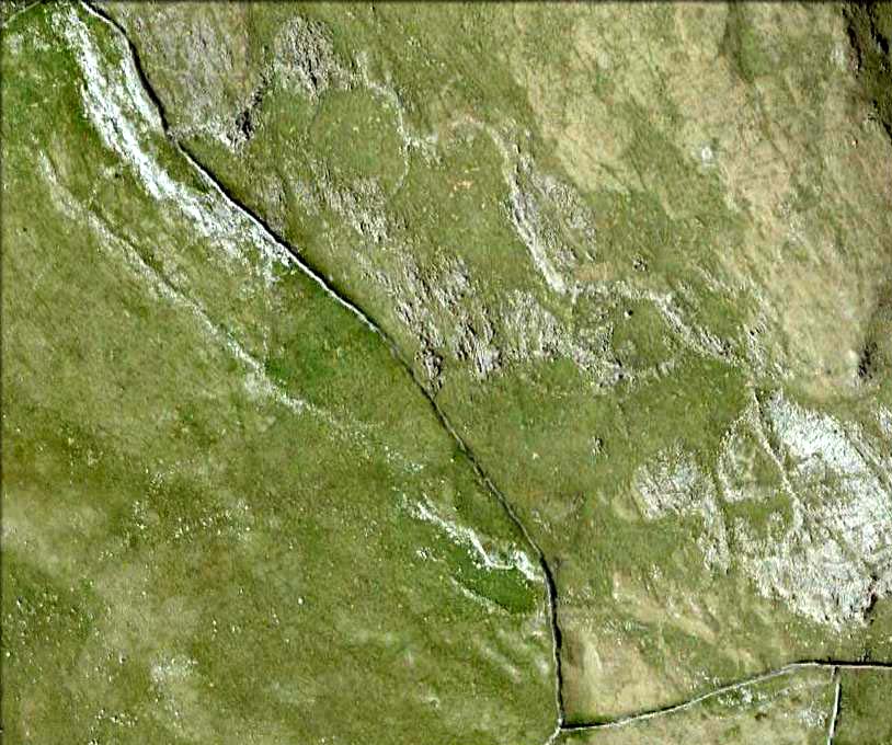
Torlery Edge from above

From Malham village, take the winding uphill road up Malham Rakes (not the Malham Cove road).  If you aint sure, ask a local.  Get to the top of the long winding road and,  a mile on, you meet with another single-track road on the top level known as Street Gate.  Stop here, then head across the grasslands on the left-side of the road, southwest.  There are a couple of footpaths running over the land here: I wouldn’t say it makes much difference which one you take as they take you in the right direction.  You’ll eventually meet the old craggy hilltop with the drystone walling down t’other side of it.  You’re here!

Archaeology & History

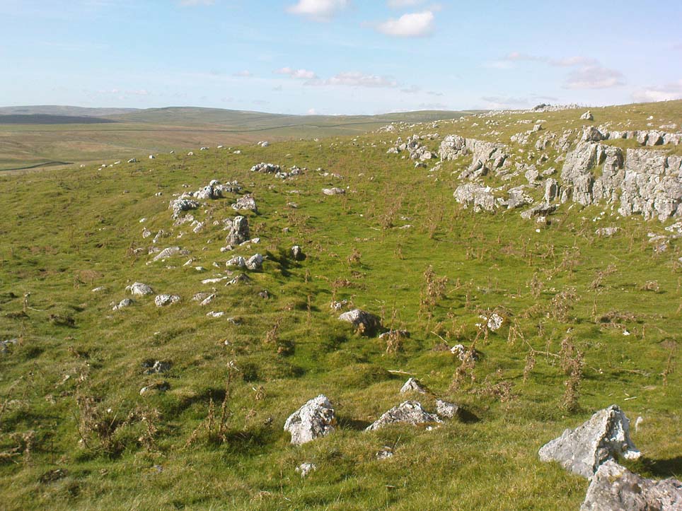
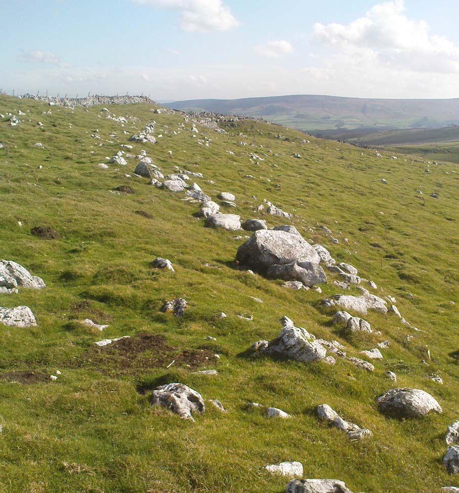
The history of this region seems to have been covered to a great deal by the likes of Arthur Raistrick and his mates, though I can’t find a specific entry in mi library about the remains we’re looking at here.  Surrounding the edges of the small hill, as can be seen in the aerial photo here, walling has clearly been built up around it, with considerable remains still visible at ground level, as indicated in the photos aswell.

Eastern edges of enclosure
Eastern walls, looking north

A settlement or large stone-walled enclosure, lying primarily on the north side of the drystone wall, measures approximately 82 yards north-to-south, and roughly 78 yards (72m) east-to-west, with a rough circumference around the outer edges of its rough elliptical outlines of more than 270 yards (250m).  Along the walled edges can clearly be seen several ‘hut circle’ remains: one in particular at the northeastern side and, more prominently, at the southeastern side, are in reasonably good states of preservation.  The northeasterly hut circle measures approximately six yards across.  The stone walls of this circle are more than a yard wide.  The ‘hut circle’ on the southeastern corner are more prominent and is in a better state of preservation, but much of the structure has of course been ruined to build the adjacent, more modern, drystone walls.  This circular structure is larger than its counterpart on the northeast, measuring some 13 yards across.

The southern edge of the main settlement walling has been built up against and onto a large length of bedrock running roughly east-to-west.  This inclusion of local geological features within man-made settlements and houses is a feature found all over Malham Moor and adjacent areas, for many miles around here. (see the Hammond Close settlement, for example)  The southernmost section of the Torlery Edge settlement is in a reasonable state of preservation, as is the length of walling along its eastern edge.  Along the northern section of the settlement it seems that an internal enclosure feature has been built (“perhaps for cattle?” would be the archaeologists usual query); whilst the western edges are the least visible part of this monument.

Hut circle on southern edges
Hut circle, looking north

If we now jump over the drystone wall running along the southern edges (and visible in the aerial photo above), we can see a series of six, perhaps seven, hut circles, all adjoining each other and running along the line of the wall.  Some of these are in a very good state of preservation and an excavation of these sites might prove fruitful. (unless it’s already been done – does anyone know?) Two of these hut circles have entrances clearly visible.  They are all roughly the same size and structure, with average diameters (from outer wall to outer wall) of 7 yards.  They consist of a rough ring of small upright stones, packed with smaller rocks and (in bygone times) peat and wood.  Sheltered from the north winds by the ridge above it and the extensive ancient enclosure walling (not the drystone, which in itself is very old), this row of prehistoric buildings were probably for members of the same tribal group.

Without excavation it’s difficult to date these hut circles, but they would probably have been used between the Bronze Age and Romano-British period.  There is every likelihood they were also used up to the medieval period, as this land was acquired (i.e. stolen) from local people by the Church and their law-bringers.  We know that much of the landscape hereabouts was possessed by Fountains Abbey in the 12th century, who made extensive use of the area for their cattle; and we find considerable evidence scattering these hills of medieval archaeological remains.

Although the site is catalogued as a separate site from, say, the settlement remains and enclosures we find at Combe Hill, Prior Rakes, New Close, and other field areas close by, this individual archaeological site must be assessed as part of a greater collective series of settlement remains hereby.  Instead of looking at this as an individual settlement, its relationship with the others in the vicinity needs re-evaluating and contextualizing and set within a wider and more realistic vision.  Whilst appreciating that detailed modern excavations have yet to be done in this region on a scale that is required (as with many of our northern archaeological landscapes), it is probable that this singular settlement was part and parcel of what was once a prehistoric city.

If you visit this particular site, spend a few days looking round at the many other settlements and prehistoric religious sites in the area.  And don’t forget to look and enquire as to why the Romans came and built a huge monument near the centre-edges of this domain of our prehistoric ancestors.  Tis a fascinating arena indeed…

References:

  1. Dixon, John & Phillip, Journeys through Brigantia – volume 2: Walks in Ribblesdale, Malhamdale and Central Wharfedale, Aussteiger: Barnoldswick 1990.
  2. Raistrick, Arthur & Holmes, Paul F., Archaeology of Malham Moor, Headley Bros: London 1961.

© Paul Bennett, The Northern Antiquarian


Rathgall Hillfort, Coolkenna, County Wicklow

Hillfort:  OS Grid Reference – S 9020 7315

Archaeology & History

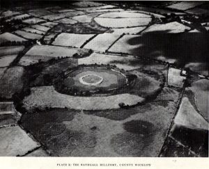
Early aerial photo of Rathgall hillfort

A prehistoric ‘fort’ with a long history behind it, with recent excavations finding burial and settlement remains from the Bronze- and Iron Ages.  The following article about this impressive archaeological site was written by Barry Raftery’s in an early edition of Antiquity journal (1970), following excavation work here.  He wrote:

“Rathgall is a large and imposing hillfort situated on the end of a long ridge some 6km east of Tullow, Co. Carlow.  It is sited impressively and commands a fine view on all sides.  The defences of the fort comprise four roughly circular, concentric ramparts.  The three outer banks, though largely overgrown, appear to be of earth faced with stone; the inner one is built entirely of granite boulders, many of considerable size.  The fort covers some 18 acres (c. 7 hectares); its overall diameter is about 310m. (Orpen 1911; 1913)

“Excavation in 1969 was confined, with the exception of one short trench, to the inner enclosure.  This is surrounded by the granite wall, dry-built and of poor quality.  It is made up of a series of straight lengths so that, though superficially the enclosure appears to be circular, it is in fact polygonal.  The entrance is a simple break on the western side.  The wall varies in thickness from 7m in the southeast, to 1.5m in the north, though the reason is not immediately clear.  In height the wall varies from 2m to 2.5m.  The minimum internal dimensions of the enclosure are 44m and 46m.

“About one-quarter of the enclosure was excavated in the northeastern quadrant.  A trench 2m wide and 20m long outside the wall and running into the interior was begun and this demonstrated the existence of occupation outside the wall.

“The first season’s excavation suggests the presence of at least three main phases of occupation on the site — Late Bronze Age, early Iron Age and Medieval.  The relatively thin soil covering on the site does not as yet allow the periods to be clearly defined stratigraphically.

“About 1500 objects came to light, over 1000 of them being pot-sherds.  The great majority belong to the Early Iron Age phase of occupation, apparently the period of densest settlement on the site.  As well as the remains of circular and rectangular structures, the excavation also revealed a number of very large hearths and a bank-and-ditch enclosure hitherto quite unsuspected.

“This latter feature partly underlay the granite wall.  The ditch had been filled in and the bank denuded before the construction of the wall.  The latter averaged about 50cm high and lay outside the ditch, which was dug carefully to a V-shaped section.  In width it varied from 1.5 to 3.5m at its edge and in depth from 75cm to 1.1m

“Bank and ditch enclosed an area about 35m in diameter.  So far no entrance to this enclosure has been distinguished, though there appears to be a gap in the south-east which may be an original opening.  It is noticeable that the bank runs, without a break, straight across the entrance to the stone enclosure, further emphasizing the lack of structural connection between the two features.

“The relationship of either of these enclosures to the outer lines of defence is not clear and so elucidation of this problem must await further excavation.  It seems, however, that the granite wall is a late feature and is probably of medieval date.  The massive outer ramparts, on the other hand, are more likely to belong to the Early Iron Age occupation of Rathgall.

“Over the whole area so far excavated indications of rectangular houses were frequent.  The walls of these houses were formed of timber posts, generally of no great size; they were set usually singly but sometimes in paris, in bedding trenches 30 to 40cm wide.  The upright posts presumably formed the framework of wattle-and-daub constructions.  There appears to have been extensive rebuilding, so that the plans are greatly confused and not always easy to interpret.  The houses were quite large: one of them was as much as 7.5m in length.

“These houses belong to the latest phase of occupation on the site and appear to be contemporary with the construction of the granite wall.  They were built on top of the fill of the ditch and were confined by the wall: there is no indication anywhere of house foundations running underneath the wall.  Green-glazed sherd from the fill of the bedding trenches suggests a 13th-century date for these houses and a late 13th-century silver coin points in the same direction.

“A circular bedding trench, apparently concentric with the large V-shaped ditch, was found in the centre of the stone-walled enclosure.  One-quarter of the bedding trench was exposed in the 1969 excavations.  In section it is roughly U-shaped and is 25cm wide and 30-35cm deep.  It encloses a space about 18m in diameter.  Its outer edge is for the most part lined with packing stones of medium size.  One metre inside this bedding trench and running concentrically with it for about one-third of the excavated arc there is a second bedding trench of similar type.  Whether these bedding trenches represent the remains of a large timber house of whether they were for a timber stockade is uncertain; further excavation may provide the answer to this problem.  As regards relative dating, however, it is clear that the circular structure, whatever it was, was earlier than the rectangular houses, for the bedding trenches of the latter lay above the trench for the former.  As well, some sherds of coarse ware of a date appreciably earlier than medieval times were found in the fill of the circular trenches.

“In turn, a huge oval hearth was found beneath the circular structure.  The hearth consisted of a steep-sided, flat-bottomed pit, 3.1m long and 1.5m wide, dug into the yellow subsoil.  A large quantity of black, burnt material came from the hearth and there appeared to be three main phases of use, each separated from the other by a layer of rough cobbling.  The hearth also produced sherds of coarse pottery, including two decorated fragments.  The decoration takes the form of one sherd of a row of finger-nail impressions and on the other a row of simple nicks in the edge of the rim.

“Large hearths of this type are, indeed, a feature of the site as a whole.  Five in all have so far come to light: one, especially elaborate, consisted of a large rectangular pit, 2.85m by 1.2m, dug 40cm into the subsoil.  At each corner there was a circular pit; two of these pits look like post-holes, the other two appear to be much too large to have served such a purpose.  All the hearths have produced coarse pottery and can thus be placed in their relative chronological position, though as yet none appears to be related specifically to any single structure on the site.  It may be that these were open-air hearths, covered by some sort of canopy.

“In addition to the hearths, the rectangular houses, the circular structure and the ditch and bank, a large number of post-holes were found.  Some of these were large, some small, but in no case could any positive pattern be established.

“The importance of the structural remains on the site is equalled by the significance of the material recovered.  The finds from the medieval period have already been referred to and the rectangular houses with which they were associated.  Before this there appears to have been a lengthy period when the site was not occupied.  The occupation before the beginning of this break appears to have been intensive.  It is characterized by large quantities of very coarse pottery.  This distinctive ware may be termed Freestone Hill Ware after the importance of the hillfort site of that name in County Kilkenny where the pottery was first isolated.  At this site it was associated with Roman bronzes of the 4th century AD and with a coin of Constantine II (Raftery, 1969).

“The sherds represent coarse, flat-bottomed, bucket-shaped pots, usually of a reddish, crumbly ware with very large grits.  Distinctive rims are characteristic: they are rounded, flat, T-shaped or internally bevelled.  At Freestone Hill a striking feature was the presence on many of the rim sherds of a row of small perforations; similar perforated rims are included in the Rathgall material.  In addition to the pottery, blue glass beads, bones, spindle whorls, portions of a lignite bracelet and many other objects of normal domestic refuse came to light.  A complete saddle quern was also found.  The most interesting of the Early Iron Age finds, however, was a small tinned strap-mount, beautifully decorated with a combination of openwork and incised curvilinear ornament of sub-La Tene type.  The art on this object has much in common with that on a bronze mount found at Freestone Hill and both appear to have a vital bearing on the transition from the true La Tene art of pre-christian times to the great flowering of art in Early Historic Ireland.

“Both at Freestone Hill and at Rathgall these decorated bronzes were associated with coarse pottery of identical type.  The pottery at the former site was dated to the mid-4th century and there, at least, the date is hardly in doubt.  It is possible to suggest a similar dating for the Wicklow material.  Coarse pottery of this type may, however, have had a fairly long life and indeed Freestone Hill may give but a central date for the group.

“Several points of some significance in relation to this pottery must be stressed.  Firstly, no excavated ring fort (rath) has ever produced this kind of ware — indeed, it is absent from any excavated site of the Early Historic Period in Ireland.  On the other hand, it is found increasingly in hillforts — to such an extent in fact, that it appears more and more to be basically a hillfort phenomenon.  Apart from the two sites referred to above, similar coarse sherds come from the hillforts at Clogher, Co. Tyrone, Emain Macaha, Co. Armagh, Downpatrick, Co. Down, and possibly also from Dunbeg in the same county.  In the present state of our knowledge therefore, it seems that Freestone Hill Ware may be regarded as characteristic of Irish hillforts: there is as yet no evidence for its continuation beyond the middle of the 1st millenium AD.

“The origins and ancestry of Freestone Hill Ware are matters which can hardly be discussed here, but pottery of this type without the perforated rims, may go back to pre-christian centuries.  Indeed, the indications at Emain Macha tend to confirm this possibility and Freestone Hill Ware may well have had its origins in the so-called Flat-rimmed wares of the Late Bronze Age in Ireland.

“This problem seems very real at Rathgall, since here are strong indications of Late Bronze Age activity.  This is the third of the three phases of occupation of the site.  Mould fragments of clay were recovered which were used in the manufacture of objects of Late Bronze Age type — swords, possibly spears and socketed implements with a rope moulding round the mouth of the socket.  The relationship of these fragments to any of the structures which were uncovered during the excavation is not clear.  In fact, apart from the mould fragments (and possibly the saddle quern) there is nothing else which can with certainty be assigned to a late Bronze Age context.  Some of the mould fragments came from the immediate vicinity of one of the large hearth, some from the fill of the ditch, and from the ditch also came the saddle quern.

“The presence of the mould fragments in the ditch is complicated by the discovery, in the very bottom, of fragments of pottery which seem to belong to that class known as Cordoned Ware which occurs in southwestern Britain and northwestern France in the centuries before and just after the birth of Christ.  It would seem then either that the mould fragments found their way into the ditch during an in-filling operation which took place at a time subsequent to the original Late Bronze Age occupation of the site, or alternatively that the pieces are contemporary with the Cordoned Ware, thereby suggesting a remarkable continuity of Late Bronze Age types in Ireland.

“At all events the construction of the ditch can be dated with reasonable certainty to the period of the Cordoned pottery.  Pottery of this type has never before been found in Ireland and its implications regarding Irish/British and Irish/Continental connections in the Early Iron Age — as well as having an important bearing on the development of the Irish hillfort — are considerable.

“The question of the date of the hearths is as yet a matter of some doubt.  It has already been pointed out that in one area  a hearth was overlain by both the circular enclosure and the much later rectangular structures.  This hearth at least belongs to any early phase of the occupation of the site and since all the five hearths so far revealed by excavation are not apparently associated with specific structures and have several points in common, such as size and details of construction, it seems reasonable to suggest that they may be broadly contemporary.

“All the hearths produced coarse ware and it therefore seems to be of prime importance to be able to distinguish between the Freestone Hill type of pottery of the Early Iron Age and the pottery to which the name Flat-rimmed Ware has been given and which is dated to the Late Bronze Age.  It may be that both are in the same developmental tradition and it is hoped that further work on the hillfort at Rathgall will help to elucidate the problem involved.”
References:

  1. Harbison, Peter, Pre-Christian Ireland, Thames & Hudson: London 1989.
  2. Raftery, Barry, “The Rathgall Hillfort, County Wicklow,” in Antiquity journal, volume 44 (no.173), March 1970.

Links:

  1. Rathgall Hill Fort on Irish Antiquities
  2. Rathgall Hillfort on Megalithic Portal

© Paul Bennett, The Northern Antiquarian


High Close Pasture, Grassington, North Yorkshire

Settlement:   OS Grid Reference – SE 003 652

Also known as:

  1. The Circus
  2. Druid’s Altar
  3. Druid’s Circle

Getting Here

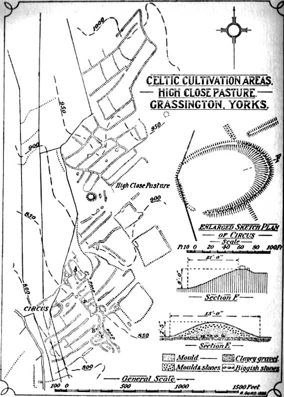
Curwen’s 1928 plan

Easy enough to locate.  In Grassington go up the main street a coupla hundred yards, turning left up past the small church, taking the footpath on your right heading up to the fields that stretch to the north.  Don’t mistake the remains of the medieval village that you’ll pass for the Iron Age and Romano-British site that we’re heading for, another coupla hundred yards up.  You’ll notice a lot of old low walling structures on the slopes heading up above you.  That’s the stuff!

Archaeology & History

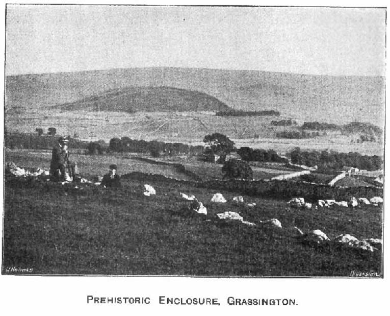
Despite the industrial devastation of the landscape on the hills around here, this entire area still teems with prehistoric archaeological remains, making you wonder just how much more once existed in this region.  In bygone days Prof Anne Ross thought this region to be the capital of northern England in Iron Age days.  She could be right: in just about every nook and cranny of small valleys and rivulets we find evidence of ancient people everywhere for miles around, settlement upon settlement in every direction you take.  The remains found here at High Close Pasture typifying the examples any ardent antiquarian will come across in this region of upper Wharfedale.

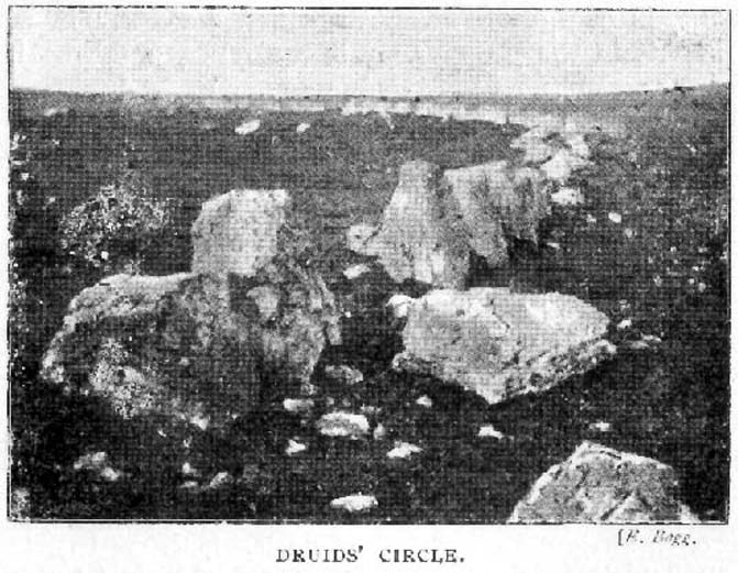
Druid’s Circle (Bogg 1904)
Earliest known photo in 1899

The settlement remains and ancient cultivations at High Close have been described by various writers over the last hundred years, with Edmund Bogg (1902) calling the most notable of the remains here the ‘Druid’s Altar’ (not to be confused with the other Druid’s Altar at nearby Bordley); a title that was similarly described as “The Druid’s Circle” when Eliot Curwen surveyed the area.  It is also locally known as ‘The Circus’, after it being a place where celebrated events once took place. This Druid’s Circle section is,

“an oval area 150 feet long by 75 feet wide. It consists of a bank surmounted by a single or double-row of flat-topped stones about one-and-half feet high by 2 feet wide… This may have been a communal meeting place of the Iron Age folk, who cultivated these fields, and who lived in isolated huts.” (Elgee & Elgee 1933)

The notion of the circle being a communal meeting place was echoed by Mr Curwen (1928) in his slightly more detailed description of this place.  He told that the interior of the Druid’s Circle had been levelled:

“It lies eight feet below the surrounding banks to the northeast and east, to which it rises with a gradient of 8 in 21.  The bank to the north is less high, while to the south and west  the arena, while seperated from it by the bank, is above the level of the sloping hillside.  The encircling bank is surmounted by a single (and) double row of stones for three-fourths of its extent.  These are apparent to the east and south, but are less so to the west, as along this side a stone wall has been built actually along the bank of the Circus; the stones belonging to this bank are, however, quite clear below the footings of the wall.  From northeast round by south to southwest the row of stones is double.  Those in the inner row, forty-six in number, stand some eighteen inches high; they are about two feet wide and are flat-topped, the line is almost continuous, and in parts the stones are placed edge to edge.  A second row of smaller stones backs the larger ones.  Entrance is obtained to the central level area by a gap to the southwest.  No fosse surrounds this earthwork.  To the southeast, a lynchet four feet high runs off it, while to the north a low stoney bank runs off in a NW direction, and one of the larger stony banks approaches to within a few feet of the northwest.”

In the fields above, particularly on the east and north of this notable ruined stone ring, the extensive “cultivation pastures” as they’ve been called, are evident all over the place.  Hut circles and copious other antiquities can all be found within a square mile of this spot.  If you like your Iron Age archaeology, this area will knock yer socks off!

…to be continued…

References:

  1. Bogg, Edmund, Higher Wharfeland, James Miles: Leeds 1904.
  2. Charlesworth, Miss D., ‘Iron Age Settlements and Field Systems,’ in Archaeological Journal, volume 125, 1968.
  3. Curwen, Eliot, ‘Ancient Cultivations at Grassington,’ in Antiquity, June 1928.
  4. Elgee, Frank & Harriett, The Archaeology of Yorkshire, Methuen: London 1933.
  5. Raistrick, Arthur & Chapman, S.E., ‘The Lynchet Groups of Upper Wharfedale, Yorkshire,’ in Antiquity, June 1929.
  6. Speight, Harry, Upper Wharfedale, Elliott Stock: London 1900.

© Paul Bennett, The Northern Antiquarian