St. Mary’s Well, Callander, Perthshire

Holy Well:  OS Grid Reference – NN 6507 0556

Also Known as:
  1. Canmore ID 24322

Getting Here

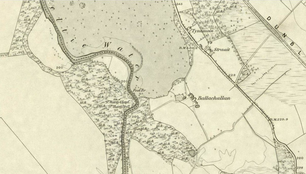
St Marys Well on 1862 OS-map

You’ll need wellies or no shoes for this excursion! From the lovely town of Callander, take the A84 road southeast out towards Doune and Stirling for a mile or so. Keep your eyes peeled for Straid by the roadside on your left and the turning right down to Ballochallan quarries. About 200 yards down, notice the industrial works on your left. Walk about 50 paces past this, then turn right into the trees.  Less than 100 yards in, you’ll hit a shallow bend in the River Teith. Walk across and into the trees opposite…and if you amble just yards above the edge of the river, along the tree-line, you’ll find St. Mary’s Well…

Archaeology & History
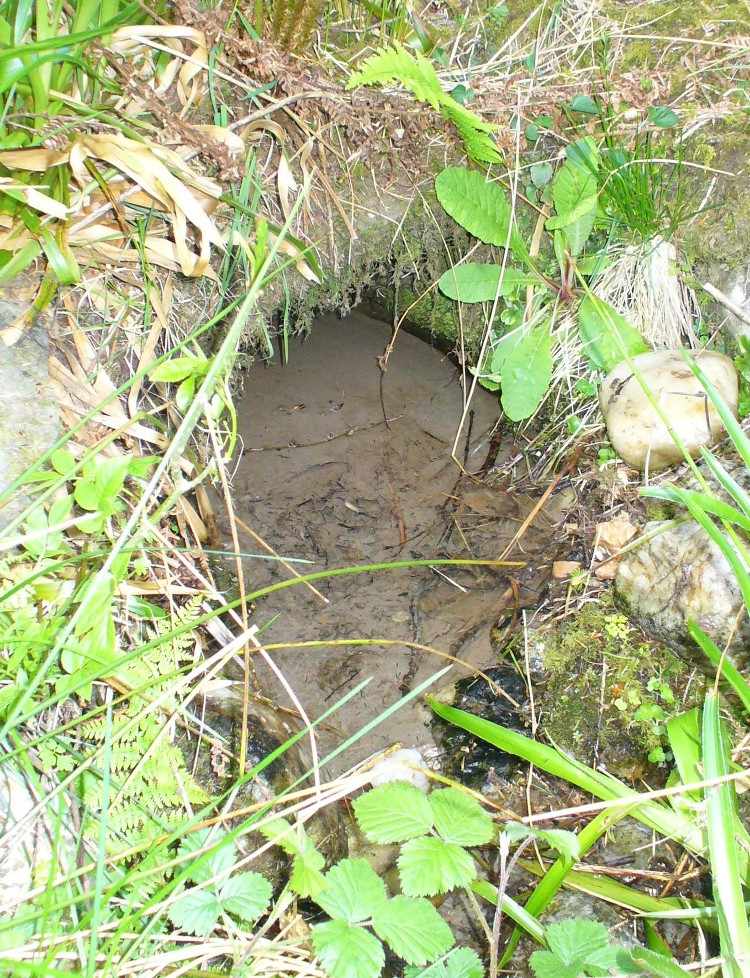
Fresh waters of the quartz-lined spring

Highlighted on the 1862 Ordnance Survey map of Callander and cited in the Object Name Book of the same year, oddly there is no mention of this mythic site in the Scottish surveys on holy wells (MacKinlay 1894; Morris 1981) — which seems rather unusual considering the importance this legendary entity (St. Mary) possessed in the christian pantheon.

There is also some doubt about the precise position of this holy well.  According to the Royal Commission account, the well “is stone lined; it measures 0.9m in diameter, and is choked with fallen leaves.”  However, this appears to be the remains of a latrine (or “a bog,” as my northern tongue so eloquently exclaimed soon after finding it), now used more by frogs to lay their spawn in which their tadpoles thankfully emerge (as we found when visiting it last week).  The holy well itself is about 10 yards further along the edge of the river and has a most curious architectural feature to it.
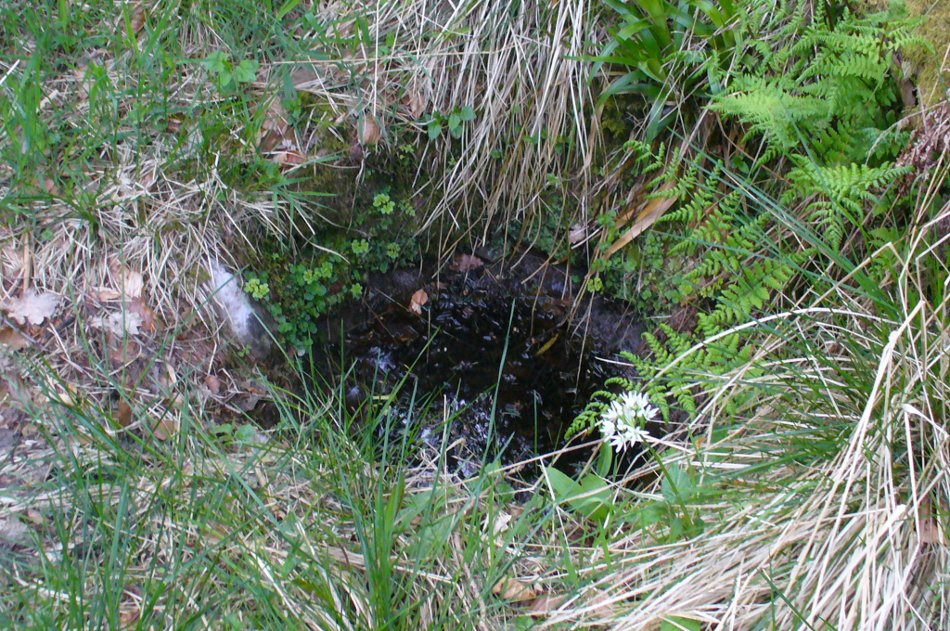
Stone-lined "well" 10 yards west of the real one
Stone-lined “well” 10 yards west of the real one

When we found the place, much of it was very overgrown indeed and it took a while to recover its status.  But in doing so, we found that on all sides where the stone-lining marked the emergence of the waters, rocks large and small consisting almost entirely of quartz constituted the opening as it came out of the ground.  This was a very deliberate construction feature no less!  Also, the fine sandy silt which clogged up the waters were also found to have small pieces of quartz laying beneath it, seemingly as offerings that had been made here many years ago.  But on the whole there seemed little evidence that the well had been used ritually for many years.  So, once we’d cleaned up the debris and made the site more notable, I drank its waters and found them very fine and refreshing indeed!

In the trees behind the well you will find the overgrown remains of the old chapel, also dedicated to St. Mary.  The tranquility and spirit of this place would have been truly superb. Even today, it is an ideal retreat for meditation and spiritual practice.  It just seems such a curious mystery that nothing seems to be known of the place…

Folklore

The 1862 “Object Name Book” told that the waters here were renowned for having great healing properties.  St. Mary’s feast day was August 15 and great were the country fairs and rituals surrounding this period across Scotland and beyond — many of which may have supplanted the more arcane festival of Lammas.  However, local records are silent about any such events performed at Callander’s St. Mary’s Well.  Do any old locals know more about it…?

References:

  1. MacKinlay, James M., Folklore of Scottish Lochs and Springs, William Hodge: Glasgow 1893.
  2. Morris, Ruth & Frank, Scottish Healing Wells, Alethea: Sandy 1982.

© Paul BennettThe Northern Antiquarian


Bengengie North, Alva, Clackmannanshire

Enclosure:  OS Grid Reference – NN 86680 00601  

Getting Here

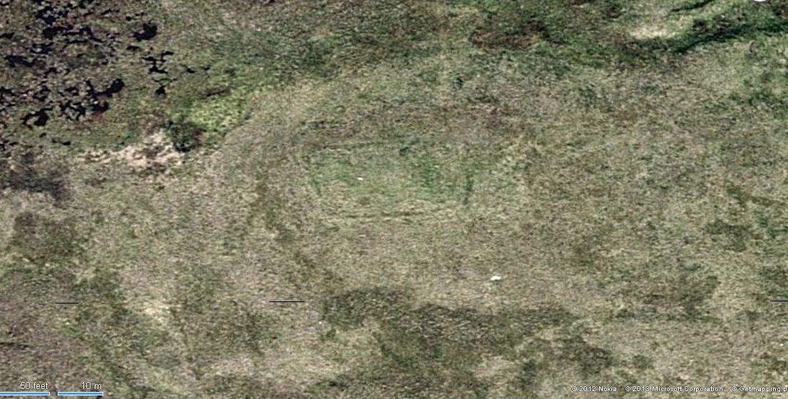
Aerial view of Bengenie enclosure

This really take a lot of effort to find. From Alva, go up through the graveyard past St. Serf’s Well, turning left and across cross the lane. A gate into the field takes you past Rhodders Farm then up the zigzagging track up the steep hill called The Nebit and into the Ochils. Where the track stops zigzagging, keep your eyes peeled for a left turn (west) about 1000ft up. Go along this, parallel above Alva Glen, for about 2 miles till you reach the sheep fanks. Naathen – go straight uphill towards Bengengie peak, steering to the right (north) side, avoiding the cliffs and onto the level moorland. Once there, you’ll see a rounded hillock a coupla hundred yards ahead. That’s the spot!

Archaeology & History

Southeastern corner of the ditch & bank

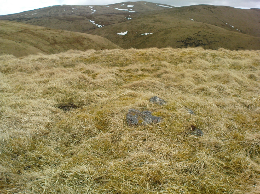
This is a bittova long hike to see a very overgrown site – but if you really enjoy the hills, it’s a good little side-track to visit.  I came across it recently on a long bimble over the Ochils, on my way back home after travelling to three of the Ochil peaks.  Walking carefully across the swampy heights of the Menstrie Moss, a rounded hillock north of Bengengie seemed to have the pimple of a cairn on its top—so I veered over to have a look.

The cairn was small and overgrown, with just a half-dozen rocks visible above ground, and a collection of others in the same pile beneath the heathland grasses.  It was obviously a man-made assemblage, but I couldn’t say for sure whether this was the grave of a person or someone’s favourite sheep a few centuries back!

Small cairn inside the enclosure

It was when I walked around the cairn to try and get some photos of it, that another very distinct feature—not immediately visible—stood out and gave this single cairn a series of additional ingredients that really brought this site to life!  For just a few yards east of the cairn I noticed an obvious ditch and outer embankment, running roughly north-south, which may have relevance to the pile of stones.  And so I walked along the edge of the embankment, for about 10 yards, only to find that it turned to the right and continued onwards, east-west, for some distance.  This then turned at a similar angle again about 30-35 yards along, and then again, and again, until I returned to where I had stood initially a few minutes earlier!

There was no doubt about it: this was a man-made, roughly rectangular-shaped enclosure, whose bank and ditch averaged 1-2 yards across.  The maximum height of the outer embankment is less than 3 feet.  Its eastern and western lengths measured roughly 17-18 yards long, and the longer lengths north and south were between 30 and 35 yards at the most.  The cairn feature that I’d initially noticed is found at the near-eastern edge of the enclosure. Apart from that, my initial ramble here indicated few other internal features that were visible, except several small stones.

Southern line of bank & ditch, running left to right
Eastern section of ditch & bank, looking north

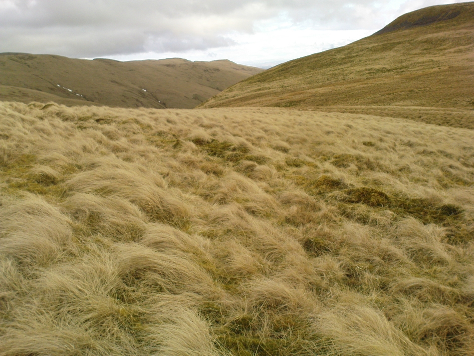
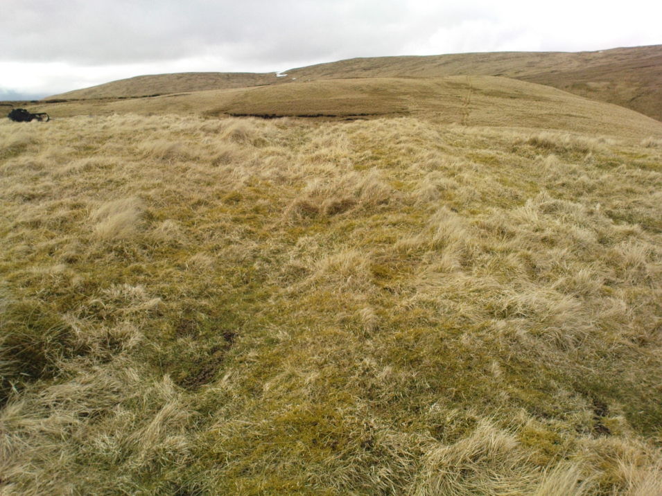
The great majority of the site is very overgrown and, as you can see, the photos of the ditch and bank constituting the enclosure are sadly not that easy to make out.  You can see it mostly by the colour changes of the vegetation, running in lines either across or up through the middle of the photos.  I need to get up there again and try get some better images sometime soon—and also to see if there are other features hiding away on the heights of these old hills, long since said to have been the abode of one of the great Pictish tribes (there is also a considerable mass of old faerie-lore in these hills, indicating considerable ancient activity of people whose cosmos was inhabited by spirits and forms long since forgotten in the consensus trance of most moderns).

As for the age of the enclosure: it’s difficult to say on first impression and I’m not keen on making a guess on this one.  It’s certainly old, as the overgrown vegetation clearly shows, both on the photos and when you see it first-hand.  It’s already been suggested by one graduate as possibly neolithic, but I’m a little sceptical about that, as its linearity isn’t consistent with neolithic features we know about in the mid-Pennines. However, this geographical arena is new landscape for me and so the possibility remains open until better, more competent investigation gives us a clearer time period.

© Paul BennettThe Northern Antiquarian


Leaston House, Humbie, East Lothian

Cup-and-Ring Stone (lost):  OS Grid Reference – NT 483 634

Also Known as:

  1. Canmore ID 54771

Archaeology & History

The lost Leaston carving

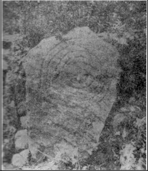
The concentric ring carving shown here was found on the north side of the large gardens at Leaston House early in the 20th century.  It was first reported by the Royal Commission (1924) boys, who told us that the small free standing stone measured 2½ feet long and was 1¾ feet wide, consisting of 5 concentric rings about 15 inches across.  No central cup-marking existed in the middle of this carving — like the Grey Stone at Harewood and a small number of other multiple-ringed petroglyphs. No other notes were made about any other associated monuments.  The carving was included in Ron Morris’ (1981) survey, with no real additional material.   Although the Canmore report told that the carving could be found “in a rockery bordering the lawn north of Leaston House,” its present whereabouts remains a mystery.

Only known photo of the stone

This is one of a number of cup-and-ring stones that have been ‘lost’, either through destruction or through some dood simply taking it for their own private collection (a practice even the modern rock art student, Paul Brown, has openly admitted in one of his books).  Not good.  This lost Leaston Hall carving was probably “acquired” by some local and probably rests either in their garden or hall somewhere.  If anyone knows where it hides, please tell us — as this is an important carving.

References:

  1. Morris, Ronald W.B., “The cup-and-ring marks and similar sculptures of Scotland: a survey of the southern Counties – part 2,” in Proceedings of the Society of Antiquaries, Scotland, volume 100, 1969.
  2. Morris, Ronald W.B., “The Cup-and-Ring and Similar Early Sculptures of Scotland; Part 2 – The Rest of Scotland except Kintyre,” in Transactions of the Ancient Monuments Society, volume 16, 1969.
  3. Morris, Ronald W.B., The Prehistoric Rock Art of Southern Scotland, BAR: Oxford 1981.
  4. Royal Commission on the Ancient & Historical Monuments of Scotland, Inventory of Monuments and Constructions in East Lothian, HMSO: Edinburgh 1924.

Acknowledgements:

With thanks to Janet Donaldson-Elder for the place-name correction!

© Paul Bennett, The Northern Antiquarian

Boiling Springs, Cambusbarron, Stirlingshire

Healing Wells (destroyed):  OS Grid Reference – NS 77 91

Archaeology & History

Old drawing of the lost wells

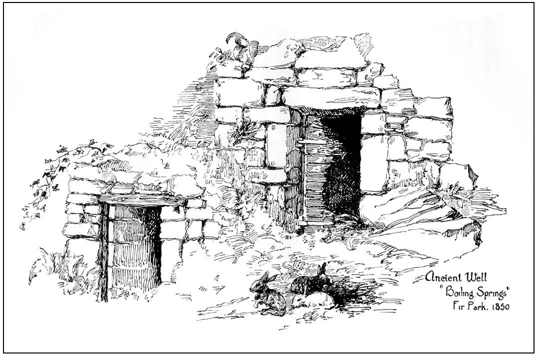
The old line drawing here is all that remains of a pair of healing wells that once bubbled up within their ancient stone well-houses, close to each other, in the middle of the old woods west of Stirling in the massive quarries at Gillies Hill.  It’s possible that the large pools of water that are now in the overgrown quarries are thanks to these ancient wells; although one of them was close to the old building of Fir Park, whose overgrown remains are within the woods at grid-reference NS 7787 9124.  Very little has been written about these wells, but thankfully the local historian Mr Fleming (1898) captured their demise in his lovely antiquarian work, saying:

“The sketch, opposite (taken in 1850) of the picturesque wells, then situated in a marshy dell and surrounded by a dense pine wood near to the ancient ‘Boiling Springs’, now dried up by the sinking of the lime pits, and immediately off the old bridle road from Stirling to Glasgow by Murrayshall, shows very ancient remains of wells connected with the original water supply of Stirling by lead pipes from ‘Lessfeerie Springs’, situated in the Touch Hills.  This supply was begun in 1774, and thus antiquity and interest are given to the sketch.  These wells, with their fringes of mosses and ferns and bramble bushes, are now, with the pine wood, demolished, and the whole face of the district changed by the operations in a quarry recently opened up in Gillies Hill crag, causing the locality to be now unrecognizable.”

References:

  1. Fleming, J.S., Old Nooks of Stirling, Delineated and Described, Munro & Jamieson: Stirling 1898.

© Paul Bennett, The Northern Antiquarian


St. Corbet’s Well, Touch, Stirlingshire

Holy Well:  OS Grid Reference – NS 738 925

Archaeology & History

This little-known holy well on the northeastern edges of the Touch Hills is another part of our ancient heritage that may well have been lost.  All that now remains are the literary remnants telling of this once important site, around which local socio-religious elements occurred from time to time.  When the local historian J.S. Fleming (1898) wrote about the site, it had already disappeared, and was himself fortunate to recover information relating to its former existence. He told:

“My attention has been drawn to an article which appeared in the Stirling Journal of 31st October, 1834, describing what is claimed to be a Holy Well dedicated to Saint Corbet, or probably Saint Cuthbert.  The well was situated in Touch Glen, not far from Gilmour’s Lynn, and was, even at that time, reduced to a spring one foot deep and three or four feet in circumference, surrounded by boggy ground.  The writer states that there were people then alive who had resorted to this Well in their younger days.  Its virtues were restricted to one hour in the year, and that the hour of sunrise on the first Sabbath of May; the supposition being that by drinking of its waters at the Well by the adventurous pilgrims to such a wild and lonely spot at early sunrise, the devotee was assured of the preservation of his life during that year.  We have never come across this Saint’s name, but Saint Cuthbert had an altar in the Rude Kirk (High Church of Stirling) and, as for the Well, from its diminishing condition in 1834, its site no doubt has long been obliterated.”

It is possible that some remnant of the waters here can still be found, or are known about, by dedicated local practitioners—but without their aid, this sacred site may be forever lost…

Folklore

In Thomas Frost’s (1899) essay on the holy wells of Scotland, he echoed what Mr Fleming had told, saying:

“Of St. Corbet’s Well, on the top of the Touch Hills…it was formerly believed that whoever drank its water before sunrise on the first Sunday in May was sure of another year of life, and crowds of persons resorted to the spot at that time, in the hope of thereby prolonging their lives.”

This restorative folklore element, implicit in the nature of water itself, was obviously related to the cycles of renewal in the social activity of our peasant ancestors, as found in every culture all over the world. (Eliade 1959; 1989)

One account relating to the disappearance of St. Corbet’s Well told that it fell back to Earth as the spirit of the site was insulted by profane practices.  Janet & Colin Bord (1985) told that:

“This theme, of real or imagined insult to the well causing it to lose its power, move its location, or cease flowing altogether, is widespread.  St. Corbet’s Well on the Touch Hills (Stirling) was said to preserve for a year anyone who drank from it on the first Sunday in May, before sunrise, and it was visited by great crowds at the height of its popularity.  But the drinking of spirits became more popular than the drinking of well water, so St. Corbet withdrew the valuable qualities of the water, then eventually the water itself stopped flowing.”

References:

  1. Andrews, William (ed.), Bygone Church Life in Scotland, W. Andrews: London 1899.
  2. Bord, Janet & Colin, Sacred Waters, Granada: London 1985.
  3. Eliade, Mircea, The Sacred and the Profane: The Nature of Religion, Harcourt, Brace & World: New York 1959.
  4. Eliade, Mircea, The Myth of the Eternal Return, Arkana: London 1989.
  5. Fleming, J.S., Old Nooks of Stirling, Delineated and Described, Munro & Jamieson: Stirling 1898.
  6. Frost, Thomas, “Saints and Holy Wells,” in Bygone Church Life in Scotland (W. Andrews: Hull 1899).
  7. Morris, Ruth & Frank, Scottish Healing Wells, Alethea: Sandy 1982.
  8. “W.H.”, “St Corbet’s Well,” in The Stirling Antiquary, volume 3, 1904.

AcknowledgementsWith thanks to Ray Spencer for pointing out the Sacred Waters reference. Cheers Ray!

© Paul Bennett, The Northern Antiquarian

Butt Well, Stirling, Stirlingshire

Healing Well:  OS Grid Reference – NS 7894 9389

Also Known as:

  1. Spout Well

Getting Here

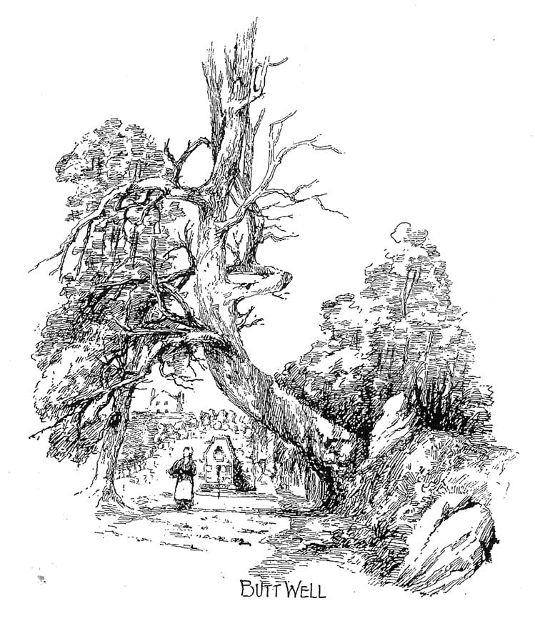
Butt Well in 1898
Butt Well in 1898

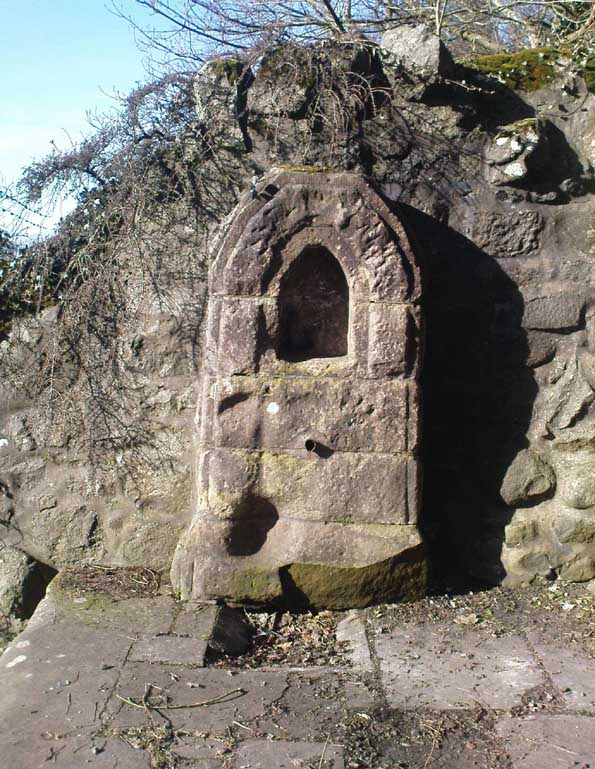
Said by John Allan (1907) to be “at the base of the Brandy Hill, about 210 yards west from the parish church,” to get to it from the town centre Stirling Arcade, go across and along the Corn Exchange Road and as it goes down the slope, take the path that leads into the trees on your right-hand side.  Follow this path along to the bottom of the woods.  Once on the level at the bottom, walk on the path in the direction of Stirling Castle and eventually you’ll reach the fancy walling with the dried-up well right in front of you!

Archaeology & History

This much-neglected site got its name from there being a number of archery shooting targets, or butts, which used to be erected in the fields immediately below this once popular drinking spot.  Although the Stirling historian J.S. Fleming (1898) could find no definitive records of the place as a holy or healing well, he told how,

“The copious spring arising in the centre of the rock on which Stirling Town and Castle are built, must have been extensively used during the Royal occupation of the Castle for watering the horses engaged in hunting in the Park…and it must also have been the source from whence the canal or ornamental waters and fountains in the ancient pleasure-grounds of the King’s Knot were supplied, the fall being amply sufficient  for the rise to a considerable height of the latter… The Well had at one time a railing surroundings its then open trough, the marks of the lead used in grouting the rails remaining visible until the last alteration.”

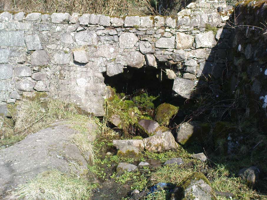
The waters emerging in the field below
The Butt Well

Early accounts of the Butt Well are few and far between.  Ronald James (1899) found it to have been known in earlier centuries as the Spout Well in 1582, but additional descriptions of the place are scant.  The well is not included in the surveys of either MacKinlay (1893) nor the Morris’ (1981), though John Allan (1907) thinks that this site was a “congenial retreat” where “the bard of the chief” would gain insight.  The remains of walling behind the old well he thought may have been the ancient remains of an old hermitage of sorts, but there’s little evidence to prove this.   Today, although dried-up, the site appears much it as did when Fleming described it:

“The Well has had the old wall — formed of granite boulders — rebuilt and cemented, and a rustic ornamental freestone front put on where the spout is inserted, but its stone seat for invalids and other surroundings remains as they were forty years ago.  The Well formed the termination of the early morning walk of the town’s folk for a draught of its cold water, and was at a late period used by the wives and washerwomen of Stirling for washing their clothes, which were then bleached on the green sward lying below the Well, the tenant of the park making a charge according to the extent of the washing.”

If you go behind the walling here you’ll notice a small flow of water which emerges into the field below.  The waters from here, although only a trickle, are still cold, fine and refreshing.

References:

  1. Allan, John, The Days of the Monasteries and Latter Days of Stirling, Stirling 1907.
  2. Fleming, J.S., Old Nooks of Stirling, Delineated and Described, Munro & Jamieson: Stirling 1898.
  3. Ronald, James, Landmarks of Old Stirling, Eneas MacKay: Stirling 1899.

© Paul Bennett, The Northern Antiquarian