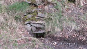
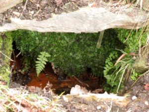
Tammy Mill’s Well, Laurieston, Falkirk, Stirlingshire

Healing Well (lost):  OS Grid Reference – NS 910 790

Also Known as:

  1. Tammy Milns Well

Archaeology & History

This all-but-forgotten site situated somewhere on the north side of Lauriston was mentioned in Falkirk’s Notes & Queries (1906) journal, but its whereabouts is somewhat of a mystery (to me at least!).   In a series of question and answers about the site, the editor of the journal, James Love, told us:

“Mr Charles Brown, factor to the Marquis of Zetland, kindly informs us that on a late occasion there passed through his hands a copy of a feu contract by the Right Honorable Francis Lord Napier in favour of Alexander Cowie, brewer, at New Merchiston (now Laurieston), of a piece of ground lying to the north of Mary Street.  This is dated 7 August, 1762 and contains the following clause:  ‘Providing also that the said Alexr Cowie and his foresaid have the Liberty of the water of Tammy Milns Well in common with the said Lord Napier’s other vassals ay New Merchiston.'”

The well was mentioned again in 1781 with similar historical information.  As to the name of the well, Mr Love wrote,

“it would appear, from the circumstance, that an old infirm man belonging to the village, called Thomas Mills or Milns, used to sit with his wooden cup at the spring which flowed from the face of the hill, over which the present structure now stands, and served out to the weary passers-by the cooling and refreshing draught for any small pittance they in their generosity might think proper to give him.  After the lands of Lauriston passed into the hands of Sir Laurence Dundas, he took the advantage of such a copious supply of what then was pure water, and built the present reservoir over the spring, and had it conveyed to Kerse House by means of leaden pipes.”

But he fails to tell us what “the present structure” was that covered the well, nor the whereabouts of the “reservoir over the spring”; and as there’s no such feature on any of the Ordnance Survey maps at the time he wrote his article, nor beforehand, I remain puzzled as to its exact position.  This situation isn’t helped by the earlier description, which said it was found on “a piece of ground lying to the north of Mary Street”.  There are two wells literlly on the other side of Mary Street, but Kerse House meanwhile—whose water supply came from the well—is about 1½ miles to the north!  All in all there are more questions than answers here.  Added to this, in John Reid’s (2009) magnum opus on local place-names, the site is mentioned, albeit in passing, where he gives us the vague grid-reference of just NS 91 79, but this may just be educated guesswork on his part.  It would be good to know exactly where it was…

References:

  1. Love, James (ed.), “Tammy Mills (or Milns) Well, Laurieston”, in Local Antiquarian Notes & Queries, Falkirk – volume 1, 1906.
  2. Reid, John, The Place-Names of Falkirk and East Stirlingshire, Falkirk Local History Society 2009.

© Paul BennettThe Northern Antiquarian

Allt a’ Choire Chireinich (06), Ben Lawers, Kenmore, Perthshire

Cup-Marked Stone:  OS Grid Reference – NN 65309 39553

Getting Here

Allt a’ Choire Chireinich 6

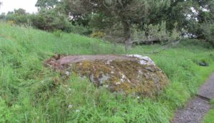
Follow the directions to reach the faint but impressive Allt a’ Choire Chireinich (04) petroglyph.  Standing here, you’ll notice the large boulder that looks as if it’s fallen down the slope immediately to your left.  You can’t really miss it.

Archaeology & History

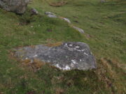
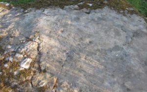
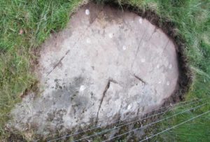
Beneath the gorgeous excess of ancient lichens you can make out at least three cup-marks on the south-facing sloping rock-face in the top-half of the boulder.  There may be some other faint cups on here, but due to the lichens they are very difficult to see, so I’m erring on the side of caution regarding their veracity.  This is another one of those carvings likely to be interest only to the most ardent petroglyphic nuts amongst you.

© Paul BennettThe Northern Antiquarian
Allt a’ Choire Chireinich (05), Ben Lawers, Kenmore, Perthshire

Cup- Marked Stone:  OS Grid Reference – NN 65305 39555

Getting Here

Allt a’ Choire Chireinich 5

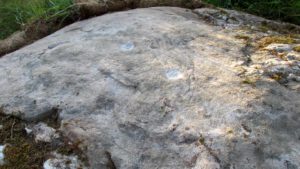
Follow the directions to reach the faint but impressive Allt a’ Choire Chireinich (04) petroglyph.  Standing here, look straight down at the dried-up burn barely ten feet below you, where you’ll see a small sloping rock.  That’s it!

Archaeology & History

Nothing much to see here apart from a single shallow cup-marking.  Most likely of interest only to the most ardent petroglyphic explorer.

© Paul BennettThe Northern Antiquarian

Ellen’s Well, Blair Drummond, Stirlingshire

Healing Well:  OS Grid Reference – NN 7196 0080

Getting Here

Ellen’s Well on 1856 map

This takes some finding!  From the village of Doune take the A84 road towards Stirling and, just over the bridge barely 100 yards along, on your left, walk down the track past the old lodge house.  350 yards along, up the slope on your right where young trees and an excess of boscage prevails, walk up through it until, about 10 yards below an overgrown path at the top, beneath a raised section of old stonework, an old pipe protrudes from the undergrowth.  The small spring of water that emerges 10 yards beneath this, amidst the brambles and reeds, is what you’re looking for.

Archaeology & History

Wells named ‘Ellen’ usually have a long and sacred history behind them, but this one seems unusually silent.   Apart from being shown on the 1866 OS-map—simply as a ‘Well’—it is only mentioned briefly in Mr Mackay’s (1953) survey of Doune, being not far from the Clans Well, and in his day it was “still in use.”  But not anymore!  The water is barely running, but the trickle that still exists is nice and clear and it tastes good.  It’s seen much better days though….

‘Ellen’s Wells’ tend to have one of three origins, being either 1) dedicated to St Helen, whose festival date is August 18; (2) named after or dedicated to the Elder tree (Sambucus niger); or, (3) named after a local person of this name.  At some wells it may be two of these elements with their relative mythologies complimenting each other, overlapping between heathen peasant lore and early christian folklore. This has been the case at a number of St Helen’s Wells I’ve surveyed in Yorkshire and Lancashire.  At this site however, there are no remaining Elder trees, meaning that its name relates to one of the two other options; but without any extant historical references to St. Helen hereby, we must conclude that at some point in the dim and distant past, a local lady called Ellen found her name immortalized in this all-but-forgotten sweet spring.

References:

  1. Mackay, Moray S., Doune Historical Notes, privately printed: Doune 1953.

Acknowledgements:  The map accompanying this site profile is Reproduced with the kind permission of the National Library of Scotland

© Paul BennettThe Northern Antiquarian


Brae of Cultullich (6), Aberfeldy, Perthshire

Cup-and-Ring Stone:  OS Grid Reference – NN 8818 4906

Getting Here

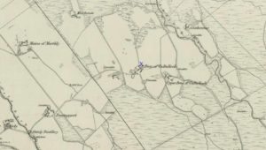
X supposedly marks the spot

Out of Aberfeldy, take the A826 road as if you’re going up Glen Cochill.  Not far up, just where the housing of Aberfeldy itself ends and the green fields open up either side of you, keep on the road for a half-mile where you meet a small copse of trees on your left, with a dirt-track that runs down the slope.  Go along the track for 0.8 miles (1.3km), past the Ursa Major Stone and where the track splits, go left past the Quartz Stone and follow the track through the farmyard.  It’s somewhere there – or is supposed to be!

Archaeology & History

On our visit here, we couldn’t locate the cup-and-ring stone that’s described in Sonia Yellowlee’s (2004) regional rock art survey.  She described it, as archaeologists always do, in the briefest manner, telling us simply:

“Leaning against a pile of rubble in the farmyard there is a split boulder bearing eighteen cupmarks, one of which is ringed.”

It may have been destroyed, as we were told by a couple of locals that there used to be “a real miserable sod” living there.  When we visited the place and tried to ask the present farm owner, sadly he wasn’t to be found.  If any rock art explorer manages to locate this seemingly lost cup-and-ring, please let us know – and mebbe send us some photos so that we can add them to this site profile. 😉

References:

  1. Yellowlees, Sonia, Cupmarked Stones in Strathtay, RCHAMS 2004.

Acknowledgements:  Big thanks to the crew – this time being Neens Harris, Paul Hornby & Frank Mercer.  And the stunning resource of Scotland’s 1st edition OS-maps is Reproduced with the kind permission of the National Library of Scotland

© Paul BennettThe Northern Antiquarian


Quartz Stone, Brae of Cultullich, Aberfeldy, Perthshire

Cup-Marked Stone:  OS Grid Reference – NN 88104 49001

Also Known as:

  1. Brae of Cultullich (4)

Getting Here

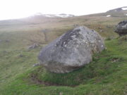
The cupmarked Quartz Stone

Out of Aberfeldy, take the A826 road as if you’re going up Glen Cochill.  Not far up, just where the housing of Aberfeldy itself ends and the green fields open up either side of you, keep on the road for a half-mile where you meet a small copse of trees on your left, with a dirt-track that runs down the slope.  Go down here and follow the slightly meandering track for 0.8 miles (1.3km), a short distance past the Ursa Major Stone where the track splits.  Take the track to the left and there, less than 100 yards on you’ll hit a large boulder on your left.  That’s it!

Archaeology & History

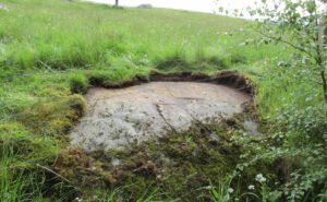
Not previously recorded, this simple cup-marked stone will probably only be of interest to petroglyph aficionados, or those folk who are into  ‘energies’ at sites.  This latter aspect is due entirely to the carving being etched onto a huge rock, much of which is composed of quartz—which isn’t too unusual in this part of the world.  But that aside…

Looking down at the cups
The cupmarks highlighted

It is one in a group of carvings within a few hundred yards of each other, with its nearest neighbour 20 yards to the north.  That one’s covered in cups—but on this large Quartz Stone, only two of them exist, on the top near the centre.  Just a couple of inches across and half-an-inch deep, they’re pretty clear once you see them.  The raised piece of ground behind the stone is artificial and has variously been described by antiquarians and archaeologist alike, as either a prehistoric dun, or a stone circle.  Whatever it may be, some of it is certainly man-made.  Check it out – and mebbe ask the friendly fat fella who lives nearby what he thinks.

© Paul BennettThe Northern Antiquarian


Ursa Major Stone, Brae of Cultullich, Aberfeldy, Perthshire

Cup-Marked Stone:  OS Grid Reference – NN 87958 49022

Also Known as:

  1. Brae of Cultullich (3)

Getting Here

The stone from the trackside

Out of Aberfeldy, take the A826 road as if you’re going up Glen Cochill.  Not far up, just where the housing of Aberfeldy itself ends and the green fields open up either side of you, keep on the road for a half-mile where you meet a small copse of trees on your left, with a dirt-track that runs down the slope.  Go down the track, bending to the right, then the left and then on for a quarter of a mile until the lines of trees appear either side of you.  Barely 200 yards along, the track swerves slowly to your right, and the field above you slopes uphill.  Keep your eyes peeled at the fencing on your right and you’ll see a stone sloping towards you right by the fence with faint cupmarks on it.  You’ll find it!

Archaeology & History

A truly fascinating cup-marked stone recently uncovered by Paul Hornby on another one of our TNA meanderings. Fascinating because of the curious arrangement of the cups on the stone.  Often, cup-marked stones have little to interest the causal visitor – but this one’s different.  As can be seen quite clearly, the cups are arranged in the shape of the constellation of the Great Bear, or Ursa Major – albeit with an extra ‘star’ in this design.  But it’s damn close!  In all likelihood (he says with his sceptical head on 😉 ), the design is fortuitous when it comes to the Ursa Major.  I know from many years experience how easy it is to see meaningful shapes and designs in the almost entirely abstract British petroglyphs, but the design is very close to the constellation we all got to know when we were kids.

Looking along the stone
Gazing down at Ursa Major

The stone itself slopes upwards at an angle of about 60º, before starting to level out as it rises.  All of the cupmarks have been pecked onto this sloping surface (the vast majority of carvings are found on top of stones).  Altogether, at least twelve faint and shallow cups were exposed when we looked at it—measuring the usual inch to inch-and-half across—but it is likely that more of them are hidden beneath the turf at the top of the stone.  We could discern no rings or other features in the design.

This is just one carving amidst a good cluster of petroglyphs within a few hundred yards of each other (the Quartz Stone being one of the nearest) that are well worth checking out if you like your rock art.  It may also be of interest to astronomy students, or those exploring archaeo-astronomy.

References:

  1. Yellowlees, Sonia, Cupmarked Stones in Strathtay, RCHAMS 2004.

© Paul BennettThe Northern Antiquarian


Auchinellan, Ford, Kilmartin, Argyll

Standing Stone:  OS Grid Reference – NM 86681 03320

Also Known as:

  1. Achadh nan Carradh
  2. Achnacarra
  3. Canmore ID 22802

Getting Here

Two stones on 1875 map

Unless you’re venturing down the tiny Loch Awe roads, the easiest way here is to turn right off the A816 Lochgilphead-Oban road, 1½ miles north of Kilmartin.  Go along this winding minor road for literally 2½ miles where, after coming out the tree-lined road, just past the small Loch Ederline, the fields re-appear on both sides of the road.  Just here, where the trees end, just a few hundred yards before the hamlet of Ford, in one of the field on the left, you’ll see a tall upright stone.  That’s it!

Archaeology & History

I was very fortunate, many years ago, to live in the old farmhouse of Auchinellan in the trees by this ancient stone.  It became a companion of mine many-a-time, as I sat with it in rain and mist and darkness sometimes, beneath the bright Moon.  It always had a good feeling about it.  And so when a small bunch of us visited here again recently, it was almost as if I’d never been away.  Tis a magickal part of our landscape.

The old stone looking N
The old stone looking NW

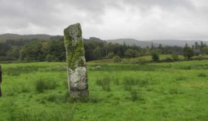
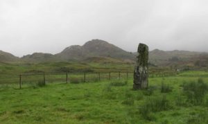
Standing ten-foot-tall on a grassy plain with craggy hills all round, this old fella once had a companion close by its side—a stone one!  Accounts of it are curious to say the least, with one telling us that it was only “a few inches high” – which is just daft.  The now-lost stone was in fact about six-feet tall and the story of its disappearance was that it was moved into the grounds of Auchinellan House where I used to live, somewhere in the garden.  I could never find it, and local folk told me that the old fella who lived in the mansion would have known about it, but died shortly before I moved in.  Clive Ruggles (1984) told that it could be found at grid-reference NM 8653 0268, but that would be smack bang on the manor house.

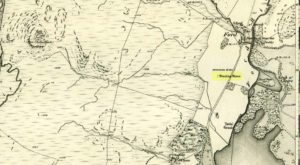
As far as I can tell, the first written testimony of this stone was by the Ordnance Survey lads after they’d visited here in 1871 and, several years later, highlighted it on their maps. (above)  On this is clearly shown, just yards apart, the two standing stones.  Much later, when the Royal Commission (1988) doods did their survey, they described the stone in their usual brief way:

“Situated on the top of a slight rise in a pasture field 270m SW of the Ford Hotel, there is a standing stone which measures 0.7m by 0.55m at the base and rises with straight sides to a flat top at a height of 3m…”

The site was included in Thom’s (1990) major survey on prehistoric stone rows where, again, only a brief description is given, saying:

“On a terrace near Loch Ederline is a standing stone which leans to the E.  It is 9ft 6 (2.9m) high.”

It’s a beautiful place in a beautiful setting and is one of countless prehistoric monuments in this part of Scotland.  Well worth having a look at.

Folklore

The Gaelic names for this site—Achnacarra and Achadh nan Carradh—means “the field of the burial stone”, which relates to the folklore of the stones reputedly marking the place of an ancient grave.

References:

  1. Campbell, Marion, Mid Argyll – An Archaeological Guide, Dolphin: Glenrothes 1984.
  2. Campbell, Marion & Sandeman, M., “Mid Argyll: An Archaeological Survey,” in Proceedings Society of Antiquaries Scotland, volume 95, 1964.
  3. Royal Commission on the Ancient & Historical Monuments of Scotland, Argyll – Volume 6: Mid-Argyll and Cowal, HMSO: Edinburgh 1988.
  4. Ruggles, Clive L.N., Megalithic Astronomy, BAR: Oxford 1984.
  5. Thom, Alexander, Thom, A.S. & Burl, Aubrey, Stone Rows and Standing Stones – volume 1, BAR: Oxford 1990.

Acknowledgements:  Big thanks to Neens Harris, Paul Hornby & Frank Mercer.  And the stunning resource of Scotland’s 1st edition OS-maps is Reproduced with the kind permission of the National Library of Scotland

Links:

  1. Auchinellan (Ford) Stone on The Megalithic Portal

© Paul BennettThe Northern Antiquarian


Mineral Well, Glen Lyon, Perthshire

Healing Well:  OS Grid Reference – NN 72110 47768

Also Known as:

  1. Iron Well

Getting Here

Mineral Well, Glen Lyon

From Fortingall village, head west and turn down into the incredible beauty that is Glen Lyon.  As you enter the trees, a half-mile along you pass the small gorge of MacGregor’s Leap in the river below.  2-300 yards pass this, keep your eyes peeled for an old small overgrown walled structure on the left-hand side of the road, barely above the road itself.  A large tree grows up above the tiny walled enclosure, within which are the unclear waters that trickle gently….

Archaeology & History

In previous centuries, this all-but-forgotten spring of water wasn’t just a medicinal spring, but was one of the countless sites where sympathetic magick was practised.  The old Highlanders would have had a name for the spirit residing at these waters, but it seems to have been lost.  The site is described in Alexander Stewart’s (1928) magnum opus on this stunning glen, where he wrote:

“Still a few yards more and Glenlyon’s famous mineral wishing well is seen gushing up, surrounded by its wall of rough stones now sadly in need of repair.  It has a stone shelf to receive the offerings of those who still retain a trace of superstition or like to uphold old customs as they partake of its waters.  The offerings usually consist of small pebbles, but occasionally something more valuable is found among them. The roadmen may clear that shelf as often as they like, but it is seldom empty for long.”

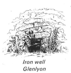
A local lady from Killin told us that she remembers the stone above the well still having offerings left on it 20-30 years ago. Hilary Wheater (1981) sketched it and called it the Iron Well.

Close-up of the waters (photo by Paul Hornby)
Hilary Wheater’s sketch

The waters in this small roadside well-house actually emerge some 50 yards up the steep hillside (recently deforested) and in parts have that distinct oily surface that typifies chalybeates, or iron-bearing springs – which this site is an example of.  Its medicinal properties would help to people with anaemia; to heal women just after childbirth; to aid those who’d been injured and lost blood; as well as to fortify the blood and stimulate the system.

Across the road from the well, Stewart (1928) told of a giant lime tree that was long known to be the meeting place for lovers (perhaps relating to the well?), and the name of the River Lyon here is the Poll-a-Chlaidheamh, or ‘the pool of the sword’, whose history and folklore fell prey to the ethnic cleansing of the english.

References:

  1. Stewart, Alexander, A Highland Parish, Alexander Maclaren: Glasgow 1928.
  2. Wheater, Hilary, Aberfeldy to Glenlyon, Appin Publications: Aberfeldy 1981.

© Paul BennettThe Northern Antiquarian


Katie Thirsty’s Well, Logie, Stirlingshire

Sacred Well:  OS Grid Reference – NS 81787 97653

Getting Here

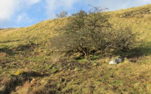
The scraggy hawthorn of Katie Thirsty’s Well

Not too tricky to locate, as long as you get onto the right footpath!  Take either road (both steep narrow and very bendy in places!) up from Logie on one side or Bridge of Allan on the other, towards Sheriffmuir and head to the Faerie or Highlandman’s Well.  About 150 yards before this, note the small car-park.  From here, go through the gate as if you’re walking to Dumyat, but 50 yards along the footpath it splits into two.  Take the lower right-hand path and keep walking for another 600 yards until you see a large worn hawthorn tree on your left, with boggy land just in front of it that runs to the path you’re walking on.  That’s it!

Archaeology & History

‘Katie Thirsty’ is a most intriguing character who pops up at a number of healing wells, primarily in Scotland.  Dedications to her are known near Abernethy, Falkirk, Innerleithen, Killearn, Kilsyth and elsewhere, with one example just over the Scottish border in Northumberland.  So who was she? And what’s the story behind this little known example, close to the ruinous Iron Age village east of Dumyat?  The truth is, we don’t know for sure as yet.  Tales are told of a local lady called ‘Katie’ at the wells near Abernethy and Kilsyth, each with their own domestic myth—but it seems that a wider mythic status underlies this dedication.

One very fine notion comes from the pen of Pictish researcher Ronald Henderson (2008; 2014), who tells that the name derives from a corruption of both St. Katherine of Alexandria [Katie] and the Pictish King, Drust or Drustan [Thirsty].  The latter etymological postulation finds faith in the fact that the great crags of Dumyat less than a mile to the east is universally credited with being the last Pictish stronghold at the old hillfort there.

The flowing clear waters

…This well on the hills north of Logie village—with its old hawthorn for companion above the old path to medieval Fossachie village—flows nicely, and its freezing waters are very good to drink.  Twenty yards east of the boggy overflow are the overgrown remains of an isolated Iron Age ‘homestead’ or hut circle, and the waters of Katie Thirsty’s Well would have been the primary drinking supply to the people living there in ancient times.

Very little is known about the specific history or folklore of the site and it is mentioned only in passing by David Morris (1935) who told us simply:

‘“Katie Thirty’s Well’ was the old name of a clear spring on the hillside by the track leading to Dumyat.”

It’s a beautiful spot to visit, with lovely views for many miles to the east, south and west.  If you’re going to visit the Fairy or Highlandman’s Well nearby, take time to visit Katie Thirsty’s refreshing flow too.

As for Katie herself: does anyone have their own ideas about her…?

References:

  1. Henderson, Ronald W., Rex Pictorum – The History of the Kings of the Picts, Perth 2008.
  2. Henderson, Ronald W., “Drust… of the Hundred Battles,” in Celtic Guide, 3:4, April 2014.
  3. Morris, David B., “Causewayhead a Hundred Years Ago,” in Stirling Natural History & Archaeological Society Transactions, 1935.

© Paul BennettThe Northern Antiquarian