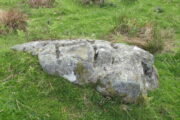
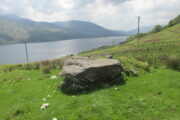
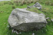
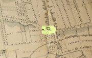
Skerray Mains, Torrisdale, Sutherland

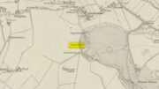
Souterrain (lost):  OS Grid Reference – NC 6601 6315

Archaeology & History

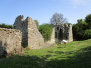
In the middle of the 19th century the opening to a prehistoric souterrain used to be in evidence on the north-side of the single track road running past old Skerray Mains house.  It was mentioned in Hew Morrison’s (1883) historical guide, albeit briefly and without ambiguity:

“Below the house of Skerra Mains is an artificial cave that enters from below the road and extends 40 or 50 yards in length.  Two urns were found it when it was discovered but they soon crumbled away on being exposed to the air.”

More than thirty years later, the Royal Commission (1911) lads ventured to check it out, only to find that it had just recently been covered up:

“At the farm of Skerray Mains is an earth-house, the mouth or entrance to which was recently exposed by the farmer.  It is situated about 15 feet distant from the northeast window of the dwelling-house, and is now entirely covered over again.”

Of the old locals I met here, only one of them remembers hearing of it, but the precise location of its entrance had been forgotten.  Surely it aint gonna be toooo difficult to find it again?

References:

  1. Morrison, Alex, “Souterrains in Sutherland,” in J.R. Baldwin’s Province of Strathnaver, SSNS: Edinburgh 2000.
  2. Morrison, Hew, A Tourist’s Guide to Sutherland and Caithness, D.H. Edwards: Brechin 1883.
  3. Royal Commission on Ancient & Historical Monuments, Scotland, Second report and inventory of monuments and constructions in the county of Sutherland. HMSO: Edinburgh 1911.

© Paul BennettThe Northern Antiquarian

St. Mungo’s Well, Peebles, Peeblesshire

Holy Well (destroyed):  OS Grid Reference – NT 2523 4045

Archaeology & History

St Mungo’s Well, 1858 map

Highlighted on the 1858 OS-map, two-thirds the way up the High Street, this long forgotten sacred well was described by the Ordnance Survey lads in their Name Book (1856) as “an excellent spring”—and no doubt an ever-flowing one, even in the greatest of droughts.  But it had already been destroyed when they came here.  It was mentioned in passing by William Chambers’ (1856), who described it as a “public fountain” dedicated to old Mungo, a.k.a. St Kentigern.  But its position in the High Street wasn’t where it originally emerged.  Local tradition told it was once on the slopes of Venlaw immediately north of the town, possibly making it into the folklore category of “Wells that Move”—usually because the spirit of the place has been offended.

But in truth, little is known about its mythic history.  Its origin seems, as with so many ancient sites, entangled in what Dr Gunn (1908) in his definitive work on the history of Peebles church explained, the heathen “superstitious regard for fountains”, pre-dating the christian dedications.  St Mungo himself, said Gunn,

“is remembered in Peebles to-day by his holy well upon the slopes of Venlaw, hallowed by its use in the Sacrament of Baptism.”

It’s profane history tells simply that, in 1728, its waters were piped into the trough on High Street for public use.  It became damaged sometime in the early 19th century, but some remains of the  stonework were found when roadworks were done here in 1845.  It would be good if we could recover further information about this important holy well.

References:

  1. Chambers, William, A History of Peeblesshire, W. & R. Chambers: Edinburgh 1864.
  2. Gunn, P., The Book of Peebles Church, A. Walker: Galashiels 1908.

© Paul BennettThe Northern Antiquarian 


Bishop’s Well, Stow, Midlothian

Holy Well (destroyed):  OS Grid Reference – NT 4598 4454

Archaeology & History

At the edge of the ruins known as the Bishop’s Palace, up the slope behind the ruined church in Stow, could once be seen the waters of the Bishop’s Well which, wrote Thomas Wilson (1924), fed the palace hereby and was used by the clergy.  Apart from a barely discernible circular depression at the edge of the old manse ruins, no trace of this site remains.

References:

  1. Royal Commission Ancient & Historical Monuments, Scotland, Inventory of Monuments and Constructions in the Counties of Midlothian and West Lothian, HMSO: Edinburgh 1929.
  2. Wilson, Thomas, The Stow of Wedale, Aberdeen Newspapers 1924.

© Paul BennettThe Northern Antiquarian

College Well, Brechin, Angus

Sacred Well:  OS Grid Reference – NO 5945 6006

Archaeology & History

College Well on 1865 map

Highlighted on the 1865 OS-map, this lost water source was located between the Brechin cathedral/round tower and the curiously-named St. Michael’s Mount, whose history seems to be lost.  It would seem to be the well which Ruth & Frank Morris (1981) name as the ‘Ancient Well’ in their survey.

Folklore

The reason behind this site being classified as a sacred (or holy) well is based on the tradition that the Culdees had a religious convent here in the 12th century and, according to David Black (1839),

“This convent is believed to have stood a little to the west of the present parish church, in the gardens now belonging to the kirk-session, still called “the College Yards.”  A small well of delightfully pure water in these gardens receives the name of the College Well, and is reported, by tradition, to have been the well of the Culdee convent.”

On the issue of St. Michael, students of folklore will know that, in the christian cult, he was an early dragon-slayer.  His annual commemoration day is September 29.  One of his shamanistic functions “relates to the very old tradition of Michael as the receiver of the souls of the dead.” (Attwater 1965)

References:

  1. Black, David D., The History of Brechin, Alexander Black: Brechin 1839.
  2. Gibson, Colin, Folklore of Tayside, Dundee Museum c.1968.
  3. Morris, Ruth & Frank, Scottish Healing Wells, Alethea: Sandy 1982.

© Paul BennettThe Northern Antiquarian

Acknowledgements:  Huge thanks for use of the 1st edition OS-map in this site profile, Reproduced with the kind permission of the National Library of Scotland

Falls of Monzie (7), Crieff, Perthshire

Cup-Marked Stone:  OS Grid Reference – NN 88737 26366

Getting Here

The site in the landscape

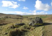
A couple of miles east of Crieff, take the A822 road from the Gilmerton junction towards the Sma’ Glen.  After literally 1¾ miles (2.8km)—just 100 yards before the track up to Connachan Farm—you’ll reach a dirt-track on your left that leads into the hills.  Go on here and after an easy walk of 400 yards or so, you’ll reach the conspicuous boulder known as the Falls of Monzie (6) stone.  Two or three yards to its side is a large flat stone.  That’s it!

Archaeology & History

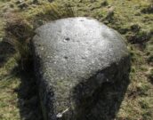
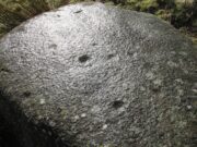
This large flat smooth earthfast rock, is possessed of a number of very faint cup-marks.  Altogether there are at least nine cup-marks, most of which are closing in to the middle of the stone, with other single cups near the western and southern edges.

The faint cupmarks
Close-up of cups

Near the middle of the rock, one cup has an equally faint semi-circular arc, just visible on the photos here.  Close-up photos of this semi-circle seem to suggest it was more complete in ages gone by, but the erosion is such that it’s difficult to say with any certainty. (possibly the computer-tech kids could give us a bit more certainty).  The nearest other carving with more definite cup-and-rings can be found on the Falls of Monzie (8) stone, about 200 yards to the west.

© Paul BennettThe Northern Antiquarian


Chapel Well, Clackmannan, Clackmannanshire

Holy Well:  OS Grid Reference – NS 9125 9122

Archaeology & History

Chapel Well on 1866 map

A little-known holy well on the south-side of the village has seen better days – if indeed it’s still there!  Located 500 yards due south of the destroyed Lady Well, this spring of water gained it name, according to local lore, from its proximity to an ancient chapel—remains of which have been frugal to say the least!  Shown on the earliest Ordnance Survey maps and continued to be shown until the 1950s, it seems that the first written account of it was in the Object Name Book of 1861 where it was told:

“A Spring well adjacent to Chapelhill.  It is cut in a freestone rock, from which issues a constant supply of pure spring water even in the dryest Seasons.  It is not impregnated with any Kind of Mineral.  A Chapel Stood near it at one time, the site of which Cannot be pointed out by any person in the neighbourhood.”

A visit by one of the Ordnance Survey lads here in 1950 found the well to be blocked-up by silt and soil; and on a quick visit I made here today I could find no remains of the well, but it may have been beneath the mass of excessive vegetation.  A subsequent visit in the winter may prove more fruitful – he sez, hopefully…..

© Paul BennettThe Northern Antiquarian

Denny Bridge, Denny, Stirlingshire

Cist (destroyed):  OS Grid Reference – NS 808 830

Archaeology & History

A small and seemingly prehistoric grave, or cist, destroyed sometime around 1840, once existed on the top of a large hillock close to the River Carron where the bridge leads from Dunipace to Denny.  Thankfully, memory of its existence was preserved by Robert Watson (1845) in his short description of Dunipace parish.  He first began by talking of some large natural mounds on the eastern side of the township which, folklore told, gave rise to the place-name Dunipace; but from those mounds,

“About two miles to the westward of these hills, there was a very beautiful one about forty feet in height, and covering nearly three roods of ground, said also to be artificial.  This hill was mutilated, from time to time, for the purpose of repairing roads and other purposes.  It was entirely removed about six years ago, to form an embankment on the turnpike road near Denny bridge. The strata of which this hill was composed, were carefully observed during its removal. These were so regular, and as if rising out of, and gradually returning again to similar strata in the circumjacent level ground, as to afford conclusive evidence that the hill was not the work of man.  On the top of this hill, and about three feet below the surface, was found a coffin or tomb, composed of five large un wrought stones, in which were the bones of a human body, scull and teeth not much decayed.  Along with these, was a vase of coarse unglazed earthenware, containing a small quantity of material resembling the lining of a wasp’s nest, probably decayed paper or parchment, which in the lapse of ages had assumed that appearance.  No conjecture could be formed about the individual here interred, tradition being entirely silent on the subject ; but this circumstance corroborates the opinion of some writers, that the hills of Dunipace might have been used as burying-places for ancient chiefs.”

The site was included in the Royal Commission’s (1963:1) Inventory, but they found no additional data about it.

References:

  1. Royal Commission on the Ancient & Historical Monuments Scotland, Stirling – volume 1, HMSO: Edinburgh 1963.
  2. Royal Commission on the Ancient & Historical Monuments of Scotland, Archaeological Sites and Monuments of Stirling District, Central Region, Society of Antiquaries of Scotland 1979.
  3. Watson, Robert, “Parish of Dunipace,” in New Statistical Account of Scotland – volume 8, William Blackwood: Edinburgh 1845.

© Paul BennettThe Northern Antiquarian 

Wester Glentarken (2), St Fillans, Comrie, Perthshire

Cup-Marked Stone:  OS Grid Reference – NN 66431 24782

Getting Here

Singe cup-mark, near the middle of the stone

Follow the same directions as if you’re visiting the Wester Glentarken (1) carving, but some 10-15 yards before reaching it, you’ll notice this smaller rock with a series of curious naturally-eroded features on it.

Archaeology & History

This rounded stone has a series of natural deep cracks and undulating geological features on its surface, some of which look like elongated man-made cup-marks—but they’re not!  The only man-made ingredient on this stone is the deep single cup-mark close to the centre of the stone, as you can see in the photo.  That’s it—nowt else!

© Paul BennettThe Northern Antiquarian

Wester Glentarken (1), St Fillans, Comrie, Perthshire

Cup-Marked Stone:  OS Grid Reference – NN 66412 24783

Getting Here

Cupmarked stone in situ

1½ miles out of St Fillans on the A85 road to Lochearnhead you’ll reach the boating marina by the lochside.  A hundred yards or so past this, park up.  Cross the road and walk 50 yards to your right then follow the dirt-track up into the trees.  After ⅓-Mile (0.5km) turn left to the old house on your left and follow the green path around it, then around the right-side of the rocky knoll in front of you.  Once you’re on the level ground around the knoll, walk forward for less than 100 yards.  Y’ can’t really miss it!

Archaeology & History

4 of the 5 main cups

A simple design, but a clear one, of four deep cup-marks which can be seen on the eastern side of the stone, with a solitary one—much more faint—just over the rise on the more western section of the rock.

There are a number of other large sections of rock around the knoll with what appear to be cup-markings of various forms, but apart from perhaps one or two exceptions, the vast majority of them—as Currie (2005) also noted—seem to be natural.

References:

  1. Currie, George, “Wester Glentarken, Perth and Kinross (Comrie parish), cup-marked rocks,” in Discovery & Excavation Scotland, vol. 6, 2005.

© Paul BennettThe Northern Antiquarian

Lady Well, Dundee, Angus

Holy Well (destroyed):  OS Grid Reference – NO 4026 3072

Also Known as:

  1. Ladies Well
  2. Our Lady’s Well

Archaeology & History

Lady Well on 1776 map

One of at least five sacred wells that could once be visited in Dundee: like its compatriots they have all fallen under the hammer of the Industrialists and flow no more.  Our Lady’s Well could once be seen near the ancient Chapel of our Lady, “flowing from under the Chapelshade Braes,” said Maxwell (1884), its waters “bright and sparkling,” but today it has been drained and laid to rest beneath the road.  Its memory however, has been preserved in the modern place-names of the Ladywell Roundabout and the nearby Ladywell Avenue.

The well was mentioned as far back as 1409 when, as Alex Lamb (1895) found, it was referred to in a contract between the Constable of Dundee and the burgesses.  It flowed freely until the beginning of the 18th century when, as Maxwell told us, “the water from the Lady well was impounded and conveyed in pipes for supplying other cisterns throughout the town.”  Nicoll (1923) thought there may have been a well-house built around it.  Previously, the water from here was one of many springs and burns that fed the larger Castle Burn down to the sea.

The generally approved idea that Lady Wells derive from St Mary was questioned in this instance in Colville’s (1822) survey, who thought, not unreasonably, that

“As a convent stood near the same place, it is more probable that it took the name of the Ladies-well, from the fair sisterhood, who must have been the guardians of it and of all the places near them.”

He may be right.  Colville also brought attention to a second water supply close by that seemed to be of equal importance in a pragmatic sense as the Lady Well herself.  In danger of being destroyed, the author brought attention to it and insisted on securing its survival.  He wrote:

“A little to the west, and adjoining to the Lady-well, is a large garden lying on a gentle declivity, called the Lady-well Yard,— in which there is a most abundant spring of excellent water, that was never known to fail in the driest summer, even when the Lady-well was so drained as not to afford supply to the inhabitants.  Should this be employed for a steam-engine in the present prosperous state of manufactures, a pit for the water would require to be sunk, which might materially injure the Lady- well.  It would certainly, therefore, be of advantage to the town, if the Magistrates could procure this property,— which would prevent the Lady- well being endangered; and the addition of this copious spring would at all seasons afford a plentiful supply of excellent water to the town.”

References:

  1. Colville, A., Dundee Delineated, A. Colville: Dundee 1822.
  2. Lamb, Alexander C., Dundee: Its Quaint and Historic Buildings, G. Petrie: Dundee 1895.
  3. Maxwell, Alexander, The History of Old Dundee, David Douglas: Edinburgh 1884.
  4. Nicoll, Alexander, The First History of Dundee, D. Winter: Dundee 1923.

© Paul BennettThe Northern Antiquarian