Cartington Cove, Rothbury, Northumberland

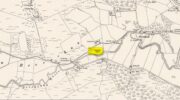
Cup-and-Ring Stone (destroyed):  OS Grid Reference – NU 0444 0186

Archaeology & History

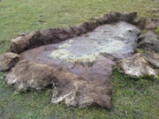
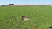
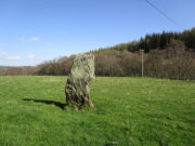
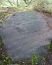
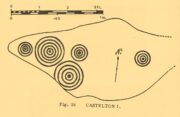
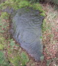
In an area teeming with prehistoric sites from the neolithic and Bronze Age periods, we had a rare example here of some cup-and-rings that had been carved within a small cave or rock shelter of some kind.  Sadly it got destroyed in the mid-19th century due to quarrying operations—but not before George Tate (1864; 1865) had a final sniff of the place and was very lucky to see some of the remains before they finally bit-the-dust.  He told us:

“The great sandstone ridge ranges from Eglingham and Beanley across the central part of the county towards Rothbury, near to which is a cave in the rock called “Cartington Cove;” concentric circles with central hollows were incised within this cave.  Mr. Williamson of Alnwick, from whom I had this information, played around them when a boy more than fifty years ago; and they were then popularly called “Cups and Saucers.”  Nearly all of them have been destroyed by the wedges and hammers of quarrymen; but on visiting the spot in 1859, I found sufficient traces to confirm Mr. Williamson’s testimony.”

But they were gone a few years later thanks to the lads at the quarry.  Although the site was subsequently described in Beckensall’s modern surveys (1992; 2006), nothing more was found about them.

Folklore

Whilst David Dixon (1903) reiterated Mr Tate’s notes on the “series of incised concentric circles and central hollows” here, he also mentioned an old piece of folklore:

“At Cartington Cove (is) a recess or cave which, local tradition says, is connected by a subterranean passage with Cartington Castle, three miles distant!”

Intriguing ingredients: caves – Underworld journey – north – all symbolic of Death in pre-christian lore.  Just saying…

References:

  1. Beckensall, Stan, Prehistoric Rock Motifs of Northumberland – volume 2, Abbey Press: Hexham 1992.
  2. Beckensall, Stan, Circles in Stone: A British Prehistoric Mystery, Tempus: Stroud 2006.
  3. Dixon, David D., Upper Coquetdale, Northumberland, Robert Redpath: Newcastle-upon-Tyne 1903.
  4. Tate, George, “The Ancient British Sculptured Rocks of Northumberland and the Eastern Borders,” in History of the Berwickshire Naturalists Club, volume 5, 1864.
  5. Tate, George, The Ancient British Sculptured Rocks of Northumberland and the Eastern Borders, Henry Hunter Blair 1865.

© Paul BennettThe Northern Antiquarian
Yeavering, Kirknewton, Northumberland

Cup-and-Ring Stone (lost):  OS Grid Reference – NT 931 302

Archaeology & History

Little is now known of this carving which was described briefly by Stan Beckensall (1983):

“A cup and ring marked stone was found in the field north of Yeavering Bell in the neighbourhood of the monolith.  The last heard of it, according to the Northumberland County History (14:67) was that it was in the grounds of Ewart Park.”

The monolith he speaks of would be the one called the Battle Stone (NT 9299 3038) and Ewart Park is 2 miles ENE of here.  The carving remains lost. (the grid reference where the stone was originally located is an approximation, but a pretty good one)

References:

  1. Beckensall, Stan, Northumberland’s Prehistoric Rock Carvings – A Mystery Explained, Pendulum: Rothbury 1983.

© Paul BennettThe Northern Antiquarian

Thief Thorne, Draughton Moor, North Yorkshire

Standing Stone:  OS Grid Reference – SE 0405 5106

Getting Here

Thief Thorne Stone

Probably the easiest way here is to take the well-trodden Dales High Way track westwards, under the bypass from Addingham, and along the old Roman Road. After 1.7 miles (2.7km) you’ll reach the Heights Lane country road.  Stop here!  Walk back on yourself along the track for maybe 50 yards and look in the field to your right (south) between 10-20 yards in the short grass and there, somewhere under your feet next to a modern stone, you’ll see peeking up at you (probably somewhat covered on the whole by the soil) a long flat stone.  That’s what you’re looking for.

Archaeology & History

This old stone had been sought after by various groups and people for many years and I was fortunate to relocate it about thirty years ago, laid down and all-but-hidden beneath the grasses.  The stone appears to have been buried nearly 100 years earlier, because when Harry Speight (1900) wrote about it in 1900 he described it as still upright.  In more recent years, it seems that the farmer has put  a replacement stone next to its position with the letters “JC” cut  into it.  You can see it in the above photo.

Thief Thorne uncovered
Thief Thorne, looking W

First mentioned in the 16th century and included in boundary perambulation records of 1709, and again in 1781, someone during that period turned it into a milestone, etching the words “To Skipton 3 m. To Addingham 2 m.”  It stood by the old Roman road, but its considerable erosion and shape is decidedly prehistoric.  Nearly 6 feet long, it is now laid in the earth and almost completely covered over.  A sure case for resurrection.

References:

  1. Bennett, Paul, The Old Stones of Elmet, Capall Bann: Milverton 2001.
  2. Speight, Harry, Upper Wharfedale, Elliott Stock: London 1900.

© Paul BennettThe Northern Antiquarian

Giant’s Grave, Cloghfin, County Donegal

Chambered Cairn (destroyed):  OS Grid Reference – H 277 998

Archaeology & History

Included in Eamon Cody’s (2002) magnum opus, this site has long since gone.  It was highlighted on the 1845-47 OS-map of the area and the only subsequent information about it was written in the 1903 Ordnance Survey Name Book, where it was described as a “supposed Giant’s Grave” that was marked by a large spread of boulders.

Perhaps the only thing we can ascertain here is from the name Giant’s Grave.  Invariably, giants are part and parcel of creation myths in early traditional societies.  Such giants, as well as being huge mythical creatures, can also be the progenitor of tribes and communities, i.e., the person who laid the initial foundation of where the tribe came to live, usually an early queen, king or shaman figure.  So, in the case of this Giant’s Grave, it was likely to have been known as the burial place of such a figure: mythical in importance as well as size.

References:

  1. Cody, Eamon, Survey of the Megalithic Tombs of Ireland: Volume VI – County Donegal, Duchas: Dublin 2002.

© Paul BennettThe Northern Antiquarian

Trows Well, Birsay, Orkney Isles

Sacred Well:  OS Grid Reference – HY 26157 26838

Archaeology & History

On the northwest side of the Loch of Boardhouse can still be found a spring of water which was, in bygone times, the abode of the supernatural creature known as the troll or trow.  The site is described in local place-name records and is located near the foot of a slope near Westerhouse, from where a small channel of water runs down into the Loch of Boardhouse about forty yards away. When it was last described in the 1960s, all folk memory of its heathen inhabitants had seemingly been forgotten and no folk-tales seem to have been recorded.  Thankfully, the Well itself is still shown to exist on modern OS-maps.

© Paul BennettThe Northern Antiquarian

Moses’ Well, Morton, Thornhill, Dumfriesshire

Holy Well:  OS Grid Reference – NX 8799 9431

Archaeology & History

Moses Well on 1861 map

This little-known Biblical-sounding spring has apparently long since fallen back to Earth (perhaps there might be some local folk who could find out for certain).  Shown on the 1861 Ordnance Survey map as being at the side of the wall in the small copse of trees—immediately east of kirk- place-names and a half-mile north of St Ninian’s Well—it was briefly described by T.C. Ramage’s (1876), who seemed to know nothing of its lore, merely telling us that,

“on Templand farm, close to the wooden bridge over the Cample, there is Moses’ Well, an unusual designation, but which some Knight Templar may have given in remembrance of his toils in Palestine.”

The Templar designation was deemed by Ramage to come from the name of the farm.  However, a few years prior to this, the early Scottish place-name surveyors were traversing the area and found from local people how it derived “its name from a Tinker named Moses Marshall who with his family lived near it in a Camp during the time they had the small pox.”  The Well was also included in the Morris survey (1982), but without comment.  Another Moses Well can be found 44½ miles to the northeast, near Galashiels at NT 4046 4306.

References:

  1. Morris, Ruth & Frank, Scottish Healing Wells, Alethea: Sandy 1982.
  2. Ramage, Craufurd T., Drumlanrig Castle and the Douglases, J. Anderson: Dumfries 1876.

© Paul BennettThe Northern Antiquarian

Cotterton, Moulin, Perthshire

Standing Stone:  OS Grid-Reference – NO 03818 63692

Also Known as:

  1. Straloch

Getting Here

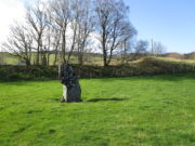
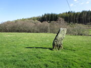
Cotterton standing stone

Along the A924 road, just over 4 miles (6.6km) NW from Kirkmichael, or about 8 miles (13km) NE from Pitlochry, you’ll hit the large farmhouse of Straloch.  You’ve really gotta keep your eyes peeled!  A few hundred yards west of Straloch itself, a small parking spot is on the south-side of the road, above the river.  From this parking spot, walk a few yards to the fence that overlooks the river and look into the field below you, where you’ll see the stone.  If y’ walk down the slope, you’ll see a gate on the right that leads you into the field.

Archaeology & History

First shown on the 1900 OS-map of the area, this petrified hunchbacked witch-of-a-stone stands on the flat grassland plain (previously scattered woodland when first raised) forty yards from the River Brerachan: a proximity characteristic found at many of the stones along Strathardle.

Cotterton stone 1900 map
Fred Coles’ sketch

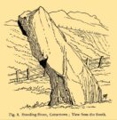
Descriptions of the site prior to 1900 seem non-existent (does anyone know otherwise?).  It was the brilliant antiquarian Fred Coles (1908) who, it seems, was the first to mention the old stone — whose very crooked appearance had an unusual effect on him, saying how “such a decided leaning over towards the north…almost make one uneasy when standing beside it”!  It didn’t have that effect on me, but I was mightily impressed by both its appearance and curious hunched gait.  Twas one of those monoliths that had a distinct ‘feel’ about it, which many people report at such places up and down the country.  Whether it was its position by the river, or the color of the landscape, or the silence, or the shape of the stone, or combinations of them all—which ever it was, there was almost a sense of genius loci residing here…

But in that other world of pragmatic measurements, as Mr Coles told us:

“The Stone is at the base an oblong in shape, measuring 14 inches on its east end, 2 feet 7 inches along its south side, 17 inches at the west, and 3 feet 6 inches on its north side—a girth, therefore, of 8 feet 8 inches.  At the middle its dimensions are the same, but the top is rather less.   At its N.E. apex the Stone is 7 feet 8 inches clear of the ground, and at the west edge 7 feet.  In the illustration…I have shown the monolith from the south, with the craggy profile of Menachban in the background.”

The stone was mentioned in passing in Hugh Mitchell’s (1923) local survey.  A few years later in John Dixon’s (1925) account he repeated the dimensions of the stone that Coles had cited; and although he found there to be no known traditions of the place, he conjectured how it may have been connected with the numerous battles “that in former days occurred along this entrance to the Highlands.”

It’s a damn good site is this.  All you megalith hunters will love it!

References:

  1. Anonymous, Notes on Strathardle, Strathardle 1880.
  2. Coles, Fred, “Report on Stone Circles Surveyed in Perthshire – Northeastern Section,” in Proceedings of the Society of Antiquaries of Scotland, volume 42, 1908.
  3. Dixon, John H., Pitlochry, Past and Present, L. Mackay: Pitlochry 1925.
  4. Mitchell, Hugh, Pitlochry District: Its Topography, Archaeology and History, L. Mackay: Pitlochry 1923.

© Paul BennettThe Northern Antiquarian

Castleton (10), Cowie, Stirlingshire

Cup-and-Ring Stone:  OS Grid-Reference – NS 85887 88394

Also Known as:

  1. Castleton 1 (Morris 1891)
  2. Castleton 1a (van Hoek)
  3. Gosham Park

Getting Here

Castleton-10, looking S

To reach here from Stirling or Bannockburn, take the B9124 east to Cowie (and past it) for 3¾ miles (6km), turning left at the small crossroads; or if you’re coming from Airth, the same B9124 road west for just about 3 miles, turning right at the same minor crossroads up the long straight road.  Drive to the dead-end of the road and park up.  You’ll notice that this is a crossroads of dirt-tracks.  Walk along the one that heads to the houses you can see on a rise above the fields, eastwards.  About 300 yards on, instead of going up towards the houses, walk thru the gate and along the wall-edge for 85 yards and go thru the gate to your right.  You’ll see a small rise covered in gorse trees 100 yards in front you and roughly in the middle of it all, you’ll find this carving.

Archaeology & History

The naked stone

When John Bruce (1896) wrote his article on the mighty Cochno Stone a few miles north of mighty Glasgow, he left some end-notes about a petroglyph near Carnock (near Castleton) that was “found to bear a few much weathered cups with concentric circles.”  He wasn’t at all clear where the carving was located, merely telling that it was “in the Gosham Park” area on the Carnock estate.  This vague description was probably the reason why, when the lads from the Royal Commission came looking for it in August 1955, they left without success.  Nevertheless, when Ron Morris (1981) explored this area he located the place-name of Gosham Field and, therein, this multi-ringed carving.  It seems more than likely that this was the carving described by Mr Bruce – and it’s an impressive one!

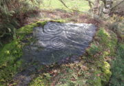
Despite being eroded by the passage of time, the carved design is still pretty easy to see, comprising a cluster of archetypal cup-and-multiple rings in close proximity to each other, etched onto a sloping stone.  Ron Morris’s (1981) description told that, 125 yards east of Gosham Field’s western wall,

“is a prominent greywacke outcrop, part of a rocky ridge running NW-SE, exposed in 1969-75 for 3m by 2m (10ft x 6ft), 4m (12) high on its S, but at ground level elsewhere, sloping 15° NE.  On its fairly smooth surface are:

“5 cups-and-complete rings, with no grooves, 3 with three rings, 1 with four, and 1 with five rings, up to 36m (14in) diameters and 1cm (½in) depth.”

Ron Morris’ 1981 sketch

Yet contrary to Morris’ description, there are some “grooves”, or carved lines emerging from some of the rings; faint but definitely there.  You can make them out in the accompanying photos above. (are there any sketch artists out there could accompany us to these carvings, so we get some good portraits of the stones?)  When Maarten van Hoek (1996) visited this carving he also missed these ‘ere carved grooves.

An additional feature that needs to be mentioned is the cluster of small geological deep natural cups, inches away from the carved rings on the southern edge of this stone (completely covered in vegetation in the attached photos).  The same feature also exists on the southern edges of the Castleton 5, Castleton 6 and  Castleton 12 carvings and it probably had some mythic relationship with the petroglyph.

Apparently there’s another cup-marked stone, now hidden beneath the dense undergrowth of gorse, 20-30 yards east along this same geological ridge.  The rock surfaces here need to be laid bare to enable a greater visual experience of the wider Castleton complex.

References:

  1. Bruce, John, “Notice of Remarkable Groups of Archaic Sculpturings in Dumbartonshire and Stirlingshire,” in Proceedings Society Antiquaries, Scotland, volume 30, 1896.
  2. Morris, Ronald W.B., “The cup-and-ring marks and similar sculptures of Scotland: a survey of the southern Counties – part 2,” in Proceedings of the Society of Antiquaries, Scotland, volume 100, 1968.
  3. Morris, Ronald W.B., The Prehistoric Rock Art of Southern Scotland, BAR: Oxford 1981.
  4. Ritchie, Graham & Anna, Edinburgh and South-East Scotland, Heinemann: London 1972.
  5. Royal Commission on the Ancient and Historical Monuments of Scotland, Stirlingshire: An Inventory of the Ancient Monuments – volume 1, HMSO: Edinburgh 1963.
  6. Royal Commission on the Ancient & Historical Monuments of Scotland, Archaeological Sites and Monuments of Stirling District, Central Region, Society of Antiquaries of Scotland 1979.
  7. van Hoek, M.A.M.,”Prehistoric Rock Art around Castleton Farm, Airth,” in Forth Naturalist & Historian, volume 19, 1996.

© Paul BennettThe Northern Antiquarian

Market Cross, Baildon, Shipley, West Yorkshire

Cross:  OS Grid reference – SE 15475 39743

Archaeology & History

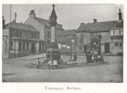
Located next to the old stocks by the main roundabout right in the middle of the town is this tall market cross, nearly ten feet high and well known to the local people.  It has been described by several local historians, although its recognition as a “market cross” is slightly contentious as it seems there are no written records to indicate that a market ever existed here.  The great Baildon historian, W. Paley Baildon (1912) was unable to find any info about such a market, commenting simply that “most villages…had crosses in medieval times, many of which still exist; so that the presence of a cross at Baildon is (not necessarily) evidence of a market.”

His description of its form is as valid then as it is to this day:

Old sketch, c.1900
Old photo of the cross c.1900

“The cross, as we see it to-day, is not an interesting object. The square platform of two stages, with its well worn stones, looks as though it might be medieval, and part of the original work.  In the centre of this is a large square block of stone, from which rises a tall cylindrical shaft.

The base is square, with chamfered corners, and a plain roll moulding at the upper edge; the cap is a plain square block, without any attempt at ornament.”

One of Bradford’s industrial historians, William Cudworth (1876) thought that the present cross replaced an earlier one, and that this one was erected by a member of the wealthy Butler family a few centuries ago.  Mr Baildon wasn’t quite as sure as Mr Cudworth.  Nevertheless they both agreed that this edifice replaced an earlier one.  Baildon said:

“My own view is that there was probably a cross here in medieval times; that it was destroyed, either after the Reformation (as so many were), or by the Puritan soldiery during the Civil War; that the steps and perhaps the base remained; and that in the eighteenth century, when the Butlers were one of the leading families in the place, one of them may have erected a new shaft on the old site.”

In much earlier days it was said to have been surrounded by a grove of trees and a brook ran by its side.  Villagers would gather here as it was “a favourite gossiping resort.”  At the beginning of the 20th century, an old gas light surmounted this old relic.

References:

  1. Baildon, W. Paley, Baildon and the Baildons – volume 1, St. Catherine’s Press: Adelphi 1912.
  2. Cudworth, William, Round about Bradford, Thomas Brear: Bradford 1876.
  3. la Page, John, The Story of Baildon, William Byles: Bradford 1951.

© Paul BennettThe Northern Antiquarian

Castleton (3), Cowie, Stirlingshire

Cup-and-Ring Stone:  OS Grid-Reference – NS 85700 87971

Archaeology & History

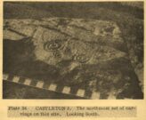
Ron Morris’ 1980 photo

40-50 yards southwest of the Castleton (11) cup-and-ring stone, beneath the marauding mass of spindly-killer-bushes (or ‘gorse’ as it’s known in the common tongue) could once be seen another  impressive cup-and-ring, etched along the edge of the small rocky rise.  But Nature has done Her bit and hidden the old stone for the time being.  A pity – for as the old photos and sketches show, it’s quite a good one.

Listed in several archaeo-surveys, the best descriptions of this carving are from the reliable pens of Messrs Morris (1981) and van Hoek. (1996)  Morris first told us that,

“Leading S from near the farm to Bruce’s Castle (a ruin) is a greywacke ridge, up to 7m (24ft) high on its SW, but at ground level elsewhere, partly turf-covered.  Faint cup-marks, some possibly ringed, can still be traced at various points on its top.  On a shelf about 7m by 2½m (23ft x 8ft), sloping mostly 20° W, near the steep SW edge, are:

“7 cups-and-complete-rings — in one case broken off at rock edge — one with five rings, 2 with three, and 4 with two rings, up to 51cm (20in) diameter and 2cm (1in) deep.  The cup-and-five-rings has a cup-and-two arcs budding from it.”

Fifteen years later, when van Hoek visited the place, it was already “becoming overgrown with gorse,” but fortunately he was able to give us a slightly more detailed description.  “There are two engraved surfaces” here, he wrote,

van Hoek’s 1996 sketch
Sketch from Morris’s text

“The north part slopes 9° to the north and has two cups with two rings each.  The smaller is clearly unfinished and possibly the pocking of the east part of the outer ring caused a part of the ring to flake off.  Undescribed (by Morris, PB) are a very small cup and one complete ring, and a faint cup with incomplete ring in between the two larger devices although Morris…gives a clear photograph of all these features. (above)  The south group is dominated by a large but worn cup-and-five-complete-rings on a sloping surface 16° SSW.  It is encircled by four rather distinct cup-and-rings and one very faint cup with one incomplete ring, which has never been reported.  All single cups drawn on the plan are very doubtful and probably all are natural, especially the small ones.”

This doesn’t necessarily mean to say that these “probably natural” cups had no bearing on the man-made designs; such elements have been given mythic importance in traditional cultures elsewhere in the world, and some ‘bowls in the UK possess curative folklore of their own.

Due to the importance of this carving, effort needs to be made to clear it of the gorse and so allow fellow students the ability to contextualize it and probably uncover yet more cups-and-rings further along the surface of the rock.

References:

  1. Morris, Ronald W.B., “The cup-and-ring marks and similar sculptures of Scotland: a survey of the southern Counties – part 2,” in Proceedings of the Society of Antiquaries, Scotland, volume 100, 1968.
  2. Morris, Ronald W.B., The Prehistoric Rock Art of Southern Scotland, BAR: Oxford 1981.
  3. Royal Commission on the Ancient & Historical Monuments of Scotland, Archaeological Sites and Monuments of Stirling District, Central Region, Society of Antiquaries of Scotland 1979.
  4. van Hoek, M.A.M.,”Prehistoric Rock Art around Castleton Farm, Airth,” in Forth Naturalist & Historian, volume 19, 1996.

© Paul BennettThe Northern Antiquarian