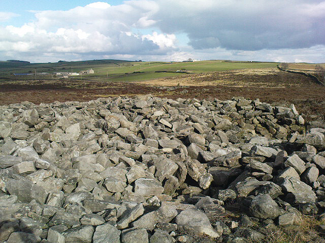
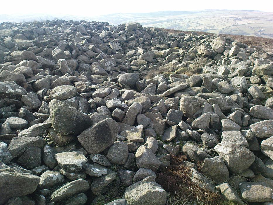
Culliford Tree Barrow, Upwey, Dorset

Tumulus:  OS Grid Reference – SY 6691 8548

Also Known as:

  1. Music Barrow
  2. Warne’s Barrow 22
  3. Whitcombe 1 (Grinsell)

Archaeology & History

Crowned by a clump of trees (planted in 1740), this hilltop site is one of the more impressive of a number of tombs hereby, with its nearest other neighbour being 70 yards southeast of here.  One of Dorset’s early tribal meeting places (Anderson 1934), the tomb was illustrated on Isaac Taylor’s 1765 map of the region and was dug into in 1858 “on the orders of a local magnate” (Marsden 1999), damaging some substantial portion of the tomb.  Of this, craniologist and antiquarian John Thurnam was most displeased; for in his description of the opening of Culliford Tree he wrote:

“A wide trench had been dug through it one side, from the summit and the rubble which had been thrown out had not been replaced… Another subject of regret was the fact that though, as we were told by the neighbouring rustics, human remains, with pottery and certain other relics, were found in the barrow, no authentic account of the exploration had, so far as we could learn, been put to print.”

Leslie Grinsell (1959) found the same trouble in his assessment of this site; and the Royal Commission (1970) lads could only describe the site thus:

“Large trench on south and top almost certainly dug in 1858 when four secondary extended inhumations, one with necklace of amber and two gold-plated beads, and cremation with incense cup in collared urn, were found.”

However, it seems that the necklace and gold-plated beads have been “lost” — i.e., someone has them in their own private collection somewhere!

Folklore

This is one of very few tombs in this part of the country where we find the tradition of fairy music.  Grinsell (1959) told that:

“The Culliford Tree barrow, formerly the meeting place of the Hundred of Culllingford Tree, is also known as the Music Barrow from the belief that music could be heard beneath the mound by those who listened at the apex at midday.”

References:

  1. Anderson, O.S., The English Hundred-Names, Lunds Universitets Arsskrift 1934.
  2. Grinsell, Leslie V., Dorset Barrows, Dorset Natural History & Archaeological Society: Dorchester 1959.
  3. Marsden, Barry M., The Early Barrow Diggers, Tempus: Stroud 1999.
  4. Royal Commission on Historical Monuments, An Inventory of Historical Monuments in the County of Dorset – Volume 2: South-East, Part 3, HMSO: London 1970.
  5. Warne, Charles, Celtic Tumuli of Dorset: An Account of Personal and other Researches in the Sepulchral Mounds of the Durotriges, Smith: London 1866.

© Paul Bennett, The Northern Antiquarian
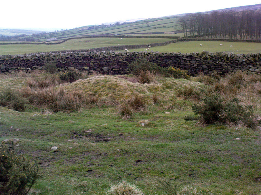

High Marchup, Silsden, West Yorkshire

Tumulus:  OS Grid Reference – SE 0501 4949

Also Known as:

  1. Parson’s Lane Tumulus

Getting Here

High Marchup tumulus

From Silsden go up the long hill (A6034) towards Addingham until the hill levels out, then turn left on Cringles Lane (keep your eyes peeled!) for about 500 yards until you reach the Millenium Way footpath, or rather, green lane track, to your right.  Walk along this usually boggy old road for another 400 yards until you’re level with the small copse of trees below the field (about 100 yards away).  The slightly raised ditched mound on the left side of the track ahead of you is what you’re after!

Archaeology & History

Unless this old tomb was pointed out, you probably wouldn’t give the place a second glance.  It’s a seemingly isolated singular round tomb, subsided on top and surrounded by a small ditch, running into the edge of the walling.  Gorse bushes and a few rocks are around the edges of the site.  Harry Speight (1900) described this old tomb as a

“lonely isolated mound, to be seen in Parson Lane about a hundred yards west of the Celtic boundary, Black Beck, where some old dying chief has called his friends around him bidding them, “heap the stones of his renown that they may speak to other years.”  It is a tumulus 80 feet in circumference and does not seem to have been disturbed.”

In Faull and Moorhouse’s (1981) magnum opus they describe the site as “the denuded remains of a ditched round barrow,” but say little else.  It may have had some relationship with the settlement remains in and around the huge Counter Hill complex, immediately north.

References:

  1. Cowling, E.T., Rombald’s Way: A Prehistory of Mid-Wharfedale, William Walker: Otley 1946.
  2. Faull, M.L. & Moorhouse, S.A. (eds.), West Yorkshire: An Archaeological Guide to AD 1500 (4 volumes), WYMCC: Wakefield 1981.
  3. Speight, Harry, Upper Wharfedale, Elliott Stock: London 1900.

© Paul Bennett, The Northern Antiquarian
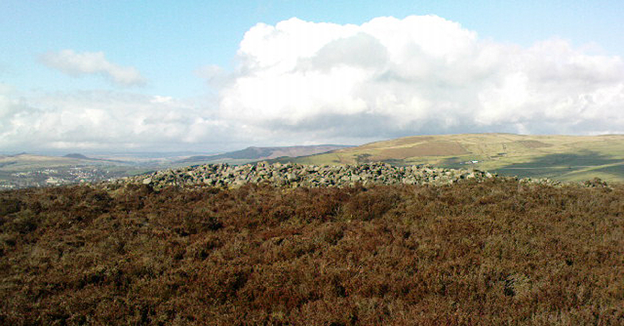

Black Hill Round Cairn, Low Bradley Moor, Skipton, North Yorkshire

Cairn:  OS Grid Reference – SE 0087 4753

Also Known as:

  1. Black Hill Cairn
  2. Bradley Moor Round Cairn
  3. Queen’s Cairn
The Black Hill Round Cairn, Bradley Moor - looking north
The Black Hill Round Cairn, Bradley Moor – looking north

Getting Here

Various ways here.  Best is probably taking the footpath onto Farnhill Moor a few hundred yards east of Kildwick Hall.  Head for the cross-bearing Jubilee Tower (supposedly built upon an ancient cairn), NW, keep going past it uphill until you reach the walling 350 yards north, where a seat let’s you have a rest.  Climb over the wall! Alternatively, walk eastwards and up through the steep but gorgeous birch-wooded slopes of Farnhill Wood; and as the moortop opens up before you, the great pile of rocks surmounts the skyline ahead. You can’t miss it! (NB: the spot cited on the OS-map as the cairn is in fact another site, 100 yards NW)

Archaeology & History

Its an awesome place in an awesome setting. You can see 360-degrees all round from this giant mass of rocks — something which was of obvious importance to the people who built it. If it had been placed 20-30 yards either side of here, that characteristic would not occur. Indeed, this is the only place anywhere on these moors where such a great view was possible. Important geomancy, as they say (or whatever modern term they give it these days).

Bradley Moor Cairn - looking down to the Long Cairn
Bradley Moor Cairn – looking down to the Long Cairn
Small section of the old cairn

Although the tomb is still of considerable size (at least 100 feet across) and made up of thousands of stones, it has been severely robbed of stone in years passed, for walling and other building materials.  A number of other small cairns scatter the heathlands a few hundred yards roundabout this central giant (though are hard to find in the deep heather); and there is a distinct cairn circle about 100 yards to the northwest, which has yet to be excavated.  This cairn circle can be made out quite easily if you stand on the ridge about 30 yards west of here, looking down the slope.  An then of course we have the equally huge  Black Hill Long Cairn, less than 100 away, aligned northwest-southeast, which obviously had an important archaeological relationship with this giant round cairn.  Also around this and the adjacent long cairn, numerous flints and scrapers have been found, showing humans have been here since at least the early neolithic period.

This site in particular gives me the distinct impression that it was the most important of the various sites upon these moors. It’s got a distinctly female flavour to it – and it’s old name of the Queen’s Cairn seems just right.  Maybe it’s the fact that when I first visited the place, a great thunderstorm broke through the previously perfect skies, scattering lightning bolts all round for perhaps thirty minutes — so I stripped down and held my arms outwards, screaming to the skies in the pouring rain!  Thereafter, no clouds appeared in the skies for the rest of the day.  It was a brilliant welcome to the place!

References:

  1. Cowling, E.T., Rombald’s Way, William Walker: Otley 1946.
  2. Keighley, J.J., ‘The Prehistoric Period,’ in Faull & Moorhouse’s West Yorkshire: An Archaeological Survey, I, WYMCC: Wakefield 1981.
  3. Raistrick, Arthur, ‘Prehistoric Burials at Waddington and Bradley,’ in YAJ 119, 1936.

© Paul Bennett, The Northern Antiquarian