Tumble Beacon, Banstead, Surrey

Tumulus:  OS Grid Reference – TQ 2432 5902

Archaeology & History

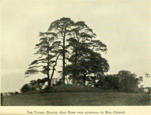
Tumble Beacon in 1911

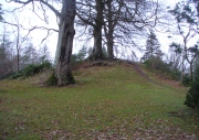
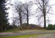
This ancient “bowl barrow” as the modern archaeo’s are wont to describe it, is a Bronze Age tumulus that has seen better days.  But at least it’s still there – albeit slightly damaged and enclosed by modern housing, in the back of someone’s garden.  I expect that if you were to ask the owners, it would be OK to see this 4000 year old burial mound (in Scotland at least, we always find people very amiable when it comes to asking such things).  It’s quite a big thing too, so you can’t really miss it!  Standing more than 12 feet high, it rises like an archetypal fairy mound—now out of place—measuring some 38 yards east-west and roughly 44 yards north-south.

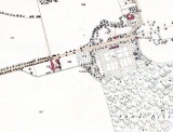
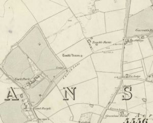
Highlighted on the early OS-map of the region, the name of the site indicates its multi-period usage, with the ‘beacon’ element derived  from when, in 1594, a fire was lit upon it to tell of the arrival of the Spanish Armada.  Whether it had been used as a beacon prior to that, I can find no historical accounts.  One of the early archaeological descriptions came from the pen of the old historian and folklorist, Walter Johnson (1903), who told us simply:

Tumble Beacon on 1871 map
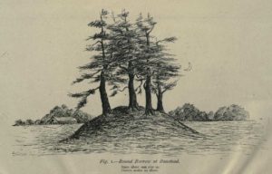
Walter Johnson’s 1903 sketch

“About a mile South-west of Banstead Church, in a field close by Tumble Farm, on the outskirts of Nork Park, is an eminence marked on the map as Tumble Beacon.  A picturesque clump of pines stands on the mound, which, from its general character, and from the flint scraps we have found there, we have every reason to believe is a round barrow, despite the local tradition that it is a ‘sea-mark.’  The Scotch pines, in such positions as we find here, may probably, Mr. Grant Allen thought, be the descendants of trees put in by human hands when the barrow was first raised.”

Whilst this latter idea might be very hard to prove, the assertion that it’s prehistoric certainly gained favour as more antiquarians examined the site.  Johnson later told that when examining this and other sites nearby (sadly destroyed) he came across a variety of prehistoric stone utensils in the area.

References:

  1. Gover, J.E.B., Mawer, A. & Stenton, F.M., The Place-Names of Surrey, Cambridge Univserity Press 1934.
  2. Grinsell, Leslie V., The Ancient Burial Mounds of England, Methuen: London 1936.
  3. Johnson, Walter, Neolithic Man in North-East Surrey, Elliot Stock: London 1903.
  4. Lambert, H.C.M., History of Banstead in Surrey, Oxford University Press 1912.

© Paul BennettThe Northern Antiquarian


Caravan Park, Blair Drummond, Stirlingshire

Tumulus:  OS Grid Reference – NS 7253 9906

Also Known as:

  1. Canmore ID 46065
  2. Old Farm

Getting Here

Caravan Park burial mound

Caravan Park burial mound

Along the A84 Stirling-Doune road, watch out for the minor Cuthill Brae road to the caravan park. Go up and into Blair Drummond caravan park (ignore the old grumpy southern-type fella who tells you “this is private”), right into and through the walled area where the caravans are situated.  Out the other side is a children’s playground— and the very large mound to your left with a tree on top (and a children’s slide built on it) is the burial mound in question.

Archaeology & History
Tumulus from the southeast

Tumulus from the southeast

This comes as something of a surprise when you first set eyes on it.  It’s big! (bigger than I expected anyway!)  Seemingly on its own, rising from the level ground and surrounded by cultivated land, there were probably others of its kin close by, but the closest that we know about is 1.5km to the east; although the standing stone of Boreland Hill a few hundred yards west might have had some relevance….

This tumulus may be the one noted by Charles Roger (1853) in his visit to the area.  He spoke of the now denuded burial mound to the east (in the Safari Park), but also told that,

“Within the park are two other tumuli, one situated in the garden, of a conical form and measuring 92 yards in circumference and about 15 yards in height…”
Blair Drummund tumulus on 1866 OS-map

Blair Drummund tumulus on 1866 OS-map

This mound is more 15 feet in height than yards, but the other measurement is close—and it does seem to be in the right area.

There is much greater certainty in J.G. Callander’s (1929) account.  He was fortunate in being part of the excavations undertaken here by Sir Kay and Lady Muir in 1927-28 and gave a damn good account of what went on:

“The mound is not quite circular, as it measures about 75 feet in diameter from north to south and about 65 feet from east to west, its height being about 15 feet.  Before the excavations were started it seemed as if the monument consisted entirely of earth, but before the examination was completed it was found that it contained a small cairn of stones, heaped over a grave formed of large slabs arid boulders which undoubtedly was the primary interment.

“Commencing at the south-south-eastern edge of the mound, a trench driven in towards the centre, revealed the presence of a short cist which had apparently been disturbed at some previous time.  A large block of stone formed the northern end and a large slab the east side.  A smaller slab lay at the south end and another on the west side, but as the latter was too short to fill the space, a larger slab lay obliquely between it and the large stone at the north end.  There was no appearance of a cover stone.  The length of this grave was 3 feet 3inches, its breadth 3 feet, and its depth 2 feet 3 inches.  The longer axis lay practically north and south.  No traces of human remains or relics of any sort were found here.  This was evidently a secondary burial sunk into the mound as far as the original surface of the ground, and covered with about 4 feet of soil at the centre.

“As the trees interfered with further excavations at this part, another trench was cut in from the northern arc as far as the centre of the mound, where an undisturbed cist, formed of large rough slabs and a cover stone, was encountered.  Although this grave was considerably larger in length, breadth and depth than any of the numerous short cists that I have examined, I think it should be classed with them rather than with the large cist-like chambers sometimes found in long cairns.  It was formed of two side and two end slabs.  The sides were roughly parallel, but the slab at the southern end was placed obliquely so that the length of the grave was 4 feet 6 inches on the east side and 4 feet on the west side. The general breadth was 3 feet at the floor, and the depth 4 feet.  Both side slabs converged towards the top.  As the slabs on the east side and at the ends were not so high as that on the west, the spaces between them and the cover stone were carefully built up with smaller stones.  A slight vacancy between the slabs at the south-east corner was filled in a similar fashion.  A small cairn of clean stones without a mixture of soil had been heaped up over the cist, covering the lid to a depth of about 9 inches: the diameter of the cairn at the base was  not ascertained.  The depth of earth above the summit of the cairn was about 8 feet.  But for a layer of a few inches of earth on the floor the cist was empty.  Nothing was found except some small unburnt fragments of human bone, very much decayed, and a few teeth.  Some small fragments of charred wood were found in making the trench and in the grave, but whether it was charred by natural carbonisation or by burning was not determined.

“In making the trench just before the grave was reached, but at a higher level, a small portion of the cutting edge of a stone axe was found.  It had no evident connection with the cist, and may have happened to be lying about amongst the soil that was piled up over the grave.

“As there remained a space on the top of the mound which could be excavated without destroying any of the trees, it was examined.  About 1 foot under the surface a cinerary urn was found in an inverted position.  The base had been crushed in, and the wall was full of cracks into which tree roots had penetrated.  On taking it out the vessel was found to have originally been about half-filled with cremated human bones.  These after examination were reinterred in the mound.  No other relics were found in the urn.

“The vessel, which is formed of buff-coloured clay with a tinge of red in places, is a cinerary urn of the cordoned variety belonging to the Bronze Age.  It is encircled at the widest part, about 3½ inches below the lip, by a raised moulding or cordon, and about 3 inches lower down by another.  The greater part of the vessel was recovered, but as the basal portion was completely crushed, it is impossible to ascertain the height of the vessel or the width of the base when complete.  It measures 10¾ inches in external diameter at the mouth and 11 inches at the widest part: what remains of the wall is 13 inches in height.  The rim, which is unusually thin for a vessel of this class, is only ⅜-inch in thickness, and it is bevelled downwards towards the interior.  The space between the upper cordon and the rim is the only part which is decorated, and here there is a row of large triangles, alternately plain and filled, with a reticulated design, bordered above and below with a single marginal line, all formed by pressing a twisted cord on the clay before it was fired.”
Protected tumulus, damaged by slide

Protected tumulus, damaged by slide

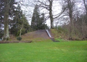
The burial mound is still in a reasonably good state of preservation… on the whole…  There is however, a slightly worrying note: this tumulus is a protected scheduled monument but despite this it has, as of late, been quite deliberately built upon.  When Penny Sinclair and I visited the nearby Christ’s Well recently (out of season), an unhelpful grumpy man working or living there told us we were “not allowed on the site – it’s private.”  We thought he was joking and I laughed that, “This is Scotland!”  He repeated his words.  A week later, Paul Hornby and I revisited the Christ’s Well and then took to see this large burial mound – only to find that a children’s play area had been built right up to, and upon, the northwestern part of the monument. This is in contravention of legal regulations to build upon Scheduled Monuments, as:

“The area to be scheduled encompasses the mound and an area around it in which traces of associated activity may be expected to survive.”

This has been violated.

If you like your prehistoric burial mounds, this is well worth having a look at.

References:

  1. Callander, J. Graham, “A Bronze Age Burial Mound at Blair Drummond, Perthshire,” in Proceedings Society of Antiquaries Scotland, volume 63, 1929.
  2. Roger, Charles, A Week at Bridge of Allan, Adam & Charles: Edinburgh 1853.
  3. Royal Commission on the Ancient & Historical Monuments of Scotland, Archaeological Sites and Monuments of Stirling District, Central Region, Society of Antiquaries of Scotland 1979.

© Paul BennettThe Northern Antiquarian


Dumpton Park, Ramsgate, Kent

Tumulus (destroyed):  OS Grid Reference – TR 389 661

Archaeology & History

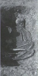
A little-known site which archaeologist Brian Philp (2002) called “a Bronze Age barrow”.  When the old Greyhound Stadium at Ramsgate was being demolished for a new housing estate, planning conditions required an archaeological evaluation and so Philps and his team set out to explore the area in February 2000.  They weren’t to be disappointed!  Unearthing a ring ditch nearly 20 yards (18m) across, they found that it had been cut into the local chalk some three feet deep.  Although there was no obvious entrance, the northeast section of the ancient monument,

“was found to be covered by a compact layer of flint metalling.  This was a wide and well-made surface or platform, perhaps of Iron Age date, which clearly covered the silted ring-ditch,  Nearby was a large male skeleton in a very shallow grave and with head missing due to later disturbances.”

The excavated ring ditch (after Philp 2002)

The excavated ring ditch (after Philp 2002)

The crouched skeleton (after Philp 2002)

The crouched skeleton (after Philp 2002)

But the best was yet to come!  In another section of the circular monument, cut into the chalk itself, they found a complete male skeleton laid in typical foetus position, on its left side, with a large beaker pot positioned in front of it.  These beakers are pretty common and tend to be seen as once holding food enabling the dead to eat in their journey into the Land of the Dead.  It makes sense.  The entire monument has since been completely destroyed.

References:

  1. Philp, Brian, Archaeology in the Front Line, KARU: Dover 2002.

Links:

  1. Kent Archaeological Review

© Paul BennettThe Northern Antiquarian 2016


Down Farm, Basingstoke, Hampshire

Barrow (destroyed):  OS Grid Reference – SU 6018 5013

Archaeology & History

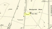
Downs Farm tumulus on 1897 map

Downs Farm tumulus on 1897 map

On the western edges of Basingstoke, at Kempshott, could once be found this ancient site—destroyed many decades ago.  It was one of number of similar prehistoric burial mounds in the area.  First described in a listing of tumuli by Mr Andrews (1898) who told us that it was “oval” in shape, the monument was completely destroyed in 1939 and according to the Royal Commission (1979) lads,

“its site now lies beneath a house at the southwest corner of Kempshott Lane and Homesteads Lane.”

When the house where it once stood was being constructed, a collared urn was recovered from the tomb, which the Royal Commission thought indicated “that the monument (was) likely to have been of early Bronze Age date”—but obviously we cannot be sure.  The site was listed in Leslie Grinsell’s (1979) extensive survey of prehistoric tombs in the area, in which he suggested it may have been a long barrow.

References:

  1. Andrews, S., “A Short List of Some Tumuli in North Hampshire,” in Proceedings of the Hampshire Field Club & Archaeological Society, volume 4, 1898.
  2. Grinsell, Leslie V., “Hampshire Barrows – part 3,” in Proceedings of the Hampshire Field Club & Archaeological Society, volume 14, 1940.
  3. Royal Commission on Historic Monuments, England, Long Barrows in Hampshire and the Isle of Wight, HMSO: London 1979.
  4. Willis, G.W., “Bronze Age Burials round Basingstoke,” in Proceedings of the Hampshire Field Club & Archaeological Society, volume 18, 1953.

© Paul Bennett, The Northern Antiquarian

Ruston Beacon, Ruston Parva, East Yorkshire

Tumulus (destroyed):  OS Grid Reference – TA 0584 6128

Archaeology & History

Ruston Beacon tumulus on 1854 map

Ruston Beacon tumulus on 1854 map

A fallen tumulus that once marked the southwestern side of the village boundary line, and was once adjacent to the prehistoric Green Dikes earthworks that once passed here.  Sadly however, sometime early in the 20th century, this ancient burial mound fell victim to usual ignorance of arrogant land-owners who place money ahead of history and local tradition and it was ploughed-up and destroyed.  Thankfully we have an account of the site in J.R. Mortimer’s (1905) incredible magnum opus.  Listing it as ‘Barrow no.272’ in the number of tombs excavated, he told us that:

“It is situated on elevated ground about half-a-mile (south)west of Ruston Parva.  On September 20th and 21st, 1886, it measured about 70 feet in diameter and 2 feet in elevation; and had originally been several feet higher, as an old inhabitant remembered assisted in removing its upper portion, which was carried away and spread on the surrounding land many years previously.  At the base of the barrow, near the centre, was a long heap of cremated bones which had been interred in a hollow log of wood with rounded ends, about 3 feet in length and 14 inches in width, well shown by impressions in the plastic soil, and by the remains of the decayed wood.  The heap of bones was rather large and probably consisted of the remains of more than one body.  No relic accompanied them.  Several splinters and flakes of flint were picked from the mound.”

The tumulus (as its name implies) became a spot besides which one of East Yorkshire’s many ancient beacons were built.  In Nicholson’s (1887) survey of such monuments, he told that

“the modern beacon, apparently, stood on the site of the old one, on the high ground in the angle of the road from Driffield to Kilham.  It was a prominent object and would be well-known to the coachmen and guards…for it stood on the side of the road from Driffield to Bridlington.  Mr John Browne, of Bridlington, remembers it; and says, ‘It would be the last of the beacons that remained in this district and was removed between fifty and sixty years ago.  My recollection of it is that it was a tall pole, with a tar barrel at the top, and had projected steppings to reach the barrel.”

One of the earliest accounts of the beacon from the late-1500s told that it took signal for its light from the beacon at Rudston, which stood upon one of the Rudston cursus monuments, a short distance from the massive Rudston monolith.

References:

  1. Mortimer, J.R., Forty Years Researches in British and Saxon Burial Mounds of East Yorkshire, Brown & Sons: Hull 1905.
  2. Nicholson, John, Beacons of East Yorkshire, A. Brown & Sons: Hull 1887.

© Paul Bennett, The Northern Antiquarian

Acharn Burn, Kenmore, Perthshire

Tumulus:  OS Grid Reference – NN 7607 4294

Also Known as:

  1. Canmore ID 25011

Getting Here

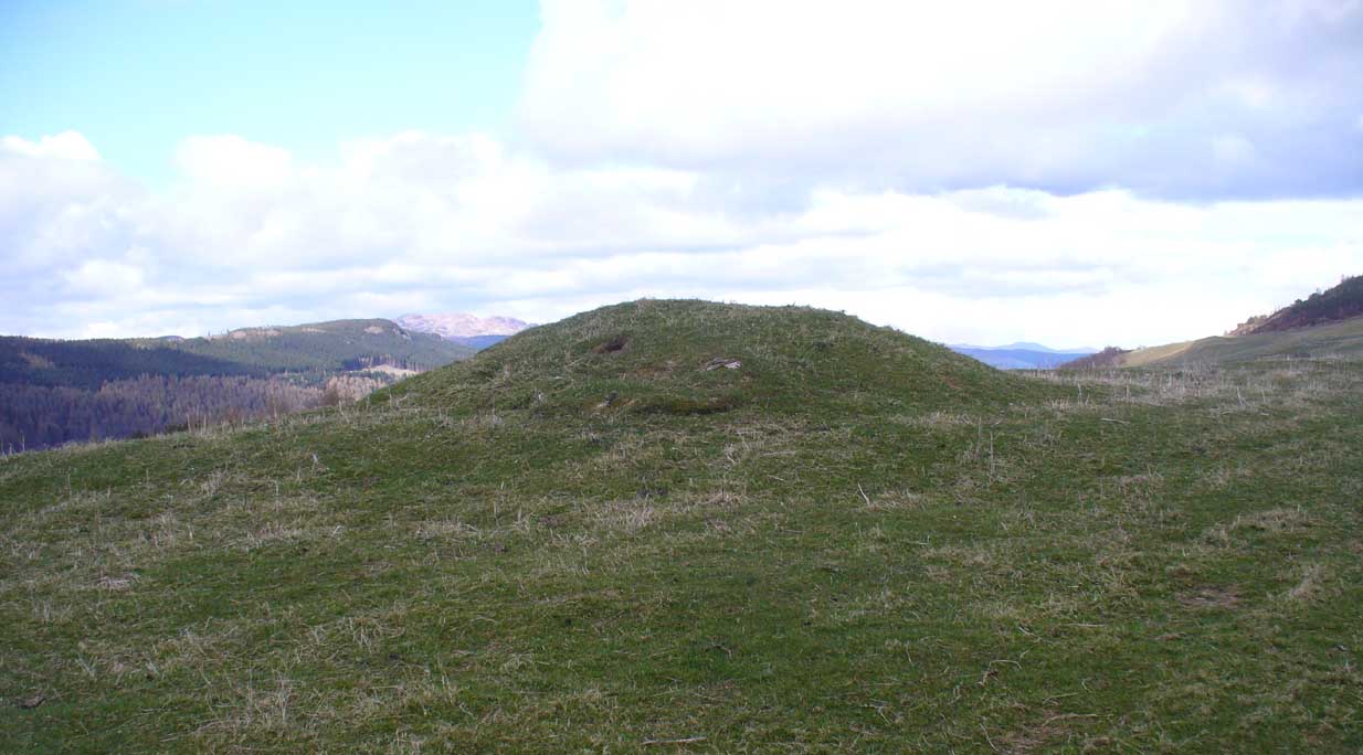
Acharn Burn tumulus, Kenmore

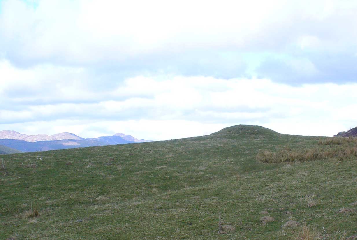
From Kenmore, take the minor road on the south-side of Loch Tay for 1½ miles (2.4km) until you reach the hamlet of Acharn.  From here take the track uphill for ½-mile past the Acharn waterfalls and when you come out on the east-side of the trees, keep walking uphill parallel to the trees and burn until the land levels-out and the track heads away, east.  200 yards ahead, on the left-side of the track, you’ll see the large fairy-mound.

Archaeology & History

The tumulus looking NE

First reported in archaeological circles in the Discovery & Excavation Scotland mag in 1964, this archetypal fairy-mound or tumulus sitting on the grassy plain overlooking the eastern end of Loch Tay and district would have been known of by local people in older times, but I can find no early accounts of it, nor its traditions.  When Bob Money (1990) came here, he told of the grand vista stretching into the distant mountains:

“From here the views…are superb, and the little mound, which is an ancient tumulus, or burial mound, has sat here undisturbed for several thousand years, guarding the secret of its once important occupant.”

Circular in structure and measuring 20 feet across, the mound rises nearly four-feet high and is probably Bronze Age in origin.  Although mostly covered in grass, there are some loose stones visible on the side of the mound, seeming to indicate that it may be a covered cairn.  No excavation have yet taken place here.

References:

  1. Money, Bob, Scottish Rambles – Corners of Perthshire, Perth 1990.

AcknowledgementsMany thanks to the unholy bunch who helped travel, locate, photograph and take notes on the day of our visit here, including Aisha, Lara & Leo Domleo; Lisa & Fraser; Nina and Paul.  Let’s do it again and check out the unrecorded stuff up there next time!

© Paul Bennett, The Northern Antiquarian

Badbury Barrow Carving, Shapwick, Dorset

Cup-Marked Stone:  OS Grid Reference – ST 9583 0294

Also Known as

  1. Badbury Rings Carving
  2. Shapwick 6a carving

Archaeology & History

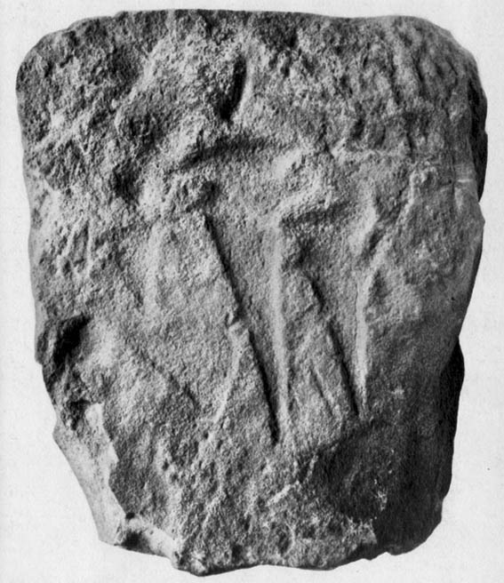
Badbury Barrow carving (after J.F.S. Stone 1958)

Amidst what was once a veritable gathering of prehistoric tombs on the ground immediately west of the Badbury Rings hillfort — a small necropolis no less! — one particular tumulus which Leslie Grinsell named as ‘Shapwick 6a‘ was in the process of being destroyed at the end of October, 1845, but was fortunate in receiving the quick attention of a local historian called John Austen, who gave us the first known account of the place. (a fuller profile of the Badbury Barrow can be found here)  Inside the churned-up remains of Badbury Barrow, which measured 62 feet across and 9 feet high, Mr Austin found a fascinating number of urns and other remains and, shortly after, this rare example of a petroglyph was identified.  The stone now lives in the British Museum where, the last I knew, you could certainly check it out.  But it’s not its original size, as sections of the stone were broken off.  As Aubrey Burl (1987) told us, the stone was originally about half-a-ton in weight, on which,

“were carvings of five cupmarks, two bronze daggers and two flat, triangular axes of early Breton type.”

Grinsell’s more detailed description of the carving from his work on Dorset Barrows (1959) tells a little more of the design found on this seeming ‘tomb-stone’:

“Sandstone slab, probably from stone cist, decorated with pecked carvings of two daggers with hilts, resembling those on stone 53 at Stonehenge; two triangular objects probably intended to be flat bronze axe-heads expanding at their cutting-edge; and five cup-shaped hollows.  The existing decorated fragment (in British Museum) is 1ft 10in long, and was detached from the original slab which weighed probably more than half a ton.  The size suggests, perhaps, a cover-slab.”

It may well have been.  Certainly it had some relationship to death!  The design was suggested in the 19th century to perhaps have been influenced by Greek imagery, when such notions were in vogue.  As Grinsell tells,

“In the centre according to Durden…was the well-known large slab of sandstone which was decorated with carvings of daggers and axes, the former of type similar to those from Stonehenge, conjectured to be of Mycenean type.”

But the Mycenean nature of the carvings is highly unlikely.  What is intriguing with this carving is the appearance of cup-markings (commonly associated in or adjacent to prehistoric tombs) alongside defined symbols of daggers.  We could infer a magickal relationship between the two symbols here: one of which, the cups, comes from a much earlier period than the dagger-design.  A more in-depth analysis of the human remains within the tumulus and a plan of the site would perhaps be more revealing…

…to be continued…

References:

  1. Austen, John H., “Archaeological Intelligence,” in Archaeological Journal, volume 3, 1846.
  2. Burl, Aubrey, The Stonehenge People, Guild: London 1987.
  3. Grinsell, Leslie V., Dorset Barrows, Dorset Natural History & Archaeological Society 1959.
  4. Knight, Peter, Ancient Stones of Dorset, Power: Ferndown 1996.
  5. Royal Commission on Historical Monuments, England, An Inventory of the Historical Monuments in the County of Dorset – Volume 5: East Dorset, HMSO: London 1975.
  6. Stone, J.F.S., Wessex Before the Celts, Thames & Hudson: London 1958.
  7. Warne, Charles, The Celtic Tumuli of Dorset, John Russell Smith: London 1866.

© Paul Bennett, The Northern Antiquarian

Kerrycrusach, Bute, Argyll

Tumulus:  OS Grid Reference – NS 08878 61033

Also Known as:

  1. Canmore ID 40375
  2. Scoulag Moor

Getting Here

Liz Sykes, Saul and I wandered up to see this lovely spot a few years ago, to be found perched upon the top of the grassy boggy ridge a few hundred yards southeast of the Kerrycrusach houses (a coupla miles south of Rothesay, down the B881, on your left-hand [east] side). There are a few easy ways to get up here and it’s a nice amble, though you’ll get yer legs pretty wet if She’s been raining!

Archaeology & History

It was pouring with rain when I visited this small round tumulus with Liz, but a damn good view opened 360-degrees all round us when we hit the spot, the old tomb talking with others scattered on a select few hilltops from here: an obviously important ingredient to those who put it here.  Mentioned only briefly in Marshall’s (1978) archaeological survey as being “seen on the skyline looking south from the West Road,” one side of the tomb had fallen away slightly, revealing numerous large pieces of quartz rocks in the construction: another obviously important ingredient (for whatever reason) to the doods who built it.  The tomb, deemed as Bronze Age by Marshall, is about 3-4 feet high above the moorland and about forty feet across. Although this tomb officially sits alone here, it’s likely there are other sites close by that have yet to be found.

If little Saul (7 year-old at the time) wouldn’t have been all freezing and saturated and dying to get back home, I’d have sat on top of this old tomb for quite sometime. Twas a fine feeling: hills talking with hills, tombs with tombs, and a soaking-wet Paulus breathing the tranquility of it all.

References:

  1. Marshall, Dorothy N., History of Bute, Bute Museum 1978.

Links:

  1. RCAHMS: Kerrycrusach, Scoulag Moor, Bute – The archaeological info on this old tomb, from the hallowed database of the Royal Commission for Ancient & Historic Monuments, Scotland.

© Paul Bennett, The Northern Antiquarian


Mutlow Hill, Great Wilbraham, Cambridge

Tumulus:  OS Grid Reference – TL 5466 5437

Archaeology & History

This once-impressive Bronze Age tomb is now much denuded and stands besides the legendary Fleam Dyke.  The name of Mutlow was first used to describe this site in the 1812 Enclosure Act and means, literally, an “Assembly Hill” or Assembly burial mound.  Reaney (1943) told that it was situated “at the junction of the boundaries of Great Wilbraham (Staine Hundred), West Wratting and Balsham (Radfield Hundred) and Fulbourn (Flendish Hundred)”, and was obviously an important moot spot where local tribal and council laws were made.

The great Cambridge archaeologist, Tom Lethbridge (1957) briefly described the place in his fascinating survey of the nearby hill-figures, Gog and Magog, saying:

“The hill itself is a Bronze Age barrow which was dug by the Hon. R.C. Neville about a hundred years ago.  In it were, amongst other things, glass beads brought to Britain from the eastern Mediterranean in the fifteenth century before the birth of Christ.  The barrow, which was presumably the site of a moot in Saxon times, seem to have been used as a sighting point for the construction of the Fleam Dyke… A circular Roman building, either a temple, or possible a signal station, stood close to Mutlow Hill.”

Lethbridge pointed out that another lesser-known trackway — “known in Saxon times as ‘the Street'” — also passed here, saying:

“When the land is ploughed and the light is right, you can see the numerous dark lines on the soil, all converging on Mutlow Hill.  These are the old hollow ways of the Icknield Way and the Street.”

Folklore

One legend here speaks of a golden chariot that is reputedly buried either inside, or near to the old tumulus.  Lethbridge (1957) again told of hearing this tale, though narrated, “it was said to be buried in Fleam Dyke near Mutlow Hill.”  When he asked a local lady about the tale,

“She replied that she had always heard that it was not in the dyke itself, but in the road which passed the dyke and went on to West Wratting and the southeast.”

References:

  1. Lethbridge, T.C., GogMagog: The Buried Gods, RKP: London 1957.
  2. Reaney, P.N., The Place-Names of Cambridgeshire and Isle of Ely, Cambridge University Press 1943.

© Paul Bennett, The Northern Antiquarian


Seaty Hill, Malham Moor, North Yorkshire

Tumulus:  OS Grid Reference – SD 90693 65374

Also Known as:

  1. New Close tumulus

Getting Here

From Malham village go over the lovely old bridge and follow the road up and round, keeping to the left (not up the Gordale Lane) where the junction appears a few hundred yards along.  Follow this steep and winding road all the way to the top for a couple of miles until you hit a junction seemingly in the middle of nowhere.  Park up somewhere to the left and notice the hillock which you’ve just passed on your right (east) with a bittova flat top to it.  Cross the stile and go up to it!

Archaeology & History

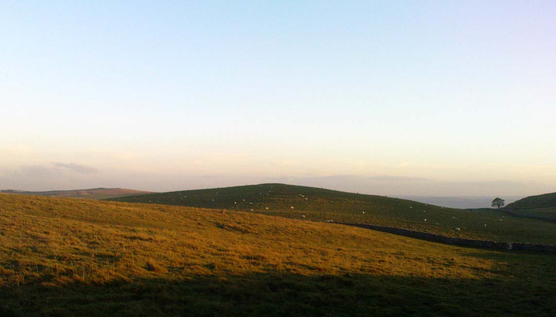
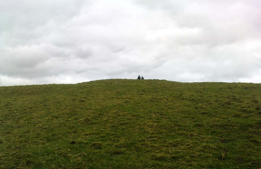
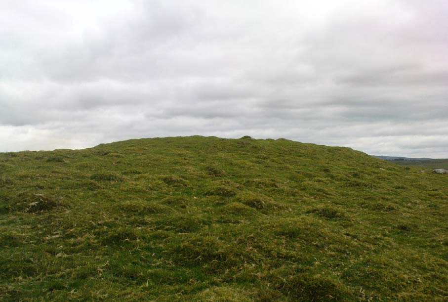
Although somewhat overgrown thanks to the persistence of Nature, this good-sized burial mound on top of this, one of many small hills in and around the moors hereby, is a fine specimen to behold and a fine place to sit and drink in the view.  Although not quite having the grandeur of the Great Close Hill tomb a mile to the north, the countryside hereby is still impressive and was of obvious importance in the mythic landscape of our Bronze Age ancestors.  If you think otherwise, there’s obviously summat wrong with you.

Approaching the tumulus
Seaty Hill tumulus

Although we can only see the remains of one singular round tomb today, at least two other tumuli were once in evidence in this large open field but they were dug out many years back.  There were probably even more of them, but any trace has long since gone.  Thankfully this one was given the attention of decent archaeologists some fifty years back, when Arthur Raistrick (1962) and his mates got stuck into the place.  His initial account of the place told us how it was,

“…surrounded by a shallow ditch and bank enclosing a low mound 66 feet diameter, rising about 4 feet above the ditch bottoms.  In the original surface of the hill top there had been dug two holes, circular and partly impinging on one another, both 3ft 6in deep.  In the northwesterly one of these a skeleton had been carefully placed in a sitting position, with knees drawn well up, and was facing the second hole  which is to the southeast.  This hole was almost filled by a carefully built cairn of limestone boulders, but nothing was found either in or beneath it.  No artifact of any kind was found with the skeleton.  Both holes had been filled in with fine sandy and gravelly loam to the natural ground level and then covered with a low mound, 15 feet in diameter and 1 foot high, of coarser gravel and small boulders.  The second mound, 66 feet diameter, of limestone rubble and boulder clay and 3 feet high above ground level, was put over this and provided with a kerb of large limestone boulders buried in the toe of the mound.  A shallow ditch was then dug and its spoil thrown outwards to form a shallow bank.

“In the surface of the large mound there were not less than 13 secondary burials of early Iron Age, each in a small saucer-shaped depression filled in with gravelly loam.  These burials are extremely fragmentary and are more like token burials than complete ones.  In three of them, beads were found, one of jet, one of blue glass and one of carved limonite.  In a burial nearly over the central older burial, a skeleton was arranged with a bone (musical) pipe between the knees, where also there were several small bones of hand and wrist and part of an iron knife.  The (musical) pipe was made from the tibia of a sheep, perforated  with three finger holes, with a well-shaped speaking lip and mouthpiece.  The pipe was playable… A full account of this unique instrument has been published elsewhere… In two of the burials there were recognizable fragments of iron knives, and in two others pieces of iron of unrecognized use, all in positions which could have been under the knee of a more primitive skeleton.  By analogy and style the primary burial has been assigned to the Early Bronze Age, and the Iron Age burials to the period first century BC to the first century AD.”

It would be intriguing to ascertain how many people from this period were playing flute-like instruments such as the one found here, and whether (as with other musical instruments in all other tribal cultures on Earth) magickal virtues were assigned to it, or the music it liberated.  Certainly in a great number of places around this very area where this instrument was found, many natural sites still abound with the hugely underrated virtue of silence; and upon the still air amidst which music would be cast, the echoes or else faint sense of such sound would evoke a marvel — curious or dreamt — to those upon who it fell.  If you think otherwise, there’s definitely summat wrong with y’!

References:

  1. Raistrick, Arthur & Holmes, Paul F., Archaeology of Malham Moor, Headley Bros: London 1961.

Links:

  1. Articles on the Malham Iron Age Pipe, by Arthur Raistrick, etc

© Paul Bennett, The Northern Antiquarian