Baildon Moor Carving (150), West Yorkshire

Cup-and-Ring Stone:  OS Grid Reference – SE 13724 40096

Also Known as:

  1. Carving no.22 (Hedges)

Getting Here

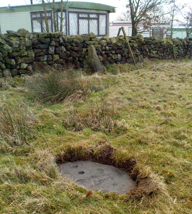
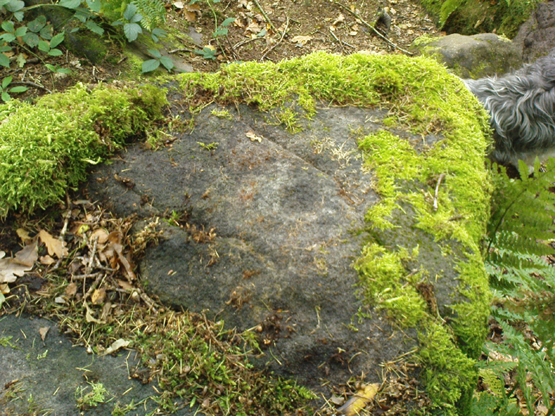
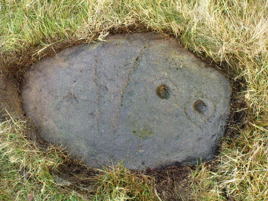
Carving 150, with Dobrudden Stone to rear

Whether you come via Shipley Glen or Baildon, head for the Dobrudden caravan park on the western edge of Baildon Hill.  As you get to the entrance of the caravan site, turn right and walk along the outer walling of the caravan site, up and around for less than 100 yards.  Keep your eyes peeled for the upright stone against the outer walling (the famous Dobrudden Cup-and-Ring Stone), and just 10 yards away, laid flat in the grasses, you’ll see this small cup-and-ring stone!

Archaeology & History

Found just a few yards from the well-known Dobrudden Carving that stands up against the wall, this small flat level stone, slowly again being encroached by Earth’s skin, is found on the edge of the High Plain, whereon the usual conjunction of prehistoric tombs and cup-and-rings is found once again.  Whether this carving ever had its own cairn or funerary monument is now hard to say for sure; and the excessive erosion of modern humans is slowly eradicating the landscape all round here.
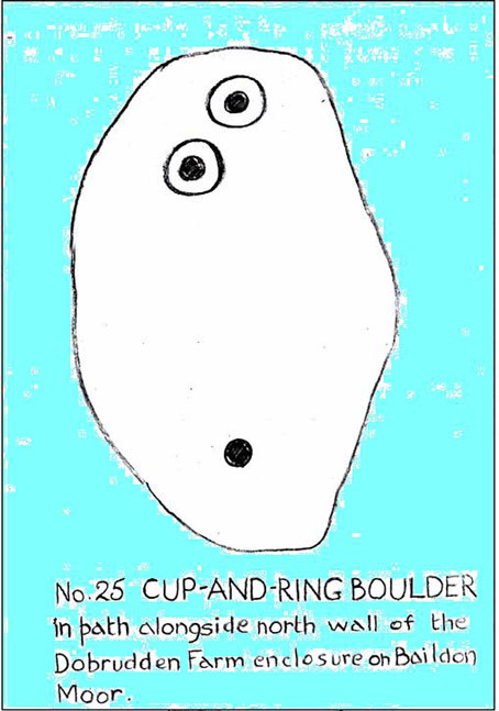
Jackson’s 1956 drawing
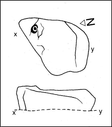
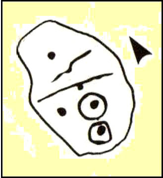
Hedges 1986 drawing

Consisting of two cup-and-rings (with very deep cupmarks in the centres), there are also what seem like artificially carved lines or grooves running across the stone.  It was first described in a short article in the Cartwright Hall Archaeology Group Bulletin (Jackson 1956)*, found lying “in the path alongside the north wall of the Dobrudden Farm enclosure.”  It seems like stone may have been covered over until some local work on Dobrudden unearthed it in the latter half of the 20th century.  There’s also an intriguing note told by a local man called Jack Taylor, which Jackson narrated, saying how he,

“always held the opinion that the rings were not contemporary with the cups, and went so far as to suggest that they had been carved within living memory by someone anxious to ‘improve’ the boulder.”

This might be the case, as there is another carving not far away near the top of Baildon Hill that certainly seems to have been done in the 20th century.  And one of the two surrounding rings on this stone does appear to have a more recent look to it than the other.  However, we must consider that the covering soil has kept the carved rings in such good condition. (There are examples of petroglyphs throughout the world where certain carved elements were added at later times by countless aboriginal tribes.)
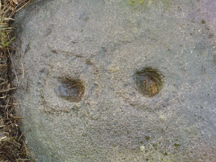
Close-up of cup-and-rings
Dobrudden carving 150

Like all of these carvings, to get an accurate picture of the true original we must visit them in all weathers all through the year, to see how differing seasons express the petroglyph. For we can see on some images we have of this carving a number of features that aren’t on the drawings of either Jackson (1956) or Hedges (1986): whether the rings surrounding the cups are ancient or not, there is a definite carved line nearly linking them together; and at least one faint line stretches down from one of the rings.  We need to visit the carving again to see if such features show up with greater clarity when lighting conditions are better.

References:

  1. Baildon, W. Paley, Baildon and the Baildons – parts 1-15, Adelphi: London 1913-1926.
  2. Bennett, Paul, Megalithic Ramblings between Ilkley and Baildon, unpublished: Shipley 1982.
  3. Boughey, Keith & Vickerman, E.A., Prehistoric Rock Art of the West Riding, WYAS: Leeds 2003.
  4. Hedges, John, The Carved Rocks on Rombald’s Moor, WYMCC: Wakefield 1986.
  5. Jackson, Sidney, “Another Cup-and-Ring Boulder,” in Bradford Cartwright Hall Archaeology Group Bulletin, 1:13, 1956.

* Boughey & Vickerman (2003) cited W. P. Baildon’s magnum opus (1913) as the first to describe this stone, but this is untrue (there’s certainly no mention nor illustration of it in my editions of the Baildon volumes).

© Paul Bennett, The Northern Antiquarian


Ashlar Chair, Burley Moor, West Yorkshire

Legendary Rock:  OS Grid Reference – SE 12075 44833

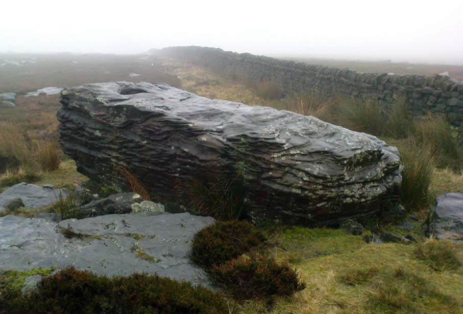
Ashlar Chair, looking southeast

Also Known as:

  1. Carving no.111 (Hedges)
  2. Carving no.115 (Boughey & Vickerman)
  3. Druid’s Chair
  4. Etching Stone

Getting Here

There are two large boulders here, one of which was deemed the Ashlar many moons back. You can approach it from the lazy way: park y’ car at the top of the road by the Whetstone Gate TV masts and walk east right along the boundary path till you get here. The better way is from Twelve Apostles: from there walk a coupla hundred yards north to the Lanshaw Lad boundary stone, where a small path heads west. Along here for another coupla hundred yards, then hit the footpath south for the roughly the same distance again. You’ve arrived!

Archaeology & History

The Ashlar Chair is ascribed in folklore, said Harry Speight (1892), “to be a relic of druidism,” as one of its titles in ages past was the Druid’s Chair.  In the nineteenth century it also became known as the Etching Stone, (Smith 1961-63) but it has retained its present title for more than two hundred years.  Shaped more like a couch than a chair, its present title—the Ashlar—is important in ritual Freemasonry, which has two aspects to it: the ‘rough’ and the ‘perfect’.  The first represents the neophyte; the latter, the illumined one.  Oaths are sworn on the ashlar, and laws are spoken from it.  In its higher aspect it is representative of the spiritual maturity  of evolved man.

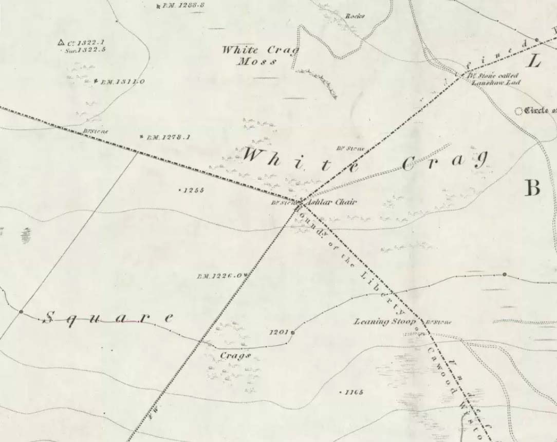
Ashlar Chair on 1851 map

Although there are no public records as to who gave the site its present name, the land which lays before it, The Square, is an even greater indicator that this rock was was considerably more than just a curious place-name, for the open moorland that is overseen from Ashlar Chair—The Square — is 396,000 square yards of flat open heathlands that have never been archaeologically explored.  The Square is also one of the most important elements of Freemasonry: representing the manifest universe, its laws are spoken from the Ashlar. (Jones 1950)

Between the two of them, represented here in the landscape near the very tops of these moors, we have a form of late geomancy, although the names of our geomancers are nowhere to be found.  It is obvious though, simply from the name of the land, that dramatic ritual of some form was enacted here.  In recent times, ritual magickians from differing Orders have found the place most effective, as have wiccan folk and other pagans who have frequented it at the summer solstice.  The possibility that some members of the Grand Lodge of ALL England (a legendary Masonic Order, said by the modern London masons not to have existed until the eighteenth century) gave this place its name is not unreasonable.  Records show that in the fourteenth century at least one member of the Order, Sir Walter Hawksworth, frequented ritual circles on these moors; and another member of the same Lodge from the nearby Washburn valley was an ally to the Pendle and Washburn witches who, we know, met on these moors at Twelve Apostles stone circle and probably the Ashlar.  But it proves nothing I suppose. (I tend to believe (not a necessarily healthy viewpoint) that the Grand Lodge did use the Ashlar as one of their moot points, along with the Pendle and Washburn witches.)

Its primary geomantic attribute is as an omphalos.  Geographically the Ashlar Chair is the meeting-point of Bingley, Burley, Morton and Ilkley moors and, metaphorically speaking, when you stand here you are outside the confines of the four worlds yet still a purveyor of them.

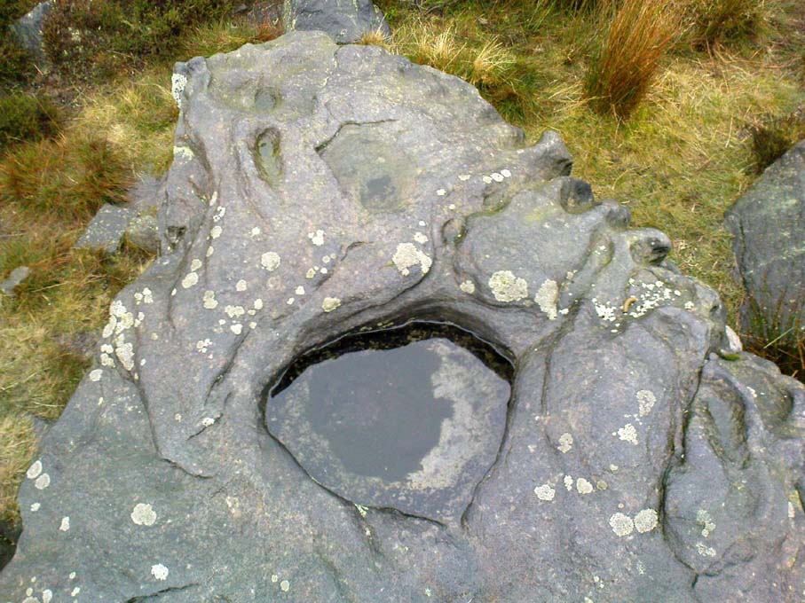
Nature’s cups-and-grooves on the Ashlar

Upon the large rock itself it are carved the faint initials, “MM, BTP, ISP and IG, 1826.”  Several early records described cup-and-ring designs on the Ashlar: firstly in Forrest & Grainge’s (1868) archaeological tour; then in Collyer & Turner’s Ilkley (1885); and lastly by the great Yorkshire historian and topographer Harry Speight (1892, 1900), who said “it bears numerous cups and channels.”  Although we can see some of these on top of the Ashlar, they are mainly Nature’s handiwork.  It is possible that some man-made cup-and-rings once existed on the rock, but if so they have eroded over time.

References:

  1. Bennett, Paul, The Old Stones of Elmet, Capall Bann: Milverton 2001.
  2. Collyer, Robert & Turner, J.H., Ilkley Ancient & Modern, William Walker: Leeds 1885.
  3. Forrest, C. & Grainge, William, A Ramble on Rumbald’s Moor, among the Dwellings, Cairns and Circles of the Ancient Britons in the Summer of 1867 – Part 1, W.T. Lamb: Wakefield 1868.
  4. Jones, Bernard E., Freemason’s Guide and Compendium, Harrap: London 1950.
  5. Speight, Harry, Chronicles & Stories of Old Bingley and District, Elliott Stock: London 1892.
  6. Speight, Harry, Upper Wharfedale, Elliott Stock: London 1900.

© Paul Bennett, The Northern Antiquarian


Panorama Woods (236), Ilkley, West Yorkshire

Cup-and-Ring Stone:  OS Grid Reference – SE 10395 47039

Faint cup-and-ring carving

Also Known as:

  1. Carving no.68 (Hedges)
  2. Carving no.236 (Boughey & Vickerman)

Getting Here

From Ilkley, take the Wells Road heading towards White Wells, bending round the bottom of the moor, making sure you keep left along Westwood Drive (not further up the moor along the Keighley Road).  Keep along Westwood Drive – it becomes Panorama Drive after a while – until you come to the small copse of woods on your right, a short distance before the end of the road.  Go along the footpath by the wall at the side of the house, bending into the woods after 10 yards.  Another 10 yards on, you’re near the edge a drop down the slope, where a number of large rocks are seen.  Look around!

Archaeology & History

Carving 236 (after Boughey & Vickerman)

A singular cup-and-ring carving can be seen, rather faintly, near the nose-end of this large mossy stone, close to the edge of the ridge.  It is one of a small cluster of carvings that remain in this small bit of woodland.  Other highly ornate carvings could once be seen in the same stretch of woodland — where the rich houses now stand — amidst remains of a prehistoric enclosure or settlement of some sort.  All remains of this settlement have been destroyed, which is a pity as it may have given us helpful information about the nature of this carving and its nearby relatives.

References:

  1. Bennett, Paul, The Panorama Stones, Ilkley, TNA: Yorkshire 2012.
  2. Boughey, Keith & Vickerman, E.A., Prehistoric Rock Art of the West Riding, WYAS: Wakefield 2003.
  3. Hedges, John (ed.), The Carved Rocks on Rombalds Moor, WYMCC: Wakefield 1986.

© Paul Bennett, The Northern Antiquarian 


Rivock Well, Silsden, West Yorkshire

Healing Well:  OS Grid Reference – SE 07782 44863

Getting Here

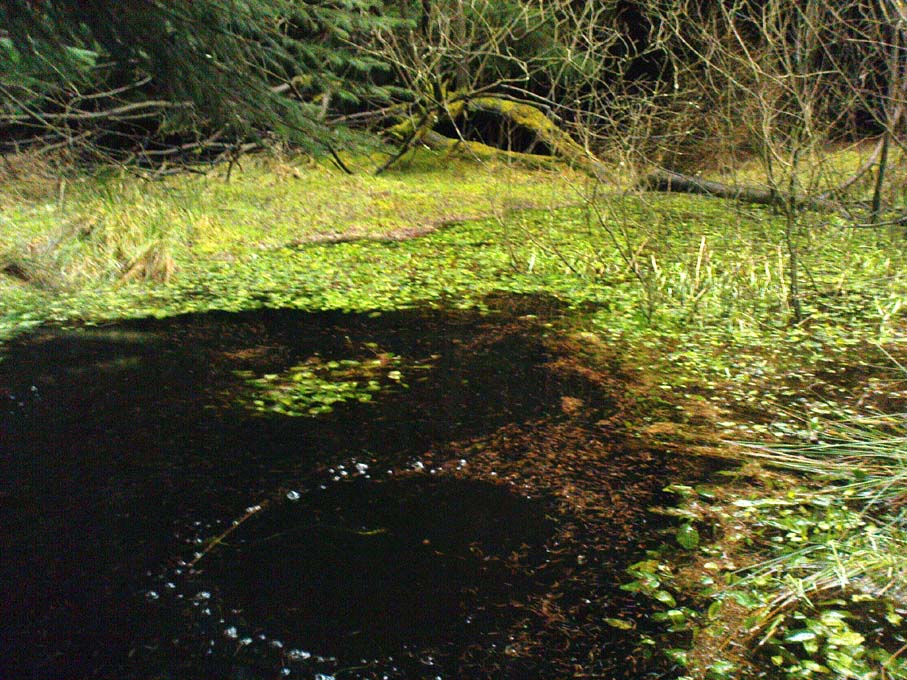
Rivock Well pool

From the B6265 valley road between Bingley and Keighley, just near Riddlesden Hall, take the road up and over the canal into Riddlesden, bearing left up past West Riddlesden Hall and up Banks Lane. As you reach the T-junction at the top, where you hit the Silsden Road that goes round the moors, park up.Cross the road and follow the footpath diagonally across the bottom of the field, then when you hit the track, follow it up through the closed gates into the woods.  A half-mile along the track, watch out for the dark pool a few yards beneath you on your left.  That’s it!

Archaeology & History

The spirit and feel of this pool is a curious one: still, calming, but with a slight sense of unease at times.  It felt like this before the large forestry plantation was planted around it — so it’s good to know it’s kept its spirit intact.  I’m not quite sure how long it will last though… The small spring of water from just above the edge of the pool which in part feeds it, tastes good and refreshing after a good downpour, but sometimes in recent years the waters have slowed somewhat compared to earlier decades — an unhealthy state of affairs that’s happening all over the world.

A favourite haunt for very colourful dragonflies, deer, pheasant and other animals, very little has been written about this site.  Said by place-name authorities to get its name from an old oak that once stood by its side, the name must be pretty old as no remains of such a tree has been mentioned by any antiquarians in the last 200 years.  But the first element in the place-name “riv-ock” is an intriguing puzzle.  Does it mean simply a split oak?  Or was it a more regal in nature, and derive from the old Gaelic Righ, (proncounced ‘ree’) meaning a King’s Oak?  More probably the name relates to the “well by the twisted oak,” from the dialect word, rive, or ‘twisted’.  However, when we begin exploring dialect variations on this word, a whole host of possible meanings emerge!

Ancient people who lived on these moors obviously used this well — and no doubt had old tales of its medicinal virtues, but sadly these are lost.  All we have to remind us that our ancestors came here are the numerous cup-and-ring stones found at Rivock Edge itself, a short distance southeast of here…

References:

  1. Whelan, Edna & Taylor, Ian, Yorkshire Holy Wells and Sacred Springs, Northern Lights: Dunnington 1989.

© Paul Bennett, The Northern Antiquarian


Dave’s Stone, Rivock, Riddlesden, West Yorkshire

Cup-Marked Stone:  OS Grid Reference – SE 07634 44209

Getting Here

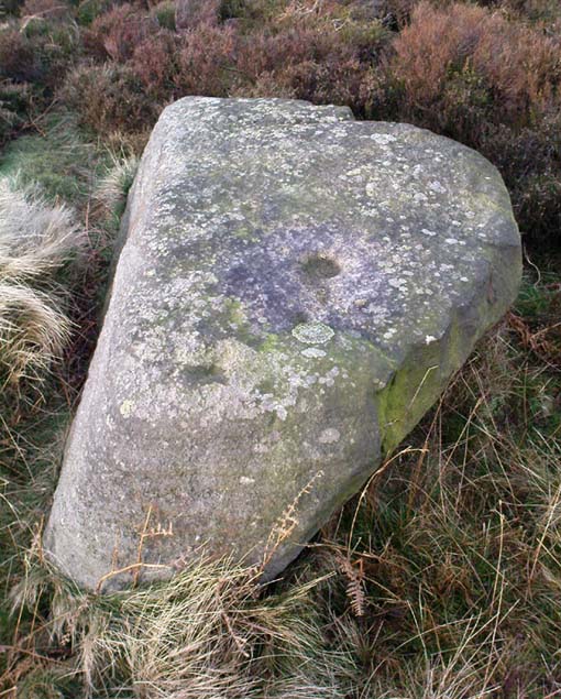
Rock with cup-markings

From the B6265 valley road between Bingley and Keighley, just near Riddlesden Hall, take the road up and over the canal into Riddlesden, bearing left up past West Riddlesden Hall and up Banks Lane. As you reach the T-junction at the top, where you hit the Silsden Road that goes round the moors, park up. Takes the footpath across the road and walk straight uphill, all the way to the top just above where the tree line ends and you’re on the moorland flat.  Bear right, over one wall, then walk 20-30 yards further and the stone in the photo here should be roughly under thine nostrils!

Archaeology & History

There’s no previous record of this as a cup-marked stone, so it needs adding here.  I’ve gotta admit that I’m not 100% sure about it as a real prehistoric carving — but considering the dubious nature of the nearby Carving no.58 and the Rivock Nose Stone, this is roughly somewhere in-between in terms of its legitimacy as an ancient carved stone.  Certainly I’ve come across other cup-markings, adjudged by newly-qualified ‘professionals’ as fine, but which I find highly questionable — so this one that Dave Hazell came across a couple of years ago should certainly be added to their professional rock art catalogues.

Close-up of the cupmarks

It’s simple enough: a four-feet long stone, whose top east-facing edge has been worked in more recent centuries by the miners who dug on the slopes below (perhaps to turn it into a gatepost?).  There are three notable ‘cups’ that are clearly visible on the photos here.  The topmost cup is something pretty recent, having had industrial attention given it; the largest cup may be natural; but the one in the middle seems to be what our English Heritage rock-art enthusiasts term a legitimate prehistoric petroglyph.  It certainly seems a good one!  Have a look for yourself and see what you reckon! It’s in a good spot and is certainly worth the wander, if only to have a look at other cup-and-rings in the region.

© Paul Bennett, The Northern Antiquarian


Rivock Edge (60), Silsden, West Yorkshire

Cup-and-Ring Stone:  OS Grid Reference – SE 07476 44475

Also Known as:

  1. Carving no.22 (Hedges)
  2. Roof Stone

Getting Here

Cup-mark on top of the rock

From the B6265 valley road between Bingley and Keighley, just near Riddlesden Hall, take the road up and over the canal into Riddlesden, bearing left up past West Riddlesden Hall and up Banks Lane. As you reach the T-junction at the top, where you hit the Silsden Road that goes round the moors, park up. Cross the road and follow the footpath up the field, but walk up the side of the field-wall where the woods are, all the way to the top. On the flat, you’ll see a gap in the woods on your left, and the triangulation pillar atop of Rivock Edge 150 yards away.  Head towards it, watching out for one of the natural rocks rising near the middle of the grasses. It’s one of them!

Archaeology & History

Faint cup-and-ring, centre of photo

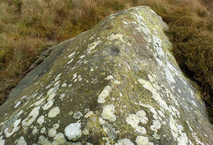
Exactly halfway between the cup-marked Niplet Stone and the large flat Carving 58 (Boughey & Vickerman survey) is this natural long upright rock, shaped in the form of a house-roof, with its apex running along an axis SE-NW, its sloping sides dropping either side into the deep wet heather.  Upon its crown is what may be a singular cup-marking, almost perfectly formed, though is just as likely to be Nature’s handiwork as much as anything else.  But on its western-face, within the mass of old lichen painting the rock surface, a more distinct man-made cup-mark has been cut.

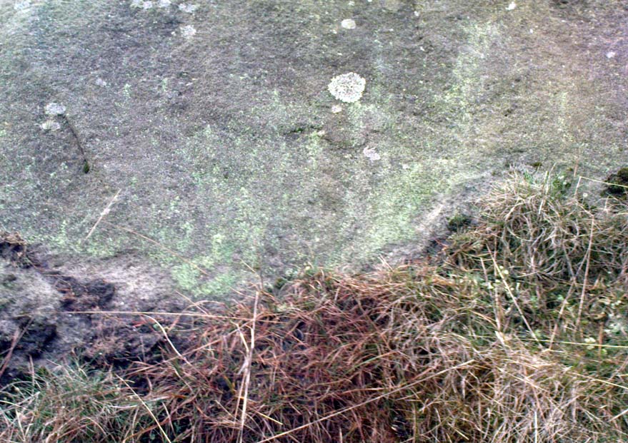
On its eastern face, close to where the rock meets the boggy Earth, a singular faint cup-and-ring design can be made out, albeit a somewhat mis-shapen one.  It’s easily missed if the lighting isn’t too good as it’s very eroded indeed.  The carving was first described in Mr Hedges (1986) survey, where he told:

“Rough grit rock with ridge, in crowberry and heather with cup and ring on E edge and possible cups and grooves.”

The stone’s certainly worth visiting, as a number of other cup-and-ring stones scatter this region — half of them officially recorded, but nearly as many again that aren’t.  It’s a good area to explore.

References:

  1. Bennett, Paul, “The Prehistoric Rock Art and Megalithic Remains of Rivock & District (parts 1 & 2),” in Earth, 3-4, 1986.
  2. Boughey, Keith & Vickerman, E.A., Prehistoric Rock Art of the West Riding, WYAS 2003.
  3. Hedges, John (ed.), The Carved Rocks on Rombald’s Moor, WYMCC: Wakefield 1986.
  4. Morris, Ronald W.B., “The Prehistoric Rock Art of Great Britain: A Survey of All Sites Bearing Motifs more Complex than Simple Cup-marks,” in Proceedings of the Prehistoric Society, volume 55, 1989.

© Paul Bennett, The Northern Antiquarian 


Rivock Edge (58), Silsden, West Yorkshire

Cup-Marked Stone:  OS Grid Reference – SE 07466 44497

Also Known as:

  1. Carving no.21 (Hedges)

Getting Here

Take the same directions as if you’re visiting the Rivock Edge 060 Carving.  It’s 25 yards NNW – you can’t really miss it!

Archaeology & History

Rivock Edge, carving 58

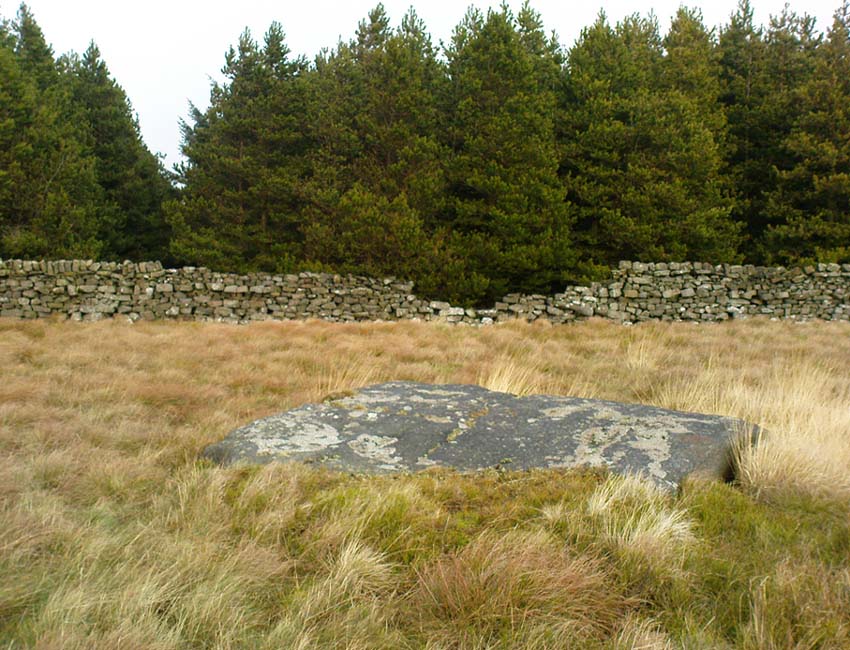
This large flat rock, with a couple of long lines almost splitting the rock into sections, was first mentioned as a prehistoric site in John Hedges (1986) survey, where he described it simply as, “Large rough grit rock with possible four cups, in crowberry.” Boughey & Vickerman (2003) said even less about it!  One of the cups is very distinct, but the others are somewhat faded and perhaps even dubious.  It’s still worth a look at, if only due to the other better carvings nearby.

References:

  1. Bennett, Paul, “The Prehistoric Rock Art and Megalithic Remains of Rivock & District (parts 1 & 2),” in Earth, 3-4, 1986.
  2. Boughey, Keith & Vickerman, E.A., Prehistoric Rock Art of the West Riding, WYAS 2003.
  3. Hedges, John (ed.), The Carved Rocks on Rombald’s Moor, WYMCC: Wakefield 1986.

© Paul Bennett, The Northern Antiquarian 


Horncliffe Well, Hawksworth Moor, West Yorkshire

Healing Well:  OS Grid Reference – SE 13214 43326

Also Known as:

  1. Horncliff Well

Getting Here

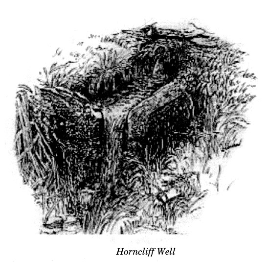
Horncliffe Well – as it once was

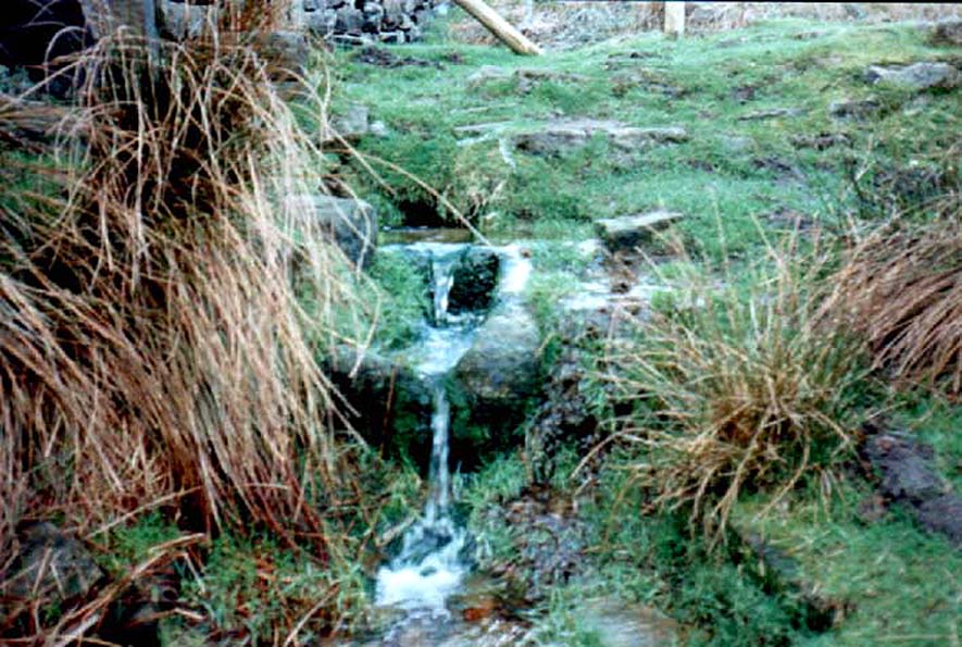
From the famous Dick Hudson’s pub on the south side of Ilkley Moor, take the road right (east) for a half-mile until you reach the large Weecher Reservoir just off the roadside on your right.  Less than 300 yards past the reservoir, a footpath takes you onto the moor itself.  Walk up the path for about ⅔-mile — crossing one wall, then walking roughly parallel with another on your right — until you reach a crossing of paths where there are 2 gates or stiles.  Take the lower of the two stiles, through the wall, but below the fence.  You’ll see an awful Yorkshire Water cover, which has just about destroyed the once-fine well that had always flowed here.  Below this, by the wallside, are the trickling remains of our old healing spring.

Archaeology & History

When I was a young boy, Horncliffe Well was the site we would visit every weekend as our first stopping-spot on our regular ventures exploring these moorlands — “from Wrose to Rombalds,” as we use to call it!  The old well was always very plentiful, strong-flowing, cold and truly refreshing.  It was undoubtedly the best water source on the entire Rombalds Moor region, never drying up.  Even in the great droughts of 1976 and 1995, after all others had just about failed, the waters at Horncliffe were still flowing as strong as ever, as they had always done.  But not anymore…

Edna Whelan’s old drawing

First described in land records of 1273 CE, this has always been a well of great repute and oral tradition told that this great old well never ran dry. It marked the ancient boundary point where the moorlands of Hawksworth, Burley and Bingley all meet.  By name alone it is associated with the nearby and curious Horncliffe Circle, whose status itself is unclear (the circle seems more a place of refuge or living than a true ritual site).

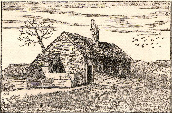
Horncliffe House around 1801

The remains of old buildings on the flat just above where the waters once flowed were built in much more recent centuries.  The building appears to have been started around 1799, for E.E. Dodds (1985) told that in 1800 it was used as a school for several years by local teacher Joshua Briggs.  J. Horsfall Turner (1907) published a copy of an old drawing of the school, as it was soon after construction.

Horncliffe Well was dug into by the privatized water company known as Yorkshire Water (owned by rich greedy fuckers) in the 1990s, who channelled most of its endless supply away for commercial benefit.  When their company was stealing the water from the moors, the workmen snapped an old markstone at its base next to the adjacent Horncliffe House (in ruins).  The waters had always flowed fast and freely, but after Yorkshire Water had finished their ‘work’ here, the great majority of Horncliffe’s water supply subsided considerably, leaving walkers, birds and animals to suffer from its demise.  In all sincerity, it’s to be hoped that good people someday will visit this once-fine site and return it to its previous healthy status.

Folklore

When we were kids we came here every weekend and got to know the old ranger who we’d meet either here or at the adjacent Horncliffe Circle, 250 yards NNE, where we’d sit and eat.  In the mid-1970s, he told us that the old well was once a site where the fairy-folk would play, around Mayday (beltane).  And though in later years I’ve sought for any information about this in all early antiquarian books that cover this area, I’ve never found any mention of this tale in print.  The old ranger knew the moors and its history better than anyone I’ve ever known and many old stories died with him after his death.

References:

  1. Bennett, Paul, The Old Stones of Elmet, Capall Bann: Chieveley 2003.
  2. Dodd, E.E., Bingley: A Yorkshire Town through Nine Centuries, M.T.D. Rigg: Guiseley 1985.
  3. Laurence, Alastair, A History of Menston and Hawksworth, Smith Settle: Otley 1991.
  4. Turner, J. Horsfall, Idle Upper Chapel Burial Registers and Graveyard Inscriptions, Harrison & Son: Bingley 1907.
  5. Whelan, Edna, The Magic and Mystery of Holy Wells, Capall Bann: Chieveley 2001.
  6. Whelan, Edna & Taylor, Ian, Yorkshire Holy Wells and Sacred Springs, Northern Lights: Dunnington 1989.

© Paul Bennett, The Northern Antiquarian


Heber’s Ghyll Chalybeate, Ilkley, West Yorkshire

Healing Well:  OS Grid Reference – SE 0988 4692

Getting Here

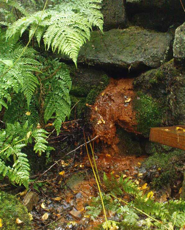
Hebers Ghyll chalybeate

Walk from Ilkley up the Wells Roads as if you’re going to the White Wells, but keep following the road along, keeping to the moorside (don’t go up Panorama Drive).  A few hundred yards up, crossing the small bridge over the gorse-scattered stream, take the footpath to your right and walk along the moor-bottom, parallel to the rich houses.  Keep walking, past the reservoir (don’t go up the slope on the newly created path) and cross the small wooden bridge.  Once over the other side, head through the gate and walk along the rocky footpath into the woods.  Less than 100 yards down where the first seat is, there’s a slow-running blood of water oozing out from the rocks.

Archaeology & History

At the top of this bit of old woodland, out of rocks near the top of the trees, emerges another of Yorkshire thousands of chalybeates, or iron-bearing springs of water, on the very edge of Ilkley Moor.  Collyer and Turner (1885) mentioned its discovery in 1883, but gave no further details.  Searching for this place on one of my countless moorland ambles as a child, I found its waters oozing slowly from betwixt moss-enriched rocks on the west side of the stream.  If you look for it in the dry season though, there is little to see.  It is best seen later in the year, after heavy rains, although the waters are pretty slow running and have that distinct “off” taste (an attribute well-known of chalybeates —taste ‘em and see!).  The only real account of this little-known healing well was told in an early edition of the Leeds Mercury (1883), shortly after its rediscovery, in which we were told:

“Our Ilkley correspondent says the existence of a chalybeate spring has lately been discovered there, and from its valuable medicinal properties will prove a valuable adjunct in the future development of this health resort.  The water from the spring (which is situated near to the Panorama Rocks, in what is known as Hebers Gill, or Briery Wood) has been submitted to Mr F.M. Rimmington…of Bradford for analysis and his report is of a most favourable character.  The data shows that the water is remarkable for the smallness of the amount of its saline constituents, and (so far as the analyst has been able to discover by reference to published analysis of either English or Continental chalybeate springs), there is not one comparable to it: whilst its ferruginous element is equal to the majority of such waters and, in Mr Remmington’s opinion, as large as is desirable for medicinal effect.  The spa that most resembles the one under notice is that of Tunbridge Wells in Kent, which is derived from exactly the same geological formation (millstone grit), the total solid constituents of this water being 13½ grains to the gallon.  The report adds that, “The use of this class of waters as medical agents has, from remote periods, been found efficacious in those states of debility denominated anemia,” and “the value of this class of spa water as a safe and natural remedy can scarcely be overestimated.”  From the foregoing it will be seen that an important discovery has been made…”

This once important spring of water — that would have been known and used by our prehistoric ancestors living on the moors above — is nowadays but a shadow of its former self.  The water tables drop annually as a result of moorland drainage and other poor land management and we only see a small trickle of water emerging from the mossy rocks these days…

…to be continued…

References:

  1. Anonymous, “Important Discovery at Ilkley,” in Leeds Mercury, August 18, 1883.
  2. Bennett, Paul, Healing Wells and Springs of Ilkley Moor, unpublished: Hebden Bridge 1995.
  3. Collyer, Robert & Turner, J.H., Ilkley: Ancient and Modern, William Walker: Otley 1885.

© Paul Bennett, The Northern Antiquarian


Pennythorn Hill, Baildon Moor, West Yorkshire

Tumulus (destroyed):  OS Grid Reference – SE 13922 40984

Archaeology & History

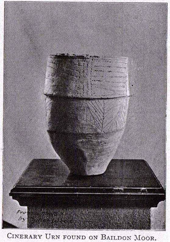
Pennythorn Hill urn
Site highlighted on 1909 OS-map
Site shown on 1909 OS-map

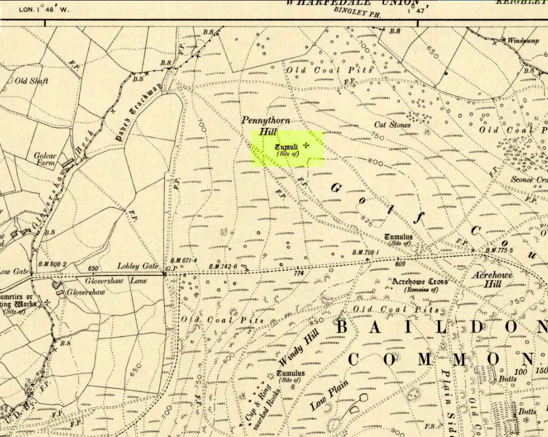
Highlighted on the 1909 OS-map of the area, on the top of the hill a short distance from the roadside, about 250 yards northwest of the Acrehowe Hill site (now at the edge of the golf course) could once  be seen another prehistoric burial mound.  The rediscovery of this tumulus was first announced briefly in the January 1905 edition of the Bradford Scientific Journal (issue no.3).  A few months later the local writer and historian William Preston (1905) wrote a more detailed article on the site, telling the following information:

“A discovery of considerable interest to local archaeologists was made early in December, 1904, on the summit of the spur of moorland on the northwest of Baildon Moor, known as Pennythorn Hill.

“A workman engaged in removing stones from an extension of the golf course, unearthed an ancient cinerary urn containing calcined human bones, a flake of flint which may have served the purpose of an arrow point, a bronze instrument, and a perforated piece of bone, unfortunately broken during calcination.  An examination of the site of the discovery revealed the remains of a tumulus, the upper part at some time removed, with a diameter as near as it was possible to tell, of about fifteen feet.  In point of construction it differed little from others which are to be found in the locality.  The vessel had been placed in an inverted position over the calcined bones, in a hole made in the sandy subsoil.  There was no indication of the urn having rested in a cist.

“The earth beneath the urn bore no evidences of fire, and it is likely that the funeral pyre on which the corpse was reduced to ashes was not erected on the spot.  It may be assumed from the association of the weapons named that the bones are those of a male person.

“The height of the urn is twelve and a half inches, it is eight and a quarter inches in diameter, and taper in the lowest third of its height to a base of about three inches in diameter.  In the course of its excavation it was broken by the workmen, but it has been excellently restored in the laboratory of the Hull Museum…

“The urn belongs to the early British type and its date is, probably, well before the Roman invasion of the island.  The general outline of the urn is very similar to that of some urns found by Canon Greenwell in the course of his exploration of the barrows of the north of England… The surface of the urn is divided into three zones.  The upper part of the vessel consists of a raised border, about four inches wide, decorated with horizontal and vertical lines alternately arranged, and produced by pressing a twisted thong up0n the clay of which it was composed… Beneath the border and upon the central part of the body, a different form of decoration has been carried out.  A zig-zag line scratched in the clay has been carried around the body, forming a number of triangular compartments, which were filled in with diagonal lines, giving he appearance of a herring-bone pattern.  The counterpart this design does not appear on any of the urns figured by Canon Greenwell in his records of digging in British barrows.”

References:

  1. Greenwell, William, British Barrows, Clarendon Press: Oxford 1877.
  2. Preston, William E., “The Discovery of a Cinerary Urn on Baildon Moor,” in Bradford Scientific Journal, no.4, April 1905.
  3. Wardell, James, Historical Notes of Ilkley, Rombald’s Moor, Baildon Common, and other Matters of the British and Roman Periods, Joseph Dodgson: Leeds 1869. (2nd edition 1881)

© Paul Bennett, The Northern Antiquarian