Ossian’s Stone, Sma’ Glen, Fowlis Wester, Perthshire

Ring Cairn:  OS Grid Reference – NN 89532 30595

Ossian's Stone, Sma' Glen
Ossian’s Stone

Also Known as:

  1. Cairn Ossian
  2. Canmore ID 25554
  3. Clach-na-Ossian
  4. Clach Ossian
  5. Giant’s Grave
  6. Ossian’s Grave
  7. Soldier’s Grave

Getting Here

Shown as Soldier's Graves on 1863 OS-map
Shown as Soldier’s Graves on 1863 OS-map

There are two ways into this glen by road. Whichever route you take (from Crieff side, or via the long Dunkeld route), when you hit the flat bottom of it, where the green fields are right by the roadside, walk along till you find the road meets the river’s edge.  On the south-side of this small roadside section of the river, you’ll see a single large boulder 10-20 yards away. That’s the spot!

Archaeology & History

Described in some of the archaeology texts as just a ‘cist’, this giant stone is obviously the remains of much more.  For a start, as the 1834 drawing illustrates here (coupled with several other early descriptions of the place), other visible antiquarian remains were very much apparent at Ossian’s Stone before a destructive 18th century road-laying operation tore up much of this ancient site.  A marauding General Wade of the English establishment was cutting through the Scottish landscape a “military road”, to enable the English to do the usual “civilize the savages”, as they liked to put it.  This curious “Giant’s Grave” was very lucky to survive.

Skene's 1834 sketch, showing surrounding ring
Skene’s 1834 sketch, showing surrounding ring
Ossian's Stone in the Sma' Glen
Ossian’s Stone in the Sma’ Glen

The earliest description of events surrounding the site, as well as the attitude of the Highlanders when they saw the disrespectful English impose their usual disregard, is most insightful.  In a series of letters written by a Captain Edward Burt (1759) in the first-half of the 18th century to the english monarch of the period, we read a quite fascinating account which must have been very intriguing to witness first-hand.

General Wade and his band of marauders had reached the Sma’ Glen at the end of Glen Almond and were about to continue the construction of their road.  Burt (1759) wrote:

“A small part of the way through this glen having been marked out by two rows of camp colours, placed at a good distance one from another, whereby to describe the line of the intended breadth and regularity of the road by the eye, there happened to lie directly in the way an exceedingly large stone; and, as it had been made a rule from the beginning, to carry on the roads in straight lines as far as the way would permit, not only to give them a better air, but to shorten the passenger’s journey, it was resolved the stone should be removed, if possible, though otherwise the work might have been carried along on either side of it.

“The soldiers, by vast labour, with their levers and jacks, or hand-screws, tumbled it over and over till they got it quite out of the way, although it was of such an enormous size that it might be matter of great wonder how it could ever be removed by human strength and art, especially to such who had never seen an operation of that kind: and, upon their digging a little way into that part of the ground where the centre of the base had stood, there was found a small cavity, about two feet square, which was guarded from the outward earth at the bottom, top, and sides, by square flat stones.

“This hollow contained some ashes, scraps of bones, and half-burnt ends of stalks of heath; which last we concluded to be a small remnant of a funeral pile.  Upon the whole, I think there is no room to doubt but it was the urn of some considerable Roman officer, and the best of the kind that could be provided in their military circumstances; and that it was so seems plainly to appear from its vicinity to the Roman camp, the engines that must have been employed to remove that vast piece of a rock, and the unlikeliness it should, or could, have ever been done by the natives of the country. But certainly the design was, to preserve those remains from the injuries of rains and melting snows, and to prevent their being profaned by the sacrilegious hands of those they call Barbarians, for that reproachful name, you know, they gave to the people of almost all nations but their own.

“…As I returned the same way from the Lowlands, I found the officer, with his party of working soldiers, not far from the stone, and asked him what was become of the urn?  To this he answered, that he had intended to preserve it in the condition I left it, till the commander-in-chief had seen it, as a curiosity, but that it was not in his power so to do; for soon after the discovery was known to the Highlanders, they assembled from distant parts, and having formed themselves into a body, they carefully gathered up the relics, and marched with them, in solemn procession, to a new place of burial, and there discharged their fire-arms over the grave, as supposing the deceased had been a military officer.

“You will believe the recital of all this ceremony led me to ask the reason of such homage done to the ashes of a person supposed to have been dead almost two thousand years.  It did so; and the officer, who was himself a native of the Hills, told me that they (the Highlanders) firmly believe that if a dead body should be known to lie above ground, or be disinterred by malice, or the accidents of torrents of water, &c. and care was not immediately taken to perform to it the proper rites, then there would arise such storms and tempests as would destroy their corn, blow away their huts, and all sorts of other mis-fortunes would follow till that duty was performed.  You may here recollect what I told you so long ago, of the great regard the Highlanders have for the remains of their dead…”

Ossian's Stone in his landscape
Ossian’s Stone in his landscape

We can rest assured that the ‘Roman officer’ idea proclaimed by our early narrator is most probably wrong and that the nature of this site, when seen at ground-level even today and moreso by referencing Skene’s 1834 drawing of the place, above (which shows a more complete low surrounding ring of stones) indicate this to be of prehistoric provenance.  Of intrigue to me, is the ritual of the incoming Highlanders, who took the relics onto another place and re-interred them in their own customary manner.  We do not know where the Highlanders moved these (probable) prehistoric relics and I can find no supporting folklore to show precisely where they went—but a likely site would be the prehistoric cairn on the mountaintop southwest of here (at NN 8899 3018), or a site that has sometimes been confused with Ossian’s Stone a short distance to the south in the Sma’ Glen, known as the Giant’s Grave (at NN 9050 2956).  This latter site would seem more probable.

Anyway…. many years after Edward Burt’s initial Letters defined the site for outsiders, one Thomas Newte (1791) came a-wandering hereby.  He found that the account of General Wade’s intrusion was still on the tongues of local people, along with additions of further giant-lore and Fingalian tales, typical of the Creation myths of our early ancestors.  In typically depreciative English manner Newte told:

“In that awful part of Glen Almon, already mentioned, where lofty and impending cliffs on either hand make a solemn and almost perpetual gloom, is found Clachan-Of-Fian, or monumental Stone of Ossian.  It is of uncommon size, measuring seven feet and an half in length, and five feet in breadth. About fifty years ago, certain soldiers, employed under General Wade in making the Military Road from Stirling to Inverness, through the Highlands, raised the stone by large engines, and discovered under it a coffin full of burnt bones. This coffin consisted of four gray stones, which still remain, such as are mentioned in Ossian’s Poems.  Ossian’s Stone, with the four gray stones in which his bones are said to have been deposited, are surrounded by a circular dyke, two hundred feet in circumference, and three feet in height. The Military Road passes through its centre.”

Cole's 1911 plan of stone & surrounding ring
Cole’s 1911 plan of stone & surrounding ring
Ossian Stone by Fred Cole

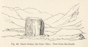
From hereon, many other writers and travellers came to see this great legendary stone within the depleted remains of its embanked circle—and thankfully it hasn’t been disturbed any further, still being visible to this day.  The greatest ‘archaeological’ attention the site has received was from the early pen of great antiquarian Fred Coles (1911).  On his journey here, after travelling past a large white stone which was mistakenly named as Ossian’s Stone by the usual contenders, he and his friend reached the right place:

“close to a strip of ground where the river and road almost touch each other, and immediately below the steepest of the crags of Dun More on the eastern side and the debris slopes of Meall Tarsuinn on the west, a most impressive environment, be the stone a prehistoric monument or not!  The spot is interesting for itself, apart from all legend; and the remains consist of a mighty monolith…and a narrow grassy mound…to its east, with a few earthfast blocks set edgewise near its eastern extremity.  Close to the roadside, but at the same level of 690 feet above the sea, there is a slab-like stone set up, measuring 3 feet in width, 1 foot 3 inches in thickness, and about 2 feet 6 inches in height.  A space of 63 feet separates this block…from the huge rhomboidal mass called Ossian’s Stone.  Five feet east of the latter is the base of the grassy mound which measures about 12 feet in length, 4 feet in greatest breadth, and 3 feet 10 inches in height.  To the north and the south in a slightly curving line are set the six small slabs shown.  There seems also to be a vague continuation of this strange alignment in both directions.  All over the ground between A and B, are many strangle low parallel ridges of smallish stones having a general direction of nearly north and south.  The rest of the ground is grassy, and here and there a little stony.  In the plan all the stones are drawn larger than exactly to scale.

“The great stone is 8 feet high and has a basal girth of 27 feet.  Several small stones lie near it.  Such are the facts as at present to be observed on the ground.”

Section of outlying grass-covered low ring, just visible
Geological cup-marks?

There are two small conjoined cup-marks on top of the stone, but these seem to be geological in nature.  The precise nature of the site is difficult to ascertain without excavation; but the Royal Commission lads reckon it to be a prehistoric ‘cist’ or grave in their own analysis, based mainly on the quoted literary texts.  The surrounding ‘ring’ of small stones doesn’t seem to have captured their attention too much; but the site needs contextualizing within this damaged circular enclosure, which appears to have been a cairn circle initially, of some sort, with Ossian’s huge stone resting over the grave of one late great ancestral character, probably placed here thousands of years back in the Bronze Age… A truly fascinating place in truly gorgeous landscape.

Folklore

The glen itself has a scattering of giant lore associated with Finn and/or Ossian.  A nearby cave was one of the places where this legendary character, and subsequent bards, were said to have spent time.

There are a small number of heavy rocks presently placed on top of Ossian’s Stone.  These may be due to the site being used as a “lifting stone”: a sort of rite of passage found at a number of sites in the Perthshire mountains and across the Highlands to indicate a boy’s strength before entering manhood. Not until they have lifted and deposited a very heavy rock onto the boulder can they rightly become chief or leader, etc.

The poet William Wordsworth wrote about Ossian’s Stone, calling it “Glen Almein, or The Narrow Glen”:

In this still place, remote from men,
Sleeps Ossian, in the Narrow Glen;
In this still place, where murmurs on
But one meek streamlet, only one:
He sang of battles, and the breath
Of stormy war, and violent death;
And should, methinks, when all was past,
Have rightfully been laid at last
Where rocks were rudely heaped, and rent
As by a spirit turbulent;
Where sights were rough, and sounds were wild,
And everything unreconciled;
In some complaining, dim retreat,
For fear and melancholy meet;
But this is calm; there cannot be
A more entire tranquillity.
Does then the Bard sleep here indeed?
Or is it but a groundless creed?
What matters it? I blame them not
Whose Fancy in this lonely Spot
Was moved; and in such way expressed
Their notion of its perfect rest.
A convent, even a hermit’s cell,
Would break the silence of this Dell:
It is not quiet, is not ease;
But something deeper far than these:
The separation that is here
Is of the grave; and of austere
Yet happy feelings of the dead:
And, therefore, was it rightly said
That Ossian, last of all his race!
Lies buried in this lonely place.

References:

  1. Anonymous, Tourists Guide to Crieff, Comrie and the Vale of Strathearn, Crieff
    1874.
  2. Burt, Edward, Letters from a Gentleman in the North of Scotland – volume 2, L.Pottinger: London 1759.
  3. Coles, F.R., “Report on stone circles in Perthshire principally Strathearn,” in Proceedings of the Society of Antiquaries, Scotland, volume 45, 1911.
  4. Finlayson, Andrew, The Stones of Strathearn, One Tree Island: Comrie 2010.
  5. Gordon, Seton, Highways and Byways in the Central Highlands, MacMillan Press 1948.
  6. Holder, Geoff, The Guide to Mysterious Perthshire, History Press 2006.
  7. Hunter, John, Chronicles of Strathearn, David Philips: Crieff 1896.
  8. Macara, Duncan, Guide to Crieff, Comrie, St Fillans and Upper Strathearn, Edinburgh 1890.
  9. Macculloch, James, The Highlands and Western Isles of Scotland, London 1824.
  10. Marshall, William, Historic Scenes in Perthshire, Edinburgh 1881.
  11. McKerracher, Archie, Perthshire in History and Legend, John Donald: Edinburgh 1988.
  12. Newte, Thomas, Prospects and Observations on a Tour in England and Scotland: Natural, Oenomical and Literary, G.G.J. Robinson: London 1791.

Acknowledgements:  Huge thanks again to Paul Hornby for his assistance with site inspection, and additional use of his photos.

© Paul Bennett, The Northern Antiquarian


Oswulf’s Stone, Mayfair, London

‘Standing Stone’ (destroyed):  OS Grid Reference – TQ 282 804

Also Known as:

  1. Oswald’s Stone
  2. Ossul Stone

Archaeology & History

Described as far back as 1086 in Domesday — as Osulvestane — this old stone was mentioned in numerous old documents, but its ancestral importance had long since been disregarded by modern Londoners. Probably heathen in nature, the stone was referenced in various texts as Osulfestan (1167 and 1168), Osolvestone (1274), Oselstone (1290), Ossulstone (1610) and variants thereof all the way through literary accounts until the emergence of the self-righteous judaeo-christian Industrialists in the 19th century, bringing about its destruction. (they’ve never really stopped to be honest)  The grand place-name masters Gover, Mawer & Stenton (1942) told us a bit about the old stone, saying:

“This was probably a stone marking the meeting-place of the Hundred.  It has been surmised that its site was near the present Marble Arch, but in 1484…there is mention of Westmynster lane leading between Tyburn and les Osilston PyttesWestmynster lane is the later Park Lane…and in a Grosvenor Estate map of 1614… Osolstone is marked as a field-name about halfway down Park Lane on the east side just beyond the present South” Street.

According to the Victoria County History of London (volume 1), the stone was actually in position up to 1822, “but was then earthed over.” However, it was resurrected during the construction of the modern Marble Arch in 1851 and stood up against the monument for several years until its eventual demise around 1869.

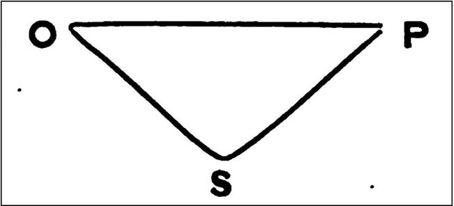
W.H. Black’s isosceles triangle, showing Oswulfs Stone at ‘O’

One intriguing commentator on Oswulf’s Stone suggested a more recent Roman origin, due to him finding that the monolith played an important part in a precise isosceles triangle.  In a talk given to a meeting of the London & Middlesex Archaeological Society on 10 January, 1870, William Black (1871) reminded his audience that he had,

“already shown that the sculptured and inscribed marble sarcophagus or sepulchral monument…at Clapton had served as a geometric point from which numerous measures extended to boundary points of Hackney and its neighbouring townships.”

And when he explored this potential at Oswulf’s Stone he found even more geometry. Alexander Thom and Alfred Watkins would have been proud of him! His research led him to compare two relative antiquities, both of which he deemed to be Roman:

“Of these two monuments the first is Ossulstone, from which the great Hundred…derives its name.  Its position and identity I had discovered some years ago by reversing my method of determining the uses of geometric stones: that is, by finding, from the proper boundary points, a centre where lines of proper quantities unite, so as to make them serve as radii from such centre to the said boundary points…

“Ossulstone is figured in Sir John Roque’s great map of 1741-1761, sheet XI, in the very spot to which my process on other maps had led me; and it is there called the ‘Stone where soldiers are shot,’ situate near the northeast angle of Hyde Park.  It was afterwards covered with an accumulation of soil, and is now dug up and lies against the Marble Arch, as stated in my petition, presented last session to the House of Commons, for the protection of ancient uninscribed stones, mounds and other landmarks…

“The second line leads to the well-known sculptured stone, undoubtedly of Roman work, formerly uninscribed, but now bearing an English inscription below the sculpture dated ‘1685’, which (now) forms part of the front wall of a house on the eastern side of Payner Alley… I had already found…that this stone had geometric uses… Now I find that this stone is equally distant from the newly-discovered Sepulchre as that is from Ossulstone.”

But the position of William Black’s stone and that mentioned in the early records described by Gover, Mawer & Stenton, are two different sites—albeit by only 700m—meaning that Black’s triangle never initially existed even if it was a Roman milestone.  The likelihood is that the stone was moved about as London slowly grew on top of the once fair Earth. (the OS grid-reference given for the site is an approximation based on the 1614 Grosvenor map)  Does anyone know owt more about the place, have any old drawings, or have copies of the old maps showing where the stone once stood?

References:

  1. Black, William Henry, “Observations on the Recently Discovered Roman Sepulchre at Westminster Abbey,” in Transactions of the London & Middlesex Archaeological Society, 4:1, 1871.
  2. Gover, J.E.B., Mawer, Allen & Stenton, F.M., The Place-Names of Middlesex, Cambridge University Press 1942.
  3. Sharpe, Montague, Middlesex in British, Roman and Saxon Times, G. Bell: London 1919.

© Paul Bennett, The Northern Antiquarian


Oldfield Hill, Meltham, West Yorkshire

Enclosure:  OS Grid Reference – SE 0874 1009

Getting Here

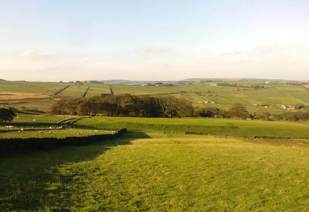
Oldfield enclosure in the field below

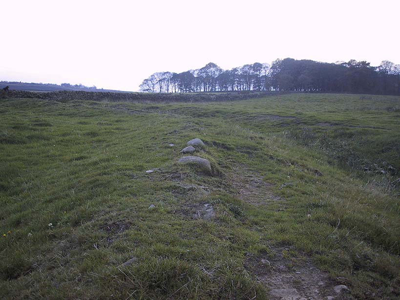
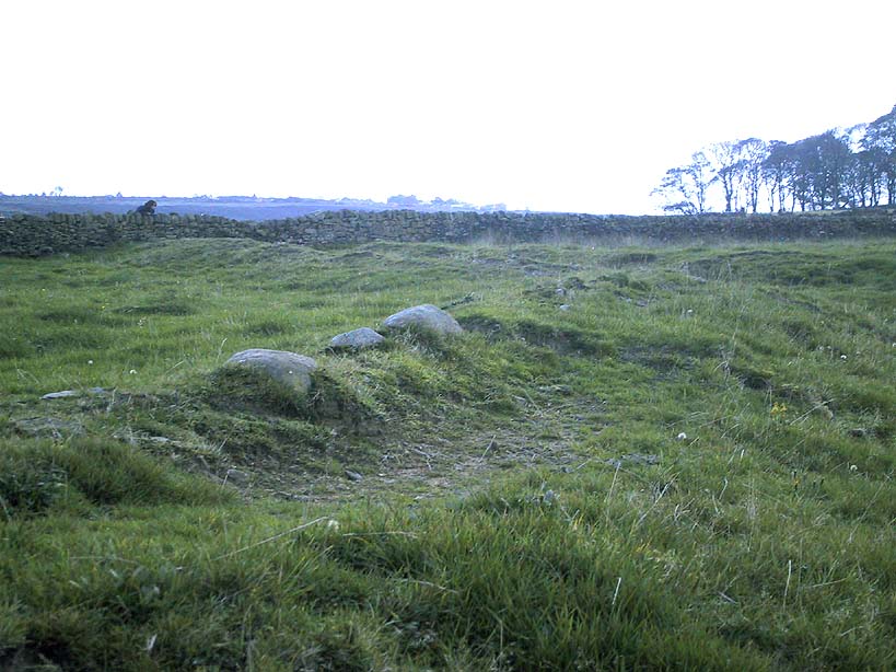
From the crossroads at the centre of Meltham, near the church, take the Wessenden Head Road up out of town for about a mile.  Keep your eyes peeled to right (north) for the track leading downhill to Oldfield Hall or Farm.  As you go down the track you’ll see a small cluster of hawthorns running along a small ridge 100 yards or so ahead, at the end of the field, with some line of embankment. This is on the right of the track and is the Oldfield enclosure!

Archaeology & History

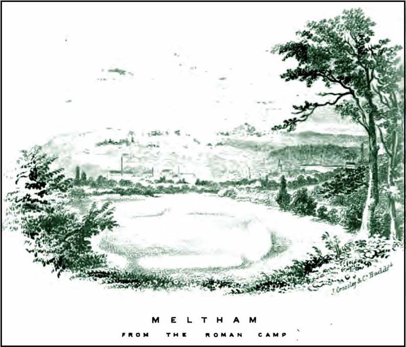
The remains of this large quadrangular settlement were first described as of ‘Roman’ origin in Mr Morehouse’s History of Kirkburton (1861), where he told that,

“In the…township of Meltham are the remains of a Roman encampment, on the moor below West Nab, a short distance to the left of the road which leads thence to the village…forming nearly a square of about four chains.  When I visited the place about twenty years since, in company with the owner and other friends, the whole was very distinct and perfect. This piece of ground has since been brought into cultivation, yet the trenches are still visible.  This encampment would appear only to have been made to supply some temporary emergency.”

Joseph Hughes old drawing of the ‘Roman’ camp
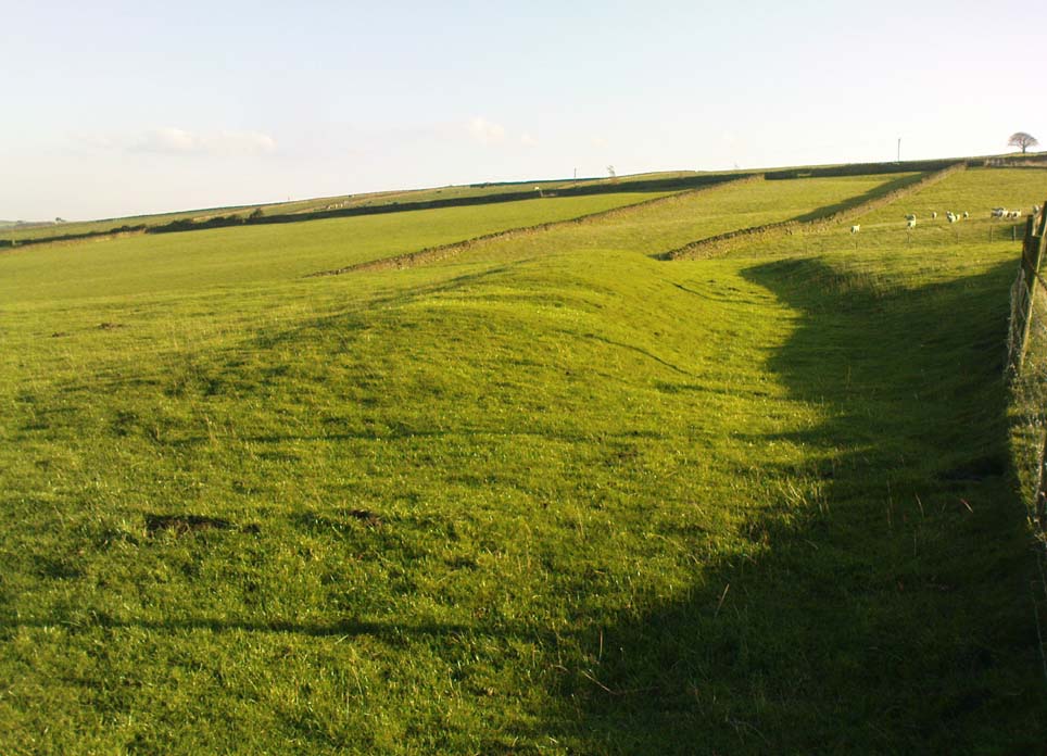
Western embankment & ditch

But Mr Morehouse’s speculation of its Roman origin and function are known to be untrue.  The site is in fact of Iron Age origin and was probably in semi-permanent use for long periods between Spring and Autumn. But the ‘Roman’ nature of the site was echoed a few years later, albeit briefly, in Mr Hughes’ History of Meltham (1866), where he told that “querns or hand-mills for grinding corn were found” at the site.

In 1909, the Saddleworth antiquarian Ammon Wrigley excavated the site but found little that could enable a correct dating of the enclosure. It was explored again a few years later by Ian Richmond and then again by J.P. Toomey in the 1960s.  Bernard Barnes (1982) summarised their respective findings, telling:

“Rampart of rubble and earth 7 feet wide faced with drystone walling; original height c.10 feet; V-shaped rock-cut ditch, 5½ feet deep and 6 feet wide, and a counterscarp bank similar to inner rampart with drystone revetment surviving to 4 courses.  Northeast entrance had double timber gateway.  Pre-rampart palisade trench on at least 2 sides of the enclosure with vertical posts 2 feet apart.  Finds include 2 stone discs, rough out beehive quern, iron slag and very small fragments of pottery.  Site dated to Iron Age.”

Another enclosure of similar period can be found a few hundred yards to the south.

…to be continued…

References:

  1. Abraham, John Harris, Hidden Prehistory around the North West, Kindle 2012.
  2. Barnes, Bernard, Man and the Changing Landscape, Eaton: Merseyside 1982.
  3. Bennett, Paul, The Old Stones of Elmet, Capall Bann: Milverton 2001.
  4. Hughes, Joseph, The History of the Township of Meltham, John Russell Smith: London 1866.
  5. Morehouse, Henry James, The History and Topography of the Parish of Kirkburton, H. Roebuck: Huddersfield 1861.
  6. Toomey, J.P., An Iron Age Enclosure at Oldfield Hill, Meltham, Brigantian: Huddersfield 1976.

© Paul Bennett, The Northern Antiquarian


Castle Hill, Kirklees, Brighouse, West Yorkshire

Enclosure:  OS Grid Reference – SE 173 216

Getting Here

Along the Brighouse to Mirfield A644 road, a half-mile east of M62’s junction 25 on Wakefield Road, note the woodland on your left-hand side, above the walling.  Although on allegedly private land, you can approach by hopping over the wall by the main road into the woods. Wander up the slope until it levels out and, just at the edge of the tree-line, past the brilliant overgrown folly amidst a mass of rhododendrons, you’ll see the denuded edges of this earthwork.  Though you might need a bitta patience seeking it out…

Archaeology & History

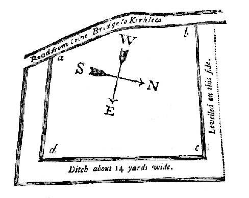
Very first sketch of this site (John Watson, 1775)

The remains of this low earthwork is found on the private land of Kirklees Hall and appointment is supposed to be made to explore, both this and the more famous Robin Hood’s Grave, a few hundred yards away. But if you can’t be bothered with that and find this little-known earthwork, you’ll see that it’s roughly squared in shape, though pretty overgrown.  In Bernard Barnes’ survey (1982) he described it as a “square or five sided enclosure, 2-3 acres in size, with bank and external ditch”, wondering whether it was used to enclosure cattle and stretching its possible origin between the Iron Age to the medieval.

Although the classical Roman archaeologist Ian Richmond (1925) believed the site to be from that period, the archaeologist J.J. Keighley thought that the site was “more likely to be Iron Age than Roman.”  He wrote:

“The earthwork in Kirklees Park is a square or five-sided enclosure with bank and external ditch… The site lies on Richmond’s trans-Pennine route.  According to Armitage and Montgomerie, the earthwork is 0.5 hectares in area, but it is actually nearer 0.8 to 1.2 hectares.  They compare its construction with the fort at Wincobank (South Yorkshire), stating that the bank on the counterscarp when excavated, revealed “a very rudely composed wall of undressed dry stone.”

Earlier local writers such as John Watson (1775) — whose early sketch of the site is reproduced above — and others also opted for the Roman date.  But, unless you’re a bit of an earthwork fanatic, this site may not be too much your cuppa tea. If you are gonna check this out though, make sure you check out Robin Hood’s old tomb in the trees not far away. Very odd.

References:

  1. Barnes, Bernard, Man and the Changing Landscape, Merseyside County Council & University of Liverpool 1982.
  2. Keighley, J.J., “The Prehistoric Period,” in West Yorkshire: An Archaeological Survey to AD 1500 (WYMCC: Wakefield 1981).
  3. Richmond, I.A., Huddersfield in Roman Times, Tolson Memorial Museum: Huddersfield 1925.
  4. Watson, John, The History and Antiquities of Halifax, J. Lowndes: London 1775.

© Paul Bennett, The Northern Antiquarian


Castlestead Ring, Cullingworth, West Yorkshire

Earthworks:  OS Grid References – SE 0514 3627

Also Known as:

  1. Blood Dykes

Getting Here

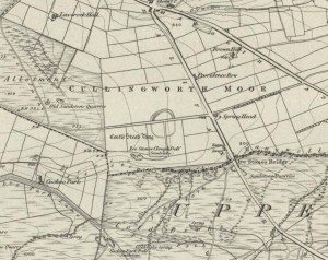
The complete Castlestead Ring on 1852 map

Dead easy this one!  On the Keighley-Halifax A629 road, about 500 yards south past Flappit Spring (public house), there’s a small road to your right.  Walk on here for 200 yards and look in the field to your right.  If the grass is long you might struggle to see it, but gerrin the field and it runs right up against the wall.  Y’ can’t miss it really!  You can park up a coupla hundred yards down the A629 main road, by the old quarry, and walk back to get here.

Archaeology & History

Although I’ve earlier described this as “nowt much to look at,” the more I come here, the more I like the place (sad aren’t !!?).  The hard-core  archaeology folks amidst you should like it aswell.  Not to be confused with the site of the same name a mile to the south of here, this large earthwork was shown on the 1852 OS-map as a complete ring, which is also confirmed in old folklore; and a survey done by Bradford University in the late 1970s indicated a complete circle was once in evidence.  To view this for yourself: if you type the OS grid-reference into Google maps, you’ll see from the aerial image that a complete ring was indeed here at sometime in the not-too-distant past.

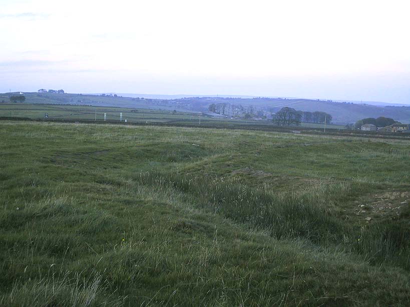
Bend in the ditch on northern side of the ring
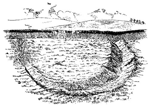
Harry Speight’s 1898 drawing

Today however – indeed, since William Keighley described it 1858 – there’s only a shallow, semi-circular ditch to be seen in the fields.  But despite this, its remains have brought it to the literary attention of about a dozen writers – though we still don’t know exactly what it was!  The best conjecture is by the archaeologist Bernard Barnes (1982), who thinks it best to describe as a enclosure or earthwork dating from the Bronze Age.  Eighty feet across and covering more than 1.5 acres, an excavation of the site in 1911 found nothing to explain its status.

One of the first descriptions of this site comes from the pen of the industrial Bradford historian, John James in 1876 (though Hearne, Leland and Richardson describe it in brief much earlier). Talking of the sparsity of prehistoric remains in the region (ancient history wasn’t his forte!), he said, “I know of no British remains in the parish that are not equivocal, unless a small earth-work lying to the westward of Cullingworth may be considered of that class.”

Indeed it is! He continued:

“It is situated on a gentle slope, about two hundred yards from a place called Flappit Springs, on the right-hand side of the road leading thence to Halifax. The form has been circular. (my italics) The greater part of it to the south has been destroyed by the plough. I took several measurements of that part which remains, but have mislaid the memoranda I then made; I however estimate the diameter to have been about 50 yards. The ditch to the westward is very perfect. It is about two yards deep and three wide; with the earth thrown up in the form of a rampart on the inner side. The remain is less perfect to the eastward.”

James then speculates on the nature of the site, thinking it to be “one of a line of forts erected by the Brigantes…to prevent the inroads of the Sistuntii.” Intriguing idea!

A few years later when William Cudworth (1876) visited the site, he described:

“At present there only remains about one-fourth part of a circle representing the appearance of a considerable earthwork or rampart. The remainder has been cut away by the construction of the road leading to the allotments.”

Echoing Mr James’ sentiments, Cudworth also suggested “it may have been an enclosure to guard their cattle, while in summer they grazed on the vast slope on which it stands.”  Y’ never know…

NW section showing bank and ditch
Exposed stonework of inner embankment

A visit to the place on October 21 2007, found not only a profusion of mushrooms scattering the field (varying species of Amanita, Lycoperdon, Panaeolina, Psilocybes, etc), and the remnants of two old stone buildings 20 yards of the NE side, but a distinctive ‘entrance’ on the northern side of the ring, which gave the slight impression of it being a possible henge monument. It’s certainly big enough! All traces of the southern-side of the ring however, have been ploughed out.

The views from here are quite excellent, nearly all the way round. You’re knocking-on a 1000 feet above sea level and the high hills of Baildon, Ilkley, Ogden Moor and the Oxenhope windmills are your mark-points. There’s one odd thing to think about aswell: if this is a prehistoric site, it’s pretty much an isolated one according to the archaeo-catalogue – and as we know only too well, that aint the rule of things. We’ve got adjacent moorlands south and west of here, very close by. Likelihood is, there’s undiscovered stuff to be foraged for hereabouts…

Folklore

An old folk-name given to this ring is the Blood Dykes, which is supposed to relate to the place being the site of a great battle.

References:

  1. Barnes, Bernard, Man and the Changing Landscape, Eaton: Merseyside 1982.
  2. Bennett, Paul, The Old Stones of Elmet, Capall Bann: Milverton 2001.
  3. Cudworth, William, Round about Bradford, Thomas Brear: Bradford 1876.
  4. Elgee, Frank & Harriett, The Archaeology of Yorkshire, Methuen: London 1933.
  5. Forshaw, C.F., ‘Castlestead, near Cullingworth,’ in Yorkshire Notes and Queries – volume 4, H.C. Derwent: Bradford 1908.
  6. James, John, The History and Topography of Bradford, Longmans: London 1876.
  7. Keighley, J.J., ‘The Prehistoric Period,’ in Faull & Moorhouse’s, West Yorkshire: An Archaeological Survey to AD 1500 – volume 1, WYMCC: Wakefield 1981.
  8. Keighley, William, Keighley, Past and Present, Arthur Hall: Keighley 1858.
  9. Speight, Harry, Chronicles and Stories of Bingley and District, Elliott Stock: London 1898.

© Paul Bennett, The Northern Antiquarian


Oliver Cromwell’s Hill, Eye, Cambridgeshire

Tumulus (destroyed):  OS Grid Reference – TF 232 018

Archaeology & History

Very little was known about this now lost burial mound.  It was one of several nearby but, thankfully, the local historian and archaeologist E. Thurnam Leeds (who once lived at the nearby Eyebury Farm) sent a letter to the Society of Antiquaries in London, describing some pottery and other remains that he’d found there:

“The small pot of a late Bronze Age type and the other sherds exhibited were found in a tumulus known as Oliver Cromwell’s Hill, at Eyebury, near Peterborough.  As only a portion of the tumulus has been examined as yet, it is proposed to defer a full account of the excavations until further progres has been made.  The tumulus is of the round type, about 40 yards in diameter and 5 feet high at the centre.  On three sides traces of a ditch were met with, containing soil which had evidently been burnt.  Close to the gravel in the centre of the tumulus there were two distinct layers of charcoal, and in two places apparently remains of hearths.  The small pot was found only 1½ feet down on the south-eastern side of the mound, 39 feet from the centre.  In the centre itself at various depths were found sherds, some of Bronze Age forms; but a pice of a rimmed vase found at a depth of 3 feet 6 inches, about 6 inches above the first charcoal layer, appears to be of Roman date, in which case the centre of the tumulus must have been disturbed in those times, though the charcoal floors were never pierced.  Bones of various animals, including sheep, pig, dog and hare, and a large flint flake were also found.”

As far as I’m aware, no further detailed examinations took place at this curiously-named hillock, whose folktale I’ve yet to read.

References:

  1. Leeds, E.T., ‘Letter,’ in Proceedings of the Society of Antiquaries, 22:1, 1910.

© Paul Bennett, The Northern Antiquarian


Stanwick Fortifications, North Yorkshire

Settlement:  OS Grid Reference – NZ 1783 1229

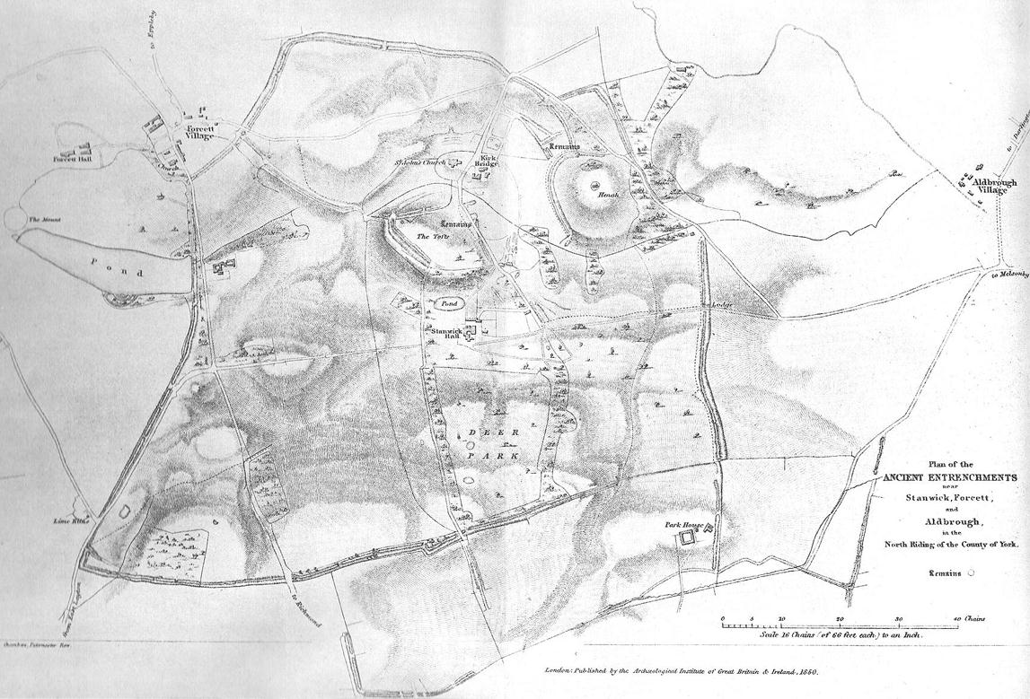
1850 map of village & earthworks

Getting Here

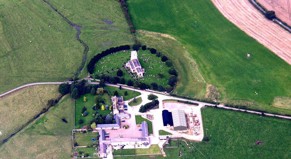
From Scotch Corner on the A1, head on the A66 and take the first right up to and straight thru Melsonby village at the crossroads and on for a few more miles till you hit the hamlet of Stanwick-St.-John.  You’re now in the middle of the fortifications and earthworks! (check the map, right) Get to the nearby church of St. John’s and you’re on what once could have been a henge.

Archaeology & History

Although the Roman’s came here, the origins of this huge enclosure and settlement — between the hamlets of Eppleby and Stanwick St. John — are at least Iron Age.  It’s very probable that this place has been used by people since at least the Bronze Age, if not earlier — but let’s keep to playing safe (for a change) and repeat what the professionals have found!  Stanwick was recorded in Domesday as Stenwege and Steinwege, which A.H. Smith (1928) and later etymologists tell us means “stone walls,” which obviously relates “to some ancient rock entrenchments found in the township”, or the Stanwick Fortifications no less!

Sir Mortimer Wheeler’s (1954) account of the history and excavation of these huge ramparts found that it was a centre of some importance to the Brigantians. His view was that it was the rebel stronghold of the Brigantian figure called Venutius, ex-partner of the Queen Cartimandua.  Archaeologists who did further work here in the 1980s concluded that it was one of Cartimandua’s “estates” — possibly even the original capital city of Brigantia.

Church on the circular henge-like remains (phot courtesy Pete Glastonbury)
Church on the circular henge-like remains (photo © Pete Glastonbury)

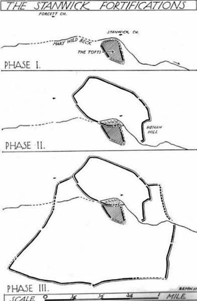
The settlement was enlarged and fortified considerably upon the arrival of the Romans in the first century. Splitting them into three phases, the earliest Phase I area (Iron Age) covered 17-acres; Phase II was extended over 130 acres; and Phase 3 extended the enclosure over another 600 acres.  A further extension of earthworks appears to have occurred, but Wheeler believed them to have been constructed at a much later period.  To allow for a decent discourse on this huge site and its multiperiod settlement, I’m gonna quote extensively Mr Wheeler’s (1954) text on the site, who headed a team of archaeologists in the summers of 1951 and 1952 and explored various sections of this huge arena.

In the introduction to his work, Mortimer briefly mentioned the finding of some chariot burials found close by, though less certain is the exact spot where these important remains came from.  He wrote:

“Of the three accounts, the earliest, dating from shortly after the discovery, states that the objects ‘were deposited together in a pit at a depth of about five feet within the entrenchment at Stanwick.  Near by large iron hoops were found.’  Two years later MacLauchlan showed the find-spot on his map…as a little to the northeast of Lower Langdale, well outside the main Stanwick earthworks, and, in spite of variant accounts, his evidence may be regarded as authoritative.”

Nothing more is said of these finds throughout the book.  Instead, Mortimer guides us through their dig, beginning with the structural sequence of the extensive earthworks that constitute Stanwick’s fortifications, from Phase 1 onwards, saying:

Plan showing 3-phase evolution of the Stanwick earthworks from the Iron Age period at the top, to Phase 3 works in the 1st century AD (from Wheeler’s ‘Stanwick Fortifications’, 1954)

Phase I.  The nucleus of the whole system is a fortified enclosure, some 17 acres in extent, situated to the south of Stanwick Church and the Mary Wild beck, on and around a low hill known as ‘The Tofts’… The name ‘Tofts’ is defined by the Oxford Dictionary as “Site of a homestead”, or “An eminence, knoll or hillock in a flat region; esp. one suitable for the site of a house.”  Appropriately the field is described by the farmer as a ‘dirty’ one; it produces an abundant crop of nettles which have to be cut twice a year and are a common sequel to ancient occupation.  The enclosure is, or rather was, roughly triangular on plan, conforming approximately with the mild contours of the hill and to that extent meriting the exaggerated designation of ‘hill-fort.’  On the west its rampart and ditch are excellently preserved in a stretch of plantation known as ‘The Terrace’ or ‘The Duchess’s Walk’, where the single bank of unrevetted earthwork rises some 24ft above the ditch… The southern corner has been almost completely obliterated, but a part of it can be traced faintly in the walled garden southeast of the The Terrace.  A stretch of the eastern side still stands up boldly beside the road from Stanwick Church to (the former) Stanwick Hall, but a large part of this side has been demolished for the making of the road, and some dumps of earth immediately east of Church Lodge may be a result of this process.  The northern side approached but stopped short of the brook, and is marked by remains of a counterscarp bank… The main rampart was here thrown into the ditch anciently, doubtless when this portion of the work was included in and superseded by the work of Phase II.  Near the northwestern corner was a stone-flanked entrance, now partially obscured by the northern end-wall of the Terrace plantation.  The rampart was of earth, apparently without stone or timber revetment, the ditch was V-shaped save where, on the northern or lowest side, its completion in depth was stopped by water and the counterscarp bank already referred to was added as compensation.

Phase II.  Subsequently, at a moment which will be defined in the sequel as not later than AD 60, the hill-fort was supplemented by a new enclosure over 130 acres in extent, so designed as to outline the slight ridge north of the brook, to bend inward round the nearer foot of Henah Hill on the east, and farther west to cut off the northern end of the hill-fort, obviously in order to enclose the brook and its margin hereabouts.  Southeast of Stanwick Church, the marshy course of the brook for a distance of over 300 yards was regarded as a sufficient obstacle, without rampart and ditch, though whether supplemented by a palisade is not known.  As already indicated, that part of the Phase I earthwork which now lay inside the new enclosure was largely obliterated by filling its rampart into its ditch.

The enclosure constituting Phase II had an entrance near its western corner…where 50ft of the ditch, partially rock-cut, were cleared with notable results… There may have been another entrance under the present road-junction immediately east of the Stanwick vicarage, in the middle of the northern side, or less probably, at an existing gap 150 yards further to the southeast.  The rampart was of earth, aligned initially at the back on a small marking-out trench and bank; in front it was revetted with a vertical drystone wall.  The ditch was cut in the boulder-clay and partially in the underlying limestone…

Phase III.  At a date which will be defined as about a dozen years later (c. AD 72), a similar though longer system, enclosing a further 600 acres, was added to Phase II.  It impinges almost at a right angle upon, and implies the pre-existence of, Phase II on the east, and terminates upon the ditch of Phase II on the west.  An entrance can be seen near the middle of the southern side, and less certainly a gap in Forcett Park may represent a second entrance in the western side.  Further stretches of the mary Wild beck were included. The rampart, like that of Site A, incorporated a marking-out trench and bank at the rear, and was fronted with a vertical stone revetment.

Phase IV.  To the southern side of Phase III was added at an unknown period an enclosure of some 100 acres, now subdivided by traces of a double earthwork extending southwards from a point east  of the southern entrance of Phase III… This double earthwork however, is of an entirely different character from those already considered, and appears indeed to overlap the rampart of Phase III at a point where the latter had already been broken through.  It is comparable with some of the double banks which constitute or are incorporated in the Scots Dike at Lower Langdale, farther east; and the Phase IV enclosure is in fact linked with the Scots Dike by a semi-obliterated ditch extending eastwards from its southeastern corner.  Phase IV…may, as has been suspected, relate to the Anglo-Saxon period.”

…to be continued…

References:

  1. Smith, A.H., The Place-Names of the North Riding of Yorkshire, Cambridge University Press 1928.
  2. Wheeler, Mortimer, ‘The Stanwick Excavations, 1951,’ in Antiquaries Journal, January 1952.
  3. The Stanwick Fortifications, North Riding of Yorkshire, OUP & Society of Antiquaries: London 1954.

Links: – Stanwick Iron Age Hillfort – For an extensive overview of the archaeology of this large site, you can do no better than this web-page.

© Paul Bennett, The Northern Antiquarian