Rudston ‘A’ Cursus, East Yorkshire

Cursus:  OS Grid Reference — TA 0998 6577 to TA 1016 6802

Also known as:

  1. Beacon Cursus
  2. Rudston Cursus 1
  3. Woldgate Cursus

Archaeology & History

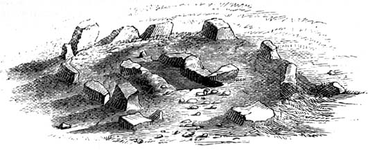
The site has been known about for nearly 150 years, albeit mistakenly as a series of prehistoric barrows that William Greenwell (1877) told were “near the division between the parishes of Rudston and Burton Agnes” near the crest of the hill.  He further told the place to be,

“Two long mounds, almost parallel, their northern end gradually losing themselves in the surface-level, but connected together at the southern end by another long mound.”
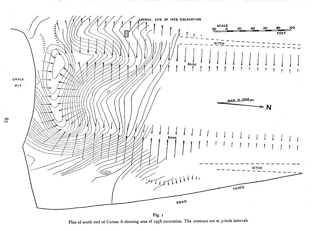
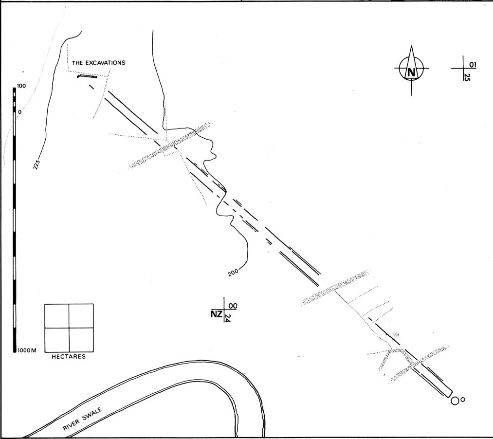
South end of Cursus A (after D.P. Dymond)
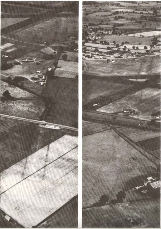
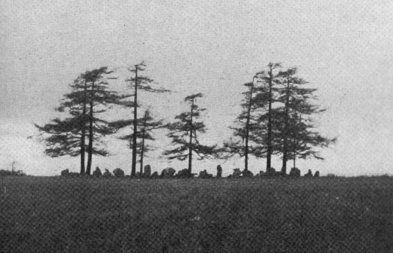
Early photo of Cursus A (after J.K.St Joseph)

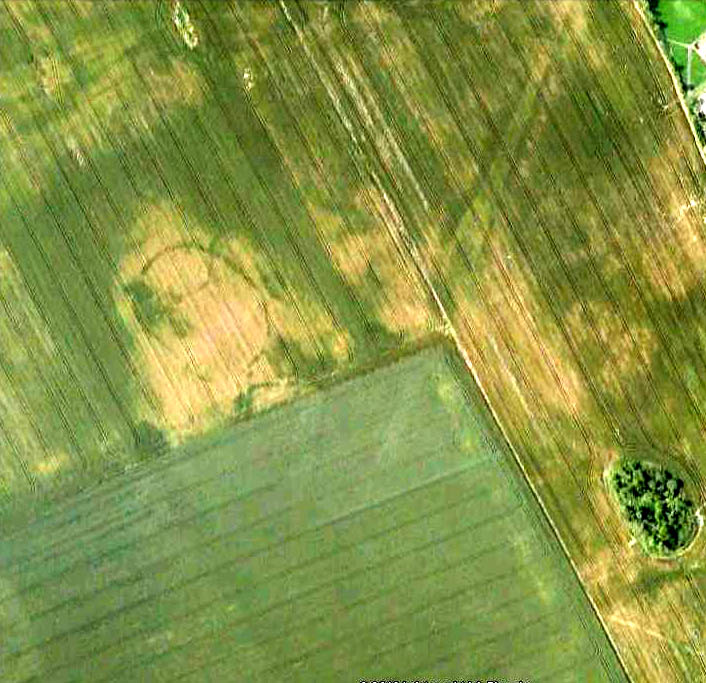
Then in 1958 when C. & E. Grantham of Driffield did the first modern excavation here across a section of the western ditch, they found that the long embankment went on much further than ever previously anticipated, for more than half-a-mile downhill in the direction of Rudston village.  It wasn’t a long barrow or tombs of any sort, they found!  Then in 1961 when Dr. J.K. St. Joseph did aerial survey work over the area, he and his colleagues established that this monument consisted of extensive parallel ditches stretching for at least 1½ miles towards and past the eastern side of Rudston village.  It’s nature as a cursus monument was rediscovered after several thousand years in the wilderness… (on St. Joseph’s survey, two other cursus monuments were also found in the vicinity, being Rudston Cursus B and Cursus C)  Readers will hopefully forgive me for quoting at some length Mr Dymond’s (1966) article on the site (with minimal editing!):

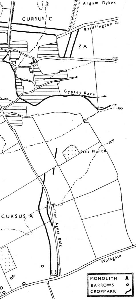
“The southern end of the cursus lies in the western angle of two roads, Woldgate and Burton Agnes Balk.  In plan it is square with rounded corners and consists of a bank with outer ditch.  Although the bank has been ploughed for many years, it still remains substantial; it stands up to 4 feet high from the outside and 1-2 feet wide from the inside.  The east and west banks decline in height northwards and are now at their greatest height where they join the southern end.  The profile of each bank is smooth and rounded and merges on the outside with the broad shallow depression of the silted-up ditch.  The south bank is now 170 feet long overall, and spread to a width of 60-80 feet.  It stands higher at both ends than in the middle.  This fact was noted by Greenwell, who also recorded that at the southwest angle “there was the appearance of a round barrow raised upon the surface of the long mound.”  There is no surface evidence today to suggest a secondary round barrow, and to some extent at least the greater height at the angles is probably due to the concentration of upcast inside a fairly sharp corner.

“The south arm of the ditch has been largely destroyed by a chalk-pit, but the southeast turn is quite clear on air-photographs.  There is no suggestion on the ground or from the air that the cursus had ever extended further to the south.

“The cursus begins its descent in a due northerly direction, and loses its eastern side for approximately 600 feet under the enclosure road, Burton Agnes Balk.  The ditch can be traced intermittently on the western and eastern verges.  It then swings gently NNW around the head of a small slack draining northwest.  Thus far the cursus is traceable on the ground.  The ditches are the most consistent feature, showing as broad shallow depressions 20-40 feet wide and 70-80 yards apart, which when in fallow attract a dark coarse vegetation (particularly thistles and nettles.  The banks inside the ditches are sometimes visible in relief though considerably spread.  Where the banks have been almost entirely ploughed out, a chalk spread usually marks their position.

“There is a suggestion on the ground that the banks and ditches may have been separated by berms, particularly on the east side near the square end.  This appears to be confirmed by the silting of the ditch in the excavated section…

“Proceeding further downhill in the direction of Rudston village, the cursus quite suddenly swings north-NNE, finally crosses Burton Agnes Balk, and passes to the west of Pits Plantation.  On the west of the road both banks and ditches are still visible in relief, and the ditches produce a firm crop-mark.  East of the road no surface traces are discernible, and only the eastern ditch shows intermittently as a crop-mark.

“For ½-mile across the floor of the Great Wold Valley, there is no trace of the cursus.  The area has been ploughed since medieval times, and there is in addition a considerable Romano-British settlement.  It is worth noting that in this length, the cursus must have crossed the stream of the Gypsey Race, surely a fact of some importance in any discussion of the function of cursuses.

“Two parallel ditches c.60 yards apart, visible on air photographs in a field immediately north of the modern Rudston-Bridlington road, seem to represent the continuation of the cursus.  The ditches travel for approximately 300 yards and end at the Bridlington Gate Plantation.  There are no surface traces in the field, but a depression in the plantation may represent the eastern ditch.  This depression is crossed obliquely by the remains of a low bank and ditch running along the length of the plantation WSW and ENE.  This latter (part) is probably part of the supposedly Iron Age entrenchment system, and has certainly been used as a road from Rudston to Bridlington, as the name of the plantation implies.

“The northern end of the cursus cannot be traced.  Possibilities are that the end was in the plantation and has been destroyed by the later earthwork, or that the cursus proceeded NNE for an unknown distance.  If the latter hypothesis is accepted, the western ditch must be under the Argam Dykes, a double entrenchment which appears to terminate at the northern side of the plantation, and the eastern ditch is indistinguishable  from ploughing lines to which it is parallel…

“Cursus A has its southern end at a height of 254 feet OD, on the forward face of a long chalk ridge running WSW and ENE.  From this point the course of the cursus is visible, except for that part west of Pits Plantation.  The last known part in Bridlington Gate Plantation, 1½ miles off, is clearly visible.  Seen against the contours of the area, the cursus has one end resting on a high ridge, crosses a broad valley, and climbs at least in part, the far side.  It appears to pass approximately 300 yards east of the monolith in Rudston churchyard.”
Line of Rudston A

The presence of this and three other cursus monuments close by (Rudston B, C and D) indicates that the region was an exceptionally important one in the cosmology of our prehistoric ancestors.  Four of these giant linear cursus monuments occur in relative proximity, and there was an excess of ancient tombs and, of course, we have the largest standing stone in the British Isles stood in the middle of it all.  A full multidisciplinary analysis of the antiquities in this region is long overdue.  To our ancestors, the mythic terrain and emergent monuments hereby related to each other symbiotically, as both primary aspects (natural) and epiphenomena (man-made) of terra mater: a relationship well known to students of comparative religion and anthropology who understand the socio-organic animistic relationship of landscape, tribal groups and monuments.

…to be continued…

References:

  1. Dymond, D.P., “Ritual Monuments at Rudston, E. Yorkshire, England,” in Proceedings of the Prehistoric Society, volume 32, 1966.
  2. Eliade, Mircea, The Sacred and the Profane, Harvest: New York 1959.
  3. Greenwell, William, British Barrows, Clarendon Press: Oxford 1877.
  4. Hedges, John & Buckley, David G., The Springfield Cursus and the Cursus Problem, Essex County Council 1981.
  5. Nicholson, John, Beacons of East Yorkshire, A. Brown & Sons: Hull 1887.
  6. Pennick, Nigel & Devereux, Paul, Lines on the Landscape, Hale: London 1989.

Links: – ADS: Archaeology of the Beacon Cursus, or Rudston A – Notes on the cursus which has been given the most attention to date.

© Paul Bennett, The Northern Antiquarian


Rudston B Cursus, East Yorkshire

Cursus:  OS Grid Reference – TA 0805 6697 to TA 0944 6755 

  1. Rudston Cursus 2

Archaeology & History

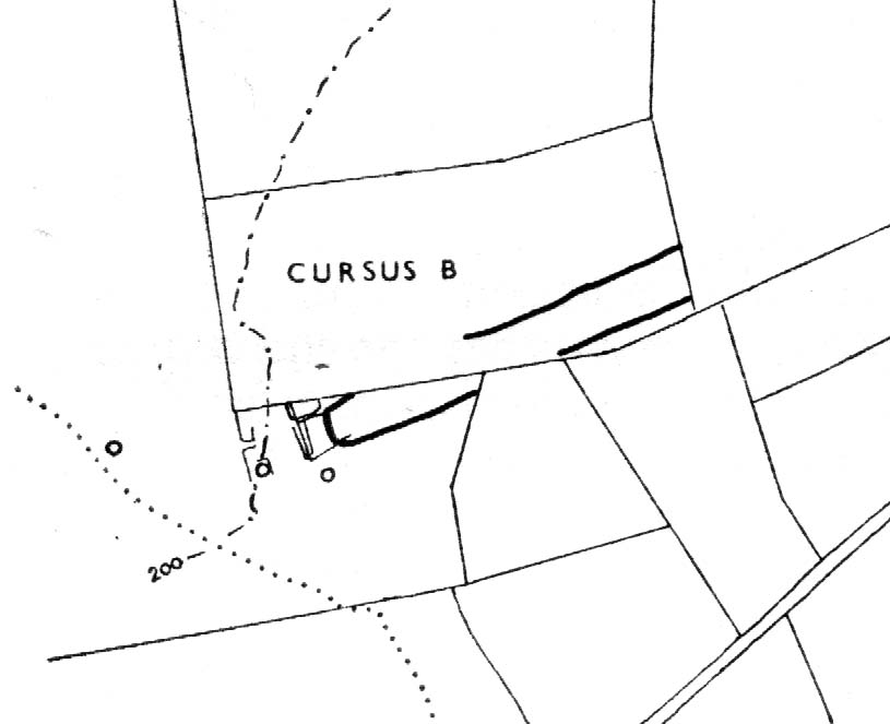
One of the four (known) cursus monuments around Rudston: this one stretches between the Ordnance Survey coordinates TA 081669 near Kilham Grange on the southwestern edge of Rudston, then heads northeast towards the village itself at TA 094675.  Described briefly in D.P.Dymond’s essay on (mainly) Cursus A, he said how Cursus B was part of,

Early ground-plan (after D.P. Dymond)
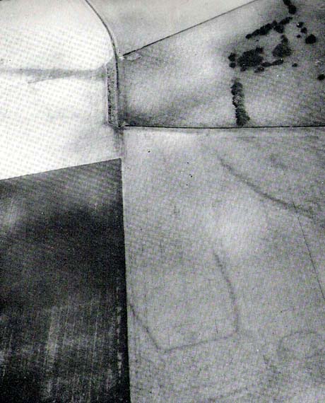
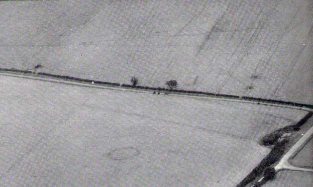
Early photo of Rudston B (after J.K.St Joseph)

“a large complex of crop marks.  The largest feature is the squared, tapering end of Cursus B, which can be traced for 700 yards in a north-easterly direction.  No surface remains seem to survive in an area intensively ploughed, except for a swelling under a hedge on the line of the south-eastern bank (at TA 0834 6703).  West of the square end and partly overlying it, are several small rectangular enclosures, which are probably part of a later (?Romano-British) settlement and field-system.  Also in this tangle of crop-marks there are four roughly circular shapes, which may well be barrow circles associated with the end of the cursus.  On certain barrow just south of the end of the cursus has an inner ring of pits.  Where the cursus is lat visible to the north-east, it is headed roughly for the monolith ¾-mile away.  The width of Cursus B is approximately 90 yards between ditch centres.  It has its square end on the forward slope of a ridge (like Cursus A) at a height of 180 feet OD, and descends towards the village, which is visible from the end, through a shallow valley.”

Dymond’s note about the alignment feature of this cursus, towards the gigantic Rudston monolith, was one echoed in the Hedges & Buckley (1981) survey.  They noted:

“At Rudston, the B cursus extended eastwards aligns upon the Rudston monolith in Rudston churchyard. Destruction of standing stones elsewhere may have removed similar associations between the stones and cursuses.”

This alignment feature was also confirmed by cognitive archaeologist and alignment specialist, Paul Devereux (Pennick & Devereux 1989) in his survey of cursus monuments.

Typical of these fascinating antiquities, nothing of any worth has been found along the length of the cursus that can give us any clues to its nature and function.  However, the presence of this and three others close by indicates that the region was an exceptionally important one in the cosmology of our prehistoric ancestors.  Four of these giant linear cursus monuments occur in relative proximity, and there was an excess of ancient tombs and, of course, we have the largest standing stone in the British Isles stood in the middle of it all.  A full multidisciplinary analysis of the antiquities in this region is long overdue.  To our ancestors, the mythic terrain and emergent monuments hereby related to each other symbiotically, as both primary aspects (natural) and epiphenomena (man-made) of terra mater: a phenomenon long known to comparative religious students and anthropologists exploring the animistic natural relationship of landscape, tribal groups and monuments.

References:

  1. Dymond, D.P., “Ritual Monuments at Rudston, E. Yorkshire, England,” in Proceedings of the Prehistoric Society, volume 32, 1966.
  2. Eliade, Mircea, The Sacred and the Profane, Harvest: New York 1959.
  3. Hedges, John & Buckley, David G., The Springfield Cursus and the Cursus Problem, Essex County Council 1981.
  4. Pennick, Nigel & Devereux, Paul, Lines on the Landscape, Hale: London 1989.

Links:

  1. ADS: Archaeology of Rudston B – Brief archaeological notes on the cursus to the southwest of Rudston.

© Paul Bennett, The Northern Antiquarian 


Stanwell Cursus, Heathrow, Surrey

Cursus (destroyed):  OS Grid Reference – TQ 0545 7431 to TQ 0448 7782

Also Known as:

  1. Heathrow Cursus

Archaeology & History

Running roughly north-to-south, this cursus was 2¼ miles long (3600 metres) and comprised of two linear sections from a field in Stanwell up through the western side of Heathrow Airport averaging, curiously, just 24 yards (22m) across.  Of course nothing of it can be seen today as the airport and surrounding industrial crap has destroyed it.  The cursus had a lengthy internal bank along its length. During excavation work done at the Perry Oaks Sludge Works section in Hillingdon, archaeologists found evidence for a short avenue of posts, about 110 feet long, apparently constructed prior to the cutting of the cursus’ ditches, following the same direction/alignment of the subsequent monument.  In Roy Loveday’s (2006) survey of cursus monuments he said this of Heathrow’s cursus:

“This site, striking across land so flat that it has been selected  for Heathrow Airport, extends for some 4km, crosses two rivers and stops by a stream — originally perhaps a more major river.  So straight and apparently narrow is it (20m) that it was originally taken to be a Roman road.  Early excavation seemed to support the idea: vestigal remains areas of gravel between the ditches were scored by shallow gullies resembling cart ruts.  Later excavation, however, demonstrated that the ditches of a Late Bronze Age field system cut across it and several scarps of Peterborough Ware (i.e., pottery – PB) were recovered from its ditches.  Evidence also emerged of a short (50m) ragged, double row of posts, removed before the ditches were dug on the same alignment.  That this was a bank barrow was hinted at by the Charlecote test and by reduction in the depth of field ditches as they crossed the central area.”

Confirmation that an earthen bank of some kind running near the middle of the cursus was confirmed by analysis of early Ministry of Defence aerial photographs.  For those who would like a more detailed description on this site, I refer you to the excellent paper by o’ Connell. (1990)

…to be continued…

References:

  1. Barclay, Alistair, et al, Lines in the Landscape, Oxford Archaeological Unit 2003.
  2. Loveday, Roy, Inscribed Across the Landscape, Tempus: Stroud 2006.
  3. o’ Connell, M., “The Heathrow-Stanwell Cursus,” in Current Archaeology, 9, 1986.
  4. o’ Connell, M., “Excavations during 1979-1985 of a Multi-Period Site at Stanwell,” in Surrey Archaeological Collections, 80, 1990.

© Paul Bennett, The Northern Antiquarian


Bryn Celli Ddu, Llandaniel Fab, Anglesey

Chambered Cairn:  OS Grid Reference – SH 50761 70185

Also known as:

  1. Bryncelli Ddu
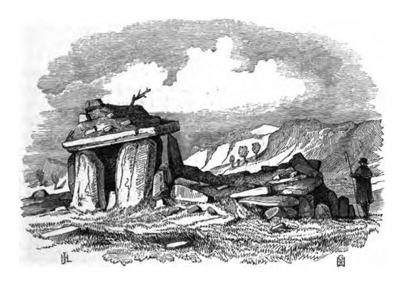
Bryn Celli Dhu in 1847

Archaeology & History

An excellent passage grave tomb that’s been described by many historians over the last two hundred years, and was subject to a fine excavation in the first half of the 20th century.  Ascribed as neolithic in origin, recent finds of human activity on the edge of the surrounding henge indicates people have been “up to things” hereby since at least 6000 BC.  Deriving its name from “the mound of the black grove,” the site as we see it today has been much restored and is so different to when it was visited by Thomas Pennant and other antiquarians.

According to an anonymously written essay in Archaeologia Cambrensis in 1847, the site was first described by Henry Rowlands (1723) where, in relation to another site, he told were,

“the remains of two carnedds, within a few paces of one another: the one is somewhat broken and pitted into on one side, where the stones had been carried away; the other having had its stones almost all taken away into walls and hedges, with two standing columns erected between them.”

A somewhat more detailed description came from Thomas Pennant a few years later.  He wrote:

“A few years ago, beneath a carnedd similar to that at Tregarnedd, was discovered, on a farm called Bryn-celli-ddu…a passage three feet wide, four feet two or three inches high and about nineteen feet and a half long, which led into a room about three feet in diameter and seven in height.  The form was an irregular hexagon, and the sides composed of six rude slabs, one of which measured in its diagonal eight feet nine inches.  In the middle was an artless pillar of stone, four feet eight inches in circumference.  This supports the roof, which consists of one great stone near ten feet in diameter.  Along the sides of the room was, if I may be allowed the expression, a stone bench, on which were found human bones, which fell to dust almost at a touch: it is probable that the bodies were placed on the bench… The diameter of the incumbent carnedd is from ninety to a hundred feet.”

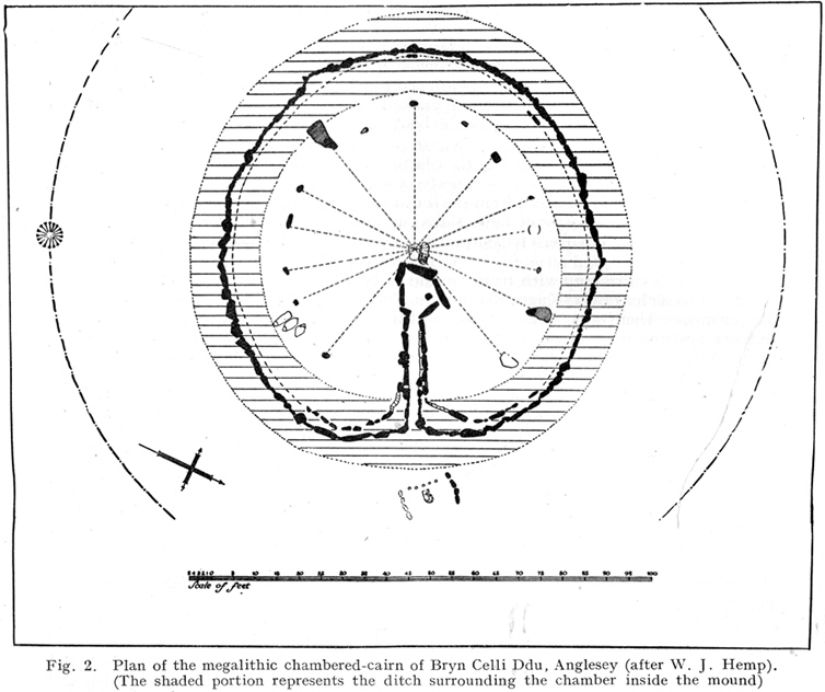
Ground-plan

But the main excavation work at Bryn Celli Ddu was done in the late-1920s by W.J. Hemp (1930) and his team, who, as usual following such digs, ended up with just as many questions about the site as they had answers!  One of the best descriptions of Hemp’s excavation work was by W.F. Grimes (1932) in an essay he wrote for the East Anglian Prehistoric Society where he gave the following detailed description of the finds:

“The cairn here was circular, with a chamber of some 160ft and an original maximum height of at least 12ft.  The chamber is a polygonal structure of large stones augmented…with dry-stone walling, entered on the northeast side by a long passage built in the same way.  Many of the stones had been dressed and in the chamber stood a single pillar which had been artificially rounded and smoothed, but which had never actually supported the capstone.

“These features had been more or less apparent for many years.  But the reparation work soon showed that this was by no means all.  In the first place, it was found that the chamber had been surrounded by four circles of standing stones.  The first of these, around the outside of the mound at its base, had disappeared, although early accounts and a single hole found in the course of the work of excavation, are evidence of its existence.  The second and third circles were found when the entrance to the passage wall was being cleared.  Here the walls of the passage were found to merge into an outer circle of large stones and an inner of smaller, set close together and elaborately packed and sunk in a ditch six feet deep and eighteen wide, enclosing the chamber in such a way that passage, chamber and circles together form a gigantic unbroken spiral, with the chamber itself as an unbroken loop in it.  The fourth and innermost circle was in the area enclosed by the ditch (which is represented on the plan by the shaded portion).  This consisted of a number of stones of various sizes, irregularly placed and in some cases inclined outwards.  Under some of them were deposits of burnt human bones.  Lines connecting these stones diametrically were found to intersect at the centre of the monument, directly behind the chamber, and here was found a slab-covered pit which contained an elaborate filling whose purpose is unexplained.  Beside the cover-stone of the pit was a second larger slab of grit, lying flat, the faces of which were covered with an elaborate and continuous pattern of spirals, scrolls and zig-zags.  The position of this stone is shown beside the central stone on the plan.  Of it purpose it can only be said that it was probably magical…

“As if the elaborate features already described thus badly were not enough, a uniform floor of purple clay was found to cover the old natural surface within the area enclosed by the ditch, and there were on the floor, in the ditch, and in many other places extensive traces of fire in the form of burnt patches, blackening and quantities of charcoal.  In addition there were outside the entrance, a line of post-holes and remains of walls suggesting the former existence of some kind of forecourt crossed by a temporary barrier.  Here also were traces of fire and of elaborate ritual.  It must be emphasized of course, that all these features, with the exception of the outer circle of stones and the forecourt, had been completely concealed by the mound, so that they were not visible once the monument was completed… Moreover…the entrance to the chamber had been closed with an elaborate blocking which suggested that once closed the chamber had not been intended to be re-opened.”

Although many questions emerged following the excavation, perhaps that relating to the chronology and evolution of the site (after its ritual use) was most important.  The site as we see it today sits within the confines of a henge monument (which should also be given an independent entry account) and once a stone circle.  And although present day field evidence is inconclusive about which came first, archaeologists like Richard Bradley, Clare o’ Kelly and others are not without opinion.  Bradley (1998) told:

“O’ Kelly argued that there had been two successive monuments on the site.  The earlier one was a stone circle, enclosed by the earthworks of the henge.  In a later phase this was replaced by a passage grave which was built over the surviving remains of the stone circle, its outer kerb being bedded in the ditch of the older monument.”

But Bradley himself doubts this for various reasons, himself interpreting,

“the sequence at Bryn Celli Ddu is to suggest that in its first phase it consisted of a circular unrevetted mound about 15m in diameter, containing a passage grave.  Around the edge of this structure was a stone circle, and beyond that there was a quarry ditch.  When the monument was enlarged, not on one occasion but twice, the passage was extended as far as the earlier ditch and a significantly larger mound was bounded by kerbstones.”

Though adding himself that there is also a trouble with this idea!  As with many other sites, Bryn Celli Ddu appears to have been aligned to the summer solstice.  This notion was first propounded by astronomer Sir Norman Lockyer (1909) in his hugely revised work on the astronomical function of megalithic sites.  It was nearly 100 years before any archaeologist got off their backside and tested Lockyer’s original proposal and found the scientist to have been way ahead of them at their own discipline.  Not unsurprisingly, archaeologist Mike Pitts (2006) was a bit slow in his gimmicky headline in British Archaeology, where he deemed Steve Burrow’s personal observation as “sensational.”  Oh how common this theme seems to be in archaeology.  Twenty years previously Miranda Green (1991) posited that the chamber alignment from Bryn Celli Ddu aligned towards “May Day sunrise” — which doesn’t seem to work.  And on a similar astronomical note, archaeologist Julian Thomas (1991) thought that five post-holes found some five yards beyond the entrance were somewhat reminiscent of the “A” holes at Stonehenge and related to some lunar alignments, thinking that:

“It seems likely that  (they) record a series of observations upon the rising of some heavenly body in order to ascertain its standstill position.”

A point that Clive Ruggles (1999) explored with a little scepticism, pointing out:

“The only possibility is the northern minor limit of the moon, and while the adjacent posts are ranged on the correct side to record the position, say, of the midwinter full moonrise in years before and after the minor standstill, many other interpretations of these posts are doubtless possible.”

There’s been lots written about this place and lots more could be added with various archaeologists showing their relative opinions about the place.  But perhaps more worthwhile is a visit to the place, later on, when the tourists have fallen back under a starlit sky…

References:

  1. Anonymous, “Cromlech at Bryn Celli Ddu, Anglesey,” in Archaeologia Cambrensis, volume 2, 1847.
  2. Barber, Chris & Williams, John G., The Ancient Stones of Wales, Blorenge: Abergavenny 1989.
  3. Bradley, Richard, “Stone Circles and Passage Graves – A Contested Relationship,” in Prehistoric Ritual and Religion, edited by Alex Gibson & Derek Simpson (Sutton: Stroud 1998).
  4. Green, Miranda, The Sun Gods of Ancient Europe, Batsford: London 1991.
  5. Grimes, W.F., “Prehistoric Archaeology in Wales since 1925,” in Proceedings of the Prehistoric Society of East Anglia, 7:1, 1932.
  6. Hemp, W.J., “The Chambered Tomb of Bryn Celli Ddu, Anglesey,” in Archaeologia, volume 80, 1930.
  7. Lockyer, Norman, Stonehenge and other British Stone Monuments Astronomically Considered, MacMillan: London 1909.
  8. Lynch, Frances, Prehistoric Anglesey, Anglesey Antiquarian Society 1991.
  9. o’ Kelly, Clare, “Bryn Celli Ddu: A Reinterpretation,” in Archaeologia Cambrensis, volume 118, 1969.
  10. Ruggles, Clive, Astronomy in Prehistoric Britain and Ireland, Yale University Press 1999.
  11. Thomas, Julian, Rethinking the Neolithic, Cambridge University Press 1991.

© Paul Bennett, The Northern Antiquarian


Scorton Cursus, North Yorkshire

Cursus:  OS Grid Reference – NZ 234 010 to SE 249 996

Archaeology & History

Aerial views of cursus

A huge linear monument that could once be found on the flats just north of the B6271 road running between the villages of Scorton and Brompton-on-Swale, east of the ancient A1 road, has long since been ruined.  Although found quite a few miles north of the main Thornborough henge and cursus complex, a number of students still posit that this northern monument was part of the same “ritual landscape” arena.

Plan of the cursus (after P.Topping, YAJ 1982)

First discovered in 1949 following aerial survey analysis by Prof. J.K. St. Joseph, this huge dead straight cursus monument ran for at least 1.3 miles (2.1km) and would have been considerably longer if the self-righteous advance of industry hadn’t quarried it away (such is “progress”!).  Built along a southeast to northwest axis, the southern end of the cursus was straight and flattened (as opposed to convex, as found at some cursuses), as Peter Topping’s (1982) illustration of the monument here shows, but the northwestern end of the cursus has not been found.  As Mr Topping himself wrote:

“The southwestern terminal, which shows clearly on the aerial photographs, consists of a straight transverse ditch which joins the two main ditches at right angles.  Clustering around it was a series of ring-ditch cropmarks.  The aerial photographs also show a series of bleach marks between the ditches at the southern end of the cursus, which may represent a series of contiguous mounds.  This area of the cursus also features what appears to be smaller outer ditches…”

Topping also commented on a most “noteworthy feature” in the accuracy of the ditches that constitute the length of the monument, being so “remarkably straight considering the distance over which they extend.”  Features which, in bygone days, a number of respected archaeologists denied our prehistoric ancestors the ability to execute.

Hopefully readers will forgive me citing more of Topping’s extensive notes regarding the archaeological analysis of this site, but I think they’re worthwhile.  Of the ditches that make up the outline of the cursus, he told:

“The ditches of the cursus are the two most prominent features of this site on the aerial photographs.  …The only evidence available for the existence of the cursus in the area to be excavated was a section exposed in the adjacent gravel quarry.  This section clearly illustrated quite distinct re-cut features visible in the profiles of both ditches, and evidence of this recutting was also discovered in the excavated areas.  However, one anomaly which did distinguish the excavated sections from those exposed in the quarry was the variable depth of the ditches. In the quarry-face sections the western ditch had a maximum depth of 60cms, while in the excavated area its maximum depth was 45cm; similarly, the eastern ditch had a  maximum depth of 65cm in the quarry and a maximum depth of 43 cm in the excavations.  This may have resulted from the actions of hillwash or ploughing reducing the height of the old land surface in this area where the ground naturally rises, or alternatively indicate no more than an uneven depth to the ditches.  Their width was fairly consistent, the maximum width of the eastern ditch being 3.40m, while that of the western ditch was 3.85m.

“Recutting in both ditches was indicated by a V-shaped notch beneath the main profile of the ditch…

“Closely datable artifacts were sadly lacking in the ditches, the one possible exception being (a) flint…possibly an arrowhead, from the upper fill of the eastern ditch… The upper fill of the eastern ditch also produced (a) flint…”

But in all honesty, these flint finds were probably of little importance to the cursus itself and can be discounted as of any relevance outside of being stray hunting flints. Three other flints were discovered by the western ditch aswell, again with little significance to the monument.  But the next part of the excavation work explored what Topping called the ‘Central Feature’, of which he said:

“Bleach marks on Prof. St. Joseph’s aerial photographs revealed what appeared to be a series of axially-placed contiguous mounds situated between the main ditches, and extending the whole length of the long axis of the monument as then known.  The presence of this feature was confirmed in the excavated area.  A low central mound was uncovered, within and respecting the lines of the ditches, which had a maximum height of 32cm above the old ground surface.”

Upon further excavation they found what one would have expected: little more than the upcast of earth and gravel dug out from the ditch that makes up the cursus, i.e., spoil-heaps made where they’d dug out the cursus lines with little other significance.  This feature is obviously apparent in many cursuses.  Of greater interest was the pit- or post-hole on the eastern ditch.

“This was stratigraphically related to the cursus to the extent that it was sealed by the same layer of hill-wash that had buried the cursus ditches. In addition, this feature clearly respected the limits of the eastern ditch.  The dimensions of the pit/post-hole were: maximum diameter at its base, 1.12m, the maximum width at its top, 2.10m, length, 4.19m, and a maximum depth of 60cm.

“…Distinct tip-lines were evident leading in and downwards towards the centre of the feature, this central area being relatively stone-free.  This could suggest that the feature originally held a post which was subsequently removed at a later date.”

I’d say this notion is highly likely!  In the event that a  complete excavation could have been made here, it’s probable they would have found other pit-holes into which upright wooden posts were erected around the time the cursus was constructed.  When Topping and his team excavated sections of the eastern ditch-floor, they found what appeared to be the truncated base of another post-hole.  He told:

“This feature was sectioned and found to be flat-bottomed and to have a depth of only 3cm and a diameter of 25cm.  The fill was indistinguishable from the fill of the cursus ditch and contained no traces of organic material…although the exact function of this feature is unknown.”

Topping’s conclusion about the nature and function of this monument is a simple one:

“it can be seen as part of a concentration or complex of magico-religious structures.”

And although this is a somewhat tentative notion based on the limited archaeological evidence here, it does accord with standard views in comparative religion on the animistic relation humans had with natural and man-made monuments from this and later periods of history; as well as reflecting the findings on the origin and development of human consciousness in Jungian and other applied psychology schools.  The construction of this gigantic landscape feature occurred at a period in human history when the division between the sacred and the profane had yet to emerge culturally.  In all likelihood, Mr Topping’s notion is correct.

References:

  1. Moorhouse, S., ‘The Yorkshire Archaeological Register: 1975,’ in Yorkshire Archaeological Journal, 51, 1979.
  2. Pennick, Nigel & Devereux, Paul, Lines on the Landscape, Hale: London 1989.
  3. Thorp, F., ‘The Yorkshire Archaeological Register: 1975,’ in Yorkshire Archaeological Journal, 48, 1976.
  4. Topping, Peter, ‘Excavation at the Cursus at Scorton, North Yorkshire, 1978,’ in Yorkshire Archaeological Journal, 54, 1982.

Acknowledgements:

To the Yorkshire Archaeological Society for use of Peter Topping’s drawing & to Cambridge University for use the aerial photograph.

© Paul Bennett, The Northern Antiquarian


Netherfield, Lockington, Leicestershire

Cup-Marked Stone:  OS Grid Reference – SK 471 291

Also Known as:

  1. Lockington Cup-Marking

Archaeology & History

Prehistoric petroglyphs are rare things indeed in Leicestershire!  But the example that was found here — at the now destroyed prehistoric tomb  which archaeologists catalogued as ‘Lockington Barrow VI’ in this small graveyard — shows that such ritual art spreads further afield than previously reported by archaeologists.  Yet as with countless other cup-marked stones, it should come as no surprise to be found associated with a tumulus.   Death and petroglyphs are common bedfellows – even in this part of Britain!

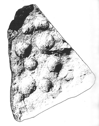
Lockington cup-marking (courtesy Gwilym Hughes)
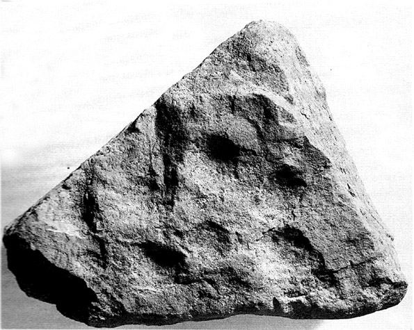
Lockington cup-marked stone

Found on the northern edge of a ring ditch surrounding this once-fine tomb, the carving was found on a small, triangular-shaped, broken piece of rock , less than 12 inches across along its longest side.  The small stone has what seems to be eight cup-marks (5 seem certain) pecked onto the stone: simple, without additional ingredients, akin to the basic forms found at Baildon and other more northern climes.  The stone itself didn’t seem to be local and was thought by Hughes (2000) “to be from one of the outcrops of millstone grit to the north of the site in southern Derbyshire.”

Less than 7 feet from this petroglyph, inside the barrow, was a pit containing a hoard of ancient gold and copper ware — though any likely relationship between the carving and the treasure hoard is doubtful.  The carving was probably a “portable” relic, carried some distance and put here for some reason or other: perhaps as an offering; perhaps a magickal artifact — we’ll probably never know…

References:

  1. Hughes, Gwilym (ed.), The Lockington Gold Hoard: An Early Bronze Age Barrow Cemetery at Lockington, Leicestershire, Oxbow: Oxford 2000.
  2. Hughes, Gwilym, “The Cup Marked Stone,” in The Lockington Gold Hoard, Oxford 2000.

© Paul Bennett, The Northern Antiquarian 


Lyneham Barrow, Ascot-under-Wychwood, Oxfordshire

Long Barrow:  OS Grid Reference – SP 2975 2107

Getting Here

Lyneham Barrow stone

Pretty easy really.  From Shipton-under-Wychwood take the A361 road north (to Chipping Norton) for just over 2 miles.  You’ll pass the TV mast on your right and then a small country lane sign-posted to Ascott-under-Wychwood.  Go past this and then stop at the next right-turn a half-mile further up the road.  The barrow is about 100 yards before this turning, in the hedgerow, on the left-hand side of the road!

Archaeology & History

This once great and proud neolithic monument is today but a shadow of its former self.  Described by various antiquarians and archaeologists over the years, O.G.S. Crawford (1925) included it in his fine survey, telling:

“The barrow is between 160 and 170 feet long and stands in two fields on the west side of the Chipping Norton and Burford main road… In the northern field, at the NE end of the barrow, stands a single upright stone, 6 feet high, 5 feet broad and 1 foot 6 inches thick.  This stone is stated to be buried three feet deep in the ground and its height is given by Conder as 10 feet 6 inches.  When visited October 18, 1922, a large piece of the top had been broken off, but replaced in position.”

This damage was reported around the same time and described in the early “Notes” of The Antiquaries Journal by a Mr A.D. Passmore (1925), who wrote:

“About 30ft from the north-east end of this long barrow stands a large monolith now nearly 6ft above ground…and roughly 6ft wide and just under 2ft thick, of local stone.  At the top is an ancient and natural fissure extending right across the stone and penetrating some way downwards obliquely.  Early in 1923, either by foul play or natural decay, another crack appeared spreading towards the first about a right-angle, the result being that a large piece at the top of the monolith became detached.  Such an opportunity of mischief was speedily taken advantage of and the piece of stone, weighing over 4 cwt, was pushed off and fell to the ground.  In August 1924 the owner of the land, his man, and the writer spread a bed of cement and hoisted up the large broken mass and relaid it in its bed.”

But even in their day, the tomb had already been opened up and checked out, by a Lord Moreton and a Mr Edward Conder, in 1894 no less!  Conder’s account (1895) of the inside of this ancient tomb told:

“There were found (1) a chamber at right angles to the long axis of the barrow; on the south-eastern side of the barrow were two uprights, 4 feet 2 inches by 2 feet 1o inches, and 1 foot 9 inches by 2 feet 8 inches.  At the north-western end of the chamber were two uprights set with their long faces (edges?) abutting.  On the surface-line at the level of the base of the barrow were traces of paving and fragments of bone, pottery and charcoal.  (2) Chamber, a little south of the south-east corner of No.1,  slightly above the ground level.  It was formed of three uprights, on the north, east and west sides respectively, and a paving slab with a perforation 4 inches in diameter.  At the north-eastern end of the barrow was a ridge of large ‘rug’ stones up to 8 feet long, 5 feet wide, and 2½ feet thick, terminating in a standing stone…10 feet 6 inches high…buried 3 feet below ground level.  At the southwest end was a standing stone, 4½ feet by 3 feet by 11 inches thick, in a horizontal position lying east and west, 2 feet below the surface. At various points were found skulls and human and animal bones and hearths, with no indications of date, and (as secondary interments) two Saxon graves.”

Today, poor old Lyneham Barrow is much overgrown and could do with a bittova face-lift to bring it back to life.  But I wouldn’t hold y’ breath…..

Folklore

At the crossroads just above this old tomb, the ghost of a white lady is said to roam.  And at the old quarry on the other side of the road a decidedly shamanistic tale speaks of an old lady who lived in a cave and guarded great treasure!  Her spirit is sometimes seen wandering about in and around the fields hereby.

References:

  1. Bennett, Paul & Wilson, Tom, The Old Stones of Rollright and District, Cockley: London 1999.
  2. Brooks, J.A., Ghosts and Witches of the Cotswolds, Jarrold: Norwich 1992.
  3. Conder, Edward, “An Account of the Exploration of Lyneham Barrow, Oxon,” in Proceedings of the Society of Antiquaries, volume 15, 1895.
  4. Crawford, O.G.S., Long Barrows of the Cotswolds, John Bellows: Oxford 1925.
  5. Dyer, James, Discovering Regional Archaeology: The Cotswolds and the Upper Thames, Shire: Tring 1970.
  6. L.V. Grinsell’s Ancient Burial Mounds of England, Methuen: London 1936.
  7. James, Dave, “A Brief Foray into Oxfordshire,” in Gloucestershire Earth Mysteries 14, 1992.
  8. Passmore, A.D., “Lyneham Barrow, Oxfordshire,” in Antiquaries Journal, 5:2, April 1925.
  9. Turner, Mark, Folklore and mysteries of the Cotswolds, Hale: London 1993.

© Paul Bennett, The Northern Antiquarian


Hastings Hill Cursus, Sunderland, Durham

Cursus: OS Grid Reference – NZ 3555 5381

Also known as:

  1. Hasting Hill

Archaeology & History

Aerial view of Hasting Hill cursus & enclosure remains

This site was discovered in the 1980s, following aerial surveying of the region.  The survey uncovered a number of previously unknown archaeological monuments in relative proximity to each other; the Hastings Hill cursus being just one.  There was also a causewayed enclosure and some round barrows some 700 yards south of Hastings Hill Farm. Although no distinctive remains of the earthworks can still be seen on the surface, limited excavation confirmed that significant remains survive beneath the ground. (in the aerial image here, note that the cursus in question aint the long thin crop-mark running to the top-left, but is the small, slightly rounded-end linear feature nearly touching the bottom-right of the oval enclosure)

A brief description of the remains on the Sunderland Council website gives the following information:

“Sections of the ditches of both the cursus and causewayed enclosure were excavated by the Department of Archaeology, University of Durham in 1980. The cursus is orientated north-south. At its northern terminus the cursus is 47m wide and is defined by a 1m wide, asymmetrical ‘V’ shaped ditch, which was 0.4m deep. The southern terminus has not been identified, but the cursus is at least 400m long. The causewayed enclosure lies 10m north west of the northern terminus of the cursus. It is an irregular oval, 92m by 65m, with its long axis orientated north-west, south-east defined by a 1m-2.2m wide ditch, which is 0.2m-0.3m deep. It has entrances in the north west and south east perimeter of the enclosure. One of the round barrows, which is 9m in diameter, is on the eastern perimeter of the enclosure. The other round barrow ditches are located just east of the cursus, 400m south of the causewayed enclosure. One of these has been measured at 20m-22m diameter. The cursus, causewayed enclosure and round barrows are interpreted as being of Neolithic date.”

References:

  1. Horne, P.D., MacLeod, P. & Oswald, A., ‘A Probable Neolithic Causewayed Enclosure in the North of England,’ in Antiquity Journal, March 2001.

© Paul Bennett, The Northern Antiquarian


Roms Law, Burley Moor, West Yorkshire

Ring Cairn: OS Grid Reference – SE 13648 44719

Also known as:

  1. Grubstones Circle
  2. Rumbles Law
  3. Rums Law

Getting Here

Early drawing of 'Grubstones'
Early drawing of ‘Grubstones’

Get to the Twelve Apostles stone circle, then walk just 100 yards down the main footpath south, towards Bingley, and watch out for a small footpath immediately to your left.  Walk on here and head for the rocky outcrop a half-mile ahead of you.  Once past the outcrop, take the first footpath right and walk down for another 100 yards.  Stop! – and walk into the heather.  The circle’s about 50 yards away!  You can of course come from the Menston side of the moor, following the same directions for the Great Skirtful of Stones, but keep walking on for another 200 yards, towards the rocky outcrop again, turning left down the path for 100 yards, before stopping and walking 50 yards into the heath again!

Archaeology & History

Roms Law circle
Roms Law circle

This is one of my favourite sites on these moors. I’m not 100% sure why – but there’s always been something a bit odd about the place. And I don’t quite know what I mean, exactly, when I say “odd.” There’s just something about it… But it’s probably just me.  Though I assume that me sleeping rough here numerous times in the past might have summat to do with it, playing with the lizards, and of course…the sheep… AHEM!!! Soz about that – let’s just get back to what’s known about the place!

Grubstones is an intriguing place and, I recommend, recovers its original name of Roms or Rums Law.  It was described as such in the earliest records and only seems to have acquired the title ‘Grubstones’ following the Ordnance Survey assessment in the 1850s.  The name derives from two compound words, rum, ‘room, space, an open space, a clearing’; and hlaw, a ‘tumulus, or hill’ – literally meaning here the ‘clearing or place of the dead,’ or variations thereof.  But an additional variant on the word law also needs consideration here, as it can also be used to mean a ‘moot or meeting place’; and considering that local folklore, aswell as local boundary records tell of this site being one of the gathering places, here is the distinct possibility of it possessing another meaning: literally, ‘a meeting place of the dead’, or variations on this theme.

The present title of Grubstones was a mistranslation of local dialect by the Ordnance Survey recorders, misconstruing the guttural speaking of Rum stones as ‘grub stones.’  If you wanna try it yourself, talk in old Yorkshire tone, then imagine some Oxford or London dood coming along and asking us the name of the ring of stones!  It works – believe me….

The site has little visual appeal, almost always overgrown with heather, but its history is considerable for such a small and insignificant-looking site.  First described in land records of 1273 CE, Roms Law was one of the sites listed in the local boundary perambulations records which was enacted each year on Rogation Day (movable feast day in Spring).  However in 1733 there was a local boundary dispute which, despite the evidence of written history, proclaimed the Roms Law circle to be beyond the manor of Hawksworth, in which it had always resided.  But the boundary was changed – and local people thenceforth made their way to the Great Skirtful of Stones on their annual ritual walk: a giant cairn several hundred yards east to which, archaeologically, there is some considerable relationship.  For at the northern edge of the Roms Law circle is the denuded remnants of a prehistoric trackway in parts marked out with fallen standing stones and which leads to the very edge of the great cairn.  This trackway or avenue, like that at Avebury (though not as big), consists of “male” and “female” stones and begins – as far as modern observations can tell – several hundred yards to the west, close to a peculiar morass of rocks and a seeming man-made embankment (which I can’t make head or tail of it!).  From here it goes past Roms Law and continues east towards the Great Skirtful, until it veers slightly round the southern side of the huge old tomb, then keeps going eastwards again into the remnants of a prehistoric graveyard close by.

In my opinion, it is very likely that this trackway was an avenue along which our ancestors carried their dead. Equally probable, the Roms Law Circle was where the body of the deceased was rested, or a ritual of some form occurred, before taken on its way to wherever.  It seems very probable that this avenue had a ceremonial aspect of some form attached to it. However, due to the lack of decent archaeological attention, this assertion is difficult to prove.

A previously unrecognised small single tomb is in evidence to the immediate southeast (5 yards) of the circle.  There is also another previously unrecognised prehistoric trackway that runs up along the eastern side of the circle, roughly north-south, making its way here from Hawksworth Moor to the south.  The old legend that Roms Law was a meeting place may relate to it being a site where the dead were rested, along with it being an important point along the old boundary line. Records tell us that the chant, “This is Rumbles Law” occurred here at the end of the perambulation – which, after the boundary change, was uttered at the Great Skirtful.  This continued till at least 1901.

Northern section of the Ring

Modern archaeological analysis of the site is undecided as regards the actual nature of Roms Law.  Ordnance Survey maps show it as an “enclosure” (which is vague); Faull & Moorhouse’s survey (1981) erroneously tell us it had no funerary nature, contrary to Eric Cowling’s (1946) report of finding bones and ashes from the small hole in near the centre of the ring, aswell as the 1880 drawing of the site in Collyer & Turner’s survey (above).  And we find the single cairn on the south-eastern edge of the ring indicating burial rites of sorts definitely occurred here.  Described variously by previous archaeologists as a stone circle, a ring cairn, cairn circle, an enclosure, aswell as “a rubble-fill wall of a circular house” (by some anonymous member of the West Yorkshire Archaeology Service, who didn’t respond to my queries about this curious assumption), the real nature of Roms Law leans more to a cairn circle site.  A fine example of a cup-and-ring stone — the Comet Stone — was found very close to the circle, somewhere along the Grubstones Ridge more than a hundred years ago, and it may have had some relevance to Roms Law.

This denuded ring of stones is a place that has to be seen quite blatantly in a much wider context, with other outlying sites having considerable relationship to it.  Simple as! (If you wanna know more about this, check out my short work, Roms Law, due out shortly!)

Describing the status and dimensions here, our great Yorkshire historian Arthur Raistrick (1929) told that:

“The larger stones still standing number about twenty, but the spaces between them are filled with stones of many intermediate sizes, so that one could with only considerable detail of size, etc, number the original peristalith.”

…Meaning that we’re unsure exactly how many stones stood in the ring when it was first built!  Although a little wider, the Roms Law is similar in form to the newly discovered ‘Hazell Circle‘ not far from here.  The site has changed little since Raistrick’s survey, though some halfwits nicked some of the stones on the southwestern edge of the site in the 1960s to build a stupid effing grouse-butt, from which to shoot the birds up here! (would the local council or local archaeologist have been consulted about such destruction by building the grouse-butt here? – anyone know?)  Thankfully, this has all but disappeared and the moorland has taken it back to Earth.

There is still a lot more to be told of Roms Law and its relationship with a number of uncatalogued sites scattered hereby.  Although it’s only a small scruffy-looking thing (a bit like misself!), its archaeology and mythic history is very rich indeed.  “Watch This Space” – as they say!

Folklore

Alleged to be haunted, this site has been used by authentic ritual magickians in bygone years. It was described by Collyer & Turner (1885) “to have been a Council or Moot Assembly place” — and we find this confirmed to a great extent via the township perambulation records.  Considerable evidence points to an early masonic group convening here in medieval times and we are certain from historical records that members of the legendary Grand Lodge of All England (said to be ordained in the tenth century by King Athelstan) met here, or at the adjacent Great Skirtful of Stones giant cairn 400 yards east.

The boundary perambulations which occurred here on Rogation Day relate to events just before or around Beltane, Mayday.  Elizabeth Wright (1913) said of this date:

“These days are marked in the popular mind by the ancient and well-known custom of beating the parish bounds, whence arose the now obsolete name of Gang-days, and the name Rammalation-day, i.e., perambulation-day, for Rogation-Monday.  The practice is also called Processioning and Possessioning… The reason why this perambulation of the parish boundaries takes place at Rogationtide seems to be that originally it was a purely religious observance, a procession of priest and people through the fields to pray for a fruitful Spring-time and harvest.  In the course of time the secular object of familiarizing the growing generation with their parish landmarks gained the upper hand, but the date remained as testimony to the primary devotional character of the custom.”

And the calling of, “This is Rumbles Law” maintained this ancient custom when it used to be uttered here.

…to be continued…

References:

  1. Bennett, Paul, The Old Stones of Elmet, Capall Bann: Milverton 2001.
  2. Bennett, Paul, The Roms Law Circle, Ilkley Moor, Heathen Earth: Keighley 2009.
  3. Bennett, Paul, The Twelve Apostles Stone Circle, TNA Publications 2017.
  4. Collyer, Robert & Turner, J. Horsfall, Ilkley: Ancient and Modern, William Walker: Otley 1885.
  5. Colls, J.N.M., ‘Letter upon some Early Remains Discovered in Yorkshire,’ in Archaeologia 31, 1846.
  6. Cowling, E.T., Rombald’s Way, William Walker: Otley 1946.
  7. Devereux, Paul, Places of Power, Blandford: London 1989.
  8. Faull & Moorhouse, West Yorkshire: An Archaeological Survey – volume 1, WYMCC: Wakefield 1981.
  9. Gelling, Margaret, Signposts to the Past, Phillimore: Chichester 1988.
  10. Gelling, Margaret, Place-Names in the Landscape, Phoenix: London 2000.
  11. Gomme, G.L., Primitive Folk-Moots; or Open-Air Assemblies in Britain, Sampson Low: London 1880.
  12. Raistrick, Arthur, ‘The Bronze Age in West Yorkshire,’ in YAJ, 1929.
  13. Smith, A.H., English Place-Names Elements – volume 2, Cambridge University Press 1956.
  14. Smith, A.H., The Place-Names of the West Riding of Yorkshire – volume 4, Cambridge University Press 1963.
  15. Speight, Harry, Chronicles and Stories of Old Bingley, Elliott Stock: London 1898.
  16. Wardell, James, Historical Notices on Ilkley, Rombald’s Moor, Baildon Common, etc., Leeds 1869.
  17. Wright, Elizabeth Mary, Rustic Speech and Folk-Lore, Oxford University Press 1913.

© Paul Bennett, The Northern Antiquarian


Rollright Stones, Chipping Norton, Oxfordshire

Stone Circle:  OS Grid Reference – SP 29578 30869

Also known as:

  1. King’s Men
  2. The Rollrights
  3. Rowldrich

Getting Here

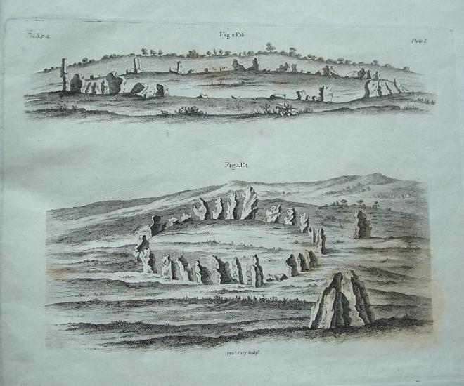
One of Camden’s early drawings

All sorts of ways to get here – all via road I’m afraid.  Those southern-types aint into walking over fields and ambling about like we can do ‘ere up North.  Best way to get here really, is get to Chipping Norton (a good little town with many good folk there), and ask!  Take the road out of the town to Over Norton, taking the first road left as you enter the village. Go along this country  lane for a mile until you reach a crossroads at the top of the hill. Turn right at the crossroads and watch out for the parking space at the roadside a few hundred yards along. Stop there and walk through the gate to go round to the other side of the trees. (if there’s a Rollright Trust member there loitering in the entrance asking you for some money to walk or sit by the stone circle – don’t give ’em it!  They’ve used the cash for poisoning the wildlife in the past (killing the moles, field mice and other indigenous creatures there) and then lied about what they did (reckoning it was nowt to do with them!), so I wouldn’t trust them).

Archaeology & History

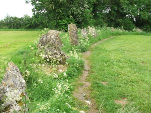
Southern arc of stones

There’s masses to be said on this site, which I can’t add all in one go (I’ve literally got a full unpublished book on the many aspects if this lovely site) — so this entry will be updated occasionally with additional bits and bats of info and images as time floats by.

This remarkable and quite atmospheric megalithic complex has so much to say for itself that entire books have been written on the place (see the extensive references below), dealing with its archaeology, folklore and ritual use.

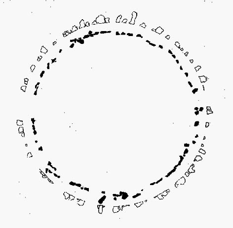
1920s Ground-plan
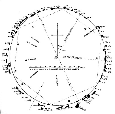
Mr Taunt’s 1907 plan

The King’s Men is a near-perfect circle of oolitic limestone uprights.  Thought for centuries to be the memorial site of some victory by the Danish King Rollo, they have been described by many historians, travellers and antiquarians from the 14th century upwards.  Several early writers described a sort of “avenue” running from the circle, not unlike the one perceived at Stonehenge and elsewhere.  Evidence for this cannot be fully disregarded, as there are some recumbent monoliths along the road beside the stone complex, known as the Jurassic Way.  This was a prehistoric trade route and it is more likely than not that some other uprights would have been nearby.

The Rollright Stones were used as the prime base for what was known as the Dragon Project: an exploratory examination of potential electromagnetic anomalies that were recorded at the standing stones here by scientists, geomancers and archaeologists who were involved daily monitoring work over many years.  Much of this was published in Paul Devereux’s book, Places of Power – required reading for everyone who pretends an interest in megalithic sciences.

Northern section of the ring

The Rollright complex today consists primarily of three sites: the Whispering Knight’s portal dolmen, the King’s Men stone circle, and the King Stone.  Of these, it is the stone circle which draws most attention. Several alignments are connected with the complex.  The original ritual use of the place would have, primarily, involved rites of passage and death rituals; though it seems obvious that menstrual rites were also an important social event here.  After dark, this stone circle has distinctly ‘female’ spirit, sometimes manifesting in a quite wrathful form (please don’t confuse any of the modern witchcraft mythos with such things – they are fundamentally different in both social and ritual aspects). Women obviously played a large part in the ritual use and geomantic layout of the original complex.  It also seems likely that the stone circle was used as a moot spot, which may have been in use until medieval times.  The recent discovery of the carving of a family crest, at least 500 years old, implies this.

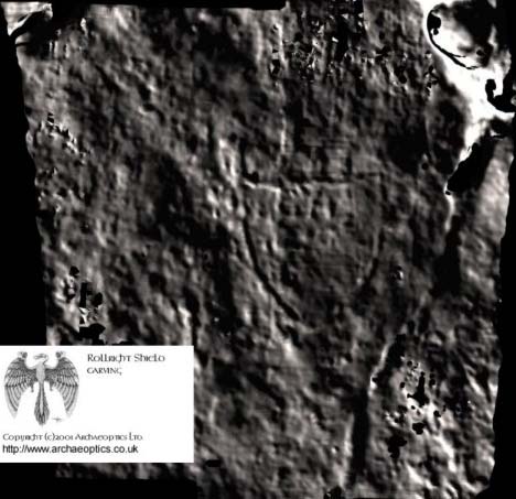
Until Tom Wilson and I lived in the hut at the circle in the 1990s, previous reports of ‘carvings’ at the stone circle were few and debatable.  But two of the stones in the Rollright circle have quite distinct carvings on them.  The most pronounced is etched on the tallest stone (stone 1 – Barnatt Survey) and comprises of a typical heraldic shield – although we cannot, as yet, ascertain the motif in the middle of the shield.  This was first seen by a visiting tourist who wanted to remain anonymous, but the finding was written up in an article I wrote shortly afterwards. (Bennett 1999)  The image below – reproduced courtesy of Alistair Carty’s Archaeoptics Limited laser scanning company – clearly shows the carving, which confirmed the initial discovery.  The report of his findings can be read here.

Shield carving on tallest stone
Shield carving on tallest stone (© Archaeoptics Ltd)
L.V. Grinsell’s 1930 photo

Not unsurprisingly, since the discovery of the shield various screwy interpretations have been put forward to account for the design.  My favourite has to be the one suggested by a pagan friend of the Rollright Trust, who, occult-like and all secret (y’ get the drift) reckoned it was all to do with King Arthur!  Needless to say, my response of, “Y’ talking bollox mate!” was received somewhat nervously by pagan Karin Attwood and the twee little entourage who were discussing the shield, in the usual ‘secrecy – secrecy’ hush-hush tone of false witches and similar idiots!

A few months later I found another set of carvings on stone 62 (Barnatt survey), comprising a set of Ogham letters. These Ogham are very faint and are best observed before midday, when lighting conditions highlight them much clearer. If anyone can decipher them, it would be greatly appreciated. (though please don’t gimme some shit about King Arthur)

Folklore

Folklore ascribes that the number of stones in the complex cannot be counted (a motif found at other megalithic sites) and, intriguingly, of the surveys done here, no two are the same!  One early illustration of the circle shows 30 stones, nother describes 46, and one survey describes just 22 stones!  As the 20th century progressed the numbers increased dramatically, with surveys differing at 58, 60, 71, 72, 73, 77 and 105. The present-day ‘guesstimate’ is about 77. Weird!

Folklore tells that if you can count the stones three times in a row and get the same number, you may have any wish you choose.  But recently this has become reversed and it is said to be a curse if you count three times the same.  Intriguingly, modern visitors who allege no superstitious beliefs, will not count the stones a third time if the same number crops up twice.

The best-known folk tale of this place is of the King, his men and the knights, who “were once men who were changed into vast rocks and fossilised,” as Camden first put it in 1586.  The King’s men sometimes go to drink at a well near Little Rollright, as does the king, but he only goes at certain times.  At midnight however, on certain days, the King’s Men have sometimes been known to come to life, join hands and dance in a circle.  This sounds more like a folk remnant of ritual use here.

Faerie folk are said to live beneath the circle, in great caverns, some of which are linked up to the single monolith across the road. Ravenhill [1926] described how local folk had sometimes seen the little people dancing around the circle by moonlight, but nobody has seen them of late.

…to be continued…!

References:

  1. Anonymous, The Rollright Stones: Theories and Legends, privately printed, n.d.
  2. Anonymous, ‘Oxfordshire Mysteries,’ in The Ley Hunter 86, 1979.
  3. Aubrey, John, Monumenta Britannica, Milbourne Port 1980.
  4. Barnatt, John, Stone Circles of Britain (2 volumes), BAR: Oxford 1989.
  5. Beesley, T., ‘The Rollright Stones,’ in Trans. N.Oxon Arch. Soc., 1, 1855.
  6. Bennett, Paul, ‘Remarkable Carving found at the King’s Men Stone Circle, Rollright, Oxfordshire,’ in Right Times 5, 1999.
  7. Bennett, Paul & Wilson, Tom, The Old Stones of Rollright and District, Cockley Press: London 1999.
  8. Bloxham, Christine, Folklore of Oxfordshire, Tempus 2005.
  9. Bord, Janet & Colin, The Secret Country, Paul Elek: London 1976.
  10. Bord, Janet & Colin, A Guide to Ancient Sites in Britain, Paladin 1979.
  11. Brooker, Charles, ‘Magnetism and the Standing Stones,’ in New Scientist, January 1983.
  12. Burl, Aubrey, A Guide to the Stone Circles of Britain, Ireland and Brittany, New Haven & London 1995.
  13. Burl, Aubrey, Great Stone Circles, Yale University Press: New York & London 1999.
  14. Burl, Aubrey, The Stone Circles of Britain, Ireland and Brittany, Yale University Press 2000.
  15. Clayton, Peter, Archaeological Sites of Britain, Weidenfeld & Nicolson: London 1976.
  16. Cooper, Roy, ‘Some Oxfordshire Leys,’ in The Ley Hunter 86, 1979.
  17. Cowper, B.H., ‘Oxfordshire Legend in Stone,’ Notes & Queries (1st series), 7, January 15, 1853.
  18. Crawford, O.G.S., Long Barrows of the Cotswolds, John Bellows: Oxford 1932.
  19. D., A.J., ‘Rollwright or Rollright,’ in Notes & Queries, 2nd series, 7, 1859.
  20. Devereux, Paul, ‘Is This the Image of the Earth Force?’ in The Ley Hunter 87, 1979.
  21. Devereux, Paul, ‘Operation Merlin,’ in The Ley Hunter 88, 1980.
  22. Devereux, Paul, ‘Operation Merlin 2,’ in The Ley Hunter 89, 1980.
  23. Devereux, Paul, ‘The Third Merlin,’ in The Ley Hunter 92, 1981.
  24. Devereux, Paul, Places of Power, Blandford: London 1990.
  25. Devereux, Paul, The Sacred Place, Cassell: London 2000.
  26. Devereux, Paul, Steele, John & Kubrin, David, Earthmind, Harper & Row: New York 1989.
  27. Devereux, Paul & Thomson, Ian, The Ley Hunter’s Companion, Thames & Hudson: London 1979.
  28. Dyer, James, Discovering Regional Archaeology: The Cotswolds and the Upper Thames, Shire: Tring 1970.
  29. Evans, Arthur J., ‘The Rollright Stones,’ in Trans. Bristol & Glouc. Arch. Soc., 40, 1892.
  30. Evans, Arthur J., ‘The Rollright Stones and their Folklore (3 parts),’ in Folklore Journal, 1895.
  31. Graves, Tom, Dowsing, Techniques and Application, Turnstone: London 1976.
  32. Graves, Tom, Needles of Stone, Granada: London 1980.
  33. Graves, Tom (ed.), Dowsing and Archaeology, Turnstone: Wellingborough 1980.
  34. Gray, William, The Rollright Ritual, Helios: Cheltenham 1975.
  35. Grinsell, Leslie V., The Ancient Burial Mounds of England, Methuen: London 1936.
  36. Grinsell, Leslie V., The Rollright Stones and their Folklore, Toucan Press: Guernsey 1977.
  37. Hamper, W., ‘Observations on certain Ancient Pillars of Memorial, called Hoar Stones,’ in Archaeologia, 25, 1833.
  38. Hawkes, Jacquetta, A Guide to the Prehistoric and Roman Monuments in England and Wales, BCA: London 1973.
  39. Higgins, Geoffrey, The Celtic Druids, Rowland Hunter: London 1829.
  40. Krupp, E.C., In Search of Ancient Astronomies, Chatto & Windus: London 1979.
  41. Lambrick, George, The Rollright Stones: The Archaeology and Folklore of the Stones and their Surroundings, Oxford Archaeology Review 1983. (Reprinted and updated in 1988.)
  42. Liebreich, Karen, UneXplained: Spine-tingling tales from Real Places in Great Britain and Ireland, Kindle 2012.
  43. Michell, John, Megalithomania, Thames & Hudson: London 1982.
  44. Millson, Cecilia, Tales of Old Oxfordshire, Countryside Books: Newbury 1983.
  45. Ravenhill, T.H., The Rollright Stones and the Men Who Erected Them, Little Rollright 1926.
  46. Richardson, Alan, Spirits of the Stones, Virgin: London 2001.
  47. Robins, Don, ‘The Dragon Awakes,’ in The Ley Hunter 87, 1979.
  48. Robins, Don, ‘The Dragon Project and the Talking Stones,’ in New Scientist, October 1982.
  49. Robins, Don, Circles of Silence, Souvenir Press: London 1985.
  50. Saltzman, L.F. (ed.), Victoria County History of Oxford, Dawsons: London 1970 (first published 1939).
  51. Stanley, Christopher C., ‘A Rollright Processional Way?’ in The Ley Hunter 90, 1981.
  52. Taunt, Harry, The Rollright Stones: The Stonehenge of Oxfordshire, Oxford 1907.
  53. Thom, Alexander & Thom, A.S., ‘Rings and Menhirs: Geometry and Astronomy in the Neolithic Age,’ in E.C. Krupp, 1979.
  54. Thom, Alexander, Megalithic Sites in Britain, Oxford University Press 1967.
  55. Thom, A., Thom, A.S. & Burl, H.A.W., Megalithic Rings, BAR: Oxford 1980.
  56. Turner, Mark, Folklore and Mysteries of the Cotswolds, Hale: London 1993.

AcknowledgementsHUGE thanks to Marion Woolley for her images in this site profile, and other memorable ventures at this awesome megalithic ring!

Links

  1. Rollright Stones on The Megalithic Portal

© Paul Bennett, The Northern Antiquarian