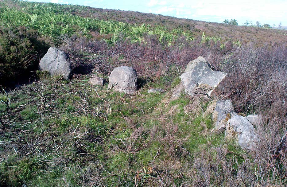
Scorton Cursus, North Yorkshire

Cursus:  OS Grid Reference – NZ 234 010 to SE 249 996

Archaeology & History
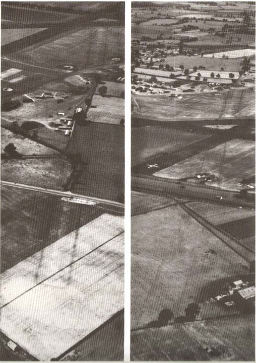
Aerial views of cursus

A huge linear monument that could once be found on the flats just north of the B6271 road running between the villages of Scorton and Brompton-on-Swale, east of the ancient A1 road, has long since been ruined.  Although found quite a few miles north of the main Thornborough henge and cursus complex, a number of students still posit that this northern monument was part of the same “ritual landscape” arena.
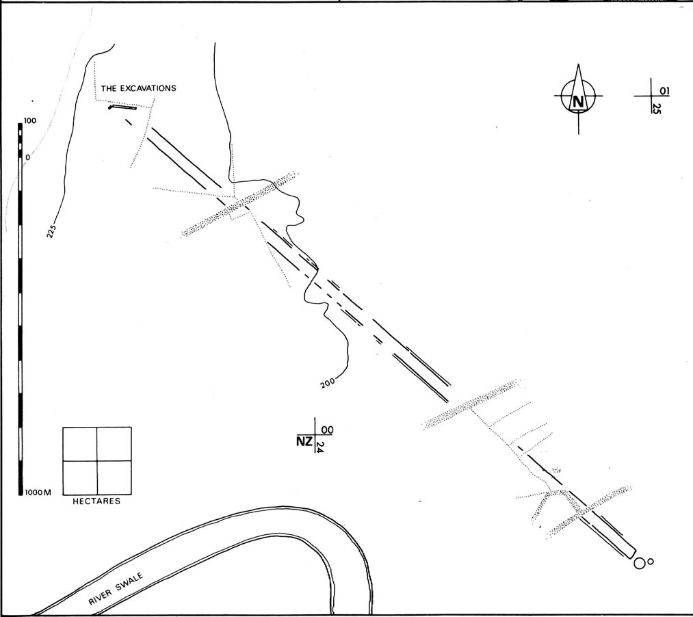
Plan of the cursus (after P.Topping, YAJ 1982)

First discovered in 1949 following aerial survey analysis by Prof. J.K. St. Joseph, this huge dead straight cursus monument ran for at least 1.3 miles (2.1km) and would have been considerably longer if the self-righteous advance of industry hadn’t quarried it away (such is “progress”!).  Built along a southeast to northwest axis, the southern end of the cursus was straight and flattened (as opposed to convex, as found at some cursuses), as Peter Topping’s (1982) illustration of the monument here shows, but the northwestern end of the cursus has not been found.  As Mr Topping himself wrote:

“The southwestern terminal, which shows clearly on the aerial photographs, consists of a straight transverse ditch which joins the two main ditches at right angles.  Clustering around it was a series of ring-ditch cropmarks.  The aerial photographs also show a series of bleach marks between the ditches at the southern end of the cursus, which may represent a series of contiguous mounds.  This area of the cursus also features what appears to be smaller outer ditches…”

Topping also commented on a most “noteworthy feature” in the accuracy of the ditches that constitute the length of the monument, being so “remarkably straight considering the distance over which they extend.”  Features which, in bygone days, a number of respected archaeologists denied our prehistoric ancestors the ability to execute.

Hopefully readers will forgive me citing more of Topping’s extensive notes regarding the archaeological analysis of this site, but I think they’re worthwhile.  Of the ditches that make up the outline of the cursus, he told:

“The ditches of the cursus are the two most prominent features of this site on the aerial photographs.  …The only evidence available for the existence of the cursus in the area to be excavated was a section exposed in the adjacent gravel quarry.  This section clearly illustrated quite distinct re-cut features visible in the profiles of both ditches, and evidence of this recutting was also discovered in the excavated areas.  However, one anomaly which did distinguish the excavated sections from those exposed in the quarry was the variable depth of the ditches. In the quarry-face sections the western ditch had a maximum depth of 60cms, while in the excavated area its maximum depth was 45cm; similarly, the eastern ditch had a  maximum depth of 65cm in the quarry and a maximum depth of 43 cm in the excavations.  This may have resulted from the actions of hillwash or ploughing reducing the height of the old land surface in this area where the ground naturally rises, or alternatively indicate no more than an uneven depth to the ditches.  Their width was fairly consistent, the maximum width of the eastern ditch being 3.40m, while that of the western ditch was 3.85m.

“Recutting in both ditches was indicated by a V-shaped notch beneath the main profile of the ditch…

“Closely datable artifacts were sadly lacking in the ditches, the one possible exception being (a) flint…possibly an arrowhead, from the upper fill of the eastern ditch… The upper fill of the eastern ditch also produced (a) flint…”

But in all honesty, these flint finds were probably of little importance to the cursus itself and can be discounted as of any relevance outside of being stray hunting flints. Three other flints were discovered by the western ditch aswell, again with little significance to the monument.  But the next part of the excavation work explored what Topping called the ‘Central Feature’, of which he said:

“Bleach marks on Prof. St. Joseph’s aerial photographs revealed what appeared to be a series of axially-placed contiguous mounds situated between the main ditches, and extending the whole length of the long axis of the monument as then known.  The presence of this feature was confirmed in the excavated area.  A low central mound was uncovered, within and respecting the lines of the ditches, which had a maximum height of 32cm above the old ground surface.”

Upon further excavation they found what one would have expected: little more than the upcast of earth and gravel dug out from the ditch that makes up the cursus, i.e., spoil-heaps made where they’d dug out the cursus lines with little other significance.  This feature is obviously apparent in many cursuses.  Of greater interest was the pit- or post-hole on the eastern ditch.

“This was stratigraphically related to the cursus to the extent that it was sealed by the same layer of hill-wash that had buried the cursus ditches. In addition, this feature clearly respected the limits of the eastern ditch.  The dimensions of the pit/post-hole were: maximum diameter at its base, 1.12m, the maximum width at its top, 2.10m, length, 4.19m, and a maximum depth of 60cm.

“…Distinct tip-lines were evident leading in and downwards towards the centre of the feature, this central area being relatively stone-free.  This could suggest that the feature originally held a post which was subsequently removed at a later date.”

I’d say this notion is highly likely!  In the event that a  complete excavation could have been made here, it’s probable they would have found other pit-holes into which upright wooden posts were erected around the time the cursus was constructed.  When Topping and his team excavated sections of the eastern ditch-floor, they found what appeared to be the truncated base of another post-hole.  He told:

“This feature was sectioned and found to be flat-bottomed and to have a depth of only 3cm and a diameter of 25cm.  The fill was indistinguishable from the fill of the cursus ditch and contained no traces of organic material…although the exact function of this feature is unknown.”

Topping’s conclusion about the nature and function of this monument is a simple one:

“it can be seen as part of a concentration or complex of magico-religious structures.”

And although this is a somewhat tentative notion based on the limited archaeological evidence here, it does accord with standard views in comparative religion on the animistic relation humans had with natural and man-made monuments from this and later periods of history; as well as reflecting the findings on the origin and development of human consciousness in Jungian and other applied psychology schools.  The construction of this gigantic landscape feature occurred at a period in human history when the division between the sacred and the profane had yet to emerge culturally.  In all likelihood, Mr Topping’s notion is correct.

References:

  1. Moorhouse, S., ‘The Yorkshire Archaeological Register: 1975,’ in Yorkshire Archaeological Journal, 51, 1979.
  2. Pennick, Nigel & Devereux, Paul, Lines on the Landscape, Hale: London 1989.
  3. Thorp, F., ‘The Yorkshire Archaeological Register: 1975,’ in Yorkshire Archaeological Journal, 48, 1976.
  4. Topping, Peter, ‘Excavation at the Cursus at Scorton, North Yorkshire, 1978,’ in Yorkshire Archaeological Journal, 54, 1982.

Acknowledgements:

To the Yorkshire Archaeological Society for use of Peter Topping’s drawing & to Cambridge University for use the aerial photograph.

© Paul Bennett, The Northern Antiquarian


Springfield Cursus, Chelmsford, Essex

Cursus Monument (destroyed):  OS Grid Reference – TL 735 084

Also Known as:

  1. Springfield Barnes Cursus

Archaeology & History

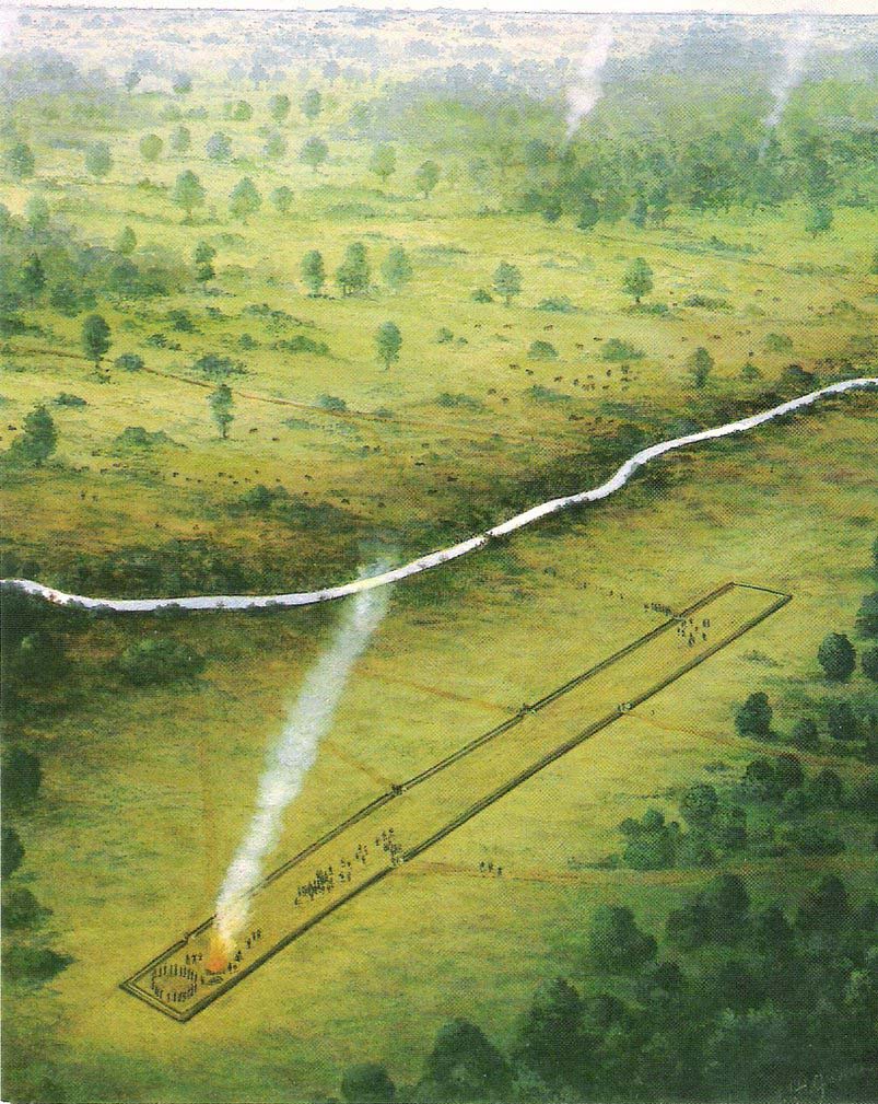
The first cursus monument discovered in Essex, archaeologists were fortunate when they came to excavate the site in 1979 as they found it almost complete.  A rarity these days!  Close to the Springfield Lyons causewayed enclosure monument, the cursus here was some 45 yards across and 750 yards long.  Like a number of other cursuses, the Springfield one was dead straight all the way down, running northeast to southwest with squared terminii at both ends. (of the Bi category, as Loveday called them)  And it appears to have had quite a long period of use.

Springfield Cursus (painting by Frank Gardiner)

The ditch that constitutes the very outline of the cursus — averaging between 3-4 feet in depth all round — was cut into the earth in the neolithic period.  It had small ‘entrances’ at certain points along its longer axis, both on the east and west sides.  The flat ends of the cursus were both ‘closed’, without entrances or breaks of any kind.  Some depositional remains were found scattered at different spots along the course of the ditch: neolithic pottery and flints in both the northern and eastern ditches, but archaeologists were unsure whether these deposits were left at the time the monument was in use, or at a later period — though it seemed consensus opinion that the deposits were from a period when the cursus was in use.  Charcoal remains were also found, but these were associated with an internal timber circle that was erected within the northeastern end of the cursus.  The timber circle was found to have consisted of 14 upright wooden posts arranged in a near-complete ring, some 26 metres in diameter.  It seems highly likely that this part of the monument had some ritual or ceremonial function relating to the dead (“mortuary practices” is the term used at the moment!).

Later excavation work here in 1984 found there to be various other linear and pit-like features within the confines of the monument, and what seemed to be the remains of a barrow beyond its eastern end.

Archaeologist David McOmish (2003), thought that “alignment is also significant,” saying that the “Springfield Cursus, 700 metres long, is aligned on a smaller enclosure some 300 metres away.”  The alignment potential here was first suggested by Pennick & Devereux (1989), albeit pointing “to the village of Wexford just over two miles to the southwest.”  McOmish also suggested there may have been some an astronomical reason for the alignment of the monument NE-SW, but I’m not aware whether this has been explored further.

The creation of these huge monuments had obvious relationships with human death rites, the spirits of trees, and celestial gods.  But much more research is needed at these sites if we’re to find out more about the nature of these prehistoric giants in the landscape.

References:

  1. Buckley, D.G., Hedges, John & Brown, N., “Excavations at a Neolithic Cursus, Springfield, Essex, 1979-85,” in Proceedings of the Prehistoric Society, volume 67, 2001.
  2. Hedges, John D. & Buckley, D.G., Springfield Cursus and the Cursus Problem, Essex County Council 1981.
  3. Loveday, Roy, Inscribed Across the Landscape: The Cursus Enigma, Tempus: Stroud 2006.
  4. McOmish, David, ‘Cursus: Solving a 6000-year-old Puzzle’, in British Archaeology, 69, March 2003.
  5. Pennick, Nigel & Devereux, Paul, Lines on the Landscape, Hale: London 1989.

Links:

  1. Unlocking Essex’s Past: The Springfield Cursus and Associated Remains

© Paul Bennett, The Northern Antiquarian


Bleasdale Circle, Lancaster, Lancashire

Timber Circle:  OS Grid Reference – SD 57717 46004

Getting Here

Pretty easy to find, and a nice walk to boot! Head up to Bleasdale Church (worth a look in itself!), keep going up the path north to the aptly named Vicarage Farm.  From here you’ll notice a small copse of trees on your left (east) heading to the hills.  To those of you who like Predator, “it’s up there – in them trees…!”

Archaeology & History

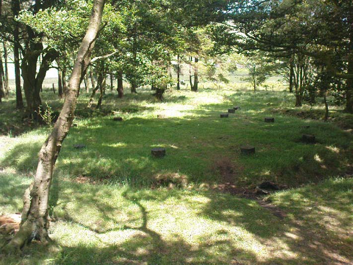
On my first visit here in the company of John Dixon and other TNA regulars, my first impression was “this is a henge” – and noted subsequently that it’s been described as such by several writers.  But the general category given to this fascinating place is a ‘timber circle.’

Bleasdale ‘henge’ circle

First discovered at the end of the 19th century and described in considerable detail by Mr Dawkins (1900), this is a gorgeous-looking monument was erected in at once a gentle and tranquil, aswell as an imposing natural setting, at the foot of Fair Snape Fell (to the northwest) and Bleasdale Fell (due southwest).  These aspects of the landscape would have  had obvious mythic importance to the people who built this ring amongst the trees.  A condensed version of Dawkin’s material was described in J. Holden’s (1980) Story of Preston, that outlined this circle as being,

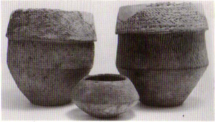
“a centre for religious worship in about 1700 BC.  It was made up of a circle of timber posts which enclosed an area 45 metres in diameter. In the centre was a small mound surrounded by a ring of oak posts and a circular ditch.  Inside the mound there was a grave that had in it two pottery urns filled with human bones and ashes. Examination of the contents of these urns shows that the bodies were wrapped in linen and burnt on a funeral pyre. A small ‘accessory’ cup was found inside one of the urns and this may have contained food or drink for the afterlife.”

Urns from Bleasdale Ring
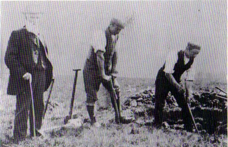
1898 photo of Shadrach Jackson (left) & Tom Kelsall (centre) digging the site

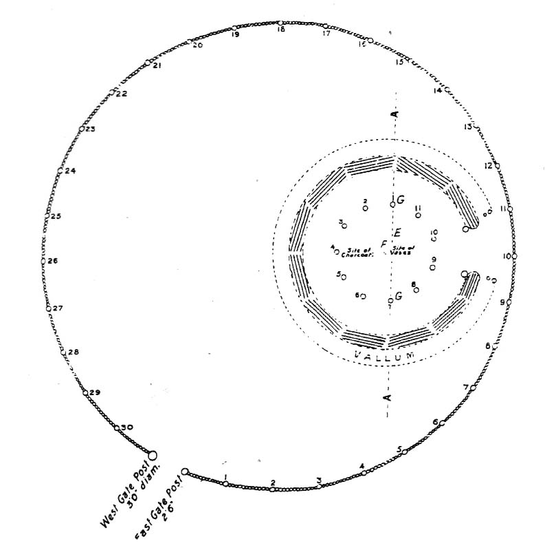
Located within a much larger circular enclosure, the internal Bleasdale ‘henge’ Ring consisted of a small circle of eleven timber posts near the edge of the ditch, and an entrance way to the east, to or from which was an avenue of further wooded posts that led to the edge of the larger enclosure.  It gives the impression that this was some sort of avenue along which a ceremonial procession may have took place, strongly suggesting a ritual function.  Robert Middleton (1996) told that,

“The post circle and barrow appear to respect each other  (in date), whilst the enclosure may be later.  The post circle has been dated to around 2200 BC, although the context and reliability of this date is unclear.”

Looking out eastwards from the middle of the internal henge-style ring and through the ‘entrance’ we find an alignment with a large notch on the skyline which, modern folklore ascribes, is where the midwinter sun rises — which is very believable, but I aint seen it proven anywhere yet.

A much greater and full excavation report of this site was written by Raymond Varley (2010), whose essay I urge fellow antiquarians to read.

References:

  1. Dawkins, W.B., ‘On the Exploration of Prehistoric Sepulchral Remains of the Bronze Age at Bleasdale,’ in Transactions of the Lancashire & Cheshire Antiquarian Society, volume 18, 1900.
  2. Dixon, John, Journeys through Brigantia – volume 8: Forest of Bowland, Aussteiger Publications: Barnoldswick 1992.
  3. Edwards, Ben, “The History of Archaeology in Lancashire”, in Newman, 1996.
  4. Gibson, Alex, Stonehenge and Timber Circles, Tempus: Stroud 1998.
  5. Holden, Jennifer (ed.),  The Story of Preston, Harris Museum: Preston n.d. (c.1980)
  6. Middleton, Robert, “The Neolithic and Bronze Age,” in Newman, 1996.
  7. Newman, Richard (ed.), The Archaeology of Lancashire, Lancaster University 1996.
  8. Sever, Linda (ed.), Lancashire’s Sacred Landscape, History Press: Stroud 2010.
  9. Varley, W.J., ‘The Bleasdale Circle,’ in Antiquaries Journal, volume 18, 1938.
  10. Varley, Raymond, “The Bleasdale Bronze Age Timber Circle,” in Lancashire History Quarterly, 2010.

© Paul Bennett, The Northern Antiquarian


Nine Stones Close, Harthill, Derbyshire

Stone Circle:  OS Grid Reference – SK 2254 6264

Also Known as:

  1. Grey Ladies
  2. Hartle Moor Stone Circle

Getting Here

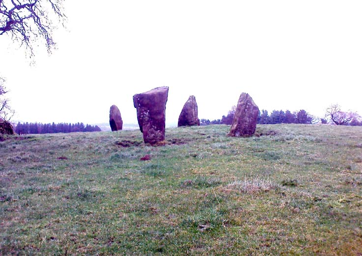
Nine Stones Close circle

From Bakewell take the A6 Matlock road, follow this till just past the signs for Haddon Hall where you take a right (the first major junction) for Youlgreave the B5056.  After about 1km take the first left over the bridge.  You then take the first right turn: a steep lane with restriction signs (don’t worry there’s access for cars but no wide vehicles). Take the first left you come to by the barn and then just follow the road, up through the woodland where the lane narrows then shortly after you’ll see Robin Hood’s Stride to your left.  Park a little way after the field gateway and look across the field to your left.  The stones are visible from the road.

Archaeology & History

This is a fine-looking ring of stones — though perhaps the word ‘ring’ is slightly misleading here, as only four of (apparently) nine originals still remain and they are, by definition, more in a square-shape than a circle!  But it’s a lovely site.  When Geoff brought us here for the first time only last weekend, despite the dark clouds and cold grey day, along with the fact that we’d been sleeping rough the night before and got soaking wet through, there was a subtle feel to this place which my shivering senses still touched.  Only just though…!

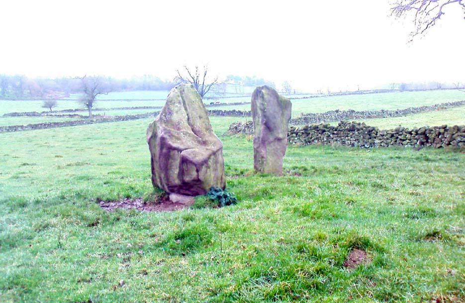
Two southernmost stones

Mebbe it was the rising crags of Robin Hood’s Stride to its immediate south?  Or the quietly hidden companionship with other stones and sites in the locale?  I don’t really think so.  There was something a little more about its own genius loci that tingled very slightly on the rise in the field upon which the circle sits.  Some people would, perhaps, acquaint my sense of a subtle genius loci here to the various leys or ley-lines that have been drawn through here by other writers— but it wasn’t that.

When earlier writers came here, they too had various inspirations of differing forms.  John Barnatt’s (1978) early impressions of the place had him signing astronomical events in and around the remaining stones here, despite knowing that the site had been damaged.  In later years he revised his early notions — as most of us do as our perspectives are enriched — but the astronomy is still assumed here.  As Clive Ruggles (1999) told:

“Other rings are located where natural features coincide with astronomical events, such as Nine Stone Close in Derbyshire…from which the Moon at the southern major standstill limit, sets behind the gritstone crag of Robin Hood’s Stride to the SSW, between ‘two stubbly piles of boulders jutting up at either end of its flat top.'”

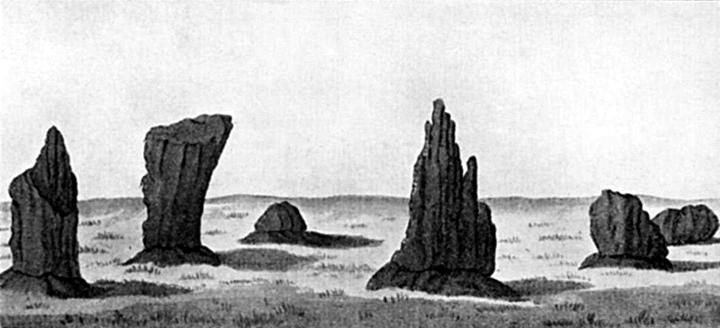
Major Rooke’s drawing of the Nine Stones Circle, c.1780

The stones that remain here are quite tall, between 6½ and 8 feet tall.  One of them seems to have originally been taken from a stream or river-bed.  They stand upon the small rise in the field and has diameters of 40 and 45 feet respectively.  Aubrey Burl described there being seven uprights still here in 1847, and the early drawing of the site near the end of the 18th century by Major Hayman Rooke highlights 6 stones around the spot where the circle now stands.  In J.P. Heathcote’s (1947) summary, he wrote that,

“Bateman, in his Vestiges, says an excavation in 1847 yielded some indications of interments in the form of ‘several fragments of imperfectly-baked pottery, accompanied by flint both in a natural and calcined state.’  In 1877, Llewellyn Jewitt and Canon Greenwell…turned their attention…to the Nine Stones.  They dug at the foot of the second highest stone and the Canon directed a good deal of digging within the circle, but nothing special turned up. The area in the circle is now quite level, but it is probable that there was, as Bateman says, a tumulus in the centre.”

This latter remark is the impression I got of the place.  Tis a really good little site.  All around here are a number of other sites: cup-marked stones, enclosures or settlements, prehistoric trackways, and more.

Folklore

One of the old names of this site was The Grey Ladies.  This came from the well known tale found at other sites across the world, that some ladies were dancing here at some late hour and were turned into stone.  A variation on this theme told how Robin Hood stood on the nearby rock outcrop to the south and pissed over the landscape here, “where seven maidens upon seeing it turned to stone.”  In this case, Robin Hood replaced an older, forgotten account of a giant, who forged the landscape and the sites around Harthill Moor.

Another tale — whose origins and nature are allied to that of the petrification of the Grey Ladies — narrated with considerable sincerity by local people, was that the circle was a place where the little people gathered and where, at certain times of the year, “fairy music and the sight of hundreds of dancing shapes around the stones” would happen.

Said by Rickman and Nown (1977) to be “Derbyshire’s most magical ancient site,” they thought the site was on a ley that linked up with Arbor Lowe, less than 5 miles west, crossing a couple of tumuli on its way.

References:

  1. Barnatt, John, Stone Circles of the Peak, Turnstone: London 1978.
  2. Burl, Aubrey, A Guide to the Stone Circles of Britain, Ireland and Brittany, Yale University Press 1995.
  3. Clarke, David, Ghosts and Legends of the Peak, Jarrold: Norwich 1991.
  4. Heathcote, J. Percy, Birchover – Its Prehistoric and Druidical Remains, Wilfrid Edwards: Chesterfield 1947.
  5. Rickman, Philip & Nown, Graham, Mysterious Derbyshire, Dalesman: Clapham 1977.
  6. Ruggles, Clive, Astronomy in Prehistoric Britain and Ireland, Yale University Press 1999.
  7. Thom, A., Thom, A.S. & Burl, Aubrey, Megalithic Rings, BAR: Oxford 1980.

© Paul Bennett, The Northern Antiquarian


Devil’s Den Cups, Clatford, Wiltshire

Cup-Marked Stone:  OS Grid Reference – SU 15211 69652

Getting Here

Follow the directions to reach the Devil’s Den, a half-mile north of Clatford up the footpath towards the Fyfield Down cup-marked rock.  You can’t miss it!  The cup-markings are on the top of the capstone.

Archaeology & History

First described and illustrated by local historian and photographer, Pete Glastonbury, as far as I’m aware these cup-markings have not previously been included in any of Wiltshire’s archaeological surveys (that can’t be, surely?).  The only reference I’ve found — not untypically — is from one of the early editions of the english Folklore Journal.

...and again!
…and again!
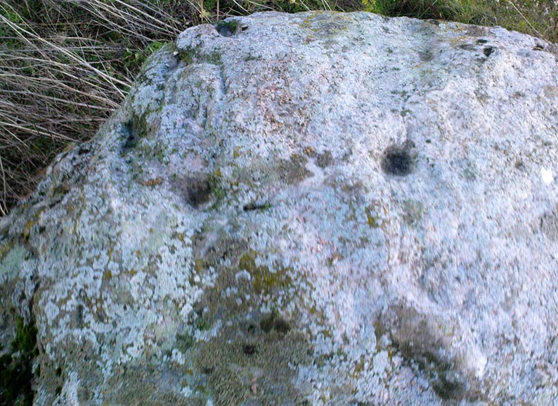
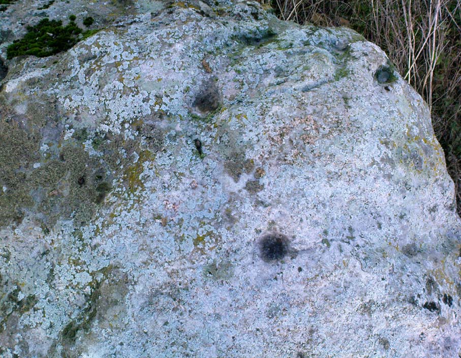
Devil’s Den cup-markings

At least two well-defined cups stand out on the top of the capstone.  Each of them have ‘cracks’ running out of them, with the easternmost one of them (closer to the edge) turning into a channel which runs upwards on the stone, before then leading down off the edge of the rock.  Each cup-mark is very clear, about two inches across and about a half-inch deep.

Archaeologists can check these cups out and work out for themselves whether they’re natural or not.  They’re far more qualified than I on such matters and may be able ascertain other faint remarks on the stone.  The proximity of the nearby Fyfield Down cup-marked rock, several hundred yards to the north, shows that such petroglyphs can be found in this region.  Although we cannot expect many examples of rock art in this area (the rock’s damn tough and takes some burrowing into), it is likely that more carvings await discovery.

Folklore

The capstone on which these cup-markings are seen was told to be immovable and had lore said of it akin to that found at the great Whispering Knights, near the Rollright Stones.  But the main piece of lore describes the cups quite specifically.  In an article by Alice Gomme (1909), she told that:

“if anyone pours water into any of the natural cup-shaped cavities on the top stone at midnight, it will always be found in the morning to be gone, drunk by a thirst-tormented fiend.”

The tale is later repeated in Kathleen Wiltshire’s (1975) survey, where she too mentions the cup-marking (though only one), saying that,

“if a person pours water into the natural cup-shaped cavity on the top stone at midnight it will always be found to be gone in the morning — drunk by the devil.”

This folklore motif — repeated in Grinsell’s (1976) text — is found at rock-art sites in a number of the northern counties, where milk has been poured into the cup-markings (some of which were known as ‘cat stones’) and left overnight for the spirits to drink.   In the case we have recorded at Devil’s Den, the spirit of the place seems to have been demonized, as is common.

Miss Gomme (1909) also reported the curious ingredient that the spirit of a white rabbit with glowing eyes would appear on the capstone at midnight and help the devil demolish the site with the aid of eight oxen!  On this latter matter, I am duly informed by one-in-the-know that, to “those of us that know the locals and their humour, we just know this tale was made up for a visiting townie!”

References:

  1. Gomme, Alice B., ‘Folklore Scraps from Several Localities’, in Folklore Journal, 20:1, 1909.
  2. Grinsell, Leslie V., Folklore of Prehistoric Sites in Britain, David & Charles: London 1976.
  3. Wiltshire, Kathleen, Wiltshire Folklore, Compton Russell: Salisbury 1975.

© Paul Bennett, The Northern Antiquarian


Dun Dubh, Ford, Argyll

Dun:  OS Grid Reference – NM 8640 0479

Also Known as:

  1. Canmore ID 22821

Getting Here

From Ford village, take the track that goes uphill (west) running near the edge of the forest-line. Keep going until you hit the top of the forest and the large rocky hill above you (on your right) is where you need to be heading.  The rise to your left is Dun Chonallaich.  Walk around the bottom of the hill until you get to the other side (you should be 100 yards or more above the tree-line) where you’ll notice a ‘pass’ running west, with a rocky knoll above you on your right.  That’s it!

Archaeology & History

Thought to date from the Iron Age, the remains here cover an area 15 yards by about 25 yards.  Remains of walling around the edge of the summit nearly a yard wide in places define quite clearly where the ‘fort’ was centred.  The entrance to the site was found on the northwestern side.  In more recent times however, animal pens have intruded on the remains here and the archaeological remnants are much denuded.

Folklore

Samhain fires were lit on the larger ridge above this ruined fort until recent years, as some old local folk will tell you. These Halloween fires (done to celebrate the old New Year) were stopped a short time after the new ‘owner’ of the Auchinellan Estate (on whose land Dun Dubh is found) took exception to them and, for all intent and purpose, deemed them a fire hazard! The lady in question who inherited the Estate was in fact a devout christian who took exception to the local “pagan” goings-on, contrary to the beliefs of the previous Estate owner, who not only allowed such old events, but played a part in them.  Local folk hereabouts, not surprisingly, aint too keen on their part-time dictatorial christian neighbour.

The fires up here were also related to the linear cemetery at Kilmartin. Here the giant tombs all line up & point to Dun Chonallaich, behind which hides the more flattened top of Dun Dubh. When the Halloween fires were lit on top of this, the glow from behind the great pyramid of Chonallaich all the way down to Valley of the Kings, was spectacular! One wonders just how long the local people had been doing this…

References:

  1. Royal Commission on the Ancient & Historical Monuments, Scotland, Argyll – volume 6, HMSO: Edinburgh 1988.

© Paul Bennett, The Northern Antiquarian


Fimber Cursus, East Yorkshire

Cursus Monument:  OS Grid Reference – SE 893 610

Archaeology & History

Very little appears to have been written about this site, due no doubt to lack of archaeological investigation aswell as the destructive powers of intense agricultural practices hereby.  It was first described in the Yorkshire Archaeological Register and told about by a Mr. H.G. Ramm, who told us of,

“a probable cursus in the Scales, Fimber Grange and Fimber Station area. An aerial photograph taken by John Dent has entended parallel ditches previously known in fragmentary form and enabling them to be interpreted as a cursus running along the valley floor, the north ditch from SE 8939 6106 to SE 9075 6104 and the southern ditch from SE 8937 6103 to SE 9068 6102. The distance between the ditches varies from 18-27m west of Fimber Grange to 30-37m east of the Grange.  A trapezoidal enclosure, 30m by 15m, possibly a small long barrow, has been identified at SE 9008 6104, oblique to the north cursus ditch, which bends to take in account of it.  A group of five ring ditches, three of which are in the cursus, lies to the west of Fimber Grange, but indicate a wartime searchlight post.”

This makes the length of this monument pretty short, but the faint remains of this possible cursus are visible on aerial shots.  A number of other large ancient earthworks were charted here by the famous archaeologist, J.R. Mortimer (1905), though he made no mention of this particular site.

More info please!

References:

  1. Edmondson, T., History of Fimber, H. Smithson: Malton 1857.
  2. Gutch, Mrs. E., Examples of Printed Folk-lore Concerning the East Riding of Yorkshire, David Nutt: London 1912.
  3. Moorhouse, S., ‘Yorkshire Archaeological Register: 1976,’ in Yorkshire Archaeological Journal, volume 49, 1977.
  4. Mortimer, J.R., Forty Years Researches in British and Saxon Burial Mounds of East Yorkshire, Brown & Sons: Hull 1905.

© Paul Bennett, The Northern Antiquarian


Hutton Moor Henge, Dishforth, North Yorkshire

Henge:  OS Grid Reference – SE 3525 7351

Getting Here

Hutton Moor Henge from above (photo © Pete Glastonbury)

From junction 49 on the A1 (M), Dishforth turn-off, bear west on the Copt Hewick and Ripon road.  100 yards past Copt Hewick, take the track on the right-side of the road, leading to Blois Hall and further up to Low Barn.  Once at Low Barn, go north through the trees called Harland’s Plantation and the barely visible henge remains are in the field on the other side – as PeteG’s fine aerial photo here shows!

Archaeology & History

At ground-level there’s not too much to see of this once fine henge, thanks to the usual excesses of modern agriculture and modern industry.  Which is a pity, as the completed monument here was similar in size and lay-out to the three huge henges a few miles north at Thornborough.  Archaeologist Jan Harding (2003) believes this and the Thornborough henges and others nearby, suggests “there was a unity of purpose behind” all of them, in terms of their lay-out, alignments and ritual purpose.  He may be right.  Aubrey Burl thinks similarly, noting how,

“The central plateau of these enclosures are remarkably similar in shape and size, slightly ovoid and varying no more than 5 metres or so from a norm of 97 by 92 metres.  All have their entrances near the northwest and southeast following the lie of the land.

Each of them could have held as many as two thousand people and yet they crowd together in a narrow rectangle 11km (7 miles) long and no more than 1.5km (1 mile) across, like an avenue of architect-designed houses with a river frontage to their west.”

Intriguing stuff – and all from the neolithic period.  But focussing on Hutton Moor’s monument, …

In Walbran’s (1851) historical work on Ripon and district, he gave us one of the earliest descriptions of Hutton Moor’s henge, telling:

“we have far more direct and conclusive evidence, that the immediate vicinity of Ripon was regarded with peculiar interest and veneration ; since one of the tribes of the Brigantian Celts had chosen it as their station for the dispensation of justice and the celebration of religious rites ; in fact, had made it the seat of their government. This position — novel as it may be — is, I believe, sufficiently proved.by a remarkable earth-work on the high land near ” Blows Hall,” commanding extensive prospects up and down the Vale of Ure, as well as of the distant ranges of hills which form the side screens of the great Yorkshire plain. Like Abury and Stonehenge, which it rivals in antiquity, its outline is that of a circle, of which the diameter is not less than 680 feet ; but no stones remain, nor indeed does that material seem to have been used in its formation. Though recent agricultural operations have partially effaced the regularity and proportion of its plan, it is sufficiently evident that it was enclosed by a lofty mound and corresponding trench — the latter being inside, and a platform or space about thirty feet wide intervening.

“…At two opposite points, bearing nearly north and south, the mound and trench, for about the space of twenty-five feet, have been discontinued, in order to form an approach to the area of the temple. Outside the mound, also, are some slight vestiges of a further avenue, but too indefinite to be traced. But, however obscure the denotation of its several parts may have become, the antiquity and purpose of the place, as a temple for the performance of Druidical rites, is satisfactorily ascertained by the existence of at least eight large Celtic barrows in its immediate vicinity ; one of which, being on the very ridge of the vale, and planted with fir trees, forms a conspicuous and useful object to guide a stranger to the site. Two of these barrows were opened five years ago, but I found nothing but a few calcined human bones, the ashes of the oaken funeral pile, and some fragments of flint arrow-heads, such as are still used by the North-American Indians. Several bronze spear-heads and celts have, however, been found in the neighbourhood, within recollection.”

Walbran also described there being some upright stones at the henge:

“two small pyramids or obelisks, built on the mound of the temple, about fifty years ago, in the place, it is said, of two similar erections, apparently of high antiquity.”

Loveday (1998) addressed some interesting notes about potential alignment features at henges first described in Anthony Harding’s (1987) text, Hutton Moor included — i.e., the angle of their respective entrances/exits very closely mirror the alignment of adjacent Roman roads.  Curious correlates akin to the ley hunter’s assertions find the alignment or direction of nearby Roman roads is echoed in the alignments of henge entrances.  Now this wouldn’t seem too unusual, but in 4 out of 5 henges, this peculiar parallel has been found.  The Hutton Moor henge is no exception; with its aligned entrances closely paralleling the ancient straight Roman road of the A1 (though there are evidences of a pre-Roman track preceding the Roman construction), less than a mile to the east.  The same alignment is echoed in all of the Ure Valley henges.

Folklore

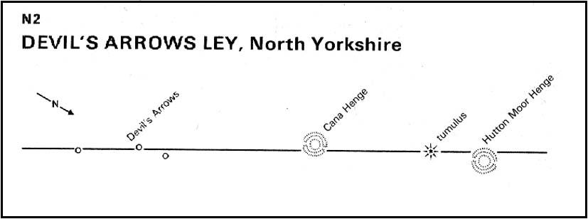
Ley alignment at Hutton henge

This is a site that seems to have been laid out in some form of linear arrangement in prehistoric times.  The notion was first posited in Norrie Ward’s (1969) work, but later expanded in Devereux & Thomson’s (1979) survey of prehistoric alignments.  Although the axis of the henge doesn’t line up with other sites surveyed, they include it in what’s known as the “Devil’s Arrow’s Ley” and the western side of the henge lines up with the Devil’s Arrows and other sites along the line.  When this ley was assessed for statistical probability, Robert Forrest found the alignment to have a probability much greater than that of chance.

References:

  1. Atkinson, R.J.C., “The Henge Monuments of Great Britain,” in Atkinson, Piggott & Sandars’ Excavations at Dorchester, Oxon, Ashmolean Museum 1951.
  2. Burl, Aubrey, Prehistoric Henges, Shire: Princes Risborough 1997.
  3. Devereux, Paul & Thomson, Ian, The Ley Hunter’s Companion, Thames & Hudson: London 1979.
  4. Harding, Anthony F. & Lee, G.E., Henge Monuments and Related Sites of Great Britain, BAR 175: Oxford 1987.
  5. Harding, Jan, Henge Monuments of the British Isles, Tempus: Stroud 2003.
  6. Loveday, Roy, “Double Entrance Henges”, in Prehistoric Ritual and Religion, Sutton: Stroud 1998.
  7. Walbran, John Richard, A Guide to Ripon, Harrogate, Fountains Abbey, Bolton Priory, W. Harrison: Ripon 1851.

Acknowledgements:

Huge thanks to Paul Devereux for use of his ley alignment drawing.

© Paul Bennett, The Northern Antiquarian 


Kelpie’s Stane, Corgarff, Aberdeenshire

Legendary Rock:  OS Grid Reference – NJ 264 087

Also known as:

  1. Kelpie Stone

Folklore

The old Scottish folklorist, A.A. MacGregor, described this legendary rock, “by the Bridge of Luib, on the River Don,” in his classic Peat Fire Flame. (1937)  One of the numerous ‘holed stones,’ it was one of countless rocks in our isles imbued with animistic spirit essence, akin to similar rocks found in all of the other cultures in the world.  MacGregor told how,

“It happened that a man summoned to the death-bed of a relative came to this crossing-place just after torrential floods had carried away the bridge. When he was on the point of abandoning all hope of reaching the opposite bank, a tall man appeared from nowhere and volunteered to carry him across. The distracted homecomer accepted the assistance proffered. But, when he and his carrier reached mid-river, the latter reverted to the form of the river kelpie and endeavoured to drag him down to the river’s bed. The victim managed to escape. As he scrambled to the bank, the infuriated kelpie hurled after him the huge boulder that to this day goes by the name of the Kelpie’s Stane.”

But the stone was also known to possess healing and magickal properties, as evidenced from MacPherson’s (1929) chronicle, which told:

“Somewhere near Dinnet was the Kelpie Stone. Childless women passed through its 18 inch (46cm) hole to concieve. A noble lady performed the task to no avail; only when she repeated it in the same direction as the river flow did the charm work.”

Close by are several other intriguing place-names which may at some time have had some archaeo-mythic relevance to this legendary rock. On the hill above is the old Carn Lian; the water course nearby is the Allt na Ciste; but most intriguingly we find the Bog of the Old Woman, or the Moine Cailleach a half-mile to the east.

References:

  1. MacGregor, Alisdair Alpin, The Peat-Fire Flame, Ettrick Press: Edinburgh 1937.
  2. McPherson, Joseph M., Primitive Beliefs in the North-East of Scotland, Longmans, Green & Co: London 1929.

© Paul Bennett, The Northern Antiquarian


Harden Moor Circle, Bingley, West Yorkshire

Ring Cairn:  OS Grid Reference – SE 07496 38675

Getting Here

Harden Moor circle01
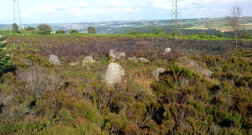
Harden Moor Circle, looking SE

From Harden, go up Moor Edge High Side (terraced row) till you reach the top. Follow the path thru’ the woods on the left side of the stream till you bend back on yourself and go uphill till you reach the moor edge. Keep walking for about 500 yards and keep an eye out to your immediate left.  The other route is from the Guide Inn pub: cross the road and go up the dirt-track on the moor-edge till you reach a crossing of the tracks where a footpath takes you straight onto the moor (south). Walk on here, heading to the highest point where the path eventually drops down the slope, SE. As you drop down, watch out for the birch tree, cos the circle’s to be found shortly after that, on your right, hidden in the heather!

Archaeology & History

This aint a bad little site hidden away on the small remains of Harden Moor, but is more of a ‘ring cairn’ than an authentic stone circle (a designation given it by previous archaeologists).  An early description of it was by Bradford historian Butler Wood (1905), who also mentioned there being the remains of around 20 small burials nearby.  When the great Sidney Jackson (1956; 1959) and his team of devoted Bradford amateurs got round to excavating here, he found “four or five Bronze Age urns” associated with the circle.  His measurements of the site found it to be 24 feet across, and although the stones are buried into the peat with none of them reaching higher than 3 feet tall, it’s a quietly impressive little monument this one.  About 20 upright stones make up the main part of the ring.

I’ve visited the place often over the last year or so since a section of the heather has been burnt away on the southern edges of the circle.  This has made visible a very distinct surrounding raised embankment of packing stones about a yard wide and nearly two-feet high, particularly on the southern and eastern sides of the circle, giving the site a notable similarity in appearance and structure to the Roms Law circle (or Grubstones Ring) on Ilkley Moor a few miles to the north.

There is also the possibility that this ring of stones was the site described by local historian William Keighley (1858) in his brief outline of the antiquities of the region, where he wrote:

“On Harden Moor, about two miles south of Keighley, we meet with an interesting plot of ground where was to be seen in the early days of many aged persons yet living, a cairn or ‘skirt of stones,’* which appears to have given name to the place, now designated Cat or Scat-stones. This was no doubt the grave of some noted but long-forgotten warrior.

* The Cairn was called Skirtstones by the country people in allusion to the custom of carrying a stone in the skirt to add to the Cairn.”

However, a site called the ‘Cat stones’ is to be found on the nearby hill about 500 yards southeast – and this mention of a cairn could be the same one which a Mr Peter Craik (1907) of Keighley mentioned in his brief survey of the said Catstones Ring at the turn of the 20th century.  We just can’t be sure at the moment.  There are still a number of lost sites, inaccuracies and questions relating to the prehistoric archaeology of Harden Moor (as the case of the megalithic Harden Moor Stone Row illustrates).

Section of the inner ring

The general lack of an accurate archaeological survey of this region is best exemplified by the archaeologist J.J. Keighley’s (1981) remark relating specifically to the Harden Moor Circle, when he erroneously told that, “there are now no remains of the stone circle on this site” — oh wot an indicator that he spent too much time with paperwork!  For, as we can see, albeit hidden somewhat by an excessive growth of heather, the ring is in quite good condition.

It would be good to have a more up-to-date set of excavations and investigations here.  In the event that much of the heather covering this small moorland is burnt back, more accurate evaluations could be forthcoming. But until then…..

References:

  1. Bennett, Paul, The Old Stones of Elmet, Capall Bann: Milverton 2001.
  2. Craik, Peter, “Catstones Ring,” in C.F. Forshaw’s Yorkshire Notes & Queries, volume 3 (H.C. Derwent: Bradford 1907).
  3. Faull, M.L & Moorhouse, S.A. (eds.), West Yorkshire: An Archaeological Survey to AD 1500 – volume 1, WYMCC: Wakefield 1981.
  4. Jackson, Sidney, “Harden Moor Circle,” in Cartwright Hall Archaeology Group Bulletin, 1:18, June 1956.
  5. Jackson, Sidney, “Harden Circle Found,” in Cartwright Hall Archaeology Group Bulletin, 2:1, July 1956.
  6. Jackson, Sidney, “Bronze Age Urn found on Harden Moor,” in Cartwright Hall Archaeology Group Bulletin, no.7, 1959.
  7. Keighley, J.J., “The Prehistoric Period,” in Faull & Moorhouse, WYMCC: Wakefield 1981.
  8. Keighley, William, Keighley Past and Present, Arthur Hall: London 1858.
  9. Wood, Butler, ‘Prehistoric Antiquities of the Bradford District,’ in Bradford Antiquary, volume 2, 1905.

© Paul Bennett, The Northern Antiquarian