Well of the Whooping-Cough, Killin, Perthshire

Legendary Stone & Healing Well (lost):  OS Grid Reference – NN 579 323

Also Known as:

  1. Fuaran na Druidh Chasad
  2. Whooping Cough Well

Archaeology & History
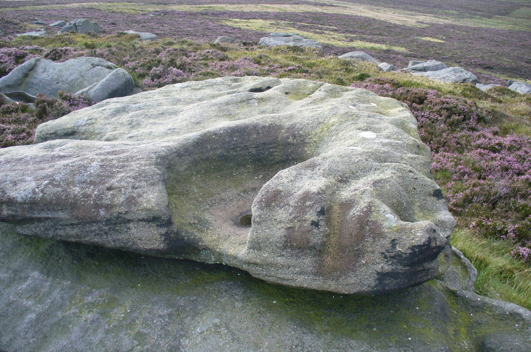
“Well of the Whooping Cough” stone, near Killin

The grid-reference given for this site is only an approximation based on the description given by Hugh MacMillan (1884), below.  The exact whereabouts of the place remains forgotten, but based on the story we have of the place it would be great if we could locate it and — as far as I’m concerned — be highlighted and preserved as an important spot in the history of religious and social history for the people of Killin and the wider mountain community.  The region here was well populated all along the northern and southern sides of the adjacent Loch Tay before the coming of the Highland Clearances (Prebble 1963), and so the lore which MacMillan describes below was very likely of truly ancient pedigree.

Not to be confused with a site of the same name (and attributes) as the healing well at Balquhidder, this site comprises of a large stone, typical of the region, covered in that delicious carpet of old mosses and lichen bestowed by the aged love from Nature that bedecks much of the hidden sites in the area.  Upon one side of the rock was a large hollow, in which water was always collected: of both dew and rain and the breath of low clouds, within which were great medicinal virtues long known of by local people.  Foreign or shallow archaeologists would denounce this rock and its virtues as little more than the superstitious beliefs of an uneducated people living in uneducated times, but such derision is simply foolish words from pretentious souls who know little of the real world.  For the attributes and mythic elements at this old stone is another example of living animism: vitally important ingredients in the spiritual background and nourishment of a people not yet overcome by the degrading influence of homo-profanus.  Here we still find the living principles of the natural world, sleeping away in the consensus trance of modern folk…

Folklore

The stone and its ‘healing well’ are not mentioned in the standard Scottish texts on holy wells (MacKinlay 1893; Morris 1982) and we have to rely solely on Hugh MacMillan’s first-person account of the place from the latter-half of the 19th century.  He told that the stone was to be found “in the woods of Auchmore at Killin,” some twelve miles from a similar curative rock at Fearnan called the Clach-na Cruich:

“This stone is called Fuaran na Druidh Chasad, or the Well of the Whooping-Cough.  I heard of it incidentally last year in Paisley from a native of Killin, who remembered vividly when a boy having been taken to drink the water in the cavity of the stone, in order to cure the whooping-cough, from which he was suffering at the time.  Happening to be in Killin lately, enjoying a few days’ holiday, I made inquiries in the village; but though some of the older inhabitants remembered having heard of the stone, and the remarkable practice connected with it, I could not get any one to describe the exact locality of it to me, so completely has the superstition passed away from the mind of the present generation.  I went twice in search of the stone; and though, as I afterwards found, I had been within a very short distance of it unawares on both occasions, I was unsuccessful in finding it. At last I met an old man, and after some search we found the stone, and he identified it.

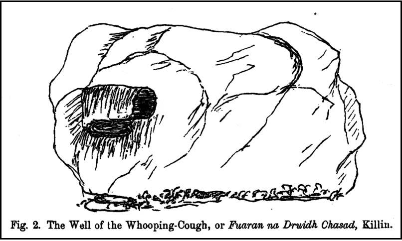
“I understood then what had puzzled me before, viz., why it should have been called Fuaran or Well, for I had supposed it had a cavity in a stone like that at Fernan. It was indeed a cavity; but it was in the projecting side of the stone, not on its top surface. It consisted of a deep basin penetrating through a dark cave-like arched recess into the heart of the stone.  It was difficult to tell whether it was natural or artificial, for it might well have been either, and was possibly’ both; the original cavity having been a mere freak of nature — a weather-worn hole — afterwards perhaps enlarged by some superstitious hand, and adapted to the purpose for which it was used.  Its sides were covered with green cushions of moss; and the quantity of water in the cavity was very considerable, amounting probably to three gallons or more.  Indeed, so natural did it look, so like a fountain, that my guide asserted that it was a well formed by the water of on underground spring bubbling up through the rock.  I said to him, “Then why does it not flow over?”  That circumstance he seemed to regard as a part of its miraculous character to be taken on trust. I put my hand into it, and felt all round the cavity where the water lay, and found, as was self-evident, that its source of supply was from above and not from below; that the basin was simply filled with rain water, which was prevented from being evaporated by the depth of the cavity, and the fact that a large part of it was within the arched recess in the stone, where the sun could not get access to it.  I was told that it was never known to be dry — a circumstance which I could well believe from its peculiar construction.

“The stone, which was a rough irregular boulder, somewhat square-shaped, of mica schist, with veins of quartz running through it, about 8 feet long and 5 feet high, was covered almost completely with luxuriant moss and lichen; and my time being limited, I did not examine it particularly for traces of cup-marks.  There were several other stones of nearly the same size in the vicinity, but there was no evidence, so far as I could see, of any sepulchral or religious structure in the place.  There is indeed a small, though well-formed and compact so-called Druidical circle, consisting of some seven or eight tall massive stones, with a few faint cup-marks on one of them, all standing upright within a short distance on the meadow near Kinnell House, the ancestral seat of the Macnabs, and it is a reasonable supposition that the Fountain of the Whooping-Cough may have had some connection in ancient times with this prehistoric structure in its immediate neighbourhood; for, unlike the cavity in the stone at Fernan, the peculiar shape of the cavity in this stone precluded its ever having been used as a mortar, and apparently it has never been used for any other purpose than that which it has so long served.  There can be no doubt that the fountain dates from a remote antiquity; and the superstition connected with it has survived in the locality for many ages. It has now passed away completely, and the old stone is utterly neglected. The path leading to it, which. used to be constantly frequented, is now almost obliterated. This has come about within the last thirty years, and one of the principal causes of its being forgotten is that its site is now part of the private policies of Auchmore. The landlady of the house at Killin, where I resided, remembered distinctly having been brought to the stone to be cured of the whooping-cough; and, at the foot of it, there are still two flat stones that were used as steps to enable children to reach up to the level of the fountain, so as to drink its healing waters; but they are now almost hidden by the rank growth of grass and moss.  There is more verisimilitude about the supposititious cures effected at this fountain than about those connected with the stone at Fernan; for one of the best remedies for the whooping-cough, it is well known, is change of air, and this the little patient would undoubtedly get, who was brought, it may be, a considerable distance to this spot. I am led to understand that, in connection with the cure, the ceremonial turn called “Deseul” was performed. The patient was required, before drinking the water, to go round the stone three times in a right-hand direction, which may be regarded as an act of solar adoration. This practice lingered long in this as in other parts of the Highlands, and the “deseul” was religiously performed round homesteads, newly-married couples, infants before baptism, patients to be cured, and persons to whom good success in some enterprise was wished; while the “Tuathseul,” or the unhallowed turn to the left, was also performed in cases of the imprecation of evil.”

Should anyone know the whereabouts of this fascinating healing stone and its waters, please let us know!

References:

  1. MacKinlay, James M., Folklore of Scottish Lochs and Springs, William Hodge: Glasgow 1893.
  2. MacMillan, Hugh, ‘Notice of Two Boulders having Rain-Filled Cavities on the Shores of Loch Tay, Formerly Associated with the Cure of Disease,’ in Proceedings of the Society of Antiquaries of Scotland 18, 1884.
  3. Morris, Ruth & Frank, Scottish Healing Wells, Alethea: Sandy 1982.
  4. Prebble, John, The Highland Clearances, Secker & Warburg: London 1963.

© Paul Bennett, The Northern Antiquarian


Robin Hood’s Bed, Blackstone Edge, Lancashire

Legendary Rocks: OS Grid Reference – SD 97204 16356

Getting Here

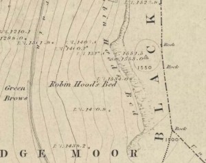
Robin Hoods Bed on 1851 map

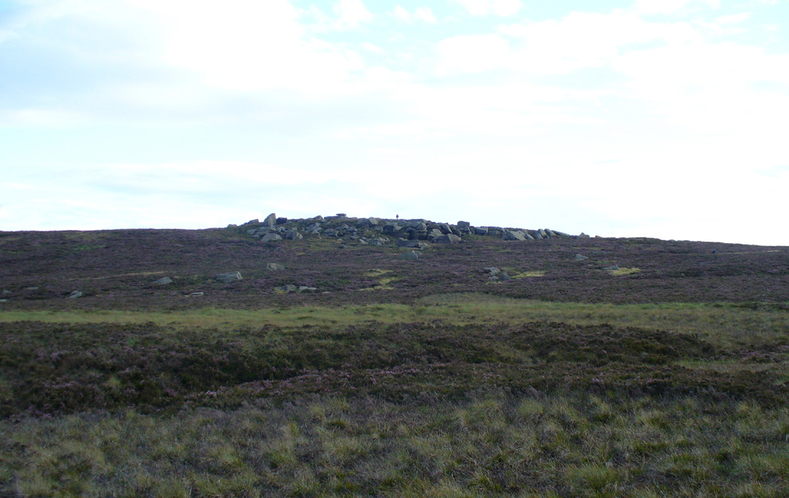
Follow the same directions to get to the Aiggin Stone.  Once here, go over the stile by the fence opposite towards the great geological ridge less than half-a-mile south.  Head for the triangulation pillar right on the top of the ridge, and there, about 20 yards past it, higher-up than the triangulation pillar at the very top of Blackstone Edge, is Robin Hood’s legendary stone bed!

Archaeology & History

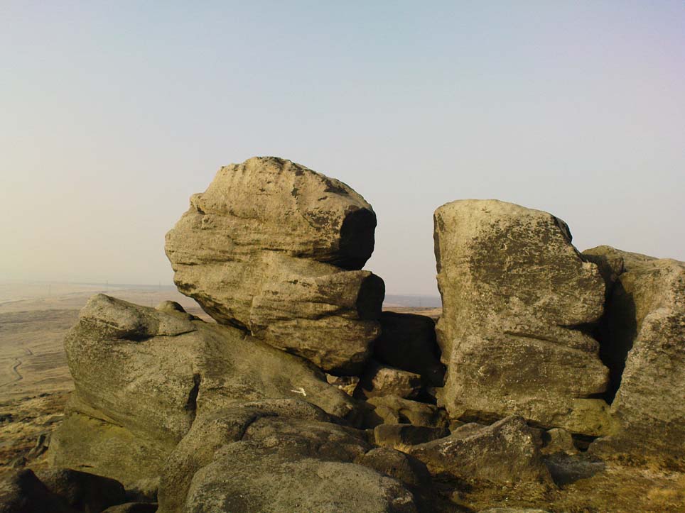
Robin Hoods Bed, looking north

There’s very little of archaeological interest known up here, save a mass of flints and scrapers that have been found scattering the moorland heights hereby, from the mesolithic period onwards.  But we have a relative lack of neolithic to Iron Age remains — officially anyhow!  A possible standing stone can be found a few hundred yards south, but there’s little else.

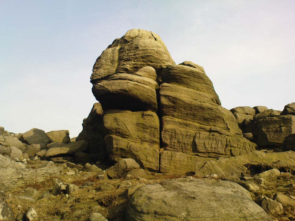
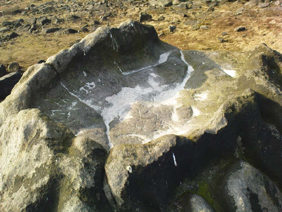
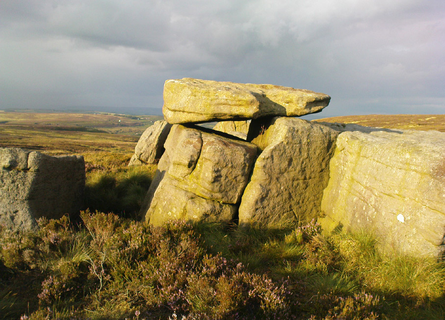
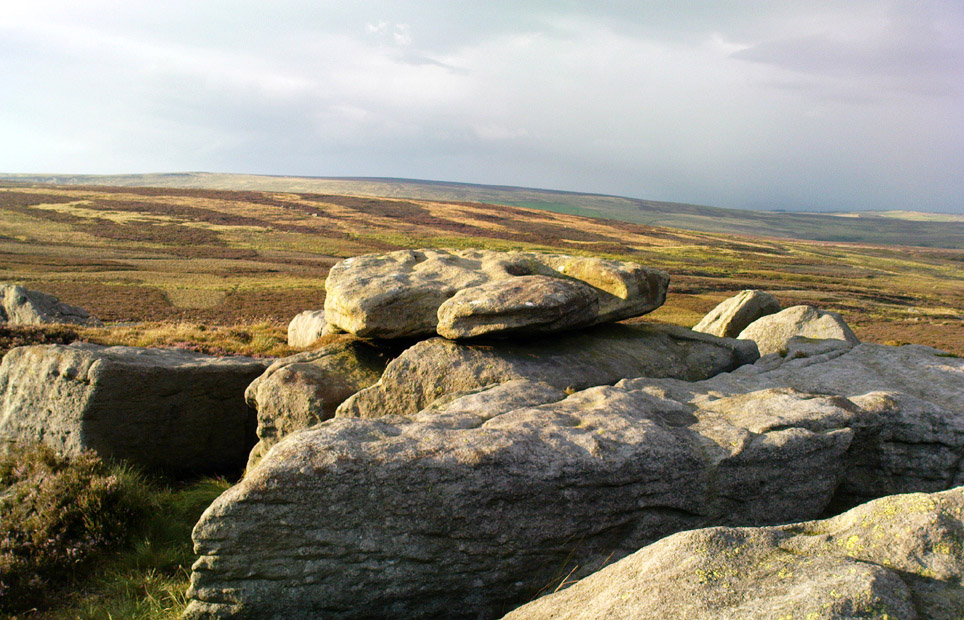
The rock that’s given its name to Robin Hood’s Bed overlooks the very edge of the ridge, detached from the main section, with a large and very curious nature-worn ‘bed’ on its very crown, more than 4 feet wide and about 7 feet long, into which one comfortably lays.  It was named in the boundary records of the township of Rishworth in 1836, where it describes other historical stones, saying:

“thence under Robin Hood’s Bed to a stone marked ‘W.S.G.S. 1742, 1770, 1792, and the following figures and letters, ‘1826 I.L.S.'”

Folklore

This enormous millstone grit boulder, sitting 1550 feet upon the high moors is, according to legend, a place where our famous legendary outlaw once slept.  Whilst sleeping here, some of his followers were said to have kept guard and looked over him.

Robin Hood’s Bed, from below

A rather odd piece of folklore recited by Jessica Lofthouse (1976) is that “no winds ever blow” at Robin Hood’s Bed, who then went on to tell of the time she visited the place.  Walking along the rocky ridge where the stone bed is found, the winds were such that “we had almost been blown over the edge,” until just a few hundred yards further when they eventually reached the fabled site, Nature granted them a sudden calmness unknown to all the high moorlands around, affirming the curious folklore.

The ceremonial stone ‘bed’

Robin Hood’s Bed itself was undeniably an important ceremonial site for both rites of passage and ritual magick to our indigenous ancestors.  The place screams of it!  It also seems very likely that the hero figure of Robin Hood replaced an earlier mythological character, akin to the fabled female creation deity, the cailleach, found commonly in more northern and Irish climes, whose echoes can still be found around our Pennine hills.  For we find that Robin Hood was said to have taken a large boulder from here and with a mighty heave threw it six miles across the landscape due west into the setting sun, where it eventually landed at Monstone Edge, near Rochdale!  Local people were so astounded at this feat that the stone was given the name of Robin Hood’s Quoit.

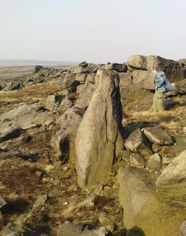
7ft tall natural standing stone

The old place-name authority Eilert Ekwall (1922) related the folklore that the giant ridge of Blackstone Edge “is said to refer to a boundary stone between Yorkshire and Lancashire.”  Which may be the curious upright standing stone, more than 7 feet tall, less than 50 yards NNE which gives a very distinct impression of having been deliberately stood upright, amidst this mass of loose geological droppings!  It would be helpful if there was a geologist in the house who could tell us decisively one way or the other…

Another etymological possibility that has been posited relates to the word ‘bed’ at this site.  Ordinarily it would be sensible to attach the word to the great stone ‘bed’ atop of the poised boulder.  But with the attached legends symptomatic of prehistoric monuments, it would not be improper to highlight that the old Welsh word ‘bedd‘ (a place-name element that is not uncommon in Lancashire) means, “a grave or tomb”.  And this site would be ideal for such an old prehistoric cairn…

References:

  1. Bennett, Paul, The Old Stones of Elmet, Capall Bann: Milverton 2001.
  2. Ekwall, E., The Place-Names of Lancashire, Manchester University Press 1922.
  3. Lofthouse, Jessica, North Country Folklore, Hale: London 1976.
  4. Smith, A.H., The Place-Names of the West Riding of Yorkshire – volume 3, Cambridge University Press 1961.

© Paul Bennett, The Northern Antiquarian


Alcomden Stones, Stanbury Moor, West Yorkshire

Legendary Rocks: OS Grid Reference – SD 97313 35737

Also Known as:

  1. Oakenden Stones

Getting Here

The ‘druidic’ Alcomden Stones

Takes a bitta getting to this spot, but it’s worth the effort!  Make a day of it and walk up here via the little-known Cuckoo Stones monoliths.  From here the walk gets steeper!  Follow the footpath from the standing stones, uphill, to the legendary Wuthering Heights building of Bronte-fame a half-mile ahead of you.  Then walk immediately up the slope at the side of the derelict house higher onto the moor (there’s no real footpath to follow) until the moorland levels out.  From here, look west and walk that way for a few hundred yards where you’ll be seeing a large rock outcrop ahead of you.  That’s where you’re heading! (if you reach the triangulation pillar, take the small path from there along the top of the moor towards this large rock outcrop)

Archaeology & History

Alcomden’s Altar Stone

To those of you who like a bitta wilderness, or healthy normal people I suppose, this is a stunning place!  Even though there’s little by way of archaeology here — save the usual expectations of a few flints and arrowheads — its geomancy, its position in the landscape, makes it excel as a once important ritual site for our ancestors in not-so-distant centuries.  Although local tradition gave these great rocks a prehistoric pedigree, the archaeological record doesn’t say as much — but that doesn’t really mean much up here.  We’ve found a singular Bronze Age cairn on the level at Middle Moor Flat 400 yards northwest (not in the record books), some prehistoric walling on the flat east of here (not in the record books), so a lot more attention is needed hereby to see what more may be hiding in this rocky heathland area.

The main feature amidst this extensive scattering of rocks is the large rocking stone, said to weigh six- or seven-tons, resting upon other glacial deposits.  The rock itself can be made to rock very slightly.  It was described in Lewis’ Topographical Dictionary as a

“cromlech, an evident druidical remain, (which) consists of one flat stone, weight about six tons, placed horizontally upon two huge upright blocks.”

But the placement here was done by Nature and not humans — making it much more important to our ancestors.  This was a site for solace, for ritual and to commune with the gods themselves.  A few visits to this place show this quite clearly — unless you’re unable to relax that is! It’s a place I wanna spend more time working with, as the mythic history around these stones feels strong, despite their absence from written records.

The ‘altar’ resting on rocks
Alcomden’s “altar”

The druidic sentiments espoused by Lewis were all but echoed by our otherwise sober historian, J. Horsfall Turner, in his history of Haworth (1879), where he describes the Alcomden Stones as “the remains of a Druid’s Altar.”  On top of the main ‘altar stone’ are what could be ascribed as worn cup-markings, but it seems they’re Nature’s handiwork once again; though this wouldn’t deny them as having some significance to our ancestors.  A number of other boulders amidst this mass of rocks also have what seem like cup-markings, but none of them can be said with any certainty to have been carved by people.  Indeed, the entirety of this legendary rock outcrop seems to have been created solely by the spirits of Nature.

One view of Earth, from Alcomden
View of Earth, from Alcomden

It was first described as ‘Alconley’ in 1371, then in the 1379 Poll Tax returns as ‘Halcom’, the etymology of which is difficult.  Al- is a cliff or rock, many of which occur here; den is certainly a valley, over which we look to the northeast (to Ponden Kirk, 500 yards away); but the central element of ‘com‘ is the greatest puzzle.  Blakeborough (1911) tells of the old Yorkshire word ‘con’ — found in the 1371 spelling — meaning “to scan, or observe critically,” which one can certainly apply here in a topographical sense, i.e., “observation stones above a valley.”  It’s simple, succinct, and makes sense!

Folklore

As Elizabeth Southwart (1923) rightly said,

“Our forefathers, instinct and imagination more highly developed than knowledge, peopled their woods with fairies and their valleys with ghosts.  On the high, wind-swept spaces they built their altars to Unknown Gods.”

Turner's 1913 drawing
Turner’s 1913 drawing

And such she thought was done at this “heap of rocks called Oakenden Stones.”  It seems likely, as this place is superb for ritual magick and meditative systems.  But all we have are the repeats of numerous old historians, from Whiteley Turner (1913) and his namesake J. Horsfall, to James Whalley, J.W. Parker and more, who recorded what the old locals said: that is was a place of the druids.  There may be a grain of truth in it somewhere…

References:

  1. Bennett, Paul, The Old Stones of Elmet, Capall Bann: Milverton 2001.
  2. Blakeborough, Richard, Wit, Character, Folklore and Customs of the North Riding of Yorkshire, W. Rapp: Saltburn 1911.
  3. Parker, J.W., Guide to the Bronte Country, J.W. Parker: Haworth n.d. (c.1971)
  4. Southwart, Elizabeth, Bronte Moors and Villages: From Thornton to Haworth, John Lane Bodley Head: London 1923.
  5. Turner, J. Horsfall, Haworth, Past and Present, Hendon Mill: Nelson 1879.
  6. Turner, Whiteley, A Spring-Time Saunter round and about Bronte Lane, Halifax Courier 1913.

© Paul Bennett, The Northern Antiquarian


Almscliffe Crags, North Rigton, North Yorkshire

Legendary Rocks:  OS Grid Reference – SE 2681 4900

Also Known as:

  1. Ormscliffe Crags

Getting Here

This is an outstanding site visible for miles around in just about every direction – so getting here is easy! If you’re coming from Harrogate, south down the A658, turn right and go thru North Rigton.  Ask a local.  If you’re coming north up the A658 from the Leeds or Bradford area, do exactly the same! (either way, you’ll see the crags rising up from some distance away)

Archaeology & History

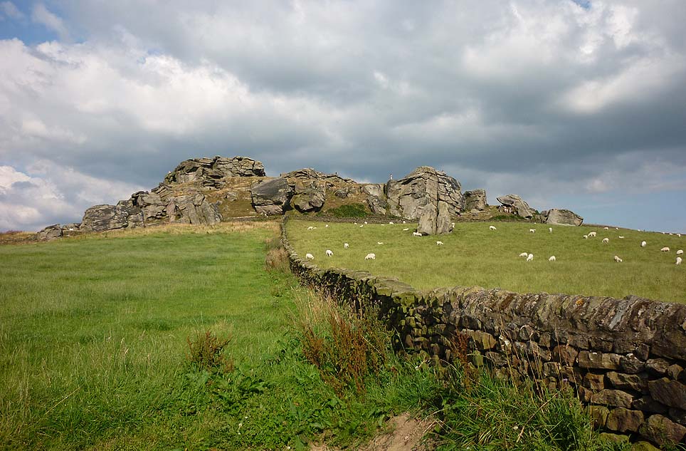
Almscliffe Crags – looking east

This giant outcrop of rock rises out from the meadowlands here like a miniature volcano, visible for many miles all round.  The history and legends surrounding the aged edifice are prodigious and the view from its tops on a fine day is one to be remembered.   It is likely, although there is little corroborative historical evidence, that is was an “omphalos”, or navel centre of the universe for the local people many centuries ago.  A great cutting runs through its centre and “runs from nearly north to south, and forms the boundary between the townships of Rigton and Stainburn, so that a portion of the rock is in each township.”  On the respective sides of this division are carved the letters “T.F.” and “E.L.”, being the initials of the families who owned the land here in olden days, Thomas Fawkes [of the legendary Guy Fawkes’ family] and Edwin Lascelles, of the ancient Harewood family.

Although Almscliffe Crags have been described in a great many local history books, it almost beggars belief to find it omitted from all the ancient mystery or “sacred sites” books ever written.  Curious…  Such lesser sites as Alderley Edge, the Cow and Calf rocks, Kilburn’s White Horse, Twelve Apostles stone circle, and many more, whilst having their respective virtues, don’t touch this place for ritual or sacred intent.

First described in the early 13th century records of Fountains Abbey, A.H. Smith (1961) thought the name of Almscliffe itself originally came from a hypothetical lady’s name, which seems an all-too-easy proclamation to make, instead of the humble option of  “I don’t know”!  But Smith wasn’t the only one to throw some curious ideas up about the etymology of Almscliffe.  Said by some local etymologists to derive from the Celtic Al-, a rock or cliff, and mias, an altar, there are other attempts to bring its rocky form into a consensus meaning.  The anglo-saxon Ael or El, being fire, and messe, or mass; and the Scandinavian Ormcliff, being the “cliff of the serpent”.  In Jones’ History of Harewood (1859), he tells

“it to have derived its name from the distribution of almes, at certain times, agreeably to the tenor of legacies left to the chapel which stood there in the sixteenth century, and was at that time dedicated to the Virgin Mary.”

It’s difficult to say which one tells its true title.  Many a druidic tale has also been carved into its form.  Such is the nature of this site that Grainge (1871) wrote how,

“it would not be difficult to show, with the exception of the artificial temple or circle of stones, this place possesses all the accessories of that ancient worship as…typical of the worship of the sun.”

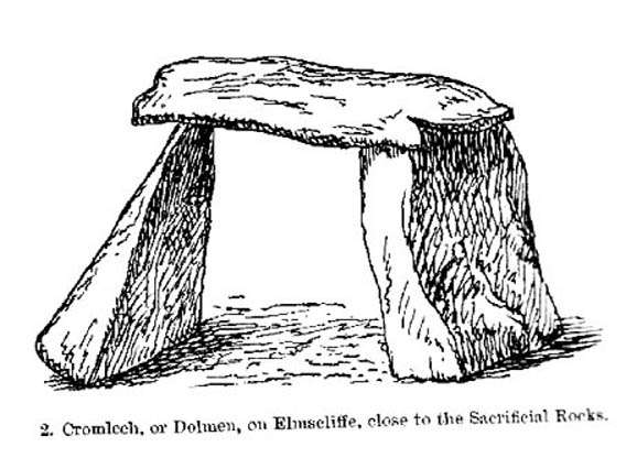
Simpson’s 1879 drawing of the Almscliffe ‘cromlech’

A remark that was even echoed by one of Yorkshire’s finest and most sober historians, Harry Speight. (1903)  Grainge also pointed out that in his day there were three standing stones by the great Crags, one fallen, but “two of these rocks yet stand upright.”  A few years later we find that the ranting christian writer,  Henry T. Simpson (1879), described similar megalithic remains here, though his description was of a “cromlech.” (illustrated here)  I can find no trace, nor further references to these relics; but think it reasonable to suggest that, perhaps, Simpson’s cromlech and Grainge’s standing stones may have been one and the same monument.

In the field 100 yards immediately north of the Crags (the one with the two rocks in it) there used to be seen the remains of some primitive early walling, suggestive of a small, early settlement site.  Very little can be seen of these remains today and, as far as I’m aware, no archaeological survey was ever done of them. In all honesty, it’s highly probable that a number of other important prehistoric sites were once in evidence at varying distances around Almscliffe Crags…

Folklore

The creation myth of Almscliffe tells that, long long ago, the great giant Rombald — whose main place of residence tended to be Ilkley Moor — was having a fight with the devil upon his homeland heath.  As is common in the myths of giants, the ‘devil’ picked up a great boulder and threw it at Rombald, but it missed and fell just short of the village of North Rigton, creating Almscliffe Crags. A variation of this tale tells that it was Rombald and his wife having the argument and she threw the stones to create the place.  Several sites have been named as the place where the mythological argument occurred: the Cow and Calf rocks, the Great Skirtful and Little Skirtful of Stones all cited in the folktales of our Yorkshire peasants.  Another variation of the tale tells that the devil was simply carrying some stones (as devils and giants are renowned to do in the folk-tales of the world) and he accidentally dropped them where the Crags now stand.  Such rock-throwing tales are, once more, symptomatic of cailleach tales more commonly found in Ireland and Scotland.

There are a great many cup-markings on the top surface of these Crags, most of which seem natural, but it is not unreasonable to think that, perhaps, some may have been carved by human hands? (not sure misself)  Eric Cowling (1946) sincerely believed the antiquity of some carvings here.  One of them particularly, three feet across and eighteen inches deep, though seemingly natural, has for several centuries been known as  the “Wart Well.”  Its name is attributed to folklore that is more commonly found in Ireland and the Scottish highlands; that is, should you have a wart, prick it with a pin until a drop or two of blood drips into the water that gathers in the stone bowl, then dip your hand in afterwards.  The wart is sure to vanish.  Another method to achieve the same end is to merely wash the skin affliction in the water, and it will soon fade. (Interestingly, an old psychotherapist friend, afflicted with the damned things, did just this and they promptly vanished.)

A more minor creation myth tells that the stone bowls we see on top of the Crags here – including the Wart Well – was actually made when the giant Rombald stepped from his home onto the Crags and left his footprint embedded in the rock face.  He was said to have made it in just one step, from the Giant Skirtful of Stones prehistoric cairn [where one legend reputes him buried].

Faerie folk were also long held to live here.  On the northwest side of the Crags is the entrance to a small cave that was always known as the Faerie’s Parlour, as it was said to be an entrance to their supernatural world.  In times past, many people have scrambled down into the cave, but never reached their Otherworldly paradise.  William Grainge (1871) wrote how the little people “were all powerful on this hill and exchanged their imps for children of the farmers round about.”  This is typical of old changeling lore!  In outlying villages surrounding the Crags there is a particular excess of faerie and old heathen lore.

One very curious-sounding tale tells how a goose was sent down the hole and, after some considerable time, re-emerged 3½ miles away out from a well near Harewood Bridge.  The goose is one of the many symbols of the sun and one of its primary symbolic attributes is that of winter.  Interestingly perhaps, as the rock art writer Graeme Chappell has pointed out, the underground journey of the goose from Almscliffe to Harewood Bridge coincides closely with the rising of sun on morning of the winter solstice.  This tale may simply be a folk remnant — and an archaic one at that — of just that event: ritualising winter solstice from these Crags.  In Norse lore, shamans tell of geese carrying the great god Wotan across the skies at the coming of the Yule period.

Another ritual date that was celebrated here was Beltane, or May 1.  Not only do we find many of the outlying villages possessed their own maypoles, but in 1879 Mr Simpson of Adel reported seeing Beltane fires atop of these rocks.  Other meetings were made here as the Crags are spliced in half by the local boundary line, and perambulation records show that people came here during the ‘beating of the bounds’, as they used to be called.  This boundary perambulation moot ingredient is what strongly implies the site to have had ritual importance.  And the fact that a mass of folktales emerge from here adds to this.  Then of course we have the physical situation of the Crags at the heart of the mid-Wharfedale landscape.  All these ingredients combined, strongly suggest the site would have been, not just the ritual meeting place of tribal elders in pre-christian times, but an omphalos: it rises majestically from the land and all monuments gaze towards its giant form.  Important giant prehistoric monuments from the hills miles away tell of myths that come and go from this proud mass of stone.  Although we have other omphali just over the extended horizons from Almscliffe, this is where the World began in the creation myths of ancient times in mid-Wharfedale, at the heart of the ancient kingdom of Elmet.

But there is still more lore to be told of these rocks…

The centre piece of the Crags is known as the Altar Rocks.  Upon its western side is carved the “figure of a large tree, which we take to be the monogram of the Celtic Jupiter,” says Grainge.  This assumption is derived from an eighteenth century writer who, said Speight (1903), told that “Almnus and Alumnus are titles of Jupiter, to whom this high altar was dedicated.”

The highest part of the Crags, to the west, is known as Lover’s Leap where, in 1766, a daughter of a respectable Rigton farmer of the name Royston, having been disappointed in love, decided to kill herself.  She jumped, so legend reputes, from a point some sixty feet above ground, but a strong wind blowing at the time caught hold of her dress and carried her through the air until she landed safely in an adjoining field with naught but a sprained thumb!  The said lady realised the stupidity of her ways and was said to have lived out a long and fine life.

In recent years earthlights (UFOs) have been seen floating above and around the great outcrop.  It is likely that these were the same things which, in days of olde, the people would call the faerie.  I highly recommend visiting the place!

References:

  1. Bennett, Paul, The Old Stones of Elmet, Capall Bann: Milverton 2001.
  2. Bogg, Edmund, From Eden Vale to the Plains of York, James Miles: Leeds 1895.
  3. Bogg, Edmund, Higher Wharfeland, James Miles: Leeds 1904
  4. Cowling, E.T., Rombald’s Way, William Walker: Otley 1946.
  5. Eliade, Mircea, Patterns in Comparative Religion, Sheed & Ward: London 1958.
  6. Grainge, William, History & Topography of Harrogate and the Forest of Knaresborough, J.R. Smith: London 1871.
  7. Jones, John, The History and Antiquities of Harewood, Simpkin Marshall: London 1859.
  8. Simpson, William, Archaeologia Adelensis, W.H. Allen: London 1879.
  9. Smith, A.H., The Place-Names of the West Riding of Yorkshire – volume 5, Cambridge University Press 1961.
  10. Speight, Harry, Kirkby Overblow and District, Elliott Stock: London 1904.

© Paul Bennett, The Northern Antiquarian


Clach Brath, Baile Mor, Iona

Bullaun Stone:  OS Grid Reference – NM 286 244

Also known as:

  1. Clacha Brath
  2. Clachan-nan-Druidhean
  3. Day of Judgement Stone
  4. Druid’s Stone
  5. World’s End Stone

Folklore

On this curious, broken, basin-shaped rock — thought by some to have at one time played a part in an old cross whose remains are in the Abbey Museum — are two deep cup-shaped hollows, in which were once “three noble globes of white marble” that were used for oracular purposes and were said to have originated in druidical rites.  In Miss McNeill’s (1954) survey of the island, she tells that:

“near the edge of the path leading to St. Oran’s Chapel, there lies a broad, flat stone, with a slit and a cavity on its surface. Here there used to lie some small round stones which pilgrims were wont to turn sunwise within the cavity; for it was commonly believed that the ‘brath’, or end of the world, would not arrive until this stone should be worn through.”

The small stones that were once in the Brath were ordered by the Church to be thrown into the sea; but local folk replaced them with three other small stones, maintaining the traditional rites of this stone until they eventually stopped sometime in the 19th century.  But in Major-General James Forlong’s (1906) study, he tells of a somewhat earlier mythic origin to this old stone, saying:

“In Iona the Druids are said to have made the flat altar stone called Clachan-nan-Druidhean, or Druid’s Stone, the stone of fate or of the last day, with round stones fitted into cup hollows on the surface, which the pious pilgrim turns round.  The world will end when the stone is worn through.  The Culdee monks preserved this monument.”

And what little is left is still preserved to this day.  The curious “end of the world” motif was something that was grafted onto an earlier mythos: what Mircea Eliade called the “myth of the eternal return”, wherein Nature’s annual cycle —from birth, life to death and subsequent renewal, endlessly, through the seasons—was the original status, later transmuted by the incoming judaeo-christian cult of linear time and milleniumism relating to a literal “end of the world” when their profane myth of Jesus returning to Earth occurs.  We might also add that the stones which once rested into the hollows of the Clach Brath would likely have possessed divinatory and healing qualities, as comparatiove studies suggest.

References:

  1. Eliade, Mircea, The Myth of the Eternal Return,
  2. Forlong, J.G.S., Faiths of Man – volume 1, Bernard Quarithc: London 1906.
  3. Holder, Geoff, The Guide to Mysterious Iona and Staffa, Tempus: Stroud 2001.
  4. McNeill, F. Marion, Iona: A History of the Island, Blackie & Son: Glasgow 1954 (4th edition).

© Paul Bennett, The Northern Antiquarian