Sulphur Well, Wigglesworth, North Yorkshire

Healing Well:  OS Grid Reference – SD 8055 5677

Also Known as:

  1. Spa Well
  2. Wigglesworth Spa

Archaeology & History

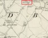
Spa Well on the 1852 map

In William Addison’s (1951) standard work on the history and development of Spa Wells, he told us that “the spas began as holy wells”; yet in spite of him listing the Wigglesworth Spa in his work, such “holiness” wasn’t a feature found here and, sadly, we have no written records that tell of any.  But that doesn’t mean to say it had no sense of importance or animistic sacrality to local people.  The earliest written record we have of this Sulphur Well is to be seen on the stone-work at the top of the small well-house, where the year “1666” was carved, marking the year when the structure was built under the directions of a local rich dood.  But earlier knowledge of these healing waters would have been passed to the land-owner by local people, as indicated in Thomas Short’s (1765) words where he told that “it has been used time out of mind.”

Mr Short (1724) makes mention of this Sulphur Well in his gigantic early work, but only in its similarity in both taste and smell to the Sulphur Well at Harrogate and letting us know that, “I have tried carefully” the waters of the two sites.  We had to wait another forty years before he gave us a more detailed account of the medicinal properties here.  He wrote,

“Now come we to a sulphur water of a very peculiar nature, such as I never met with or heard of in England besides, and deserves to be much more strictly examined and enquired into, viz. Wigglefworth Spaw, near Settle, in the parish of Long-Preston.  It has been used time out of mind, and more formerly than at present, because it is little known; rains and drought affect it not.  Country people drink four or five pints of it in a morning to vomit them, and six or seven pints to purge them.  The water is very black, smells strong of sulphur, has a very small stream, but stagnates not, bubbles not, but springs up; it is always covered with a white scum, (and) dies all in its course white.  It rises out of a great stone soil, near much lime-stone, at the foot of a hill.  It tastes salt, yet curdles not soap, and boils with milk.  A phial glass, one third part full of it, well corked, and tied down with a bladder, and set in the cold water to be evaporated; when the water began to boil, it was taken out and poured a little of it on solution of silver, which turned black and curdled.  The phial was corked again, and set half an hour longer in the boiling water, it still turned solution of silver black.  It was corked a third time, and set half an hour longer in the boiling water, then tried, but was not so black as before, and caused little curdling.  This last stood all night, next day its precipitation was blackish; the water was clear above.  This is the only blackish sulphur water I have met with (as Rippon is a greenish yellow) and retains its sulphur the longest, from its contained oil.”

Consistent with other writers of his time, Mr Short then wrote at length on how the Wigglesworth waters reacted to various chemical tests, many of which were done in order to indicate the veracity, or otherwise, of any medical qualities.  He also made comparative studies between this and the sulphur wells at Harrogate and elsewhere, and concluded that the Wigglesworth Spa would successfully deal with the following ailments or conditions:

“Sloth, idleness, too violent slavish exercise or labour, too great affluence, or plenty of nourishing rich high foods, spices, forced meats, acrid, stimulant and aromatic viands; the earthy viscid dregs of fermented liquors, or the parching, drying, shriveling spirits of wine, sugar, fruits, grain, or fermented liquors, as well as poverty and unwholesome diet, irregular hours, etc, are the parents of many diseases, whose cure lies in relieving oppressed nature from the unwieldy load (brought upon her by indolence, gratifying the vitiated taste, intemperance and debaucheries) by cleansing and rousing the vessels, restoring the juices to a healthy state; rectifying and establishing the secretions and excretions of the body, and restoring vigour and activity to the fibres, vessels and solids.  To the above causes of diseases, we may add pride, luxury, sensuality, inverting the natural course of time, turning day to night, and night to day.  These give birth to many chronic diseases, as well as acute, from acidities, crudities, viscidities in the stomach, communicated thence to the bowels, and so to the whole habit; hence are vitiated juices, great obstructions, and a long train of diseases affecting sundry parts of the body, and therein the whole nervous system, with hypo, hysterics, melancholy, costiveness, or looseness, suppression of natural necessary discharges, etc., which require thinning, relaxing, resolving, opening, or invigorating remedies.”
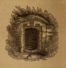
Photo of the well, c.2008
Howson’s 1850 sketch

For about two centuries this well had a very favourable reputation.  It’s therefore slightly curious as to why the great spa-writer, A.B. Granville, in his visit to this part of Ribblesdale to seek out some of the medicinal springs in the 1830s (including a petrifying well), made no mention of our Sulphur Well.  Whether this down to his patronizing attitude towards local people isn’t known, but it certainly wouldn’t have helped him in Yorkshire!  One might suggest it was due to the fact that the spa had fallen into disuse, but this wasn’t the case as, subsequent to Granville’s visit, the local writer William Howson (1850) later told that,

“In the woody dingle to the north of the village is a sulphurous spring, protected by a neat and antique stone canopy bearing the date 1666, and the initials of Sir Richard Sherburne and Isabella his wife, a daughter of John Ingleby of Lawkland Hall.  Of this well, Dr (John) Murray the well-known analytical chemist says, ” It is a most valuable and unusually strong sulphuretted water, and as far as I have examined mineral waters, second to none.”  From his analysis and that of Dr. Garnett it appears that a gallon of the water contains seventeen cubic inches of sulphuretted hydrogen, four of azote, and a small portion of carbonic acid, sulphate of magnesia in the proportion of seventy five grains to a gallon, a considerable quantity of muriate of soda, and a minute proportion of carbonate of lime.”

(The aforementioned Dr Garnett was a renowned 18th century authority on medicinal wells in Yorkshire, best known for his works on the spa wells of Halifax (1791) and Harrogate (1791, 1792), along with some in Scotland.)

Messrs Short (1765) and Howson (1850) mentioned other medicinal springs very close by, including the Chalybeate Well in the field immediately north on the other side of the stream.

References:

  1. Addison, William, English Spas, Batsford: London 1951.
  2. Brown, G.H., Walks, Drives and Excursions around Settle, Craven Printing: Settle 1880.
  3. Howson, William, An Illustrated Guide to the Curiosities of Craven, Whittaker: London 1850.
  4. Short, Thomas, The Natural, Experimental and Medicinal History of the Mineral Waters of Derbyshire, Lincolnshire and Yorkshire, privately printed: London 1724.
  5. Short, Thomas, A General Treatise on Various Cold Mineral Waters in England, privately printed: London 1765.
  6. Anonymous, Water for Life, North Craven Building Preservation Trust 2010.

AcknowledgementsMany thanks to the North Craven Building Preservation Trust for use of their photo.

© Paul BennettThe Northern Antiquarian

Chalybeate Well, Wigglesworth, North Yorkshire

Healing Well (destroyed?):  OS Grid Reference – SD 8047 5700

Archaeology & History

In Thomas Short’s (1765) description of the once-renowned Wigglesworth Sulphur Well, he mentioned briefly that there were “some (other) chalybeates near it.”  Thankfully 85 years later, with the aid of William Howson (1850) who gave us a marginally better description, we were able to locate the whereabouts of one of them!  From the Sulphur Well, this one could be found,

“two hundred yards above, on the other side of the rivulet there is a chalybeate spring, but (it was) of no unusual strength.”

In fact it’s a little closer to being 300 yards than 200—but that’s a minor issue in the grand scheme of things!  The place in question was marked on the 1852 OS-map, marked simply as a “Well.”  …This iron-bearing spring would have been a good pick-me-up and, as with all such wells of this nature, fortifies the blood and the immune system.  Mr Howson also told us that “ferrugineous springs, stronger than this, are of frequent occurrence in the neighbourhood,” echoing Short’s earlier remark.  Sadly, it seems that all trace of this Well has disappeared.

References:

  1. Howson, William, An Illustrated Guide to the Curiosities of Craven, Whittaker: London 1850.
  2. Short, Thomas, A General Treatise on Various Cold Mineral Waters in England, privately printed: London 1765.

© Paul BennettThe Northern Antiquarian

Cross Gates Cross, Slaidburn, Lancashire

Wayside Cross (base): OS Grid Reference – SD 70039 53609

Also Known as :

  1. Historic England ID 1163860
  2. Pastscape ID 44742

Getting Here

The Cross shown on the 1850 6″ OS Map

Take the Town End Road out of Slaidburn, and turn right along Wood House Lane at the Gold Hill junction, continue past the entrance to Myttons Farm on the right, and the cross base will be seen on the right next to the gateway just before the sharp left hand bend.

Archaeology & History

Only the socketed red sandstone base of this mediaeval wayside cross survives. It is unusual in that it has carved decorative fluted corners. It has an OS bench mark carved on its north face and has suffered recent damage to one of the corners, probably from a grass  cutter.  It is beside the old salt road over Salter Fell from Bowland into Lancashire and the Lune Valley.

There is one surviving complete cross and a cross base at the other end of the salt road, south of Hornby.  Wood House Lane was known as Cross Lane when the 1850 6″ OS map was printed. It is a Grade II listed building and is described in the citation as:

“Base of cross, probably medieval, sandstone. Of irregular shape with a rectangular socket in the top.”

Three views of the Cross base

Folklore

The farmer of the adjoining land told me that a local elder had told him that the smashed remains of the Cross had been built into an adjoining dry stone wall, which, if this is correct, may indicate
destruction of the Cross at a comparatively late date.

Note:  the monument is in the historic county of the West Riding of Yorkshire.

© Paul T. Hornby 2020


Minspit Well, Preston, Lancashire

Healing Well (destroyed):  OS Grid Reference – SD 540 293

Archaeology & History

Here we have another example of one of the many healing wells destroyed thanks to those industrialists who tend to do that sort of thing.  Found in close proximity to several other water sources — including the Syke, Preston’s main watercourse in bygone times — very little has been written of the place. However, in Dave Hunt’s (2005) recent work on Preston, he told us the following:

“The Minspit Well in Mainsprit Weind at the foot of the Church Street ridge is close to the line of the Syke, has a good claim to be one of Preston’s earliest wells, and remained one of the principle water sources well into the 18th century.  The ‘spit’ or ‘sprit’ element in the name perhaps indicates the original strongly flowing spring or fountain. The site is now covered over, but Kuerden, writing in the 1680s, describes the picturesque early morning scene as the town’s housemaids collected water in what was accordingly referred to as Pettycoat Alley.”

References:

  1. Hunt, David, The Wharncliffe Companion to Preston: An A to Z of Local History, Wharncliffe: Barnsley 2005.

© Paul BennettThe Northern Antiquarian


Sheep Scar Circle, Giggleswick, North Yorkshire

Ring Cairn:  OS Grid Reference – SD 80519 66474

Also Known as:

  1. Borrins Top

Getting Here

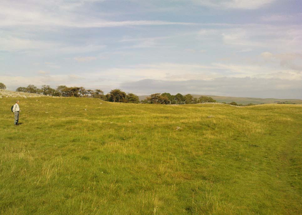
Sheep Scar cairn circle, looking east

From Settle, take the same direction as if you’re visiting the giant Apronful of Stones cairn.  Walk past it, keeping to the walling for 350 yards (319m) until you reach the gate on your right.  Go through this and walk along the grassy footpath ahead of you for 75 yards (68.5m) and there, right by your left-hand side, you’ll see this low grassy circular embanked monument, or cairn circle.

Archaeology & History

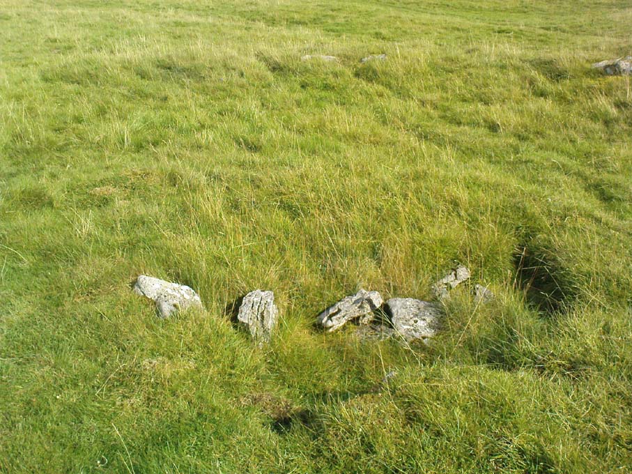
This gorgeous, little-known cairn circle, hiding almost unseen beside the ancient grassy pathway that leads down to the haunted Borrins Wood, sits innocently, forgotten by those who would claim its importance.  When this overgrown ring of stones was first built, the trees of Borrins Wood grew around the sacred court of this monument, watching rites committed to the ancestors, annually no doubt at the very least, under guidance of the Moon.  But now such ways have been swept from the memory of those living, into worlds made-up of artifacts, linear time and dualist ideals, and our thoughts when brought here are encloaked by beliefs not worthy of such a place.  Like many other small rings of stone, this was important for the rites of the dead.  For here we can see a small stone-lined cist (grave) near the middle still growing from the Earth, with the small outer ring encircling the place of rites.  It was obviously of ‘religious’ importance to those who lived here, probably even centuries after initial construction.

Embankment and central ‘grave’
Central & southern section of the ring

Similar in size and structure to the Roms Law Circle on Burley Moor, this site on the hills above Giggleswick seems to be Bronze Age in nature.  From outer-edge to outer-edge the rough circular monument measures approximately 14½ yards (13m) north-south, by 15½ yards (14m) east-west, with an outer circumference of about 49 yards (43m).  The edges of the ring, as you can see in the photos, is made up of an embankment of thousands of small stones and rubble, measuring between 1-2 feet high and between 2-3 yards across.  The old cist in the middle of the ring—about 1 yard by 2 yards—has been dug into at some time in the past and a small mound of stones surround this central grave.  The entire monument is very much overgrown, but still appears to be in relatively good condition.  A new excavation of this and nearby prehistoric monuments would prove worthwhile.

The ruined circle has a tranquil spirit, enclosed within a rich green panoramic landscape, enhanced with the breaking of old limestone and gnarled hawthorns.  Other prehistoric cairns can be found nearby and the remains of a previously unrecorded prehistoric enclosure stands out on a small rise 164 yards (150m) southeast.  We’ve found other unrecorded prehistoric remains in this arena which will be added to TNA, as and when…

References:

  1. Speight, Harry, The Craven and Northwest Yorkshire Highlands, Elliott Stock: London 1892.

Links:

  1. Images & Walk to the Sheep Scar Circle and Nearby Sites

© Paul Bennett, The Northern Antiquarian


Sheep Scar Cairn, Giggleswick, North Yorkshire

Cairn:  OS Grid Reference – SD 80678 66436

Getting Here

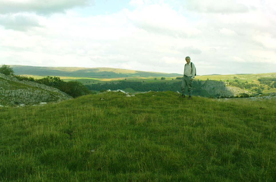
Paul Hornby on the old mound

Follow the same directions as if you’re visiting the Apronful of Stones giant cairn, above Giggleswick.  Walk past the giant cairn for a coupla hundred yards until you reach the large section of fallen walling, which you can clamber over and head towards the small rise of the Sheep Scar enclosure 100 yards in front of you.  Walk to the far end of this walled enclosure and look down the slope to your left, for 50-60 yards where you’ll see a small rocky mound rising above the edge of the hollow footpath.  That’s it!

Archaeology & History

This lovely old overgrown prehistoric cairn seems to one of what were once the remains of many other old tombs that scattered this grassy rocky plain, on the western ridge between Stainforth and Settle.  Although there are what seems to be the remnants of others nearby, this particular stone heap, its edges buried beneath centuries of earth, is a fine little-known specimen that deserves attention after so long a period in the sleep of ignorant moderns.  The cairn is found within an area that Harry Speight (1892) called the “Field of the Dead”, where he came across “traces and remains of human graves which carry us back to the far dim ages of unwritten history.”  Whether he saw this particular cairn rising up above the edge of the old track that winds up from Borrins in the valley below, he doesn’t say — but I’d be amazed if the diligent Speight missed it!

The overgrown cairn, looking NW
Cairn centre, with Sheep Scar enclosure above

Standing more than a yard high, when Paul Horby and I paced this old ruin, it measured 10 yards by 12 yards across — though so much loose and overgrown stone was beneath the surface that it could be much bigger.  The top of the cairn had come loose, perhaps explored by some antiquarian in times gone by, exposing a considerable mass of small rounded and misshapen rocks, typical of such constructions.  When Harry Speight found the place more than a hundred years earlier, he described the situation much as we’d found it, telling of,

“other mounds of similar and smaller dimensions within the same area, some of which have been examined, but others do not appear to have been disturbed.  Many of the barrows or ‘raises’ have at some time or other been carelessly dug into in the hope of finding valuables, and as doubtless in most cases nothing was found but rude chests or coffins, containing bones, these were tossed aside and no record of them deemed worthy of preservation.”

A situation we find still prevalent thanks to the ignorance of some archaeologists in some regions of Yorkshire to this day (despite what they tell folk).  We could see nothing of any note in our brief look at this old cairn, except that it had the usual hallmarks of prehistory in its form, probably Bronze Age.  Possible remains of other similar-sized cairns can be seen a little further up the slope on the northeastern edges of the enclosure.  The prehistoric Sheep Scar Cairn Circle and other ancient remains scatter the fields all round here; something indicated by the place-name Borrins found in the woods below the ridge, meaning simply, ‘burial place.’ (Smith 1956: 57-8)

References:

  1. Smith, A.H., English Place-Name Elements – volume 1, Cambridge University Press 1956.
  2. Speight, Harry, The Craven and Northwest Yorkshire Highlands, Elliott Stock: London 1892.

© Paul Bennett, The Northern Antiquarian


Sheep Scar Enclosure, Giggleswick, North Yorkshire

Enclosure:  OS Grid Reference – SD 80648 66374

Getting Here

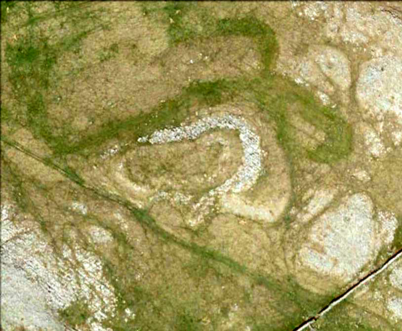
Aerial view of enclosure

To reach here, follow the same directions to get to the Apronful of Stones giant cairn.  Walk on the footpath past the cairn for about 200 yards until you reach a large gap where the old walling has collapsed.  Go through this and walk across the limestone rocks, towards the small rocky hillock rising up 100 hundred yards in front to your east (not the more rounded one to the north).  That’s it!

Archaeology & History

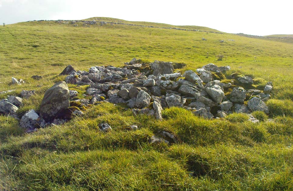
This is a most intriguing find, and one to which I can find no other literary reference (though I aint checked Brayshaw’s Giggleswick).  An undeniably large natural hillock has been modified and added to by people at some considerable time long ago and at some considerable effort!  Measuring more than 47 yards (43m) roughly east-west, and 21 yards (19m) north-south, the most definable man-made remains here is the length of elliptical walling on the southern and western edges.  The internal circumference of the enclosure measures roughly 113 yards (103m) all round the edges.  The northern and eastern sides of the hill would appear to be mainly natural, but seem to have been modified a little — not unlike the mass of settlements and enclosures a few miles to the east, like Torlery Edge, Lantern Holes and others around Malham Moor and district.

The site needs professional assessment: first to ascertain its period (which seems Iron Age on first impression, but could be much later), and second to ascertain its nature.  On the ridges close by we find a veritable mass of archaeological remains, ranging between Bronze Age to Medieval in nature.  The giant Apronful of Stones is only 172 yards (158m) south; the Sheep Scar cairn circle 156 yards (143m) northwest; and one of the remaining Sheep Scar cairns only 58 yards (53m) away.  And hopefully when we return to the place next week (fingers crossed!), we’ll be able to get some more photos of the walling you can see that define some edges of the site…

…to be continued…

References:

  1. Brayshaw, Thomas & Robinson, Ralph M., A History of the Ancient Parish of Giggleswick, Halton & Co.: London 1932.

© Paul Bennett, The Northern Antiquarian