Wray Stone (314), Ilkley Moor, West Yorkshire

Cup-Marked Stone:  OS Grid Reference – SE 13173 46585

Also Known as:

  1. Carving no.150 (Hedges)
  2. Carving no.314 (Boughey & Vickerman)

Getting Here

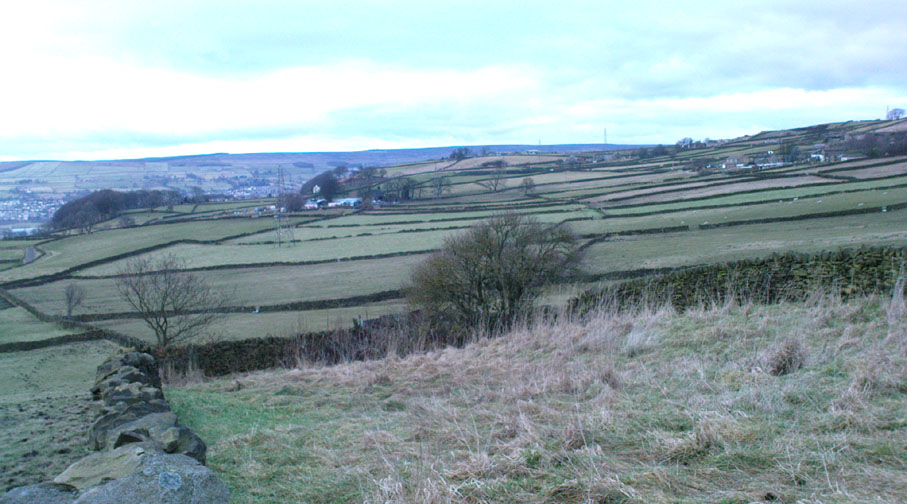
Take the road up across from Ilkley train station uphill towards the moor until you reach great rocks on your right.  From here, the Cow & Calf Stones car park (packed with tourists and litter everywhere these days), go up the steep footpath onto the moor.  As you level out looking across the first moorland ridge, to your left is a rounded hillock.  Go into the heather there and near its small peak and you’ll find what you’re looking for.

Archaeology & History

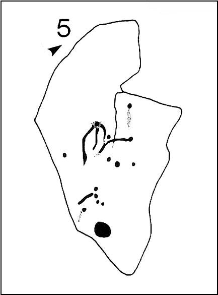
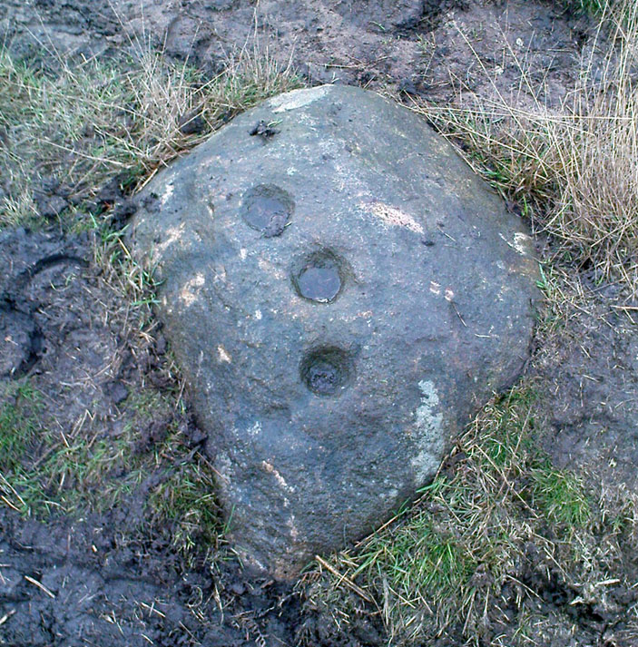
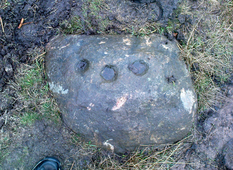
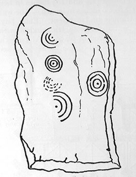
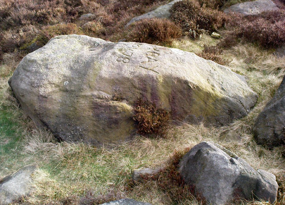
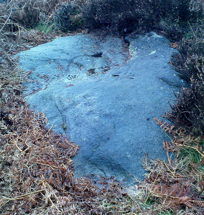
This is a nice big stone, found amidst a clump of other stones, that gives the distinct impression of once being a large cairn or similar artificial prehistoric feature.  But that’s wishful thinking on my behalf…  This long fat 10-foot long rock has the distinct signature of someone who thought it a good idea to carve his little name on the carving in 1978, as the name of the rock tells: “Wray Nov 78” — vandalism which the local Ilkley Parish Council and local businessman Tom Lonsdale validate as little more than “twenty-first century informal unauthorised carving.”  Beneath the great artist’s signature we find two distinct cup-marks above a large rounded bowl, inside of which seems to be the impression of an old ring, but this seems due to the actions of water and lichen.  There are perhaps another two faded cup-markings alongside those distinctly visible.  In Hedges (1986) survey he described the “top flat surface has three cups and one basin” — so let’s play safe and go with that!
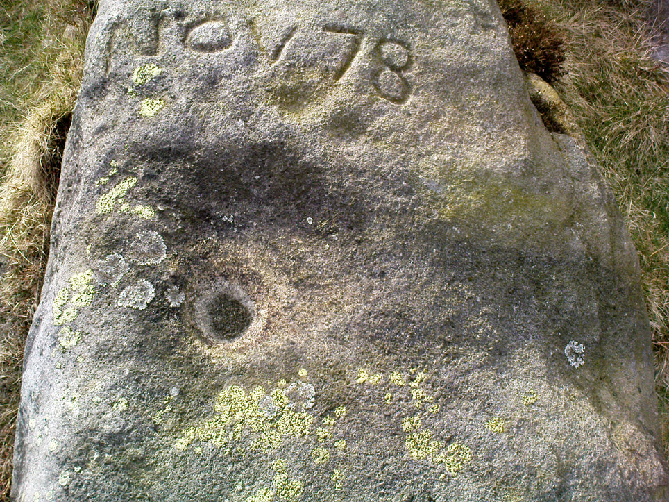
Close-up of cups, bowl & modern etching

It’s a good stone, sat upon a fine ridge with distinctive views for miles both east and west along the valley of the Wharfe, and north to the ancient settlements and burial grounds of Middleton Moor on the other side of the River Wharfe.  From here, behind and up onto Ilkley Moor, unfolds its greater mythic history, scattered and hidden over differing ages.  In years past, this site was a fine one for reflection and insight.  Today, one must venture further and to other sites for such quiet realities. Close by you can find the double-ringed carving of stone 318 and other faded cup-mark stones nearby.

References:

  1. Boughey, Keith & Vickerman, E.A., Prehistoric Rock Art of the West Riding, WYAS: Wakefield 2003.
  2. Cowling, E.T., Rombald’s Way: A Prehistory of Mid-Wharfedale, William Walker: Otley 1946.
  3. Hedges, John (ed.), The Carved Rocks on Rombalds Moor, WYMCC: Wakefield 1986.

© Paul Bennett, The Northern Antiquarian

Counter Hill Carving, Silsden, West Yorkshire

Cup-Marked Stone:  OS Grid Reference – SE 0463 4995

Also Known as:

  1. Carving no.31 (Boughey & Vickerman)

Getting Here

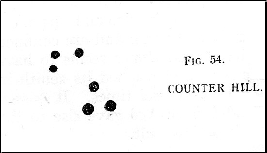
Cowling’s 1946 drawing

From Silsden go up the long hill (A6034) towards Addingham until the hill levels out, then turn left on Cringles Lane (keep your eyes peeled!) for a half-mile where you need to veer right along Banks Lane and go 100 yards past Moorcock Farm Hall where the footpath takes you into the fields on your right.  Walk down the line of the wallings, thru the gate, and keep following down until you reach a cluster of large rocks.  Stop here and look over the wall where you’ll see one of the boulders poking its head out on the other side.  That’s it!

Archaeology & History

First discovered by Eric Cowling in the late 1930s during one of his explorations of the immense Counter Hill earthworks (thought to be Iron Age), whose remains can still be seen encircling the peaked hill close by.  The stone is found in the edge of the walling halfway down the field towards the Marchup enclosure and is just inside the outer edge of the Counter Hill ditched enclosure surrounding the hill above you. (on the other side of the wall from the carving, you can make out the remains of the faint line of the ditch running pretty straight up towards the next wall)

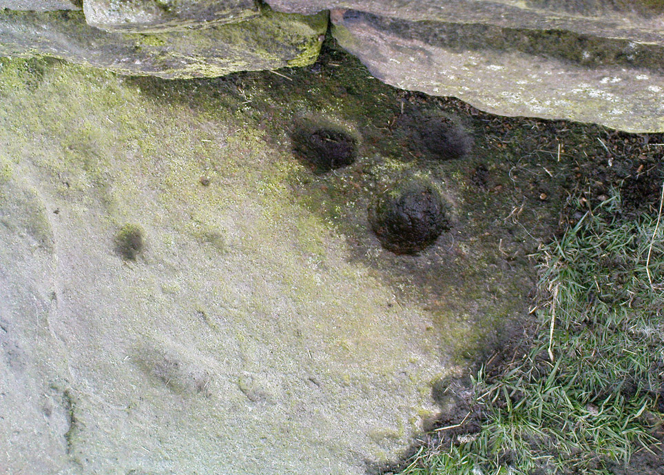
Cluster of cups by walling
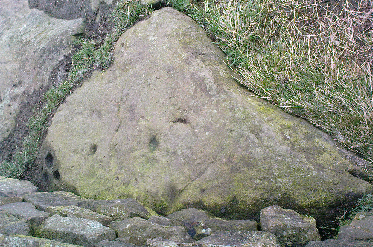
Counter Hill carving from above

At the top eastern edge of the stone is a clear cluster of 3 cup-markings, just as the rock meets the walling.  A much more faint group is visible to the left.  Cowling (1946) suggesting that the three-cup-cluster “shows the final form of the fylfot symbol,” i.e., the three-armed swastika.  Boughey & Vickerman (2003) meanwhile suggest that one of the two clusters are “doubtful (possibly recent?).”

When we came to this site yesterday, the day was overcast and cloudy.  But it seemed there may be more to this carving than has previously been recorded.  What may be a faint ring seemed possible near the middle of the stone, with a natural crack running through it (you can just about make it out in the photo on the right).  There also seemed to be other faint lines on the rock, but until we’ve been here again with better lighting conditions, the two groups of 3-cups is the symbolic state of play for this stone!

References:

  1. Boughey, Keith & Vickerman, E.A., Prehistoric Rock Art of the West Riding, WYAS: Wakefield 2003.
  2. Cowling, E.T., Rombald’s Way: A Prehistory of Mid-Wharfedale, William Walker: Otley 1946.
  3. Hedges, John (ed.), The Carved Rocks on Rombalds Moor, WYMCC: Wakefield 1986.

© Paul Bennett, The Northern Antiquarian

Harden Moor Cairnfield, Bingley, West Yorkshire

Cairns:  OS Grid Reference – SE 0757 3869

Getting Here

Overgrown cairn, looking north

Follow the same directions to reach the Harden Moor circle.  From here, walk down the footpath at its side down the slope for 100 yards and take the first little footpath on your left for 25 yards, then left again for 25 yards, watching for a small footpath on your right.  Walk on here for another 100 yards or so, keeping your eyes peeled for the image in the photo just off-path on your left, almost overgrown with heather. 

Archaeology & History

This is just one of several cairns in and around this area (I’ll probably add more and give ’em their own titles and profiles as time goes by), but it’s in a pretty good state of preservation.  Nothing specific has previously been written about it, though it seems to have been recorded and given the National Monument number of 31489, with the comment “Cairn 330m north of Woodhead, Harden Moor.” (anyone able to confirm or correct this for me?)

It’s a good, seemingly undisturbed tomb, very overgrown on its north and eastern sides.  Three pretty large upright stones, a couple of feet high, remain in position with an infill of smaller stones and overgrowth (apart from removing a little vegetation from the edges to see it clearer, we didn’t try disturbing it when we found it).  It gives the impression of being a tomb for just one, perhaps two people and is more structured than the simple pile-of-stone cairns on the moors north of here above Ilkley and Bingley.  Indeed, the upright stones initially gave the impression of it once being a small cromlech of sorts!  Other cairns exist close by, but until we get heather-burning done up here, they’re difficult to find – or at least get any decent images of them!

© Paul Bennett, The Northern Antiquarian

Low Snaygill Stone, Skipton, North Yorkshire

Cup-and-Ring Stone:  OS Grid Reference – SD 9940 4973

Also Known as:

  1. Carving SK1 (Hedges)
  2. Carving no.16 (Boughey & Vickerman)
  3. Snaygill Farm Stone

Getting Here

Stone by the roadside

Not too far from the High Laithe cup-and-ring stone.  Along the A6131 out of Skipton, park up at the Rendezvous hotel and go up the road on your left, over the canal.  As you approach the second house up, note the rock on the right-hand side of the tiny road, perched on the edge above the stream, with ivy creeping up one side of it.  That’s it!

Archaeology & History

This stone was moved to its present position a few decades back, sometime before Hedges (1986) first recorded it in his Carved Rocks work.  It’s a reasonably large boulder, resting on the slope above the drop to the stream below, and will probably drop into the waters in the not-too-distant future.  Whether the stream had any initial relationship with the cup-markings etched on its surface, we’ll probably never know (a number of rock art students love the water-stone relationship — and this one is no doubt in their listings!).  Its first literary appearance by Hedges described it thus:

“Large fairly smooth grit rock sloping down to stream at E and into ground and grass at W.  Eleven cups, circle of nine very small cups at one end, groove from depression, one other groove and possible cup.”

Lower half of CR-016

Which just about does it justice.  When we visited the place yesterday, the cluster of small cups at the top of the rock were difficult to see clearly in the grey daylight; but what seems to be another 2 cups (not in Hedges, nor Boughey & Vickerman’s [1986] survey) may be on the lower-half of the stone, and can be seen in the photo here.  We need to go back again on a bright day and catch the stone in a different mood to suss out whether we were just seeing things.

References:

  1. Boughey, Keith & Vickerman, E.A., Prehistoric Rock Art of the West Riding, WYAS: Leeds 2003.
  2. Hedges, John (ed.), The Carved Rocks on Rombald’s Moor, WYMCC: Wakefield 1986.

© Paul Bennett, The Northern Antiquarian

High Laithe Stone, Skipton, North Yorkshire

Cup-and-Ring Stone:  OS Grid Reference – SD 9952 4991

Also Known as:

  1. Carving SK2 (Hedges)
  2. Carving no.17 (Boughey & Vickerman)

Getting Here

High Laithe cup-and-ring stone

Worth the short trek if you like your cup&rings!  On the Aire Valley Keighley-to-Skipton road (A629), as you approach the southern outskirts of Skipton, take the turning at the roundabout as if you’re going into the town up the A6131. Go over the next roundabout a coupla hundred yards on, then 200 yards further on note the right-turn up over the canal (big hotel just here, where you could park up).  Walk over the canal up the tiny country lane. Ignore the first left turn and walk up, bearing next left uphill and onto the footpath. Walk up the hillocky quarried bit until you reach the stile in the wall.  Once on the other side, look in the walling 20 yards uphill.  You can’t miss it!

Archaeology & History

First described by Messrs Hartley and Radley in the Yorkshire Archaeological Register of 1968, this small “standing stone”, less than three-feet tall, has a distinct cup-and-double- ring carved onto its upright north-facing edge.  The outline of the carving is visible even in bad light, though you might wanna rest and gaze for a minute or two for yourself and the lighting to adjust if it’s a grey day.  There’s another cup-marking below the bottom right of the double-ring, with another ‘possible’ just above ground-level.

References:

  1. Boughey, Keith & Vickerman, E.A., Prehistoric Rock Art of the West Riding, WYAS: Leeds 2003.
  2. Hedges, John (ed.), The Carved Rocks on Rombald’s Moor, WYMCC: Wakefield 1986.

© Paul Bennett, The Northern Antiquarian

Glovershaw Quarry Stone, Baildon Moor, West Yorkshire

Cup-Marked Stone:  OS Grid Reference – SE 13044 40093

Also Known as:

  1. Carving BM5 (Hedges)
  2. Carving no.122 (Boughey & Vickerman)

Getting Here

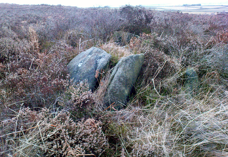
Follow the same directions as those to reach the small Central Design Stone up past the top-end of Shipley Glen.  You’ll notice the small disused quarry just a few yards away, and this partly-covered flat stone lies right at the very edge of the quarry itself.

Archaeology & History

Faint cups on CR-122
Plan of CR-122 (after Hedges)

Unless you catch this stone in good light, many of the cups on this design are difficult to make out; but defocus for a bit and they’ll come to you.  Around 13 cups have been counted on this stone, with a couple of grooves: one of which descends just by the small arc (a common local feature on Baildon’s carvings), near the eastern side of the stone.  A larger basin below this, covered by earth, may or may not be natural.  Two of the cups here may have been carved sometime in the late 19th or early 20th century, probably around the time the quarrying was being done.

As is common in some parts of Britain, this carving (and others nearby) was found in association with a small cairn-field, much of which has long since gone.

It’s very probable that there were other petroglyphs close to this one, but which have subsequently been destroyed as a result of the quarrying operations here.

References:

  1. Baildon, W. Paley, Baildon and the Baildons – parts 1-15, Adelphi: London 1913-1926.
  2. Bennett, Paul, Megalithic Ramblings between Ilkley and Baildon, private manuscript: Shipley 1982.
  3. Boughey, Keith & Vickerman, E.A., Prehistoric Rock Art of the West Riding, WYAS: Leeds 2003.
  4. Jackson, Sidney, “Cup-Marked Boulder near the Glovershaw Footpath,” in Cartwright Hall Archaeology Group Bulletin, 2:17, 1957.
  5. Hedges, John, The Carved Rocks on Rombald’s Moor, WYMCC: Wakefield 1986.

© Paul Bennett, The Northern Antiquarian

Goff Well, Keighley, West Yorkshire

Healing Well:  OS Grid Reference – SE 06149 38822

Getting Here

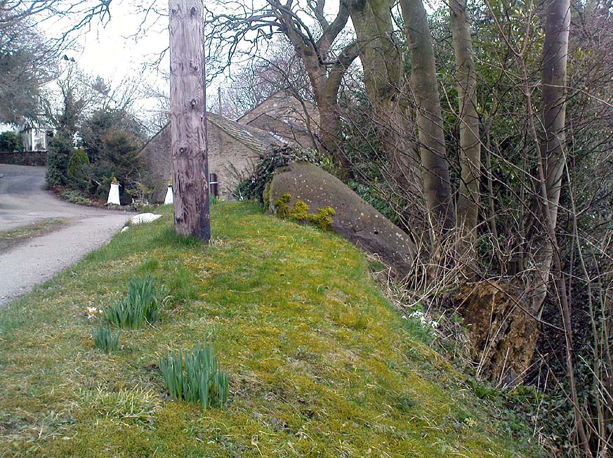
Goff Well is by the Elder tree in the middle

Various ways here. From Keighley, go up the A629 Halifax Road, first left after the Ingrow West train station, uphill; then turn right, and up the long, cobbled, zizaggy road past the little hamlet of Hainworth and uphill till you reach the solitary farmhouse of Goff Well Farm (where its friendly owners can sell you organic fresh eggs!).  It’s the field just before here on your left (if you reach the Guide Inn pub further uphill by the crossroads, you’ve gone too far). Alternatively start at the Guide Inn pub and walk across the road and downhill till you reach the farm. It’s in the first field on the right just past it.

Archaeology & History

Little is known about the history of this water source.  The first description of it seems to be in 1852.  Harry Speight (1898) mentions it briefly when he talks about the holy wells of the locale, saying simply:

“Goff Well, close to the road on Harden Moor leading to Hainworth, has given name to a neighbouring farm, but the purpose or virtues of this water are not now known.”

Goff Well on 1852 OS-map

Today the well is much overgrown and in need of attention.  It’s near the bottom corner of the field where the larger of the elder tree grows (the witch’s tree par excellence) and could do with being cleaned out.  When the owner of Goff Well Farm, Barry, took us to see the site, the waters couldn’t be seen but we could hear the water running clearly just beneath the surface, so it just needs a few hours work to bring it back into life.  Twouldst do the land and the genius loci the world of good!

The very name of the well is something of an anomaly.  There are several possibilities and we (as yet) cannot say which is the more likely derivation.  We know in northern dialect that Goff is a simpleton or fool, and although we can apply that definition in some cases, it’s unlikely to apply here.  If we could ascertain there was ever an apple tree growing here, the mystery would be solved, as a goff was an old word used for the common apple.  In West Yorkshire dialect the word was also used to denote “a hammer worked by water-power”; aswell as it being a corrupted form of the word ‘God.’  Take your pick!

Folklore

The early Victorian historian William Keighley (1858) thought Goff Well was named after a long-forgotten hermit called Goff who, at some time in the past, gave his name to the old hamlet of Hermit Hole, a half-mile downhill from this water source.  Mr Keighley wrote:

“On the skirts of Harden Moor is a farmhouse known by the name of Goff Well; and as goff is said to be the Danish word for red, it would probably be no great stretch of the imagination to suppose that the hermit was so named on account of his red hair, and the spring or well designated after him from the frequency and sanctimonious nature of his visits.”

But this is pure supposition on Keighley’s part — nice idea though it is!  The only tangible piece of folklore we have is that the well “was a famous resort of gypsies before the moor was enclosed in 1861.” (Speight 1898)

References:

  1. Keighley, William, Keighley, Past and Present, Arthur Hall: London 1858.
  2. Speight, Harry, Chronicles and Stories of Old Bingley, Elliott Stock: London 1898.

© Paul Bennett, The Northern Antiquarian

Baildon Moor (126), West Yorkshire

Cup-Marked Stone:  OS Grid Reference – SE 13066 40095

Also Known as:

  1. Carving no.9 (Hedges)
  2. Central Design Stone

Getting Here

Arc of deep cups

From the old Glen House pub, walk up the road onto ‘Shipley Glen’ as all locals call the place.  Go up the Glen Road for about half a mile, watching out for the small dirt-track turning going the slope on your left-hand side just near where the road starting swerving uphill to the right.  At this point where the track heads down and into the trees, there’s a footpath going into the bracken along to the right, heading onto level ground.  Walk up and along here.  After 100 yards or so you’ll notice the disused quarry on your left.  Keep walking along the footpath (two end up running parallel to each other) and you’ll see this carving right beneath your feet!

Archaeology & History

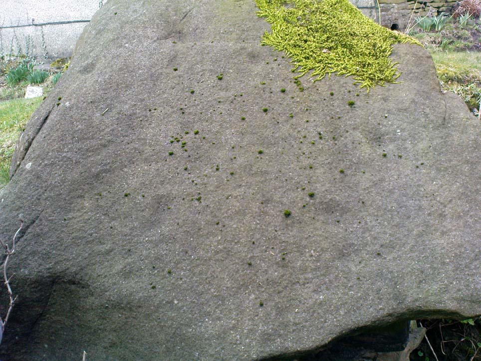
Baildon Moor carving no.126, near Glovershaw Quarry

This was one of the very first examples of “cup and ring stones” that I ever saw, when I was a mere 10 or 11 years old!  I’m not quite sure what I expected to find, but something about this stone with its deeply set cup-markings obviously had an effect on me – as I’m still foraging about looking at them more than 35 years later!  About 20 yards away from the Glovershaw quarry carving (Baildon Moor 122), this central design stone — as I used to call it — was first recorded in W. Paley Baildon’s (1913) magnum opus and was then all-but-forgotten until the Bradford Archaeology Group mentioned it again more than forty years later.  Although you can only see three distinct cups on this small rock, another 2 or 3 seem in evidence under better lighting conditions, and a small line runs below the cups in the photo here, which you can just make out above the central cup.

This carving and others close by give the distinct impression that they were once part of some seemingly lost cairn-field, awaiting rediscovery…

References:

  1. Baildon, W. Paley, Baildon and the Baildons – parts 1-15, Adelphi: London 1913-1926.
  2. Bennett, Paul, Of Cups and Rings and Things, unpublished: Shipley 1981.
  3. Bennett, Paul, Megalithic Ramblings between Ilkley and Baildon, unpublished: Shipley 1982.
  4. Boughey, Keith & Vickerman, E.A., Prehistoric Rock Art of the West Riding, WYAS: Leeds 2003.
  5. Cowling, Eric T., Rombald’s Way, William Walker: Otley 1946.
  6. Hedges, John, The Carved Rocks on Rombald’s Moor, WYMCC: Wakefield 1986.

© Paul Bennett, The Northern Antiquarian

Carlowrie, Kirkliston, Midlothian

Cup-and-Ring Stone (destroyed):  OS Grid Reference – NT 138 746

Archaeology & History

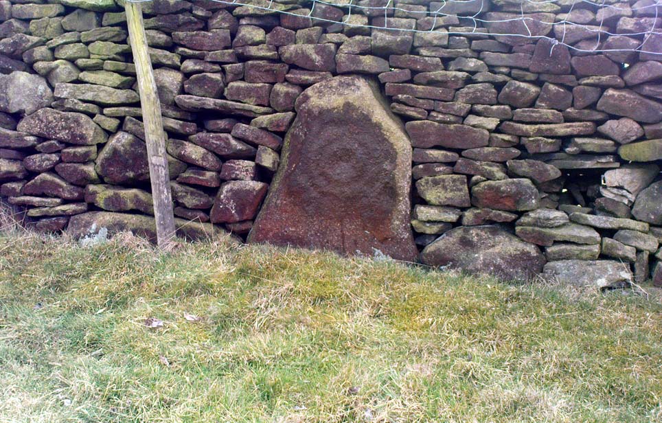
Lost carving of Carlowrie

Two-thirds of a mile west of the Cat Stane, on land immediately north of the River Almond by Edinburgh Airport in an area that was reported in 1780 to be “filled with the skeletons of human bodies,” this old petroglyph could once be found.  The Scottish Royal Commission (1929) described it as being a covering stone for a short prehistoric tomb near the OS-grid reference cited here, “but when discovered it was much broken by the plough that it does not appear to have been preserved.”  They refer instead to the last report of the site in the Scottish Society of Antiquaries journal, where we were informed that the cover stone was,

“marked with three series at least of concentric circles… The widest diameters of the sets of rings cut on the inside of the lid is about five inches, and each set is composed of five concentric circles.”

All trace of this carving appears to have been lost.  Other carvings reported nearby in the 19th century also appear to have been lost or destroyed.

References:

  1. Morris, Ronald W.B., The Prehistoric Rock Art of Southern Scotland, BAR 86: Oxford 1981.
  2. Royal Commission on Ancient & Historical Monuments, Scotland, Midlothian and Westlothian, HMSO: Edinburgh 1929.
  3. Simpson, J.Y., The Cat-Stane, Edinburghshire, Neill & Co: Edinburgh 1862.
  4. Simpson, J.Y., “On Ancient Sculpturings of Cups and Concentric Rings,” in Proceedings of the Society of Antiquaries, Scotland, volume 6, 1864-66.

© Paul Bennett, The Northern Antiquarian

Corwen Cross, Denbighshire

Cross & Cup-Marked Stone:  OS Grid Reference – SJ 0787 4340

Getting Here

Simple.  The church in the centre of the village across from the T-junction with the A5 is where it’s at!

Archaeology & History

Cross-base with cup-marks (from Owen, 1886)

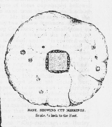
At Corwen churchyard we find a number of curious old stone relics — not least of which is this seemingly 12th century christian cross, more than seven-feet tall, on the west side of the church. Not only does this have a curious history in itself, but the base on which the cross stands has what may be at least seven cup-markings etched on it.  These were first mentioned – I think – by Elias Owen in his Old Stone Crosses of the Vale of Clwyd, (1886) who wrote:

“The stone basement in which the (cross) shaft is placed is elliptical in form, with transverse and conjugate diameters measuring respectively 64 and 60 inches; it is 12 inches or so thick, is of a slaty nature and might have been procured in the neighbourhood… There are seven peculiar artificial depressions along the surface of the pedestal, strongly resembling the cup-markings which are found occasionally on the capstones of cromlechs, etc. They are irregularly arranged: on the north side there are three, almost in a line; and on other parts of the stone there are four of these marks. They differ somewhat from each other in size and shape, but they are for the most part circular, though one is more of an oblong than a circle. They vary also in depth, one being two-and-half inches deep, while the others are shallow. The largest is three inches in diameter; the others are not so broad.”

Owen makes note of a previous description of the Corwen “cross” by Thomas Pennant in 1784, where sounds as if this stone had a decidedly megalithic precursor. He told us:

“A most singular cross in the churchyard merits attention: the shaft is let into a flat stone, and that again is supported by four or five rude stones, as if the whole had been formed in imitation of, and in veneration of, the sacred Cromlech of very early times.”

Two other crosses are found at Corwen church – one of which has a decidely heathen legend attached to it. The Carreg y Big yn y Fach Rhewllyd monolith is also found here, in the porch wall.  A few miles east of here we also find another cup-marked stone, shown on The Old-Fashioned Antiquarian website.  Looks a good n’!

References:

  1. Owen, Elias, Old Stone Crosses of the Vale of Clwyd and Neighbouring Parishes, Bernard Quaritch: London & Oswestry 1886.

© Paul Bennett, The Northern Antiquarian