Temple of Anaitis, Lusta, Waternish, Skye

‘Stone Circle’: OS Grid Reference – NG 2725 5273

Also Known as:

  1. Annait
  2. Temple of Annait

Getting Here

1880 map of Anaitis

1880 map of Anaitis

Otta Swire (1961) told how to find this place, thus: “The Waternish road turns off to the north at Fairy Bridge, whence it runs along the valley of the Bay river. On the left of the road, though at some little distance from it, where the river cleaves its way through a gorge to the sea, stands the mound which is now all that remains of the ‘Temple of Anaitis’ (so called).”

Archaeology & History

This is a curious place, full of archaeological potential if the folklore and history records are owt to go by, yet little of any substance remains to substantiate what may have been an important stone circle or other heathen site in earlier times. It seems to have been described first of all in the famous Hebridean journeys of Boswell and Johnson in the late 18th century.  Amidst his insulting description of both the landscape and local people, on Friday 17th September 1773, James Boswell visited the site and told:

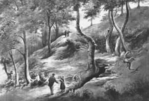
“The weather this day was rather better than any that we had since we came to Dunvegan. Mr M’Queen had often mentioned a curious piece of antiquity near this which he called a temple of the goddess Anaitis.  Having often talked of going to see it, he and I set out after breakfast, attended by his servant, a fellow quite like a savage.  I must observe here, that in Skye there seems to be much idleness; for men and boys follow you, as colts follow passengers upon a road. The usual figure of a Sky boy, is a lown with bare legs and feet, a dirty kilt, ragged coat and waistcoat, a bare head, and a stick in his hand, which, I suppose, is partly to help the lazy rogue to walk, partly to serve as a kind of a defensive weapon. We walked what is called two miles, but is probably four, from the castle, till we came to the sacred place. The country around is a black dreary moor on all sides, except to the sea-coast, towards which there is a view through a valley, and the farm of Bay shews some good land. The place itself is green ground, being well drained, by means of a deep glen on each side, in both of which there runs a rivulet with a good quantity of water, forming several cascades, which make a considerable appearance and sound.  The first thing we came to was an earthen mound, or dyke, extending from the one precipice to the other.  A little farther on, was a strong stone-wall, not high, but very thick, extending in the same manner.  On the outside of it were the ruins of two houses, one on each side of the entry or gate to it. The wall is built all along of uncemented stones, but of so large a size as to make a very firm and durable rampart. It has been built all about the consecrated ground, except where the precipice is deep enough to form an enclosure of itself. The sacred spot contains more than two acres. There are within it the ruins of many houses, none of them large, a cairn, and many graves marked by clusters of stones. Mr M’Queen insisted that the ruin of a small building, standing east and west, was actually the temple of the goddess Anaitis, where her statue was kept, and from whence processions were made to wash it in one of the brooks. There is, it must be owned, a hollow road visible for a good way from the entrance; but Mr M’Queen, with the keen eye of an antiquary, traced it much farther than I could perceive it. There is not above a foot and a half in height of the walls now remaining; and the whole extent of the building was never, I imagine, greater than an ordinary Highland house. Mr M’Queen has collected a great deal of learning on the subject of the temple of Anaitis; and I had endeavoured, in my journal, to state such particulars as might give some idea of it, and of the surrounding scenery” —

But in all honesty it seems Mr Johnson was either too lazy to write about the place, or simply didn’t actually get there, in spite of what he alleged!  But later that evening, Boswell dined with the same Mr MacQueen, who told him more of this site.  In the typically pedantic tone of english supremacy (which still prevails in some idiots who visit these lands), he continued by saying:

“Mr Macqueen had laid stress on the name given to the place by the country people, Ainnit; and added, ” I knew not what to make of this piece of antiquity, till I met with the Anaitidis delubrum in Lydia, mentioned by Pausanias and the elder Pliny.”  Dr. Johnson, with his usual acuteness, examined Mr Macqueen as to the meaning of the word Ainnit, in Erse, and it proved to be a water-place, or a place near water, “which,” said Mr. Macqueen, “agrees with all the descriptions of the temples of that goddess, which were situated near rivers, that there might be water to wash the statue.”

There ensued a discussion between Mr MacQueen and Samuel Johnson about the etymology of ‘Anaitis’, with one thinking it was of a goddess, and another that it represented an early christian site.  To this day it is difficult to say what the word means with any certainty.  In W.J. Watson’s (1993) fine work he tells us,

Andoit, now annaid, has been already explained as a patron saint’s church, or a church that contains the relics of the founder.  This is the meaning in Ireland and it is all we have to go upon.  How far it is held with regard to Scotland is hard to say… They are often in places  that are now, and must always have been, rather remote and out of the way.  It is very rarely indeed that an Annat can be associated with any particular saint, nor have I met any traditions connected with them.  But wherever there is an Annat there are traces of an ancient chapel or cemetery, or both; very often, too, the Annat adjoins a fine well or stream…”

The great Skye historian and folklorist Otta Swire (1961) also wrote about this mysterious site, mainly echoing what’s said above, but also adding:

“This name of Annait or Annat is found all over Scotland. It has been interpreted as meaning the ‘Water-place’ from Celtic ‘An’ = water, because many are near water. Others suggest ‘Ann’ = a circle (Celtic) and claim that most Annats are near standing stones. The most-favoured derivation seems to be from Ann, the Irish mother of the Gods, and those who hold this view claim that the Annats are always near a revered spot, where either a mother-church or the cell of a patron saint once stood. Probably Annat does, in fact, come from an older, pre-Celtic tongue, and belongs to an older people whose ancient worship it may well commemorate. The curious shape of the Waternish Temple of Anaitis and its survival make it seem likely that it was something of importance in its day, built with more than usual care and skill. Perhaps the Temple tradition is correct – but whose, if so, and to what gods? One cannot help wondering if cats played any part in its ritual, and if so, if any faint memory remains, for the nickname of the people of this wing was ‘Na Caits’ = The Cats, and not far off, by one of the tributary burns on the right of the roadway, there stands a small cairn, crowned by a long, sharp stone somewhat resembling a huge claw. This is the ‘Cats’ Cairn’.”

The Cats’ Cairn (NG271526) is said to mark the grave of a young boy from the 18th century, who was buried where he died and its story is told elsewhere on TNA.  Another example of the Annait place-name can be found elsewhere on Skye at the megalithic site, Clach na h’annait.

References:

  1. Boswell, James, The Journal of a Tour to the Hebrides with Samuel Johnson, National Illustrated Library: London 1899.
  2. Swire, Otta F., Skye: The Island and its Legends, Blackie: Glasgow 1961.
  3. Watson, W.J., The History of the Celtic Place-Names of Scotland, Birlinn: Edinburgh 1993.

© Paul BennettThe Northern Antiquarian


Tods Stone, Monifieth, Angus

Standing Stone (destroyed):  OS Grid Reference – NO 486 339?

Archaeology & History

The only reference I can find about this site is in A.J. Warden’s (1880) massive survey of the county of Angus—previously called ‘Forfarshire’—where, in his discussion of the hillforts of the area, he told us that,

“About a quarter of a mile distant from The Laws is the Gallow Hill of Ethiebeaton.  In a field, a little to the south, there formerly stood a large upright stone called Tods Stone.”

All trace of it disappeared when quarrying operations were undertaken there, also destroying a number of prehistoric tombs close by.  The monolith may have had some association with the tombs, but we cannot be certain.

The name of the stone, tods, probably derives from the word ‘foxes’, although we cannot be certain of this either, as there are a variety of other Scottish dialect words relating to ‘tod’that may have had bearing on the name.

If anyone has any further information about this long lost site, we would gladly welcome it.

References:

  1. Grant, William (ed.), The Scottish National Dictionary – volume 9, SNDA: Edinburgh 1973.
  2. Warden, Alex J., Angus or Forfarshire – volume 1, Charles Alexander: Dundee 1880.

© Paul BennettThe Northern Antiquarian


Ghaist Stane, Fern, Angus

Standing Stone:  OS Grid Reference – NO 4832 6173

Getting Here

Ghaist Stane on 1865 OS-map

Ghaist Stane on 1865 OS-map

Whichever route you take to reach this lovely hamlet, hiding away in deep greenery, when you get to the one and only road junction, where it goes downhill (towards the old church), look just above you just below the first tree.  All but covered in vegetation, the ruined stone lays down there. Climb up and see!

Archaeology & History

Tis up on the verge here

Tis up on the verge here

An exploration of this site was prompted when fellow antiquarian, Paul Hornby, came across the curious place-name of ‘Ghaist Stane’ when he was looking over some old Ordnance Survey maps of the region.  So we met up and took a venture over there!  Last highlighted on the 1865 map (when the old village was known as Fearn, not the modern spelling), even the Canmore lads had missed this one.  But it’s not easy to find….

After meandering back and forth by the village roadside, on the tops of the walls, into the field above, Paul eventually said, “Is that it?!” just above the roadside, almost buried in vegetation below the roots of a tree.  So I clambered back up and brushed some of the vegetation away – and there it was – in just the place that the old OS-map showed it to be (give or take a few yards).

The remains of the stone measure roughly 3 feet by 3 feet; with the present upper portion of the stone being of a lighter colour than the lower portion, indicating that this section of the stone was the portion that was underground when it was standing upright.  Its history is fragmentary, but we know that it was almost completely destroyed in the middle of the 19th century.  Notes from the Object Name Book of the region in 1861 told,

“The “Ghaist Stane”…formerly well known, is becoming little known from the stone having been recently blasted in making the Dike it now forms a part of, but it may be observed in the wall as a huge stone much larger than those beside it in the Dike. It does not project now from the side of the Road.”

Now the stone is almost entirely forgotten and lays covered, ignored, even by local people.  It could do with being resurrected and its heritage preserved before it disappears forever.

Folklore

The uncovered Ghaist Stane

The uncovered Ghaist Stane

The word “ghaist” is a regional dialect word meaning “a ghost or goblin”, inferring that the site was haunted.  And, considering the inherent animistic cultural psychology of the people here in earlier centuries, we must also consider the distinct possibility that the stone itself was the abode of a resident spirit, perhaps an ancestral one of a local chief, or queen, or elder of some sort.

In James Guthrie’s (1875) analysis of the folklore of Fern township, he told of the peculiarly odd violent brownies of the district and thought that they and the spirit of the Ghaist Stane were one and the same.

“In addition to the leading characteristics of Brownies in general the more prominent of these being, that they forded the rivers when their waters were at their highest, and that the sage femme always landed safely at the door of the sick wife—the brownies of Ferne are connected with scenes of cruelty and bloodshed.  This peculiarity would seem to indicate that the brownie and the ghaist of Feme, were one and the same.  The Ghaist Stane is in the vicinity of the church.   To this piece of isolated rock, it is said this disturber of the peace was often chained as a fitting punishment for his misdeeds, but tradition is silent as to the brownie being similarly dealt with, which strengthens the supposition that they were, in this quarter at least, generally regarded as one being.”

The spirit of the Ghaist Stane roamed far and wide in the district it seemed, and a long rhyme telling a tale of the ghaist was once well-known in the area which, thankfully, Mr Guthrie gave us in full:

THE GHAIST O’ FERNE-DEN

There liv’d a farmer in the North,
(I canna tell you when),
But just he had a famous farm
Nae far frae Feme-den.
I doubtna, sirs, ye a’ hae heard,
Baith women folks an’ men,
About a muckle, fearfu’ ghaist —
The ghaist o’ Ferne-den!
The muckle ghaist, the fearfu’ ghaist,
The ghaist o’ Ferne-den;
He wad hae wrought as muckle wark
As four-au’-twenty men!

Gin there was ony strae to thrash,
Or ony byres to clean,
He never thocht it muckle fash
0′ workin’ late at e’en!
Although the nicht was ne’er sae dark,
He scuddit through the glen,
An’ ran an errand in a crack —
The ghaist o’ Ferne-den!

Ane nicht the mistress o’the house
Fell sick an’ like to dee,—
“O! for a oanny wily wife!”
Wi’ micht an’ main, cried she!
The nicht was dark, an’ no a spark
Wad venture through the glen,
For fear that they micht meet the ghaist —
The ghaist o’ Ferne-den!

But ghaistie stood ahint the door,
An’ hearin’ a’ the strife,
He saw though they had men a score,
They soon wad tyne the wife!
Aff to the stable then he goes,
An’ saddles the auld mare,
An’ through the splash an’ slash he ran
As fast as ony hare!

He chappit at the Mammy’s door—
Says he — “mak’ haste an’ rise;
Put on your claise an’ come wi’ me,
An’ take ye nae surprise!”
“Where am I gaun?” quo’ the wife,
“Nae far, but through the glen —
Ye’re wantit to a farmer’s wife,
No far frae Ferne-den!”

He’s taen the Mammy by the hand
An’ set her on the pad,
Got on afore her an’ set aff
As though they baith were mad!
They climb’d the braes—they lap the burns—
An’ through the glush did plash:
They never minded stock nor stane,
Nor ony kind o’ trash!

As they were near their journey’s end
An’ scudden through the glen:
“Oh!” says the Mammy to the ghaist,
“Are we come near the den!
For oh! I’m feared we meet the ghaist!”
“Tush, weesht, ye fool! “quo’ he;
“For waur than ye ha’e i’ your arms,
This nicht ye winna see!”

When they cam to the farmer’s door
He set the Mammy down:—
“I’ve left the house but ae half hour—
I am a clever loon!
But step ye in an’ mind the wife
An’ see that a’ gae richt,
An’ I will tak ye hame again
At twal’ o’ clock at nicht!”

“What maks yer feet sae braid?” quo’ she,
“What maks yer een sae sair?”
Said he, — “I’ve wander’d mony a road
Without a horse or mare!
But gin they speir, wha’ brought ye here,
‘Cause they were scarce o’ men;
Just tell them that ye rade ahint
The ghaist o’ Ferne-den!”

References:

  1. Guthrie, James C., The Vale of Strathmore – Its Scenes and Legends, William Paterson: Edinburgh 1875.

© Paul BennettThe Northern Antiquarian


Manor Farm, Bolnhurst, Bedfordshire

Hillfort:  OS Grid Reference – TL 0849 5985

Also Known as:

  1. The Camp

Archaeology & History

Wadmore's 1920 groundplan

Wadmore’s 1920 groundplan

This much disturbed Iron Age ‘hillfort’ is effectively a large enclosure of Iron Age origin, much ruined by farming and subsequent landscape alterations through the centuries, with much of it re-fashioned as a medieval moat more than a thousand years after first being built.  Even when the site was visited and described in Mr Wadmore’s (1920) fascinating work he told of the variants in its apparent construction phases:

“This large earthwork is situated on flat level ground, a few yards off the Bedford-Kimbolton Road, at the VIIth milestone out of Bedford.  In shape it is very irregular and presents little to aid one in arriving at an estimate of its original form, except the construction of its defensive lines, which are of two totally different characters and suggest that a comparatively modern manor has been added to an older work.

“The portion which I take to be the older, lies to the south, and is contained on this and the western side, as far as and including the great sweep bending east, by a strong vallum with a parapet and external fosse.

“The modern portion appears to me to commence between the east and west faces where the lines run north, and are purely the remains of a fosse without any indication of a parapet.  The extension of these lines, so far as can be traced, would tend to prove that the work occupied both sides of the road; but such a fact should not prejudice one’s view concerning the work as a whole….”

Section of the earthworks drawn by Wadmore

Section of the earthworks drawn by Wadmore

Adding with a good sense of humility that, “I am quite willing to admit that I may be mistaken, as the matter is entirely speculative.”  But modern archaeological analysis tends to prove that much of Wadmore’s words were correct and the remaining northern section of these earthworks is where the medieval moated section was built.  Roman remains and other period artifacts have also been unearthed in and around the site.

A few hundred yards southwest of the hillfort we find a place called Greenbury Farm.  This place was known in the 14th century as ‘Grymesbury’, which has been taken by some students as relating to the Norse deity, Grim.  However, Mawer & Stenton (1926) point out that in this instance,

“The Grym family had a holding in Bolnhurst in 1302 and bury is here used in the manorial sense. Hence ‘Grym’s Manor.’”

References:

  1. Mawer, A. & Stenton, F.M., The Place-Names of Bedfordshire and Huntingdonshire, Cambridge University Press 1926.
  2. Wadmore, Beauchamp, The Earthworks of Bedfordshire, Bedfordshire Standard: Bedford 1920.

© Paul BennettThe Northern Antiquarian 2016


Lund Well, Bingley, West Yorkshire

Sacred Well (destroyed):  OS Grid Reference – SE 0973 4091

Archaeology & History

Lund Well on 1852 map

Lund Well on 1852 map

Once found in a cluster of three little wells all very close to each other near the top of the field where the Crossflatts roundabout joins up with the Aire-Valley trunk road, this is an intriguing site if you happen to be a pagan, or have an interest in druidism — and for one main reason: its name.  When I first came across a reference to the place about 25 years ago, the only piece of information I could find about it came from the arduous detailed researches of the Victorian industrial historian J. Horsfall Turner who, unfortunately, neglected to record much of the fading folklore in the region at his time.  Marked on the 1852 6-inch Ordnance Survey map, ‘Lund’ was a bit of an etymological curiosity, and Mr Turner (1897) thought the well’s name was little other than that of a local mill owner, whose nickname was ‘Lund’ Thompson.  He was guessing of course…and I thought little more about it…

Years later when looking through A.H. Smith’s (1961-63) magnum opus on the place-names of West Yorkshire, I found that he didn’t include the Lund Well in his survey.  However, an eventual perusal of Kenneth Cameron’s (1996) work told that in Old Norse place-names (and there is a preponderance of such places scattering Yorkshire and Lancashire), lund or lundr was a “‘small wood, grove,’ also had a meaning, ‘sacred grove’.” The word is echoed in old French, launde, meaning ‘forest glade’.  In A.H. Smith’s (1954) earlier etymological magnum opus he said that the word derives from a “small wood, grove, also a sacred grove, one offering sanctuary.”  However, Margaret Gelling (2000) urged caution on the origin of lund as a sacred grove and erred more to the usual English tendency of depersonalizing everything, taking any animistic attribution away from its root meaning; but we must urge caution upon her caution here!  Neither Joseph Wright (English Dialect Dictionary, vol.3 1905) nor William Grant (Scottish National Dictionary, vol.6, 1963) have entries for this word, so we must assume the Scandinavian root word origin to be correct.

One vitally important ingredient with the Lund Well is its geographical position.  For across the adjacent River Aire the land climbs uphill—and a few hundred yards above we reach the well-known and legendary Druid’s Altar, with its Druid’s Well just below.  This association is what suggests our Lund Well may have had a real association with a “sacred grove of trees”, as—despite us knowing very little about them—we do at least know that druids performed rites in sacred groves.  In Greenbank’s (1929) historical analysis of the Druid’s Altar, he was left perplexed as to the origin of its name as all early accounts and popular culture assigned it this title, and so he opted for the probability that the druids did indeed once perform rites here.  If this was true, then our seemingly innocuous Lund Well once had a much more sacred history than anyone might have thought.  Sadly, through their usual ignorance of such matters, the industrialists destroyed it….

References:

  1. Cameron, Kenneth, English Place-Names, Batsford: London 1996. 
  2. Gelling, Margaret, Place-Names in the Landscape, Phoenix: London 2000.
  3. Greenbank, Sydney, The Druid’s Altar, Bingley, R.G. Preston: Bingley 1929.
  4. Smith, A.H., English Place-Name Elements – volume 2, Cambridge University Press 1954.
  5. Smith, A.H., The Place-Names of the West Riding of Yorkshire – 8 volumes, Cambridge University Press 1961-63.
  6. Wainwright, F.T., Scandinavian England, Phillimore: Chichester 1975.

© Paul BennettThe Northern Antiquarian


Kirk Stones, Morton Moor, West Yorkshire

Legendary Rocks (destroyed):  OS Grid Reference – SE 0886 4479

Archaeology & History

Kirk Stones on 1851 map

Kirk Stones on 1851 map

A place-name that is still recognised on modern Ordnance Survey maps, even though the original site giving rise to it was all but destroyed some one hundred-and-fifty years ago.  Derived from the old word kirk, meaning a church or sacred site, no christian remains of any kind have ever existed here and so we must presume an earlier, more heathen site of sanctity (an abundance of prehistoric petroglyphs exist very close by).  The singular reference detailing the nature of these Kirk Stones is in J.A. Busfield’s (1875) rare tract on the history of Upwood, in the parish of Bingley.  Upwood Hall was built by the Busfield family and, as the author tells,

“one of the most striking features in the vicinity at this age [c.1800, PB] was the fine range of magnificent rocks called Kirkstones, which had existed for countless ages. These grand rocks, towering one above another, extended along the whole southern boundary of the [Whetstone] Allotment on the left of the road to Ilkley, and were really a fine object, but alas!, through the ignorance or stupidity of the agent Colonel Bence, the “Crags of Kirkstone” were broken up and disposed of in the construction of the Bradford Water Works about the year 1854.”

Sadly we have neither illustrations nor other references to these fine sounding sentinels.
Undoubtedly the Kirkstones were a natural feature, despite their venerated title. It would have been their very appearance that gave rise to their revered title, as in the great and contorted rock masses seen at Brimham Rocks which, from Bensons’s description, these Kirk Stones seem reminiscent. The only piece of extant lore to these stones is that the uprights that went into making the recently destroyed Bradup stone circle a short distance south of here, came from this sacred outcrop.  It seems reasonable to assume that they played an important role in the magickal history of these hills when they were scattered with forest.

The Kirk Stones aligned along the equinox axis to the Black Knoll standing stone less than a mile [1.4km] due east.

References:

  1. Bennett, Paul, The Old Stones of Elmet, Capall Bann: Milverton 2001.
  2. Busfield, Johnson Atkinson, Fragments Relating to a History of Bingley Parish, Bradford 1875.
  3. Smith, A.H., English Place-Name Elements – Part 2, Cambridge University Press 1956.

© Paul BennettThe Northern Antiquarian


Staniston Hill, Stainburn, North Yorkshire

Standing Stone (lost):  OS Grid Reference – SE 2522 5010

Archaeology & History

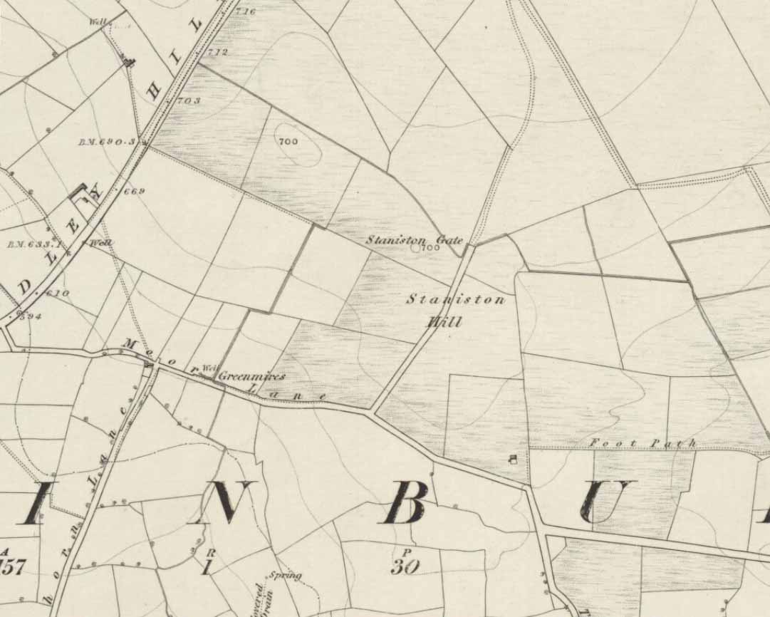
Staniston Hill on 1851 map

This long-lost standing stone gave its name to the small hill between the geological giants of Little Almscliffe and Almscliffe Crags, ‘Staniston Hill.’  Described as early as the 13th century in the Cartulary of Fountains Abbey as ‘Standandestan’, its precise whereabouts is unknown—but it’s damn close to the grid-reference cited here.  As the early OS-map shows, a small rounded hill occurs a short distance northwest of the small copse of trees now growing.  The monolith may have been felled by some grumpy christian, or it could be standing in some nearby walling.  Local antiquarians, dowsers or archaeologists may or may not find a search for it worthwhile…

Its position between the two Almscliffe Crags makes it very close to marking the midway point of a natural solstice marker: the Winter sunrise from Little Almscliffe and summer sunset from the greater Almscliffe.

References:

  1. Bennett, Paul, The Old Stones of Elmet, Capall Bann: Milverton 2001.
  2. Smith, A.H., The Place-Names of the West Riding of Yorkshire – volume 5, Cambridge University Press 1961.

© Paul Bennett, The Northern Antiquarian

Cockplay Well, Auchinloch, Lanarkshire

Healing Well:  OS Grid Reference – NS 6438 6962

Archaeology & History

The name of this site alone insisted that I bring it to people’s attention!  If it was a healing well relating to its name, I wonder what it was used for!  It’s described just once in the New Statistical Account (1845) for Lanarkshire, where Pete Brown said briefly:

“On the south side of the road from Auchinloch to Glasgow, there is still the Cockplay Well, over which many proprietors and feuars have a servitude.”

Two roads came out of the village at the time of the NSA notes: one to the immediate west and the other to the south.  None of the maps cite the place-name ‘Cockplay’, but two ‘wells’ occur on the outgoing western road. One is in the village itself, behind some cottages; this is not likely to be the site in question, as the description would surely have stated that the well was in the village.  However, “on the south side of the road” one mile west of the village, roughly halfway between Wallace’s Well and Cardyke there is a ‘Well’ shown on the early OS-maps.  This has to be the most likely contender.

The etymology may revolve around variants on the word old english word cocc, which in this instance is likely to be ‘bird/s’ or a cock, as a in the male domestic fowl; effectively making it the ‘well where the birds played.’  More help and information on it would be good.

References:

  1. Bennett, Paul, Ancient and Holy Wells of Glasgow, TNA 2017.
  2. Brown, Peter, “Parish of Cadder,” in The New Statistical Account of Scotland – volume 6: Lanarkshire, William Blackwood: Edinburgh 1845.
  3. Parson, David P., The Vocabulary of English Place-Names – volume 3, EPNS: Nottingham 2004.
  4. Taylor, Simon & Markus, Gilbert, The Place-Names of Fife – volume 5: Discussion, Glossaries, Texts, Shaun Tyas: Donnington 2012.

© Paul Bennett, The Northern Antiquarian 


Pear Tree Well, Kelvinside, Glasgow, Lanarkshire

Healing Well (destroyed):  OS Grid Reference – NS 56728 67797

Also Known as:

  1. Canmore ID 164370
  2. Three Tree Well

Archaeology & History

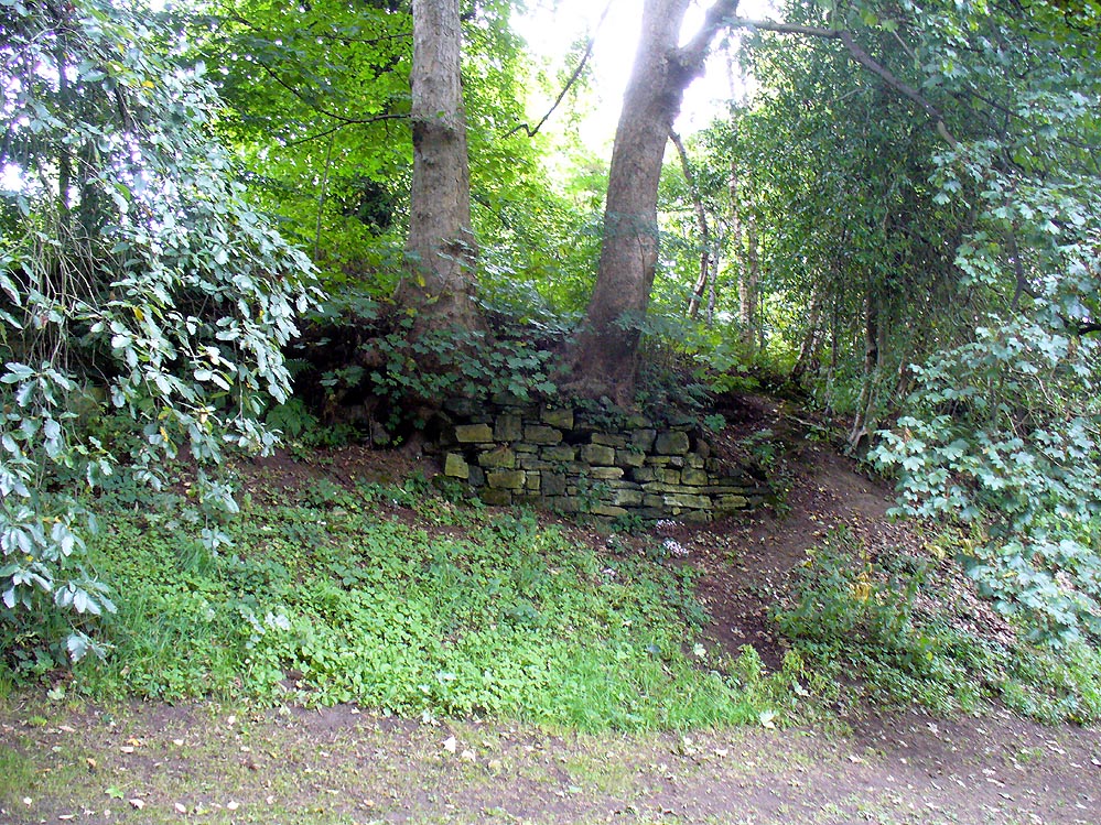
Site of the Pear Tree Well

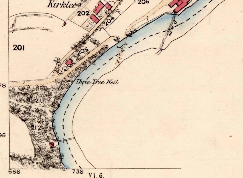
The demise of this old healing spring of water occurred a few generations ago by the look of things.  Marked on the earliest Ordnance Survey maps—erroneously as the ‘Three Tree Well’, as Mr McDonald (1860) will soon explain—it was located on the west side of the River Kelvin, halfway between the Kirklee footbridge and the ancient ford, but the only remains we can see of it now appears to be the brick-walling above which a pair of sycamore trees rise, or perhaps beneath the man-hole cover on the path lower down.

Three Tree Well on 1865 map

…But it wasn’t always this way… Known to be a chalybeate, or iron-bearing spring (which are always regarded as tonics in local lore, fortifying the blood general health), when the local writer Hugh McDonald (1860) wrote about it in his wonderful Rambles round Glasgow in the middle of the 19th century, he cast a picture of the area that few Glaswegians would recognise today—and a damn good swipe at the incomers trying to alter the names of traditional places:

“At the western extremity of the Botanic Gardens a narrow passage, in popular parlance called “the Kyber Pass,” leads over a green knoll to the volley of the Kelvin at the famous “Pear-tree Well.” …The scenery of the Kelvin in the vicinity of the Pear-tree Well is of the most romantic and beautiful description.  The banks are bold, and in many places fringed with masses of foliage to the water-lip; while the rustic bridge, the lonely cottage, and the picturesque mill, seem planted by the very hand of taste, along the meanderings of the rippled and murmuring stream, wherever they are likely to produce a telling effect… Altogether the scene and its accessories present the very choicest of those harmonious combinations of colour and form which the landscape limner loves to gaze upon, and fondly endeavours, in the pride of his skill, to transfer to the living canvas.  No wonder it is that Kelvin Grove has long been the favourite haunt of our City lovers, and the favourite theme of our local poets; for Nature has, indeed, strewn its recesses with charms as fresh and beautiful as though it were situated far from the dwellings of men, instead of almost under the wing of our most dinsome and dusky of towns.

“The Pear-tree Well issues from the bottom of a steep and thickly-wooded bank, which, at this point, rises gracefully from the rocky bed of the streamlet.  The crystalline and deliciously cool water is collected into a considerable cavity in the earth; immediately over which three large trees—a plane and two handsome ashes—raise on high their umbrageous heads, while their sturdy roots, in serpent-like convolutions, twine around the watery hollow beneath, as if to defend it from the intrusion of the penetrating noonday sun.  Some suppose that it is from this trio of sylvan guardians that the fountain has received its name — and that the ‘Three-tree’ and not the ‘Pear-tree’ Well is its proper denomination.  The advocates of the latter theory further remark, that there is no pear-tree in the vicinity, and that consequently the popular name is probably but a corruption of “Three-tree.”  There is high authority for saying that names are things of slight consequence; but however that may be, we are inclined, in the present instance, to be conservative of the old name for this favourite well, and to retain it in spite of all attempts at innovation.  Whether from langsyne associations or not, we shall not attempt to discover, but Pear-tree Well sounds most musically on our ear — and we should be loath to have it suppressed by the word-coinage of any crotchety theorist; and besides, who can tell what kind of trees may have formerly graced the locality?  A perfect orchard of the pear tribe may, at some past period, have clothed the banks of Kelvin for anything that these violators of a time-honoured name—”these men who are given to change”—know to the contrary.  No, no!  Pear-tree Well it has been, and Pear-tree Well to us, at least, it must remain.  We had as lief meet an old friend with a new face, as an old haunt with a new name.

“Having done our devoirs to the spirit of the fountain, by draining a bicker of the translucent water, which, by the way, is slightly impregnated with iron, we sit ourselves down on the bank above, under the ashen tree, when one of two friends with whose company we have been honoured, inspired by the half-gelid beverage, bursts suddenly out with—

“Let us haste to Kelvin Grove, bonnie lassie, O.”

“We of course join heartily in the measure, which has for many years been highly popular in the west of Scotland, and which we naturally enjoy with double zest, amid the scenery to which it refers…”

Pear Tree Well in 1896

The great historian and romantic, J.A. Hammerton (1920) even passed here, telling how sufferers of disease relied upon its curing waters to heal them.  It is just such a pity that this picturesque medicinal spring and its rivulet are with us no more…

References:

  1. Brotchie, T.C.F., Glasgow Rivers and Streams: Their Legend and Lore, John Maclehose: Glasgow 1914.
  2. Brotchie, T.C.F., “Holy Wells in and Around Glasgow,” in Old Glasgow Club Transactions, volume 4, 1920.
  3. Hammerton, J.A., Wonderful Britain: Its Highways and Byways – volume 1, EBC: London 1920.
  4. McDonald, Hugh, Rambles round Glasgow, John Cameron: Glasgow 1860.
  5. Millar, A.H., By-gone Glasgow, Morison Bros: Glasgow 1896.
  6. Pagan, James & Stoddart, J.H., Relics of Ancient Architecture and other Picturesque Scenes in Glasgow, David Bryce: Glasgow 1896.

Acknowledgements:  Huge thanks to Nina Harris for guiding us to the spot where this old well could once be seen.

© Paul Bennett, The Northern Antiquarian


St. John’s Well, Welham, Nottinghamshire

Holy Well: OS Grid Reference – SK 7255 8280

St John's Well house
St John’s Well house

Getting Here

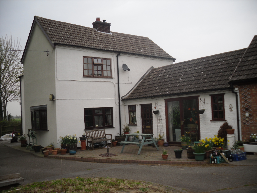
One of the most unusually sited of Nottinghamshire’s holy wells is St. John’s Well at Welham. It lies beneath a private kitchen floor in a house in Bonemill Lane in Welham, just off the Clarborough Road out of Retford.

Archaeology & History

The well itself is undoubtedly an ancient one. The Domesday Book refers to ‘Wellun’; this changed to ‘Wellum’ by 1166, and by the 16th century had become ‘Wellom’; but in Chapman and Andrews map of Nottinghamshire in 1775 was shown as ‘Welham’.  None of these sources call it St John’s Well and it is not so named until 1710, either as a re-dedication once the Reformation zealouts had died down, or perhaps coined by John Hutchinson to give the bath a story to explain its healing waters.  It is shown on Chapman’s map of Nottinghamshire (1774) as ‘Well House’.  Piercy (1828) gives the greatest information and states that the hamlet of Welham was named after St. John’s Well whose waters contained magnesium and gypsum and was:

 “good for rheumatics and scorbutic diseases. Its waters formed into a large bath, and remained entire during the early part of the 18th century, it was famous for many cures, but latterly it has lost much of its celebrity.John Hutchinson, Esq. erected a cottage adjoining, and enclosed the bath, to preserve it from injury. Cold baths like this were formerly regarded with superstitious reverence, being supposed to possess a sovereign remedy for agues such as rheumatism.”

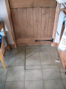
The well-cover
The well-cover
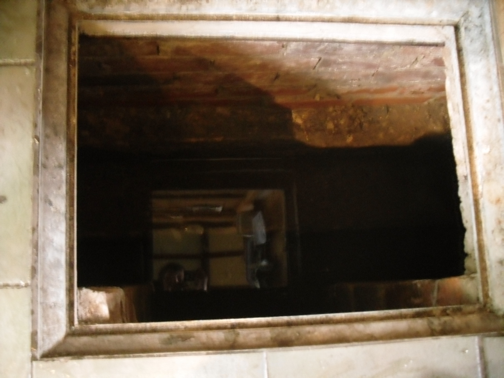
Looking into the well

By 1832 White’s Directory notes that it had lost much of its former celebrity. A Robert Walker was a bath keeper at the Well house and may well have been the last one as it appears the well soon fell into terminal decline and I can find nothing is noted of it until 1938. At this time it is noted that its water was still used to provide several cottages in the village. An article written in 1957 states the bathhouse disappeared stating the coming of the railway encouraged people to move away to find more effective spas around the 1830s. It goes on to note that the actual spring location was lost. This I thought was to be the situation, but local investigations not only showed the house to be still existence but the bath still remained! Records show that the estate, was bought by an Arthur Robert Garland of Welham Hall from the deceased estate of John Henry Hutchinson of Clarborough Hall acres117.3.16 along with Well House Cottage and garden for the sum of £3200 on in 1910. He then sold the cottage and garden to Fred Anderson on 1910 for £130. This was subsequently bought by the late Mr Eric Durham on 1955, later to be purchased by the current owner, Mr Whelan, in 1975.

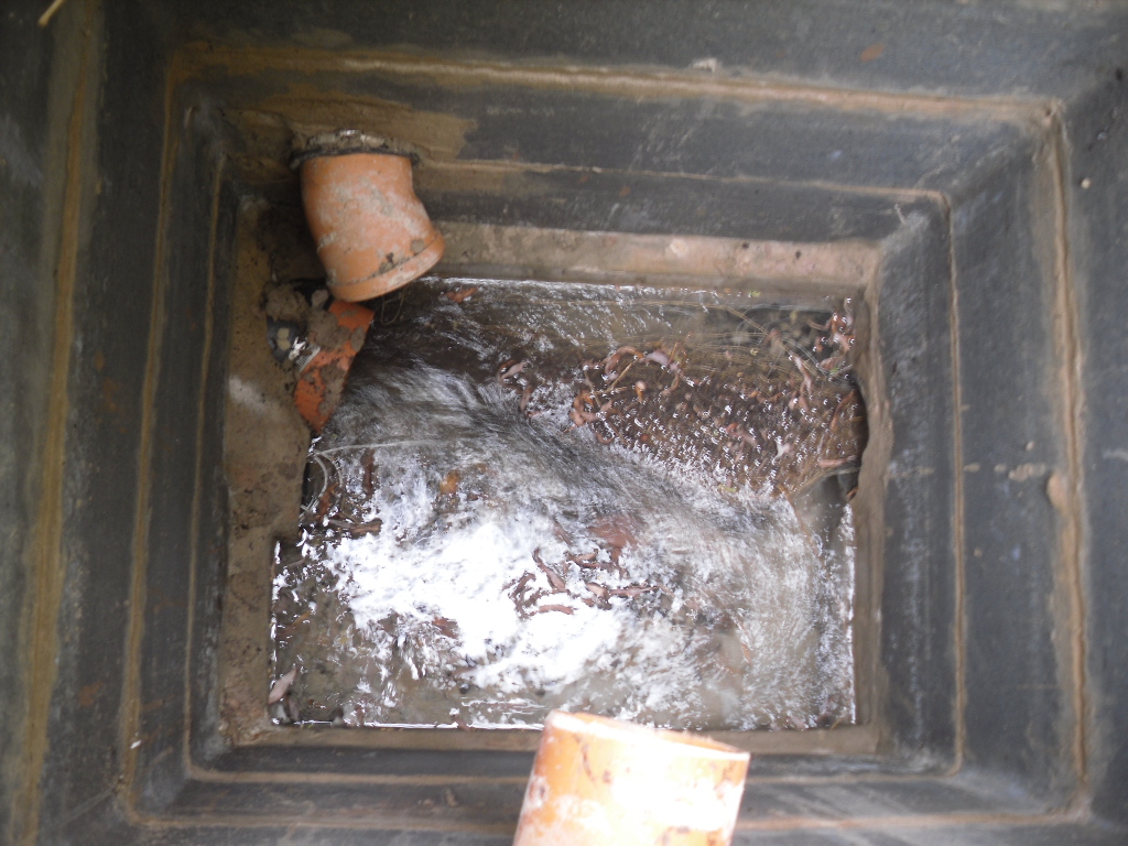
st-johns-well-welham04 The present house, although it had been added onto in the last century, has its core fabric as John Hutchinson built it. The large house being the well keeper’s abode with the side building, now a modern kitchen was the bath house.  Arriving at the house, I was at first shown the site by Mr. Whelan the spring which filled the bath which was diverted to the side of the house, the spring itself arising close to the footpath behind the house. A man-hole cover in the drive way revealed that the spring flows at a fast rate, several gallons per minute. He notes that it had a very high mineral content, soaking through the gypsum in Clarborough hills. He stressed it is drinkable, in small quantities, due to its high magnesium and sulphate (like Andrews Liver Salts). It is quite chalky to taste flat but is very pleasant to drink if aerated. However he did not recommend long term drinking was probably not good for one’s health.

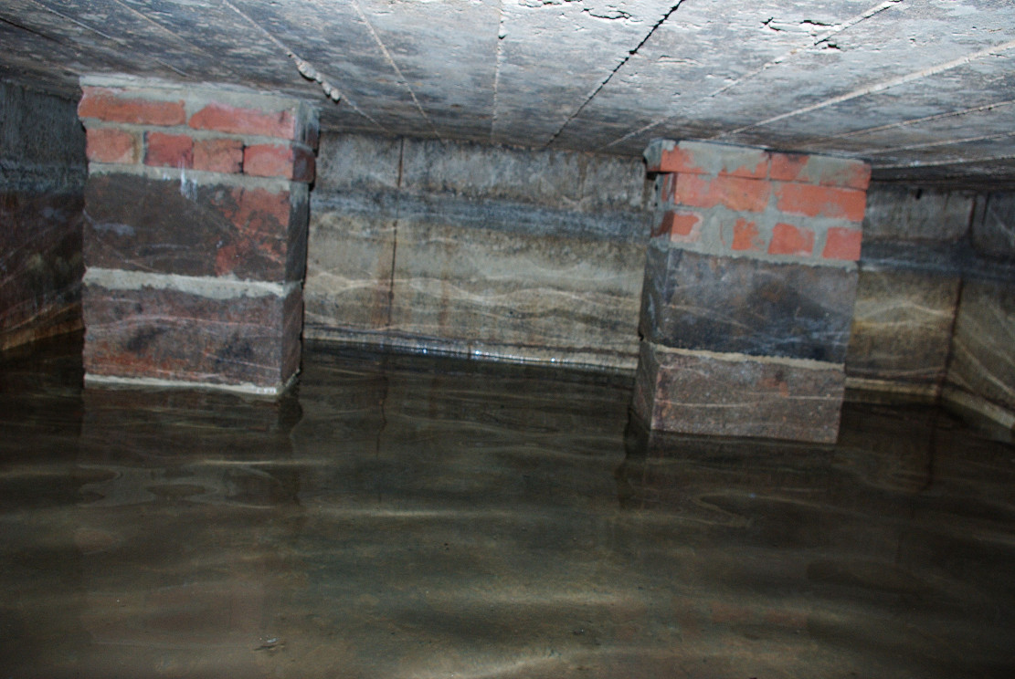
st-johns-well-welham05In the kitchen, a small trap door can be removed and beneath the remains of the bath is revealed. This appears to as Mee (1938) describes; a stone basin twelve feet square with a flight of steps entering the water. I scrambled down into this bath and found it presently to have two stone steps which enter the bath, although bricks built upon these suggest that there may have been more.

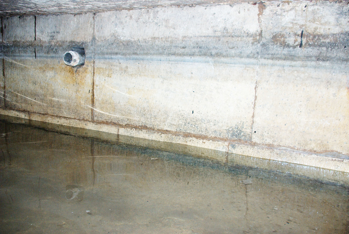
st-johns-well-welham06Remarkably the bath still remains enclosing an area fifteen feet by twelve feet, and despite the water being diverted, was full to over a two foot of water. The present kitchen is supported by four brick pillars but this does not appear to have damaged the fabric of the bath which is in fine condition, being made of good quality neat squared stonework. A pipe is found four feet high or so in the wall and a line around it made by the presence of water indicates that the water was of a considerable depth supporting the fact that it was large enough to be a hazard, explaining how Thomas Heald, Vicar of Babworth drowned in it on the 18th June 1759. Mr. Whelan informs me that although the house is not a listed building previous owners had sensibly preserved the bath. Around 30 years ago he was often showing local school children, but it appears now to forgotten. So there it remains a curious relic preserved in its most unusual place.

Folklore

John Piercy (1828) notes:

“Here was, until lately, a feast, or fair, held annually on St. John’s day, to which the neighbouring villagers resorted to enjoy such rural sports or games as fancy might dictate.”

What is interesting about this account is the reference of games and a fair suggesting that if the well itself did not have such a dedication, the saint was celebrated in the locale. This may indicate that indeed the well was so dedicated or that Hutchinson chose this name because of the local fair. Without further information we shall never know.

It must be noted that due to its location, under a private kitchen, that the site is not readily viewable so please don’t turn up unannounced.

References:

  1. Mee, Arthur, Nottinghamshire, Hodder & Stoughton: London 1938.
  2. Parish, R.B. (2010) Holy Wells and healing springs of Nottinghamshire
  3. Piercy, John S., The History of Retford, F. Hodson: Retford 1828.

Links:

  1. Holy and Healing Wells

© R.B. Parish, The Northern Antiquarian