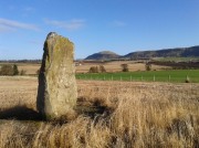
Cunnel Fold Well, Marsett, Bainbridge, North Yorkshire

Healing Well:  OS Grid Reference – SD 88727 85543

Archaeology & History

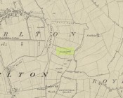
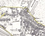
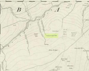
Cunnel Fold Well on 1856 map

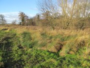
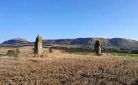
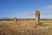
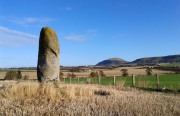
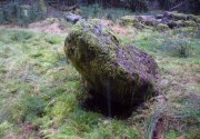
Found high on the moors several miles south of Hawes, this is a small almost insignificant water source that I sat with, drinking in both the landscape and the waters many moons ago in a daydreaming amble.  It’s history is only remembered in the name it was given, no doubt by some local to the Ordnance Survey lads in their own, albeit more focussed assessment on these hills.  Its name puzzled me for a long while and I wondered if some untold story lay behind it.  Sadly that doesn’t appear to be the case.  Although there are doubtless many tales that could be told of the people who, through the centuries, have sat and drank the waters here, we know none.

Its name very probably derives from the misapprehended dialect word ‘cannel’ which, as Mr Wright (1898) explains, is simply “a ditch…gutter, watercourse,” which seems appropriate here.  Of the place-names shown on the 1856 OS-map, it seems the most likely solution to the word.

As for a place to sit and have a drink, it’s very refreshing after the rains have fallen.  All too often nowadays, as with many of the old hilltop watercourses, their life-blood is falling back to Earth…

References:

  1. Wright, Thomas (ed.), English Dialect Dictionary – volume 1, Henry Frowde: London 1898.

© Paul BennettThe Northern Antiquarian


Swithins Well, Rothwell, West Yorkshire

Healing Well (destroyed):  OS Grid Reference – SE 3442 2686

Also Known as:

  1. St. Swithin’s Well

Archaeology & History

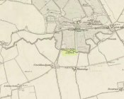
Swithins Well on 1854 map

Highlighted in the fields on the south-side of Rothwell village on the 1854 OS-map, Swithin’s Well was, according to historian Andrea Smith (1982), previously known as a holy well, dedicated to the obscure Saxon saint of the same name.  Although no ‘well’ relating to St Swithin comes from any early texts, the field and farmhouse of ‘Swithins’ were cited in records from the Cartulary of Nostell Priory in 1270 CE; then subsequently in a variety of records throughout the 14th, 15th and 16th centuries.  According to Miss Smith (1982),

“The first recording of St Swithin’s Well, Rothwell…was on an estate map of 1792 (‘Plan of St. Clement’s lands in the parish of Rothwell in the County of York, two-third part of the tithes of corn and grain of which belong to the King in right of His Ducky of Lancaster’, PB), and the field-names arising from it—Swithin’s, Swithin’s Barn, Swithin’s Lane Close—serve to give an indication of the well’s past importance as a local landmark.”

When she visited the site around 1980, she reported finding,

“several wet patches running in a line westwards downhill, but the farmer’s wife seemed certain that this was a broken drain and nothing else could be seen in that field or neighbouring ones, which could have been the well.”

Very recently, the Wakefield pagan and antiquarian Steve Jones went to see if the well or any remains of it could still be seen and told us:

“We went looking for the well down a footpath but it was obviously filled in when a colliery was nearby in the early 20th century and (there is) no trace of any spring now.”

Another one’s bitten the dust, as they say…..

But we must note that the grand place-name authority, A.H. Smith (1962) found no references to St. Swithin here and instead suggested the name derived from the old Norse word, sviðinn, ‘land cleared by burning’, which is echoed in the old local dialect word swithen, ‘moorland cleared by burning’ (Smith 1956), and similarly echoed in Joseph Wright’s (1905) magnum opus, where—along with meaning ‘crooked, warped’—it means “to burn, superficially, as heather, wool, etc.”   There is also a complete lack of any mention to the saintly aspects of this place in John Batty’s (1877) primary history book on Rothwell parish, and yet he cites numerous other springs and wells in the region that have fallen out of history.

References:

  1. Batty, John, The History of Rothwell, privately printed: Rothwell 1877.
  2. Jones, Steve, Personal communication, Facebook 27.08.2018.
  3. Rattue, James, “The Wells of St Swithun,” in Source, Summer 1995.
  4. Smith, Andrea, “Holy Wells Around Leeds, Bradford & Pontefract,” in Wakefield Historical Journal 9, 1982.
  5. Smith, A.H., The Place-Names of the West Riding of Yorkshire – volume 2, Cambridge University Press 1961.
  6. Smith, A.H., English Place-Name Elements – volume 2, Cambridge University Press 1956.
  7. Wright, Joseph, English Dialect Dictionary – volume 5, Henry Frowde: Oxford 1905.

Acknowledgements:  Many thanks to Steve Jones of Wakefield for his informing us about the status of this site.

© Paul BennettThe Northern Antiquarian


Lady Well, Airth, Stirlingshire

Holy Well (destroyed):  OS Grid Reference – NS 89801 86524

Also Known as:

  1. Canmore ID 46862
  2. Lady’s Well
  3. Spaw Well

Archaeology & History

Site of the Lady Well, Airth

Once to be seen flowing on the south-side of the Pow Burn below Airth Castle, all traces of this once sacred site has fallen prey to the usual advance of the so-called ‘civilized’.  In literary terms, the site was first described in church records from 1657—as Ladieswell—and the accounts we have of the place from then are most revealing in describing the traditional use of the place by local people.  It was a sacred site, obviously, chastised by the madness of the christian regime of the period, in their attempt to destroy indigenous customs and societal norms.  William Hone (1837) gave an extended account of what some people were up to here in his Everyday Book:

“In 1657, a mob of parishioners were summoned to the session, for believing in the powers of the well of Airth, a village about six miles north of Falkirk, on the banks of the Forth, and the whole were sentenced to be publicly rebuked for the sin. –

“”Feb. 3, 1757, Session convenit. Compeared Bessie Thomson, who declairit scho went to the well at Airth, and that schoe left money thairat, and after the can was fillat with water, they keepit it from touching the ground till they cam horm.”

“”Ffebruary 24. — Compeired Robert Fuird who declared he went to the well of Airth, and spoke nothing als he went, and that Margrat Walker went with him, and schoe said ye beleif about the well, and left money and ane napkin at the well, and all was done at her injunction.”

“”Compeared Bessie Thomson declarit schoe fetch it horn water from the said well and luit it not touch the ground in homcoming, spoke not as sha went, said the beleif at it, left money and ane nap-kin thair; and all was done at Margrat Walker’s command.”

“”Compeired Margrat Walker who denyit yat scho was at yat well befoir and yat scho gave any directions ”

“”March 10. Compeared Margrat Forsyth being demand it if scho went to the well of Airth, to fetch water thairfrom, spok not by ye waye, luit it not touch ye ground in homcoming? if scho said ye belief? left money and ane napkin at it? Answered affirmatively in every poynt, and yat Nans Brugh directit yem, and yat they had bread at ye well, with them, and yat Nans Burg said shoe wald not be affrayit to goe to yat well at midnight hir alon.”

“”Compeired Nans Burg, denyit yat ever scho had bein at yat well befoir.”

“”Compeired Robert Squir confest he went to yat well at Airth, fetchit hom water untouching ye ground, left money and said ye beleif at it.”

“”March 17. Compeired Robert Cochran, declairit, he went to the well at Airth and ane other well, bot did neither say ye beleif, nor leave money.”

“”Compeired Grissal Hutchin, declairit scho commandit the lasses yat went to yat well, say ye beleif, but dischargit hir dochter.”

“”March 21. Compeired Robert Ffuird who declairit yat Margrat Walker went to ye well of Airth to fetch water to Robert Cowie, and when schoe com thair, scho laid down money in Gods name, and ane napkin in Robert Cowie’s name.”

“”Compeired Jonet Robison who declairit yat when scho was seik, Jean Mathieson com to hir and told hir, that the water of the well of Airth was guid for seik people, and yat the said Jean hir guid sister desyrit hir fetch sum of it to hir guid man as he was seik, bot sho durst never tell him.”

“”These people were all 44 publicly admonishit for superstitious carriage.””

The practices continued.  In 1723, a Mr Johnstoun of Kirkland, writing about the parish of Airth, also told of the reputation of the well, saying,

“Upon the south side of the Pow of Airth, upon its very edge, is a spaw well famous in old times for severall cures, and at this day severalls gets good by it, either by drinking or bathing. Its commonly called by the name of Ladies well. Its about two pair of butts below Abbytown bridge.”

The fact that he told us it was “good for bathing” suggests a pool was adjacent, or at least the tiny tributary between it and the Pow Burn gave room for bathing and had a curative reputation. (there are many pools in the Scottish mountains with this repute – some are still used to this day!)

It was then described by Robert Ure in the first Statistical Account of 1792, where he told how the people were still using the waters, despite the crazy early attempts to stop them.  “There is a Well, near Abbeytown Bridge,” he told,

“called Lady-Well, which is thought to be medicinal.  Numbers have used it, and still use it as such.  It is supposed to have obtained that name, from the holy water, in the time of Popery, being taken from it, to supply the abbacy, or Catholic Church, then at Airth.”

Lady Well on 1865 map

But we know that its origins as a celebrated well pre-date any christian overlay.  People were reported visiting the site from as far away as Edinburgh, such was its repute!

Much later when the Ordnance Survey lads came here, showing it on their first map of Airth, they made their own notes of the place, saying briefly,

“A small well close to the Pow Burn – it is supposed to have derived its name from the Custom of dedicating wells to the Virgin Mary – so Common prior to the Reformation. It is not a mineral well.”

Ugly plastic pipe is all that remains

But its demise was coming.  In the wake of the christian Industrialists and their myth, subsuming the necessary integral sacrality of the Earth, the waters of the well were eventually covered.  When the Royal Commission (1963) lads gave the site their attention in October 1954, they reported that “no structural remains” of any form could be seen here, and in recent years all trace of the well has vanished completely.  When we visited the site a few months ago, perhaps the very last remnant of it was a small plastic pipe sticking out of the muddy bankside, dripping dirty water into the equally dirty Pow Burn.

It would be good if local people could at least put a plaque hereby to remind people of the history and heritage that was once so integral to the way they lived their lives.

References:

  1. Bennett, Paul, Ancient and Holy Wells of Stirling, TNA 2018.
  2. Fraser, Alexander, Northern Folk-lore on Wells and Water, Advertiser Office: Invermess 1878.
  3. Frost, Thomas, “Saints and Holy Wells,” in Bygone Church Life in Scotland (W. Andrews: Hull 1899).
  4. Hone, William, The Every-day Book – volume 2, Thomas Tegg: London 1837.
  5. MacFarlane, Walter, Geographical Collections Relating to Scotland – volume 1, Edinburgh Universoty Press 1906.
  6. MacKinlay, James M., Folklore of Scottish Lochs and Springs, William Hodge: Glasgow 1893.
  7. Morris, Ruth & Frank, Scottish Healing Wells, Alethea: Sandy 1982.
  8. Murray, G.L., Records of Falkirk Parish – volume 1, Duncan & Murray, Falkirk 1887.
  9. Reid, John, The Place-Names of Falkirk and East Stirlingshire, Falkirk Local History Society 2009.
  10. Royal Commission on the Ancient & Historical Monuments Scotland, Stirling – volume 2, HMSO: Edinburgh 1963.

© Paul BennettThe Northern Antiquarian


Gilfeilzie Well, Alyth, Perthshire

Sacred Well (destroyed):  OS Grid Reference – NO 2675 5071

Also Known as:

  1. Well of Gilfeilzie

Archaeology & History

Long lost, this was a sacred well whose history has all but fallen away.  Were it not for the historian James Meikle (1925), whose excellent survey of Alyth parish cites a record and brief narrative of the site, we’d no longer know it ever existed.

It was located 1¾ miles northeast of Alyth, roughly halfway between the giant and mightily impressive Barry Hill hillfort (NO 2623 5039) and the lost stone circle of Hell Hole (NO 2801 5066).  It is the name of the Well itself that invited scrutiny in Meikle’s place-name book which, he told, meant a hut, but also a “cell, shrine in a temple,” or “at the church.”  No church has ever been recorded here, although a small hamlet was in the adjacent field to the west—long since cleansed by the English in the genocide known as The Clearances.  The well was shown and named on an 18th century estate map by William Panton in 1772, as Meikle told us,

“near the south bank of the Slatenty Burn, known there are the Burn of Babylon.  The well is now drained, but it was evidently within what is the first cultivated field east of the heath-covered skirts of Barry Hill, and 40 or 50 yards from its north-east corner.  Above the well and above the old loan from Inverqueich, and mostly within the same field, were half a dozen scattered cottages, with a kiln…; and as baptisms in 1649 tend to show that there were more houses than one in Gilfeilzie, the whole group must have been so named.”

When Paul Hornby and I visited the place yesterday, we could find no trace whatsoever of the well.

References:

  1. Meikle, James, Places and Place-Names round Alyth, Alex Gardner: Paisley 1925.

© Paul BennettThe Northern Antiquarian


Machar Stones, Fintry, Stirlingshire

Standing Stones:  OS Grid Reference – NS 65705 83932

Also Known as:

  1. Canmore ID 45311
  2. Waterhead Stones

Getting Here

The Machar Stones

The Machar Stones

Of the 2 ways to reach here: one via the Crow Road, up to Waterhead Farm and then meandering through the forest—we took the other one!  From the car park at the western end of Carron Reservoir, take the track into the forest. Stick to the track closest to the loch until, after crossing the small river bridge, veer right at the next junction 200 yards on.  Another 600 yards (0.5km) along, take the right turn and walk all along this track to the very end.  From here, take your feet down into the opening along the small burn and stick to this gap in the trees for 100 yards or so, where the gap in the trees veers left.  Keep walking for another 200 yards.

Archaeology & History

These stones might take some finding, but they’re worth the effort if you like your megaliths.  When Nina, Paul and I visited them yesterday, the meander turned into what have become known as Barmy Bennett Bimbles as we ventured off-path and into the forest, wading through marshland and getting our eyes poked out in the dense trees!  And then the snow came. Twas gorgeous to be honest…
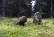
Machar Stones, looking SE
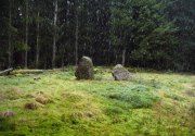
Machar Stones, looking SE

Machar Stones, looking west

Machar Stones, looking west

Probably neolithic in origin, the Machar Stones are set upon an elevated rise above the confluence of the Bin Burn and the River Carron on what seems to be an enhanced artificial platform, akin to those which some stone circles and ring cairns are mounted upon. Around the edges of the stones themselves, the earth has been dug into at some point in the past, as evidenced by the distinct oval dip in the ground surrounding the stones; although I can find no antiquarian accounts describing such a dig.  There is the possibility that these stones may once have marked the site of a prehistoric tomb.

Once you walk ten yards away from the stones in any direction, you begin to walk downhill.  Sadly the trees presently obscure any view from the stones, completely silencing the panorama that quite intentionally awoke from here in centuries gone by, disabling any immediate visual landscape analysis or geomancy.  The proximity of the two rivers was probably relevant in the construction of the stones; as may be the ridge between the Little and Meikle Bin to the southeast.

First described in Nimmo’s Stirlingshire (1817) as “a druidical remain…in the parish of Fintry, about the middle of the moor towards Campsie and northwest of the Meikle Bin”, another early account of these megaliths was in H.G. Smith’s (1896) work on the parish of Strathendrick, before the imposition of the modern ‘forest’ occurred and the views from the stones were unrestricted.  After describing their geographical position, he told:

“On a comparatively level part of the muirland between the two rivers and under Meikle Bin, there are two old standing stones known locally as the Machar Stones, this name being derived from the Gaelic magh, a plain.  The more northerly stones measures 8 feet in height, and the other is 5 feet 7 inches high.  Little…is known of the origin of these standing stones… They were apparently in some way connected with the religious worship of the prehistoric inhabitants of the land.  The general uniform direction in which they point, which is to the north of east, looking as nearly as possible to the quarter of sunrise at the summer solstice, seems to point to their having been erected by a race of sun worshippers.”

Machar Stones, looking NW

Machar Stones, looking NW

Around the same time, A.F. Hutchison (1893) gave a lecture on these and other Stirlingshire megaliths, giving slight variants on the heights of the monoliths, adding that “the two stones are standing in a line pointing to 220°.”  Sadly, even the great authorities of Aubrey Burl (1993) and Alexander Thom (1990), in their respective tomes on the subject, were unable to define any astronomical alignments here.  Hutchison puzzled about the seeming artificiality of the platform upon which the stones appear to have been set, though wrote how “geological authority pronounces it to be a quite natural formation.”

As to the name of the site, William Grant (1963) ascribes the word ‘Machar’ and its variants to mean “a stretch of low-lying land adjacent to the sand” or “low-lying fertile plain”—which doesn’t seem relevant here, unless it was so named by people living on the higher grounds.  It seems odd… As does the alignment of the stones.  When Nina Harris stood between the stones with a compass to work out the cardinal points, the stone that was leaning was due north of the upright stone.  When she walked several yards away from them, the compass deviated and we were given a more northeast-southwest alignment from stone to stone.  This isn’t too unusual as we find similar magnetic anomalies at other megalithic sites in Britain (see Devereux 1989), due to a variety of geophysical ingredients.
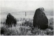
Royal Commission 1954 photo

Royal Commission 1954 photo

Not that your bog standard archaeo-tomes ever mention magnetic anomalies, as basic physics is too complex a subject for your standard archaeo-types!  Instead however, we just get the usual measurements and data-sets, much as the Royal Commission (1963) lads gave us after their visit here in 1954—but at least there was no forest when they came here!  They were fortunate.  “These two stones,” they told us,

“stand on a slight eminence in open moorland, half a mile ENE of Waterhead farmhouse and at an elevation of 850ft… Described by Nimmo’s editor as “a Druidical remain”, they have also been nown as the Machar Stones.  The more northerly stone, a four-sided pillar of irregular section, has fallen almost prostrate and its whole length, 7ft 6in, is revealed.  At the centre it measures 3ft in width by 2ft 6in in breadth.  The other stone stands 4ft 6in further S.  It is a slab…standing to a height of 5ft and measuring about 2ft in thickness.  Its width is 2ft 8in at ground level, 3ft 8in at a point 2ft above this, and 2ft at the top.”

They posit the idea that the reason the taller stone is leaning at such an angle was due to there being a prehistoric cist nearby which had been ‘excavated’ by peoples unknown, who then took it upon themselves to explore the Machar Stones with similar venture.
The 'cup-marked' stone

The ‘cup-marked’ stone

In recent years it has been said that there are cup-markings on the leaning stone, seven of them apparently.  When we visited yesterday they were difficult to make out.  There were a number of ‘cups’ on the stone, but these were debatable and seemed more the result of conglomerate disintegration than man-made.  A couple of them were perhaps ‘possibles’.  However, the light was poor and I’d prefer another visit before making my mind up!

The Machar Stones are quite evocative megaliths, despite their lack of grandeur.  Maybe it was the snow.  Maybe it was the trees.  Maybe it was me.  Or probably a mix of all three and more; but this had a real feel to the place.  Well hidden, miles from human touch or visits, awaiting just the occasional visitor—and in this weather (of floods, downpours, cold and snow) saturated humans would be the only sorts of crazy people whose spirits would risk getting completely lost to find them.  And my god were they worth the effort!  Paul, Nina and I thought so anyway!

References:

  1. Burl, Aubrey, From Carnac to Callanish, Yale University Press 1993.
  2. Devereux, Paul, Places of Power, Blandford: London 1990.
  3. Feachem, Richard, Guide to Prehistoric Scotland, Batsford: London 1977.
  4. Grant, William (ed.), Scottish National Dictionary – volume 6, SNDA: Edinburgh 1963.
  5. Hutchison, A.F., “The Standing Stones of Stirling District,” in The Stirling Antiquary, volume 1, 1893.
  6. Nimmo. William, History of Stirlingshire, Andrew Bean: Stirling 1817.
  7. Royal Commission on the Ancient & Historical Monuments Scotland, Stirlingshire – volume 1, HMSO: Edinburgh 1963.
  8. Royal Commission on the Ancient & Historical Monuments of Scotland, Archaeological Sites and Monuments of Stirling District, Central Region, Society of Antiquaries of Scotland 1979.
  9. Smith, H. Guthrie, Strathendrick and its Inhabitants from Early Times, James Maclehose: Glasgow 1896.
  10. Thom, A., Thom, A.S. & Burl, Aubrey, Stone Rows and Standing Stones – 2 volumes, BAR: Oxford 1990.

Acknowledgements:  Huge thanks to Nina Harris and Paul Hornby for their endurance and endeavor in locating these great old stones, in attendance with the great rain, snow and deep muddy bogs!

© Paul BennettThe Northern Antiquarian


Tod’s Well, Comiston, Edinburgh, Midlothian

Healing Well (destroyed):  OS Grid Reference – NT 239 692

Also Known as:

  1. Three Foxes Well

Archaeology & History

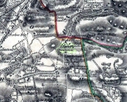
Springs at Comiston, 1632 map

Springs at Comiston, 1832 map

A renowned site of once clear running water, the Tod’s Well got its name from being the abode of foxes many centuries ago.  It was one of the five well-known ‘Comiston Springs’ as they were known—each dedicated to a certain animal—but the eternally present water in this venerable landscape was corrupted from Nature’s course by the usual Industrialists as early as 1681, so as to feed the polluting edifice of Edinburgh city.  James Colston (1890) told how,

“The Town Council entered into a contract with a Dutchman, named Peter Bruschi (aka Peter Brauss) for the sum of £2,900, “to bring the water of Tod’s Well (Anglice fox) at Comiston to Edinburgh, in a leaden-pipe of a three-inch bore, to be laid one foot deep in the ground.””

When the local council upgraded the water supplies in 1820, this piping was replaced to feed the ever-needy merchants and marketeers.  In Hope & Telford’s (1813) survey, the water from here was described as “constantly pure” and “excellent.”

References:

  1. Bennett, Paul, Ancient and Holy Wells of Edinburgh, TNA: Alva 2017.
  2. Colston, James, The Edinburgh and District Water Supply, Edinburgh 1890.
  3. Harris, Stuart, The Place-Names of Edinburgh: Their Origins and History, Gordon Wright: Edinburgh 1996.
  4. Hope, Thomas C. & Telford, Thomas, Reports on the Means of Improving the Supply of Water for the City of Edinburgh, A. Constable: Edinburgh 1813.

© Paul BennettThe Northern Antiquarian


Harlaw Stones, Balerno, Midlothian

Standing Stones (destroyed):  OS Grid Reference – c. NT 178 655

Archaeology & History

We are uncertain about the nature and form of what was once known to be “a group of five standing stones” near the destroyed giant cairn of Harlaw, west of Balerno (which was probably built near the old trig-point at NT 1783 6594).  This cluster of standing stones may have been the remains of a stone circle or a possible megalithic stone row, and it’s even been postulated as a line of possible boundary stones—but this is most unlikely.

The only known reference of the site comes from the New Statistical Account in 1845 which told:

“About a quarter of a mile to the south of the large cairn were five very tall and large stones set perpendicularly in the Earth.”

They were destroyed around the same time as the cairn in the early 1800s. Until we find further information, its exact status remains unknown. (Kaledon Naddair – are you out there?)

References:

  1. Baldwin, John & Drummond, Peter, Pentland Place-Names, FotP: Edinburgh 2011.
  2. Dixon, Norman, The Place-Names of Midlothian, University of Edinburgh 1947.
  3. Harris, Stuart, The Place-Names of Edinburgh: Their Origins and History, Gordon Wright: Edinburgh 1996.
  4. McLean, Adam, The Standing Stones of the Lothians, Megalithic Research Publications: Edinburgh no date (c.1978).

© Paul BennettThe Northern Antiquarian


Bell Stane, Queensferry, Midlothian

Legendary Stone (destroyed):  OS Grid Reference – NT 1292 7840

Bell Stane on 1896 map

Bell Stane on 1896 map

Archaeology & History

An intriguing site that needs adding to the Northern Antiquarian due to the foraging research of the Edinburgh historian Stuart Harris (1996).  Although the Bell Stane has been ascribed by the Canmore researchers to be just,

“a stone near the Mercat Cross on which the hand bell was set (rung to herald the opening of the weekly market or annual fair),”

Mr Harris dug deeper and found other references which led him to think that the site was “a conspicuous boulder or standing stone.”  I have to agree with him.  In his outstanding work on the historical place-names of Edinburgh and district, Harris wrote:

“The Bellstane…is noted on Ordnance Survey 1854 as the name of an object just outwith the burgh boundary and in the southwest corner of the little square that now bears the name.  Whilst it has been surmised that it was a stone named for a handbell rung beside it on market days, in point of fact a burgh council meeting of 1642 (quoted in Morison’s Queensferry, p.131) records that a piece of ground hitherto waste and unused, within the burgh but near the bellstane, was to be set aside for markets and fairs in times coming; and the clear inference is that the name belonged to the stone before any markets were held near it.  In absence of a reliable description of the stone or of early forms of its name, the origin of the name can only be guessed at.  Similar names (of sites) in Kirknewton and Whitburn are no better documented, but the early forms of Belstane in Lanarkshire (BellitstaneBellistaneBelstane and Bellstane prior to 1329 and Beldstanein 1452) suggest that its first part may be Anglian ballede or early Scots bellit (from a Celtic root, ball, white), making the name ‘the stone with a white or pale patch or stripe on it’ — such as one with a band of quartz running through it.  A conspicuous boulder or standing stone of this sort on this spur of higher ground above the shore would have been a useful meith or landing mark for boats making for the narrow landing place at the Binks.”

If anyone uncovers additional evidence about this Bell Stane that can affirm it as a standing stone (or otherwise), we will amend its status.

References:

  1. Harris, Stuart, The Place-Names of Edinburgh: Their Origins and History, Gordon Wright: Edinburgh 1996.
  2. Morison, Alexander, Historical Notes on the Ancient and Royal Burgh of Queensferry, West Lothian Courier: Bathgate 1927.
  3. Orrock, Thomas, Fortha’s Lyrics and other Poems, privately printed: Edinburgh 1880.

© Paul Bennett,  The Northern Antiquarian 2016

Adam’s Well, Colinton, Edinburgh, Midlothian

Healing Well:  OS Grid Reference – NT 225 691

Archaeology & History

Unlike the Adam’s Well in Kent, deep daan saaaf, this northern site of the same name is not only long lost, but we can find no traditions relating it either—something of an oddity for these northern climes.  It could once be found in the open meadows east of Colinton, near where now the Redford Barracks exist and was a puzzle to the regional historian Stuart Harris (1996), who could find no early accounts of the site.  Although its name may relate to a local man called Adam, there are other examples of wells with this name from Kent to Scotland: the Kent example is deemed as an authentic holy well, whilst examples in Yorkshire and those in southern Scotland relate to the waters themselves being known as ‘Adam’s Ale’ or Adam’s Wine’—an old nickname for water itself!

References:

  1. Bennett, Paul, Ancient and Holy Wells of Edinburgh, TNA: Alva 2017.
  2. Harris, Stuart, The Place-Names of Edinburgh: Their Origins and History, Gordon Wright: Edinburgh 1996.

© Paul BennettThe Northern Antiquarian


Orwell, Milnathort, Kinross

Standing Stones:  OS Grid Reference – NO 1494 0432

Also Known as:

  1. Canmore ID 27912
  2. Mawcloych

Getting Here

The Orwell standing stones

The Orwell standing stones

Drive from Milnathort SE down the A911 road towards Balgedie and Scotlandwell.  About a mile out of the village, keep your eyes peeled on the farmed fields on your left.  You’ll notice the standing stones a few hundred yards ahead and, if you, see them in time, will be able to park up by the track on your left a coupla hundred yards before Orwell Farm. Ensure you visit this site between October and March – otherwise the fields are in full crop.

Archaeology & History

Stones marked on the 1857 map

Stones marked on the 1857 map

These are impressive standing stones by anybody’s standards.  Although we have two impressive uprights today on the highest point in the potato fields, in the 19th century the place-name writer Liddall (1896) told that “in this district are still three large pillar stones known as the Standing Stones of Orwell.” (my italics)  Their existence was recorded, he said, in early topographical accounts in an obsolete place-name Mawcloych, or “place of the stones.”  But if there were three standing stones here, they must have stood prior to the article written by the pseudonymous “W.H.”, who described them in the October edition of The Scottish Journal in 1847, saying:

“About half-a-mile above the old (Orwell) churchyard, in a field by the roadside, are two large upright stones, known as “the Standing Stones of Orwell.”  They are placed east and west of each other about fifteen yards apart—that to the west is flat, and about six feet in height—the one to the east is of a round form, tapering slightly to the ground, and stands nine feet high.  The latter, although still of considerable size, has lost somewhat of its circumference within the last ten years, and, at the present moment, there is a large crack down one side, which, by the action of the weather, will lead to a further diminution of its bulk. It has not been ascertained to what depth these stones are embedded in the earth, but it must be considerable, in order to retain them in the position they occupy.

“The common belief is, that these stones are of Danish origin, erected in commemoration of a victory, or to mark the spot where those who had fallen in battle were interred. This supposition is so far countenanced by the fact that a stone coffin, of large size, was found on digging up the space between the stones. Similar coffins have also been turned up in the same field, and, ten or twelve years ago, the ground was dug up in several places by a neighbouring proprietor, when large quantities of bones, much decomposed and mixed with charcoal, were discovered.”

Fred Coles 1906 ground-plan

Fred Coles 1906 ground-plan

Orwell Stones, looking north

Orwell Stones, looking north

This early description telling of the poor condition of one of the stones presaged its eventual fall in the late 1960s; but this thankfully led to an archaeological evaluation which gave us more information about the site.  Before this however, the great northern antiquarian Fred Coles (1906) visited the stones in August 1904, describing them with his usual meritorious detail, telling:

“They stand on a very gently rising ground, the space between them and for some distance to the south being somewhat higher than the surrounding field.  In ground plan they are related as shown (attached).  The east stone is the higher, standing 9 feet 8 inches clear of theground, smooth-sided and hexagonal. At the base its girth is 9 feet 9 inches, swelling up at the 5-foot level into 10 feet 8 inches. The West Stone, very rugged and angular, is 7 feet 5 inches in height, girths at the base 11 feet 1 inch, and at about 3 feet upwards, 10 feet 5 inches, its broadest side facing the East Stone. Both are of whinstone. The shortest distance between the two Stones is in a line nearly north-west, and measures 46 feet 10 inches.

“Mr R. Kilgour, one of the oldest residents of Kinross, showed me a fine partially flattened oval pebble of dark reddish quartzite, measuring 5 inches by 2⅞ inches, which he found in the ground between these two Stones. The abrasion at each end clearly shows that this pebble has been used as a pounder.

“In a book which to some extent deals with local antiquities, occurs the following passage with reference to these two Standing Stones: ‘In the same field stone coffins have occasionally been turned up by the plough; and, about the beginning of the 19th century, the ground was in many places dug up by the neighbouring proprietor, when quantities of bones much decomposed and mixed with charcoal were discovered.’”

But after the west stone fell down, J.N.G. Ritchie (1972) and his team turned up to resurrect it—and also check out what might be underneath it.  His initial notes of the findings were published in Discovery & Excavation Scotland, which said:

“Excavation at the bases of these two standing stones…was undertaken prior to the re-erection of the W stone and to the embedding of both stones in cement.  The original position of the fallen stone could be detected only as a slight hollow in the natural gravel, but as this corresponded with the position of the stone on Coles’ plan…the stone could be re-positioned comparatively accurately.

“A cremation deposit was found in an insubstantial stone setting in a scoop in the natural gravel some 0.5m S of the stone.  The E stone, which is an impressive whinstone 3.8m in total height, had been set up in a hole 1.5m x 1.4m and 0.75m in depth.  Within the pit on the SW side of the stone there was an unusual two-storeyed cremation deposit; the lower cremation was contained within a rough setting of stones with one side formed by the standing stone itself, and was covered by a flat slab.  On this slab and again surrounded by a setting of small stones was the upper cremation.  It seems most likely that these were inserted into the stone hole at the time of the erection of the stone. Another cremation was found at the lip of the stone hole on the SE side.  The discovery of cists and cremation patches in the same field in the early 19th century suggests that the stones have acted as a focus for such burials.”

The southeasterly stone

The southeasterly stone

The northwesterly stone

The northwesterly stone

Ritchie (1982) later wrote how they had found “burnt dog and pig bones with the lower cremation deposit,” implying “rituals” at the site.  He even posited how such deposits at standing stones “may have a bearing on their postulated use  as astonomical markers,” although Alexander Thom’s (1990) exploration of the Orwell stones indicated no archaeoastronomy here.  So it seems very obvious that these giant monoliths were markers for a neolithic and/or Bronze Age cemetery or necropolis in prehistoric times.  Aubrey Burl (1993) defined the stones here as having “an Irish setting, with the east emphasized, as alway, by the taller stone.”

Fred Coles' 1906 drawing

Fred Coles’ 1906 drawing

Unmentioned by the archaeologists in all of the references I have at hand, is the probable relationship the Orwell stones had with the rising background of the Lomond Hills to the east, with its archaic legends of cailleach, neolithic tomb creations and other geomantic indicators.  These elements (and more) need to be explored more diligently by forthcoming students.  It’s a remarkable setting as far as I’m concerned!

References:

  1. Burl, Aubrey, “Pi in the Sky”, in Douglas C. Heggie’s Archaeoastronomy in the Old World, Cambridge University Press 1982.
  2. Burl, Aubrey, From Carnac to Callanish, Yale University Press 1993.
  3. Coles, Fred, “Notices of Standing Stones, Cists and Hitherto Unrecorded Cup-and-Ring Marks in Various Localities,” in Proceedings of the Society of Antiquaries, Scotland, volume 40, Edinburgh 1906.
  4. Day, J.P., Clackmannan and Kinross, Cambridge University Press 1915.
  5. Feacham, Richard, Guide to Prehistoric Scotland, Batsford: London 1977.
  6. Jack, James W., Glenfarg and District – Past and Present, Miller & Smail: Perth 1903.
  7. Liddall, W.J.N., The Place Names of Fife and Kinross, William Green: Edinburgh 1896.
  8. Ritchie, J.N.G.,”Orwell Standing Stones,” in Discovery & Excavation in Scotland, 1972.
  9. Ritchie, J.N.G., “Archaeology and Astronomy: An Archaeological View”, in Douglas C. Heggie’s Archaeoastronomy in the Old World, Cambridge University Press 1982.
  10. Royal Commission on the Ancient & Historical Monuments of Scotland, Fife, Kinross and Clackmannan, HMSO: Edinburgh 1933.
  11. Simpkins, John Ewart, County Folklore – volume VII: Examples of Printed Folk-Lore Concerning Fife, with some Notes on Clackmannan and Kinross-Shires, Folk-Lore Society: London 1914.
  12. Thom, A., Thom, A.S. & Burl, Aubrey, Stone Rows and Standing Stones – volume 2, BAR: Oxford 1990.
  13. “W.H.”, “A Ramble in Kinross-shire,” in The Scottish Journal of Topography, Antiquities, Traditions, volume 1, 1848.

© Paul BennettThe Northern Antiquarian