Allt a’ Choire Chireinich, Kenmore, Perthshire

Cup-and-Ring Stone:  OS Grid Reference – NN 65096 39442  —  NEW FIND

Getting Here

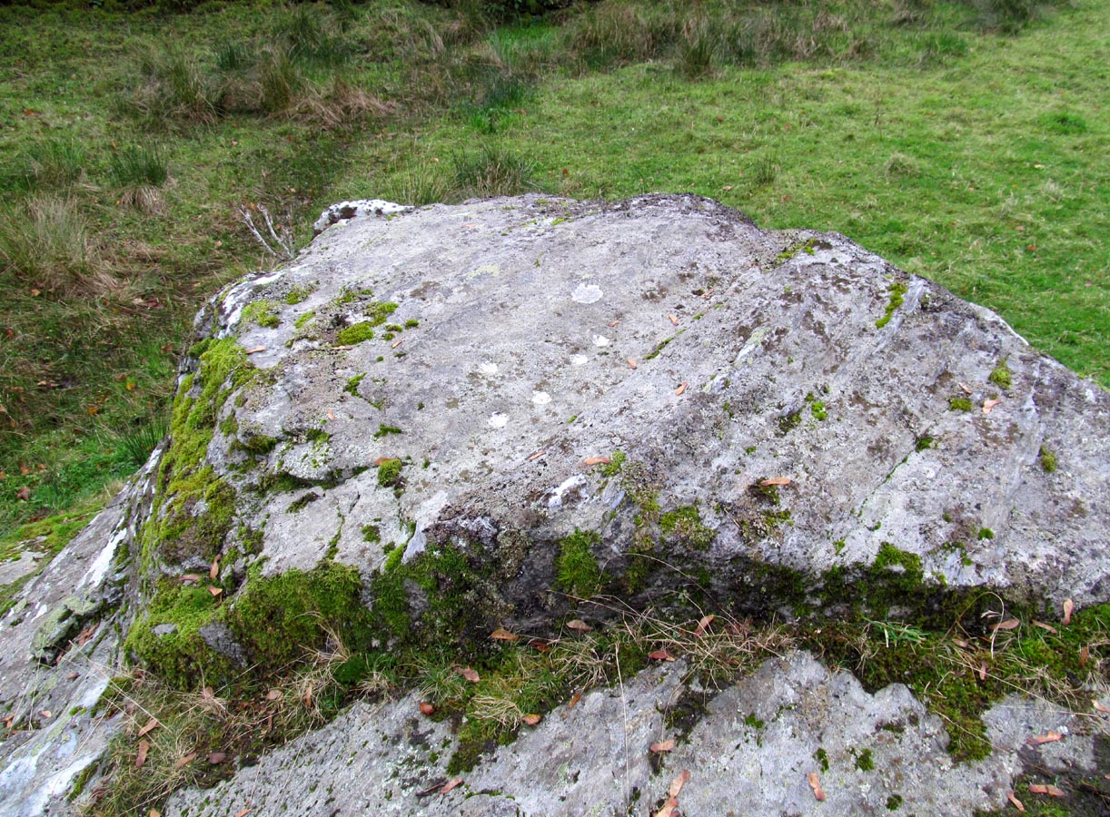
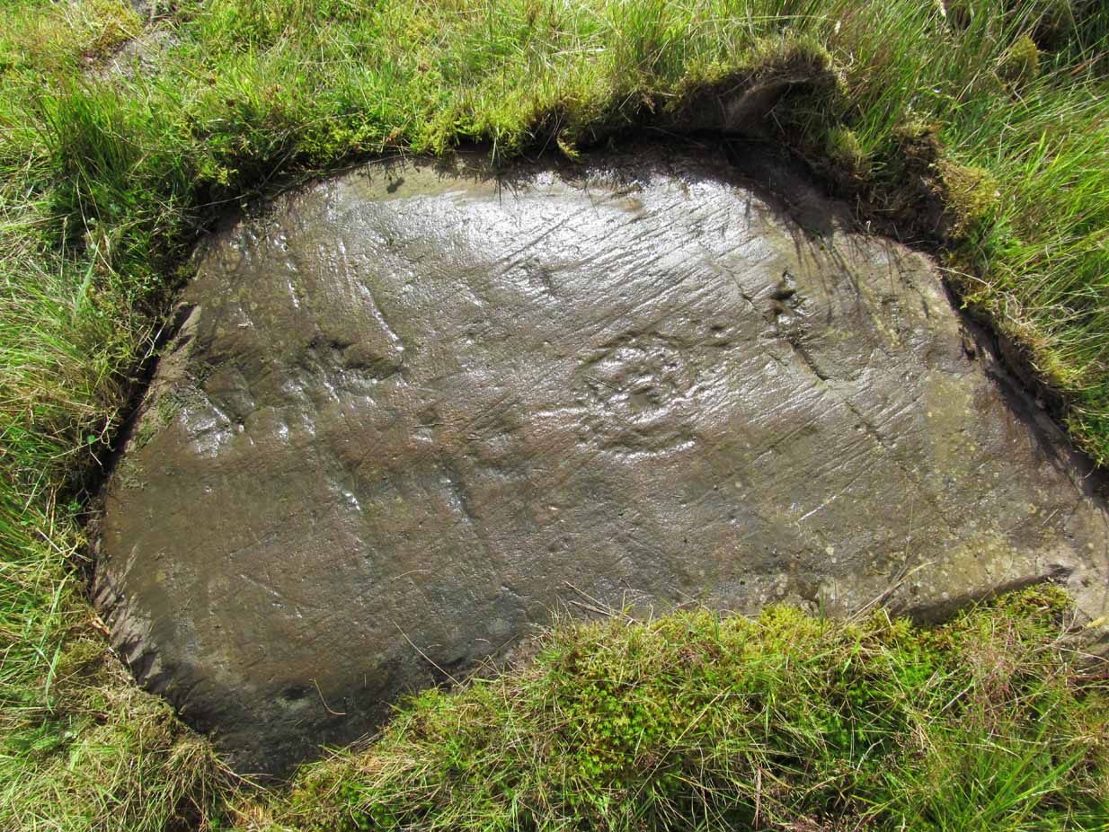
The stone, uncovered

The stone, uncovered

Take the A827 road between Killin and Kenmore and park-up at the entrance to Tombreck. Cross the road and walk up the track that goes up Ben Lawers.  As it zigzags uphill, watch out for you being level with the top of the copse of trees several hundred yards west, where a straight long overgrown line of walling runs all the way to the top of the copse. Go along here, and just as you reach the trees, walk uphill for about 50 yards.  You’re damn close!

Archaeology & History

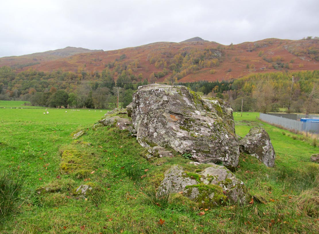
Whether you’re into prehistoric carvings or not, this is impressive!  It’s one of several with a very similar multiple-ring design to be found along the southern mountain slopes of Ben Lawers.  Rediscovered on May 13, 2015, several of us were in search of a known cup-and-ring stone just 260 yards (238m) to the northwest in this Allt a’ Choire Chireinich cluster, but one stone amongst many called my nose to have a closer sniff—and as you can see, the results were damn good!

Looking from above

Looking from above

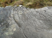
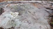
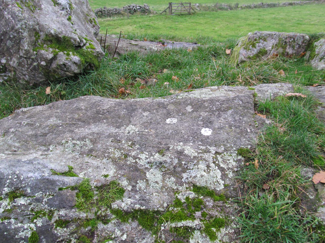
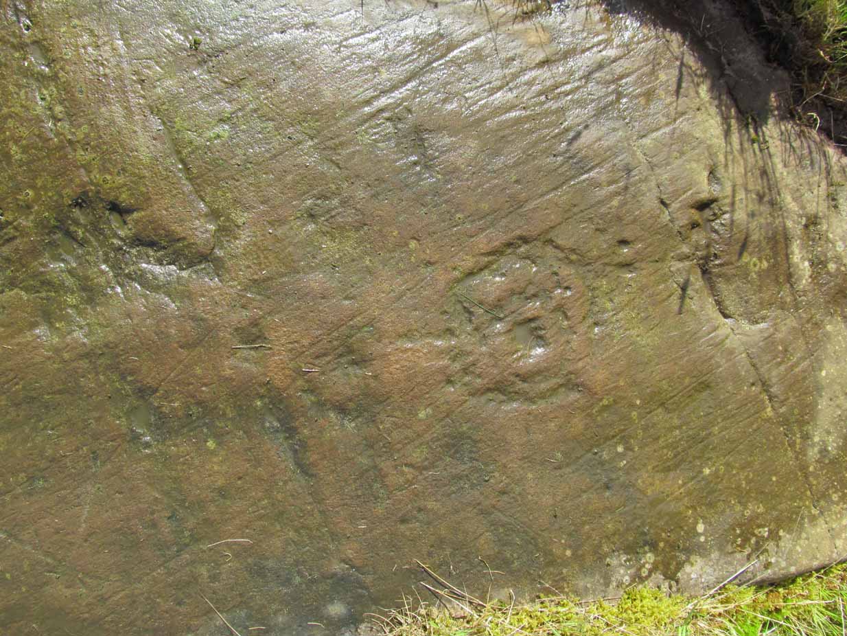
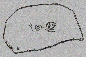
Etched onto a large flat rock perhaps 5-6000 years ago, probably over at least two different seasons, the primary design here is of two sets of multiple-rings: in one case, seven concentric ones emerging from, or surrounding a central cup-marking (more than an inch across); and the other is of at least eight concentric rings emerging from a cup-marking, about half-an-inch across. The largest cup-and-seven-rings is the one near the centre of the stone.  Initially I thought this was simply two concentric seven-rings; but the more that I looked through the many photos we’d taken, the more obvious it became that the residue of an eighth ring (possibly more) exist in the smaller-sized concentric system.  It must however be pointed out that neither of the concentric carved rings seem to be complete – i.e., they were never finished, either purposefully or otherwise.  The largest cup-and-seven-rings is the one near the centre of the stone; with the outer smaller example being half the size of the one in the middle.  At first glance, neither of the concentric rings seem complete – and so it turned out when it was enhanced by rain and sun.

First photo of the double-rings

First photo of the double-rings

The large central cup-and-seven-rings has two additional cup-marks within it: one on the outer fifth ring to the southeast, and the other in the outer sixth ring to the west.  This western cup-mark is also crossed by a carved line that runs from the first ring outwards to the west and to the edge of the rock, crossing another cup-mark along the way.  This particular carved line might be the same one that integrates itself into the first ring, and then re-emerges on is northeastern side, to continue out of the multiple-rings themselves and curve over to the eastern side of the rock.  Running roughly north-south through the middle of this larger seven-ring element, a line scarred by Nature is visible which has been pecked by humans on its northern end, only slightly, and running into the covering soil eventually, with no additional features apparent.  Another possible carved line seems in evidence running from the centre to the southeastern edge – but this is by no means certain.

The carving, looking north

The carving, looking north

This large central seven-ringed symbol has been greatly eroded, mainly on its southern sides, where the rings are incomplete, as illustrated in the photos.  Yet when the light is right, we can see almost a complete concentric system, with perhaps only the second ring from the centre being incomplete on its eastern side.  On the southern sides, the visibility factor is equally troublesome unless lighting conditions are damn good.  The northernmost curves, from west to east, are the deepest and clearest of what remains, due to that section of the stone being covered in soil when it was first discovered, lessening the erosion.

Smallest 7-ring section, with cups

Smallest 7-ring section, with cups

Multiple-ring complex & cups

Multiple-ring complex & cups

Moving onto the second, smaller concentric set of rings: this is roughly half the size of its counterpart in the middle of the stone.  Upon initial investigation you can clearly make out the seven rings, which have faded considerably due to weathering.  It seems that this section was never fully completed.  And the weathering on this smaller concentric system implies one of two things: either that it was left open to the elements much much longer than its larger seven-ring system, or it was carved much earlier than it.  In truth, my feeling on this, is the latter of the two reasons.  Adding to this probability is the fact that even more rings—or at least successive concentric carved ‘arcs’—are faintly visible around this more faint system: at least eight are evident, with perhaps as many as thirteen in all (which I think would put it in the record-books!).  But we need to visit it again under ideal lighting conditions to see whether there are any more than the definite eight.  It is also very obvious that the very edge of the rock here has been broken off at some time, and a section of the carving went with it—probably into the ancient walling below or the derelict village shielings on the mountains slopes above.

Just above the eroded eight-ring section are three archetypal cup-marks close to the very edge of the rock, one above each other in an arc.  Of these, the cup that is closest to the eight-rings possesses the faint remains of at least two other partial rings above it, elements of which may actually extend and move into the concentric rings themselves—but this is difficult to say with any certainty.  However, if this is the case, we can surmise that this small cup-and-two-rings was carved before its larger tree-ring-looking companion.

Below the smaller seven-ringer is the possibility of a wide cup-and-two-rings: very faint and incomplete.  This only seems visible in certain conditions and I’m not 100% convinced of its veracity as yet.

Curious 'eye'-like symbol

Curious ‘eye’-like symbol

'Eye' to the bottom-left

‘Eye’ to the bottom-left

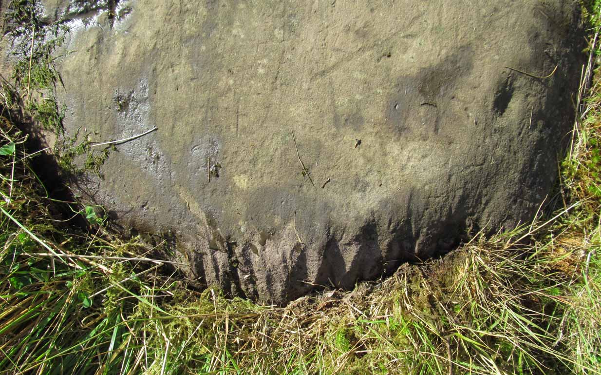
We also found several other singular cup marks inscribed on the rock, all of them beneath the two concentrics, moving closer to the edge of the rock.  But a more curious puzzle is an eye-like symbol, or geological feature, on the more eastern side of the stone.  It gives the impression of being worked very slightly by humans, but as I’m not a geologist, I’ve gotta say that until it is looked at by someone more competent than me, I aint gonna commit myself to its precise nature.  What seems to be a carved line to the left (west) of this geological ‘eye’ may have possible interference patterns pecked towards it.  Tis hard to say with any certainty.

So – what is this complex double-seven-ringer?!  What does it represent?  Sadly we have no ethnological or folklore narratives that can be attributed to the stone since The Clearances occurred.  We only have the very similar concentric six- and seven-ringed petroglyphs further down the mountainside to draw comparisons with.  We could guess that the position of the stone halfway up Ben Lawers, giving us a superb view of the mountains all around Loch Tay might have some relevance to the carving; but this area was probably forested when these carvings were etched—which throws that one out of the window!  We could speculate that the two multiple rings represent the Moon and Sun, with the smaller one being the Moon. They could represent a mythic map of Ben Lawers itself, with the central cup being its peak and outer rings coming down the levels of the mountain.  Mountains are renowned in many old cultures as, literally, cosmic centres, from whence gods and supernal deities emerge and reside; and mountains in some parts of the world have been represented by cup-and-ring designs, so we may have a correlate here at Ben Lawers.  O.G.S. Crawford (1957) and Julian Cope (1998) would be bedfellows together in their view of it being their Eye Goddess.  But it’s all just guesswork.  We do know that people were living up here and were carving other petroglyphs along this ridge, some of which occur inside ancient settlements; but the traditions of the people who lived here were finally destroyed by the English in the 19th century, and so any real hope of hearing any old myths, or possible rites that our peasant ancestors with their animistic worldview possessed, has died with them.

Tis a fascinating carving nonetheless—and one worthy of seeking out amongst the many others all along this beautiful mountainside…

References:

  1. Bernbaum, Edwin, Sacred Mountains of the World, Sierra Club: San Francisco 1990.
  2. Cope, Julian, The Modern Antiquarian, Thorsons 1998.
  3. Crawford, O.G.S., The Eye Goddess, Phoenix House: London 1957.
  4. Eliade, Mircea & Sullivan, Lawrence E., “Center of the World,” in Encyclopedia of Religion – volume 3 (edited by M. Eliade), MacMillan: Farmington Hills 1987.
  5. Evans-Wentz, W.Y., Cuchuma and Sacred Mountains, Ohio University Press 1980.
  6. Gillies, William A., In Famed Breadalbane, Munro Press: Perth 1938.
  7. Michell, John, At the Centre of the World, Thames & Hudson: London 1994.
  8. Yellowlees, Sonia, Cupmarked Stones in Strathtay, Scotland Magazine: Edinburgh 2004.

Acknowledgements:  Huge thanks to Paul Hornby for the use of his photos in this site profile; to Lisa Samson, for her landscape detective work at the site; and to Fraser Harrick, for getting us there again.

© Paul BennettThe Northern Antiquarian


Aikenhead Farm, Blairgowrie, Perthshire

Cup-and Ring Stone (destroyed):  OS Grid Reference – NO 143 430

Archaeology & History

In John MacDonald’s History of Blairgowrie (1899), he describes a number of the prehistoric sites in the neighbourhood, including the cup-marked standing stone at nearby Glenballoch. However, one petroglyph that seems to have escaped the attention of all previous surveys was, “one unearthed in 1897 at Aikenhead,” southeast of Blairgowrie.  Mr MacDonald described it as possessing “a large number” of cup markings “of various sizes.” But even in his day he reported that the carving had, “unfortunately, been destroyed.”

I can find no other references to this site.  Is anyone aware of any, or know anything more about this lost stone?

References:

  1.  MacDonald, John A.R., The History of Blairgowrie, Advertiser: Blairgowrie 1899.

© Paul BennettThe Northern Antiquarian


Glenshervie Burn, Glen Almond, Perthshire

Ring Cairn:  OS Grid Reference – NN 82614 32996

Also Known as:

  1. Canmore ID 25565
  2. River Almond

Getting Here

The ruins of Glenshervie Circle

The ruins of Glenshervie Circle

Take the dirt-track, off-road, up to the start of Glen Almond, for more than 4 miles — past the curious Conichan Ring, and past the standing stone of Clach an Tiompan, until you see the large modern walled circle in the field on your left.  Go into that field and you’ll notice a ruined pile and small standing stones 56 yards (51m) WSW.  Y’ can’t really miss it!

Archaeology & History

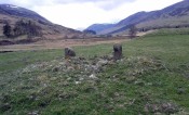
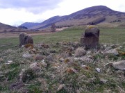
Sitting upon a flat grassland plateau close to the confluence of the Glenshervie Burn with the River Almond, the visitor here will notice an overgrown ovoid mass of old worn stones in the form of a prehistoric cairn, with two upright standing stones on the western edges of the pile.  This is the remains of what the megalithic magus Aubrey Burl (1988) called the Glenshervie “four poster” stone circle.

Glenshervie stones, looking N

Glenshervie stones, looking N

Glenshervie stones, looking W

Glenshervie stones, looking W

Structurally similar to the neighbouring four-poster of Clach an Tiompan 470 yards (427m) to the ESE, and less damaged than the remaining megaliths of Auchnafree 568 yards (520m) to the northwest, this megalithic ruin was first mentioned in passing by Audrey Henshall (1956) in her survey of the giant Clach an Tiompan tomb and its adjacent ring.  She told that,

“In meadowland beside the Almond, a small circle of standing stones, hitherto unrecorded, protrude through the water-worn material of a low cairn.  This is a similar type of monument to the ruined site at Clach na Tiompan.”

Close-up of cairn & stones

Close-up of cairn & stones

Glenshervie ruins, looking S

Glenshervie ruins, looking S

Indeed it is!  Sadly however, it remains unexcavated — so we know not what its precise nature and function may have been.  When Burl included the site in his 1988 survey, he could add nothing more than I can; but curiously described the two standing stones here as being only “about 1 ft (30cm) high.”  They’re between two and three feet tall respectively, and the remaining cairn is between 5 and 6 yards in diameter, with the central rubble rising between 1 and 2 feet above the natural ground level.

The landscape at the point where this circle was built enables you to look up and down the glens of Almond and Shervie in three different directions.  Whether or not this was deliberate, we cannot know for sure.  But the setting on the whole, in the middle of where the glen widens out and hold this and the nearby monuments, is a beautiful setting indeed…

References:

  1. Burl, Aubrey, Four Posters: Bronze Age Stone Circles of Western Europe, BAR 195: Oxford 1988.
  2. Henshall, Audrey & Stewart, M.E.C., “Excavations at Clach na Tiompan, Wester Glen Almond, Perthshire,” in Proceedings of the Society of Antiquaries, Scotland, volume 88, 1955.

© Paul BennettThe Northern Antiquarian


Lochay Woods, Killin, Perthshire

Cup-and-Ring Stone:  OS Grid Reference – NN 54125 35388

Also Known as:

  1. Canmore ID 274203

Getting Here

The stone in question

Going out of Killin towards Kenmore on the A827 road, immediately past the Bridge of Lochay Hotel, turn left.  Go down here for just over 2 miles and park-up where a small track turns up to the right, close to the riverside and opposite a flat green piece of land—right by The Green cup-marked rock-face.  Walk up the small bendy track for about ⅔-mile (1km) and eventually, high above the tree-line, the road splits.  Right here, go through the gate and walk downhill, over the boggy land, cross the burn, then the overgrown wall, and a second overgrown wall.  Very close hereby is a small rise in the land amidst the mass of bracken, upon which is the stone in question!

Archaeology & History

Close-up of some cups

This large long, undulating, quartz-rich stretch of rock has two main petroglyphic sections to it, with curious visual sections of natural geological forms accompanying the cup-markings, found either side of the stone on its north and south sides.  Its northern face has at least 20 cup-marks, of differing sizes, measuring between one and two inches across and up to half-an-inch deep.  Their visual nature is markedly different to those on the more southern side of the stone, where they are generally smaller and much more shallow, perhaps meaning they were carved much earlier than their northern counterparts. One of the cups on this section has a very faint incomplete ring around it.

Running near the middle of the rock is a large long line of quartz and a deep cleft in which I found a curious worked piece of quartz shaped like a large spear-head, and another that looks like it’s been deliberately smoothed all round the edges.  Both these pieces fit nicely in my hand.  All around the edges of the stone, many tiny pieces of quartz were scattered, as if they had been struck onto the stone—either to try carving the cups (damn problematic!), or for some visual/magickal reason.

© Paul Bennett, The Northern Antiquarian

An Sithean, Lawers, Kenmore, Perthshire

Legendary Hill:  OS Grid Reference – NN 6806 3976

Getting Here

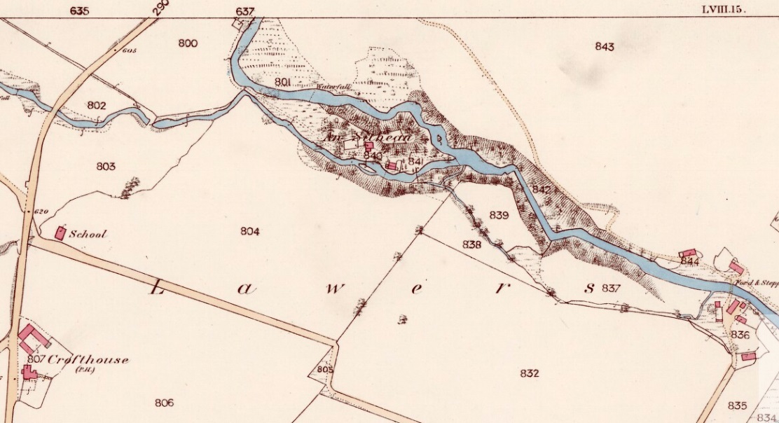
An Sithean on 1862 OS-map

Take the A827 road on the north-side of Loch Tay between Killin and Kenmore, and roughly halfway along you’ll find the tiny hamlet of Lawers.  Go down into the hamlet itself and, amidst the remains of the old trees where now are houses, nestled on a rise in the land with burns (streams) on either side, remains of the fairy mound of An Sithean still lives…

Folklore

Remnants of the legends of little people are legion in the Scottish mountains.  Sadly, many of them died when the English arrived and culled the population in ‘The Clearances’ of the 19th century – none moreso than in the area surrounding Loch Tay.  But thankfully, in the latter-half of the 19th century, a local man called James MacDiarmid (1910), took it upon himself to write down many of the old stories told by the remaining locals – as well as narrate those he remembered as a boy, as told by the elders around him.  Whilst tales of ‘fairies’ and other such creatures are thought by city-minds to be little other than fantasies, mountain-folk cosmologies differ greatly to those who are disconnected from the natural world.  Genius loci abound, and animism is the basic plinth integral to communities in the hills, where the world is much much more real.  This is one such tale…

“Not many years ago there lived in the neighbourhood of Killin a man who was in the habit of recounting his wonderful adventures with the white horse of the fairies.  When coming home one night from Kenmore market, and just as he was passing Sithean, Lawers, he heard most enchanting music proceeding from the knoll.  Unable to resist the temptation, he gradually went nearer and nearer the fairies’ place of abode, till at last he was fairly among them.  They received him most kindly, and on parting gave him one of their white horses to carry him home.  His steed went through the air at a speed almost equalling that of lightning, and in a few minutes he found himself above a house at Clifton, Tyndrum, some twenty-five miles westward from Lawers.  Happening to shout “ho!” when he was right above the chimney, the fairy horse threw him off its back, and down he dropped feet foremost through the wide, old-fashioned chimney, and alighted in the midst of a wedding party, much to their surprise and alarm. He continued in their pleasant company till daylight, when he returned home at his leisure, thanking the fairies for the pleasure they had so unexpectedly given him!”

Usually, tales such as this relate to the existence of prehistoric cairns or tumuli (burial sites), but no such archaeological remains have ever been known to live here.  Equally curious is how the man in this tale wasn’t kept in the timeless realms, beloved of faerie-land, where reveries with them would take decades from a man’s life, even though it only felt like one night.  This would imply

I’ve come across old locals who still speak, not just of the little-folk, but of other hauntings in this beautiful part of Loch Tay.  May the land not be cursed by the fools who put their idea of ‘development’ in front of the genius loci here; lest madness and ill-fortune will prevail…

References:

  1. MacDiarmid, James, “More Fragments of Breadalbane Folklore,” in Transactions of the Gaelic Society Inverness, volume 26, 1910.

© Paul Bennett, The Northern Antiquarian


Moirlanich (1), Killin, Perthshire

Cup-Marked Stone:  OS Grid Reference – NN 56404 34148

Getting Here

‘Moirlanich 1’ stone

Take the same directions as if you’re going to the nearby Moirlanich 2 Carving (about 550 yards down Glen Lochay, on the north side of Killin). In the same field, about 150 yards northwest of Moirlanich 2, you’ll see another large rock close to the wall.  That’s the spot!

Archaeology & History

Cup-marks highlighted

Looking down upon the River Lochay, with views east and west along the glen, here we find a carved rock that’s probably of interest only to the petroglyphic purists amongst you.  Two simple cup-markings, about 5 inches apart, can be seen etched into the slightly sloping southern-face of this small rocky outcrop.  The sacred mountain of the Creag na Cailleach rises to the immediate north.

© Paul BennettThe Northern Antiquarian


Moirlanich (2), Killin, Perthshire

Cup-Marked Stone:  OS Grid Reference – NN 56522 34078

Getting Here

‘Moirlanich 2’ Stone

From Killin, take the A827 road out of the north side of the village, turning left down Glen Lochay just before the Bridge of Lochay Hotel.  500 yards along the single-track road you’ll reach the electricity station. Just past this, in the field on your right, a large rock stands out just a few yards away. Go through the gate and walk to the spot!

Archaeology & History

Highlighted cup-marks

This is a simple cup-marked stone, perhaps used in ages gone by as a look-out spot by villagers.  Only for the petroglyphic purists amongst you, this carving consists of just five cup-marks on the topmost section of the flat stone, with four of them roughly in a line and a solo one (the most pronounced of the them all) a few inches south of the row.  The cup-marked Moirlanich 1 stone can be seen in the same field, 150 yards (137m) to the northwest.

© Paul BennettThe Northern Antiquarian


Witches Stone, Pittensorn, Murthly, Perthshire

Cup Marked Stone: OS Grid Reference — NO 0851 3881  

Getting Here

Witches Stone on 1867 map

Park up at Murthly village, follow the farm road west, opposite the Kinclaven junction up to the cross roads, and turn right and go past Douglasfield Farm, following the road as it bends to the left; then through the metal gates and walk on until you come to an earth bridge over the ditch to your left. Cross the bridge and the low-lying Witches Stone is about 30 yards on to your left by the drainage ditch.

Archaeology & History

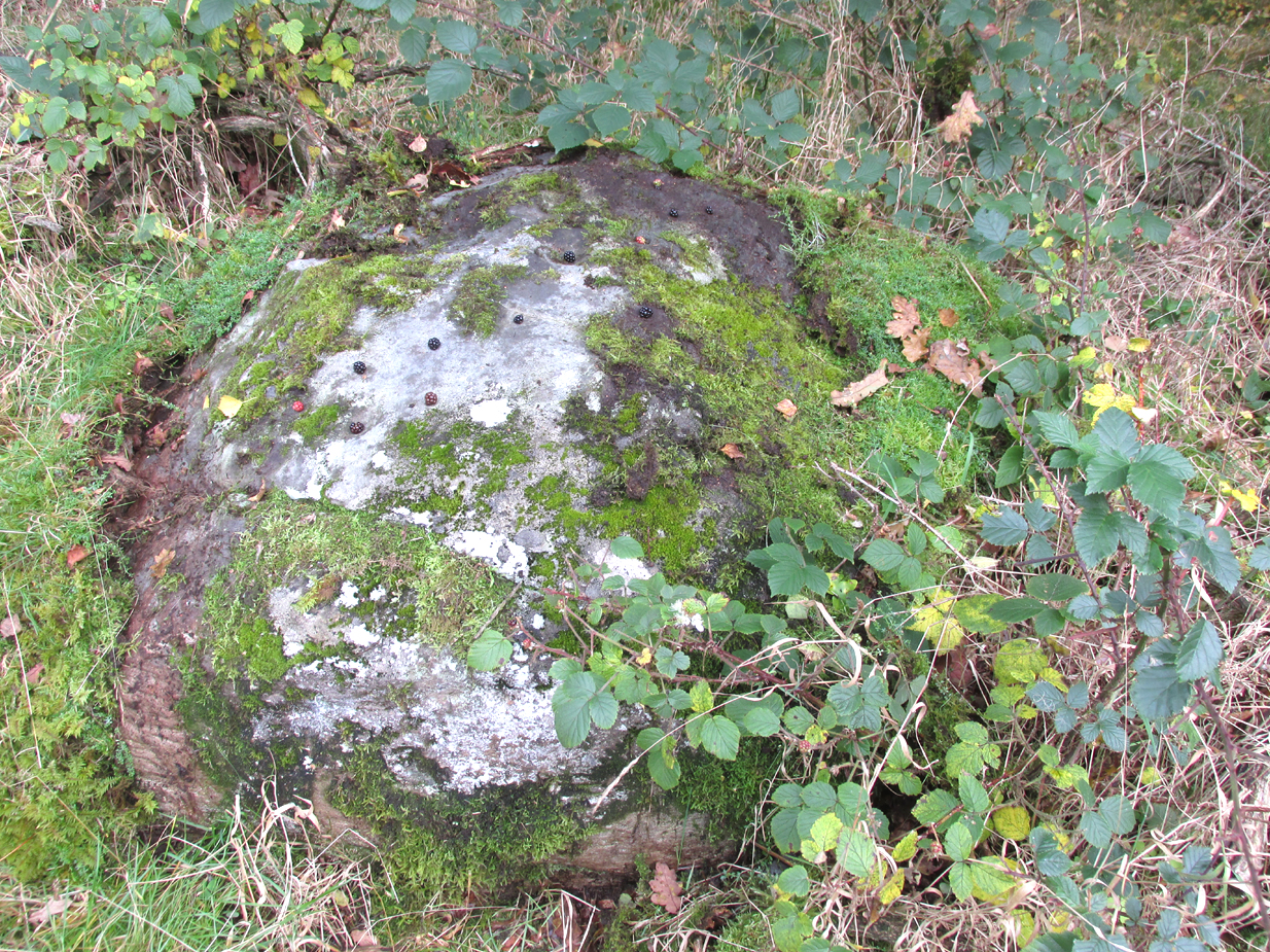
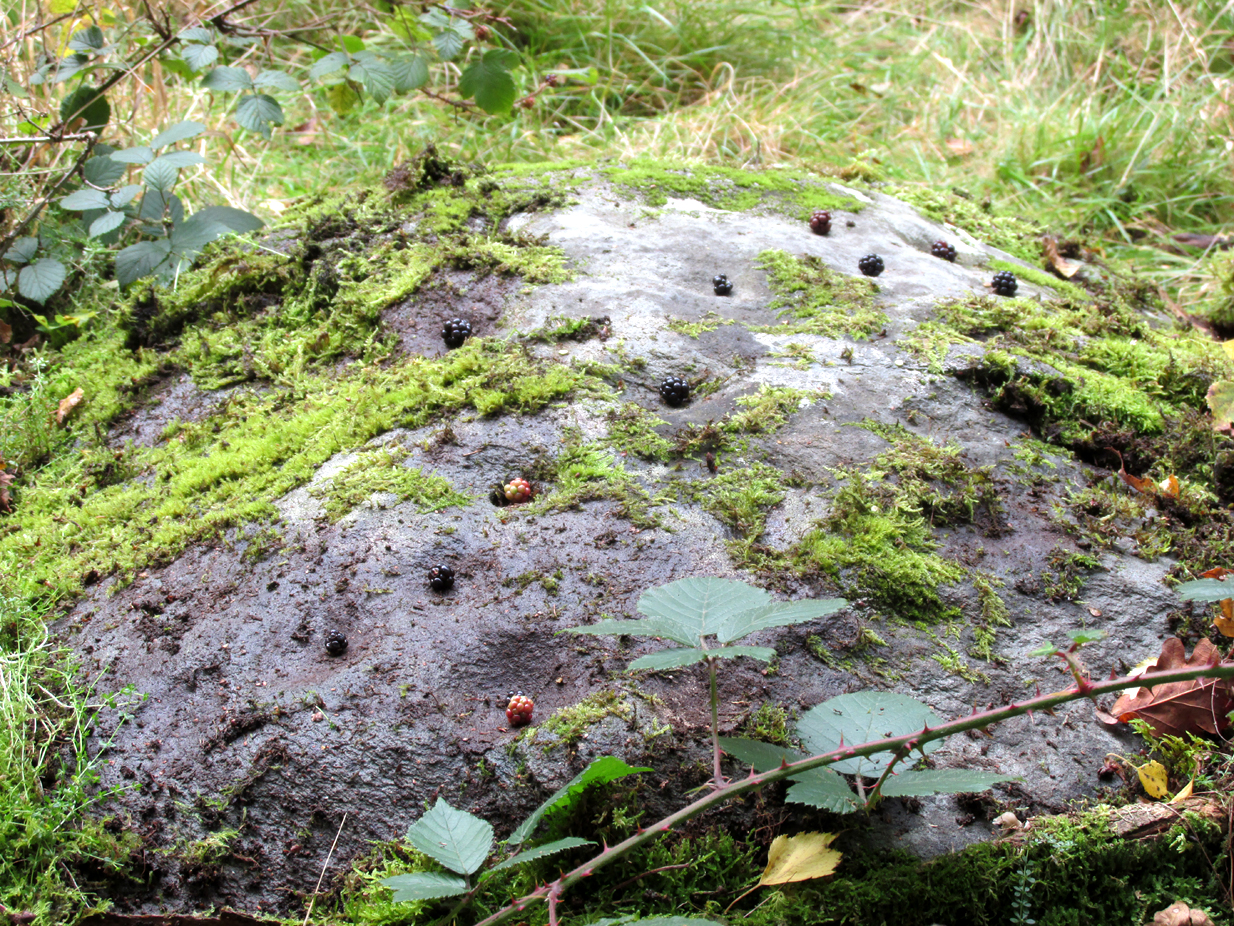
The stone with cupmarks highlighted in blackberries

Not recorded on the Canmore online database, the Witches Stone is a low-lying, domed, earthfast rock bearing at least 12 cup marks. One cup mark has been drilled at some time in the past. Did the land owner do this as a preliminary to blowing it up with gunpowder? There is an interesting story relating to the origin of the cup marks, and it seems the name of the rock and its folklore may point to its ritual significance having passed down through oral tradition from the Bronze Age to historical times.

Close-up of cups

Folklore

The mid-nineteenth century Ordnance Survey Name Book has the following record, attested by Sir W.D. Stewart, Mr. T. Cameron & Mr. J. Cameron:-

“A small rock nearly level with the ordinary ground surface, underneath which it is traditionally held that a large sum of money is buried. In order to test the truth of this tradition, it is said that some years ago a man commenced to excavate the soil around the rock in order, if possible, to secure the hidden treasure, while so employed, a small dog suddenly appeared on the top of the rock and desired the man to desist, assuring him at the same time that the reputed treasure was really there, but it was never intended that the eye of mortal should behold it. There are some marks on the rock which the superstitious tell you are the prints of this very sagacious dog’s paws.”

References:

  1. Ordnance Survey Name Book: Perthshire – volume 50, page 63, 1859-62.

© Paul Hornby 2017, The Northern Antiquarian

Over Glenny (05), Port of Menteith, Stirlingshire

Cup-and-Ring Stone:  OS Grid — NN 56993 02835

Getting Here

‘Over Glenny 5’ Carving

Along the A81 road from Port of Menteith to Aberfoyle, watch out for the small road in the trees running at an angle sharply uphill, nearly opposite Portend, up to Coldon and higher. Keep going, bearing right past Mondowie and stopping at the dirt-track 100 yards or so further up on the left.  Walk up this dirt-track for ⅔ mile, and just before reaching the planted forestry, turn right along another dirt-track.  Less than 200 yards along there’s a large sycamore tree, and about 20 yards below it (south) is the carving you’re looking for.

Archaeology & History

It’s difficult keeping up with the carvings in this region to the north of the Lake of Menteith, as we find new unrecorded ones on every visit, maintaining the tradition of fellow rock art students Maarten van Hoek, Kaledon Naddair, George Currie, Jan Broewer and the rest—and we know that there’s more of them hidden away.  This one doesn’t seem to be in the Canmore listings, but I put that down to the fact that they’ve got a grid-references wrong somewhere, as it’s pretty plain to see.  Although, to be honest, in the rather vague descriptions of the adjacent carvings (Over Glenny 4 and 6), this carving is in-between them, so you’d expect it to be listed.  Anyway, that aside…

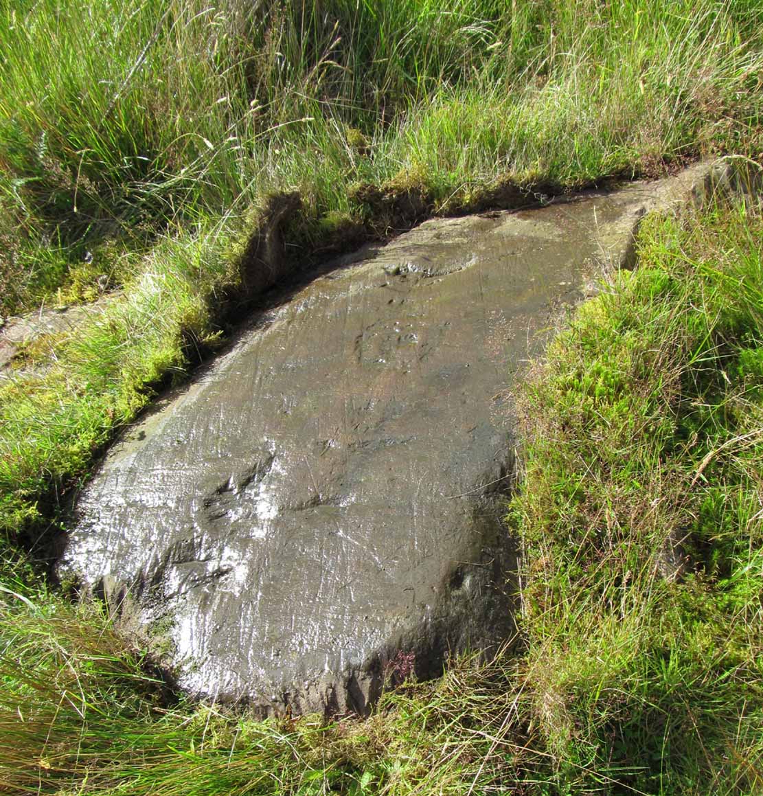
Looking down at the rings
Close-up of faint rings

This long flat exposed rock surface has two primary cup-and-rings upon it: one cup with a double-ring, and the other standard cup-and-ring; there are also two single cup-markings on the stone: one near the middle of the rock and the other on its lower-right side.  The main element is the double-cup-and-ring, which appears to be incomplete—not only in terms of its design, but also, as you can see in the photos, seems unfinished. From the central double-ring, a faint carved line runs out from the centre and into the other faint, incomplete, single cup-and-ring.

Series of metal-sharpening grooves
Arty-farty sketch of the design

At the bottom of the stone (as with several others hereby) a curious set of deep scars have been cut into the edge of the rock.  They’re unmistakable when you see them.  They have probably been created by metal artifacts being sharpened along the bottom of the rock—many many times by the look of it.  These deep cuts reminded me of the more famous Polisher Stone, down Avebury-way.  They may be explained by the fact that, several centuries ago, a battle occurred here and some of the men gathered in the area before the attack.  It would seem as if this and the other cup-and-ring stones were used to sharpen their blades before going into battle.  Whether this was done because of some local lore which imbued these stones with some sort of magick, we do not know.  Folklore here seems curiously scarce (english incomers destroyed local traditions, as writers were telling us in the 19th century), apart from the well-known one of the area being rife with fairies: Robert Kirk’s famous The Secret Commonwealth of Elves, Fauns and Faeries (1691) was written three miles west of here, at Aberfoyle.

References:

  1. Brouwer, Jan & van Veen, Gus, Rock Art in the Menteith Hills, BRAC 2009.

Acknowledgements:  Massive thanks to the rest of the crew: Paul Hornby, Lisa Samson & Fraser Harrick.

© Paul BennettThe Northern Antiquarian

Auchensalt, Thornhill, Stirlingshire

Broch:  OS Grid Reference – NN 6533 0099

Also Known as:

  1. Canmore ID 24398
  2. Easter Borland
  3. Keir

Getting Here

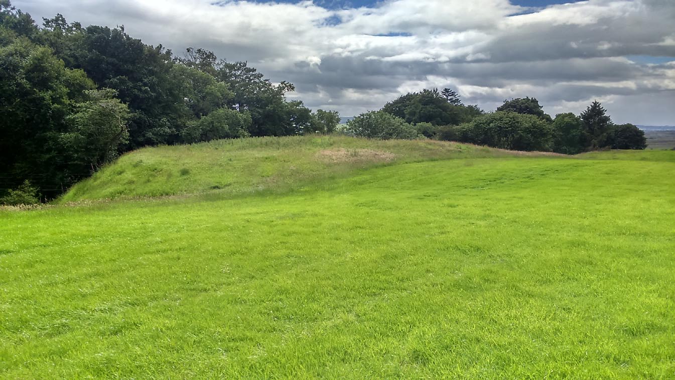
Auchinsalt broch, looking south

Take the A873 from Thornhill to Aberfoyle, and literally 1 mile west of Thornhill turn right up the track up and past Easter Borland farm (as if you’re heading up to Auchensalt).  250 yards past the farm, a large field opens up.  Walk 100 yards east along the side of the wall towards the trees and follow the tree-line upstream 250 yards (don’t go into the lovely little glen) until, on your right, you’ll see a reasonably large area of grassland that rises up, with a steep-ish slope down to the burn below.  This is the remains of the broch.

Archaeology & History

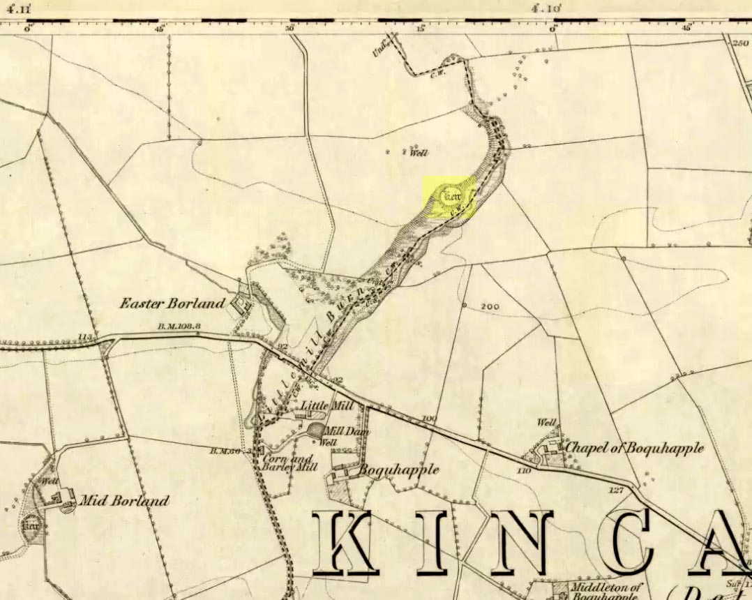
Shown as a ‘Keir’ on the 1866 OS-map, this is an old Scottish dialect word, barely used at all nowadays (folk need to start using it again!) which meant “an ancient fortification” or “rude forts”.  The word is mentioned in early Statistical Accounts in 1795 and in the Second Account of 1845 the “Kiers at Auchinsalt” are mentioned specifically, albeit in passing….

Auchinsalt ‘Keir’ on 1866 map

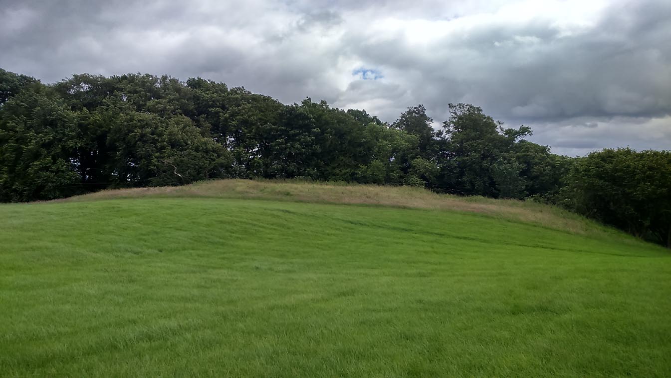
When we visited the site yesterday, very little could be seen due mainly to the summer vegetation covering the area.  A very small section of open walling was noted on its western side, and beneath the undergrowth a roughly oval structure was in evidence on the rise between the edge of the field and the drop into the small glen below.  Something obviously man-made lies beneath the grasses, but in the last 100 years or so there has been debate as to whether it was a fort, a dun or a broch.  The consensus at the mo, tells Euan Mackie (2007), is that it’s a broch!

Auchinsalt broch, looking east

Measuring some 25 yards across, the walling that makes up the broch was between 4-6 feet wide all round, and about 2 feet high.  There seemed to be aggregates of large scattered stones inside and outside the main oval feature.  If there was an entrance, it seemed to be at the western side, but I wasn’t sure about this. In truth, unless you’re a hardcore broch fanatic, you’d be truly disappointed with the dilapidated state of this monument.  Much better ones can be seen just a few miles away…

References:

  1. Chrystal, William, The Kingdom of Kippen, Munro & Jamieson: Stirling 1903.
  2. Grant, William (ed.), The Scottish National Dictionary – volume 5, SNDA: Edinburgh 1960.
  3. MacKie, Euan W., The Roundhouses, Brochs and Wheelhouses of Atlantic Scotland c.700 BC-AD 500, BAR: Oxford 2007.
  4. McCulloch, Stuart J., Thornhill and its Environs, Munro Trust: Perth 1995.

Acknowledgements:  Huge thanks to Paul Hornby for getting us here. Cheers matey!

© Paul Bennett, The Northern Antiquarian