Bishop’s Well, Dunblane, Stirlingshire

Holy Well (destroyed):  OS Grid Reference – NN 78126 01281

Also Known as:

  1. Canmore ID 24681

Archaeology & History

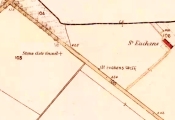
Bishop’s Well on 1899 map

This now-lost holy well was a place whose history was integrally tied to the adjacent and also destroyed Bishop’s Palace: a large ostentatious building that was already in ruins in 1579, just below Dunblane Cathedral. It was the water supply for the bishops who lived here; although exactly when it received its original dedication, and by whom, seems unknown.

The best description we have of it is in Alex Barty’s (1944) excellent history work on Dunblane, where he wrote:

“Perhaps the best-known well in Dunblane was the Bishop’s Well, in the Bishop’s Yard or Grassyard.  This well is now dry and the explanation is that it was fed by a strong stream from about Kirk Street which was incorporated into the town sewer when it was laid in Kirk Street.  There was a right-of-way, or at least a  privilege, held by some of the inhabitants to pass through the north end of the Manse ground out by a gate which still exists and down a path to the well.”

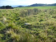
Mr Barty informed us that the line of the footpath was still visible in his day, but it has long since gone.  When Archie McKerrarcher (1992) wrote about the site, he described minor remains of it still extant, telling that “the Bishop’s Well can be seen marked by circular stonework in the grass”; but this has now also been destroyed.  One would think that the local christian community would at least have tried to preserve this ancient site.

References:

  1. Barty, Alexander B., The History of Dunblane, Eneas Mackay: Stirling 1944.
  2. Dennison, E.P. & Coleman, R., Historic Dunblane: The Archaeological Implications of Development, RCAHMS: Edinburgh 1997.
  3. McKerracher, Archie, The Street and Place-Names of Dunblane and District, Stirling District Libraries 1991.

Acknowledgements:  To Paul Hornby in his help seeking out this site; and to the staff at Dunblane Library.

© Paul BennettThe Northern Antiquarian


Witch Tree, Aberuthven, Perthshire

Sacred Tree:  OS Grid Reference – NN 9621 1587

Getting Here

Witch Tree on 1901 OS-map

Witch Tree on 1901 OS-map

Just off the A9 between Stirling and Perth is Aberuthven village.  Down the Main Street and just south of the village, turn west along Mennieburn Road.  A half-mile on, just past Ballielands farm, you reach the woods.  Keep along the road for another half-mile, close to where the trees end and go through the gate where all the rocks are piled. Walk up to the tree-line 50 yards away and follow it along the line of the fence east, til it turns down the slope.  Naathen – over the barbed fence here, close to the corner, about 10 yards in, is the tree in question…

Archaeology & History
Witch Tree03

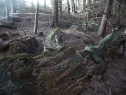
Looking along the fallen trunk

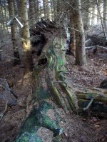
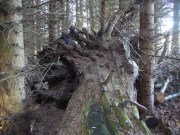
Laid down on the peaty earth, fallen perhaps fifty years ago or more, are the dying remains of this all-but forgotten Witch Tree.  To those of you who may strive to locate it—amidst the dense eye-poking branches of the surrounding Pinus monoculture—the curious feature on this dying tree are a number of old iron steps or pegs, from just above the large upturned roots.  About a dozen of them were hammered into the trunk some 100 years or more ago and, were it to stand upright again, reach perhaps 30 feet high or more.  These iron pegs give the impression of them being used to help someone climb the tree when it was upright; but their position on the trunk and the small distance between some of them shows that this was not their intention.  Their purpose on the tree is a puzzle to us (does anyone have any ideas?).
Embedded pieces or iron from roots...

Embedded iron from the roots

Embedded iron 30-40ft along

Embedded iron 30-40ft along

The fallen trunk has broken into two main sections, each with iron pegs in them.  The very top of the tree has almost completely been eaten back into the Earth.  Unfortunately too, all the bark has completely rotted away and so identifying the species of the tree is difficult (though I’m sure there are some hardcore botanists out there who’d be able to enlighten us).  The possibility that the early map-reference related to a Wych-elm (Ulmus glabra) cannot be discounted, although this would be most unusual for Ordnance officers to mistake such a tree species with a ‘witch’.  Local dialect, of course, may have been a contributing factor; but in Wilson’s (1915) detailed analysis of the regional dialect of this very area, “wych elm” for witches does not occur.  Added to this is the fact that the indigenous woodland that remains here is an almost glowing birchwood (Betula pendula) in which profusions of the shaman’s plant, Amanita muscaria, exceed.  There were no wych elms hereby.

The tree was noted by the Ordnance Survey team in 1899 and was published on their maps two years later, but we know nothing more about it.  Hence, we publish it here in the hope that someone might be able top throw some light on this historical site.

Folklore
Looking along the fallen trunk

Halfway along the fallen tree

We can find nothing specific to the tree; but all around the area there are a plethora of tales relating to witches (Hunter 1896; Reid 1899)—some with supposedly ‘factual’ written accounts (though much of them are make-believe projections of a very corrupt Church), whilst others are oral traditions with more realistic tendencies as they are rich in animistic content. One of them talks of the great mythical witch called Kate McNiven, generally of Monzie, nearly 8 miles northwest of here.  She came to possess a magickal ring which ended up being handed to the owners of Aberuthven House, not far from the Witch Tree, as their associates had tried to save her from the crazies in the Church.  This may have been one of the places where she and other witches met in bygone centuries, to avoid the psychiatric prying eyes of christendom.

Until the emergence of the Industrialists, trees possessed a truly fascinating and important history, integral to that of humans: not as ‘commodities’ in the modern depersonalized religion of Economics, but (amongst other things) as moot points—gathering places where tribal meetings, council meetings and courts were held. (Gomme 1880)  The practice occurred all over the world and trees were understood as living creatures, sacred and an integral part of society.  The Witch Tree of Aberuthven may have been just such a site—where the local farmers, peasants, wise women and village people held their traditional gatherings and rites.  It is now all but gone…

References:

  1. Gomme, Laurence, Primitive Folk-Moots, Sampson Lowe: London 1880.
  2. Hunter, John, Chronicles of Strathearn, David Philips: Crieff 1896.
  3. Reid, Alexander George, The Annals of Auchterarder and Memorials of Strathearn, Davdi Philips: Crieff 1899.
  4. Wilson, James, Lowland Scotch as Spoken in the Lower Strathearn District of Scotland, Oxford University Press 1915.

© Paul BennettThe Northern Antiquarian


Well of the Mosses, Glen Almond, Perthshire

Healing Well:  OS Grid Reference – NN 82865 33096

Getting Here

Spring of the Mosses

Spring of the Mosses

Take the dirt-track up Glen Almond for 3½ miles until you reach the standing stone of Clach an Tiompan.  The giant long cairn of the same name is just above the track on the other side.  Walk past this and start walking uphill, diagonally, until a few hundred yards up, a ridge levels out with some unrecorded habitation sites upon it.  The clear waters of this spring are on the eastern edge of this ridge.

Archaeology & History

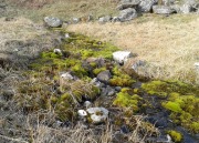
A little-known spring of water found on the slopes immediately above the giant Clach an Tiompan long cairn.  Beautifully clear water emerges from beneath a large rock that rests by an ancient pathway running across the mountain-slope, used by the local people who lived here before the genocide of The Clearances.  When we visited the place recently, the waters were low, but still running, and the mosses which reach along the length of the burn were almost iridescent in the evening sunlight.

The living glows of moss & water

The living glows of moss & water

Looking upstream to its source

Looking upstream to its source

Upon drinking here, there was that subtle sweetness to the waters, typical of many moss-clad sites, indicating it to have that typical medicinal virtue as a place to renew or revitalise your low-sugar energies after you’ve finished your meditation and rest, gazing within the enchanting mountains in which you are being held.  It’s a truly wonderful little site!

© Paul BennettThe Northern Antiquarian


Tombreck (10), Kenmore, Perthshire

Cup-Marked Stone:  OS Grid Reference – NN 65042 37559

Getting Here

Tombreck's cup-marked stone

Tombreck’s cup-marked stone

Along the A827 north road around Loch Tay, between Killin and Kenmore, a few hundred yards east of Carie—and on the same side of the road—there’s a dirt-track down to the Tombreck community.  Go into it and just past The Big Shed you’ll see the small caravan where the helpful and friendly Gabriela lives.  The stone just in front of her caravan is the one you’re looking for!

Archaeology & History

Close-up of the cups

Close-up of the cups

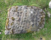
Although this cup-marked rock has been known about for sometime by local people, it is one of many that are not in the archaeological record.  It’s nothing like as impressive as some of its petroglyphic neighbours on the slopes of Ben Lawers, as this simple carving comprises of two well-defined simple cup-marks, and another two that appear to have been worked slightly into natural cracks in the rock.  These two remain incomplete.  It’s nothing too special to look at and is, once again, only gonna be of interest to the petroglyphic purists amongst you.

© Paul BennettThe Northern Antiquarian


Tombreck (08), Kenmore, Perthshire

Cup-Marked Stone:  OS Grid Reference – NN 64795 38648

Getting Here

Tombreck (8) on its mound

Along the A827 road between Killin and Kenmore, park at the entrance to the Tombreck track and cross the road, walking up the track heading up Ben Lawers.  Pass the sheep pens, through the gate and keep going for a few hundred yards until you hit the old straight line of walling which runs off east into the pine trees a few hundred yards away. Walk along here, keeping to the south side, for less than 100 yards, watching out for a small stone on a small rise on a small hillock – and make sure your eyes are in good condition!

Archaeology & History

The stone in question

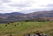
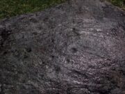
This is a seemingly unrecorded cup-marked stone, with very faint petroglyphic evidences just visible on the surface.  Set within the wider surrounds of more recent enclosure walling, this is a small slightly raised female (rounded, smooth) stone, roughly three feet in diameter, which has at least five cup-markings on its surface—mainly near the middle of the stone.  The rock itself is next to the western edge of a raised man-made feature, reminiscent of a collapsed denuded cairn or hut circle, which itself has not been archaeologically assessed.  It is one of a number of petroglyphs in relative proximity to each other on the geological ridge above Loch Tay (not visible from here).

Close-up of faint cups
Closer-up of faint cups

As you can see in the photos left and right, the cups are only truly visible when the stone has been wet.  Initially I thought that this carving may have been one that was mentioned briefly in George Currie’s (2009) notes—at NN 64736 38647, 62 (57m) yards to the east—but it doesn’t seem to be the case as the grid reference he cited differs from this.  There are going to be a number of other unrecorded carvings scattered about beneath the great shadow of Ben Lawers…

References:

  1. Currie, George, “Cup-and-Ring Marked Rocks,” in Discovery & Excavation, Scotland, volume 10, 2009.

Acknowledgements:  Huge thanks to Paul Hornby for the use of his photos in this site profile; and to Lisa Samson, for her landscape detective work at the site.

© Paul BennettThe Northern Antiquarian


Tombreck (07), Ben Lawers, Kenmore, Perthshire

Cup-Marked Stone:  OS Grid Reference – NN 65022 38285

Also Known as:

  1. Canmore ID 238573

Getting Here

Tombreck 7 carving, beneath Ben Lawers

Tombreck 7 carving, beneath Ben Lawers

Take the A827 road that runs alongside Loch Tay between Killin and Kenmore, and about 6 miles from Killin watch out for the signposts for The Big Shed.  Stop and walk NW up the track across the road from there, up toward Ben Lawers.  Several hundred yards up, past the sheep-fold on the left-side of the track, a line of ruinous walling runs straight over the grasslands. Walk along here until it meets with the next walling that runs uphill.  Look down into where the wall has collapsed.  It’s under your nose!

Archaeology & History

This is a fascinating and pretty impressive example of a simple cup-marked stone.  It’s the design that does it I suppose – similar in some ways to the well-known Idol Stone carving on my old playground of Ilkley Moor (that’s what this one reminded me of when I first clapped eyes on it)—but much better!

Lines of cups from above

Lines of cups from above

The carving from the east

The carving from the east

Its similarity lies in the series of parallel rows of cup-marks running very close together along the line of the low-lying rock, found at the base of some ancient walling that runs up the mountain for several hundred yards.  Not only that, but the line of walling itself also has a parallel line of walling running adjacent for the same distance up the mountainside — more than half-a-mile from start to finish.  This “parallel” feature of walling and cup-markings is a curious coincidence, perhaps.  But certainly the linearity of the cup-marks was itself a very deliberate feature by the person who carved it, representing something ‘structural’, in whatever mythic form that may have been!

The carving in its walling

The carving in its walling

Of the rows of cups constituting this petroglyph, four of them run completely from one side of the stone to the other, rough north to south; with four other shorter rows running only halfway across the rock surface.  Altogether there are perhaps seventy cups etched onto the rock.  No rings or semi-circles of any form were visible in our visit here—although the skies were grey and overcast, making any decent visual analysis more difficult.

A damn good carving and well worth checking out by anyone into prehistoric rock art!

© Paul BennettThe Northern Antiquarian


Shealwalls Enclosure, Alyth, Perthshire

Enclosure:  OS Grid reference – NO 23922 51484  —  NEW FIND

Getting Here

Aerial view of the oval, at centre

Aerial view of the oval, at centre

Take the B954 north out of the Alyth, up through the hills.  After just over 2 miles (3km), take the left turn up to Bamff.  Go along here and past the copse of trees on your right for literally three-quarters of a mile (1.2km), where a gate takes you into the overgrown meadows on your right.  Walk back on yourself for about 100 yards or more, across the boggy stream and up the slope.  The embankments of this enclosure are right under nose!

Archaeology & History

Some 70 yards west of the little four-poster ‘stone circle’ of Shealwalls, is this previously unrecorded enclosure.  Oval in shape and well-defined at ground level, the great majority of the inside of this enclosure is relatively even and flat.  Around its perimeter there are, at intervals, a number of small stones defining its edges along its internal embankment, but these are intermittent and seem to have no deliberate architectural regularity: they may simply be elements of an internal raised platform that have become visible due to erosion processes.

Northwest section of ditch

Northwest section of ditch

At its greatest width from the edges of the outer ditch to outer ditch, the enclosure measures more than 22 yards (20.3m) east-west, and at its longest it is 30 yards (27.3m) north-south.  The circumference of the enclosure is between 88-89 yards (80m).  The average width of the surrounding or enclosing ‘ditch’ is between 2 and 2½ yards (2m) and it has a depth of no more than 2 feet all round.  All along the southern side, very little remains of the ditch and in sections it has been eaten into by foraging rabbits and cattle.  The most conspicuous section of the surrounding ditch and embankment is along the eastern length (where it gives the impression of being hengi-form in nature); the more rounded northern section of the ditch is very distinct, but is overgrown in Juncus reeds; whilst the western section of the ditch is clear until reaching its southernmost part, where its outer edges become less visible.

SW edge of enclosure

SW edge of enclosure

NE arc of ditch, looking west

NE arc of ditch, looking west

There seemed to be no visible structures within the enclosure itself, which added to my thoughts that the site was hengi-form in nature, as defined in the surveys by A.F. Harding (1987) and Jan Harding (2006).  However, it is best to maintain a simple description regarding the nature of the site until archaeological evaluation can give us a more accurate assessment.  Without excavation it is obviously impossible to give an accurate idea of its age, but its architectural form and similarity with other enclosures would seem to place its construction in the late Bronze Age to early Iron Age period.

The monument proved very difficult to photograph with any success as it is much overgrown and the bright sun was in the wrong place! (serious) So, another visit is needed in the hope that we can get better images.  A fascinating little site!

References:

  1. Harding, A.F., Henge Monuments and Related Sites of Great Britain, BAR 175: Oxford 1987.
  2. Harding, Jan, The Henge Monuments of the British Isles, Tempus: Stroud 2006.

© Paul BennettThe Northern Antiquarian


St. Euchan’s Well, Collace, Perthshire

Holy Well (destroyed): OS Grid Reference – NO 1997 3297

Also Known as :

  1. Canmore ID 28605
  2. St Deuchan’s Well 
  3. St Teuchan’s Well
  4. St Ukan’s Well

Getting Here

The site of the well is on the north side of the road between Saucher and Collace, just past the small stand of trees.

Archaeology and History

s. euchans map 1860s

The site shown on the 1867 OS 25″ map

Nothing now remains of the well, but across the road on the strip of grass leading to the burn there is patchy Cotton Grass growth, evidence of the vestigial flow of the spring. A nearby water pumping station on the same side of the road as the former well is probably responsible for the spring well’s demise.

IMG_6737

The site of the Well

There may have been a nearby chapel dedicated to the Saint, of which no trace remains, and in the 1860s, the Ordnance Survey recorded “A few yards from the site of the chapel there is an excellent spring well by the name of  ‘St Teuchan’s Well.’”  The Ordnance Survey further recorded “Mr James Stewart, Kinrossie,… supposes [the Saint’s name] to be a corruption from St Vigean’s. Ukans appears to be the common pronunciation, and the T or D of the authorities being silent the spelling Euchans will…answer either of them.”

IMG_6738

Across the road from the Well, Cotton Grass provides evidence of the vestigial flow of the spring.

Saint Euchan was made the titular or patron Saint of Collace by Bishop de Bernham in 1242. The exact identity of the Saint is unclear but he is believed to be the Irish Saint Eoghan, the son of Caennach of Leinster who was ‘carried off in his early youth by pirates to Britain’ later spending some years at Whithorn, before returning to Ireland, where he became the master of St Kevin at Kilnamanach, the monastery he founded in County Wicklow, and Bishop of Ardstraw, County Tyrone.  His saint’s day is August 23rd. As there seems to be some doubt as to the Saint’s true identity it is perhaps worth mentioning that Euken is a Basque man’s first name, but this is almost certainly coincidence.

Folklore

The well was at one time believed to have had healing properties.

References:

  1. Forbes, Alexander Penrose, Kalendars of Scottish Saints, Edmonston and Douglas: Edinburgh 1872.
  2. Collace Parish Millenium Committee, Off The Main Road, Kinrossie District Recreation Club, 2010
  3. Scotland’s Place Names
  4. Gizonezkoen ponte-izenak (Basque Men’s Names) – Euskaltzaindia, Bilbao 2015.

© Paul T Hornby 2016 The Northern Antiquarian

Samson’s Stone, Crieff, Perthshire

Legendary Rock:  OS Grid Reference – NN 82519 22021

Also Known as:

  1. Canmore ID 96866

Getting Here

Samson Stone on 1866 map

Samson Stone on 1866 map

Tale the A85 road between Comrie and Crieff and, roughly halfway between the two towns, take the minor road south to Strowan (it’s easily missed, so be aware!).  A few hundred yards along, stop where the trees begin and walk into the fields immediately east.  Keep walking, below the line of the trees, and you’ll get to it within five minutes.

Archaeology & History

Samson's Stone, looking east

Samson’s Stone, looking east

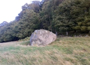
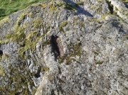
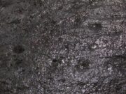
Mistakenly cited by some as a standing stone, the large boulder which rests here on the hillside just below the woodland is a glacial erratic.  Highlighted on the 1866 OS-map of the region, I hoped that we might find some rock art on the stone, but cup-and-rings there were none.  However, there is a curious ‘footprint’ on top of it, similar to the ones found at Dunnad, at Murlaganmore and other places (see Bord 2004); but I can find no previous reference to this carved footprint.

'Footprint' on top of stone

‘Footprint’ on top of stone

In 1863 the site was described in the local Name Book, where it was reported to be “a large oblong shaped stone lying on the surface, eight feet long, four wide, and three thick”; but, much like today, it was also reported that “There is no tradition respecting it in the neighbourhood. Supposed to have received the name in consequence of its great size.”

Most peculiar…..

References:

  1. Bord, Janet, Footprints in Stone, Heart of Albion Press 2004.

© Paul BennettThe Northern Antiquarian

Nether Glenny (42), Port of Menteith, Perthshire

Cup-Marked Stone:  OS Grid Reference – NN 5643 0229

Also Known as:

  1. Canmore ID 87397

Getting Here

Archaeology & History

The stone in situ

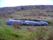
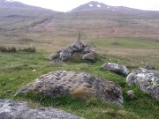
The easiest way to see this is to reach the Nether Glenny 2 Cairn, looking north to the slope a coupla hundred yards away, where you can see a long rock halfway up.  If you can’t see it from here, walk to the impressive Nether Glenny 35 Carving, where the large long slab is much more obvious on the hillside. Walk through the gates to the Nether Glenny 37 carving and then diagonally up to the rock itself.  You can’t really miss it.

This 15-foot long stone halfway up the slope was said by the Royal Commission lads to have “four possible cup-marks” on it, whereas there are at least nine of them and maybe as many as eleven!  Most of them are dead certs as prehistoric etchings, not just ‘possibles’.

Small faint cluster of cups
Some of the faint cups

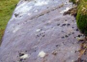
The more visible cup-marks here are found on the more western end of the stone, just below the grass-line.  The cups here are quite distinct, measuring some two-inches across and nearly half-an-inch deep in two of them.  The others in this section are a little smaller and further down the slope of the rock.  Seemingly not noticed for a long long time however is a small cluster of very faded cups, gathered like a very faint 4-star Pleiades cluster more than halfway along out in the photo here (I hope!).

The biggest of the cups

This entire area is covered with cup-and-ring stones, possessing one of the greatest densities of carvings anywhere in Scotland.When we visited the place last week, Nature was pouring with rain, so we weren’t able to sketch the design.  Something that we’ll hopefully amend in the near future!

References:

  1. Brouwer, Jan & van Veen, Gus, Rock Art in the Menteith Hills, BRAC 2009.

© Paul BennettThe Northern Antiquarian