Giant’s Stones, Arnbathie, Perthshire.

Legendary Stones: OS Reference – NO 16695 26086

Getting Here

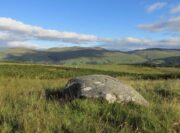
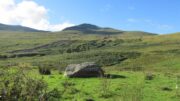
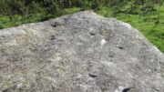
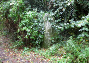
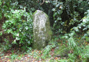
The two stones in relation to each other

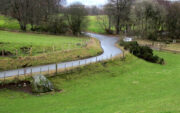
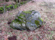
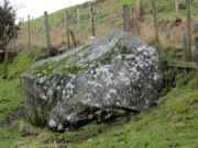
Travelling north from Perth on the A94, take the right turning for Murrayshall just before entering Scone, then take the first right and continue up to the road junction, and park up at the trackway opposite.  You’ll see the big stone in the field to the right, up against the road embankment; and the small stone is in the paddock to the left of the trackway at the edge of the trees.

Archaeology & History

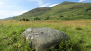
Two large glacial erratics which have acquired mythic status and picked up a Christian triumphalist message on the way.

Folklore

In Lawrence Melville’s (1939) excellent local history work, he thankfully put to pen an all-but-forgotten tale of oral tradition:

“Where the road from the Muir of Durdie leaves Kilspindie parish, a grass grown road leads north to Boglebee….. A few yards from the highway lie two large stones, said to have been flung from the Giant’s Hill in Collace parish – the flat topped eminence lying due north from the stones, about two or three miles away, better known as “Macbeth’s Hill”, or “Dunsinane Hill”.

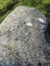
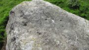
The ‘string’ marks of legend
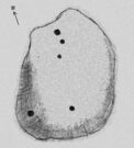
The smaller stone with its ‘string’ marks

“When the church dedicated to St John in Perth was being built and its tower began to appear, a witch living in Collace was enraged to see this proof of the approach of Christianity and determined to destroy it. She had a son, a giant (after whom the hill receives one of its names), whom she sent to the top of the hill, giving him two huge stones with which to destroy the rising church.

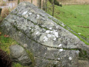
“By her incantations she had supernatural power and knew that when Christianity came her power would be destroyed. She gave him her mutch from her head to be used as sling and in it the giant put the two huge stones. Whirling it around his head, he aimed them in a line with the tower, but, just as he let them fly, the string of his mother’s cap broke and the stones only went the length of Boglebee. The marks on the stones are said to be the marks of the witch’s mutch strings.”

Another view of the larger stone

A familiar folkloric message is remembered the length of Britain:  a giant, a devil or other supernatural being throwing stones that either spill out of an apron or otherwise miss their mark.  And in this case an unsubtle message to anyone trying to take on the might of the church.  But what was the original story of these stones as told by the old time oral storytellers before Christian missionaries stalked the land?

If the string hadn’t broken and the stones had followed their original trajectory they would have fallen south of St John’s Kirk, but it was the thought that counted….

Reference:

  1. Melville, Lawrence, The Fair Land of Gowrie, William Culross: Coupar Angus, 1939.

©Paul T. Hornby 2020, The Northern Antiquarian
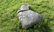

Giant’s Leap & Rock, Black Hill, Abernyte, Perthshire.

Legendary Rock: OS Reference – NO 21559 31659

Getting Here

Giant’s Rock in ravine overlooked by the Leap

The Rock and Leap may be seen from the B953 Bandirran to Abernyte road.  Approach across the fields.

Archaeology & History

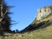
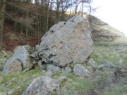
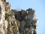
A large boulder perhaps 40 tons in weight lies in a ravine between Dunsinane and Black Hill. The ‘Leap’ is a flat topped ledge jutting out from the west side of Black Hill facing Dunsinane.

Folklore

Melville (1939) in his The Fair Land of Gowrie writes of the simple pleasures of the giant:

“From the farther side of the ravine [between Dunsinane and Black Hill], a precipitous rock juts out, which is called the “Giant’s Leap”. According to the lore of the Sidlaws, a giant, who once lived in these parts, leaped from this rock right on to the top of Dunsinane Hill.  The giant also amused himself by tossing about a huge boulder which can be seen lying at the bottom of the ravine.”

And adds:

The Big Fellow’s toy
Giant’s Leap from the north

“Fairies haunted the hills here and on summer nights they descended to the meadows, where they danced at a spot called “Fairygreen”. The Black Hill gets its name from the dark heath which covers it. Weird and bleak looking for most of the year, the lower slopes are brightened by glowing patches of purple flowers in late summer.”

Fairygreen Farm lies a mile almost due north of Dunsinane.

Reference:

  1. Melville, Lawrence, The Fair Land of Gowrie, William Culross & Son, Coupar Angus, 1939.

© Paul T Hornby 2020, The Northern Antiquarian
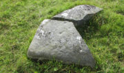

Tombreck (15), Kenmore, Perthshire

Cup-Marked Stone:  OS Grid Reference – NN 64894 38308

Getting Here

Tombreck (15) carving

Along the A827 Loch Tay road between Morenish and Lawers, take the track uphill where Carie farmhouse and Tombreck are either side of the road. Walk up this track 2-300 yards till you go through the gate just past the sheep-folds on your left.  Ahead of you is a small grassy hillock on your right upon which you’ll find the unimpressive Tombreck-1 carving.  Walk down the grassy-slope to the boggy stream and then up the rounded knoll on the other side, where you’ll find a stone that’s been split in two.  You’re here!

Archaeology & History

This is another unrecorded carving, found amidst this already large petroglyphic cluster on August 9, 2020.  Carved on a stone that’s been spilt in half, three simple cup-marks can be seen on the larger easternmost section, with the lowest of them having a possible short line running towards the cup on the right.  It seems that the right-hand (north) side of the stone has also been cut, but there is no trace of this part of the stone on the ground.  Additionally, there is the possibility that this stone once stood upright, as evidenced by its very worn rounded top and the larger bottom end of the stone being distinctly lower compared to the ground all round it. But this is speculative.

The 3 cups, highlighted
3 cups on the lower stone

Although the rock is close to being on the top of a rounded knoll, giving good visibility both east and west for a few miles along the extensive grassy ridge (where many other petroglyphs exist), the grandeur of Loch Tay  in the glen below is not and could never have been visible from this, or indeed many other carvings on this ridge.  I mention this due to the fact that some students are positing that the existence of so many carvings along here may relate to some sort of deification of Loch Tay.  But here and at many others along this ridge, the idea simply aint valid, unfortunately.

© Paul BennettThe Northern Antiquarian
West Dron Hill, Bridge of Earn, Perthshire

Cup-and-Ring Stone:  OS Grid Reference – NO 11845 15169

Getting Here

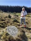
West Dron’s petroglyph

In the middle of Bridge of Earn village, take the Heughfield Road until, ⅓-mile on you hit the T-junction.  Turn left along Forgandenny Road and go along the curvaceous road for just over a mile where you need to keep your eyes peeled for the small left turn that takes you up the dead straight road.  At the top, turn left at the junction and go ⅔-mile, turning right at the next junction until after 400 yards you reach the houses on your right.  Go up the footpath opposite the houses (south) until, after nearly 400 yards, it splits.  Bear right and zigzag up the track for nearly a mile till you reach a large opening in the forest.  40 yards up the slope to your left is the stone—at last!

Archaeology & History

After the trail to get here, you might not be overly impressed by what you see – and it’s nothing special to look at to be honest.  But its location is a good one: reasonably high up on a sloping plateau which would have given good views were it not for the surrounding forestry plantations.  The only literary description of the site was the brief one in Discovery & Excavation Scotland, shortly after being rediscovered.  Mrs Johnson (1960) wrote:

Close-up of the carving

“A cup-marked stone was found by Mr. J. R. Morrison on the N side of West Dron hill.  The stone measures approx. 4ft long by 1ft 9in broad.

There are 17 cup-marks: five of which have channels, and two of which are joined in the form of a dumb-bell.  The stone lies with its longer axis NE-SW, and its broad face uppermost.”

Its seeming isolation is a peculiarity that I don’t buy.  Other carvings are going to be in the locale, probably on the same north- or north-east facing ridges – but due to the dense forestry, any other petroglyphs will remain hidden for quite some time…

References:

  1. Johnson, M., “Dron, Perthshire,” in Discovery & Excavation Scotland, SRG 1960.

Acknowledgements:  Huge thanks to Theresa Hughes for the use of her photos of this carving.

© Paul BennettThe Northern Antiquarian
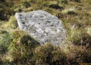

Allt a’ Choire Chireinich (06), Ben Lawers, Kenmore, Perthshire

Cup-Marked Stone:  OS Grid Reference – NN 65309 39553

Getting Here

Allt a’ Choire Chireinich 6

Follow the directions to reach the faint but impressive Allt a’ Choire Chireinich (04) petroglyph.  Standing here, you’ll notice the large boulder that looks as if it’s fallen down the slope immediately to your left.  You can’t really miss it.

Archaeology & History

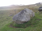
Beneath the gorgeous excess of ancient lichens you can make out at least three cup-marks on the south-facing sloping rock-face in the top-half of the boulder.  There may be some other faint cups on here, but due to the lichens they are very difficult to see, so I’m erring on the side of caution regarding their veracity.  This is another one of those carvings likely to be interest only to the most ardent petroglyphic nuts amongst you.

© Paul BennettThe Northern Antiquarian
Allt a’ Choire Chireinich (05), Ben Lawers, Kenmore, Perthshire

Cup- Marked Stone:  OS Grid Reference – NN 65305 39555

Getting Here

Allt a’ Choire Chireinich 5

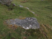
Follow the directions to reach the faint but impressive Allt a’ Choire Chireinich (04) petroglyph.  Standing here, look straight down at the dried-up burn barely ten feet below you, where you’ll see a small sloping rock.  That’s it!

Archaeology & History

Nothing much to see here apart from a single shallow cup-marking.  Most likely of interest only to the most ardent petroglyphic explorer.

© Paul BennettThe Northern Antiquarian
Ellen’s Well, Blair Drummond, Stirlingshire

Healing Well:  OS Grid Reference – NN 7196 0080

Getting Here

Ellen’s Well on 1856 map

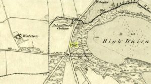
This takes some finding!  From the village of Doune take the A84 road towards Stirling and, just over the bridge barely 100 yards along, on your left, walk down the track past the old lodge house.  350 yards along, up the slope on your right where young trees and an excess of boscage prevails, walk up through it until, about 10 yards below an overgrown path at the top, beneath a raised section of old stonework, an old pipe protrudes from the undergrowth.  The small spring of water that emerges 10 yards beneath this, amidst the brambles and reeds, is what you’re looking for.

Archaeology & History

Wells named ‘Ellen’ usually have a long and sacred history behind them, but this one seems unusually silent.   Apart from being shown on the 1866 OS-map—simply as a ‘Well’—it is only mentioned briefly in Mr Mackay’s (1953) survey of Doune, being not far from the Clans Well, and in his day it was “still in use.”  But not anymore!  The water is barely running, but the trickle that still exists is nice and clear and it tastes good.  It’s seen much better days though….

‘Ellen’s Wells’ tend to have one of three origins, being either 1) dedicated to St Helen, whose festival date is August 18; (2) named after or dedicated to the Elder tree (Sambucus niger); or, (3) named after a local person of this name.  At some wells it may be two of these elements with their relative mythologies complimenting each other, overlapping between heathen peasant lore and early christian folklore. This has been the case at a number of St Helen’s Wells I’ve surveyed in Yorkshire and Lancashire.  At this site however, there are no remaining Elder trees, meaning that its name relates to one of the two other options; but without any extant historical references to St. Helen hereby, we must conclude that at some point in the dim and distant past, a local lady called Ellen found her name immortalized in this all-but-forgotten sweet spring.

References:

  1. Mackay, Moray S., Doune Historical Notes, privately printed: Doune 1953.

Acknowledgements:  The map accompanying this site profile is Reproduced with the kind permission of the National Library of Scotland

© Paul BennettThe Northern Antiquarian

Brae of Cultullich (6), Aberfeldy, Perthshire

Cup-and-Ring Stone:  OS Grid Reference – NN 8818 4906

Getting Here

X supposedly marks the spot

Out of Aberfeldy, take the A826 road as if you’re going up Glen Cochill.  Not far up, just where the housing of Aberfeldy itself ends and the green fields open up either side of you, keep on the road for a half-mile where you meet a small copse of trees on your left, with a dirt-track that runs down the slope.  Go along the track for 0.8 miles (1.3km), past the Ursa Major Stone and where the track splits, go left past the Quartz Stone and follow the track through the farmyard.  It’s somewhere there – or is supposed to be!

Archaeology & History

On our visit here, we couldn’t locate the cup-and-ring stone that’s described in Sonia Yellowlee’s (2004) regional rock art survey.  She described it, as archaeologists always do, in the briefest manner, telling us simply:

“Leaning against a pile of rubble in the farmyard there is a split boulder bearing eighteen cupmarks, one of which is ringed.”

It may have been destroyed, as we were told by a couple of locals that there used to be “a real miserable sod” living there.  When we visited the place and tried to ask the present farm owner, sadly he wasn’t to be found.  If any rock art explorer manages to locate this seemingly lost cup-and-ring, please let us know – and mebbe send us some photos so that we can add them to this site profile. 😉

References:

  1. Yellowlees, Sonia, Cupmarked Stones in Strathtay, RCHAMS 2004.

Acknowledgements:  Big thanks to the crew – this time being Neens Harris, Paul Hornby & Frank Mercer.  And the stunning resource of Scotland’s 1st edition OS-maps is Reproduced with the kind permission of the National Library of Scotland

© Paul BennettThe Northern Antiquarian


Quartz Stone, Brae of Cultullich, Aberfeldy, Perthshire

Cup-Marked Stone:  OS Grid Reference – NN 88104 49001

Also Known as:

  1. Brae of Cultullich (4)

Getting Here

The cupmarked Quartz Stone

Out of Aberfeldy, take the A826 road as if you’re going up Glen Cochill.  Not far up, just where the housing of Aberfeldy itself ends and the green fields open up either side of you, keep on the road for a half-mile where you meet a small copse of trees on your left, with a dirt-track that runs down the slope.  Go down here and follow the slightly meandering track for 0.8 miles (1.3km), a short distance past the Ursa Major Stone where the track splits.  Take the track to the left and there, less than 100 yards on you’ll hit a large boulder on your left.  That’s it!

Archaeology & History

Not previously recorded, this simple cup-marked stone will probably only be of interest to petroglyph aficionados, or those folk who are into  ‘energies’ at sites.  This latter aspect is due entirely to the carving being etched onto a huge rock, much of which is composed of quartz—which isn’t too unusual in this part of the world.  But that aside…

Looking down at the cups
The cupmarks highlighted

It is one in a group of carvings within a few hundred yards of each other, with its nearest neighbour 20 yards to the north.  That one’s covered in cups—but on this large Quartz Stone, only two of them exist, on the top near the centre.  Just a couple of inches across and half-an-inch deep, they’re pretty clear once you see them.  The raised piece of ground behind the stone is artificial and has variously been described by antiquarians and archaeologist alike, as either a prehistoric dun, or a stone circle.  Whatever it may be, some of it is certainly man-made.  Check it out – and mebbe ask the friendly fat fella who lives nearby what he thinks.

© Paul BennettThe Northern Antiquarian


Ursa Major Stone, Brae of Cultullich, Aberfeldy, Perthshire

Cup-Marked Stone:  OS Grid Reference – NN 87958 49022

Also Known as:

  1. Brae of Cultullich (3)

Getting Here

The stone from the trackside

Out of Aberfeldy, take the A826 road as if you’re going up Glen Cochill.  Not far up, just where the housing of Aberfeldy itself ends and the green fields open up either side of you, keep on the road for a half-mile where you meet a small copse of trees on your left, with a dirt-track that runs down the slope.  Go down the track, bending to the right, then the left and then on for a quarter of a mile until the lines of trees appear either side of you.  Barely 200 yards along, the track swerves slowly to your right, and the field above you slopes uphill.  Keep your eyes peeled at the fencing on your right and you’ll see a stone sloping towards you right by the fence with faint cupmarks on it.  You’ll find it!

Archaeology & History

A truly fascinating cup-marked stone recently uncovered by Paul Hornby on another one of our TNA meanderings. Fascinating because of the curious arrangement of the cups on the stone.  Often, cup-marked stones have little to interest the causal visitor – but this one’s different.  As can be seen quite clearly, the cups are arranged in the shape of the constellation of the Great Bear, or Ursa Major – albeit with an extra ‘star’ in this design.  But it’s damn close!  In all likelihood (he says with his sceptical head on 😉 ), the design is fortuitous when it comes to the Ursa Major.  I know from many years experience how easy it is to see meaningful shapes and designs in the almost entirely abstract British petroglyphs, but the design is very close to the constellation we all got to know when we were kids.

Looking along the stone
Gazing down at Ursa Major

The stone itself slopes upwards at an angle of about 60º, before starting to level out as it rises.  All of the cupmarks have been pecked onto this sloping surface (the vast majority of carvings are found on top of stones).  Altogether, at least twelve faint and shallow cups were exposed when we looked at it—measuring the usual inch to inch-and-half across—but it is likely that more of them are hidden beneath the turf at the top of the stone.  We could discern no rings or other features in the design.

This is just one carving amidst a good cluster of petroglyphs within a few hundred yards of each other (the Quartz Stone being one of the nearest) that are well worth checking out if you like your rock art.  It may also be of interest to astronomy students, or those exploring archaeo-astronomy.

References:

  1. Yellowlees, Sonia, Cupmarked Stones in Strathtay, RCHAMS 2004.

© Paul BennettThe Northern Antiquarian