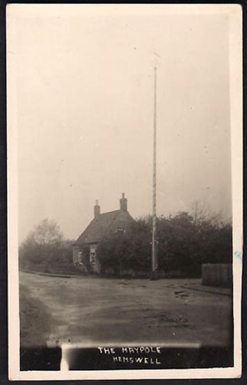
In Hemswell Village at the junction of Church Street and Maypole Street.
History & Archeaology
According to a 2010 report in the Scunthorpe Telegraph, the Hemswell villagers,
“claim to be the hosts to one of the oldest maypole celebrations in the world, dating back to at least 1660”.
The then clerk to the parish council, Dianne Millward is quoted as saying:
“Hemswell is widely regarded in historical circles as having one of the oldest if not the oldest celebrations for May Day. We have pictures of the pole being prepared for the big day in the very early 1900s.”
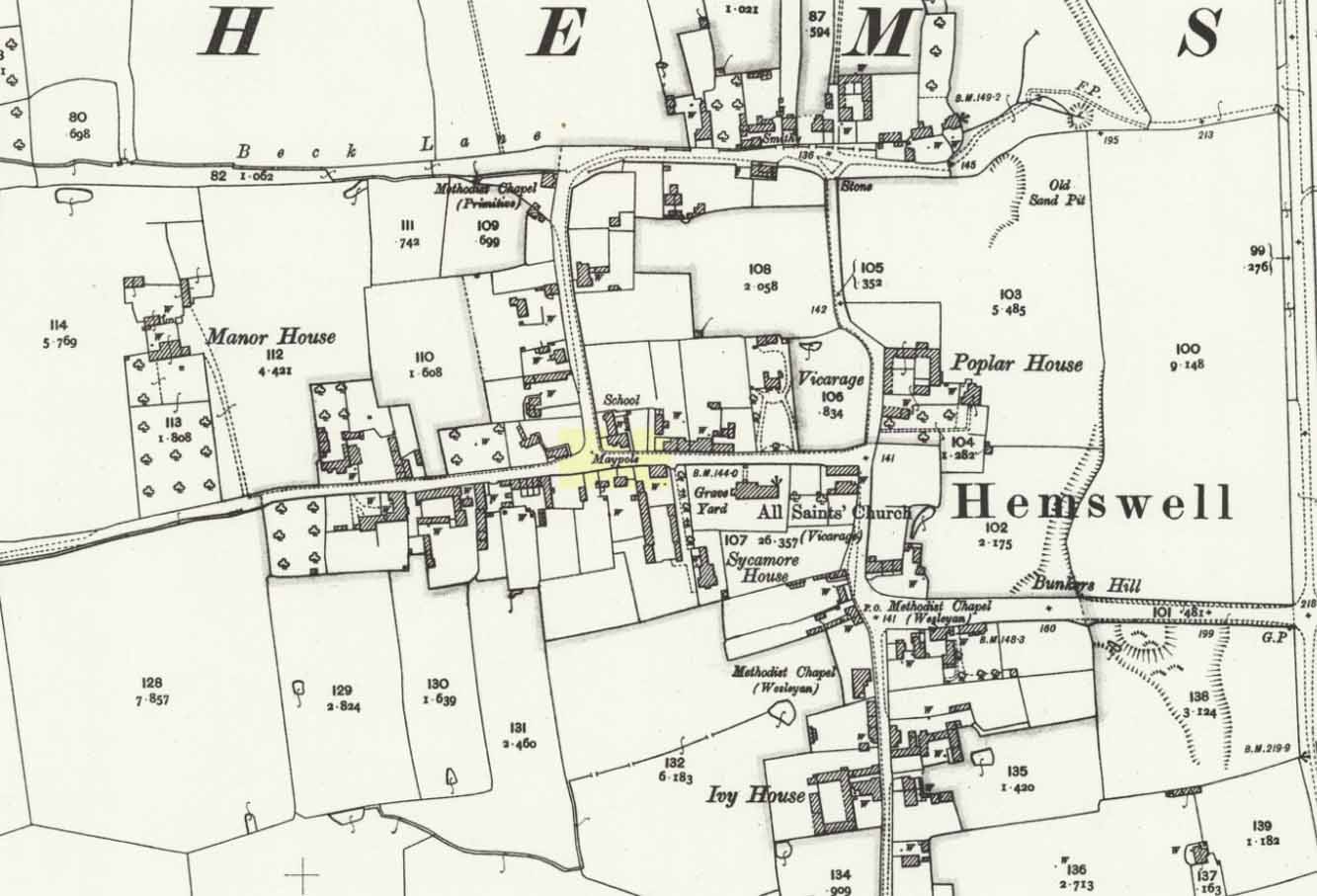
Hemswell maypole on 1906 map
This writer has not yet been able to independently verify these claims.
May Day is still celebrated in the village with dancing around the maypole and an accompanying fete. Recent online photographs show that it is now only children, in ‘historic’ fancy dress who ribbon-dance around the Pole.
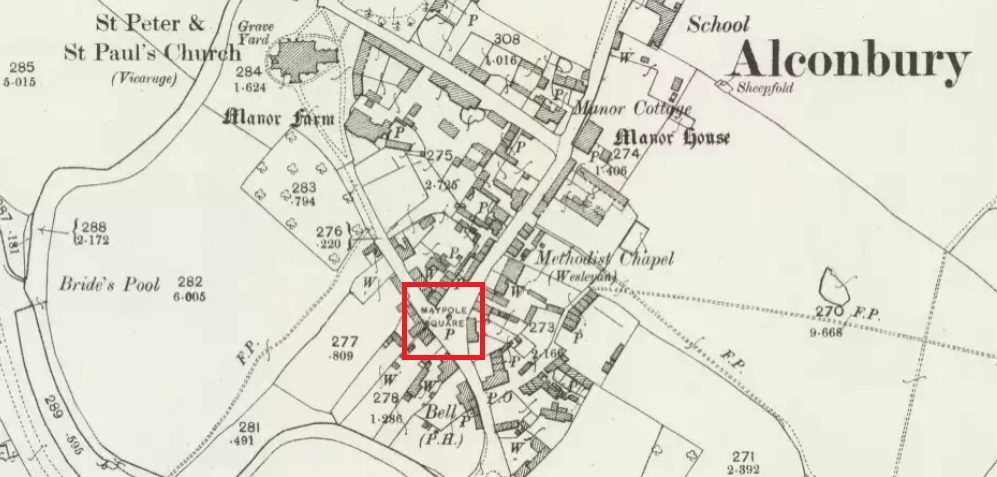
Maypole Square, outlined in red on the 1901 OS map
Maypole Square forms the junction of High Street, Church Way and Chapel Street in the centre of the village.
Archaeology & History
The Alconbury Maypole had passed out of living memory by 1942, but was historically attested by the ‘Maypole Square’ in the centre of the village.
Folklore
C.F. Tebbutt wrote in 1950:
“At Alconbury, it is remembered that about 1890 an old soldier, who lived in the corner house (east end) of the row of cottages facing Maypole Square, used to dig holes in the road opposite the row and set up May bushes there on May day”.
References:
C.F.Tebbutt, “Huntingdonshire Folk and their Folklore”, in Transactions of the Cambridgeshire and Huntingdonshire Archaeological Society, Volume VI, part V, 1942.
C.F.Tebbutt, “Huntingdonshire Folk and their Folklore II”, in Transactions of the Cambridgeshire and Huntingdonshire Archaeological Society, Volume VII, part III, 1950.
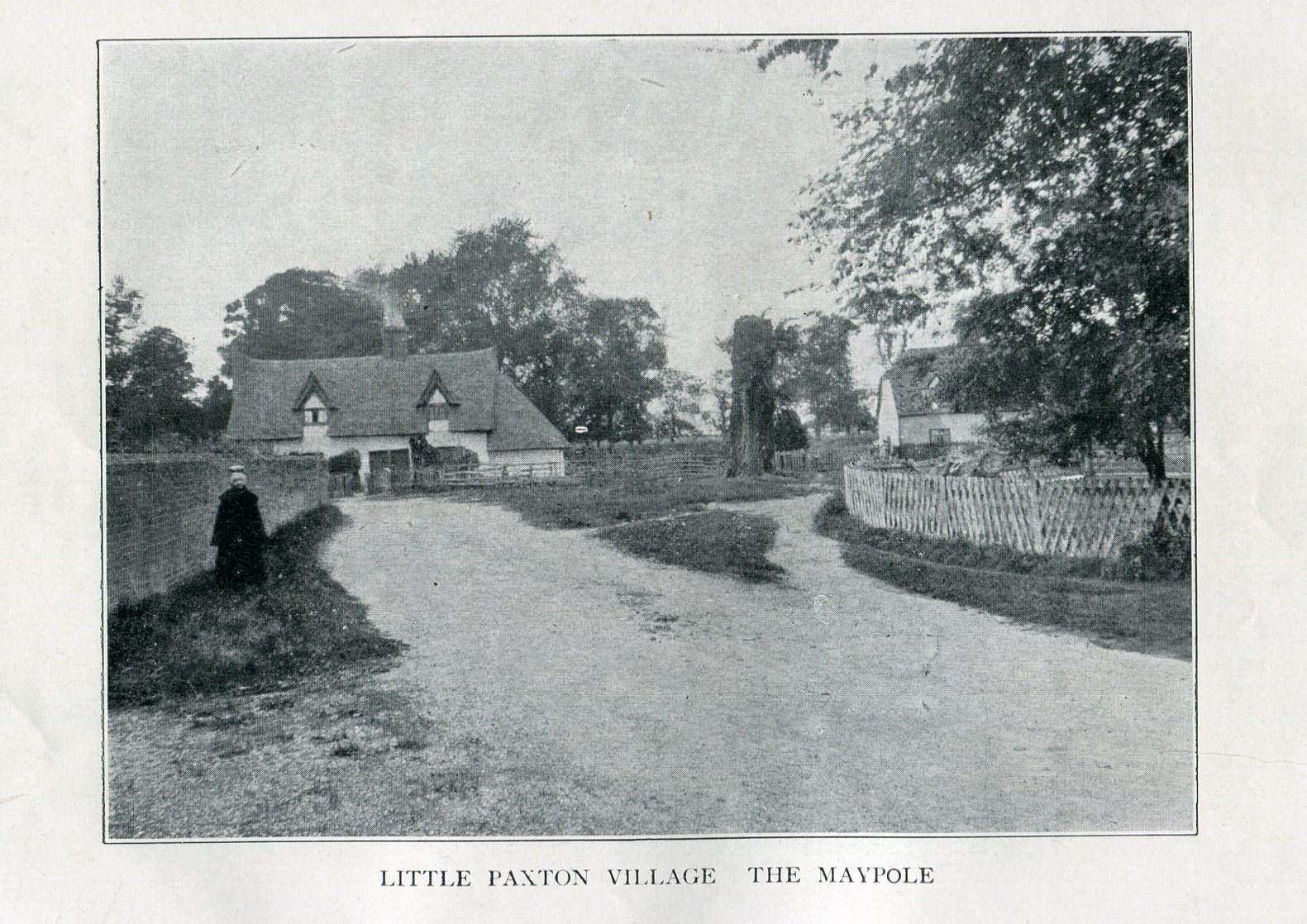
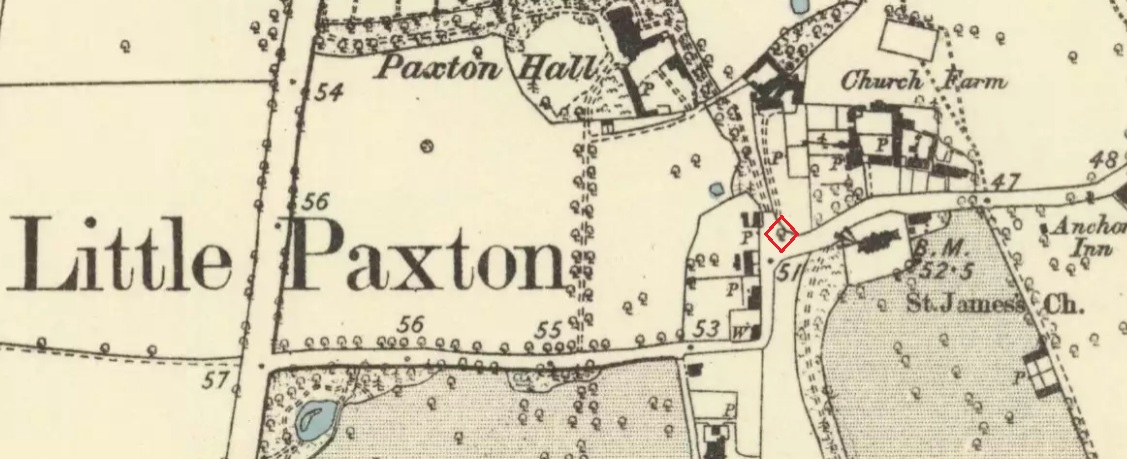
Imposing trunk of The Maypole Tree, right background
The road layout of the village has changed since the destruction of the Tree, but its approximate position was on the north side of the present High Street, at the junction with the east side of St James’ Road.
Archaeology & History
The Little Paxton Maypole Tree was a very late survival of a tradition where Mayday revellers danced around an actual tree rather than a symbolic tree in the form of a maypole. It was described as “a tall straight elm tree” that stood in front of what was then the village Post Office, and from what may be the only surviving photograph, it appears that only the very substantial trunk survived of what was clearly a very old tree.
The 1887 6″ OS Map, showing the Maypole Tree outlined in red
A Miss Ethel Ladds, who had been born in Little Paxton, recalled in the early 1940s:
“I remember the old tree very well, it was always called ‘the Maypole’, but I don’t know any more about it, except that they used to dance round it“.
The St Neots Advertiser recorded that the Maypole Tree was blown down in a great gale on 24th March 1895.
Folklore
While this writer has been unable to find direct folklore relating to the Little Paxton Maypole Tree, it may be worth remarking that botanically the Elm tree is a cousin of the Stinging Nettle, the Hop and Cannabis. Another Elm Tree used for May revels was the Tubney Elm, near Fyfield in Berkshire and recorded by Matthew Arnold, in his ‘Scholar Gipsy’.
References:
C.F. Tebbutt, “Huntingdonshire Folk And Their Folklore”, in Transactions of the Cambridgeshire & Huntingdonshire Archaeological Society, Volume VI, Part V, 1942
C.F. Tebbutt, “Huntingdonshire Folk And Their Folklore”, in Transactions of the Cambridgeshire & Huntingdonshire Archaeological Society, Volume VII, Part III, 1950
Gerald Wilkinson, Epitaph For The Elm, Arrow Books, London, 1979
The best way here is to walk a mile to find it. All the way up the road from Gleneagles Standing Stones to Glendevon, right at the very top where the two glens meet, there’s a small road heading to the Fishery. 100 yards along, park up. Then take the old green road back down the Glen, north towards Gleneagles, parallel with the new road. A mile or so down you’ll reach the farmhouse, but a coupla hundred yards before this, in a wooden gap in the electric fence, you can walk straight downhill to the large pool below you. Y’ can’t really miss it!
Archaeology & History
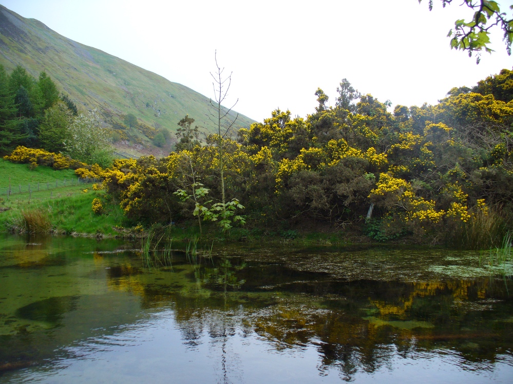
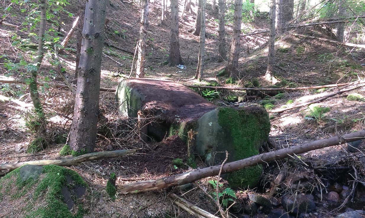
The strong cold spring of water known as St Mungo’s Well, now gathers into a large crystal clear pool and is gorgeous to drink and very refreshing! All around the edges are the brilliant yellow masses of gorse, held amidst widespread vivid hues of green in this most rocky of landscapes. Tis a gorgeous setting here….
St Mungo’s Well, 1860 map
Unfortunately there is no literary information that tells us why this spring of water, amongst the many others all around these hills, gained the ‘blessing’ of one of those roaming christians and was deemed to be ‘holy’. The greatest likelihood, as usual, is that the waters had some important heathen association which our peasant ancestors would have been able to tell us about if their animistic tales hadn’t been outlawed and demonized by the incoming cult — but we’ll probably never know for sure. As a result, we know nothing now of its medicinal qualities or old stories.
The transference of its old name (whatever it may have been) to their ‘St. Mungo’ may date from when the character was wandering with his christians in the 7th century, but we have no literary account proving as such. The name ‘St Mungo’ was an alternative name (a nickname if y’ like) of St. Kentigern — or at least that’s what the church historians tell us. There is no history of Kentigern or St Mungo up the glen, but we do have a more prosaic account that tells of a Mr Mungo Haldane of Gleneagles, a member of the Scottish parliament in 1673 onwards; he was succeeded by another Mungo Haldane MP in 1755. However, it’s highly unlikely that these political characters gave their name to the well.
The clear waters, looking southCrystal clear perfect drinking water
Even the Scottish holy wells surveys are pretty silent on this beautiful site. It was mentioned in Morris’ (1981) survey, but with no real information. The earliest account seems to come from an article written in the Perthshire Advertiser in 1856, and thankfully reproduced in the otherwise tedious genealogical history of the Haldane (1880) family; but even here, the narrative simply mentions the presence of the well and no more. Described in a walk up Gleneagles, it told:
“Journeying westward along the desolate moor…we soon came in front of Gleneagles, a narrow picturesque glen in the Ochils, through which the old road from Crieff leads into Kinross-shire. The hills here, as throughout the whole range, are strictly pastoral, but in no place more so than Gleneagles. Crowning the heights on both sides of the glen, we have craigs ragged and bare enough; but their show of beetling hard sterility is as nothing to the winding receding mass of grassy heights that bound the view. In looking on that quiet, sunny, Sabbath-like retreat, one would be apt to deem the name a misnomer, and yet it is not much above a hundred years since the monarch of birds had a home among its cliffs. There, too, the Ruthven Water that dashes past Auchterarder has its rise — not in a scarcely seen bubbling spring almost covered with moss, but issuing at once into daylight at the bottom of yonder steep in volume sufficient to drive a mill. In ancient times, as now, it must have been an object of mark, as it is called St. Mungo’s Well; but who this St. Mungo or St. Magnus was — whether the ghostly patron of Glasgow, Auchterarder old chapel, or the guardian saint of this particular spot, we cannot tell. But he seems to have relished cold water; and it is satisfactory to know that he must have got his fill of it there, if his cell happened to be in the vicinity.”
The well was mentioned in passing in the Object Name Book in 1860 and shown on the earliest Ordnance Survey maps.
Folklore
Apart from the fact that the waters here never run dry, we have no other folklore. However it should be noted that St. Mungo’s Day was January 14th — which may have been when the qualities of the spring were deemed most efficacious, or when olde rites were enacted here. However, a hundred yards down we pass the stream known as Bride’s Burn, probably in honour of the heathen Queen St. Brigit, whose name and myths are integral to our great Earth goddess, the Cailleach and whose celebration date is only two weeks later than that of Mungo. Hmmmmmmm…..
References:
Attwater, Donald, Penguin Dictionary of Saints, Penguin: Harmondsworth 1965.
Haldane, Alexander, Memoranda Relating to the Family of Haldane of Gleneagles, C.A. MacKintosh: London 1880.
MacKinlay, James M., Folklore of Scottish Lochs and Springs, William Hodge: Glasgow 1893.
The 6″ OS map of 1913 has a ‘Fairy Well’ marked on the northern edge of Preesall Hill. Travelling north through the village on the B5377, the Hill is to your right. Immediately past it is a stile, cross over this and go straight on with the hill to your right. The approximate site of the fairy well is now marked by a boggy area at the foot of the hill.
Archaeology & History
Almost a footnote in Reverend William Thornber’s 1852 paper on the Britons, Saxons and Danes in the Foreland of the Fylde, here is how this site is described by him in the quaint (to our eyes) language of the mid-nineteenth century:
“…the hill of Presal, (the ‘Pressonde’ of Domesday), with its well all but deified; and although the votaries, like those in the pool of Laconia, may not have cast into it cakes of bread-corn to Juno,* yet a bush was named ‘Beggar’s bush,’ from the circumstances of the offerings of rags and clouts being affixed to it, over which a prayer was said; for Bishop Hale ridicules a superstitious prayer for the blessing of clouts for the cure of diseases.”
In addition, the following reference was found on-line:
“…If the travellers had lingered, however, they would observe the inhabitants placing half eggshells on the edge of the Fairy Well at the foot of Preesall Hill; a practice of the local school children even at the beginning of the 20th century. Recording some of the traditions of the country areas of 19th century Wales, Sir John Rhys in his “Celtic Folklore”, mentioned how half eggshells were left out for the fairy folk to use as cooking pots in which to prepare food and brew beer for the reapers at harvest time.”
Close-up of the boggy waters
The Beggar’s Bush is long gone, but the red colour of the deposits in the adjoining ditches would indicate a chalybeate (iron-bearing) spring rather than a well, and the northern slope of the hill seems to have become an unofficial children’s play area. Curiously, at the top of the hill, next to the playground of the Fleetwood’s Charity School, there is a modern ‘beggar’s bush’, festooned with white and yellow plastic strips, in a small nature trail area…
* quoted from Borlase, in his Natural History of Cornwall (1758): “…In Laconia they cast into a pool, sacred to Juno, cakes of bread-corn; if they sunk, good was portended; if they swam, something dreadful was to ensue.”
¶ http://www.lancastrians4ever.homecall.co.uk/lancastrians4ever/precha1.htm – Believed to be an online digest of out of print Preesall history publications by Stan Jones
References:
Thornber, William, ‘Traces of the Britons, Saxons and Danes in the Foreland of the Fylde,’ in Proceedings and Papers of the Historic Society of Lancashire and Cheshire, Liverpool 1852.
Acknowledgements: – My thanks to the staff of the Local Studies Department, Borough of Blackpool Library Services for their assistance
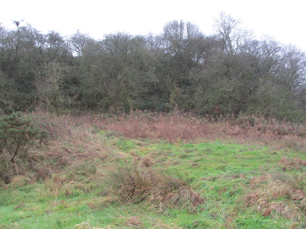
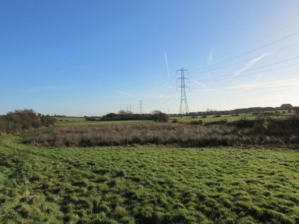
The boggy ground of the Bull Spring – from the site of possible cairn
To get here, leave Staining village along Mill Lane, turning right at the windmill along Smithy Lane. Walk along Smithy Lane, then 2-300 yards past a derelict piggery on the left go into the gated trackway on the right, and Bull Meadow is to the south-east, a boggy area at the western end of OS parcel 356. Be prepared to cross barbed wire fences.
Archaeology & History
Like the Staining Wrangdomwell or Fairy Spring recorded elsewhere, knowledge of this site owes its historical survival to the writings of Blackpool cleric, Rev. William Thornber (1803 – 1885), who wrote in 1851 about the now forgotton ‘Teanla’ or Hallowe’en bonfire cairns of Hardhorn:
“…but here adjoining the cairns are attached two wells, the one celebrated as Fairy or Wrangdomwell, and the other, issuing from a huge oblong mound of stones, as Bel spring or vulgarly Bull spring, in the Bull meadows, evidently bearing the same name as Beltain Meadow in Blackpool. Here on this Hardhorn oblong cairn, ceremonies were observed for the purpose of obtaining health to the herds of the farmers of the township – to free the wheat-land from tares, weed &c. – to bring good luck to the votaries, and to enquire into the secrets of futurity.
The ceremony was thus:- first, large fires were lighted, two or three families joining at a circular cairn, the ashes of which were carefully collected. Then the white stones, which at first, had circled the fire were thrown into the ashes, and being left all night, were sought with anxious care at sunrise, when the person who could not distinguish his own particular boulder was considered fey, i.e. some misfortune would happen to him, during the course of the ensuing year¹.
As a finale, the stones recognised were thrown, as an offering, on the oblong cairn to the god or saint who presided over it, and the well, and thus, such collections were made in a succession of years, as to astonish the curious. The water of the wells also had a sovereign virtue for healing the disease of men and cattle….”
The healing procedure at the wells is transcribed in the description of the nearby Fairy Well. Mr Thornber continues:
“The site of the large circular cairn (at Bull Meadow) is not now easily to be distinguished, since Mr. Fisher, the proprietor of the field, has carted away upwards of twenty loads of the refuse that composed it, but the soil around it is burnt red and black. This farce was carried on in its pristine glory long after the reformation; for rational Christianity (sic), which had been almost lost previously, progressed but slowly in the district of the Fylde. Even the waters of Marton Mere (SW of Bull Meadow),…were held sacred.”
Perusal was made of the Schedule to the 1839 Tithe map which revealed a ‘Bull Meadow’, owned and occupied by William Fisher, and from this, its location was able to be identified on the OS map.
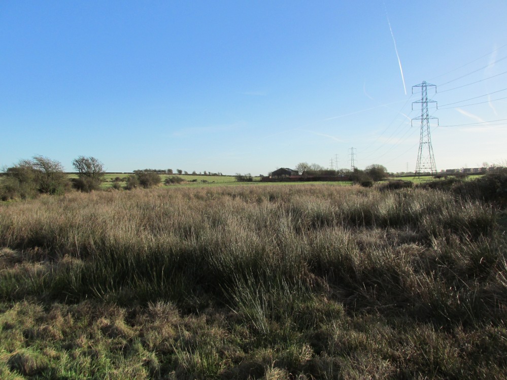
Possible source of the waters
Like Wrangdom Well, half a mile to the north-west, the Bull Spring issues from an area of swampy ground, and the exact place of issue was hard to pinpoint when this writer visited in December (see photo the right). The oblong cairn—if indeed that is what it is—can still be identified, about 2 feet above the marsh, it is firm to stand on but not easy to distinguish owing to the amount of vegetation.
¹ Writing in the January 1883 edition of the The Folk-lore Journal, the Reverend Walter Gregor describes ‘ristin the halla-fire’ a broadly similar Scottish ritual carried on in the Fraserburgh area up to the late 18th century.
References:
Thornber, William, ‘Traces of the Britons, Saxons and Danes in the Foreland of the Fylde,’ in Proceedings and Papers of the Historic Society of Lancashire and Cheshire, Liverpool 1852.
Tithe Map & Schedule Transcript – ‘The Township of Hardhorn with Newton’ Surveyed by Thomas Hull in 1838, with Schedule dated 1839.’
Acknowledgement: My thanks to the staff of the Local Studies Department, Borough of Blackpool Library Services for their assistance.
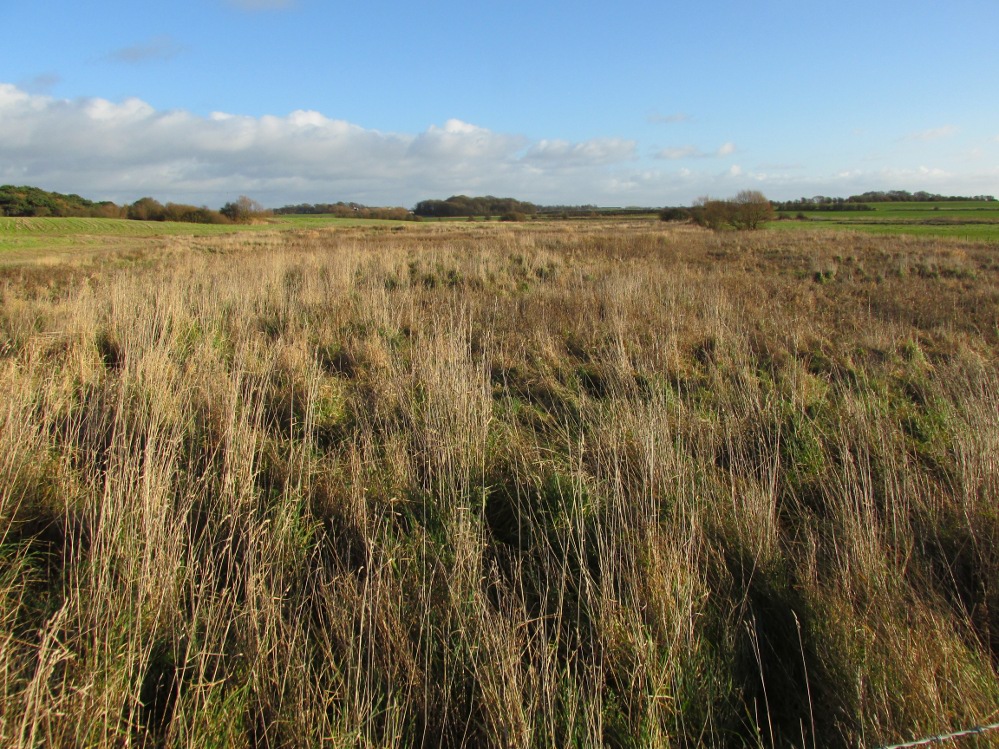
One and a half centuries of neglect have not been kind to the Wrangdomwell, which is now in the middle of a large area of swampy land, reached from Staining village along Mill Lane, turning right at the windmill then walking along Smithy Lane. Just before a derelict piggery on the left go into the field, and Wrong Well Meadow is on the right at the back of the piggery, with the spring issuing from the boggy ground. Be prepared to cross barbed wire fences, and to meet some friendly ponies.
Archaeology & History
Were it not for the researches and writings of an eccentric cleric, this site would almost certainly now be lost to history. The Reverend William Thornber recorded, in his 1837 History of Blackpool that:
“The fairies of our fathers…were kind good natured creatures, at times seeking the assistance of mortals, and in return liberally rewarding them. They had a favourite spot between Hardhorn and Staining, at a cold spring of water, called Fairies’ Well to this day.”
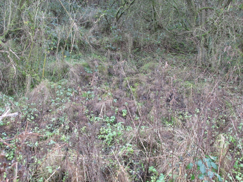
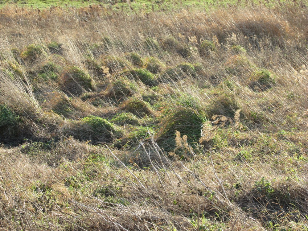
The legendary waters hide in the rushes
Writing in a paper published in 1851, Thornber described the Fairy Well or Wrangdomwell in the context of the “Teanlas”, the enormous Hallowe’en bonfires (4) that were still at that time being lit at ritual cairns of stones in parts of west Lancashire. One of these fire cairns once adjoined the Fairy Well, which in 1850 was still being visited for its,
“sovereign virtue for healing the diseases of men and cattle. To succeed in obtaining a cure, the patient, escorted by his friends, was made to pass through the cairn, then he was sprinkled or dipped in the well, and lastly, he made an offering of a shell, pin, a rusty nail or a rag, but principally three white stones burnt in the Teanla fire. It is surprising in what numbers pieces of iron may be picked up. I have found since the meadows were ploughed, nails, an old shaped knife, leather thongs etc.”
Thornber wrote that the cairn no longer existed, and gave no precise location for the well.
Looking at the area between Hardhorn and Staining on the 1891 25″ OS map revealed only one ‘spring’; in land parcel 295. This parcel of land is recorded in the Schedule to the 1839 Tithe map as ‘Wrong Well Meadow’, occupied by Thomas Dobson, and owned by ‘School of Marton’, a charitable endowment established in 1717. Adjoining Wrong Well Meadow are Old Meadow and Nickers Meadow (‘Old Nick’?), which might appear to show the Wrangdomwell as in the past having been part of a larger heathen ritual locality. Notwithstanding this, the Church was happy to take its tithe.
References:
Thornber, William, The History of Blackpool, Smith Market Place: Poulton-le-Fylde 1837 (republished in 1985 by the Blackpool and Fylde Historical Society).
Thornber, William, ‘Traces of the Britons, Saxons and Danes in the Foreland of the Fylde,’ in Proceedings and Papers of the Historic Society of Lancashire and Cheshire, Liverpool 1852.
Tithe Map & Schedule Transcript, ‘The Township of Hardhorn with Newton’ Surveyed by Thomas Hull in 1838, with Schedule dated 1839.’
Michelle Harris & Brian Hughes, in their ‘The History of the Wyre from Harold the Elk to Cardinal Allen‘ (4th ed. 2007) p35, write – “According to Tom C. Smith’s ‘History of the Parish of Chipping‘ published in 1891: ‘Teanlaes was the name given to fire celebrations, observed until quite recent years on May 1st, Midsummer Day, August 31st, and November 1st.’ These dates, it should be said, are at variance with Henry Taylor who, in his 1899 publication ‘Ancient Crosses of Lancashire’, quotes Atticus as saying: ‘The ceremony observed on Teanlow night, the last night of October, consisted of making bonfires on all the neighbouring hills.'”
Acknowledgements: My thanks to the staff of the Local Studies Department, Borough of Blackpool Library Services for their assistance.
A few hundred yards below the legendary old Wizard’s Stone, we find there’s a real cluster of witch-lore in the small area to the north of Dollar which, to be honest, is deserving of wider analysis from competent researchers and historians. Not only is there the legendary Lochy Launds of the Black Goddess hereby, but we also find this curious rock, described by one ‘J.C.’ in an early edition of the Scottish Journal (1848), which told:
“On the confines of the parish of Dollar, not far from Hillfoot, the seat of John McArthur Moir, Esq., lies a glen, called Burngrens, watered by a small stream and planted with numerous large trees. A great number of these, however, have fallen, during the last few years, beneath the unsparing axe; but strong, healthy saplings are rising rapidly to supply their place.
“In this glen there is a large stone, of peculiar formation, in every way like a cradle. It is currently believed by the superstitious in the vicinity, that the stone, every Hallowe’en night, is raised from its place, and suspended in the air by some unseen agency, while “Old Sandy,” snugly seated upon it, is swung backwards and forwards by his adherents, the witches, until daylight warns them to decamp.
The following rather curious affair is told in connection with the “Cradle:”
“One Hallowe’en night a young man, who had partaken somewhat freely of the intoxicating cup, boasted before a few of his companions that he would, unaccompanied, visit the stone. Providing himself with a bottle, to keep his courage up, he accordingly set out. The distance not being great, he soon reached his destination. After a lusty pull at the bottle, he sat down upon the “Cradle,” boldly determined to dispute the right of possession, should his Satanic majesty appear to claim his seat. Every rustle of a leaf, as the wind moaned through the glen, seemed to our hero as announcing the approach of the enemy, and occasioned another application to fortifying “bauld John Barleycorn.” Overpowered at last by repeated potations, our hero, dreaming of “Auld Nick,” and his cohort of “rigwuddie hags,” fell sound asleep upon the stone.
“His companions, who had followed him, now came forward. With much shouting and noise, they laid hold of him, one by the head and another by the feet, and carrying him, half-awake, to the burn, dipped him repeatedly, accompanying each immersion with terrific yells. The poor fellow, thinking a whole legion of devils were about him, was almost frightened to death, and roared for mercy so piteously that his tormentors thought proper to desist. No sooner had our hero gained his feet than he rushed up the glen, and ran home, resolving never to drink more, or attempt such a feat again. For many a long day he was ignorant who his tormentors really were.
“We stood upon the stone about a week ago. Ivy and moss are slowly mantling over it, a proof that it is some considerable time since the Devil has been rocked on it.”
Historian Angus Watson (1995) told the place to be “south of Wizard’s Stone…near Kelty Burn,” and also that,
“it is said to be where witches rock Satan to sleep on Halloween.”
Above here, the tree-topped rounded hill to the north was one of the meeting places of the witches of Fife, Perthshire and Clackmannan. Something of sincere pre-christian ritual importance was undoubtedly enacted in this region, as we also find sites of the Maiden a short distance due north. Does anyone know more about this fascinating sounding place?
References:
‘J.C.,’ “The Deil’s Cradle”, in The Scottish Journal, February 5, T.G. Stevenson: Edinburgh 1848.
Simpkins, John Ewart, County Folklore – volume VII: Examples of Printed Folk-Lore Concerning Fife, with some Notes on Clackmannan and Kinross-Shires, Folk-Lore Society: London 1914.
Watson, Angus, The Ochils: Placenames, History, Tradition, PKDC: Perth 1995.
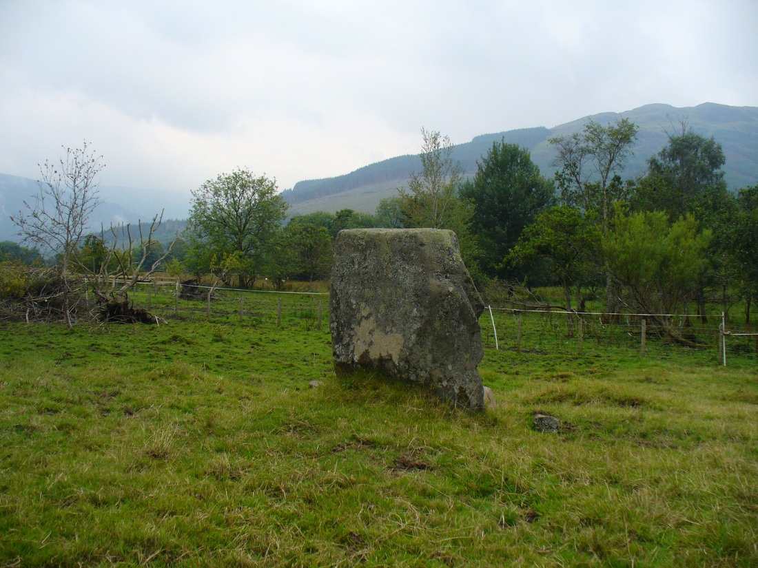
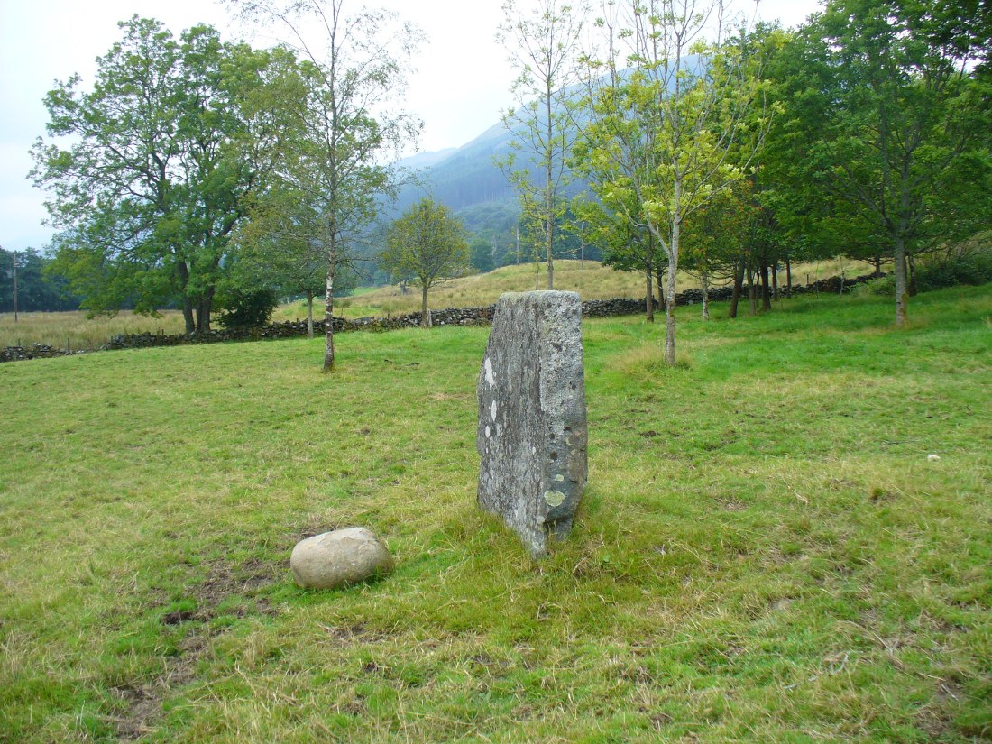
From Balquhidder village, take the road east towards Auchtubh as if you’re gonna visit the Priest’s Stone, just past the house of Tom na Cruich on the right-hand side of the road. When you get to the house, if you ask the owners there how best to get to the stone, they are very friendly and very helpful in pointing you in the right direction.
Archaeology & History
This solitary standing stone first seems to be mentioned in J.W. Gow’s (1887) essay on the prehistoric antiquities of this part of Rob Roy’s country. Found below the house and hillock where the old gallows used to be, he told:
“On the level ground below (Tom na Croich) …there is a prominent monolith, standing about 4½ feet above ground, quite flat, on the top. It is shaped like a wedge, with the edge to the east, and is famous in Balquhidder as the place where trials of strength took place.”
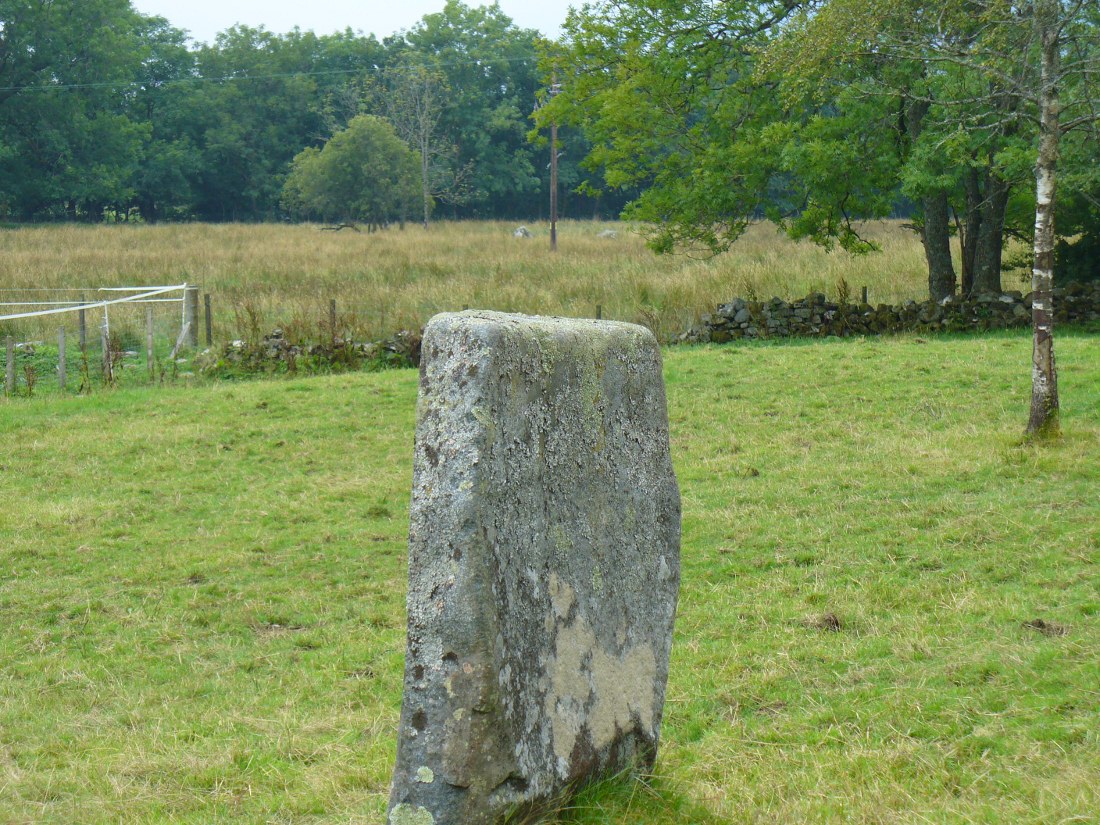
Note the stones in next fieldPuidrac Stone, looking N
Below the standing stone is a small rock, whose predecessor played an important part in some local traditions relating to this site. (see ‘Folklore’ below) Also, due west of here in the next field, you will be able to see a couple of seemingly upright stones in the tall reeds 200 yards away, which early records say were part of a stone circle—now much in ruin—known as Clachan Aoraidh or the Worshipping Stones. There is the possibility that this single stone was an outlier to the circle. It’s astronomy might be worth checking….
Folklore
When we visited the stone last week, the owners of the house above asked if we’d managed “to lift the stone”—and I wondered what they meant at first, until they told us the folklore about the site. They narrated the tale almost exactly as it had been described first of all in J.W. Gow’s (1887) essay, which said the following:
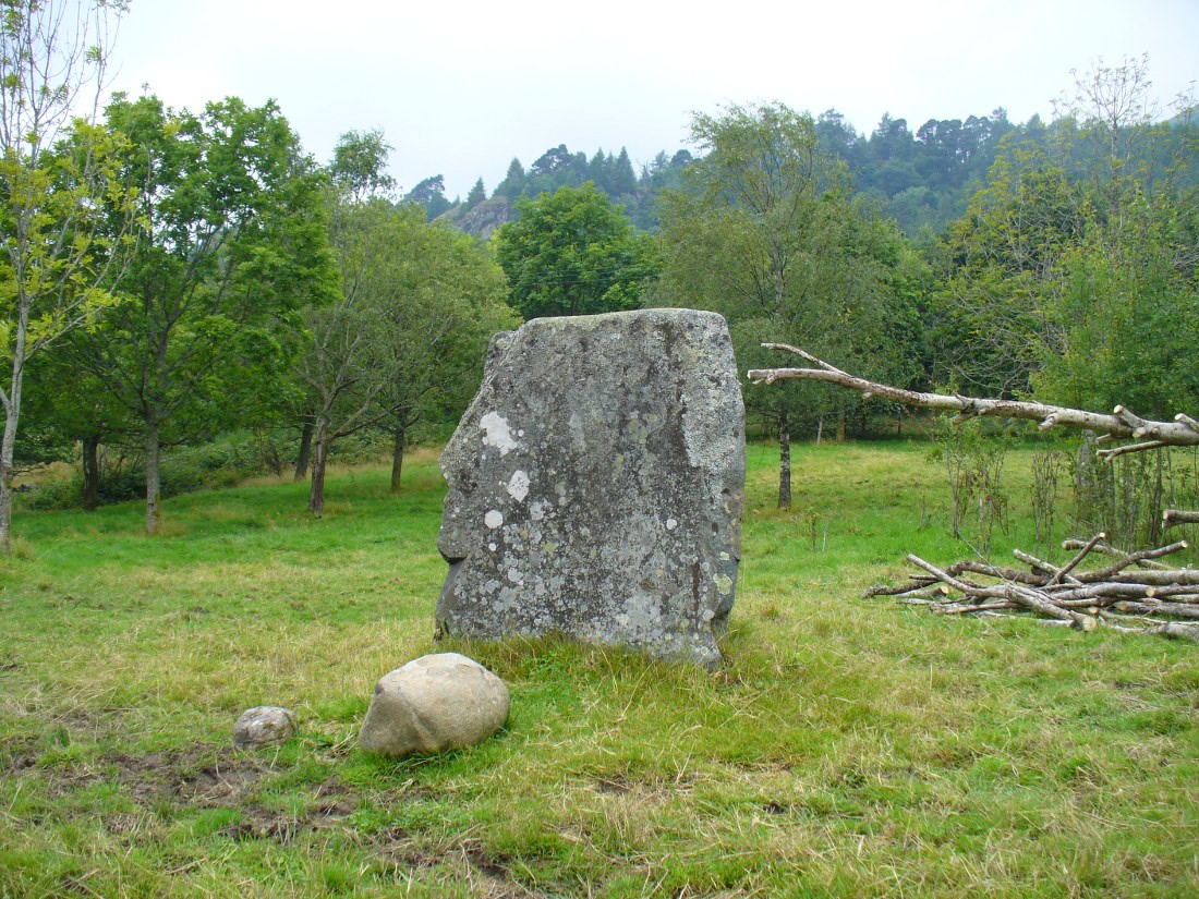
A new ‘lifting stone’ in front of Puidrac
“It is shaped like a wedge, with the edge to the east, and is famous in Balquhidder as the place where trials of strength took place. A large round water-worn boulder, named after the district, ‘Puderag’, and weighing between two and three hundredweight, was the testing stone, which had to be lifted and placed on the top of the standing stone. There used to be a step about 18 inches from the top, on the east side of the stone, on which the lifting stone rested in its progress to the top. This step or ledge was broken off about thirty years ago, as told to me by the person who actually did it, and the breadth of the stone was thereby reduced about 8 inches. This particular mode of developing and testing the strength of the young men of the district has now fallen into disuse, and the lifting-stone game is a thing of the past. A former minister of the parish pronounced it a dangerous pastime. Many persons were permanently injured by their efforts to raise the stone, and it is said that he caused it to be thrown into the river, but others said it was built into the manse dyke, where it still remains. There were similar stones at Monachyle, at Strathyre, and at Callander, and no doubt in every district round about, but the man who could lift ‘Puderag’ was a strong man and a champion.”
The present stone that is positioned on the ground below the standing stone was put here in much more recent times.
References:
Gow, James M., “Notes in Balquhidder: Saint Angus, Curing Wells, Cup-Marked Stones, etc”, in Proceedings of the Society of Antiquaries Scotland, volume 21, 1887.
Acknowledgements: To Kenny and Laura for their help and guidance here. Huge thanks!
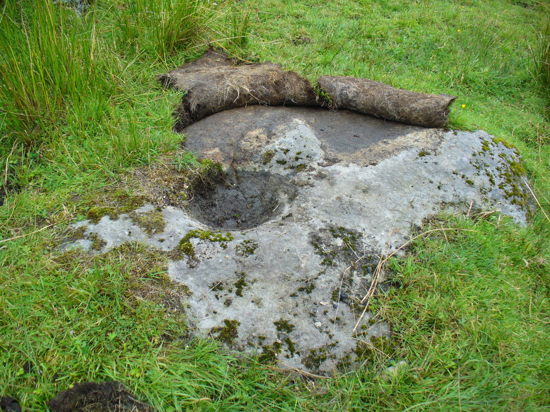
From Balquhidder village, take the road east towards Auchtubh as if you’re heading to the Clach nan Sul or Wester Auchleskine cup-marked stones. Before reaching either of these sites, a few hundred yards on the road as you pass Tom na Cruich on the right-side of the road, you need to look in the next field past this house. About 40 yards past here in the field, and less than 10 yards from the wall, you can see the large rock from the roadside. If not, you’re damn close! Ask the owners of the adjacent house, who are very friendly and helpful.
Archaeology & History
This curious, large, man-made cup-marking or bowl was first described in J.M. Gow’s (1887) essay on Balquhidder antiquities. He wrote:
“Regaining the high road, and still going east, about 40 yards from the cottage of Mr Macdiarmid, there lies just inside the road dyke a large five-sided stone, about 8 feet long by 5 feet broad at the broadest part, and about 2 feet above ground. It is called “Basan an Sagairt” (the Priest’s Basin). When the present road and dyke were made, its name must have saved it. The hollow or basin is 18 inches in diameter and 6 inches deep, and is unmistakably artificial. The stone is the mica slate of the district, hard and granitic.”
Looking down on the basin
The large bowl here was also deemed to be artificial by members of Ordnance Survey and Royal Commission archaeologists who have inspected the site. It is thought to have been a healing stone of some sort, or at least possessed some religious function, but we have no records stating this with any certainty. In examples similar to this, the water which collects in the carved bowl is deemed to have curative properties. It may have been a christian attempt to take locals away from magickal healing stone practices enacted at the Clach nan Sul, or Stone of the Eyes, just a couple of hundred yards along the road east of here. Or it may have being a stone used by indigenous medicine men for other medicinal purposes.
Carved stone in one of the fields across the road
On the other side of the road from here, in the field immediately past Wester Auchleskine farm, as you go through the gate just ahead of you is a rounded earthfast stone with a similar man-made circular impression like the Priest’s Basin carved upon it. (NN 5451 2089) However, this carving doesn’t appear to have been finished. Whether it has any mythic relationship to the Priest’s stone or the cupmarked rocks at Wester Auchleskine in the same field, is not known.
References:
Gow, James M., “Notes in Balquhidder: Saint Angus, Curing Wells, Cup-Marked Stones, etc”, in Proceedings of the Society of Antiquaries Scotland, volume 21, 1887.